The Mobile Mansion is Gone

Another chapter of my old life ends.

On Monday, I delivered my 36-foot fifth wheel Montana Mountaineer RV, affectionately nicknamed “the Mobile Mansion” to its new owners. Yesterday, I met them at the bank to have the paperwork notarized and get my check.

Early Life of the Mobile Mansion

I bought the Mobile Mansion brand new back in 2010 in Quartzite, AZ. I got a great deal on it. The Great Recession was killing RV manufacturers and dealers; by January 2010, Quartzite dealers were desperate to unload brand new RVs.

Mobile Mansion in Quincy
Here’s the Mobile Mansion parked at the golf course I stayed at in Quincy, WA, for about two months each summer. (I now hire pilots to work my Quincy contracts.)

It was the second — well, fourth if you count the popup camper and horse trailer with living quarters — in a line of RVs I’d owned since the early 2000s. Like its predecessor, a Starcraft hard-sided camper with pop-out beds, It was a business asset for Flying M Air: I bought it as a place to live when I traveled for my flying work. I’d begun working in Washington every summer in 2008 and wanted an affordable and comfortable place to live while I was there. The Starcraft was affordable but not comfortable. The Montana was very comfortable mostly because it was very large. I got a big one because I expected that I’d be living in it for four to six months a year with the man I was married to and our mid-sized dog. I wanted us to have plenty of space. I wanted it to be a true home away from home. When I bought it, I blogged that it was the “perfect” RV.

A Temporary Home for the Homeless

When my marriage fell apart in June 2012, I was living in the Mobile Mansion in Washington State, where I was working for the fifth summer in a row. I didn’t bother bringing the Mobile Mansion back home to Arizona at the end of the summer. Instead, I stored it in a friend’s garage, along with my boat. I’d need it in Washington the following year no matter what happened, so it made no sense to bring it home.

I did move it down to California in February 2013 for the frost control work I started there that year. It was a lot of fun to live part time at an airport with my helicopter parked a few hundred feet away.

At Watts-Woodland
The Mobile Mansion parked alongside a hangar in the Sacramento area. You can see my helicopter parked on the ramp at the left side of the photo.

In May 2013 when the court stuff was finally done and my wasband finally agreed to a division of personal assets in our Wickenburg house and Phoenix condo, I moved out of Wickenburg permanently. By that time, the Mobile Mansion was back in Washington, settled in for my summer work, and I moved right back into it.

I lived in it for most of the next two years. I traveled a bunch in the winter, as I usually do, and had a three-month housesitting job during the coldest months of the winter of 2013/14 when living in the Mobile Mansion parked outdoors would have been tough. The following winter, the shell of my new home was finished and, when I wasn’t in Arizona or California, I lived in the Mobile Mansion inside the RV garage. I had a full hookup in there: 30 amp power, water, and sewer. It was comfortable, but cave-like — sort of like that Phoenix condo I’d hated so much — and it really motivated me to finish up my living space upstairs.

Mobile Mansion in Construction Zone
The Mobile Mansion was my home and base of operations while my new home was being built. I even set up a time-lapse camera on one of the slides to record the whole building process.

In early April 2015, I moved upstairs, sleeping on an air mattress on the bedroom floor. The shower wasn’t done yet, so I still showered down in the Mobile Mansion in the garage. But by the end of the month I was mostly moved in, with my furniture in place. Although my home wasn’t 100% complete, I was done living in the Mobile Mansion.

Or so I thought.

The Mobile Mansion stayed in the RV garage until July. I’d been playing around with AirBnB, using the full hookup campsite at the edge of my driveway as a rental and getting some activity. But in July, I moved the Mobile Mansion back outside and parked it near where it used to be. I pulled all of my personal items out of it, leaving only what was needed for guests. And then I put it on AirBnB. Amazingly, I was able to rent it almost every weekend right into October, getting $80/night with a two night minimum.

Mobile Mansion
People paid $160/weekend to live in the Mobile Mansion with it parked right where it is in this photo. (And no, the helicopter usually wasn’t parked in the side yard.)

(I could probably write a whole blog post about squeezing money out of assets without a lot of headaches. I’ve gotten pretty good at it.)

Mobile Mansion for Sale

By September, I had decided I definitely wanted to sell the Mobile Mansion. I wanted to travel for the winter but I wanted a smaller rig. I’d already started shopping for one. At the time, I was thinking of a much smaller bumper pull. I listed the Mobile Mansion in various places, hoping to sell the truck with it.

After that last AirBnB rental, I took everything out of the Mobile Mansion, gave it a good cleaning, and dropped it off at an RV sale lot in East Wenatchee. The folks there were pretty confident they could get my price.

They came in with two offers, both of them very low. Bargain hunters looking for “motivated” (read that desperate sellers.) I didn’t have to sell the Mobile Mansion. It was fully paid for and not costing me a thing to keep. I’d even made nearly $2K using it as a rental for part of the summer.

By December, I’d decided to go south for the winter. My friends were camping out in the Colorado River backwaters and I wanted to join them. I figured I’d sell the Mobile Mansion while I was away and come home with a different rig. So after my Christmas skiing trip, I went to the sale lot with all the gear I’d need for the winter, packed up the Mobile Mansion, hooked it up to my truck, and headed south on what was supposed to be a three-month trip.

Old Ford
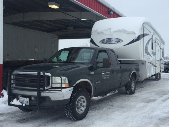
The last of the snow melted off the roof when I reached Blythe, CA.

Despite the in-transit trials, I had a great time. It was good living off the grid with my friends, soaking up the sun, fishing, paddling, horseback riding, and shopping for deals in Quartzsite. I almost sold the Mobile Mansion once — I had a decent deal to trade it for a truck camper and still get cash in hand. But I wasn’t mentally ready for such a huge downsizing. I made some improvements to the Mobile Mansion, thinking I might keep it after all.

Mobile Mansion Parking
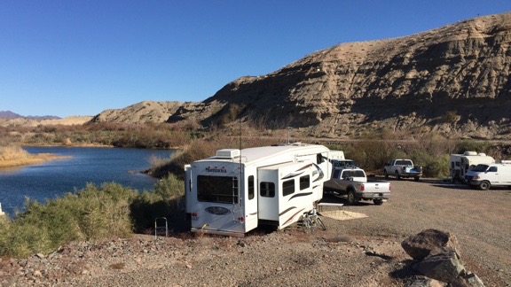
Living in Arizona along the Colorado River in the Mobile Mansion last winter was tough. Not.

I regretted not taking that offer when I left Arizona in February and started my trip to California for my frost control work there. Truck trouble stranded my truck and the Mobile Mansion in southern California, really screwing up my plans. I went home, fetched the helicopter for my contract, and spent some time in the Sacramento area with it. But without the Mobile Mansion to live in, I didn’t want to be there. I went home, leaving the helicopter, my new used truck, and the Mobile Mansion scattered around California. It wasn’t until April that I was able to fetch everything and bring it home.

After cleaning the Mobile Mansion out yet again, I brought it right to a sale lot in North Wenatchee. Once again, the sales guy told me how sure he was that he’d sell it — possibly even within a few weeks.

But I didn’t wait for the Mobile Mansion to sell before getting on with my plans. (I am so done waiting for someone else to do something to move forward with my life.) I bought a truck camper to replace it and almost immediately put it to use. After an overnight “shakedown tour,” I put it to work housing one of the pilots who worked for me in Quincy. (I suspect he would have been more comfortable in the Mobile Mansion. Oh, well.)

The sales lot guy was unable to sell it. I think it’s because he was asking so much more than it was worth, hoping to turn a tidy profit on my rig. And the fact that when he didn’t feel like coming to work, he didn’t — so the lot was closed more often than it was open. (Needless to say, he won’t be seeing me again.)

It Pays to Wait

Fortunately, I hadn’t stopped telling the people I know about it. And two of them were interested — but not for the price the guy on the lot was asking.

We agreed on a price. Ironically, it was more than the price my wasband had accepted on our jointly owned 40-acres of vacation property in Northern Arizona the month before. (Desperate sellers will take anything. Yes, I accepted the low offer, too, but the only thing I was desperate about was finally ending any ties I had to the sad sack old man I’d married 10 years before. The money was nothing. Almost literally.)

And I didn’t have to split the proceeds with anyone.

I delivered the RV to the new owners on Monday. I let one of them use my truck to back it into their hangar, which was just deep enough for him to back it in. I showed them how to unhook it. I gave them the full tour, including the “secrets” I’d learned about it in the five years I’d spent so much time in it. That took nearly an hour. I had mixed feelings as I was doing it, but I think the overwhelming feeling was that of relief.

Yesterday, I met them at the bank where we signed and notarized the title and other papers and I got my check. After handshakes and even a hug, I left them and went right to the bank to drop off the check.

Although I’m a tiny bit sad about closing the Mobile Mansion’s chapter in my life, I’m also very happy to do it. To me, the Mobile Mansion was a constant reminder of broken promises, miscommunication, and lies. Although I’ll miss its spacious comfort when I travel, I’m very glad it’s gone.

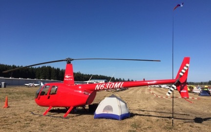
At AOPA’s Bremerton Fly In

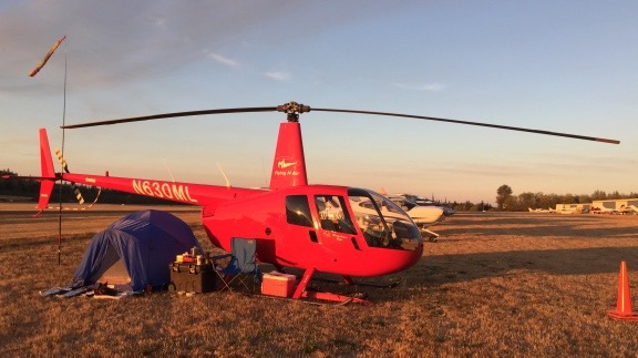
Why yes, a helicopter can camp with the airplanes at an AOPA event.

With cherry season over, travel season has begun for me. I started with a week-long road trip with my truck and the Turtleback at the beginning of the month. At mid-month, I set off in my helicopter for a four-night adventure with my favorite co-pilot, Penny the Tiny Dog.

About the Fly In

I’ve been an AOPA (Aircraft Owners and Pilots Association) member for almost 20 years now — from the very start of my aviation training. Back then, I joined up primarily to get an AOPA credit card, which would give me a 5% rebate on all of my flight training. When you’re spending $200/hour for dual time in a helicopter — the going rate back in the late 1990s — 5% back is welcome. Later, AOPA helped me finance both of my helicopters, including the R44 I bought back in 2005 and still own.

I get AOPA’s magazine, Pilot, and write for their helicopter blog, Hover Power, which has apparently been merged with their regular blog. I’d heard a lot about their fly ins, but none of them were ever convenient to attend. But this year was different. This year, there was a fly in in Bremerton, WA, which was about an hour’s flight time due west of my home in North Central Washington. Best of all, it was after cherry season, so I’d be free to attend.

A “fly in,” if you’re not familiar with the term, is a gathering of pilots who fly in to a destination. There’s usually something there to draw them in. Often, it’s something as simple as a pancake breakfast or barbecue. But when the fly in is sponsored by a larger organization, such as AOPA, there’s usually a lot more. In Bremerton, there would be seminars, vendor booths, parties, display aircraft, and that all-important traditional pancake breakfast.

The timing was right — I had nothing else on my calendar (although I admit I turned down two charter flights for that weekend). Best of all, the weather would be perfect for a direct flight over the Cascade Mountains. And I even had one or two destinations for after the fly in so I could extend my weekend from two nights to four.

A Stands for Aircraft

As I sort of expected, it wasn’t going to be as easy to arrange as I’d hoped.

The camping information I was promised when I signed up never arrived in my email in box. (Oddly, a lot of stuff I’ve been expecting has never arrived; I’m beginning to think I’ve got email issues.) When the Bremerton Fly In website proclaimed that camping was full, I decided to follow up with AOPA. I was bounced from one person to another and finally began an email exchange with a woman named Paula who could help. She confirmed that I was registered for camping. But because I was flying a helicopter, they’d park me on the “north ramp” and help me get my gear over to the camping area.

So I would not be able to camp with my helicopter?

No, Paula told me. They can’t have helicopters with the airplanes. There were only two helicopters signed up and the other one wasn’t camping.

I told her that was unacceptable. I told her I wanted to camp with everyone else and that I needed my aircraft as a place to secure my valuables. I reminded her that the A in AOPA stood for Aircraft and not Airplane. I told her I’d been a dues-paying member for almost 20 years and was entitled to the same treatment as all other members.

She was at a loss for how to proceed, so I helped out. I told her I’d be arriving early on Friday and departing Sunday. Surely they could park me on the edge of the camping area and let later arrivals fill in the space between me and the folks that arrived before me.

To my surprise, she agreed. She said that many people arrived late on Friday and most left on Saturday so that should work.

I told her I’d be there sometime between 2 and 3 PM on Friday. I also told her I’d bring wheels in case I needed to be moved on the ground.

And then I set about packing.

Packing for the Trip

I do two kinds of camping: tent camping and RV camping.

RV camping is easy; almost everything I need is already stowed in the Turtleback. I add food and clothes, put it on the back of my truck, and set off.

Tent camping takes a bit more effort to prepare for. I stow all of my tent camping gear in two wheeled tool boxes. If I’m going on a regular car camping trip, I add food and clothes to those boxes, include a cooler with ice block jugs for cold items, and gather together items from the Turtleback, like my portable grill and fuel. When I went camping last summer with the guy I was dating at the time, we crammed all this stuff into the back of my Jeep. The wheeled boxes make it easy to transport camping gear from a vehicle to a campsite that might not be nearby.

I don’t go backpacking anymore. At least I haven’t for a very long time. I have no desire to do so and it would be a hard sell to get me to change my mind.

Camping with the helicopter would be a little more challenging. I had room for the smaller of the two wheeled boxes, but not both. Fortunately, I didn’t need all the gear in both boxes. I’d need a small cooler, but not my grill. I’d need a stove and percolator, but not a mess kit. I’d need a tent, but not a large tarp. So I had to go through all my gear and get what I needed packed into the smaller of the two boxes. Tent, air mattress, sheets, fleece sleeping bag, chair, throw rug, lamp, small tarp, stove, fuel, percolator. Most of it fit right into the bin. The rest, including a small cooler with milk for my coffee, dog food, drinks, and other food items, filled the back seat area of the helicopter. I added my orange traffic cones and ground handling wheels. My weekend bag full of clothes went under one of the back seats.

I put Penny on her bed on the front passenger seat — there was no room for her in back — and at around 12:30 PM on Friday, we set off for our long weekend.

The Flight West

We stopped at Pangborn Airport to get fuel before heading west. I had to wait behind two other airplanes fueling up. Is it my imagination or are there more planes flying at Pangborn these days?

I set my panel mount GPS for Auburn Airport and Foreflight on my iPad (EFB) for Don Johnson’s Home heliport. Don (not the famous one) is a friend of mine who owned a helicopter until just a few years ago. He recently accompanied me on a flight from the Sacramento area to his home in Auburn, WA. Don had a pair of helicopter door covers he no longer needed and wanted to give them to me. Since his home was on the way and I hadn’t seen him for a while, I figured I’d drop in for a few minutes.

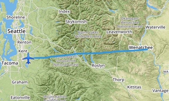
The sky was cloudless and winds were light when we took off from Pangborn heading almost due west. My track would take me straight over the Cascade Mountains, between Stevens and Stampede Passes. This is a sort of “no mans land” for pilots — once I left the Wenatchee area, I’d pass over just two paved roads for the next 50 or so miles of the 80 nautical mile distance. In between were steep, rocky mountains peaks, steep slopes, mountain streams, and lakes. An engine failure would be a very bad thing — but any pilot who flies chooses a route based on the convenience of an engine failure along that route probably shouldn’t be a pilot.

Wenatchee to Auburn
My route west took me straight across the mountains. This is my actual track, recorded by ForeFlight.

I climbed out gradually, crossing each ridge I reached at a few hundred feet above it. Crossing the Cascades isn’t a big deal on a clear day. Although I honestly can’t remember the highest altitude I reached, I doubt it was more than 6,000 MSL. While a lot of sea level pilots might think that’s high, I learned to fly in Arizona, where there are many airports at 5,000 feet elevation or higher and mountain ranges that forced me above 8,000 feet to cross. The air smooth for most of the flight, although it did get a little rough when I reached the lakes far below me between Cle Elum and Snoqualmie Pass. I crossed I-90, continuing west. Mount Rainier towered in the near distance, snow-covered and serene. I remembered the flight I’d done a year or two before, following the course of the Green River to the base of the mountain and thought again about the deserted fire lookout tower we’d found perched on one of the mountain’s north-reaching arms.

From there, the terrain was mostly downhill. I descended, letting my speed creep up to 120 knots at times. The lower we got, the warmer it got. I opened the front door vents and the main cockpit vent. Penny stirred in her seat yet again — her bed was in the sun and I could tell that she was frustrated that she couldn’t climb in back. It was hot enough without a black fur coat on.

We got close to Don’s house and, as usual, I had to hunt around a bit to find it. The GPS coordinates on Foreflight were off by at least 1500 feet. I knew some of the landmarks and, of course, I knew what Don’s house looked like from the air. But the area was thick with tall trees. I finally caught sight of it, then set up for a straight in approach on my usual route in. It’s a steep descent; you can see a video of it in my post about my April flight with Don. As I came in, I saw two of Don’s garage doors closing; he was working in one of his garages — he has 10 — and was trying to prevent my downwash from blowing things around in there. Then we were on the ground and I was cooling down and Don was outside waiting for me. I let Penny out to run around with Don’s dog while I shut down the engine.

We chatted for a while and he gave me the two door bags, which I managed to squeeze into the helicopter with the rest of the gear in the back seat. Then we went inside for a cold drink. When he heard I was camping, he insisted on giving me a battery operated fan he’d used on a recent overnight bike ride. He said it had been so hot every night that he would have been lost without it. He gave me a fresh set of batteries to go with it, too.

I was already running late for my promised early arrival at Bremerton, so I didn’t stick around long. I got Penny back in the helicopter, said goodbye to Don, and started up. It was just after 2 PM when I climbed out the way I’d come.

Arrival at Bremerton

AOPA released an 18-page PDF with arrival procedures for the fly in. It contained detailed instructions on how airplanes coming in from just about any direction should approach and enter the traffic pattern. Although Bremerton is not a towered airport, there would be an Air Boss directing traffic. The document listed frequencies, provided waypoints (with GPS coordinates), and showed maps. If you were flying an airplane and had any questions about flying in, this document would answer it.

Unfortunately, the word “helicopter” did not appear anywhere in the document. There were no helicopter instructions at all.

Airplane pilots might be thinking, so what? Just follow the airplane instructions. But that’s not what helicopter pilots are supposed to do. FAR Part 91.126(b)(2) is clear on this:

Each pilot of a helicopter or a powered parachute must avoid the flow of fixed-wing aircraft.

To me, that means don’t follow the instructions in that 18-page document.

So what do I do? Fortunately, I knew exactly what the airplanes would be doing so they would be easy to avoid. I also knew that the Air Boss would be directing traffic. I figured I’d fly in as I normally would: direct to the airport and make a call a few miles out with my intentions. In this case, however, I’d be calling the Air Boss with a request and take his orders for landing.

I skirted around the south side of the surface airspace for Seattle Tacoma Airport (KSEA or SeaTac) and headed directly for Bremerton. I admit that I wasn’t too happy flying over the south end of Puget Sound — all that open water! I climbed to about 2000 feet to make a glide to land in the event of an engine failure just a little more possible. Then, on the other side, I descended to about 1000 feet, taking in the scenery around me. It was hazy from fires that were burning on the Olympic Peninsula to the northwest. I was flying over a land of forest-covered islands with straits between them.

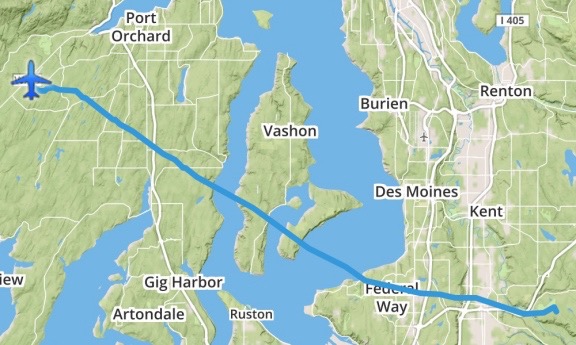
Auburn to Bremerton
Here’s my route from Don’s place to Bremerton.

I tuned into the frequency for the Air Boss at Bremerton. It was busy with pilots calling in and the Air Boss patiently telling them to follow the procedures for approach. Occasionally, he would clear airplanes to land and provide taxi instructions. Once, he urged a pilot to get off the runway because another plane was landing behind him. (That 18-page document said, in several places, that pilots should not linger on the runway.)

I didn’t have the airport in sight when I called in from 3 miles out. I was only 500 feet up, avoiding the flow of fixed-wing traffic by staying below the traffic pattern altitude. “Bremerton Air Boss, helicopter six-three-zero-mike-lima is three east landing for camping.”

There was a pause before the Air Boss replied, “Are you the one that called in?”

“I’ve been emailing with Paula,” I told him. (I should mention here that a benefit of being a member of the female pilot minority is that my voice is easily distinguishable from other pilots on the frequency, making it possible to skip identifiers once in a while. Normally, I’d include my N-number in every radio communication.)

“Okay, zero-mike-lima. We know where to put you. Do you see that airplane on downwind?”

I looked. At that point, I could see a plane flying south at what might be traffic pattern altitude. “Zero-mike-lima has that traffic in sight.”

“I’m going to want you to make a lower traffic pattern to the south, outside of his,” the Air Boss said.

As I tried to envision what he wanted, the runway came into view. There was no one on base or final. It would be so easy to just dart across the runway. But I obediently started a turn to the southwest. “Zero-mike-lima turning downwind.”

“I’ve got you in sight now,” the Air Boss said. “Zero-mike-lima, just cross the runway to taxiway alpha and turn south. They’ll direct you.”

“Zero-mike-lima crossing the runway.” I banked to the right and bee-lined it for the taxiway on the opposite side of the runway. I found myself in a hover not far from where some airplanes were parked with tents set up. South would have taken me farther away from them, completely out of the area. So I turned north, figuring he’d made a mistake, looking for someone to flag me in.

A guy with two orange sticks like the kind they use to direct airliners was at the north end of a grassy parking area, directing me in. I followed his instructions to set down at the top of a tiny slope where stakes had been put in to prevent pilots from driving down the little hill. There was some confusion when he had me park perpendicular to all the other aircraft and I asked him whether I could turn sideways. He said he knew helicopters needed to take off into the wind so he thought I’d like that direction better. But the wind was a tiny breeze and I wasn’t taking off for two days. So he let me park facing west, which turned out to be a good thing when the sun really beat down on my camp.

I put Penny on her leash and dropped her out the door while I cooled the helicopter’s engine and shut down. We had arrived.

Making Camp

As I had suggested, they parked me at the edge of the airplane camping area. In the hours to come, they’d start parking other airplanes west and south of me. After climbing out and chatting with Paula, who’d come in a golf cart to greet me, I set up camp.

The breeze was just enough to keep me on my toes as I set up my little domed tent, which I’ve had for at least 20 years. It’s a good quality tent with a rain fly that really works — I can tell you from experience. I had bought new stakes for it and brought along a small sledgehammer to drive them in. I only staked the four corners. Then I inflated my air mattress using a rechargeable air pump I’d bought a few weeks before and made the bed with clean sheets. I opened my fleece sleeping bag and draped it over the bed as neatly as I could. It was going to be hot that weekend — it had already topped out at over 90°F — and I couldn’t imagine needing more. I set Don’s fan up nearby and hung a small battery lamp from the top of the tent. I didn’t bother with the dark blue tent fly — I knew from experience that it would turn the tent into a small oven.

Campsite in Afternoon
My campsite, right after setting up.

I stowed the gear I didn’t need back in the rolling box and set up my stove on the lid. I set up my chair beside it and my cooler beside that. I set the stack of cones — I really only needed one — under the end of the forward facing rotor blade to prevent a fuel truck or some other tall vehicle from driving where a blade strike might be possible.

I was just putting up my wind ribbon on a pole when Paula drove up again. “I can tell you’ve done this often,” she said.

I laughed. “No. This is only my second camping trip with the helicopter. But I’d like to do it more.” (The other time, in case you’re wondering, was at the Big Sandy Shoot way back in 2006.)

By this time, the sun was starting to dip to the west and the north side of the helicopter was in the shade. I settled down on my chair for a rest and to cool down. Penny, who’d been off her leash for a while, had to go back on it; other pilots were arriving and more than a few had dogs Penny wanted to visit with. I set her up with some cold water and food and watched the world go by while sipping an ice cold lemonade from my cooler.

Friday Night at the Fly In

It was probably around 5 PM when Penny and I headed toward the main event area. I didn’t have any tickets for any of the meal events and needed to buy them. I also needed a schedule of the seminars and other activities that would keep me busy on Saturday.

Some of the AOPA guys and vendors were still setting up, but the place was pretty much ready for the event. I wandered around, getting the lay of the land — the main event tent, the smaller session tents, a handful of vendor booths, and the big exhibition tent (which was closed). A bunch of airplanes were on display, including Miss Veedol from Wenatchee. I chatted briefly with Tim, one of the pilots who I already knew. Like me, he’d had a smooth direct flight across the Cascades.

I bought tickets for that evening’s party, the Saturday pancake breakfast, and Saturday’s lunch. Then, since it was hot and there wasn’t much else to do, I headed back to my camp.

A woman wearing a propeller beanie hat and riding a bicycle rode over to chat. Her name was Patrice and she was soon joined by her husband Pat who I’d apparently met (but, as usual, didn’t remember) in Wenatchee when he’d stopped in on a flight. Other people came and went. Some asked questions about the helicopter. I saw one person take a photo of my campsite when he thought I wasn’t looking.

After a while lounging around, studying the program, and catching up on social media, I headed back over to the event area. Although I’d arrived right on time for the party, there was already a long line for food. Penny and I queued up. I chatted with a couple on line behind me as we inched forward. Dinner was pulled pork with cole slaw and beans. And one of those Hawaiian rolls that was so good I finished it before I got to the salad bar.

Although I saw Patrice, who was looking for Pat, I wound up having dinner with Tim and the Miss Veedol gang. Tim had said to me that I had to meet his new friend Barry, who was also a writer. Barry, who was with them at dinner, turned out to be none other than legendary pilot/author Barry Schiff, a man who has been writing about aviation almost as long as I’ve been alive. We chatted a bit about writing and he got me motivated to get back to work on my flying memoir. (A winter project?)

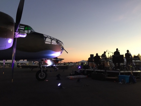
All the time we were eating and chatting, a live U2 cover band was playing outside on a stage set up in front of the B-25, “Grumpy.” As night fell, it got cooler. There were stars and a big moon. It was great to be among so many pilots, most of whom were camped out for the night. I said goodnight to my companions and headed back to camp with Penny. I let her off her leash for the walk between airplane tent camp sites and she tore around like a crazy dog, excited to be let loose after hours of being under foot and under tables. I made a quick stop at the blue plastic building — which had a nice hand washing station beside it — along the way.

Music and Warbirds
They set up the band in front of “Grumpy.”

First Night at Camp

Back at camp, I took a few moments to attach the rain fly to the tent. Despite the fact that it had gotten very warm during the day, it had cooled off considerably. My tent has thin nylon walls, which makes it great for summer camping. But in cold weather, it really needs that full-sized rain fly to provide a layer of insulation. The wind had died down completely, so it was an easy job. I staked it out away from the tent in the back so I’d get air flow through the back window, as well as along the staked poles, not really knowing what to expect.

We crawled into the tent and settled in for the night. I closed the screen but left the door panel open. I got a reasonable flow of air through the tent. That was great — when I first lay down. But as the night progressed, the air got cooler and cooler. I woke up in the middle of the night, thoroughly chilled. After a quick walk in the moonlight to the blue building, I closed up the tent more securely, hoping to keep more warmth in. But I slept fitfully for the rest of the night, feeling the cold ground come up through the bottom of my air mattress. My fault entirely — I’d expected it to be very warm and it wasn’t. I’d have to redo the bed for Saturday night.

Saturday at the Fly In

It was light out — although the sun hadn’t yet risen — when I fully woke the next morning. I threw on some clothes and stepped outside for another visit to the blue building, this time with Penny in tow. It was a perfectly clear day with the temperature probably in the 60s. The sun felt good when it rose above the trees to the east and shined down on my little campsite. Other campers were stirring.

First Light at the Campsite
First light at our campsite on Saturday morning. It was a beautiful day!

Percolator on Stove
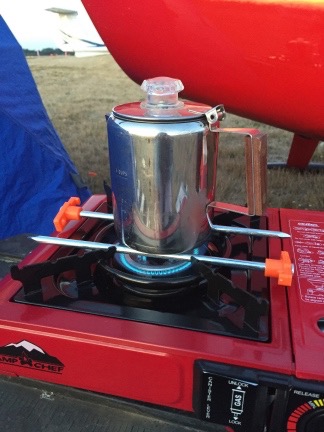
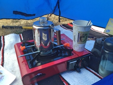
I “fixed” my coffee pot size problem with two heavy tent stakes. And no, the plastic parts did not melt.

I prepped the percolator to make a cup of coffee and got my first surprise: the pot was too small to fit on the metal brackets over the burner! ! Instead, it slipped down onto the actual burner, extinguishing it. I felt a moment of panic before annoyance took over. Surely I could do something to make this work. The solution turned out to be two of the tent pegs positioned on either side of the burner. The pot sat atop them. Problem solved. I was drinking fresh, hot coffee a short while later.

Other than a few snacks, I hadn’t brought any food — at least not for me. I did bring food for Penny, which I put out for her. She sniffed it and gave me a look as if to say, “You’re kidding, right?” For the rest of the trip, I’d be sharing my food with her.

After I made a second cup of coffee and dressed for the day — at which time I decided I needed a larger tent that I could actually stand up in — we headed over to the main event area. Breakfast lines were surprisingly short. I had pancakes and sausage, sitting inside the main tent with two pilots from Canada.

Then it was off to the seminars.

The first was about ADS-B, a new ATC tracking system that will be required on all aircraft that fly wherever a Mode C transponder is required — basically within 30 miles of any Class B airspace (think Seattle, Phoenix, Denver, LAX, JFK, etc.) — by 2020. I had a vague idea of what ADS-B was and what it might entail in the way of avionics upgrades, but by the end of the session I completely understood what I’d have to do and how I might benefit. I say “might” because I generally fly too low to be picked up on radar around where I live — literally “below the radar” — and since the ADS-B stations are ground based, I wasn’t likely to be picked up by any of them, either. But if I had a dual band receiver, I could pick up signals sent out by other ADS-B equipped aircraft so I’d see them on my GPS screen — if my systems were compatible.

After that session, the next time slot didn’t have anything that interested me — remember, this event was primarily for airplanes and so much of what the sessions covered simply didn’t apply to helicopter flying — so I decided to take that time to visit the vendor tent. I was mostly interested in applying what I’d just learned to figure out what my upgrade options were and what they’d cost me. There wasn’t much memorable about the vendor area except a few ForeFlight clones, a very crowded Garmin and ForeFlight booth, and a handful of vendors specializing in products or services for airplanes.

ForeFlight, in case you don’t know, was the first successful iPad app for pilots. I was an early adopter and have been using it for years. The FAA even certified ForeFlight on my iPad as my EFB (electronic flight bag) so it’s actually not legal for me to conduct a Part 135 charter flight without it on board. I can’t say enough nice things about ForeFlight. It’s changed the way I plan flights and navigate while in flight. It’s also saved me hundreds of dollars every year on Garmin GPS updates for my panel-mount Garmin 430 GPS — indeed, it saves me enough to buy a brand new iPad with ForeFlight subscription update every two years if I want/need to. (I’m even thinking of pulling that 430, which cost a whopping $12K back in 2005, out of my panel.) And Foreflight isn’t satisfied to rest on their laurels and just rake in the dough like other aviation product makers do — ahem, Garmin? — they’re constantly improving and updating their app, adding features all the time. They even listen to feedback from users; when I complained that their flight planner wouldn’t let me plan a helicopter flight with less than 30 minutes of reserve fuel (the airplane minimum), they modified the software to allow helicopters flight plans with 20 minutes of reserve fuel, as allowed by the FAA.

Do you think I like ForeFlight?

Anyway, since ForeFlight came out, a bunch of copycats have followed it. Garmin makes one of them. (Too little too late, guys.) There were a few others in the vendor tent. I wasn’t interested in switching. I’m sure that none can offer any more helicopter-specific features than ForeFlight or save me any money. And who wants to learn a new app?

But the beauty of using a tablet for an EFB is that I could easily change apps if I wanted to without dumping a lot of money on new panel-mount hardware.

I chatted with a few vendors about a few products. Along the way, I learned that one vendor’s ADS-B solution wasn’t certified for helicopters because of vibrations (huh?) and that I could probably get an ADS-B transmitter/receiver that would work with my iPad and ForeFlight. Although all the vendors at the seminar had urged pilots to get their systems upgraded now because of long waits at avionics shops, it’s clearly in my best interest to wait. As time goes by, more and possibly better and definitely cheaper solutions are coming to market. I could spend $3,000 to $5,000 now or wait three years and spend $1,500 to $4,000 for something better that might be more powerful or smaller/lighter. That’s what I think, anyway. Time will tell.

Penny Sleeping at Seminar
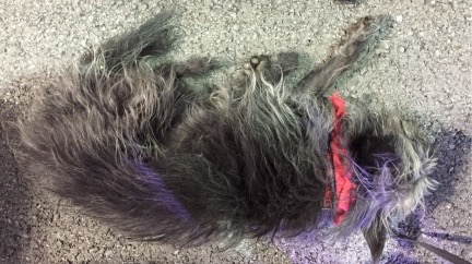
Here’s Penny, sound asleep at the ADS-B seminar.

I had lunch at 11:00 and ate it at a table in the shade of the big main stage tent. It was getting hot outside, just as forecasted — a beautiful sunny day that would soon be in the 90s. I shared my hot dog with Penny, who gobbled it right up and looked for more. She’d been extremely well-behaved all day, snoozing on the floor or my lap in the seminar and letting me carry her in the more crowded areas of the vendor tent.

A speaker came on the stage at 11:15. It was an older female pilot who had made as an airshow pilot. She started her presentation with a story about her father, an airline pilot, who crashed his plane when a passenger went berserk and how much it meant to her when accident investigators determined it wasn’t his fault. It was a weird story and it really turned me off to whatever came next. I got the distinct impression that she’d been telling that story in front of every audience she’d addressed for the past forty years, vindicating her father every chance she got. I was done eating anyway, so I left.

I’d planned on going to the ForeFlight tips seminar at 11:15, but arrived at 11:30 to a standing room only crowd. There was no way I was getting inside the tent — people lined the outside of the seating area and flowed out the doors. I didn’t think I wanted to go in anyway. With poor ventilation in the tent, it had to be nearly 100° in there. I’d get my tips some other time.

Grumpy
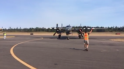
“Grumpy,” coming in to park after a flight.

Instead, I went back to the vendor tent and chatted with the few vendors that were too busy to speak to on my first time through. Then I wandered around the airplane exhibits, chatted with a few pilots, and watched the B-25, “Grumpy,” take off with a bunch of passengers who’d paid $495 for the privilege.

The 12:45 seminar I chose was back at the main stage. It was led by AOPA’s media guy, who apparently makes videos related to flying. He showed a series of snort video productions about various pilots or aircraft. Although they were pretty good, his “Top 40 Radio Voice” narration didn’t always fit in and sometimes made me laugh.

An hour later, I was sitting closer to the front of the room in the same tent for Barry Shiff’s presentation, which consisted mostly of funny flying stories with photos. It was, in a way, a sort of aviation stand up comedy routine. Not laugh-your-ass-off funny, but extremely entertaining. Barry has had a long career in aviation and aviation writing and has gotten many opportunities to be part of many interesting projects. Am I alone in considering him a legend? I felt fortunate to have had the opportunity to chat with him the evening before.

I stayed in the tent for the start of the AOPA Pilot Town hall — the last event of the day — but it seemed too much like an airplane-specific commercial for AOPA membership than a chance to learn something. So Penny and I wandered back outside and killed time at vendor booths and watching the B-25 some more. When the Town Hall was over, we near the front of the line for the “ice cream social,” which was basically a bunch of volunteers handing out wrapped ice cream sandwiches and pops that had to be eaten very quickly.

And then it was over. AOPA staff members and volunteers had already begun taking video equipment and signs out of the seminar tents. Vendors began packing up. And the folks who had flown in began leaving.

The stats, available a few days later, were impressive for the event. Over 4,000 people attended, with 690 aircraft (that would be 689 airplanes and one helicopter) flying in and 162 campers. (I’m thinking the campers number is people and not planes, but it could be planes because there were a lot of us.) You can find a summary with some photos here. An AOPA photographer came by my site on Saturday morning to take a photo but I haven’t found it anywhere online yet.

Evening After the Event

Penny and I headed back to the helicopter. I attempted to feed her again and she again turned her nose up to it. She’d had some water during the day and had more when we got in. I sat in my chair in the shade, watching the parade of airplanes taxi by and then take off past me. About half the campers had packed up and left; the others seemed to be sticking around for another night like I was. A few people came by to chat and look at the helicopter.

Someone came by with a flyer for a party that would have a live band. Its location was a bit vague so when Penny and I tried to find it later on, we found a hangar party with no live entertainment that seemed to be wrapping up and a tiny gathering of people in front of a band that seemed to be practicing. Nothing that matched what was on the flyer. (In hindsight, I think it was the gathering by the band which was likely poorly advertised so it was poorly attended.)

Penny with a B-25
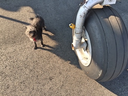
Penny looks really tiny next to the front gear of a B-25.

I took some more photos of the classic airplanes sitting around, got yelled at for letting Penny off her leash, and then wandered over to the airport restaurant, leaving Penny tied up outside. (Penny is used to being left on her own when I go into a restaurant or someplace else she can’t go and is very well behaved when I have to leave her.) The place was crowded and I think the staff was overwhelmed. There was no air conditioning and the evaporative cooler I think they had running made the place kind of cool and steamy — if that’s even possible. I had a very unsatisfying meal, bought a plain hamburger for Penny, and headed back to camp. By this time, the sun was setting and I was ready to call it a day.

I remade the bed with my fleece sleeping bag zipped up and my top sheet folded inside it. This would provide two more layers between me and the ground. Then, after watching the sun set and the moon rise, visiting the blue building, and tidying up my camp in case the wind kicked up overnight, I crawled into the tent, got into my pajamas, and slipped into my sleeping bag. Penny curled up on her bed nearby. I read for a while and then fell asleep.

A Foggy Morning

Bremerton was IFR when I woke up the next morning. That means visibility was below minimums and it wasn’t legal to depart. Of course, helicopters can usually get a special VFR clearance, but what good would that do me if I couldn’t get to my next destination? Besides, I wasn’t in any hurry. As a matter of fact, I wasn’t quite sure where I was going to go.

Inside Coffee
My vestibule was large enough to set up my stove and make coffee.

After a visit to the blue building in the dreary predawn light, I staked out the front of my tent fly to create a little vestibule, moved my stove into it, and got the percolator going. A while later, I was drinking hot coffee while I caught up on social networking on my air mattress.

Outside, the other campers were beginning to stir. It was kind of wet outside — not the weather you’d want to be rolling up a tent in — so few were packing up. As the morning progressed, a few planes able to get IFR clearances took off into the gray sky. After a second cup of coffee, I got dressed, put Penny on her leash, and went back to the restaurant for breakfast. There were fewer people in there and both service and food were better. I had an egg scramble with bacon that was huge and brought back some for Penny. When I gave it to her back at camp, she turned her nose up to it, which got me worried because she hadn’t eaten much of the hamburger the night before either.

Back at camp, I made plans for departure. I’d originally thought I’d be bringing the helicopter to a children’s burn camp event in Bellingham, but the friend who’d asked me to do that had completely dropped the ball and hadn’t made any arrangements. (He later told me he’d been busy with a lot of other things. Whatever.) I was due to visit a friend in Salem, OR, but hadn’t planned to arrive until Monday and he wasn’t ready for me a day early. That meant Penny and I had a day to kill. With a helicopter.

I took my time packing up my camp. The weather was clearing slowly and there were pockets of visibility along the coast. I definitely wanted to be south of where I was by the end of the day, making my trip to Salem shorter instead of longer. But where to go? I did a bunch of research on my iPad and found an inn in West Port, WA, on the coast, that was walking distance from the airport there. They allowed dogs and had vacancy. I didn’t want to book a room until I was sure I could make it there, but there didn’t seem to be a problem on a Sunday night.

So with a destination in mind, I finished packing up my campsite, getting all my gear back into the rolling box and eventually back into the helicopter. A few of the folks I’d spoken to over the past day and a half stopped by to say goodbye. The weather had improved to the point where the airport was marginal VFR, so when I was ready to go, I started up the engine and warmed it up. Penny seemed to be happy in the co-pilot seat, curled up on her bed, already resting up for the next adventure.

It was just after 11 when I lifted off. Where was I going? For pie, of course! But that’s another story.

Summer 2016 Road Trip, Day 8: Winetasting My Way Home

The day I learn just how big Canada’s Okanogan wine country is.

I woke up not long after dawn, although it was a while before the sun would shine down on the Turtleback. I finished up the Day 6 blog post while I was having my coffee. No attendant had come by to collect my $12 camping fee, so by the time Penny and I rolled out at about 9 AM, we’d had our fifth free night of camping.

We got back on the main road (Route 3 AKA Crowsnest Highway) and headed toward Princeton, where I stopped for fuel. That’s where I learned that in Canada, green pump handles do not mean diesel; yellow pump handles do. I had to cancel a transaction and move the truck before I could fuel up. (I really do need to pay closer attention.)

The road continued along the Similkameen River and I have to admit that a full week later (as I write this) I don’t remember anything terribly interesting about it. (This is why I really need to write up my trips promptly.) I do recall it being a pleasant enough drive without much traffic.

Hedley

My canoeing friends at Hozomeen had highly recommended taking the tour offered by the First Nation People of the mine high above Hedley, so when I saw signs for that town, I turned in. I parked across the street from the Visitor Center/Museum and, leaving the windows open for Penny, took a walk around to see what I could learn about the tour.

There was a gift shop in what looked like an old house with a sign proclaiming it had “extraordinary gifts for extraordinary people” and I went in to check it out. It was a disappointing collection of the same tourist shlock you’d find in any area gift shop, most of it Chinese made, although there was a collection of supposedly locally made goat milk soaps. The place was for sale and the guy behind the counter, who probably owned it, was obviously not interested in replenishing any stock he sold; the shelves were half empty. He did have a decent collection of books and maps, though, and if I was still buying that kind of stuff, I probably would have bought a few.

Outside was a farmer’s market consisting mostly of a few vendors selling peaches. A duo performed live music on the gift shop’s porch; he played guitar while she sang off-key, doing an especially bad job on a Janis Joplin song. Nearby was a roadside restaurant that was open but also had a For Sale sign on it.

It was not a very uplifting spot.

Mascot Mine
Mascot Mine, shot through the telescope.

There were no signs around for any tours so I decided to check out the museum, which was also in an old house. I got about two steps onto the porch before a young woman from just inside the door approached me and asked me if I’d like to know about the town. Sure, I told her. So she told me about the town’s history as a mining community and pointed out the Mascot Mine site perched at the top of a nearby mountain. A small telescope had been set up and aimed right at it, so I could look through and see the buildings. Before those buildings had gone in, miners had to hike up there every day. There was a lot more, but I honestly don’t remember it. The young woman was knowledgeable and friendly and could answer just about any question I had.

When I asked about the mine tours, she said they were closed for the season — in the first week of August? — and she wasn’t sure if they’d ever start up again. That seemed a real shame because the tours appeared to be the only thing of real interest in the town. The museum was interesting, but unless you’re a real history buff, it isn’t worth stopping for.

I did walk through the museum and look at the exhibits. That’s where I saw photos of all the buildings in town that had burned down or been washed away by floods over the years. No wonder there wasn’t much going on in town.

There was a cafe in one room and I ordered a piece of pie. I sat out on the porch to eat it, chatting with the young woman and an older woman who I suspect might have been her grandmother. Then the phone rang and the older woman was called away. Two other tourists stepped onto the porch and the history lecture began again for them.

I threw away my paper plate and headed back to the truck. I took a slow drive through the downtown area, hoping to see something of interest and came up empty.

So I got back on Route 3 and continued on my way.

Fruit Stands and Wineries

It wasn’t long before I reached Keremeos. That’s where traffic picked up and the fruit stands began. I don’t think I’ve ever seen so many. I stopped at the first one, not expecting to see many more, and bought some very ripe apricots. Back in the truck, I passed one after another.

I paused to look at the Wine Country brochure I’d picked up in Hedley. That’s when I discovered that the Okanogan Valley between Penticton and the U.S. border was just crammed with wineries. It was like Napa Valley. I’d known there were wineries there, but never expected that many.

Pedometer
Guess which day I went wine-tasting? I grabbed this screenshot the next day, after all my steps had been tallied.

It was Sunday and I figured I may as well have a day of rest after my week of daily hiking. So I picked out some wineries to visit: Seven Stones, Burrowing Owl, and Road 13 (recommended by a Facebook friend).

Seven Stones has a small tasting room with an outdoor patio overlooking the Similkameen River valley. But their draw seems to be their “wine cave,” which is where the wines are stored. After letting Penny out for a quick run and to meet the winery dogs, I put her back into the truck and went inside for a tasting. The tastes were tiny — barely enough to really taste the wine. (I understand that they don’t want people to get drunk, but I need two sips to get a good taste of a wine.) I asked what the area specialized in and was told “reds.” Not a specific grape — just “reds.” Okay. I wound up buying one bottle each of Merlot and Meritage. (Unless the wine is awful or the staff is rude, I always buy wine when I go to taste.)

I should mention that the whites were good, too — nice and dry, the way I like them — but since I rarely drink white wine and have accumulated quite a collection of it, I’ve decided not to buy any, no matter how much I like it. I really need to drink (or serve) what I’ve got before I buy more. White wine just doesn’t last as long as reds do.

Seven Stones Wine Cave
The wine cave at Seven Stones Winery.

I asked about the famous wine cave and was told that they do tours for $7 per person. What the hell; I was on vacation. So I paid for my wine and the tour and the woman who’d done my tasting took me out back where a spiral staircase wound down into the base of a tower. Through a door was a basement room with a kitchen area and some stacked wine barrels. My tour guide told me they have cave tastings and other events down there. Through another door was a larger room with many more stacked barrels. An open elevator large enough to accommodate a loaded forklift stood against one wall; a very nice mural of the seven stones of the area (which give the winery its name) decorated the elevator shaft. It was all nicely done and very pleasant and the smell of wine was heavy in the air. It was apparently the only wine cave in the area. It was more of a basement than a cave but I don’t think “Tour our Wine Basement” would be quite as impressive on signs.

Burrowing Owl's Guest House
My seat on the deck at Burrowing Owl gave me a nice view of the Guest House facility. If a room had been available and they were dog friendly, Penny and I would have spent the night.

Back at the truck, I gave Penny another chance to run around. Then we loaded up and headed out to our lunch destination: Burrowing Owl Estate Winery in Oliver. This is quite a place, with a large tasting room, restaurant, and “guest house.” It reminds me of a cross between Cave B in Quincy and Tsillan Cellars in Chelan. I was hungry — I hadn’t eaten since breakfast and it was well after noon. I left Penny in the truck with the windows open and went into the restaurant. After washing up, I was seated out on a deck overlooking the valley. The host who sat me commented on how great the view was; I didn’t tell him that the view off my own deck at home was a lot better.

Duck for Lunch

Dessert
My lunch: duck (top) and Napoleon (bottom).

I had an amazing meal. After a week of camping and eating simply prepared food mostly from my garden, it was a real treat to have food that took flavor combinations into consideration. I started with a salad special that combined greens with beets and goat cheese and followed that up with the most amazing duck confit (duck leg, cornbread, popcorn gremolata, creamed corn, and baby kale). A glass of the recommended wine, a Syrah, went with it. Dessert was a Napoleon of strawberries, hazelnut puff pastry, and creme fraiche mousse with basil and white chocolate ice cream. (How do I remember this? I’ve looked up the menu online.) It was the flavor combinations that they got so completely right. I’d arrange different combinations on my fork and taste it for a constantly varying result. Wow. This was, by far, the costliest part of the trip — my lunch cost nearly $75 US — but it was so worth it.

After lunch, I went to the tasting room and tried four wines. I would up with a bottle each of the Syrah and Merlot. A required $5 tasting fee supposedly went to a fund to protect burrowing owls, which, ironically, they didn’t have on the property.

Tractor outside of Road 13
One of the two tractors outside of Route 13 Vineyards. As you can see, the terrain in the area is remarkably similar to where I live, which was only 3 hours away.

My last winery of the day was Road 13 Vineyards. This is a dog-friendly place on a hill overlooking the valley, so Penny came in with me. The building has turrets, like a little castle, and big windows to take in the view from inside. Like our local Jones of Washington Winery, they use a tractor as a symbol of their place; it appears on the foil caps over each cork and there are two of them parked outside.

I tasted a few wines and liked about half of them. The one I liked most was way over my budget (of course), but I wound up buying one bottle each of Merlot/Syrah and a red blend. Oddly, when I asked what the area specialty was, the response was simply “reds.”

I might mention here that in each winery, I asked what the policy was for taking wine across the border back to the U.S. In each place, I got a different story. One said two bottles per person and then 23¢ per bottle in excess. Another said one bottle per person and then a tariff based on price so I should keep my receipts handy. The said that all wine was subject to tariff, but it wasn’t more than about a dollar a bottle. Seems to me that this should be a question most wineries so close to the U.S. border should have a correct and consistent answer for.

One More Night? Maybe Not

By this time, I’d had enough wine tasting. In all honesty, I think I’d had enough vacation. I felt a little road weary. I had no real plans for an overnight stop or destination. I figured I’d just head south and get back into the U.S., then decide what to do.

So we headed south,crossing the border at Osoyoos, BC, just north of Oroville, WA. There was no one on line ahead of me. I stopped and handed over my Passport Card. There were two people in the booth, a woman and an older man. I soon realized that the woman was training the man.

He asked me where I lived and I told him Malaga, near Wenatchee. He asked how long I’d been in Canada and I told him just a few days. He asked where I’d been and I told him various parks along the southern border of BC. Then I named them. He asked if I was bringing anything from Canada into the U.S. I told him I’d bought six bottles of wine. He consulted with his companion and she signaled that it was okay. He then asked about farm produce and firewood. I said I had some of both on board but I’d brought them from the U.S. (I’d eaten all the apricots on my drive.) Then he just gave me back my card and waved me through.

We were back in the U.S.

I drove south on Route 97, through Oroville, Tonasket, Omak, and Okanogan. This was all new territory for me — I’d never driven this stretch of road, although I had seen Omak and Okanogan from the air back in 2008 when I had orchards to cover there during cherry season. It wasn’t a terribly interesting drive. I think it was because I was tired. It was after 5 PM and I’d done a lot of driving with just enough wine tasting to make me mellow.

By the time I reached Lake Pateros near Brewster, I was ready to stop for the night. But I was also less than two hours from home. Part of me wanted one more night of vacation while the other part of me was looking forward to a long, hot shower and my own bed.

Still, when I reached the junction of route 17, I headed south instead of continuing west. I was lured by the camping icon on the sign for Bridgeport State Park. One more night.

But when I got to the park, I found a typical state park campground: small sites relatively close together, few sites with hookups, nothing appealing. It was a park parking lot. And although I was tired enough to accept that, I couldn’t accept the price tag: $35/night for a site with no view, privacy, or hookups. Seriously, Washington? Asking so much money for an overnight parking spot was borderline obscene.

And this makes me wonder exactly why people go “camping” in places like this. What is it that they think they’re getting for their money? I can’t figure it out. Other than a piece of asphalt that’s likely to be level, a picnic table, and a fire pit, there’s nothing there. Well, maybe they had flush toilets. But is that worth $35/night? I don’t think so.

But maybe I was spoiled. I’d camped in some pretty nice spots during my seven nights on the road and had spent a total of $34 on camping fees.

Anyway, I turned around and left. Then I asked Google to find me a route home and followed its directions over the Waterville Plateau. There was no traffic until I got to East Wenatchee.

I was home before 8 PM.

And that shower felt heavenly.

Summer 2016 Road Trip, Day 7: Hozomeen to Copper Creek

A few short hikes and a sweet creekside campsite.

I slept with the camper’s door open (and screen door closed, of course) for the first time. Unlike my other overnight stops, I suspected it would stay warm enough overnight and it did.

I slept really well until around midnight when I woke up with a weird allergy attack. I read until the faucet in my nose turned itself off. Even then, it wasn’t easy to get back to sleep. The frogs were really croaking! I didn’t mind being kept up for that, though. It’s desertlike where I live and there aren’t any frogs.

It was getting light when I woke up. I worked on a blog post, getting it ready to publish, while I had my coffee with some cereal and the last of the blueberries I’d picked a full week before. (It’s amazing how long they stay fresh when you pick them yourself.) By the time I was ready to emerge from the Turtleback for the day, the lake was glassy smooth. I grabbed my camera and shot a few photos of the reflections with the morning sun shining on the opposite shore.

Hozomeen Dock at Ross Lake
One of the boat docks at Winebago Flats. Ross Lake was glassy smooth in the morning.

Meanwhile, the folks who had held my campsite for me were packing up to leave. I thought that odd — they had a canoe on the roof of their car. Surely they didn’t drive all the way down to Hozomeen to just to camp for one night. I said goodbye and thanked them again as they climbed into their car. They turned right instead of left when they left — maybe they were going to put that canoe in the water after all.

I’d already packed up my campsite the night before — it’s important to keep a clean campsite when there are bears in the area — so there wasn’t anything else to do before leaving.

Except take a hike, of course.

The Lakeside Trail

Penny and I set off on the same trail we’d taken to the campground the afternoon before, this time heading downlake. It was wonderfully cool — even the shoreline was in the shade — and quiet. I walked at a good pace, stopping every now and then to look around me and maybe take a photo. I admit that I spent more than my fair share of time wondering if the local bear would put in an appearance; I did see some relatively fresh bear scat along the lake.

Ross Lake near Hozomeen
Along the trail from Winnebago Flats to the Hozomeen Campground boat ramp.

Fork in the Trail
A fork in the lakeside trail at Hozomeen.

I could hear the rushing of Hozomeen Creek long before I got to where the trail split. I knew from the previous day’s hike that the left fork would take us up to the road near Ranger Housing. Where would the right fork take us? To the lake, I assumed. But would there be a bridge across the creek?

Log Bridge
The shorter of two split log bridges across Hozomeen Creek near Ross Lake.

The answer was yes. There were actually two bridges, each of which were created by splitting a log so it had a flat walking surface and then attaching a handrail to it. I was impressed by the first one, but the second one, which had to be close to 100 feet long, blew me away. Had the logs fallen there naturally and then been turned into bridges? Or did someone actually put them in place? I couldn’t imagine getting any heavy equipment in there.

After the bridges, the trail wound down to the boat ramp. And that’s where I saw my two camping neighbors. They were at the ramp with their canoe upside down. The woman was fanning the bottom of the canoe with a foam pad while the man stood by, waiting. Their gear, in dry bags, was neatly organized nearby.

We got to talking (of course). It seems that when they launched the canoe, it began taking on water. They were repairing the bottom with duct tape. Neither of these things surprised me. The canoe looked old and very well used. It had other signs of patches in its fiberglas bottom. And duct tape — well, you use what you’ve got. They were cleaning and drying each area before applying the tape and putting multiple layers on. They seemed pretty confident that their repairs would hold. Then they’d be out for an overnight camping trip along the lake.

We chatted while the woman made the repairs. We talked about the north and south ends of the lake and how Americans had to come all the way up to Canada to launch a boat. We talked about hiking trails in the North Cascades National Park and how US parks had better trails than Canadian parks (their opinion; I didn’t have enough data to come to any conclusion). The conversation inevitably turned to politics. Seriously: Canadians are very worried about Donald Trump becoming president. Even when I tried to steer the conversation somewhere else, it led back. I learned a little more about Canadian politics, too.

Finally, their boat was patched sufficiently and we were all ready to move on. We said our goodbyes and I continued hiking, now up the road to the boat ramp. The previous day, I’d noticed a trail that continued down toward the lake. Maps showed that it went down to a point of land — you can see it in the photo above. So Penny and I plunged back into the forest, in the strip of land between the campground we’d first parked in and the lake.

Pissed Off Squirrel
This was one very pissed off squirrel.

At one point, Penny saw a squirrel and chased it up a tree. It ran up 20 or more feet, then turned and started making really weird little noises at us. I had to record a video. (I just played it and Penny went nuts.)


I’ve never heard a sound like this out of an animal.

We went off the trail briefly to walk down to the lake’s edge. The water was deep right off the shore there with a series of rock shelves that would make a great point for getting in and out of the water. A perfect swimming hole on a hot day.

In the distance, I could see my canoeing friends paddling toward us on the glassy smooth water. I envied them, in a way. It was an absolutely perfect day for paddling and I wished I could be out there, too. I expected them to continue right past me with a wave and final goodbye, but they paddled right up to where I was standing. Then they proceeded to tell me about other places along my route of travel that might interest me: the Othello Tunnels, the wildflower meadow at Manning Park, and the mine tour at Hedley. I committed all of this to memory (somehow), including driving directions and other tips.

Canoeing on Ross Lake
Nice day for a paddle, eh?

At one point, the woman reached down into the water and exclaimed “It’s so warm! Like bathwater! Feel it!” I had my doubts — after all, this was a mountain lake on the Canadian border — but I did as she asked and dipped a hand in. She was right: it was very warm. Seeing people in the water at Winnebago Flats the previous afternoon no longer surprised me.

We chatted a while longer, then all got on our way.

The trail ended at a bench overlooking the lake. Well, kind of overlooking the lake — there were enough trees in front of the bench that sitting at it wouldn’t give you much of a view. I got a last look at my canoeing friends far down the lake, paddling a few hundred feet out from the shoreline.

Penny and I turned around and headed back the way we’d come. Total distance hiked was 2.8 miles. Not bad for an easy morning hike. Interested in a track log with photos? Here you go: Hozomeen Lakeside.

The Othello Tunnels

The Border
The border between the US and Canada is easily visible as a clearing between the two countries. It’s all ready for Donald Trump’s northern wall. Or, more likely, the wall the Canadians would put up to keep out Americans if Trump were elected.

Since we were already all packed up, all I had to do was visit my tiny bathroom — the pit toilets at Winnebago Flats were not something I was willing to face — and close up the Turtleback’s slide. Then we were back in the truck and heading north. I made one stop at the border and that was to take two photos. One was the border sign I showed in the previous day’s blog post. The other was of the actual border, which you can see as a clearing that stretches as far as the eye can see in either direction.

The road north started out smooth and became progressively rougher as I continued north. The more use it got for Canadian parks along its length, the rougher it became. I was glad to reach that sorry excuse for pavement and even gladder to reach the main road in Hope an hour after leaving the park.

I stopped alongside the road and uploaded two blog posts and a handful of track logs. I didn’t bother checking email — nothing of interest had arrived the last time I’d checked. Besides, I was rather enjoying the illusion of being off-the-grid even when I technically wasn’t. Like most connected people, I spend far too much time looking at a computer.

I eventually got on the main road and found my way to Route 3. Then I took the exit for Route 5, looking for the Othello Tunnels. It wasn’t far off my route. I steered my way along a side road and into a very tight parking lot. I was immediately glad again that I’d shed my Mobile Mansion for the Turtleback — I could park in a regular spot. There’s no way I could have parked anywhere nearby towing a virtual house behind me.

The place was crowded with families and people walking dogs — it was a Saturday, after all. It was after noon and I was hungry and not at all in a hurry so Penny and I climbed into the Turtleback and I made myself a nice lunch: sardines I’d bought at Trader Joe’s the previous week with some diced onion on some of that multigrain bread I’d bought my first day in Canada. (It never seemed to go stale.) Then I gathered together my camera and a water bottle and climbed back down into the parking lot with Penny on a leash and headed for the trailhead.

Othello Tunnels Map
Here’s a map of the trail. It actually extended quite a bit past Tunnel 5. You can download the entire map from the park website.

The Othello Tunnels are a series of five old railroad tunnels built into the side of Coquihalla Canyon, a 300-foot deep channel cut in solid granite by the Coquihalla River. They were (and are) an engineering marvel that combined tunnels and bridges, making it possible for the railroad to get through a difficult area instead of having to go around it.

First Othello Tunnel
Penny looked eager to go into the first of the five tunnels.

Although there were a lot of people on the trail, it was plenty wide. It descended at a gentle grade — after all, it had been a train route once — through the woods with plenty of places to look down at the roaring river beside it. The first tunnel began not long after the river entered the gorge it had created. The longest of the tunnels, it got very dark in the middle. A few hikers had flashlights. Penny walked along with me, a tiny shadow at the end of her leash.

On the other end, it was bright and sunny and the river roared through the gorge beside us. The next tunnel started almost immediately. It was a lot shorter and never got very dark. Then there was a bridge and tunnels 3 and 4, which really didn’t have any space between them. Another bridge over the river and then the final tunnel, which had a bend to it.

We walked along at a good pace, stopping between tunnels to look out over the river and gorge. It was a really beautiful place and I tried to imagine what it must have been like to be on a train going along this route. Terrifying, likely, to a passenger.

Between the Tunnels A look into the Gorge
I stopped to take photos between the tunnels — it made no sense to take photos inside them. The gorge was actually quite beautiful. The water gets its color from glacial “flour” — silt in melting glaciers.

Railroad Trail
The trail beyond the last tunnel is mostly in a cut in the granite walls.

We kept walking past the last tunnel. The trail continues on, mostly in a cut that’s canopied, in some places, by fallen, moss-covered trees. Fewer people were on this part of the trail; most seemed to walk through the tunnels and back. We walked as far as another gate, which was also open, and then turned back. The tunnels were darker on the way back because of the direction of the sun, especially that long first tunnel.

Want a track log for this little hike? My GPS said we did more than 3 miles, but I’m not sure how accurate that is since it likely lost contact with satellites inside the tunnels and there are some odd-looking elevation spikes in the track log graph. But here’s what I uploaded, with photos: Othello Tunnels.

In Manning Park

Back in the truck, I headed out, taking a few minutes to chat with my sister (via the trucks’s bluetooth audio) along the way. I like to check in periodically to make sure I’m not missing anything important. I wasn’t.

I lost the cell connection as I headed eastbound on Route 3, the so-called Crowsnest Highway. This road runs a zigzag course through the south end of British Columbia, winding around heavily trees mountains and through valleys. It wasn’t long before the road passed into EC Manning Provincial Park, which must be one of the larger parks in British Columbia. It has lots of trails and campgrounds, and points of interest. It even has a ski resort.

I saw the sign for the Wildflower Meadow and turned left. The narrow road immediately began climbing steeply up the side of a mountain. It went on for a few miles before there was a view point. I was one of about five vehicles that turned in. I let Penny out, leashless, and she immediately began chasing chipmunks that hid in the drainage openings of the curb. It was pretty entertaining for onlookers. The view from up there, at least 2,000 feet above the valley floor, was amazing. A sign pointed out the names of various peaks, including Hozomeen Mountain (which looked very close) and Mount Winthrop, both of which are in the US. Far below us, I could see the resort area for the park, with its restaurant, lodging, and other amenities.

From Manning Park
The view from the overlook on the road to the Wildflower Meadow at Manning Park.

Penny and I continued the climb. There was a trailhead parking area and we kept going. Then the road ended at another trailhead. Parking was tough, but I found a spot alongside the road. I put Penny on a leash and we set out to explore the Paintbrush Trail.

Wildflower Meadow Sans Wildflowers
There weren’t many wildflowers at Wildflower Meadow, but there was a massive antenna installation and an even better view. This is looking southeast.

The trail likely gets its name from the only flower still blooming: Indian Paintbrush. But even those had already faded. Between the cold nights at that elevation — over 6,000 feet — and the lack of rainfall, the flowers were already gone. I imagine it must be something in spring or early summer, but at the end of the first week in August, it’s a bust. (My canoeing friends warned me that it might be too late in the season for flowers.) We did a short hike anyway — maybe a mile — and admired both the view and the massive antenna array that guaranteed me a cell signal. Then we went back to the truck and retraced our route down the mountain.

Copper Creek

By this time, it was after 5 PM and I was starting to think about a place to spend the night. My trip planning had pretty much ended the day before and now I was making up everything as I went along. So I started by driving into the resort area, following a sign to Lightning Lake campground. That was full, but there was a ranger at the booth and I asked her about camping possibilities. She told me that camping in the park is only allowed in designated sites and that there might be a few available in other campgrounds. She gave me a map and circled three of them, two of which were on my route east. I thanked her, turned around, and headed back out to Route 3.

I skipped the first campground, mostly because it was right on the main road, and pulled into the second one, which was about 10 kilometers from the resort turn. This one was almost full. There were two sites that weren’t reserved or taken and both were on the main road. The idea of paying $25 to camp in such a full campground so close to a highway really bugged me. So I left and we continued on our way.

We passed out of the park. I looked for camping possibilities. I suspected I’d have to go off on a side road, but I had no idea where to try. A bunch of signs warned about road work and flagmen up ahead so I slowed down. I got to a bend in the road where a woman was turning around a truck at an intersection where a gravel road went off to the right. There were lots of road work signs. I stopped beside her and rolled down my window. “Are you a pilot car?” I asked.

She looked surprised. “No,” she replied.

I pointed down the road beside us. “Where does that go?”

She gave me a huge shrug. “I don’t know, but Copper Creek is down there.”

“Any camping?”

“I don’t know,” she said.

I thanked her and let her pull away. Then I turned right down the road toward Copper Creek.

The road was obviously a logging road — signs at the beginning provided information about radio calls and warned, “No seatbelt, no job.” I proceeded cautiously. I didn’t have far to go. About a quarter mile down the road was a bridge over a creek. And right before the bridge was a clearing with a picnic table and fire pit. No, two picnic tables with firepits. I slowed to a stop and looked at the sign: Copper Creek Recreation Area. I turned in.

It was a tiny campground with 5 sites, three of which were right on the creek, and a pit toilet. No one else was there. The $12 fee would be collected by “an attendant.”

At Copper Creek
My campsite at Copper Creek. The creek is right beyond the trees to the right of the Turtleback.

After scouting the area — including some minor road damage from erosion — I chose a campsite and backed into it. I had trouble getting the Turtleback level and wound up backing up almost all the way to the picnic table. When I was satisfied with what the level said, I put the truck in park and shut it off. (Unfortunately, I misread the level and we were camped on a bit of an angle for the night. I have since ordered leveling blocks.) I let Penny out and went about setting up my grill to make dinner: sausages with salad and garden tomatoes.

The site, which was about 10 feet from the creek, was extremely pleasant with the sound of flowing water. If the road was for logging, either the loggers were done for the day or had the weekend off. No other campers showed up. No attendant showed up, either. I had dinner outside at the picnic table, and then, when the sun dipped below the trees, I went in for the evening.

I didn’t realize it then, but it would be my last night on vacation.

Summer 2016 Road Trip, Day 6: Chilliwack Lake to Hozomeen Campground

Back over the border to the U.S.

It was just getting light when I woke up. The forest canopy over my campsite was too dense for me to get an idea of the weather, but it wasn’t raining.

I made coffee and settled down at the table to finish up the two previous day’s blog posts. I needed to add the photos. That’s the most time-consuming part because it requires me to choose the photos I want to illustrate what I’ve written open them in an image editing app, crop them, and then save them as JPEGs. Then I have to import them into just the right place in my blog post and write captions. (I’ve got a blogging app I’ve been using for years — it’s called ecto and is no longer supported by its author — and I’ve got it all tricked out with macros that make blogging quick and easy for me. When ecto stops working, I don’t know what I’ll do. I’ve tried other tools that just don’t seem to do the job I need them to.)

I finished up that Trader Joe’s almond danish, too. Had to do it. Didn’t want it getting stale.

Chilliwack Lake Hike

I was done by the time the sun started shining on the trees around me. Time for a walk. I still hadn’t really seen the lake. According to the map I had, the trail I could pick up out behind my campsite would take me right to it. So I finished getting dressed, put Penny on her leash, and set off with my camera.

The trail was wide and carpeted with evergreen needles. The trees formed a canopy over us. Each campsite had a small trail running from it to the larger trail, but when we’d passed the last campsite, that stopped. We headed deeper and deeper into the woods, without any sound from the campground.

I met up with a woman walking two border collie mix dogs. We stopped to chat while Penny and the dogs did their dog greeting things.

Further along the trail, we met up with a woman who seemed absolutely terrified of Penny to the point that she walked off the trail as we approached. I kept Penny’s leash short until we’d passed. That was weird. Penny barely noticed her.

Lakeside Trail at Chilliwack Lake
One of many narrow trails that wound through the woods near Chilliwack Lake.

The trail took me down to the a footbridge where the Chilliwack Lake dumps into the Chilliwack River. The water rushed by as Penny and I crossed the bridge. The trail continued up to Radium Lake, which I was not interested in visiting, so we doubled back across the bridge and found another trail that paralleled the northern shoreline of the lake, taking us back toward the campground and boat launch. Soon we were among tents and RVs, not far from the site I’d almost stayed in the previous day.

Bridge across Chilliwack River Trailside Sign
Left: The bridge across the Chilliwack River at the outlet of the lake was rustic but sturdy. Right: A typical trail sign in a Brtitish Columbia park is full of useful information about distances, trail conditions, and even exact location.

Early Morning at Chilliwack Lake
Early morning at Chilliwack Lake.

I found another trail down to the beach and followed that. Boats were tied up along the shoreline there, waiting for another day of fishing or water sports. The lake’s water was clean and clear; the mountains around the lake were majestic, robed in thick green forests. It looked just like you’d expect a Pacific Northwest lake to look. Picture postcard stuff. Was I starting to get numb to all the magnificent scenery around me?

We walked back up to the campground and headed back to our site. I chose one of the other trails that cut through the woods in the approximate direction I wanted to go. I realized that the whole park was criss-crossed with a network of unmarked trails. Once you were 50 feet or so down a trail, you were in woods so dense that you couldn’t see any signs of campgrounds or people. It was kind of pleasant, but I expect it would unnerve people without a good sense of direction or situational awareness.

Chores before Departure

Back at the campsite, I did the dishes and packed up. On the way out of the campground, I made one stop: at the dump station. I didn’t need to dump my tanks — I’d done that two days before on the way to Mount Baker. But I did want to top off the water tank. My fresh water system seemed to be having a pressure issue and the pump would go on when I wasn’t using the water. I suspected it was because the water level was low. One way to test that theory was to top off the water level and see if the problem persisted.

There was a man with a motorhome filling his water tank when I arrived. He was a little older than me and wore a knit cap and small-lensed sunglasses. We chatted for a while — hell, I’ll chat with nearly anyone. We talked about our rigs and their pros and cons and traveling to Arizona and all kinds of things. The water spigot did not fill very quickly so we had at least 15 minutes to talk. I realized that I’d have to either pull out a hose to reach my fresh water fill port or turn my truck around. So when he was done and we said our goodbyes, I followed him out, turned around, and pulled in going the wrong way. As my tank filled, I told the folks behind me (or in front of me, I guess) what I was up to so they didn’t have to wonder. It seemed to take forever for my tank to fill; I guess it was emptier than I thought.

I toyed with the idea of taking the road all the way down to the south end of the lake, but decided against it. Instead, I headed out the way I’d come in. Without a cell signal, I wasn’t sure about how to get to my next destination, but I figured I’d pick up the highway — and a cell signal — in Chilliwack. (Note to self: Get paper maps of all destinations prior to trip departure.)

On the Road Again

I paid closer attention to the road that I’d taken down to the lake the day before. I realized that my blog description wasn’t quite as clear as it could have been. I saw that it was mostly straight through a heavily forested area. It was the kind of area where they clear cut trees in big areas but leave the trees close to the road intact, to hide the cutting. But you can easily see the bright patches through the trees along the road, making it clear that there are no trees 50 or 100 feet in. You can also tell the area is heavily forested by simply looking up a the hillsides where there have been clearcuts in the past. I’ve seen this all over the northwest, particularly in Oregon and Washington. When you’re in a helicopter, these areas are hard to miss.

The road came close to Chilliwack River in several places. In one area not far from the city of Chilliwack there are rapids where kayakers practice. I’d noticed it on my way in and decided to stop. I got out of the truck with my camera, leaving Penny behind. And who do you think I ran into right near the river bank? The same guy I’d chatted with at the campground dump station.

We must have talked for another 30 of 45 minutes. Travel, politics, relationships, trucks. He told me how worried Canadians are about our elections. About how a Donald Trump presidency would make us the laughing stock of the world. I told him that Canada is going to need a wall if he gets elected.

I managed to get some photos of kayakers coming through the rapids as we chatted. Unfortunately, they’re all on my Nikon so I can’t add any to this blog post until I get home.

Although I think we could have talked all day, I reminded him that I was facing a two-hour drive to my next destination and was hoping to get a hike in there before dinner. So we went our separate ways and I got back on the road.

There was traffic in Chilliwack. I debated stopping and using my cell phone connection to publish the two blog posts I’d finished but decided to wait until I got to Hope, where my next exit was. By this time, my Internet connection was working fine in the car and Google was providing driving instructions. I got on the highway and headed east again.

I drove at the speed limit — after using my glasses to figure out what 110 kph was in mph (almost 70). The road was just curvy enough that I didn’t feel comfortable going any faster with the Turtleback on top. I’m starting to think that’s how they establish speed limits: put a camper on the back of a pickup and drive as fast as they can. When the load starts feeling a little unstable, that’s the speed limit.

There was nothing remarkable about the drive. There seldom is on a freeway. That’s why I tend to avoid freeway driving on a road trip. If I wanted to move quickly between two distant points, I’d fly. Driving is to be enjoyed, whenever possible. Back roads offer an insight into the way people in an area live. They give drivers a chance to see the world around them when they’re not doing 70 mph.

One thing I did notice, though: Canada has the same familiar brands we have in the U.S. The first thing I noticed after crossing the border was a Costco, followed immediately by Lowes. There are all the same fast food places, there are Starbucks everywhere. Banks and supermarkets had different names. Of course, I wasn’t on the freeway when I noted all this. Can’t notice much at 70 mph.

The Road to Hozomeen

Google alerted me to my exit up ahead, one of the first in Hope. From there, it had me turn south on a relatively narrow road with neglected pavement. I drove past a row of small, condemned houses alongside a creek and then a residential area. And then I was heading south toward another provincial park and the border. I’d gone at least 10 miles before I remembered my planned stop at Hope to publish those blog posts. Oh, well. It could wait another day.

The road was in sorry shape. This was not a surprise. All the reviews I’d read about Hozomeen mentioned the road. It was 38 miles from Hope to the campground and although I’m not sure what the speed limit was, I was able to keep my speed at about 30 to 40 miles per hour. The road was actually worse on the north end because it also led to handful of lakeside and riverside provincial parks that, according to the ranger I met later at Hozomeen, were pretty popular with the locals. At a certain point, the road gave up any pretense of being paved and continued with a hard-packed gravel surface that had potholes but very little washboarding.

Although I’d lost my cell phone signal not far from the beginning of the road, GoogleMaps still showed my route with an estimate how how much time/distance I had left. I realized after a while that it was counting down the minutes faster than real time — I suspect I was going faster than Google thought I would.

Cars, some pulling trailers or boats, passed me in the opposite direction. Maybe ten of them total. There was no one in front of me and no one behind me.

I reached the turn for Ross Lake Campground in Skagit Valley Provincial Park and turned in. This would be plan B for the night. The campground was remarkably similar to the one I’d spent the previous night in: wooded, decent sized sites with trees or brush for some privacy. The sites along the lake — I’d reached the north end of Ross Lake at this point — were either taken or reserved. But there were plenty of empty sites, many of which would meet my needs. So if Hozomeen didn’t pan out, this would work.

Boundary Sign
This is the US sign looking toward Canada. The Canadian sign is on the flip side. This sign post can’t be more than 3 feet tall.

I left the campground and continued south. There was a turn for a day use area on the lake. And then a nondescript sign that said International Boundary. I kept driving, slowly now, looking for the border station where I’d need to stop and show ID.

There wasn’t any.

Instead, the speed limit signs went from kph to mph. I was in the United States.

And this is what really makes me laugh. Politicians talk about putting up walls and fences to keep out illegal immigrants and terrorists. If they only had a glimpse of reality! This isn’t the first time I’d crossed an International border that wasn’t protected by anything more than a sign. The borders between the United States and its neighbors to the north and south are thousands of miles long. It is impossible to protect every inch of them. Anyone who tells you different is either lying or completely ignorant. Hell, I blogged about this way back in 2010 when John McCain was going on and on about a fence along the U.S./Mexico border. Same tune, same completely idiotic plan.

Ranger Station at Hozomeen
The ranger station at Hozomeen is a cute little a-frame that looks as if it’s been there for 50 years or more.

A little bit farther down the road was a cute little A-frame building that was clearly the ranger station. The flagpole was bare. The door was wide open. I parked and got out to see whether I had to check in or show ID or pay a fee. There was no one in the building, although it had clearly been set up for ranger business. The placed smelled old and musty, like my godfather Jackie’s basement antique shop. There were flyers — including one titled “Insects: Masters of Survival,” which I took, hoping I wouldn’t need to consult it — but no area maps. A sign outside was titled “How to Find a Ranger” and provided a list of places to look if you needed a ranger. Talk about loosey goosey.

Ranger Station Door Open Inside the Hozomeen Ranger Station
Left: The door to the ranger station stood wide open. Note sign titled “How to Find a Ranger.” Right: Inside the Hozomeen ranger station.

But let’s face it: we were in the middle of nowhere and the only road led north, back into Canada. It wasn’t as if this was a waypoint along a heavily trafficked route into Seattle. We were at the end of the road and beyond it were only bear-filled mountains. The only people coming to this place were people who wanted to be in this place — not somewhere beyond it. It wasn’t the kind of place you’d stumble into. The rangers likely realized that people who came here had done some sort of homework and likely wouldn’t need their help. Why sit in an office to greet the handful of people who might show up each day?

So I got back in the truck and continued down the road, trying to get a feel for the place and an idea of where I could camp for the night.

Three Sites at Hozomeen

Hozomeen lies at the far north end of Ross Lake, a 25-mile long, manmade lake along the Skagit River in the North Cascades. A mentioned above, it’s only accessible by car through Canada. It’s also the only place on the lake where where there are boat launches. So if you want to put a decent sized boat on the lake, you have to go to Canada to do it — even though less than 3 miles of the lake are within Canadian borders. There’s supposed to be good trout fishing in the lake, although limits are determined by whether you caught the fish in the U.S. or Canada.

Other than boating and fishing, there’s hiking. Hozomeen Campground was named for Hozomeen Mountain just to the east. A trail winds up from one of the camping areas to Hozomeen Lake. It was that trail that I was hoping to hike when I got here. But by the time I arrived in early afternoon, after being bumped around for an hour on the road from Hope, I wasn’t in the mood for a 7-mile round trip hike, the first mile or so of which was a steep climb. But I’m getting ahead of myself now.

A few hundred feet farther down the road was the first campground, Winnebago Flats. I’m thinking that’s more of a nickname than anything else. It was a mostly open area right on the water and was nearly full of RVers and tent campers baking in the sun. There were boats tied up at the docks and boat trailers parked here, there, and everywhere. Some kids and dogs, a generator running — definitely not the kind of quiet place I wanted to stay. I kept driving.

The road climbed a bit above the lake and entered the same dense woods I’d come to expect. Off to the right was the ranger housing — one of the places you might find a ranger — and beyond that, to the left, was a road marked Hozomeen Trailhead that climbed into the hillside. And beyond that, a campground loop. This one was just about deserted, with only three campers in 30+ sites. As I drove through, I liked what I saw. I picked a site on a hillside with views of the lake through the trees, backed my rig in, and got out to set up camp.

By “set up camp,” I really mean make lunch. I had the same thing I’d made the day before: grilled eggplant and goat brie on the bread I’d bought two days before. I finished up the brie but had no shortage of eggplant or bread. Penny sat in high alert while I made and ate my meal. I suspect she smelled the bears that were supposed to be in the area and was waiting for one to come bounding out of the woods.

After lunch, we followed the signs to the boat launch just down the road. I’d seen a ranger SUV head down there and figured I’d ask a few questions about the area. The road was longer than I expected and we reached the ranger boat dock first. That’s where the two rangers were. One was fiddling with the motor on a 20+ foot aluminum-hulled boat while the other sat on the dock waiting. Both wore uniforms and inflatable collar life jackets, like the ones I’d bought for overwater operations in my helicopter years ago.

I called out and the waiting ranger walked over. I asked him if there was a fee and whether I needed a backcountry permit. (No and no.) We talked about the bear situation (there was a resident bear), leaving fires unattended (a definite no-no), and leaving food out overnight (another no-no). He reminded me that Penny needed to be leashed at all times. We talked about the other campground and he mentioned that there were fewer bugs there because of the breezes — which is one reason it was so popular. The mosquitoes weren’t bad — yet — he assured me. (I’d already noticed them.) Then we talked about the condition of the road and the fact that bad weather in July had kept park attendance low, which kept the road from getting washboarded. We also talked about living and working in such a remote place and agreed that there were a lot worse places a ranger could be stationed.

By then, the other ranger had the engine running. I volunteered our services to help out on the boat if needed and we both laughed. Then we parted ways. As I headed back up the road, the boat roared out over the lake towards the opposite shore.

There’s a lot to be said about a career as a U.S. Park Ranger.

Back at the campsite, I took a nap. It seemed like something that had to be done.

Customs Cabin
I read in one of the guide books that this was originally a customs cabin.

I woke up around four and felt that I really needed to do something. So Penny and I got into the truck and drove up to the Hozomeen Trailhead. It was a lot closer than I remembered it being — we could have walked. I parked by the old Customs Cabin there and got out to look around. The cabin was neat and clean inside, with two beds and a kitchen area. The padlock on the door wasn’t clasped shut, but I didn’t go in. I didn’t want to intrude on what might be someone’s living space. A creek roared by past the back of the cabin and there was a tall water tank nearby — likely the source of all the water in the park.

There were campsites nearby, too. One very close to the trailhead was large with what looked like a level place to park. There was a restroom nearby. No other campers. I peeked into the restroom and it was immaculately clean and odor-free — as if it were brand new.

Campsite Two
My second campsite for the day.

I got to thinking that this might be a better campsite. Clean restrooms, water right across the road, ranger housing just down the hill. I didn’t need any of these things, but they somehow figured into my calculations. Penny and I got back into the truck, drove it down to our first campsite, gathered together the few things I’d left out, and drove back to the new site on the hill. I backed in, maneuvering to get the Turtleback as level as possible, and parked. Then I unpacked those outdoor items and left them at the table.

I tried to sit for a while, but the mosquitoes were bugging me — literally, I guess. I put on some of the “all natural,” Deet-free bug repellant I’d bought in the Mazama Store a few days before. I didn’t have high hopes of it working — I’d read a review of bug repellants online recently and it rated the ones with Deet a lot higher than the others. But this one seemed to work. The mosquitoes stayed clear. And it didn’t smell bad, either.

There was a trail down to the road and feeling the need to take some kind of hike, I leashed up Penny and followed it. From there, we walked a short distance down the road before another trail led to the lake. That eventually put us right on the shore. It was after 5 PM at this point and still bright and sunny on the east shoreline. I quickly worked up a sweat and began wondering how that bug repellant would handle it.

Ross Lake Trail
The trail through the woods eventually led to one right alongside the lake. You can see the campers at Winnebago Flats in the near distance.

The sunny campground was 3/4 of a mile from where I’d parked. As I walked through, I realized that the campers on the south end were the noisy groups while those on the north end were more laid back. I stopped and took photos from a few of the docks and chatted with a woman floating in an inner tube beside a boat with two barking dogs in it. (I’d left Penny on shore; she didn’t want to walk on the dock surface.) When I noticed the top of Hozomeen Peak to the east — which is impossible to see from the shore — she told me that in late afternoon as the sun was going down, it glowed.

That’s probably the seed that got me thinking about moving my campsite again. There was a campsite at the north end right beside a trailer parking spot. The lake would be right out my back door. It wasn’t a tough decision. When I told the folks two sites down that I was thinking of moving there, they offered to hold it for me while I fetched my rig. Thirty minutes later, I was backing into my third (and last) campsite for the day.

Campsite 3
My third (and last) campsite for the day was small and not very private, but had nice views of the lake out the back windows.

Funny, but usually the problem is there not being enough good campsites to choose from. In this campground, there are too many.

Penny and I relaxed out behind the camper for a while. I sat in my new chair with my feet up on the picnic table bench. It was a quieter than I expected it to be. I’d made a good decision.

A ranger came by and invited me to attend a ranger program at the International Border Amphitheater at 8 PM. She wasn’t clear about how far away it was. I thought about walking over after dinner.

Later, I took out the grill again and cooked up a chicken thigh and some zucchini. We ate out at the picnic table, overlooking the lake. 8 PM came and went. My neighbors walked up to the presentation. I stayed at my site.

Stand Up Paddleboarders with Dogs
As I ate dinner, a pair of standup paddle boarders paddled down from Canada with their dogs. I shot this photo when they were on their way back after sunset.

When it got too chilly to sit outside, I went in and got to work on this blog post. I’m rather proud of the way I’ve been keeping up on this trip. It’s got me thinking that it is possible for me to get real writing work done when I travel.

My neighbors got home and started a campfire. But I was in bed asleep before they put it out.