Whale Watching at Point Reyes

And so much more.

I went whale watching yesterday. At least that was the excuse I used to make the two-hour drive to Point Reyes National Seashore. The motivation to get out there by 9:30 AM was provided by the Sacramento Paddle Pushers, a Meetup.com group that had suggested the trip. (I’d gone on a 9-mile paddling trip with the SPP a few weeks before; they’re really active and do a lot more than paddling. Thought I’d blogged about it, but I guess not!)

I didn’t carpool with the group. Although I like the idea of carpooling — saving gas, companionship for a drive, etc. — I don’t like the idea of being tied to another person who I may or may not know very well. I like the freedom to make things up as I go along. And I absolutely detest waiting for other people to get organized or to give the green light for setting out on the next part of a drive. So I didn’t carpool. I drove out on my own, with Penny beside me and Google providing turn-by-turn driving instructions.

It was dark when I left at 6:30 AM. I not only wanted to get there on time, but I wanted the freedom to stop wherever I wanted to along the way. I headed westbound on I-80 as it got lighter and lighter and foggier and foggier. By the time I’d exited at Route 37, the fog was thick — so thick that I had to slow down going through the San Pablo Bay National Wildlife Refuge. Then it lifted just enough to make normal speed possible and I continued on my way.

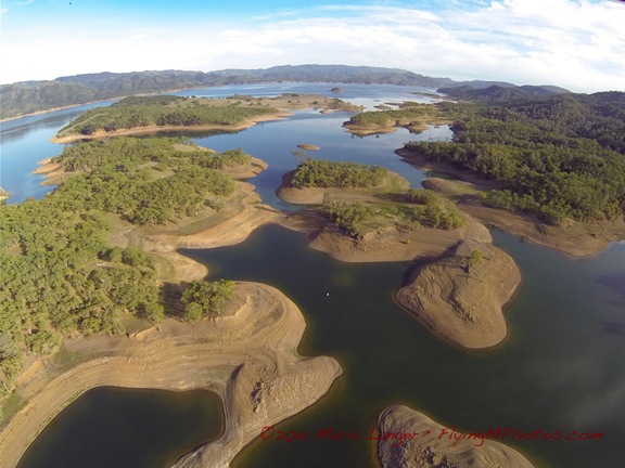
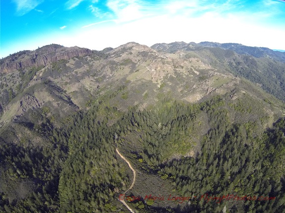
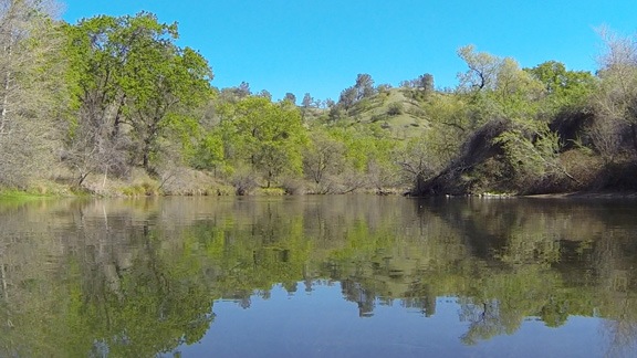
The route Google chose took me through some residential areas before sending me toward the coast on Novado Boulevard. There were cows grazing on lush green hills along the way. The road wound up and down and around, past small lakes as wisps of fog got caught up in trees and floated on lake surfaces. The early morning sun shined brightly above the marine layer, trying so hard to break through. I stopped at Stafford Lake Park to let Penny take a walk while I shot a few photos.

Stafford Lake
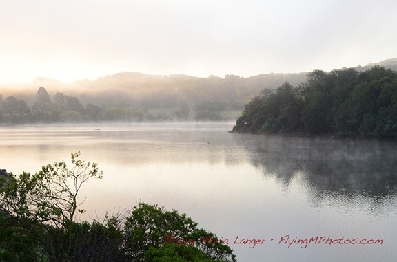
The scene at Stafford Lake Park yesterday morning.

Interesting Breakfast
Not sure how I wound up with a veggie breakfast, but it was good. It’s always nice to try something different.

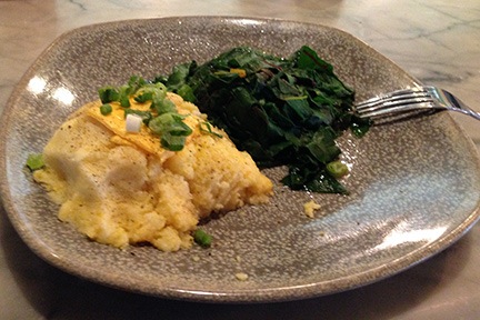
Eventually, we wound up at Point Reyes Station. It was early — only 8:30 AM. I had a whole hour to go the last 16 miles, which Google said would take me 33 minutes. I decided to stop for breakfast. I wound up at the Station House Cafe, which was pretty much empty. (Heck, the whole town was empty at 8:30; it would be very different later on.) I sat at the counter and although my brain really wanted an omelet as good as the one I’d had in Winters the morning before, I went with something completely different: cheese grits and sauteed Swiss chard. As I told a Facebook friend later in the day, it was good, but bacon would have made it better.

Please don’t lecture me about leaving my dog in the car. First of all, I only do this when I’m certain that the temperature in the car won’t exceed a balmy 70° or 80°F or get below 40°F. On warm days, I always park in the shade if possible. And if I’m parked in town, I always leave the doors unlocked so anyone could simply open them up if there was a concern.

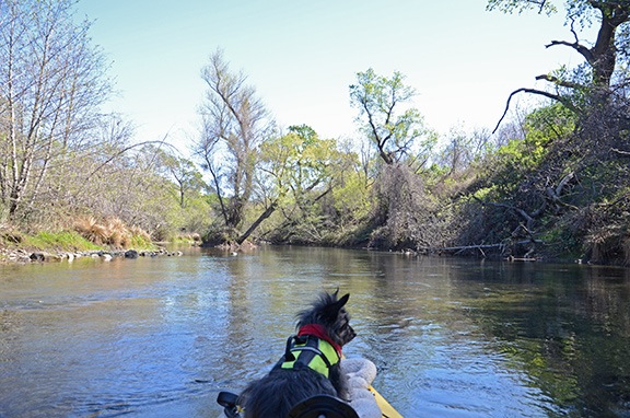
Penny has spent a lot of time in the car — whether it’s my Honda, Jeep, truck, or a rental car — and is quite accustomed to it. She usually just settles down and goes to sleep.

On that particular day, the high in the area was forecasted as 50°F and although there was no shade, I did leave both front windows down a good 4 inches. I locked the doors, but anyone with a long, skinny arm could have unlocked them.

I was back in the truck, finishing up my drive by 9:00 AM. The road wound through the tiny town of Inverness on Tomales Bay before cutting west across the peninsula into the park. I followed the signs and wound up in the nearly empty Drakes Beach parking lot. I took Penny out for another quick walk and moved the truck to a spot closer to the ranger station. Then I gathered my camera equipment together, made sure Penny was set with food and water, locked up the car, and went to find the others.

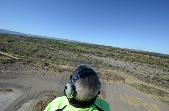
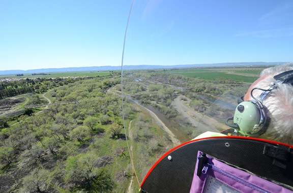
I brought all my good camera equipment with me that day: my Nikon D7000 and 3 lenses, including my 300 mm lens, which I thought might be good to capture images of the whales. I also had my Manfrotto monopod. Yes, I know a tripod would be better, but I detest using one in situations involving moving subject matter. My monopod gives me enough steadying on full-sun shoots.

And there was plenty of sun that day. The fog was mostly burned off, although there was a definite white haze in the air. I went to the building just as the ranger was unlocking it. There were a handful of people milling about, but no one I recognized. I didn’t think it worth querying people to see if they were with the group. Again, I was leery of tying myself to one or more people until I knew how the day would unfold.

Like most other people there, I paid $5 for a shuttle bus ticket. Then I went outside and followed the group to a nice charter coach that was being used to shuttle park visitors to two points of interest: the Point Reyes Lighthouse and a spot called Chimney Rock. The bus pulled away from the curb and the driver, a big man who obviously had a lot of passion about the park and his job, told us a little about the wildlife we were already seeing: black-tailed deer and Tule elk. He then put in a short CD that explained a little of the park’s history and told us about the dairy farms we were passing along the way.

We were making the final climb up the road toward the lighthouse, when the man in front of me and I saw the same thing out on the ocean to our left: a whale! We’d already made our first spotting.

At the bus stop, we all got out and headed up the hill toward the lighthouse. There were about 20 of us in this first trip of the day. I took my time, taking in the view of the surf on the beach stretching out to the north. This was my third trip to Point Reyes and this particular view has become iconic for me. No matter when I come — late afternoon, midday, or morning — the pounding surf seems to disappear into the far distance, perfectly illustrating one of the themes I like to capture in my photography: infinity.

Infinity Waves
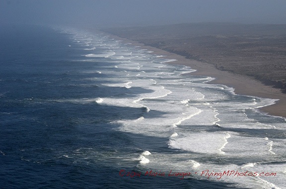
It looks like this pattern of waves against the shore could go on forever, no?

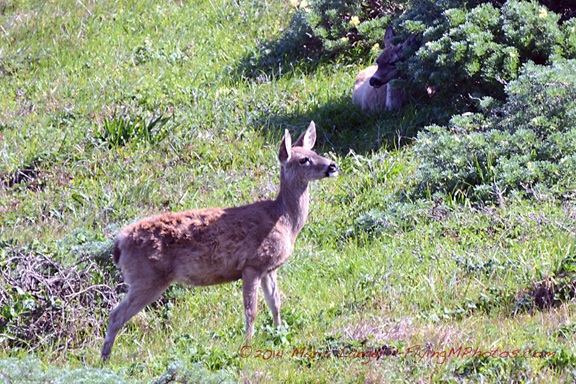
I caught sight of movement over a small hill and moved farther up the trail to investigate. On the other side of a clump of trees, on the hillside sloping down to the cliffs, were two black-tailed deer, grazing. I moved in among the trees for some photos while other bus passengers hurried by behind me, talking at full volume about anything other than their surroundings, oblivious to nature around them. Finally, someone spotted me with my camera and took a closer look. By the time I was finished, a small crowd had gathered with people snapping photos of the deer less than 100 feet away. To their credit, no one tried to approach them more closely.

Black-Tailed Deer
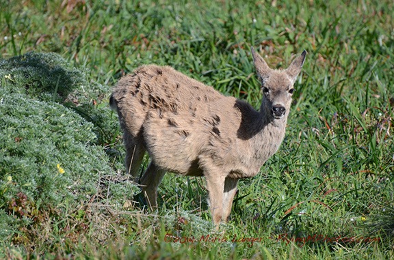
Shot with a 300 mm focal length lens, cropping this photo was not necessary; this deer was close.

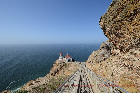
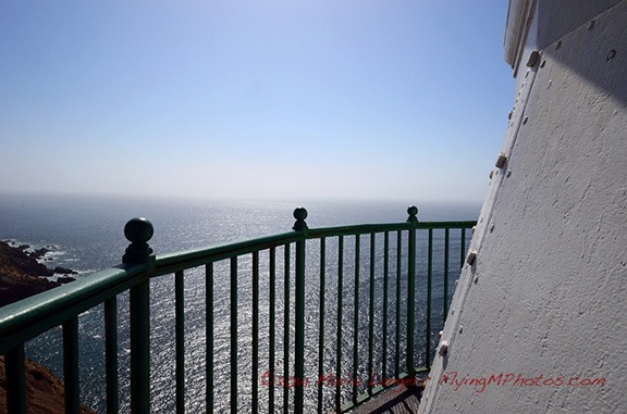
I reached the top of the steps leading down to the lighthouse and stopped for a moment to take in the view. We were on a point of land facing due west with sweeping views to the south and northwest. There wasn’t a cloud in the sky. The blue of the sky and the blue of the ocean met in a somewhat blurred line out in the distance. The sound of the waves and calling birds laid a background soundtrack to the chatter of the people around me. There was almost no wind at all. An absolutely perfect day to be at Point Reyes.

Map View of Point Reyes
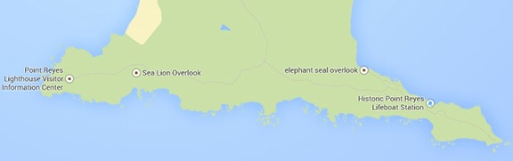
Google’s Map view of Point Reyes. The lighthouse is on the left (west) point; Chimney Rock is on the right (east) point.

There were 300 steps down to the lighthouse. A sign at the top of the steps warned that the climb back up was the equivalent of climbing a 30-story building. (I seriously doubt that. The stairs were shallow and easy. Maybe 20 stories.)

Lighthouse at 70 mm

This is an interesting illustration of the way various lens focal lengths affect the appearance of distances. The top image was shot from the top of the stairs at 70mm. The bottom image was shot about halfway down the stairs (on my way back up) at 10mm. Neither image was cropped; both are shown here at the same size. Doesn’t the stairway look longer in the second image?

Lighthouse at 10mm

Once at the lighthouse, I joined a few other people there who were actively looking for whales. We were rewarded many times. A pair of young whales, maybe 20-25 feet long, were making their way around the point. They’d surface together every 5 or 10 minutes quite close to us, send up two sprays of misty air, give us a good look at their backs, and then disappear under the waves. They did this at least a half-dozen times while I watched with the others. Good photos weren’t possible — there just wasn’t any exciting activity. These whales were motoring, not auditioning for SeaWorld. This is the best I could do.

Whales
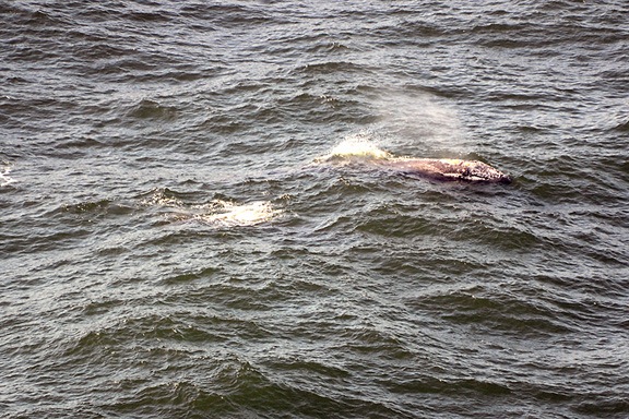
Yes, there are two gray whales in this photo. No NatGeo photo op yesterday.

Lighthouse Tower
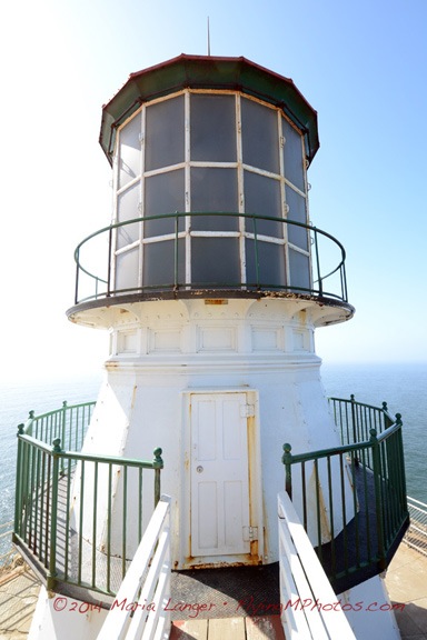
An example of symmetry — or as much as possible, considering the light and rust patterns.

Since I wasn’t getting any satisfying whale photos, I started looking at other things that were interesting. The lighthouse, flowers along the stairway, equipment in the lighthouse building. Other themes and techniques I like to explore in my photography include symmetry, patterns, filling the frame with an image, and putting foreground items against out-of-focus backgrounds.

Detail from Lighthouse
I don’t know why I like this photo so much, but I do. It seems to me that anyone can take a picture. But when a picture evokes an emotion — as this one does for me — it’s something worth looking at.

Iris Iris
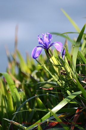
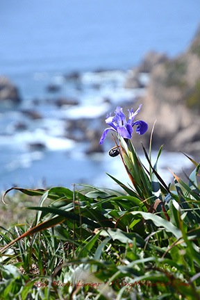
Two examples of an interesting foreground — irises in bloom — against an out-of-focus background. Which do you think works better?

Red Maid
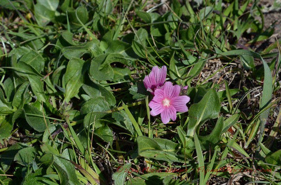
I’m not sure, but I think this one is called red maid.

Voilet
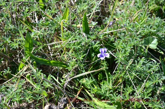
And I’m pretty sure this is a violet.

Indian Paintbrush
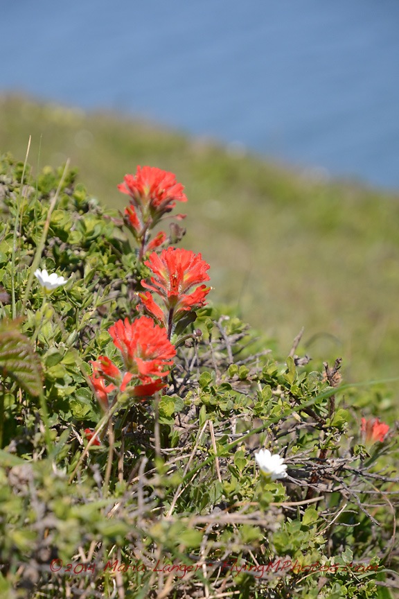
I’m pretty sure this is Indian Paintbrush.

Yellow Bush Lupine
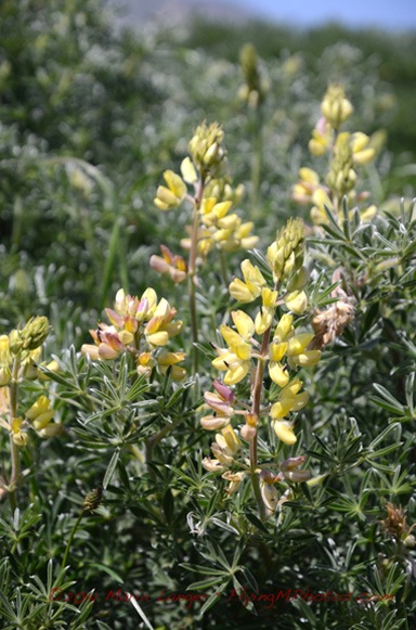
Yellow bush lupine grows in huge clumps out on the peninsula.

One of the huge benefits of traveling alone is that you can spend your day the way you want to do it. No one to compromise with. No one to get bored and hurry you along. No one to drag you places you couldn’t care less about.

That was me yesterday. Spending as much time as I liked, seeing what I wanted to see. I know a companion would have lost patience with the amount of time I spent kneeling or even lying in the dirt to frame up some of these photos. I’ve had traveling companions like that in the past and I can’t begin to imagine the things I missed because of them.

(You could also argue that traveling companions can reveal a whole new world for you. I think that’s possible — with someone who is imaginative, open to seeing new things, and not opposed to changing plans as opportunities arise. But I haven’t had a companion like that for many, many years. Instead, I spent a lot of time stuck with someone who was tied to a schedule. Any suggested change resulted in, “But I thought we were going to….” I’d rather travel alone than deal with that ever again.)

Once I’d finished up at the lighthouse and made the climb up the 300 steps, I walked back to the bus stop. Along the way I peeked through the row of trees to see if the deer were still there. They were. And that’s when I noticed a third deer lying in the shade of a bush.

Two Deer
Can you see the deer in the background?

While I was enjoying my day, taking lots of photos, and really having a great time being outdoors in such a beautiful place, I was also chatting with the folks around me. One by one I met up with about a dozen of the SPP members, including Lynn, who’d organized the meetup. The group had broken into smaller subgroups of twos and fours, each wandering around the park at their own pace. Nice. No pressure.

I rode the bus to the Chimney Rock stop. There were three points of interest there: the elephant seal beach, the historic life boat station, and Chimney Rock point. The elephant seals were closest, so I took that path, getting into a conversation along the way with a woman from Las Vegas who was also traveling alone — and enjoying every minute of it. She and I would cross paths a few more times before the end of the day.

At the end of the path was a lookout point where we could clearly see hundreds of young elephant seals and their mothers stretched out on the sand, sunning themselves. Every once in a while, one of them would start barking or screeching or making some other weird noise. Seals would swim out of the water and shimmy up onto the beach. A harbor seal splashed around in the weeds just offshore. There were no breakers in the sheltered cove, making it ideal for the young animals to rest and learn how to swim.

Elephant Seals
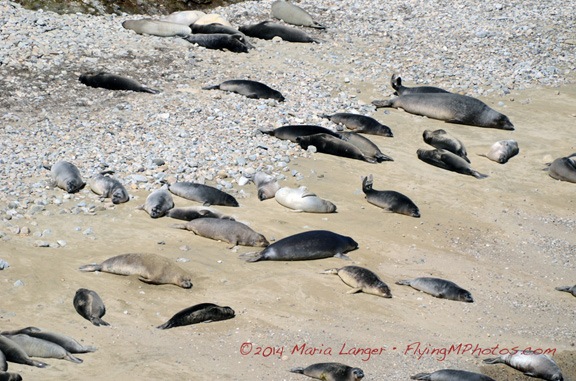
Elephant seal weanlings sun themselves on the beach with their mothers.

Seal Beach
There were hundreds of seals along the stretch of sheltered beach.

I chatted with a volunteer naturalist about the seals and the flowers I’d been seeing throughout the day. She was extremely informative and had some visual aids to show how the features of the elephant seals change throughout their lifetimes. While we chatted, a male seal swam up to the base of the cliff right below us. Meanwhile, a ranger worked with some kids to teach them about the seals. (Really, parents, why aren’t you taking your kids to places like this?)

My Ex Brother In Law
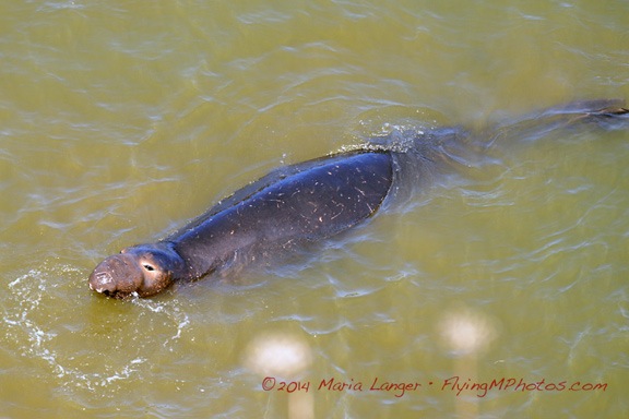
You can kind of get an idea why they call them elephant seals — the males get an elongated nose as they age.

Chocolate Lily
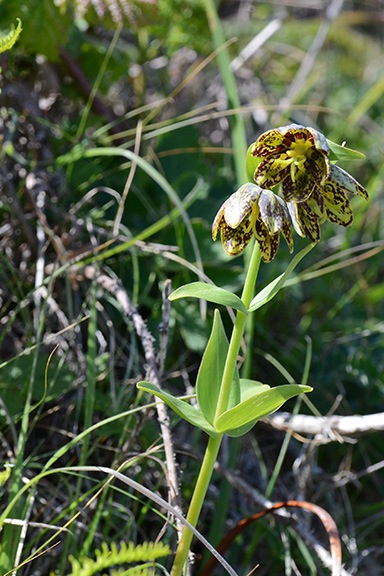
Chocolate lily. This plant also grows in the mountains near where I live.

Afterwards, the naturalist walked back along the trail with me and another member of the group to show us a relatively rare chocolate lily in bloom. I’d only seen one before — on a wildflower hike in Washington State near where I live — and it was nice to see one again out in the wild.

Although the historic boathouse was open that day for tours, I decided to skip it. Instead. I walked out along the 1.6 mile trail to Chimney Rock. I got a nice photo of the boathouse and Drakes Bay from along the trail. I also snapped some photographs of some of the flowers I’ve already shown above.

Historic Boathouse
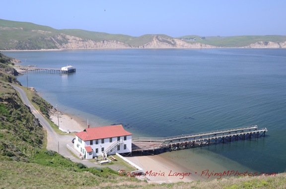
The historic life boat station with the old pier and seal beach in the distance.

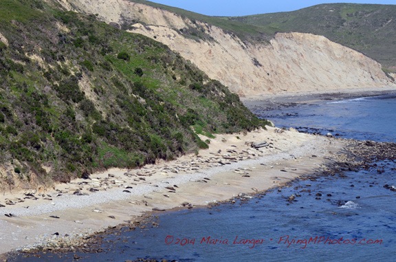
The trail to Chimney Rock was interesting mostly because it ran along a relatively narrow spit of land with open ocean on one side and Drakes Bay on the other. The ocean side had dramatic rock cliffs with more seals sunning themselves on small beaches. At the end was a rocky point, a fence to discourage wandering along the cliff, and some benches. Off the point, a buoy bounced it the waves, making a mournful sound. Some members of SPP were having lunch.

From Chimney Rock
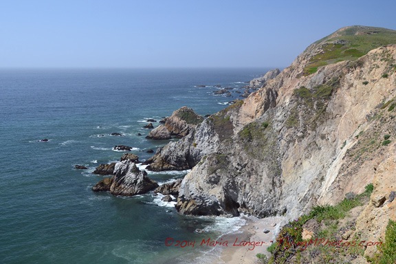
View from along the trail to Chimney Rock. The beach was full of sunning seals.

I’d chosen to carry camera equipment instead of food and was quite hungry by that point. It was after 2 PM. I was starting to get a little worried about Penny being stuck in the car for 4-1/2 hours. It was time to head back.

I met up with Lynn again at the bus stop. Most of the group was going to stop in Point Reyes Station — coincidentally, at the restaurant I’d had breakfast — for a meal. Others were going to the Cowgirl Creamery nearby. Neither plan sounded that good to me; I wanted to try something different and preferred to avoid the temptations of cheese. And I knew I couldn’t wait around for the group to gather. So I decided to stick to my solo plan for the day.

Back at the main parking lot, Penny was fine but glad to see me. I put her leash on and walked her out along one edge of the parking lot where there was a picnic area with grass. Despite the No Dogs sign, there were four other dogs on leashes nearby. Penny got a lot of pee and barking out of her system before we climbed back into the truck and headed out.

My stomach did the driving, retracing our route past the cows and various park turns toward Point Reyes. When I got to Inverness, I spotted Vladimir’s Czech Restaurant, which had outdoor seating. Soon Penny and I were sitting beneath the shade of an umbrella, eating stuffed cabbage with a hearty grain bread. The sound of live musicians playing Irish music (for some reason) drifted out the restaurant’s open doors, flooding the patio with a cheerful sound.

I made a few more stops on the way home — Point Reyes Station, which was packed with people, and Muir Woods, which was just emptying out — before heading home. I’ll cover Muir Woods in another blog post; it deserves one.

It had been another great day out. Yes, I’d seen some whales, but I’d also enjoyed experimenting with photography again, doing some good walking, and being out in great weather. Although I’d debated spending the night in the area and doing more the next day, I soon realized that an overnight trip would be better during the week when it wasn’t so crowded. I have a month left here in California; I need to plan a nice two or three day trip with Penny before I head back home.

Maybe next week? Got nothing else planned and the only schedule I need to check is my own.

Joy-Flying Over Napa Valley

Sometimes it’s nice to treat yourself to an afternoon out.

I went for a joy ride in my helicopter this afternoon.

I hadn’t been flying since last Wednesday when I finished my Part 135 check ride with an FAA inspector from South Dakota. The helicopter was sitting out on the ramp, blades tied down, gathering dust and then standing up to high winds for a week.

Torn Tie Down
Like the helicopter, the tie-downs are now 8 years old. A strong wind earlier this week tore this one.

One of the blade tie-downs had torn and, although it was still holding, I thought I should repair it. So I untied the blades, brought the tie-downs inside, and did some mending. I looked out the back window while I was on the phone with a client, talking about work this coming summer season back home in Washington. My helicopter sat there patiently in the afternoon’s gentle breeze, less than 200 feet away, waiting for me to tie down its blades again.

Or fly it.

So I flew it.

It was very warm this afternoon — in the high 70s here in the Sacramento area. Too warm for the black T-shirt and jeans I was wearing. So I slipped into a tank top and shorts before going out with Penny and my iPad and my GoPro camera.

Penny waited on her bed in the front passenger seat while I preflighted and added a half quart of oil. Then I snapped the camera into it’s “BellyCam” position, turned on its wifi, and climbed on board beside Penny. A short while later, the engine was running, the camera was recording video, and I was listening to classic rock through my Bose headset. I made a radio call to the empty sky around me, eased up the collective, and lifted gently off the ground. Then I was speeding across the runway only 10 feet off the ground, gathering momentum and climbing out into the California afternoon.

As usual when I’m joy-flying, I didn’t have a specific destination. I had some vague idea of flying down to Nut Tree airport (VCB) in Vacaville, which I’ve been told has a restaurant within walking distance. Thought I’d check it out as a possible destination for when my friend George gets back from Alaska and we take turns flying his gyro and my helicopter. But that destination was too close. I wanted to get out for at least 45 minutes. Maybe I’d stop there on my way back.

I wandered south along highway 505 and turned right at Winters. I was following the road that runs to Lake Solano County Park, where I’d gone paddling the previous Thursday, and beyond that to Lake Berryessa. I was flying into the sun, though, and I knew the video wouldn’t be much good. Would it capture any decent footage of that nice canyon going up to the Lake?

Apparently, it did.

Aerial View of Lake Solano Park
Here’s an aerial view of the Lake Solano County Park. You can see the dock where I put in my kayak last week. I paddled upstream (up in this photo) from there.

I followed the canyon up to the lake, keeping a sharp eye out for wires. There were power poles on the right side of the canyon, but none seemed to cross the canyon. I flew over the dam and headed up lake. The water level was low — California is suffering from a serious drought — but the hillsides were fresh and green from the rain we’d had two weeks ago. Without more rain, the grass would turn brown, possibly before it even got a chance to go to seed.

I saw cattle in the low lands along the lake and ranches up in the hills. Very picturesque.

I flew about halfway up the northeast side of the lake with the sun coming into the cabin from my left. Penny, who had been hot while we were flying into the sun — she hasn’t fully shed her heavy black winter coat — was now in partial shade, leaned back in her seat but still panting from the heat. I was comfortable in my summer clothes; I didn’t realize until I got home how much sun I’d gotten. (Next time I’ll wear shorter shorts and really work on my tan.)

Napa Valley Balloons
In Napa Valley? Want an amazing experience you’ll remember for the rest of your life? Fly with these guys.

I got the idea that I wanted to see Yountville from the air. About a month ago — the day after I arrived with the RV, in fact, a hot air balloon had landed in my “backyard” here — the airport ramp. I’d introduced myself to the pilot and sent him a copy of a picture I’d taken of him landing, along with a suggestion that we swap flights. He booked me on a flight tomorrow morning at Yountville, at the Domain Chandon tasting room. I wanted to see what it looked like from the air.

Hell, I can come up with an excuse to fly anywhere if I try hard enough.

So I banked hard to the left and flew back down lake. I figured I’d follow the road toward Rutherford and then branch off to the south when I got to Napa Valley. I switched the camera from video mode to time-lapse with shots every 10 seconds. I captured this image as we flew down the lake.

Lake Berryessa
Here’s a shot of Lake Berryessa.

I followed the road I’d driven a few times before, most recently on Sunday, on my way back from Napa Valley. Then I made some turns, following valleys, watching out for power lines. Finally, I popped over some hills and dropped down into Napa Valley over the Silverado Trail.

Silverado Trail
Over the Silverado Trail, somewhere near Rutherford, CA.

Below me, the homes, wineries, and vineyards of Napa Valley stretched in all directions. Although the vineyards were not yet leafing out, there was an abundance of green in the grass, trees, and hillsides. It was gorgeous.

Somewhere around this time, I started thinking of my wasband, as I often do when I have amazing experiences I think he would enjoy. We did more than a few joy-flights together over the years, exploring the desert around our home in Arizona or going further afield, perhaps on cross-country trips to Lake Powell or Las Vegas or Washington State. We shared a bird’s eye view of so many amazing things from the air: the red rocks of Sedona, the blue waters of Lake Powell, the winding path of the Colorado River, the grandeur of the Hoover Dam, the haystack rock formations of the Oregon coast.

As I flew over the vineyards, I could imagine him beside me, trying to identify things we’d seen from the ground on previous visits to Napa Valley. His memory was better than mine — at least before he became delusional — and maybe he’d remind me of things I’d forgotten. Would he spot the winery where they’d served us chocolate cake with our cabernet? Surely it was down there somewhere. He might remember where.

But I reminded myself that any fond memories of my wasband were flawed and false. Maybe he wouldn’t have enjoyed this afternoon’s flight after all. Although he always seemed to like being in the helicopter, especially when he got to take the controls, these days I wasn’t sure what he really thought of those flights. He insinuated in court that he thought they were “work” that, for some reason, he should have been paid for — even though he lacked the pilot certification to do commercial flying and I was always sitting beside him in the pilot-in-command seat. Thinking back on our last few years together, I remember all the weekends he spent in front of a television, watching DVRed car shows. Perhaps he preferred doing that to flying. (He didn’t fly his plane either.)

His loss.

I don’t think I could ever get tired of flying a helicopter, especially on days like today when I’m free to go wherever I like in such a beautiful place. Sure beats anything on TV.

I consulted Foreflight on my iPad and realized I had passed Yountville. I made a sweeping turn to the right, lining up with route 29 on the other side of the valley as I headed north. Moments later, I overflew Yountville and the site I think we’ll be departing from tomorrow in a hot air balloon.

Domaine Chandon
I’m not 100% positive, but I think this is where our balloon will be launching from tomorrow.

I continued up the valley, once again retracing my route, in reverse, from Sunday’s drive. Rutherford, St. Helena, Calistoga. I saw the V.Sattui Vineyard looking quiet and empty on the late weekday afternoon. I saw the main drag in St. Helena. I saw the spas and resorts in Calistoga.

St. Helena
An aerial view of St. Helena in Napa Valley.

At Calistoga, I turned east again. I climbed over the mountains on the east side of the valley and dropped into a rugged canyon. I’d been flying for more than 30 minutes and was starting to think of heading back. I punched a GoTo to my base airport into the GPS and turned in the direction of the line. On Sunday I’d driven past Clear Lake, but I didn’t feel like flying out that way. I thought I’d give Lake Berryessa another flyby instead.

East of Calistoga
The mountains east of Calistoga are rugged, with basalt cliffs not unlike those near my home in Washington.

Pope Valley
The valley east of Napa — which I think is called Pope Valley — has vineyards, lakes, and ranch land.

Lake Berryessa Narrows
A narrow channel on Lake Berryessa. I had to be careful here; there were wires across the lake nearby.

Dam at Lake Berryessa
The BellyCam just happened to capture this perfect image of the Dam at the lower end of Lake Berryessa.

I flew down the lake, over the dam, and back into the canyon leading to Winters. Then, before I reached town, I headed north in the foothills with the vague notion of overflying the Cache Creek Casino. But before I got to Esparto, I changed my mind. Instead, I turned inbound to my base airport and, after a few radio calls, landed on the runway and taxied into parking. I set it down gently exactly where it had been an hour and 10 minutes earlier.

Penny
Penny waited for me while the BellyCam continued to snap photos every 10 seconds.

Penny stood up and looked at me, wagging her tail. She was ready to get out. I lifted her out and set her on the ground. She waited at the nose of the helicopter while I cooled the engine and shut it down. The camera caught several images of her standing on the tarmac with my mobile mansion home in the background.

Later, I used the mended tie-downs to secure the main rotor blades and locked up the helicopter.

It had been a great afternoon flight — one I’m glad I treated myself to. I’ll fly again soon — maybe with a balloon pilot beside me and two of his crew in back. Or maybe with my pilot friend George at the controls, exploring a new place. (Something tells me that he’s not very interested in television.) I’ve got a month left here and I plan to enjoy it every way I can.

I never did get down to Nut Tree airport.

Paddling with the Birds (and Turtles) at Lake Solano

It’s more than just an upper-body workout.

On Thursday, I took my kayak out to Lake Solano near Winters, CA.

I blogged a little about this lake last week — I’d driven through the campground there and was amazed to see dozens of peacocks strutting around. I took lots of photos.

Map of Lake Solano
The area of Lake Solano where I paddled on Thursday.

The lake isn’t anything to brag about. Really, it’s more of a very long, narrow pond. When I mentioned it to a local friend, his response was “What lake? Never heard of it.” In fact, Google Maps doesn’t even refer to it as Lake Solano — instead, it’s just Putah Creek.

What attracted me to it was the calm, smooth water. An easy paddle — something I was really looking for after my 9-mile paddle last Saturday on the American River. (If you’re wondering why I didn’t blog about that trip, it’s because I’ve been just too darn busy to blog most of the things I do these days. Maybe if I ever slow down.) Secondary was the wildlife — including birds — that I expected to find along the way. I’ve bring my camera and turn it into a “Photo Paddle.”

The weather couldn’t have been better. Temperature in the low 70s and not a cloud in the sky. I put on my swim shorts and a tank top, packed a picnic lunch that included a salad, some almonds, some string cheese, and a bottle of icy water. I grabbed Penny’s life jacket and the waterproof case I used to keep my phone safe on the water. Then I loaded up the kayak into the back of my truck and headed out. It was around noon.

I took the freeway to route 128 and headed west through Winters, stopping only long enough to put some fuel in the truck. A short while later, I was pulling into the parking lot for the day use area near the bridge, ignoring the signs that said “No Pets Beyond this Point.” After all, it wasn’t as if Penny and I were going to have a picnic in the park. We were there for the boat ramp.

I backed the truck down the narrow ramp, pulled down the tailgate, and slid my kayak into the water. I put the picnic lunch in the watertight compartment and my bottle of water in the cupholder in front of my seat. I carefully stowed my camera bag on the floor of the boat, shoved up toward the bow where it was more likely to stay dry. Then I put Penny’s life jacket on her, fastened her leash to it, and put her in the boat. I attached the leash to the elastic tie-downs on the front of the boat and left her to move the truck. I parked it in the shade, locked it up, and returned to the boat.

I decided not to wear my life jacket, although I did bring it with me as required by one of the many signs in the park. I’d use it as a backrest. The water was calm and smooth and not very deep. The possibility of me flipping the boat and then being unable to keep my head above water was pretty much nil.

I pushed the boat out a little and climbed on board. I settled myself into the comfy seat, put my feet on the supports on either side, and paddled out into the lake. After fiddling with my camera while the boat drifted in lazy circles, being pushed by a mild current and light winds, I started paddling upstream (northwest) with Penny sitting on one of her dog beds fastened to the bow.

I started seeing photography subjects immediately. The first was a heron, which I’ve always had trouble photographing. The birds are extremely spooky; it’s next to impossible to get anywhere near one. Fortunately, I had my 300mm stabilized lens. I managed to frame a few shots before it took off.

Heron
This great blue heron was standing in deep water when we drifted by.

Heron
Another heron along the shore of Lake Solano.

Later on, I shot another one on the other side of the lake. As I expected, he didn’t wait around. If it weren’t for the 300mm lens, I never would have captured these images. I really like that lens for wildlife photography.

Heron in Flight
Although I didn’t capture an image of the heron taking off, I did get this shot of it flying away. (Frankly, I’d rather look at wildlife than photograph it.)

After that, it was mostly various types of ducks.

Ducks
A pair of Barrows Goldeneye ducks. IDed by my friend Dale.

Ducks
A pair of Common Merganser ducks. Also IDed by Dale.

Duck on a Log
A female Common Merganser.

Paddling was pretty easy, even though I was moving upstream. There was a little bit of a breeze behind me and the current, for the most part, wasn’t even noticeable. I took my time, pausing plenty of times for rest and to just look around me or snap photos.

Eventually, we reached the lower end of a long island (see map above). I brought the boat up on a gravelly shore and stepped out. Penny jumped out and I unfastened her leash. It was a nice place to stop for lunch — sunny and quiet with a nice view down the lake. I settled down with my picnic lunch of salad, cheese sticks, and almonds while Penny sniffed around the island and nibbled goose poop. (Of course, that could explain why her digestive system hasn’t been quite right since then.)

Lunchtime View
I sat on the shore and looked down the lake while eating lunch.

After lunch, we continued upstream on the southwest side of the island, which seemed a bit shadier. Since spending the winter in Wenatchee, I’ve lost most (but fortunately, not all) of my year-round tan and I’m a bit susceptible to sunburn. The creek got narrower as I paddled upstream and the current became noticeable. I kept going, paddling around fallen trees and rocky sandbars.

Finally, we reached a place where there were “rapids” — if I could use so strong a word — as water rushed over rocks. I suspected I was pretty close to the top end of the island and got the idea that I could sort of portage the boat up the rapids by dragging it and then come back down the other side. I climbed out and gave it a try. I got about 100 feet upstream — far enough to look beyond to see whether I was near where the water split around the island. It didn’t look as if I was. So I turned the boat around, got back in, and paddled through the rapids back downstream.

Rapids
Here’s a GoPro BowCam image as we left the “rapids” on our way back downstream. (You didn’t think I’d do this trip without a GoPro on board, did you?)

For the most part, Penny was pretty comfortable up on the bow, taking in the view. After her initial frustration of seeing so many ducks so close up and not being able to get them, she settled down. She took great interest in the weeds and sometimes river rocks right below the surface. She may even have seen a fish or two — she certainly reacted as if she’d seen something interesting.

Penny in the Bow
My dog will go anywhere with me.

The paddling was easy in the smooth, calm water with a hint of a current behind us. We were back at the bottom end of the island in no time. With no hurry to be anywhere else, I turned up the northeast side of the island and started paddling upsteam again.

Calm Water Reflections
Here’s another BowCam shot. The water was mirror smooth in some places.

Canada Geese
There was more to this scene than just a pair of Canada geese.

I shot some more photos along the way. The Canada geese shot was particularly memorable. As I paddled up the northeast side of the island, I saw a goose standing alongside the creek. I got my camera ready as the boat drifted upstream. That’s when I realized that there were two geese standing side by side. I snapped two good shots of them and then took a moment to just look at them. That’s when I saw the deer behind them, moving away into the brush. I’d been so focused on the geese that I’d missed the deer. And I’d been so surprised to see the deer that I didn’t react with my camera. Photo op lost, but that’s okay.

All of the birds — except the geese, of course — were spooky. Any time I got close, they’d take to the air. As I paddled up the side of the island, I got rather close to a pair of ducks. The GoPro captured footage of them taking off.

Runaway Ducks
A screen grab from the BowCam video. The ducks were airborne in less than 2 seconds.

I reached the rapids at the top end of the island and turned around without stopping. By then, I was ready to go back.

Later, back in the main body of the lake, I managed to capture some images of turtles, sunning themselves on logs. Like the birds, they were pretty spooky and I could only snap photos from quite a distance away.

Turtle on a Log
Bet you didn’t know turtles could climb trees. Per my friend Terry, this is a red eared slider.

Great Egret
This great egret was fishing across the lake from the boat ramp.

I caught sight of a great egret not far from the boat ramp and paddled over as close as I dared to get one final photo.

Afterwards, I paddled back to the boat ramp and brought the boat onshore. I fetched the truck, loaded up the boat, and climbed into the cab.

I took one quick ride through the campground to look at the peacocks again before heading back to our temporary home.

It had been a nice, relaxing day out. According to my GPS track, I’d paddled about four miles. Best of all, I had some really nice photos to share from my day out.

Gyro Flight

A friend takes me for a ride in his open cockpit gyroplane.

An Angry Bird
Now this is an angry bird!

One of the great thing about living at an airport is that you’re exposed to neat aviation things on a daily basis. And what isn’t neat about an open cockpit gyroplane sporting a custom Angry Birds paint scheme?

My friend George owns this one. He was at the airport most of this week, teaching a friend how to fly it. Well, he was trying to. The wind howled pretty fiercely on Tuesday and much of Wednesday morning.

George and his Gyro
George posing with his gyro.

(This is a gyroplane or autogyro, by the way. Gyrocopter refers to the Bensen Gyrocopter manufactured by Bensen Aircraft.)

On Wednesday afternoon, George took me for a ride — despite winds 14 gusting to 20. It was an interesting experience for me.

With George
Strapped in and ready to go.

Like helicopters, gyroplanes have a mast and main rotor blades. But unlike a helicopter, a gyro has a means of propulsion — normally a pusher engine/prop. To fly a gyro, you use a pre-rotator to get the blades spinning. You then use the engine/prop to move forward on a runway or other suitable surface. At the right speed, the pilot pulls back on the stick like he would in an airplane to take off. Lift is generated by the rotor blades, which remain spinning in a mode very similar to an autorotation in a helicopter. The engine does not directly drive the rotor blades; the pre-rotator is disconnected before takeoff roll.

Low and Slow
Low and slow in an open cockpit plane? What could be better?

We were airborne for about 20-30 minutes. George demonstrated low flight along a creek bed, high flight, and a power-off landing that had us descending backwards in the stiff wind. (He had to dive to make the runway.) He demonstrated several very short landings and takeoffs. We flew low much of the time and waved at people on the ground waving up at us.

Side View
It’s a great feeling to have nothing between you and the ground you’re flying over.

I thoroughly enjoyed the flight. It reminded me a bit of the powered parachute ride I had a few years ago back in Washington — the closest thing to flying like a bird.

George is a CFI and I’m tempted to take a few lessons. It would be fun to better get to know this kind of aircraft. But there’s no gyroplane in my future — at least I don’t think there is — so getting a gyro rating would probably not be worthwhile.

Still, you never know…

The Peacocks of Lake Solano Campground

A campground drive through turns into an amazing photo opportunity.

There are a few weird little things I like to do. (Actually, there are probably enough weird little things to fill a book, but we won’t go there now.) One of them is driving through public campgrounds to check out the facilities.

I don’t remember when I started doing this. It might have been way back when I first started doing road trips with my wasband in the 1980s. Or it might have been in 1995, when I began doing road trips on my own. In any case, when I’m on the road just wandering around and don’t have anyplace special to go and I see a state or county park campground that looks interesting, I detour to drive through it.

I’ve seen a lot of really neat places to go car camping this way. A lot.

Lake Solano, west of Winters, CA, was just a point on the map when I went out for a drive to Lake Berryessa midday yesterday. The satellite view on Google Maps didn’t show it to be anything special. But when I drove by it on my way up route 128 into the mountains, I noticed its calm, clear water stretching alongside the road. And after a 9-mile kayak paddle the day before that had left me very sore indeed, the calm water of the little lake looked extremely inviting for a paddle one day in the future. So on the way back, I drove slowly past the lake. And that’s when I noticed the sign for the campground.

A campground near a lake. Of course, I had to check it out.

It’s a nice campground with plenty of wooded site. I didn’t really notice whether water and electricity were available. The reason for that was the initial distraction of seeing what looked like a small person carrying some sort of netted frame along the road ahead of me. My brain asked, “What the hell is that?” I looked harder and soon realized I was seeing the side of a peacock with his fan of feathers fully extended. It was the fan that looked like a frame with a net.

I pulled over on the side of the road and grabbed my camera. I’d brought my Nikon D7000 with me, hoping to see something photographic at Lake Berryessa. (I’d been disappointed.) The bird was standing in the middle of the road, rotating slowly so all the females in the area could see him. When he faced me, I snapped a photo with the 24-70mm “everyday” lens that I keep on the camera.

Peacock

Surrounded by PeacocksAnd that’s when I realized that we were pretty much surrounded by peacocks and peahens. They were strutting through the empty campsites, along the road, and into the brush. Occasionally, one would let out a shrill call. Penny stared at them through her window. I used my phone to grab a photo of that.

I spent the next twenty minutes driving around the campground, snapping photos out the truck window of the peacocks and peahens. When I realized after a few minutes that I wasn’t scaring them off, I took a moment to put my 70-300mm stabilized lens on the camera. Then I kept shooting. Yes, every single one of the shots on this page was taken from inside a running diesel pickup truck.

Peacock

Peacock

Peacock

Peahens

Peacock

Peacock

I did get a chance to check out the boat launch, which was perfect for canoes, kayaks, and other non-motorized boats. And I looked at a bunch of campsites, trying to judge whether my mobile mansion would fit into any of them.

But mostly I looked at the peacocks. I never realized just how beautiful these birds are.