Snowbirding 2020 Postcards: Paddling with Penny

We take the boats out into the backwater.

Backwaters
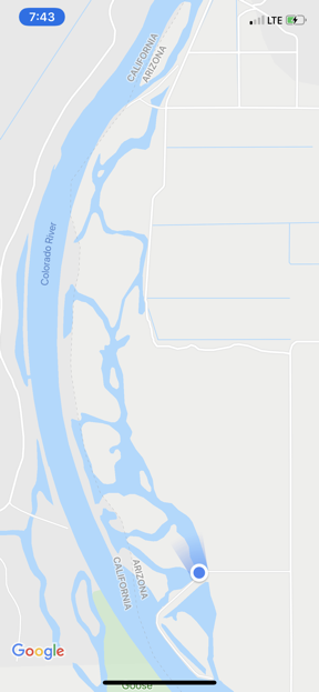
Here’s a Google Maps image of the backwaters in the area. Keep in mind that not all of the channels actually go as far as they appear to on the map due to the growth of tall reeds and bamboo along the shore. We’re at the blue dot.

One of the things I like most about our campsite this year is that it’s right on one of the longest backwater channels off the Colorado River. Last year I’d camped near this site, which has its own boat ramp, and had launched my inflatable Hobie pedal/paddle kayak into it, so I was already familiar with the waterway. I knew that I could go at least two miles north with very little current in either direction. It was perfect for a casual afternoon out in the kayak.

My friend Janet, who is sharing the same site, also brought her fishing boat along. It’s an inflatable one-seat affair — I’ll have to get a picture for a future post — designed for fishing. We both inflated our boats Tuesday afternoon and launched them, despite the chill in the air and a pretty stiff wind from the north.

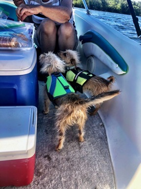
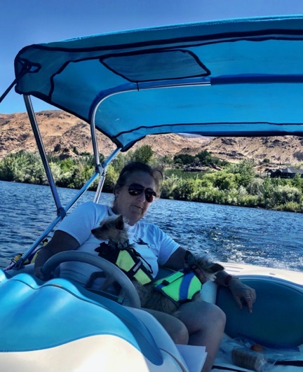
Penny came along, of course, I prepped the boat by securing her fleece blanket on the bow so she’d have some traction when she stood or sat there. I also put her life jacket on so I wouldn’t have to worry about her trying to swim if she fell in. Because the water had virtually no current, I didn’t bother tethering her to the boat. She’s only fallen in once and that was a long time ago in my old kayak. I didn’t expect her to fall in today, but if she did, I knew she wouldn’t get swept away.

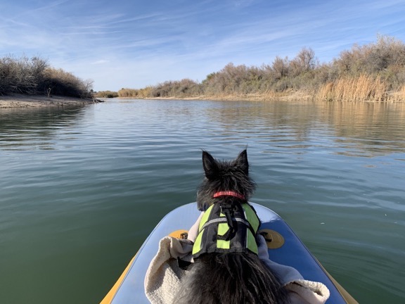
We headed out around 2 PM, with me pedaling and Janet rowing against the breeze. Penny soon settled down on the bow, which is when I got this photo.

Tiny dog on bow of kayak
Penny the Tiny Dog settled down on the bow and remained in place for most of the trip.

We were out a lot longer than I think we expected to be. Janet’s boat goes fastest when she rows backwards, but that’s not always enjoyable so she kept switching. Also, her boat seemed to have a bit more trouble battling the wind than mine did. My boat, on the other hand, rode very well yesterday, with its speed wholly dependent on how fast I pedaled. It didn’t take much to get it moving at a decent clip. But I was cold when moving into the wind and I suspect I’ll suffer for that later this week.

We got nearly to the end — Janet wanted to see a fishing spot she calls “the walk in” from the water — and then turned around and headed back. Although we were looking forward to the wind at our backs, the wind didn’t cooperate. Instead, it died down. We didn’t get back until nearly 5 PM.

More pictures to come; we’ll be here for the next two weeks and I’m sure we’ll do a lot more boating.

My Inside Passage Cruise, Part 1: Bellingham to Nanaimo

A summary, with photos, of my spring vacation.

Greetings, Cruisers!

If you’ve found this blog post while Googling for information about big cruise ships in the inside passage, I’m sorry to disappoint you. My cruise was on a 65-foot historic wooden boat. But don’t click away! Read a little more about it or at least look at the photos. And then consider a trip on the David B or another small ship like it instead of an impersonal floating city. It’ll be a trip you remember for the rest of your life.

The past nine or so months has been a crazy travel time for me. A 4-day trip to the Washington coast and Tacoma for a jewelry class in September. An 18-day trip to New York, Washington DC, and Vermont in September and October to visit family and friends and see the sights. A 3+-month trip to Arizona and California in December through March. And then a real vacation: 12 days aboard a small, historic ship called the David B as it cruised slowly up the Inside Passage from Bellingham, WA to Ketchikan, AK at the end of April and into May.

(A side note here: all this travel would not be possible if I were still married. Once again, I have to thank my wasband for freeing me from a boring life in his rut, waiting for him to get his shit together and start enjoying life. Thanks, honey!)

I’ve mentioned elsewhere why I booked Northwest Navigation‘s “Learn to Cruise – The Canadian Inside Passage to Alaska” trip late last year for this spring. It would be a learning experience, and I’ve come to realize that learning experiences are the best experiences because they stay with you the longest and can change your life.

And this trip did not disappoint me in the least. I learned a ton about navigation, small boat cruising, tidal impacts, salt water boat maintenance, customs requirements, and “camping” on the water — which is basically what we did. I see small boats like the David B and the Ranger Tug R-27 I’m considering for my own use to be seaworthy RVs — recreational vehicles for use on the water. Like a motorhome, a boat with living space is a vehicle you can use to travel from place to place with a degree of flexibility, privacy, and comfort. What makes the boat I want different from the David B (other than size: 65 feet vs. 27 feet) is that mine can be easily trailered from place to place giving it almost unlimited options for exploration in fresh and salt water. What I learned on the David B can easily be applied to any serious boating I do in the future.

Anyway, although I brought my old laptop with me on that trip with the idea of blogging daily, that didn’t happen. Who wants to bury their head in a computer when there’s so much going on outside and around you? So I’ll try to share some of my experiences now, along with photos and charts of where we went.
And don’t worry; I’ve split this into multiple parts. I hope you read them all. Lots of photos!

Getting to Bellingham

I won’t bore you with details of my pre-trip travel. The short version is that it involved a flight from Wenatchee to Seattle to Bellingham. I saw no reason to make the 4-hour drive to Bellingham when the trip wasn’t going to finish there. Instead, I bought plane tickets from Wenatchee to my starting point in Bellingham with return flights from my ending point in Ketchikan to Wenatchee.

I spent the night in an AirBnB room that was cheap and walking distance (barely) from the marina where I’d get the boat the next day. It was also the smallest room I’d ever slept in (which turned out to be good preparation for my cabin on the David B). I did a lot of walking on that Tuesday, making the trek down to Anthony’s restaurant where I ate oysters two ways and had wine and dessert — entirely too much food. I then walked along the marina until I found where the David B was parked before walking back to my lodging.

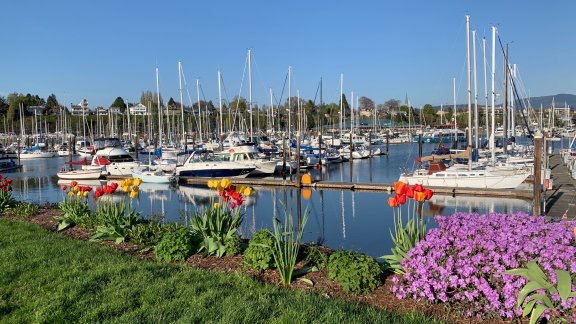
Bellingham Marina
Bellingham’s marina was absolutely gorgeous that late April day.

Day 1: Bellingham to San Juan Island

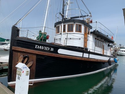
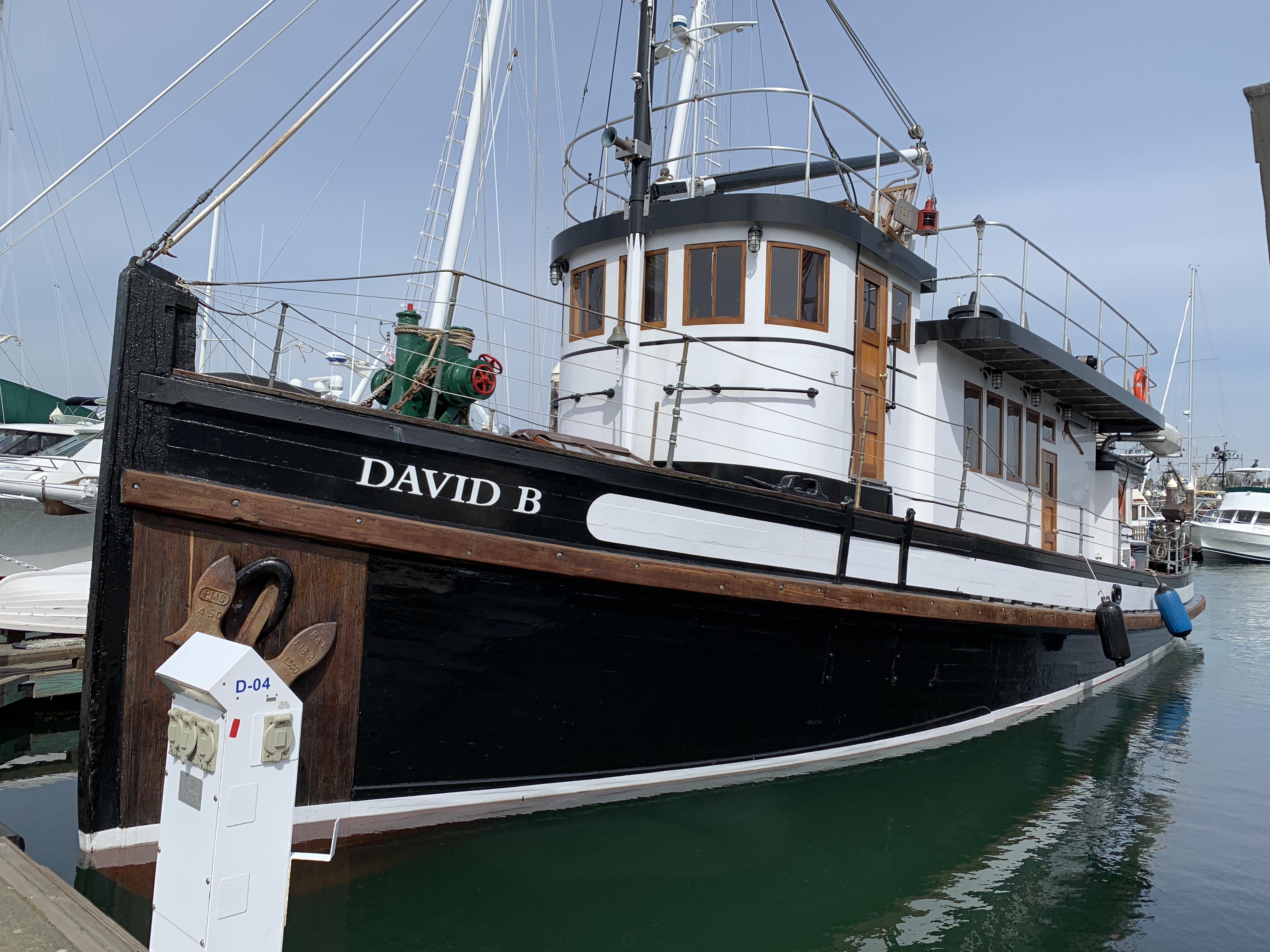
David B at the Dock
The David B when I arrived on Wednesday morning.

The next day, I took a Lyft to Bellingham’s art district with my giant rolling bag, had coffee in one restaurant, and breakfast in another. I then took a short walk, dragging the bag behind me, visiting a few antique stores to buy old sterling silver and silver plate tableware that I thought might be turned into nice rings. Finally, as the time to board got closer, I called another Lyft to take me the mile or so to the pier. If my bag wasn’t so damn big, I probably would have walked.

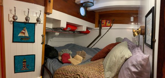
I was a half hour early but they let me board anyway. I wasn’t the first passenger to arrive. I met Sarah, who is in charge of reservations and other office stuff in Bellingham briefly before she left. Captain Jeffrey introduced himself and helped me wrestle my bag down the stairs to where the cabins were. There were five of them, including a crew cabin, and they were tiny. Mine had a queen sized bed, a head with toilet and sink, two portholes (one of which was in the head), and enough space for me to stand next to the bed. There was space under the bed for my bag, but about a third of it was occupied with manufactured logs, which I later learned were for the wood burning stove in the galley. They bring up a whole summer’s supply of logs and one of the other cabins was full of them. I had enough space, but it would have been challenging if I was a very large person or was traveling with a friend. Other cabins had different configurations and were better suited to couples. Mine was fine for me.

My Cabin
My cabin on the David B, as seen from the doorway with a panoramic photo. It was cosy!

Stairs The Head
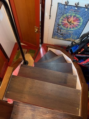
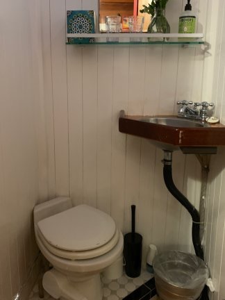
The stairs were steep and winding. The first door at the bottom was a spacious bathroom (head) with shower that we shared. My tiny head was so small that when I sat on the toilet seat, I had to put my left arm on the sink counter.

I went back upstairs to the saloon (not salon, as we later learned) and met co-captain/cook Christine, who was Jeffrey’s wife. We chatted for a while in the saloon and I told them about the boat I wanted to buy and what I hoped to learn. (They must have thought I was nuts.) Then I learned about the David B and a little about our trip.
The Saloon
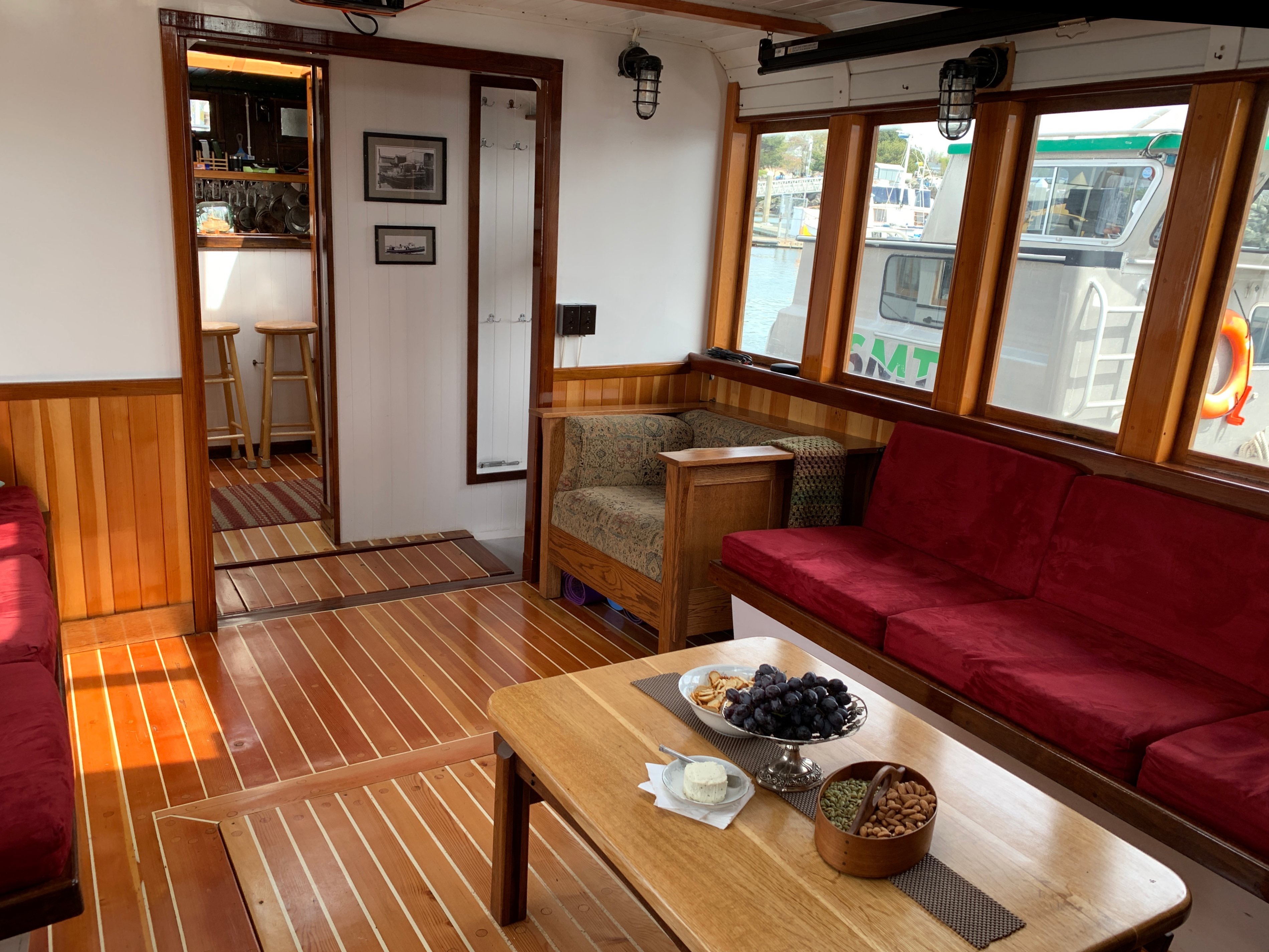
The saloon was our central gathering and lounging place on the David B. The snacks set out on that first afternoon should have warned me of the food to come.

Before long, I met my fellow passengers: Graeme from Australia and David and Leslie from Kettle Falls. Graeme was a wooden boat fan who had made the trip the centerpiece of a visit to the American northwest and Alaska. David and Leslie had just purchased a C-Dory 22 — coincidentally, the same boat my ex-friend at Lopez Island had that got me interested in small boat cruising two years before — and David was very interested in learning more about navigation since they’d just bought a home in Bellingham and I suspect he planned to move the boat there.

And that was it: only four passengers and two crew. I expected to be one of seven passengers, so this was a pleasant surprise.

We left port that afternoon.

I followed Captain Jeffrey down a ladder to the engine room and stood out of the way while he squirted oil into more places than I could count before doing a bunch of other things and then finally bringing the engine to life. I had questions but didn’t want to ask. He reminded me of a pilot preflighting an aircraft and if there’s one thing a serious pilot hates, it’s being interrupted doing a preflight. Then we both climbed back up and I told him I’d watch again, which I did the next morning.

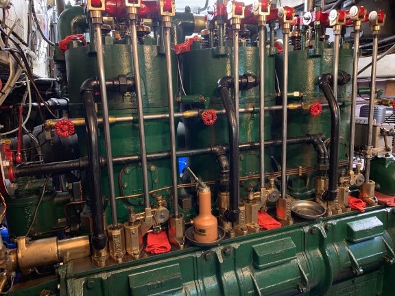
Engine
The David B’s three-cylinder engine.

Backing the David B out of its slip was probably the most challenging job; those of us who wanted to help were given big bumpers to separate the boat from other boats or dock parts if we drifted too close to something. But Captain Jeffrey had it covered. Backwards and forwards and backwards and forwards, he inched the 65 feet of wooden boat out and into the space between the slips. Then we were on our way while various friends and family members waved us off from the dock.

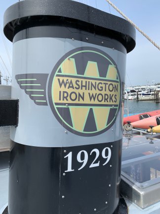
Smoke Stack
The Washington Iron Works logo adorns the David B’s smokestack atop the ship. The boat was built in 1929 and had just celebrated its 90th birthday.

The day had started to cloud over and get a bit chilly, but there wasn’t much wind and the San Juan Islands area we wound through was only a bit choppy. (I had my Sea Bands on for a while, just in case.) We were all excited about starting off and, after a lunch of hearty chicken soup and salad, spent a lot of time out on the deck or in the pilot house watching the San Juan Islands drift by and chatting about the homes we saw on shore. The David B literally chugged along under the power of its 90-year-old 3 cylinder engine, averaging about 6 to 7 knots of speed. We saw a few other boats, including some large tankers and freighters when we crossed the Rosario Strait. And there were ferry boats, of course.

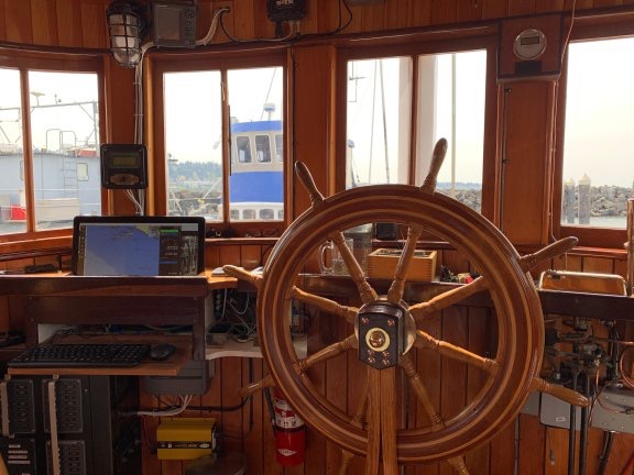
Pilot House
The pilot house is a neat compilation of early 20th century and 21st century technology. For example, the computer ran a navigation application that actually turned the big wooden steering wheel. We all spent a lot of time in this room, which had enough seating for all four passengers.

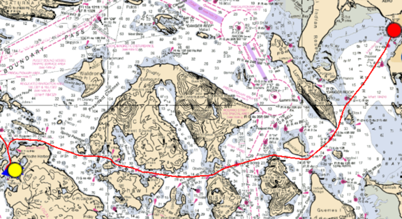
I’d prepared for the trip by downloading, installing, and subscribing to an iPad app called Time Zero (TZ) iBoat. Throughout the trip, I had tracking turned on so it kept track of our exact route. (Yes, I know I’m a geek.) Looking back at that track now, I can tell you that we passed south of Eliza, Lummi, and Sinclair Islands; between Obstruction and Cypress Island through Peavine Pass; between Orcas and Shaw Islands in Harney Channel; north of Crane Island; south of Jones Island; and then into Roche Harbor on San Juan Island. We passed the main harbor and wound through some channels before finally settling for the night at the mouth of Garrison Bay, which was named for nearby English Camp.

Day 1 on a Chart
Here’s the view of our first day’s track as it appeared zoom-to-view on my iPad.

Captain Jeffrey slowed the boat until it was almost stopped and Christine worked some equipment on the bow to drop one of the two large anchors with enough chain to hold us in place. Then he shut down the engine and the sound we’d been listening to for the past few hours stopped.

The Stove
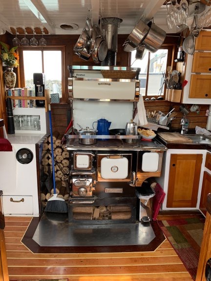
A fully-functional replica wood-burning stove was the centerpiece of Christine’s galley.

By this time, Christine was cooking dinner in the amazing galley. I say “amazing” because she was using a wood-fired stove and I personally can’t imagine dealing with the intricacies of such a device after a lifetime of gas, electric, and microwave cooking power. Because the boat had a generator and inverter, she had all the usual appliances — mixer, blender, ice cream maker. There were several refrigerators and freezers. The only thing she didn’t have was a dishwasher, but we all took turns washing the dishes after meals.

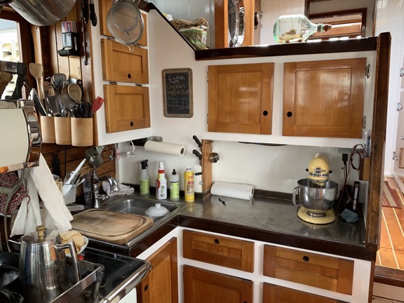
Galley
David B’s galley.

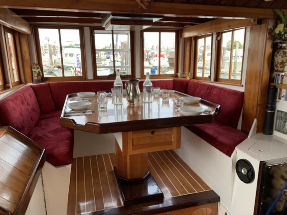
Dining Area
Here’s where we sat for meals. Although Christine plated dinners, breakfast and lunch was usually family style.

We had baked salmon, asparagus, and black rice for dinner. The “bread course” — which became a sort of running joke because every meal had some kind of freshly baked bread — was sourdough. I ate more bread on that trip than I had eaten in the previous year but I simply couldn’t resist.

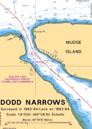
After dinner, we spent some time discussing the next day’s cruise, which would take us into Canada. Part of the trip was a passage through Dodd Narrows, a narrow space between Mudge and Vancouver Islands that was well known for dangerous eddies during tidal flows. We had to plan our arrival at slack tide, a narrow window when the eddies were minimized. If we arrived too early or late, we’d have to wait on the south side of the narrows. An early arrival wasn’t a big deal but a late one would have us waiting for hours until the next safe time to pass through. This was my first introduction to the concept of tidal currents and it came with a lesson on how to use various reference guides to calculate when slack tide would occur.

Not long afterward, we all turned in for the night. I quickly realized that the walls were paper thin and I could hear everything Leslie and David said to each other. They didn’t say anything embarrassing, but I made some noise so they knew how thin the walls were. I suspect they figured it out — probably from hearing me snore! — because they didn’t talk much on subsequent nights.

Day 2: Bellingham to Nanaimo

I woke up early, as I usually do, but with a very sore throat that got me very worried. I’ve been on two vacations where I was sick with a cold and it really sucks. If I was taken down with a cold on this trip, I’d be very upset.

I spent some time lounging in bed with my iPad, which is what I do at home, too. I still had Internet access — heck, we were in the San Juan Islands. Around 5:30, I heard movement upstairs and went up in my pajamas to see what was going on. Christine had stoked up the stove and made coffee. I hung around in the kitchen for a while with my coffee, then went down to put real clothes on. The other passengers appeared one by one. Christine made us a frittata with asparagus (leftover from the previous night), fruit, granola, and yogurt. (The last three would be at every breakfast.) She didn’t have any orange juice, but I did have an orange to start pumping Vitamin C into my system.

The day was beautiful and the water was glassy smooth. I launched my drone for the first time to get some aerial views of the boat. I was a little skittish about flying it over water after my Lopez Island crash, but I faced my fears. There was a big clear area on the roof of the saloon and that’s where I launched from. I did not rely on auto-land to bring it back.

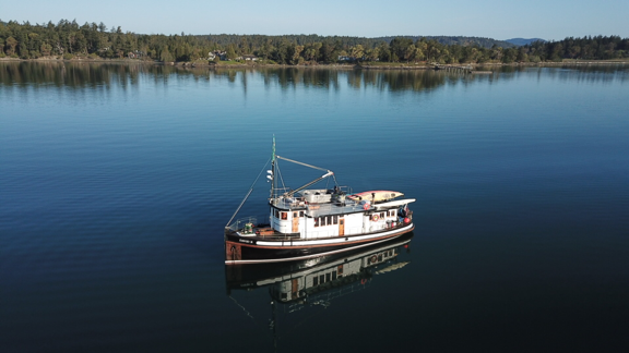
David B at Garrison Bay
The David B at anchor in Garrison Bay.

Afterwards, I went back down into the engine room to get a narrated view of the engine start. I tweeted it.

Captain Jeffrey engaged the windlass and Christine started pulling up the anchor. Once it was stowed, we were ready to go. It was about 9 AM.

We left San Juan Island behind and headed out into Haro Strait. Somewhere northwest of Stuart Island, we crossed into Canada. I spent some time trying to find a good place to sit outside while cruising. The two lounge chairs above the pilot house were windy and chilly. I finally settled — at least for a while — into one of the back facing seats on the stern which was sheltered and in the sun.

It wasn’t long before I realized that the David B was cruising slowly because the David B cruises slow. The engine, which required oiling and other attention every two hours while it was running, was set to a six knot cruise speed. We were going to cruise over 700 nautical miles at 6 knots.

No wonder the trip took 12 days.

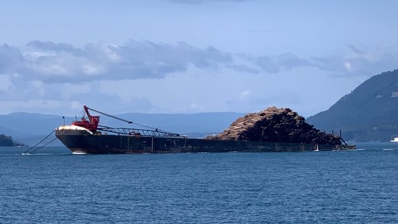
My notes for the second day mention a lot of boats on the water in Canada, including a Canadian Coast Guard boat, tug boats, and a tug boat pulling a barge of oddly loaded logs. I took some pictures, but not many. Everything was big and far away and didn’t look very impressive in photos.

Log Barge
I guess this is one way to load logs on a barge. What’s interesting to me is that in the Pacific Northwest they use chain to attach the tug to the barge and the chain dips way down into the water. This is very different from the barges I remember on the Hudson River when I was a kid; they used cables that were taught when the barge was being towed.

Dodd Narrows
The chart for Dodd Narrows. The red line is our path through it.

We arrived at Dodd Narrows about 30 minutes early. During our slow approach, we could see several boats waiting to enter the narrows, including a tugboat towing a bunch of floating logs tied together. Captain Jeffrey liked the way it looked so he didn’t wait and kept going. A sailboat under engine power pulled in behind us. There was current in there, but it wasn’t bad enough to cause any problems for us. I was glad there weren’t any boats coming through from the opposite direction.

We got into Nanaimo, a port city that’s commonly used by American on private boats to clear Customs into Canada, at about 4 PM. Captain Jeffrey went to shore to deal with the paperwork for himself, Christine, and their four passengers.

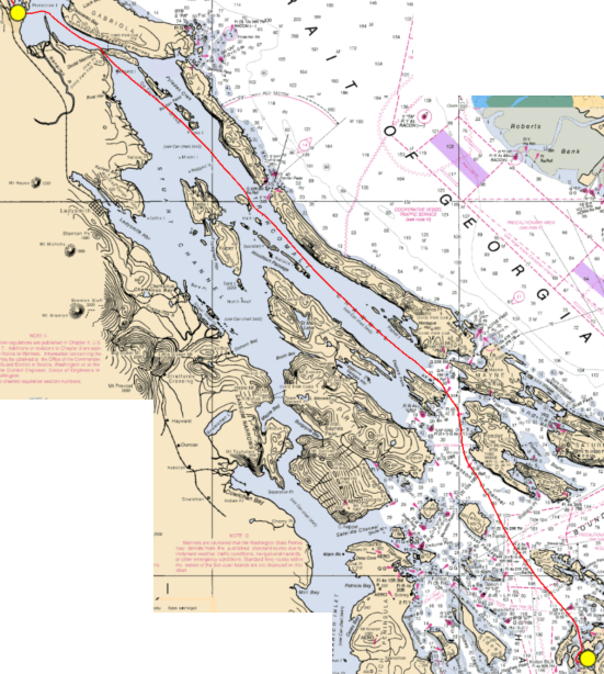
Day 2
Day 2’s track from San Juan Island to Nanaimo in British Columbia.

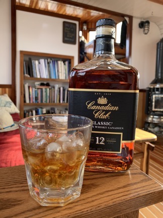
Canadian Club
When in Canada, drink Canadian Club.

I was told that there was a supermarket nearby, so I set off alone in search of orange juice and vitamin C tablets. I had $40 in Canadian money with me and the goal of not being identified as an American. I found the supermarket and accomplished my mission with a credit card so I could save the cash for someplace that didn’t take credit cards, also returning to the boat with a bottle of Canadian Club whiskey and a reusable shopping bag.

Christine made us another amazing dinner with fresh bread. She was feeding us very well. Too well, I think. I’d brought along some snacks in case I got hungry between meals but (1) I didn’t get hungry and (2) there were always snacks available (which is probably why I didn’t get hungry).

Nanaimo Sunset
Mother nature treated us to an amazing sunset.

Day 3: Nanaimo

The wind kicked up overnight and was blowing hard by 8 AM. Captain Jeffrey decided to delay departure by 2 hours. When that time had gone by, he delayed departure again. After lunch, he announced another delay.

I really couldn’t blame him. The wind was howling and the seas that we could see through a gap in the islands nearby was full of whitecaps. A big cargo ship anchored there drifted 90° or more at anchor. Even the seaplanes based near us at the harbor weren’t flying most of the day.

I spent most of the day reading and wasting time on Twitter. I wanted to go see Avengers Endgame at a theater in town, but the only showing I could see was at 3 PM and we might leave.

In the afternoon there was some excitement when a kayaker capsized about 30 feet from the boat. He couldn’t right the boat and he was hanging on in water that had to be icy cold. We got a line to throw to him while Christine called the coast guard. One of his companions paddled back and helped him to the dock in front of the boat. Fortunately, he’d been wearing a wet suit so he wasn’t that cold. But they went into a panic when they realized another kayaker was missing. They later found him back at their starting point at a nearby island; he’d turned around when he realized the seas were too rough for him.

At 4 PM, Captain Jeffrey announced that we’d be spending another night. He went ashore to pay for our space on the dock.

I walked into town with Leslie. We stopped at a tea shop where she had him make a custom blend of Earl Grey and lavender. We also went into a very nice gift shop. I would have visited more shops — including a chart shop Jeffrey had told us about — but I think Leslie was done so I walked back with her.

Back at the boat, we did more waiting. Then dinner. I think all of us were ready to move on.

The wind started to let up before bedtime.

(More to come…)

A Helicopter Trip to the Anacortes Boat & Yacht Show, Part 2

I fly to my helicopter to the boat show in Anacortes, see a bunch of boats, get tempting special show pricing, and fly home.

(Continued from previous post)

My goal was to be in the air by 8 AM so I’d arrive at Anacortes Airport with plenty of time to get to the Boat Show when it opened. I assumed it would take me all day to see the boats that interested me and was worried that exhibitors would start packing up early since it was the last day of the show.

Weather Woes

But the weather did not cooperate. Overnight, the local forecast had changed. Now it wasn’t expected to clear up until after 11 AM. I don’t need clear skies to fly, but I do need ceilings (cloud bottom heights) above the pass where I expected to cross the Cascades. As I went about my morning routine, the clouds seemed to drop in the west and rain began.

Rain to the West
The view from my deck at 6:34 AM. My route would take me right through the middle of this photo.

I continued my morning routine, but without the same sense of urgency. I showered and dressed in clean jeans and a shirt that suggested it wasn’t out of the question that I might spend nearly a quarter million dollars on a boat. Then Penny and I headed down to Pybus Market, where I’d left my tables and display stuff. I was supposed to be selling my jewelry there that day and had already paid for my spot. But with sales so bad the previous day, I didn’t have high hopes for a good day and didn’t mind eating the fee to do something more interesting with my time. I packed everything up and loaded it into the back of my truck.

Back at the helicopter, I took my time setting up my GoPro, preflighting, adding oil, and settling Penny in the front passenger seat. The rain had passed and it was clearing a little. I used a microfiber cloth to dry the helicopter, which also took any dust off. By the time I was ready to head over to the airport for fuel, it was nearly 10 AM. The weather still looked iffy.

My friend Rich, who bought my friend Jim’s old R44 Raven I, was doing pattern work when I radioed my approach. He landed beside me as the fuel guys were topping off my tanks. I told him where I was headed and that I hoped to get over the ridge at the headwaters of Icicle Creek. I’d discovered on a flight to Lopez Island years ago that that particular ridge is adjacent to Stevens Pass on a more direct line from Wenatchee. If the ridge was clear of clouds and I could cross it, there was a good chance that I could drop into the valley beyond and follow Route 2 due west toward the coast. We chatted about other things and then parted company.

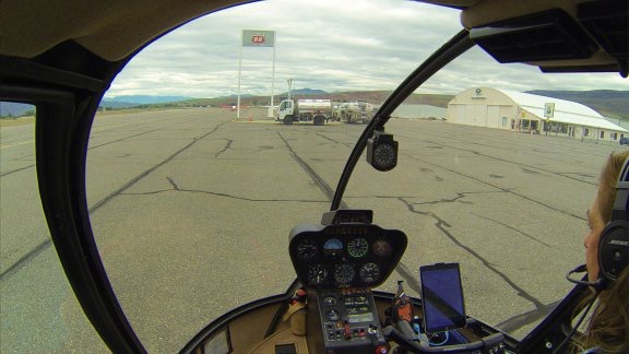
It was just after 10 when I did my walkaround, climbed back on board with Penny, and got my GoPro running. Mounted via suction cup over the front passenger seat, it was connected to a battery power pack and the helicopter’s intercom system. It would shoot continuous video as well as a still image every 60 seconds.

Leaving Pangborn
Here’s the GoPro’s view just before departure from Pangborn Memorial Airport. As you can see, the weather does not look promising.

Nothing ventured, nothing gained. I took off, heading northwest.

The Flight to Anacortes

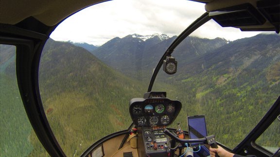
One of the benefits of flying a helicopter is that there is no minimum airspeed. This makes it extremely suitable for flying in conditions where it might be necessary to slow down or make a very tight 180° turn. As I flew northwest toward the mouth of the canyon at Icicle Creek near Leavenworth, I was mentally prepared to make a turn if low clouds obscured the mountains and made it impossible for me to cross the mountains.

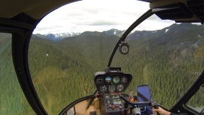
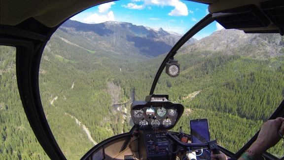
And it sure looked like it would be necessary as I got closer and closer to the ridge. The clouds were sitting atop the Enchantments — that’s the mountains just west of Leavenworth. I was in a relatively narrow canyon with the creek below me and cloud covered mountains on either side. If I couldn’t go forward, I’d have to stop, turn around, and go back.

Of course, you can’t see the end of the canyon from halfway down it. So although it looked very bad at one point, when I rounded a bend, it didn’t look so bad after all. Then bad, round a bend, and not bad. I was at least 1,000 feet off the creek and climbing with the terrain. I never reached the level of the clouds.

Icicle Creek Canyon
This is one of the points where it looked iffy. But when I rounded that bend, it looked much better.

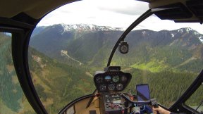
Then the ground came up to a ridge with plenty of space between the treetops and the cloud bottoms. I steered over it and saw Route 2 winding down the west side of Stevens Pass. Just like that, I was over the Cascades. I didn’t even have to slow down.

Crossing the Ridge Crossing the Ridge
These photos, taken 1 minute apart, show me approaching the ridge at the headwaters of Icicle Creek (left)and then topping the ridge where I can see Route 2 coming down the west side of Stevens Pass (right).

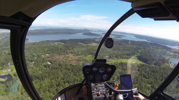
I descended down into the valley and followed Route 2 almost due west to Skykomish, then headed northwest toward Anacortes. The canyon opened up and the terrain dropped around me to mere hills. I flew along at a cruise speed between 100 and 110 knots, over creeks and marshes and forests, past logged terrain and waterfalls and quarries. The wind was still calm and the ride was smooth. Penny occasionally stirred in her seat or sat up as if to ask “Are we there yet?”

Over Logged Terrain
I crossed over a lot of wooded, hilly, and logged terrain between Skykomish and the coast.

I tuned into various nearby airport frequencies as I flew. I got close enough to Arlington and Skagit to make radio calls, but didn’t fly over either one.

Eventually, I left the mountains and hillsides behind, crossed I-5, and flew over the flat farmland along the shoreline. As I flew over various waterways, I wondered whether a boat with a 30-inch draft could navigate them. (Yeah, my boat lust had gotten that bad.)

Flying Near the Coast
This was shot somewhere west of Mount Vernon.

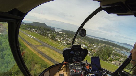
Then I was over Fidalgo Island, climbing over one last hill before looking for the airport. I found it very close to the hillside and came in for a landing on the parallel taxiway. I set down in an airplane parking spot near the fuel island, wondering whether the hose would be long enough to reach me where I was parked. I didn’t see a fuel truck.

Landing At Anacortes
Making the turn for landing at Anacortes.

I shut everything down and let Penny out while I gathered everything I’d need for the day. Then, after a quick bathroom visit in the Pilot Lounge, I used Uber to call for a ride. We were on our way to the Marina five minutes later.

At the Boat Show

If you haven’t read the first post in this two-post series, you probably should before continuing. It explains why I wanted to go to the boat show in the first place and the kinds of boats I’m interested in.

Andrew at Ranger Tugs had put tickets aside for me at the Will Call office, so that where I started. The event isn’t expensive — only $10/person — but I think they charge a fee to discourage low-budget lookie Lous. Let’s face it: the Anacortes Boat & Yacht Show has the word “yacht” in it for a reason. The majority of boats on display were far beyond the means of 99% of the people who attended.

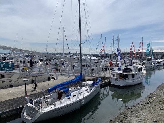
BoatShow1
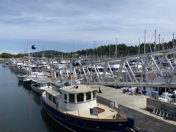
A look to the right from the ramp leading down to the boats for sale.

Boat Show 2
A look to the left at the boats for sale.

I didn’t waste my time looking at boats I couldn’t afford, although I do admit looking at a few that didn’t quite fit my needs. In most cases, the problem was towing: I needed a boat I could easily tow from home to anywhere I wanted to launch it, whether that was 12 miles from home at the boat ramp behind Pybus Market or 1200 miles from home in Arizona’s Lake Pleasant. That meant it could be no wider than 8-1/2 feet, which is the legal limit for normal trailer loads. Wider than that and I’d need a special permit to tow it and would have to get Wide Load signage and possibly a pilot car. The Cutwater boats seemed to fall into this category. Other boats were lacking in the livability department and wouldn’t be comfortable for more than a few days. Some were inboard motors and I preferred an outboard. None of them had the finely honed feature set the R-27 Ranger Tug I lusted for had.

I should mention here that “looking” at a boat didn’t mean looking at it from the dock. It meant climbing on board, and looking from the stern of a boat. All the boats had ramps leading to them so it was an easy deal. In most cases I either left Penny tied up on the dock or I picked her up and brought her on board. Although it would have been quite a treat to explore the giant yachts parked here and there along the dock, there was no reason to make me want something I couldn’t afford. It was best to stick to the program and let the lookie Lous have their fun without me.

I spoke to a sales guy at the Ranger Tugs area where their five models — R-23, R-27, R29, R31, and R41 — were parked. He gave me a sales spiel that included favorable pricing on the R-27 parked there. Prices go up by $10K in July for the 2020 model year, he warned. This was the last boat off the line for the 2019 model year. I checked out the smaller R-22, which I think would be too small for me. I asked questions about the windlass — cruising on the David B had convinced me that I would be unable to pull up an anchor, especially if it had 50 feet of chain and another 100 feet of rode set out. Andrew walked up and I chatted with him about it. He gave me even better pricing. We talked about desalination and dingy storage.

Later, I walked around the marina to look at some used boats on the far end. There was a 2016 Ranger Tug for sale there at the same price as the deal Andrew offered. Jeez. Was it wishful thinking on the part of the owner/broker or did the boats really hold their value that much? Why would anyone buy a used 2016 model when a brand new 2019 model, with all its improvements, from the factory could be had for the same price?

Penny and I left the docks and walked up to where other exhibitors were gathered inside a big tent or outside under smaller canopies. I got into a conversation with a boat broker about her upcoming trip to Ketchikan on her 41 foot Nordic Tug and my recent one on the David B. Her husband joined us and we talked about financing, which I hadn’t even considered. Even though they knew I wasn’t going to buy a boat from them, they were every helpful. And they seemed impressed that I was considering an R-27; the woman said it was an excellent option for me.

I looked on as a sales guy explained a desalination system to a couple. The system was very large and convoluted — not to mention expensive — and I wandered off.

I chatted with two sales guys about a Zodiac boat to use as a tender for an R-27. Andrew had recommended them because they’re relatively light weight. Apparently they come in sizes as small as 6 feet (inside length), although they said the next size up might be better for me. One guy even described how he gets his Zodiac out of the water and stowed on his boat by himself. They seemed confident that I could handle it alone.

I had wanted to look at Bayliners — Captain Jeffrey on the David B mentioned that they had models similar to the tugs I liked — but they were not at the marina. They were in a boatyard who knows where. This morning, as I started researching links for this blog post series, I looked them up. Although they may have had boats like a tug in the past, their current lineup did not include anything remotely similar. So I’m glad I didn’t track them down. It likely would have been a waste of time.

Since I hadn’t had a thing to eat all day, I decided to have lunch before heading out. Fortunately, between the marina entrance and Anthony’s Restaurant, there was a casual dining place called the Cabana. Penny and I walked right through and I got a seat on an Adirondack style chair in the shade of an umbrella — did I mention that the weather was sunny and warm? — overlooking an unused bocce court and the marina. A short while later, I was digging into a blackened rock fish taco while Penny was stretched out in the sun for a nap.

I had a lot to think about. Too much. It was strange to me, almost as if the stars and planets were aligning for me to buy this boat. There’s no doubt that I loved it and that it met all of my needs and most of my desires. (I’ll be honest a much larger boat that came with a bunch of guys to move it around for me would be a lot more attractive but definitely not in my budget.) I knew that I’d be happy with it, perhaps for a very long time. Who knows? It — or something a lot like it — could be my next home.

But I won’t kid you: there are financial hurdles to jump. Selling the helicopter would make the boat easily affordable without any financing, but was I ready to retire from flying? Could I get a seasonal job flying for someone else? Did I really want to sell the helicopter? I’d been an owner for nearly 20 years and I honestly couldn’t imagine life without one.

But could I have both? Did I want the financial burden that came with owning both? The answer to that is no.

Meanwhile, as I sat in the shade at the Cabana, I realized that clouds were building in the mountains to the east. Was I going to have trouble getting home? Time to find out.

The Flight Home

Watch My Helicopter Videos on YouTube

Time for a shameless plug…

Flying M Air Logo

If you like helicopters, you’ll love the FlyingMAir YouTube Channel. Check it out for everything from time-lapse annual inspections to cockpit POV autorotation practice to a flight home from a taco dinner at a friend’s house — and more.

Getting an Uber back to the airport wasn’t quite as quick as I’d hoped. The closest car was 25 minutes away. I tried Lyft, but they didn’t have anyone at all. So I parked myself on a bench near the entrance to the show and waited. Penny found shade under the bench and took another nap.

Back at the helicopter, I decided I had enough fuel to get me home with required reserves. So I just started up — with some trouble, which will be covered in a future post — and took off.

Departing Anacortes
Flying down the west side of Fildalgo Island.

Mountain Obscuration
The clouds were low as I approached the canyon where Route 2 wound up toward Stevens Pass.

The conditions started off nice — after all, it was a really great day out near the San Juan Islands — and then got very iffy. The cloud level in the foothills to the Cascades had definitely dropped since I’d come through that morning. Some of the cloud tops were obscured. A gusty wind was blowing out of the south, setting me up for mechanical turbulence — turbulence caused by the motion of wind over landforms. It began raining lightly.

For a while, I was worried about the flight. Because I hadn’t taken on more fuel at Anacortes, I didn’t have enough on board to do detour around weather looking for a clear passage to the other side. (Yes, I did have enough to get home with required reserves.) That meant that if I hit a dead end on my course, I’d have to go back, probably to Arlington, to get more fuel before trying again. Conditions were likely to get worse before they got better, so going back might even mean spending the night, which I really didn’t want to do.

(They say that the only time you have too much fuel on board is when you’re on fire. It’s always better to have more fuel on board than you need — unless it puts the aircraft weight over limitations. It gives you more flexibility.)

As for the weather, now you can see why I fly to the Seattle side of the mountains so seldom.

Once I got to Skykomish again, however, the rain stopped and the clouds lifted a bit. I was even sheltered from that gusty wind. I reached the ridge near Stevens Pass, climbed up, and hopped over it, down into the Icicle Creek Canyon where it was a beautiful day full of sun and big fluffy clouds.

IcicleCreekCanyon
It was a typically beautiful day on the east side of the mountains as I flew down Icicle Creek.

The rest of the flight was great and I even took a moment to record a little in-flight lecture about what it’s like to be a helicopter pilot and owner. I recently discovered that has far more subscribers than I thought and I’m now motivated to add new content there regularly.

I was back at my base by 5 PM. I spent the rest of the day gardening and doing chores around the house.

If I had driven, I’d be starting my return trip around 6 get back in the dark.

A Helicopter Trip to the Anacortes Boat & Yacht Show, Part 1

The backstory on why I flew my helicopter out to Anacortes on Sunday.

Those of you who know me well in person, by reading between the lines on this blog, or by following me on Twitter, have probably come to realize that I have been lusting for a boat for the past few years.

Boating with my friend Jim
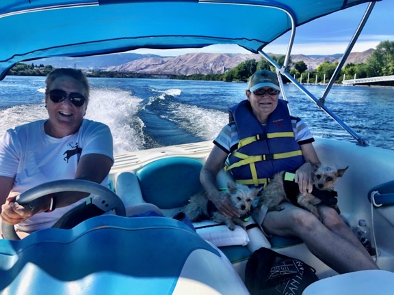
Here I am boating with my friend Jim on the Columbia River back in 2012.

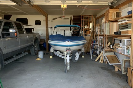
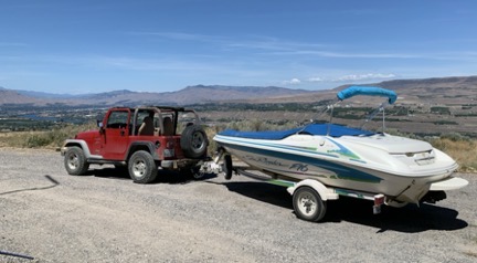
Yes, I know that I already have a boat — a little 1995 Sea Ray Sea Rayder F-16 that I bought back in 2011 for about $2,000, including the trailer — but although it’s a nice little toy to get me out on the water, it just doesn’t meet the needs of someone with a yen for exploring new waterways on extended length trips. Someone who has always wanted to live on the water but can’t decide exactly where that might be.

What Planted the Seed — and How It Grew in my Brain

I got this desire for a more substantial boat after a few outings with an (ex)friend at Lopez Island. He’d bought a 22-foot C-Dory Cruiser, which is an ocean worthy power boat in a sort of tugboat style. I loved the bright roominess of the cabin and the features, which included a usable galley (kitchen) and sleeping area. It was lacking one thing I needed in a boat: a head (toilet). But I poked around a bit and discovered that the C-Dory made a larger boat, the 25 foot Cruiser, which had everything I needed. I started thinking about that.

After a while, I started exploring other options — heck, even when I dream about something big like this, I do some research. I knew I wanted an ocean worthy boat that could be towed and stored in my big garage when I wasn’t using it. I knew I wanted the tug style, which had lots of big windows and stand-up cabin space throughout. I knew I needed a decent sized galley and a head, as well as full-time sleeping space. That weeded out a lot of possibilities.

Possible brand names included C-Dory, Nordic Tug, Cutwater, and Ranger Tugs. I eventually zeroed in on the 27′ Ranger Tug — specifically, the 2018 or later model. Not only did it meet all of my criteria, but it was fully loaded with all of the features I needed and wanted, from the Garmin navigation system with autopilot to the solar panels and inverter system.

Trying to Get Over It

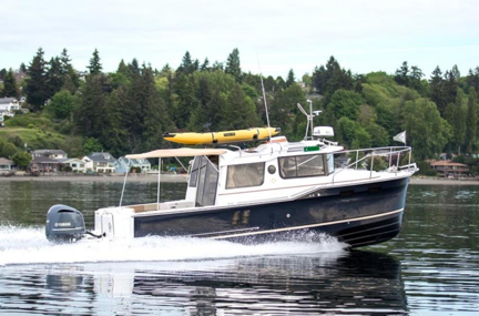
R-27 Ranger Tug
Photo of the 2018 (or later) R-27 Ranger Tug from Ranger Tug’s website.

As time went on, I lusted after this boat. I carried photos of it from the Ranger Tugs website on my phone. I thought about it when I was camping out in the desert or driving/flying past a waterway. I figured I’d better do something to get it off of my mind.

My first step was to see the boat in person. So far, all I’d seen were photos and videos online. I kind of hoped that seeing it in person would disappoint me and get it off my mind.

So I made an appointment with the General Manager of Ranger Tugs in Kent, WA, where the R-27 model is made. I had to take my helicopter to Hillsboro, OR and fly back through Seattle, so I scheduled my return flights with a long layover in Seattle and took a Lyft to the boat factory. It was very nondescript and certainly didn’t look as if they built $200K boats inside. I met with Andrew and boarded one of the two boats being built in a metal building behind their offices.

It was amazing. Better than the website. Shit. Now I really wanted one.

R-27 Interior
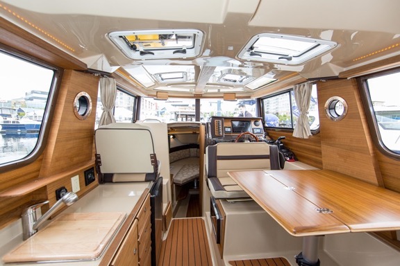
The interior of the 2018 R-27 Ranger Tug. If you took a comfortable little RV and stuck it into a boat, this is what you’d get.

The next step had already been set up. Last fall, I’d booked a 12-day “Learn to Cruise the Canadian Inside Passage to Alaska” cruise with Northwest Navigation on a small ship called the David B. I figured it would be a good way to learn new skills — marine navigation — and experience a long trip on a relatively small boat. (The David B is 65 feet.) So only a week after I visited the Ranger Tug factory, I was one of just four passengers on a 12 day trip that might be very similar to one I’d be able to do in the boat I lusted after. I hoped I wouldn’t like it.


Shot of the David B at its slip in Bellingham. I need to blog at least a little about that trip.

Of course, I loved it. How could I not? Exploring sheltered, glacier-carved channels along the coast of Canada? Enjoying the solitude of secluded anchorages where the only sound comes from birds or waterfalls? Getting daily sightings of wildlife that included bears, eagles, seals, porpoises, dolphins, whales, and countless water birds? Navigating from point to point with the challenges of tidal currents in narrow passageways? Jeez! I could spend a lifetime doing that.

I’m not saying the trip was perfect. There were a few times we had to cross open water that was a bit rough and my landlubber head and stomach weren’t happy. (As I told Captain Jeffrey and Co-Captain/Cook Christine, my wasband, who would have really enjoyed the trip, would have been puking his brains out.) But even the weather cooperated with very few overcast or rainy days. (Whodathunkit?) As for the open water crossings, the David B chugged along at 5-7 knots; the boat I had in mind was capable of planing and could cruise a lot faster. So even though I wouldn’t take rough water at high speed, I could probably comfortably cruise at double the David B’s speed and cut the crossing times in half.

I also learned a ton about marine navigation and cruising — everything from reading details in charts to how much chain/rode (anchor rope) to set when anchoring. It filled me with new questions to ask Andrew at Ranger Tugs.

I also got advice from Captain Jeffrey: check out other boats. There might be one you like better that might even be less expensive. He was right, of course. I needed to do more homework.

Planning a Trip to the Boat Show

I was still on the David B when the invitation to the Anacortes Boat & Yacht Show arrived via email from Andrew. Seemed like a perfect opportunity to see a lot of boats at once.

The trouble was, it was in Anacortes and I live in Malaga. It’s a 3-3/4 hour drive. Each way.

It was a four-day show: Thursday through Sunday. I was helping my neighbors at Malaga Springs Winery bottle wine on Friday. I was supposed to be at Pybus Public Market selling jewelry on Saturday and Sunday. I had done very well at Pybus the previous weekend and was looking forward to a repeat performance. That left Thursday.

But did I really want to drive a total of nearly 8 hours in one day just to see some boats? Maybe in my S2000 with the top down. But there was rain in the forecast for Anacortes, so not only would I be driving in the rain, but I’d probably be walking around the boats in the rain. It wasn’t very appealing.

Thursday came and went; I did things at home. I bottled wine on Friday. I went to Pybus on Saturday — and had a crappy sales day.

I’d started looking at the forecast for Sunday. Earlier in the week, it had been bad, with clouds and rain on both sides of the mountains. But as time went on, the forecast changed. By Saturday evening, it looked like Sunday would be a good day.

Good enough to take the helicopter over. Instead of a dull 3-3/4 hour drive, I could have a 1-1/4 hour flight.

So I whipped out ForeFlight on my iPad, created a flight plan, got a weather briefing, and filed my plan for the next day.

()

Snowbirding 2018: Lake Havasu Adventure

It wasn’t supposed to be like that.

I spent Sunday through Wednesday camped out at Cattail Cove State Park on Lake Havasu, about five miles upstream from the Parker Dam on the Colorado River. I put the boat in the water as soon as I arrived and didn’t take it out until I was ready to leave. I was on the boat every day. (I think I’ve used my boat more in the past two months than I have since I bought it in 2011.)

You have to understand one important fact: the winter weather in southern Arizona is perfect. It’s clear every day and the sun warms the air consistently to temperatures in the high 60s to low 80s — unless a cold front happens to blow through and drop daytime temps to the low 60s. It gets chilly at night — I still need to turn the heater on when I get up in the morning — but that’s because all that daytime heating escapes back into space without a blanket of clouds to hold it close to earth. But day after day is beautiful, perfect for just about any outdoor activity.

On Tuesday, I decided to take the boat to Lake Havasu City for lunch. The weather was good, the wind was relatively calm. The city, with its famous relocated London Bridge attracting tourists, was a haven for boaters. There was plenty of docking space and lots of restaurants within walking distance.

Boat
This terrible photo is the only one I have of my boat anchored just past the swimming beach at Cattail Cove.

I packed a few things in my small day pack and walked out to the boat, which was anchored just off the beach. I’d set a stern anchor with a fender as a buoy so the boat wouldn’t swing around and get beached if water levels dropped — a trick I’d learned while camping on the Colorado River backwaters in December. The bow line was secured with rocks on shore. That meant I had to wade out to the boat. No big deal; I was wearing a short denim skirt and didn’t get it wet when I carried Penny, my bag, and the bow line out. Within a few minutes, Penny and I were settled in the boat, the stern line was disconnected, and the boat was idling out toward the lake.

I say “idling out” because my boat has no true idle. It’s a sport jet propulsion system — like in a Jet Ski or Waverunner — so it’s always moving. This worked fine at Cattail Cove because there was a big No Wake area all around the beach. As I puttered out toward the lake, I was warming my engine, which, in my opinion, let out a lot of smoke when it was cold. I’ll have it checked and serviced when I get home.

Once past the No Wake buoys, I opened it up to about full throttle. At 5000 RPM, that gives me about 32-35 miles per hour. As the boat accelerates, the front end comes way up out of the water with very little speed gain. Then the front end drops down and it moves, planing over the surface of the water. My little boat loves smooth water — the smoother the better, in fact — and the lake was smooth enough that morning.

I headed upriver, favoring the Arizona side and watching out for hazard buoys that marked underwater “reefs.” When you remember that Lake Havasu is basically a flooded canyon area, those reefs make sense: they’re rock formations that were once rock ridges high above the river surface. As the water levels rose, the ridges became submerged, but some of them are still quite close to the surface of the lake. These hazards are all marked at Lake Havasu — remember, it’s a popular boating destination — so you’d have to be a real idiot to run aground there.

I sped uplake, feeling the warm air blow through my loose sleeveless cotton shirt. I’d tied my hair up with a clip at the back of my head so I wouldn’t be combing knots out of it later in the day. Although the boat has a bimini top, it wasn’t hot enough to deploy it. I was enjoying the feel the sun on my skin. I had a good base tan, especially on my face and arms, after two months mostly outdoors in Arizona and wasn’t worried about burning.

According to my rough measurements on Google Maps, Lake Havasu was about 15 river miles away. That was the longest distance I’d taken the boat that winter. I had plenty of fuel, but knew that my oil situation was less than optimal. My boat’s two-cycle engine has an injector system that takes oil from a reservoir under the hood. I’d poured in the last of the extra oil the previous day but the reservoir was far from full. One of the things I wanted to do at Lake Havasu City was buy more oil.

The trip was uneventful. The landscape around the lake is rugged, rocky desert. There are only a few places where roads can reach the lakeshore and that’s where you’ll find remote desert communities of manufactured homes and RVs. Black Meadow Landing is a community directly across the lake from Cattail Cove. Havasu Palms is another community on the California side about halfway to Lake Havasu City. On the Arizona side, there are numerous boat-in campsites, many of which have ramadas and toilets.

Many of the small coves had fishing boats in them. There was a bass tournament going on — or coming soon; I never did get the whole story — and lots of folks were fishing. There were also numerous pleasure boats speeding one way or another and, closer to the city, quite a few patio boats.

Signs of civilization started up suddenly, right after a construction site. Soon there were buildings and roads and parks on the Arizona side. I reached a No Wake area and cut speed, letting the boat settle back into the water. Then I putted along into the narrow, manmade channel that led to the city’s centerpiece: London Bridge.

Lake Havasu City
The lay of the land at Lake Havasu City. The canal exists solely so London Bridge has water to cross.

London Bridge — which was the real London Bridge from London, England — was brought out to the Arizona desert as a tourist attraction. Of course, Lake Havasu City didn’t need a bridge. There was nothing for a bridge to cross. So the folks who arranged to buy and move the bridge turned a peninsula of land jutting out into the lake into an island by digging a canal. They then assembled London Bridge in the city to reach the island. You can learn more about it on Wikipedia, which also includes a great photo of the city right after the bridge was assembled.

(The island, by the way, used to have Lake Havasu City Airport on it. They moved the airport about ten miles north of town and redeveloped the land with parks and resorts and condos.)

Penny at the Bow
Penny at the bow of the boat as we puttered up the canal toward London Bridge.

My boat is difficult to control at slow speeds, but I managed to set the throttle at a low enough speed to satisfy No Wake rules while maintaining control. This turned out to be about the same speed as a kayaker who was in front of me for most of my drive through the canal. Finally, I saw the bridge and the restaurants and shops clustered around it. There were numerous empty boat slips on the right. Signs said they were public. I aimed the boat into one of them, cut the engine, and drifted in.

Boat at London Bridge
I parked my boat next to a sailboat in one of the empty slips near London Bridge.

Penny was out of the boat before I’d even had a chance to tie up. After securing the fore and aft lines for the boat, I gathered my things and joined her on the floating dock. I fastened her leash and led the way out, through an unlocked gate to a sidewalk where tourists wandered and locals power-walked. I was in search of pizza.

You see, I’d gotten my hands on a Lake Havasu City dining guide and had found a pizza restaurant right near where I parked. I hadn’t had pizza in months. But although it was in the guide, it didn’t seem to exist. I couldn’t find it, anyway. So I kept walking. Soon, I’d walked under the bridge and was running out of options.

There was a fish and chips place with outdoor seating near the bridge and I homed in on it. I fastened Penny to the fence near a table and went in to order. My timing was perfect; a tour boat from Laughlin had just arrived and let off its passengers. Although a loud (possibly drunk?) guy from the boat was in front of me on line, a long line quickly grew behind me. I ordered fish and chips (of course) and a Bloody Mary and went out to wait for my food with Penny.

It was a perfect day for people watching. More than half the folks in the area were seniors who either lived there or were visiting for the day. There was a London style telephone booth near the water that a lot of tourists liked to stand in to pose for photos and I watched them one after another. Other folks milled around while exercise minded folks hurried through. There really isn’t that much to do in the bridge area other than shop in tourist shops.

London Bridge
The view from my seat at the fish and chips restaurant on a rare moment with no one on the sidewalk.

My lunch arrived and it was very good. I used malt vinegar on my fries; I really do prefer it over catsup.

As I ate, the wind started to kick up. I got into a conversation with the couple at the next table who were there with a dog. Although I thought at first that they were a married couple, I soon realized that they were either friends or dating. When I offered him the bowl of water the waitress had brought for Penny, he said that his dog preferred iced tea, put the dog on his lap, and let the dog lap tea out of his cup. (Ick.) He then told me that he’d been living in Havasu for a few years and he thought it was paradise. (Coincidentally, that’s what the Welcome to Lake Havasu City signs said.) Then he offered to drive me down to Cattail Cove if I thought it was too windy to make the trip in my little boat. His companion was very agreeable did a lot of nodding.

I thanked them but told them I thought it would be okay.

London Bridge
Another shot of London Bridge. The Union Jacks are a nice touch.

A while later, I left in search of ice cream. Instead, I found a Hobie dealer and got to see the full line of Hobie paddle kayaks I’ve been thinking about for the past few years. These boats are very cool. They’re sit-on kayaks with comfortable, removable seats and drop-in pedal propulsion systems. Some models are even compatible with an add-on sail kit and petite outriggers. Before I bought my first kayaks, I considered one of these. But they don’t come cheap and I was worried that I wouldn’t use it. Now I’m thinking that I might, especially if I could figure out a way to take it south with me without towing a trailer or putting it on the roof. In any case, it was good to see them and be able to ask a knowledgeable person questions. The folks there were very helpful, even after I told them I couldn’t buy from them due to inability to transport it. The place is called Southwest Kayaks and they rent kayaks, too; I recommend them if you’re in the Lake Havasu City area. If I’d been staying in the area, I would have rented a kayak with a sail kit just to give it a try.

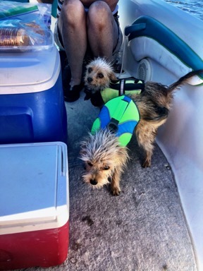
I went to various places to take photos of the bridge. By that time, the wind was really blowing. We headed back to the boat, stopping only to buy an ice cream cone for me (and a taste for Penny) and take a few more photos. Then we were back on the boat and I was casting off with the engine put-putting in “idle” speed out into the channel. This time, Penny’s life jacket was on and mine was on my seat as a back rest.

Penny Life Vest
I swung around for one last photo of the bridge before leaving Lake Havasu City.

The water in the channel was smooth enough, but I could sure feel the wind at my back as I retraced my route back out toward the main lake. When I got out of the channel, I could see whitecaps on the water. All the boats I saw were coming in from the lake.

I saw a marina on the right and headed toward it with thoughts of buying fuel and oil. But then I looked at my fuel gauge and realized that at nearly half full I had enough to get back to Cattail Cove. I should have enough oil, too. The wind would only get worse and taking 30 minutes to fuel and get oil I probably didn’t need would just make for a rougher ride all the way back. So I turned back toward the lake and increased speed a little to hurry through the No Wake area. When I passed the last No Wake buoy, I hit the throttle and the boat climbed out of the water into planing cruise.

But it was not a good cruise. The water was beyond just choppy and the boat would periodically surge out of the water while the engine screamed with nothing to pump through it. The hull repeatedly hit the water hard: bam, bam, bam. The fuel gauge swung wildly from nearly empty to half full — what was the real level? And then I heard the first beep.

You see, the oil reservoir has a warning system to let you know when you need to add oil. It beeps when it’s low. When I’m in rough water, the oil level sloshes around and, if it’s low enough, causes that warning system to beep. That basically tells me that I need to add oil pretty soon. If I don’t, the level will get so low that it’ll beep constantly, which is not only annoying, but stresses me out about running out of oil and destroying my engine.

So just like that, my boat told me what it wanted: go back and get more oil. And some fuel probably would be a good idea, too.

Backtracking
I happened to turn on the tracking feature in the GaiaGPS app on my phone when leaving the No Wake area the first time; you can see the start of the track in the middle of the loop here. You can also see where I turned around, went back to the marina, and then headed back out down the lake.

I turned around and headed into the wind. That was not fun. With the wind at my back, when water splashed up, it splashed away from the boat. But when I was driving into it, the splashes went right into me. I had to slow down to minimize the splashing but somehow that didn’t minimize how wet I was getting.

Then I was past the No Wake buoys and was supposed to slow down a lot more. I slowed down a little more. I honestly didn’t see a reason to maintain No Wake speed. Not only would that have kept me at a virtual standstill driving into the wind, but there was a lot more wave activity from the wind than from my little boat no matter what the speed was.

Eventually, I made it into the marina. It was sheltered there and I had no trouble tying up at the dock. I went right inside to inquire about oil and bought a quart; I usually buy it by the gallon but they didn’t have gallon sized bottles. Then I hit the ladies room. Then I went back to the boat, added the quart of oil, and topped off the fuel. About 20 minutes after arriving, I was ready to get back on the lake.

Of course, just as I expected, things out there were worse. The wind was blowing at around 19 miles per hour. How do I know this? Because at one point I was driving at 19 miles an hour (per my phone’s GPS) away from the wind and my hair and clothes weren’t blowing around. That was seriously weird.

We rode back at the fastest speed I could drive without the boat repeatedly screaming out of the water. That was usually around 15 to 20 miles per hour. At one point, the water seemed calmer and I got it up to 30 miles per hour. But then later I had to slow down again.

The whole time, Penny sat on the seat beside me. I think she wanted to be done with our adventure more than I did.

I drove close to shore, hoping that there would be some shelter from the wind and waves, but it was impossible to avoid them. The wind blasted down the lake, turning the whole surface into a choppy, white capped mess. I thought more than a few times about how nice it would have been to get back to Cattail Cove in a car with that couple from the restaurant and their iced tea sipping dog.

Other than the wind, the weather couldn’t be better. It was still bright and sunny without a cloud in the sky. The air was warm and I saw no need to put on a long-sleeved shirt. The boat wasn’t taking on any water so there was no danger. I did worry a bit — probably needlessly — about the hull banging down on the water surface so many times and mentally rehearsed what I’d have to do if something broke. And there were still a few boats out on the lake so if I had a serious problem and needed help I probably wouldn’t have to wait long.

I finally saw the trailer homes at Black Meadow Landing. Then the buoys at Cattail Cove came into view. I slipped between them and cut speed, maneuvering against the wind to my stern anchor buoy and line. I killed the engine as I reached out and caught the line, then held tight and let the anchor bring us to a stop.

The water in the cove bounced around a little. No one was on the beach. No one was in sight. The wind was howling there, too.

I tied off the line and the boat swung around, leaving the bow over deep water. I could see the bottom, but I knew it was deeper than I wanted to jump into. I repositioned the anchor twice, tossing it toward shallower water each time. Soon, it became obvious that I’d have to get my clothes wet. When I did finally jump in, expecting the water to be up to my thighs, it was up to my waist. And it was cold.

I had half a mind to let Penny swim to shore, but I didn’t. After tying the boat’s bow line to rocks on the beach, I went back to get her and my bag. I walked back to the campsite with my skirt completely soaked and dripping. No one was outside to see me.

It had been a bit more of an adventure than I like, but it was still a great day out.