Tips for Flying at Lake Powell: Points of Interest

The third of a four-part series about flying at Lake Powell.

Although Lake Powell is simply a beautiful place to overfly, it does have a few specific points of interest that you may want to check out from the air. I’ll cover them in this part of my series, beginning with the downlake points and moving uplake as far as the tour planes go on their standard tours.

To help you locate these places, I’ve included several maps, each of which has letters corresponding to their descriptions here. This first map is for the downlake points; the map you’ll find a bit farther down in this article is for the points that are farther uplake.

LakePowellPoints1.jpg

Horseshoe Bend

Horseshoe BendThe first point isn’t even on the lake. Horseshoe Bend (A) is a horseshoe-shaped curve in the river a few miles downstream from the dam. It’s often photographed from the viewpoint at the outside “top” of the bend, which you can walk to from a parking area right off Route 89. Here’s a photo I took today from the overlook.

From the air, however, Horseshoe Bend takes on a completely different look, since you can see all of it at once. There’s an excellent photo of Horseshoe Bend from the air, taken by Mike Reyfman, in Part II of this series.

Keep in mind that this is one of the points visited by the tour planes. They’re normally flying a right hand turn around the bend at about 5500 feet, so be listening for them if you overfly.

Glen Canyon Dam

Glen Canyon DamThe Glen Canyon Dam (B) is the dam that keeps all the water in the lake. It’s accompanied by a bridge a few hundred feet downstream that crosses Glen Canyon. From the air, you can get good views of both.

Again, remember that the tour planes are also showing off this area. They tend to fly past between 4800 and 5500 feet, right after climbing out from the airport.

Wahweap Marina

Just past the dam, to the northwest, is the Wahweap area of the lake. It’s off the main channel and is home to the Wahweap Resort and Marina (C), currently managed by Aramark Services for the National Park Service. It includes a marina with slips and buoys, a tour boat dock, a rental boat dock, a resort hotel with two pools, and a campground. You can’t miss it.

The tour planes fly in the vicinity, usually at 5500 feet.

Navajo Canyon

Navajo Canyon (D) is an extremely long lake canyon that winds its way to the south. Outlined in white by the “bathtub ring” water line, it makes a fine subject for aerial photography early in the morning and late in the day. What sets it apart from other long side canyons on the lake is its width — it remains quite wide for miles. There’s also a huge sand dune against one canyon wall that’s a popular houseboat overnight spot.

The tour planes overfly this canyon, descending from 5000 feet (or higher) as they return to the airport.

Tower Butte

Tower Butte (E) is the iconic symbol of Lake Powell that you’ll see on various logos, etc. throughout Page. I don’t think it’s anything special, other than the fact that its top would make an excellent (but illegal) landing zone for a helicopter. It’s not even that close to the lake. But at sunset, it makes a good foreground subject for the illuminated cliffs and buttes behind it.

And if you’re flying low-level (think helicopter or ultralight) you might be able to spot some of the ancient ruins along the base of the butte — although I haven’t been able to find them lately.

This is a reporting point for the tour planes, which begin their descent for the airport right around here. Uplake beyond this point, the tour planes are on the uplake frequency (122.75).

Gunsight Butte

Gunsight Butte from Romana Mesa
Gunsight (F) is a large rock formation that resembles a gun sight. It’s just uplake from Romana Mesa, which is one of the tour plane reporting points. Beyond the butte is beautiful Padre Bay, which has some interesting history and is popular with houseboats.

This photo was taken from the top of Romana Mesa on one of my 4WD outings. In it, distant Navajo mountain is lined up in the “sight” of Gunsight Butte.

Gregory Butte

Gregory ButteGregory Butte (G) stands out in my mind primarily because of its photogenic qualities. If you’re flying uplake early in the day and take a photo up Last Chance Canyon with Gregory Butte in the foreground…well, you get the photo you see here. It’s one of my favorite views of the lake. This shot was taken by my husband on one of our first helicopter trips to the lake together. The water level is a bit higher right now. If it rises some more, Gregory will become an island.

This is another tour plane reporting point, as they fly downriver at 5000 or 6000 feet.

LakePowellPoints2.jpg

Rock Creek

The mouth of Rock Creek (H) is also an extremely photogenic viewpoint. Whether you’re looking up Rock Creek’s three separate canyons or up Lake Powell itself, the view from the air at this point is magnificent. I usually see it from around 4800 feet, which is admittedly low — remember, I’m doing photo flights — but it’s also good from above.

This is one of the turnaround points for tours, so expect a lot of tour plane traffic here. Listen in on 122.75. Traffic coming downlake will be at 5000 or 6000 feet. Traffic turning downlake here will be descending in a right hand turn from 5500 to 5000 feet.

Dangling Rope Marina

Out in the middle of nowhere, on the north side of the lake, tucked into a canyon, you’ll find Dangling Rope Marina (I). This is an important fuel and supply stop for boaters on the lake. What’s odd about it, however, is that it’s only accessible by water. There’s no road in or out of this place. Supplies are brought in on barges and garbage is taken out on the same barges.

Rainbow Bridge

Rainbow BridgeEveryone wants to see Rainbow Bridge (J) from the air. Everyone, that is, except those who know better.

The truth of the matter is, Rainbow Bridge is much better seen from the ground. The trouble is, it’s tucked into a relatively deep canyon that aircraft simply cannot get into safely. From a moving aircraft, you just get a glimpse of the bridge. And if you go too early or too late in the day, the whole thing is in shadow. Not the best experience.

If you’re serious about seeing Rainbow Bridge, get on a boat and take the 2-hour ride from Page to see it from the ground. You won’t regret it.

The Tour Points

Those are the basic downlake points of interest from the air. There are others, but I’ll let you discover them for yourself. As you’ll see when you overfly the lake, the entire lake is magnificent from the air. If it’s your first time visiting, you’ll be too awed to bother tracking down specific places to see. Just take it all in and enjoy.

In the final part of this series, I’ll tell you about some of the interesting points beyond Rainbow Bridge. If you’re flying in the area and aren’t on a schedule, you might want to check them out as well.

Microsoft Flight Simulator — for Pilots?

Realistic? Are they kidding?

Yesterday, I received a flurry of packages delivered by USPS, FedEx Ground, and FedEx — all within 30 minutes of each other. Inside were Christmas presents from my family.

The Benefit of Having an Amazon.com Wish List

I maintain an Amazon.com Wish List. I use it primarily to store the items I’d like to buy but don’t want to buy right now. But it also makes a handy way for family members to send me gifts at Christmas time. There are items there ranging in price from about $10 up to $200 or more, and ranging in type from books and music to movies and electronics and housewares. So whether someone is shopping by price or by type of item, they can find me something I really want.

This year, my mother, sister, and brother decided to dip into the list. And because I told them not to pay extra for shipping if free shipping was available, most of my Christmas gifts arrived after Christmas.

Yesterday, in fact.

My First Computer Game in 10 or More Years

Product ImageAmong the items on my list was Microsoft Flight Simulator X Deluxe. On the surface, that may seem like a pretty average gift for a pilot. But I’m a helicopter pilot and I normally use Mac OS computers. FSX (as it’s apparently nicknamed by its cult of users) runs on a Windows PC.

I’d asked for this to help me with my instrument rating, which I’m working on this winter. A flight instructor had suggested it to help me with my “scan.” The scan is an important part of instrument flying — it involves scanning a certain group of instruments in a certain order or frequency to maintain situational awareness and keep the aircraft from doing aerobatics in the clouds with you on board.

Although I’m a Mac user, I do have a PC. Each year for the past 10 years, I’ve written a book about Quicken for Windows. [Greetings Google Alert scanners at Intuit!] I did a Mac version for a few years, too, but sales weren’t impressive enough for the publisher to keep doing it. I’ve also used PCs when writing about Microsoft Office products. In fact, I did two Microsoft Office Excel 2007 for Windows books in 2007. So although I don’t really like using PCs, I have one — a Dell laptop everyone who knows about PCs seems to be impressed by — and I do know how to use it. And since it’s sufficiently loaded to run Vista in all of its questionable glory, I didn’t think it would have any trouble with FSX.

My brother and his wife got the software for me. This makes sense. My brother is a big Windows PC gamer and spends hours fighting wars on the Internet. (Ah, if only that were enough to satisfy world powers!) He’d asked for a bunch of components to load up his PC, but I was a more practical gift giver this year and sent him and his wife Home Depot gift certificates to help them fix up their kitchen, which really needs work. Oddly enough, I’ll probably give him this game when I’m finished with it.

I mentioned in the subhead that this is my first computer game in 10 years. I’m estimating. My first computer game was Myst, which I found interesting, if not a little spooky. I followed that up with the sequel, which I don’t recall actually playing. That’s the extent of my game experience. I’m not a gamer; I don’t believe in spending hours in front of a computer entertaining myself. I’d rather read a book or do something more constructive with my time.

The Flight Simulator

Product ImageI installed FSX last night. It took nearly an hour to copy the 15GB of data from two DVDs to the Dell. While it installed, I perused another gift from my Wish List, Microsoft Flight Simulator X For Pilots Real World Training. My mom sent me that one and it arrived yesterday, too.

This book is a big, fat, extremely well thought out volume that explains how to fly, using FSX as a training tool. It assumes you know nothing about flight but want to learn. It then teaches you from the ground up (pun intended), using accurate descriptions, illustrations, and features within FSX. It has chapters that take you through all the ratings you might want: sport pilot, private pilot, and instrument rating. It’s the instrument rating chapters that interest me and they look very complete.

The only problem is, the book — and the software, for that matter — assumes you want to fly airplanes.

I don’t fly airplanes and I don’t want to learn.

FSX comes with two helicopters: a Robinson R22 Beta II (which I’ve already customized with the N-number of my old helicopter) and a Bell 206B JetRanger. So rather than mess around with the airplanes, I went right for the R22.

And crashed it numerous times.

I have to mention here that when you’re a 2,000-hour pilot and you’re manipulating the controls of a virtual aircraft and can’t keep it in control, you can get pretty freaked out.

The problem is, the controls are not sufficiently realistic. In a helicopter, when you move the cyclic, you get immediate feedback. Push it forward, the nose immediately dips. Push it to the right and the aircraft immediately starts to bank. And you don’t have to push very much, either — a little dab will do ya (with apologies to Brylcreem). Although there might be delays of a fraction of a second in different helicopters depending on hydraulics or rigging, a pilot can get the “feel” for these minor differences within a few minutes and be able to fly.

But these delays were not fractions of a second. The delays between control input and aircraft reaction had to be at least two or three seconds. While a non-pilot might think that two or three seconds delay isn’t such a big deal, it really is — when it’s not what you’re accustomed to. I’d make a control input and, when nothing happened right away, I’d make a bigger input. By that time, the first input was just starting to take effect and the second would send the aircraft careening out of control. Too much correction and it would be headed the other way.

If I climbed into the cockpit of a real-life helicopter today and it had lag time like FSX’s R22, I’d crash it, too.

R22 PanelThe details inside the cockpit, on the other hand, are amazingly accurate, from the vertical card compass (not shown here) on the split cockpit bubble to the instrument panel — although this particular configuration is not one you’re likely to find on a real R22. (The instrument in the bottom center is normally found on Instrument trainers, which have a larger panel with more instruments.) The realism of the scenery, airports, etc. is also pretty good. This screenshot has everything set to low quality graphics — I’m trying to realistic performance — but when you crank it up a few notches it looks pretty darn good. (Of course, there aren’t any houses near the runway at Phoenix Sky Harbor.)

As I type this, I’m downloading a 213MB update to the software. I’m hoping that the update, as well as finding the power cord for the Microsoft Force Feedback Joystick we have (from Mike’s old Flight Simulator days) will work together to make these aircraft fly more realistically.

I’m simply not willing to re-learn how to fly just to get practice on a computer — when I can go out and fly the real thing for a lot more benefit.

Noise

When will they learn? If they live near an airport, they’re going to hear aircraft noise.

Yesterday, while wandering Las Vegas Boulevard with my husband, taking in the outrageous sights of the mega-casinos with my husband, I got a phone call from the guy I sold my FBO business to. He’s still there and apparently only calls me when he has something to annoy me about.

Yesterday was noise. “A guy called and said you flew over his house three times yesterday.”

I explained patiently that that was not possible. I’d left Wickenburg at 7 AM that day and hadn’t been back.

The conversation didn’t take long to turn ugly. Apparently the complainer didn’t think it was important to provide his name and phone number or even the location of his house. Perhaps he thinks I shouldn’t overfly any house anywhere in the world. I told the FBO guy that it obviously wasn’t me and that I wasn’t about to take the rap for every helicopter pilot in Arizona who happened to fly near some unidentified guy’s house in Wickenburg. I told him that it wasn’t his problem — he ran the fuel concession and had no other management responsibilities at the airport — and that he should have the complainer call me directly.

But that wasn’t enough for the FBO guy. He started recycling earlier parts of the same conversation. He said he might have to take it to the Town — clearly some kind of threat in his mind. I told him to go ahead. I told him that I was following FAA regulations regarding minimum flight altitudes. I added that as a business owner, it wasn’t in my best interest to annoy the public. This guy obviously had some kind of axe to grind and he was attempting to grind it with me.

But that still wasn’t enough for this FBO guy. I had no idea what he wanted me to say because he never suggested anything. He just kept recycling points from earlier in the conversation. We’d still be talking if I hadn’t cut it short by saying goodbye and hanging up.

He called back moments later. I pushed the Ignore button on my phone. He left a text message saying it was last week, not this week. Yes, let’s get the facts after we make the complaint. And make sure the facts fit the story.

I texted back, telling him to have the complainer contact me directly. That’s the last I heard from him.

One Complainer I Do Know

There’s only one guy in town who has ever complained to me about noise — and I’ve been flying helicopters out of Wickenburg since 2000. It’s a guy who lives in the Country Club area, which is conveniently located just southeast of the approach for Runway 23 (see satellite image below). He showed up at the airport one day right after I landed, steaming and ready to make a fight. He complained that I’d flown over his house too low and that I should not fly over Country Club when I came into the airport.

I said, “Okay, I’ll keep that in mind.”

That took the steam out of him. He had nothing else to say, so he left.

I began following Sols Wash into the airport when I arrive from the east or southeast and winds are favoring Runway 23. That path has me descending from about 700 feet AGL over town to about 300 to 400 feet at Vulture Mine Road over an empty wash area that no one lives in. So I don’t fly directly over any homes from the point where I pick up Sols Wash in downtown Wickenburg. An easy enough solution.

But a few weeks ago, I talked to Dave, another local helicopter pilot. He said he’s spent over an hour on the phone with what was likely the same guy. The guy told him that helicopters should avoid the Country Club area by flying 3 miles north or south of it on their way in. Dave pointed out that that simply wasn’t practical. Country club was about 3/4 mile from the airport. Why would anyone fly 3 miles out of their way to land at the airport?

When Dave told me about this, I pointed out that a 3-mile diversion would have us flying over other houses that weren’t within the normal aircraft traffic area. As people who buy homes close to an airport know, they’re required to sign an easement with the town that shows they understand their proximity to an airport that’s likely to generate noise. Why should we make a practice of overflying the homes of people who were smart enough to buy outside the airport influence area?

Stupid Planning, Stupid Development, Stupid Home Buyers

It all boils down to sheer stupidity.

The town takes a generous land donation years ago to build a very nice little municipal airport. At the time, the nearby Phoenix metro area is small and the town is tiny. The airport gets use primarily from a few hobbyists. But as the town grows, the planners don’t realize that more people means more airplanes. And if you want nice resorts, you’re going to get corporate jets. Blind — or perhaps I should say deaf — to the noise issues of an airport, they allow development to get ever closer to the airport. Soon, there are homes on three sides of the runway.

Then the town and planners, in their infinite wisdom, take a very large grant from the Federal Government to stretch one end of the runway 1500 feet toward the Country Club that has sprung up on its approach end. So now planes are taking off and landing 1/4 mile closer to these homes. And heck, just for the fun of it, they approve Hermosa Ranch, which will put another 34 homes right at the end of that runway, less than 3500 feet from the runway’s centerline.

The following image from GoogleMaps shows the reality of the situation. I purposely left the scale indicator in the image to show how close everything is.

Wickenburg Airport

Meanwhile, greedy developers hop onto the real estate boom and build as many homes as they can get on that land. The town obliges by changing the zoning from one house per acre to two or three or four houses per acre, just so they can cram them in.

Then the Realtors come in and sell these homes to unsuspecting — or maybe unbelieving — home buyers. I spoke to one realtor when “Traffic Pattern Acres” (our name for Black Mountain Ranch) went up for sale on the west side of the airport, right under the airport’s traffic pattern. “There’s never any planes at that airport,” he told me angrily.

Hmm. Tell that to the flight schools from the Phoenix area who use it for landing practice every day: Pan Am Flight Academy, Westwind, Embry Riddle, Silver State Helicopters, Universal Helicopters, Lufthansa, and Sabena. And what about the L39s that come up from Deer Valley for practice landings and 120-knot flybys? I bet they really rattle the china.

So people are told, “Sure, there’s an airport over there. And you need to sign this piece of paper. But the airport’s used by just a few local pilots and isn’t very busy at all. Sign on the dotted line.”

And people sign it.

And when the jets come in and out, and the flight schools practice takeoffs and landings, and Embry Riddle does an all-day spot landing competition, and the helicopters practice autorotations they start to complain.

The Mystery Complainer

I don’t know who’s been complaining about me lately. I’m pretty sure it’s the same guy. He’s the only guy that ever does. (I really do fly neighborly whenever possible.) And, if it is, I know I’m not flying over his house. (But yes, I am flying within 3 miles of it and I will continue to do so until they move the airport. Hell, I fly within 3 miles of my own house!)

But I won’t know who it is unless he comes forward and tells me where he lives. What is he afraid of? Does he think I’ll land in his backyard? How does he expect me to identify his home as a “noise sensitive” area if he doesn’t tell me where it is?

And what does he honestly expect? If he lives near an airport, he’s going to hear aircraft noise.

Period.

Ferry Flight

We fly by small plane to Chandler to pick up my helicopter.

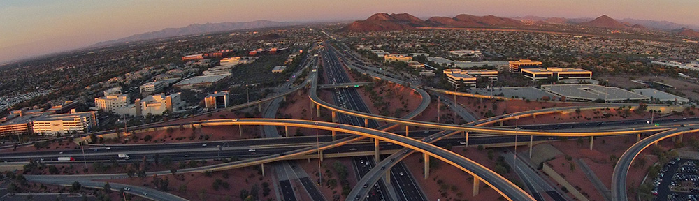
I brought my helicopter down to Williams-Gateway Airport (KIWA, commonly known as “Willie” around here) in Chandler, AZ the other day. My Robinson mechanic, Kelly, is based there. There were a few things I wanted him to take care of before mid-month when all hell breaks loose and I spend more time in the pilot seat than the seat in front of my computer. I wrote about that ferry flight here.

Although I was perfectly willing to let Kelly keep the helicopter until my next big gig, I picked up two smaller gigs for the weekend. And since Mike needed to be at Sky Harbor by 9 AM on Saturday for a flight to San Diego, it made sense for me to drive him down in my Toyota “airport car,” leave the car at Willie, and fly back. That would get me back to Wickenburg in time for the first gig.

That was the plan, anyway.

Plan B

On Friday, Mike cancelled his plans to go to San Diego. I won’t go into why. It was supposed to be a day trip anyway, so it wasn’t a big deal. And his plane ticket, surprisingly, was fully refundable.

So I told him that he’d have to fly me down to Willie in his plane.

Mike's Grumman
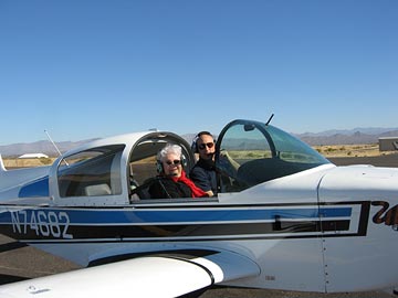
Mike’s one of two partners on a 1974 (I think) Grumman Tiger. It’s a beautiful little plane, immaculately cared for by its previous owner and Mike and his partner. I don’t know anything about planes but when I show it to someone who does, they’re always impressed. (The photo here shows Mike and his mom in the plane at Wickenburg about a year and a half ago.)

Sadly, the thing has become a sort of “hangar queen,” spending all of its time in the hangar and very little of it in the air. In fact, I don’t think it flew more than 20 hours in the past 12 months.

Mike’s always saying that he doesn’t have time to fly. On Saturday morning, with his travel plans swept away, he did. And he had a destination, too.

But Mike had never flown into Willie, which was on the opposite corner of the Phoenix Class Bravo airspace from us. So he decided to ask our friend Ray, a Mooney pilot who has taken me to Willie at least twice, to come with us. Ray, who will take advantage of any excuse to fly — even as a passenger — agreed to come.

The Flight Down

Taking off from WickenburgI sat in the back for the flight down. I busied myself with using my Treo to take photos as the flight progressed, immediately sending them to my TumbleLog from the plane. I did that until the Treo decided it wasn’t going to take photos anymore. (I don’t know what caused the problem, but after syncing with my computer, it recovered. Go figure.) Unfortunately, the PowerShot I usually keep in my purse is at Canon being repaired — I seem to be camera challenged these days — so the photos end abruptly as we reached the Estrella Mountains.

The first thing we all noticed after takeoff was the thermal inversion. It was at least 10°F cooler on the ground in Wickenburg than it was 2000 feet up. Because it was early — around 7:30 AM — it wasn’t that hot yet, so the inversion didn’t bother us.

The flight was smooth. Mike did the flying. Ray did the navigating.

The Estrella MountainsRay never flies directly to Willie. He usually flies a roundabout route that takes us past Buckeye (due south of Wickenburg) around the south end of the Estrella Mountains, past the south side of Chandler Airport’s airspace (that’s CHD), and into Willie. Once we even went all the way down to Casa Grande and the Sanford VOR. I don’t care how we go, as long as we get there.

Since Ray was navigating, we took Ray’s route.

The flight was uneventful. I do wish I had some photos of the landing, however. The tower landed us on Runway 12R while a Cessna took off from Runway 30C. I never saw a tower do that before.

At Willie

Mike parked the plane right next to a large bizjet on the ramp in front of the terminal. A ramp guy came out as we started climbing out. He wanted to know how long we’d be there. Ten minutes, we assured him. Mike told he we’d come to pick up a helicopter.

“The red R44?” he asked.

I wondered how he knew but didn’t ask.

He escorted us into the terminal — everyone at Willie needs to be escorted if they don’t have an official ramp pass — and we made our way into the helicopter company’s office to pay my bill. Then we all walked to the hangar two buildings down where my helicopter was waiting. Unfortunately, the door to the interior of the hangar was locked and I didn’t have the combination for the keypad. At least I didn’t think I did. When we were unsuccessful at getting someone to open the door, I guessed at the combination. I got it right on the first try. Nothing like high security.

The helicopter company guy showed up as I was doing a quick preflight. Mike told him we were stealing the helicopter and I think he may have believed him for a moment. Then I produced the keys, which I’d gotten from the office, and finished up my preflight. Mike, the hangar guy, and I rolled it outside while Ray supervised. Then the hangar guy brought them back to Mike’s plane while I started the engine and warmed up.

The Race is On

Mike’s plane is faster than my helicopter. He can cruise at 130 knots, although he seldom flies faster than 110 or 120 knots. I can cruise at 110 knots, which I almost always do when I’m alone flying point to point. I suspected that I could beat them to Buckeye simply by taking a shorter route.

We’d both agreed to meet at Buckeye Airport, where fuel was about 50¢ a gallon cheaper than in Wickenburg. While I won’t usually fly out of my way to get a bargain on fuel, Buckeye was on one of my possible routes home — although I admit not the most direct. But I wasn’t going the way they were — around the south end of the Estrellas. I was going almost direct to Buckeye.

At Willie, helicopters use a different frequency to talk to the tower. I hover-taxiied to the edge of the Silver State ramp and requested a departure to the northwest. I immediately got clearance and took off. Mike was still on the ramp, engine running. I tuned into the frequency he’d use to talk to the tower — I didn’t know the ground frequency — and monitored it on my second comm. I was just exiting Willie’s airspace when I heard the tower clear him for departure. So I started with a 5 mile head start.

I was crossing I-10 north of Firebird Lake when the tower cleared him for a right turn. That put me at least 10 miles west of him.

The flight was uneventful. I flew south of South Mountain, crossed the Gila River, and passed over the top of the north end of the Estrellas. My route took me north of Chandler Airport and Stellar Airpark and south of Glendale and Goodyear Airports. I didn’t have to talk to a soul.

I tuned into Buckeye’s frequency early and made several attempts to raise Mike and Ray on the radio. I don’t know what frequency they were monitoring, but it wasn’t the one I was on.

There were jump planes at Buckeye, which is an active skydiving airport. I was coming in from the east, which is the side of the airport the jumpers land at. Hearing me on the radio worried the jump plane pilots. But I’m familiar with the operation and assured them I’d come in from north of I-10, thus avoiding the area completely. A jump plane taxiied into position for takeoff as the airport came into view. I landed on runway 17 moments after he departed and hover-taxiied to the fuel area.

Fueling at Buckeye

Buckeye has self-serve 100LL fuel, which is a good thing. It means you can get fuel 24 hours a day. It was partially because of this capability at Buckeye that I pushed Wickenburg so hard to get self-serve fuel when I ran the FBO there.

Unfortunately, the geniuses at Buckeye decided to shade the fuel pump with a shade structure about 10 feet tall. That’s right about the height of my main rotor blades. I have to get close enough for the hose to reach my fuel tanks but not close enough to hit the shade with my blades.

Once, in my R22, I didn’t park close enough. I had to restart the engine and move another two feet closer so the hose would reach.

So imagine this: I’m hover-taxiing into position at the fuel island. My main rotor blades are spinning at about 400 rpm. I’m moving forward very slowly about 3 feet off the ground, trying to estimate the distance between my blades and that damn shade. If the blades hit the shade, three things will happen: (1) ) my main rotor blades will be destroyed (and they cost $48K a pair), (2) the shade will be severely damaged, and (3) I will hit the ground hard and, if I’m unlucky, roll over and total the aircraft.

I got as close as I dared, set down, and started my shutdown procedure. When the blades came to a stop, I realized that I had about 10 feet to spare. And the hose does reach.

Next time I’m going to bring some paint with me and paint a mark on the pavement where my skid should line up.

I climbed out and went through the motions of introducing my credit card to the machine in the closet and telling it I wanted 30 gallons. Then I came out and did the pump thing. While I worked, a Cessna 172 landed and taxiied over to the ramp. Three big guys came out. One of them commented on the shade and the proximity of my main rotor blades to it.

I was finishing up when a flight instructor I know came out of the terminal building with a student. He told me that it’s very scary when helicopter flight students park at the pump because the wind kicks them around so much. He also said that the airport has an unpublished rule that says helicopters are supposed to park outside the fueling area, put wheels on, and roll into the area. That’s not an option for me, since I don’t carry ground handling wheels with me.

Mike and Ray landed a little while later. They parked on the ramp, since there’s only enough room at the fueling area for one aircraft and no one wants to park next to a helicopter.

Back to Wickenburg

I left Buckeye a short while later. One of the jump planes had come in for fuel and was waiting, engine running, on the ramp, effectively blocking my way. Since I won’t overfly other aircraft on departure, I had to go around him, over the dirt, to leave. I hope his window was open and that I blew a lot of dust in his cockpit. Jerk.

From Buckeye, I flew north, past new housing developments and into the open desert. I steered toward Vulture Peak, which I could clearly see in the distance. Wickenburg Airport is five miles north of this landmark, so aiming for it would take me directly home.

But when I reached the Hassayampa River, I got quite a surprise: there was water flowing in it. So I decided to make a detour and follow the river back to Wickenburg. I dropped down to about 150 AGL and followed the brown trickle northeast, curving to the left or right with the riverbed. I flew past people playing down there in 4WD trucks and quads and dirt bikes. I flew over a cow with a calf that couldn’t have been more than 3 days old. I flew past a bunch of people camping out in the sand. I climbed to cross power lines, then dropped back down as the riverbed approached the rocky hills of the Morristown area. When houses started lining the cliffs, I climbed up to a respectable 500 feet AGL and followed the river into town.

If you’re interested in what all this looks like on a chart, here’s one for you. The red line is my flight path, the blue one is Mike and Ray’s. I know the lines are kind of wiggly, but I just drew them using a trackpad. Wickenburg is the airport in the upper left corner, Buckeye is in the lower left corner, and Willie is in the lower-right corner.

Wickenburg to Willie

My passengers arrived in Wickenburg just as I did. We had a nice tour of the town and they got some great photos of their property from the air. By noon, both Mike’s plane and my helicopter were tucked away in their hangar and I was hard at work on Chapter 17 of my Leopard book.

A Helicopter Ferry Flight with a Special Guest

I learn a little about the world from a pilot friend.

I flew my helicopter down to Williams Gateway airport in Chandler yesterday. I need to have some work done on it and that’s where my Robinson mechanic, Kelly, is based. It’s about a 45-minute flight from Wickenburg. Although it’s a lot more pleasant to fly in the morning this time of year, the plan was to work until 3 PM on my Leopard book, fly down there, get picked up by Mike, have dinner in an interesting restaurant, and drive back together.

Company for the Flight

Sometime earlier in the day (just as my office was really heating up with the air conditioning broken), I got the bright idea to see if Alta was home and wanted to come with me for the flight.

Alta had flown with me once before from Chandler Airport, back in the days when I was working on my commercial ticket and was leasing my little R22 back to the flight school. I’d drive down on a Friday and fly for an hour or two with my instructor, then leave my car at the airport and fly the helicopter home. On Monday, I’d fly the helicopter back to Chandler, fly with an instructor for an hour or two, and drive home. Alta accompanied me on one of my flights — I think it was a drive to Chandler/fly to Wickenburg day.

Alta is a flight engineer on 747s. She’s in her early 60s now and works for a charter operation that does mostly freight. Her schedule keeps her out of Wickenburg a lot of the time, which she doesn’t mind very much because, like me, she sees its limitations and needs more out of life. She travels frequently to China and countries that used to be part of the USSR. She occasionally sends postcards of these weird places and I post them on my refrigerator for months on end, wondering what it would be like to actually visit them myself. She’s good company because she’s not only a good listener — which everyone appreciates — but once you get her talking, she’s full of interesting stories.

But because she’s out of town so much, I was very surprised when I called her at home and she answered. I told her what I had in mind and she said she’d be happy to come along.

Delays at Home

The air conditioning guy was supposed to show up at 11:30 AM. He actually showed up at 2:30 PM. In Wickenburg, being 3 hours late is not even considered late. In fact, I considered myself lucky that he came the same day I called. I’m still waiting for the screen guys and I’ve already crossed two landscapers, a builder, a carpet guy, and two painters off my list. (If these can’t return repeated phone calls, they certainly won’t get my business.)

But what was really lucky about the whole thing is that the problem was just a blown capacitor on our 10-year-old heat pump unit. So the entire repair, with service call and diagnostics, was only $150. That compares favorably with the $1,400 we expected to pay for a new unit plus installation.

And today I’ll be comfortable in my office while I work.

Of course the late arrival of the repair guy made me late. I was supposed to stop at a neighbor’s house to try to fix her printer (don’t ask) on my way to the airport. But I didn’t get out of the house until 3:15. So I had to blow that off and expect to apologize profusely about it today. When I got to the airport, Alta was there, waiting for me. I don’t have her cell phone number — I’m not even sure if she has one — so I couldn’t call to tell her I’d be late. (When I called her house, she was already gone.)

The Flight Down

Alta accompanied me to the hanger and kept me company while I preflighted, threw my door in the back, and pulled the helicopter out to the fuel pumps. Alta used to work for me when I had the FBO at Wickenburg Airport. She was one of my best people because she understood what I was trying to do there and had the right attitude about the work. I filled her in on airport gossip as I fueled the helicopter. Then we unhitched it from the towbar, put the cart in the hangar on its charger, and walked back out to the helicopter. It was 3:45 when I finally started the engine.

It was hot. 106°F on the ramp. My door was off, but that didn’t do enough to cool us down. By the time the engine was warmed up — very quickly, I might add — we were both dripping. I made a radio call, picked up, and made a textbook departure down the taxiway parallel to runway 5 with a turnout over the golf course to the southeast

It was a typical late summer afternoon: hazy, hot, and humid. Back in New York, they call that a 3-H day. But in New York, the big H is for humid; in Arizona, it’s for hot. The humidity was only 20-30%, but with surface temperatures in the sun approaching 140°F, it really doesn’t matter how humid it is. Anyone outside will suffer.

With my door off, there was just enough air circulating in the cabin to dry the sweat on our bodies, thus keeping us cool. I’d brought along two bottles of cold water and I sucked mine down. Dehydration is a real issue in Arizona, especially in the summer.

There was enough wind and thermal activity to keep the flight from being smooth. So we bumped along at 700 feet AGL, making a beeline for Camelback Mountain. My usual route is to pass just north of Camelback and east of the Loop 101 freeway, thus threading my way between controlled airspaces so I don’t have to talk to any towers until I get to Williams Gateway.

But as I approached the Metro Center mall on I-17 I thought I’d take Alta down Central Avenue through Phoenix. That meant talking to the tower at Sky Harbor. I dialed in the ATIS, listened to the recording, and then switched to the north tower frequency.

Good radio etiquette requires you to listen before you talk. This prevents you from interrupting an exchange between the tower and another aircraft or, in a UNICOM situation, between two aircraft. I listened. For a full minute. Of silence. I was just starting to think I had the wrong frequency when a Southwest Airlines pilot called the tower. When they were done talking, I identified myself and made my request. The tower cleared me to proceed as requested. I’d go down Central Avenue, then make a left at Baseline. Along the way, I’d cross the extended centerlines for Phoenix Sky Harbor Airport, where the jets were taking off to the west, right over where I’d be flying. (You can read more about flying this route in “Phoenix Sky Harbor to Grand Canyon.”)

PhoenixAs we flew through Phoenix, Alta seemed very interested in landing opportunities. “You can land in just about any of those parks,” she pointed out.

I knew what she was thinking about. When you train to be a pilot, you’re trained to always think about where you could land in an emergency situation. Phoenix, unlike New York or other older cities, has lots of open space, including parks, vacant lots, and parking lots. There are actually more emergency landing areas in Phoenix than there are in Wickenburg — if you can imagine that.

I wondered briefly what kind of emergency landing zone you’d need to land a 747 in trouble.

All the time, of course, I was descending. I had to be at 1600 feet MSL or lower by the time I got to Thomas Road. By the time we got to the second bunch of tall buildings on Central, we were only about 100 feet off some of the rooftops. I was winding my way between them, about a block west of Central. Then another quick drop in altitude as we crossed the riverbed and I could start to climb a bit again.

I always have trouble remembering which road is Baseline, so I checked street signs as I flew. Phoenix has these very large street signs hanging from traffic signal poles, making it pretty easy to find a street’s name — even from 500 feet above it. I turned left at Baseline and we headed east. A while later, I passed out of the Phoenix surface space. I told the tower I was clear to the east and squawked VFR again.

The final challenge was landing at Williams Gateway. Although I’ve landed there at least a dozen times, I never seem able to manage my approach and landing just the way the tower wants it. They simply are not clear with instructions. To make matters worse, the taxi/ramp area is a bit complex, and doesn’t line up with the runways. So I always fly with an airport diagram handy.

Yesterday, when I called in, the tower asked me if I was familiar. Although admitting it always seems to get me in trouble, I admitted it again: “Zero Mike Lima is familiar.” Now I had to get it right or get yelled at by the tower. Again.

This time, I screwed it up again, but not as bad as usual. Check out the diagram below. The Orange line is what I did last time. Very wrong. I overflew some buildings that I wasn’t supposed to overfly. The Blue line is what I did yesterday. Closer, but not exactly right. After landing, the tower said, “Next time you come in, fly direct to that spot parallel to the runway.” So I think he means I should follow the Green line. I’ll try that next time.

Williams Gateway Airport

Fortunately, leaving is a lot easier. I just get into position between the runway and ramp on the northwest side of the airport and take off parallel to the runway.

Kelly and his assistant, Kim, came out with ground handling wheels as I shut down. I put the door on the helicopter. They insisted they didn’t need our help dragging it in, so I didn’t argue. I was glazed with sweat. When the helicopter was parked in the hangar, we discussed the work to be done, then left him. It was 5 PM.

Story Time

Mike was waiting in the main terminal, reading a magazine in air conditioned comfort. He told us we looked glazed and we went into the Ladies’ room to splash water on our faces. We then went to dinner. Our first choice, Duals, which was right near the airport, had gone out of business. (It’s a sad state of affairs when people would rather eat in some nationwide chain with the same old menu and factory-prepared food than in a nice, local place.) So we headed over to Ahwatukee and had dinner in an Italian place off I-10. I wish I could remember the name. It’s a nice little place with good food and good service at a reasonable price.

During dinner, Mike quizzed Alta about some of the places she’d flown. Although she’d told me some stories during our flight, she really opened up when questioned. She explained to us that in many places of China and former Soviet Union countries, people were poor to the point of living in ditches and starving. In China, she told me, it’s so bad that people have begun selling their children to brick factories since they can’t afford to feed them anyway. She said that the Chinese people could make do with all kinds of things we’d consider trash — for example, she said, they could make a cart out of two broken bicycle wheels. Sometimes a family of 5 would ride together on a single motorcycle. She said that many people had no knowledge of the things we take for granted.

She told us a story about landing in some former Soviet country — I can’t remember which — that had no security in the cargo area of the airport. When they parked the jet, there were young couples walking hand-in-hand along the ramp area — a cheap date looking at the big planes. She said there were a number of relatively well-dressed young women in the area, collecting planks of wood that had broken off shipping palettes. The flight mechanic told her that these people had nothing at home and were collecting the wood to make benches and other furniture. The mechanic called her down from the flight deck to meet one of these young women and Alta brought her up to the cockpit to see where she worked. Alta said the woman looked very nervous about being there, like she was afraid she’d get in trouble, so Alta cut the visit short and brought her back down to the ramp. She realized later that all of the woman’s friends and acquaintances had seen her go into the plane and that had given her a certain status among them. On their next trip through, she brought Alta a dress as a gift. Alta never got the dress — someone else apparently walked off with it — but she was amazed that this woman, who had nothing, would thank her with such a generous gift.

She also told us a few stories that illustrated the complete lack of quality control in China. She explained that the Chinese people think the point is to make something look good and polished. That’s why they put lead in toy paint — it makes the colors brighter. They sacrifice quality and safety for appearance because they simply don’t understand the importance of quality or safety. That’s not a part of their lives. “If they find a pair of shoes that they can walk in, they’re happy,” Alta explained. “It doesn’t matter if the shoes don’t fit right or fall apart in a month.”

This made me understand the whole Chinese quality problem. It isn’t because they’re trying to make cheap crap. It’s because that’s all they think they have to make. Their standards are so much lower than ours that they think they’re doing a fine job. And because the price is right and Americans have a “disposable good” mentality, we don’t mind buying the same cheap crap over and over. If it breaks, we think, we’ll just throw it away and get a new one. It’s cheap enough. We don’t see the effects on our landfills and in our own economy.

On the drive home, Alta told us about some of her more interesting experiences overseas. Being ignored by airport officials while she was trying to do her job in Dubai because she was a woman. Losing engine on takeoff in Kazakhstan when the aircraft was near max gross weight — 637,000 pounds! Overflying Baghdad, which she does quite often, and being given specially coded transponder codes. Seeing the border of Iraq and Kuwait from 30,000 feet, lit up in bright, white light. Walking down into the cargo hold to check on live cargo like horses and brahma bulls and thousands of baby chicks.

She lives in one world and works in many others. But he time as a world traveler is getting short as she grows older and the newer planes do away with the engineer position. She said it all at one point yesterday: “I’m an antique flying an antique. Does that make me a classic?”

I assured her that it did.