
A rant followed by step-by-step instructions for those who care.
I need to start this article with a statement: I do not support the War in Iraq. I think it was a mistake. I also think that the tragic loss of lives — our service men and women and Iraqi civilians — is a tragedy. This is not up for discussion here and if you post a comment trying to argue with me about it on my blog, I will delete the comment. Write your own blog entry about this issue if you feel so strongly about it.
That said, even though I don’t support the war, I do support our troops. The men and women in our armed services are making incredible sacrifices — sometimes even the ultimate sacrifice — to do their duty and serve their country. They’re living in cramped quarters, often without simple luxuries — lip balm comes to mind — and looking forward to the day they can come home to be with their families and friends and rebuild their lives.
Yet while they’re overseas, getting shot at and blown to pieces by roadside bombs, we’re all comfortably at home watching Dancing with the Stars and the latest reality TV crap in front of our wide-screen TVs, complaining about gas prices and our jobs, and spending our money on trivial things that we don’t really need.
Got a Minute?
Yesterday, I got an e-mail message from my friend Joe (not his real name). Joe is a good guy who means well. Like a handful of other people, he forwards jokes and other interesting tidbits to me via e-mail. The jokes are usually pretty funny, but not reprintable here. Many of the tidbits are Democrat- or Hillary-bashing exercises written up by some Republican party-liner to spread the hate. Some of the other tidbits are calls for action, like the one subject-lined “Got a Minute???” that arrived in my e-mail box. (And yes, it did have three question marks.)
The e-mail pointed me to a Xerox-sponsored Web site where you could design a card for and it would be printed and sent to a random service man or woman for free. Here’s the text of the message:
If you go to this web site, www.LetsSayThanks.com you can pick out a thank you card and Xerox will print it and it will be sent to a soldier that is currently serving in Iraq . You can’t pick out who gets it, but it will go to some member of the armed services.
How AMAZING it would be if we could get everyone we know to send one!!! This is a great site. Please send a card. It is FREE and it only takes a second.
Wouldn’t it be wonderful if the soldiers received a bunch of these? Whether you are for or against the war, our guys and gals over there need to know we are behind them…
This is wrong on so many levels:
- This is obviously a public relations ploy by Xerox to make them look like the “we support our troops” good guys. It may seem like a huge effort by Xerox, but the cards you create online are sent to another support organization that randomly sticks them in boxes already going overseas to the troops. So for the cost of a few color printers and consumables, Xerox looks like a big supporter.
- Can Americans honestly achieve the warm and cuddly “feel good” feelings they’re evidently trying to achieve by clicking a few buttons and filling our a form on a Web site? Is this an appropriate sacrifice to show support for our troops? It’s free and it takes a minute. Is this what we’ve sunk to? We can support the troops by visiting a free Web site and taking “a minute” to create card?
- How do you think our service men and women really see these cards? These are machine-generated cards with a handful of standard “thank you” wishes. It’s the equivalent of handing a box of Hallmark cards to a stranger. Does it have any meaning? Do you honestly think the service people who get them feel adequately thanked when they get one? Or insulted that that’s the best we could do?
Amazing? That Americans can take a minute out of their day to click a few buttons on a Web site and send a free card? Pretty sad, if you ask me.
Now, I’m not stopping you from visiting the Web site and sending cards. Go right ahead. But don’t stop there.
True Support Takes More than a Minute
As you may have gathered, Joe’s e-mail pissed me off. I responded rather harshly, which will probably offend his Republican sensitivities. Although I don’t mean to hurt his feelings, sometimes you need to be harsh to bring people back to reality and help them see more of an issue than they already see.
But since I don’t feel that it’s right to criticize one solution without providing a better one, I spent about an hour doing my homework and came up with a better idea for folks interested in truly making a difference in a deployed soldier’s life.
I found a Web site called Any Soldier (www.anysoldier.com). It collects e-mail messages from real soldiers and marines in real military units. These service people explain where their units are based, what living conditions are like, and what kinds of things they need or want to make their lives a little nicer. The person sending the e-mail represents a group and has agreed to distribute any material addressed to “Any Soldier” at his or her address to the soldiers that most need or want these items.
Here’s an example e-mail posted on November 25:
Hi and thank you for this wonderful website. I am the leading petty officer for the Medical Department of the USS Tarawa. We are currently on deployment to the Gulf. I have many sailors who are not receiving packages/mail. This is causing a little dip in moral. Even though some families send extra stuff in the mail, it doesn’s even come close to covering all sailors out here. The following are a few items we deem a luxery out here:
Flushable baby wipes, female and male razors, body lotion, Sunscreen (30+ SPF), Lip Balm/gloss, Tiger Balm (for stiff muscles), or any muscle rub, White cotton crew neck t-shirts: S/M/L, Gum, Dental floss, Toothpaste, ponytail holders, bobby-pins (black/brown), Playing cards, Books (mystery, sci-fi, history), Movies (DVD), Music CD’s, writing paper, pens, pencils, post cards, Lysol or Clorox disinfecting wipes, Hand sanitizer, Q-tips, cotton balls, beef jerky, magazines (women and mens), sewing kits, instant coffee, cool-aid packets (single serve), crystal light single serve drink packets, tea, kleenex (tissues), double-sided tape, crossword puzzles.
Thank you so much!! We really do appreciate your support!
Respectfully,
HM1(SW) [omitted]
Get the idea? An e-mail like this makes it possible to send a custom care package to service people who really need them. And look at these items! Lip balm, playing cards, Q-Tips, pencils! The cost of many of these items is trivial, especially when purchased in bulk at a place like Costco. But if they’re simply not available to these people where they’re deployed, they’re priceless.
Sending a care package sure sounds a lot better to me than sending a machine-generated greeting card.
Spend a Few Minutes and a Few Dollars
Here’s how you can read the e-mail messages from soldier in this program and get their deployed addresses to send them packages.
- Go to http://www.anysoldier.com/WhereToSend/.
- In the left column of the page, click the name of a soldier who has recently submitted an e-mail message.
- The message appears in the main part of the window. Read the message.
- If the person represents a unit you’d like to support with a care package, click the HERE link near the top of the page to get that person’s address. You’ll have to fill in a form with your contact information — I’m pretty sure this is for security reasons. When you submit the form, the address is e-mailed to you.
- Repeat this process as desired. You can request up to two addresses per day.
The soldier’s message page lists all of the e-mail messages that soldier has sent, so if a soldier has sent more than one message, you can read them all on one page. You can also see how many times that soldier’s address has been requested.
You can also donate to AnySoldier.com. Your donation helps keep the Web site alive. However I believe that if you have limited financial resources, they’re best spent sending items to the soldiers themselves.
Some Notes on Shipping
When the address for the service member arrives in your e-mail in box, it will include some links. Click the one beside “Restrictions to this address.” A Web page with additional shipping information appears. This is important information because it will provide additional details you’ll need for shipping. For example, the above-quoted service member’s location does not allow packages addressed to “Any Soldier,” etc. and must be accompanied by customs Form 2976-A if it weighs more than 16 ounces.
Although sending a care package to a deployed military unit does require you to do some extra paperwork, it really isn’t that much of a hassle. And it isn’t as expensive as you might think (from the U.S.), since you’re sending to a FPO address with a U.S. zip code.
Possibly the most cost-effective way to get a package to a deployed unit is with a U.S. Mail Priority Mail Flat Rate Box. This method of shipping costs the same ($8.95) no matter how heavy the box is, so you can fill it with magazines or books and it’ll still get there fast without costing you a fortune. (If you have a lot of printed material to send and don’t care how long it takes to get there, Media Mail is usually cheaper.) You can do all the paperwork to create and print a label, fill in the customs forms, and print postage right on the Postal Service’s Web site, www.usps.com.
All of the resources I’ve seen say that you must be quite specific about a package’s contents in the customs form. Packages may be X-rayed and if something inside the package looks suspicious and is not listed on the form, the package may be rejected or destroyed. Although you can make this easy by sending just a few types of items in a package, remember that this exercise is to provide support — not make your life easier. (If you want it easy, send a machine-generated card.)
When you package the items, be sure to keep edibles separate from non-editble or hygiene items. You wouldn’t want those cookies you baked tasting like deodorant when they arrive, would you? Also, be sure to fill empty spaces in the box with packing peanuts or air bags, etc. Shredded paper works, too. Be sure to properly pad any items that could be damaged in shipping.
And really get personal. Enclose a hand-written card addressed to the unit representative who took the time and effort to post the message on AnySoldier.com. Tell him or her what a great job they’re doing and how much you appreciate their efforts. If you don’t agree with the war, keep it to yourself — they don’t need to know that. Instead, just give them your wishes for a speedy and safe return home.
How can you get more involved?
First, spread this information to as many people who care about our service men and women as you can.
Contact your local school to see if the kids want to get involved by putting together care packages, drawing pictures, and creating cards for service members you can reach with this program. Ditto for your church group, if you have one, or other social organization.
If you’re on a budget and can’t afford to buy care package items or pay for the postage to send them, getting others involved in your efforts could be a good way to say your thanks. Take a copy of an e-mail from a unit representative and approach friends and family members for their contributions. You can do the leg work and let busy people help out with the cost. If you approach 10 people and they each contribute an item and $1 toward the cost, you can easily send a nice little care package to someone who will appreciate it.
How AMAZING it would be if everyone who read this post or got this information from someone else who did sent out a custom care package to one of these units!
Remember what the holiday season is really all about — giving, caring, helping, sharing. Do your part to support our troops in a way they can really appreciate.
Have You Sent a Package?
If you’ve sent a care package to a unit using Any Soldier or a similar organization, I’d love to hear from you. What was your experience? Please let us know by adding a Comment to this post. Please don’t use this space to share information about sites similar to the Xerox-sponsored site mentioned above. They don’t impress me and I think our troops deserve a lot more sacrifice on our part — time, effort, and even a bit of money — than these “free card” sites could ever offer.
 The first thing I noticed as we settled down for the night in our hotel room was the sound of the city. New York, you see, has a background noise, like a soundtrack. At its very base is a low rumble, like a low frequency hum. It’s the conglomeration of the movement of cars on city streets and the hum of climate control systems on rooftops and restaurant exhaust fans at street level. It includes subways rumbling under the streets and bus and truck engines and planes and the odd helicopter. Sometimes it includes the sound of the wind whistling down streets and around buildings. During the day, it includes voices: people in conversation as they walk the streets, whether it’s with a physical companion or the virtual companion on a cell phone.
 The light comes from the lights in building windows — office lights that are apparently never extinguished. It comes from the hundreds of television screens, many of which are larger than my two-story house, that display a never ending barrage of advertisements at anyone who glances at them. It comes from neon signs at street level or high atop skyscrapers: Ernst & Young, Kodak, Reuters, UBS, GE — these are just the few I see with a quick look out my window. The light comes from search lights that dance off buildings and pierce the sky, drawing attention to some new nightclub or the Christmas decorations on a posh shop. It comes from the Christmas decorations themselves: snowflakes twenty or thirty feet across, strings of lights wound around windows and trees and buildings, flashing lights forming wreaths and reindeer and Christmas trees. The scene pulsates with colored lights.
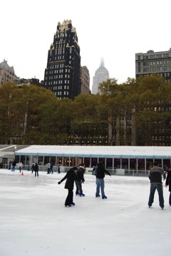 Around every corner is another surprise: a landmark building, a skating rink, a park, a farmer’s market, a holiday crafts market. The Public Library offers an exhibit of Jack Kerouac’s notebooks and his famous scroll, along with permanent displays of artworks and a real Guttenburg Bible (one of fewer than 200 made). There’s a fresh food market between corridors deep inside Grand Central Terminal. On Vanderbilt, there’s a public display of proposed designs for land development over the west side’s train yard — at least these developers understand the importance of open space park land. Step inside the lobby or study the facades of buildings on Sixth Avenue to see a WPA mural or art deco entrance or mosaic history. It’s impossible to be bored in a city like this.