After three months contractually bound to the Quincy and Wenatchee areas of Washington, I was finally off contract at the end of August. Mike flew out to Washington and we went on a road trip to the Olympic Peninsula. This series of blog posts is a summary of that trip, with photos.
- Day 1: Wenatchee to Port Angeles
- Day 2: Victoria, BC
- Day 3: Port Angeles to Clallam Bay
- Day 4: Claliam Bay to Lake Quinault
- Day 5: Lake Quinault to Seattle
On the recommendation of several people, we spend the day in Canada.
We started the second day of our trip with a quick breakfast at the hotel and a trip to the ferry terminal. The plan was to spend the day in the Canadian city of Victoria, a 90-minute ride from Port Angeles on the Black Ball Ferry Line’s M.V. Coho.
We’d learned, belatedly, that if you wanted to take a car on the ferry to Canada, you needed to get to the terminal for security inspection 90 minutes before the 8:20 AM sailing. That was not possible. So we walked on board, assured that there was plenty within walking distance of the ferry terminal on the other side. There was also the usual collection of taxis and other means of transportation.
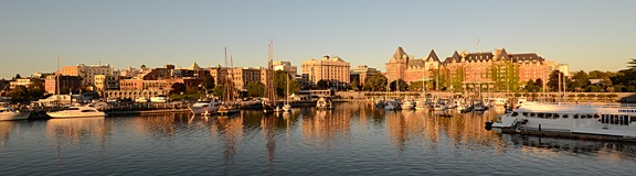
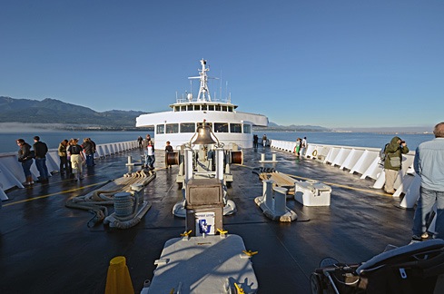 Although the sky was clear in Port Angeles, we hit fog within 15 minutes of departure. The crew shooed all passengers away from the bow of the boat and we went inside. We filled in our immigration paperwork and found a comfortable place to sit. I was feeling more than a little queasy from the rocking of the boat, but that cleared up soon enough. So did the fog. We went back out on deck as we came into Victoria Harbor. A seaplane was just landing. It was another beautiful day.
We spent the entire day touring the harbor area — and a bit beyond it — on foot.
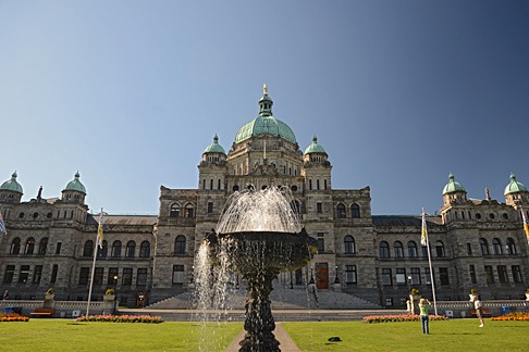 First up was the Legislative Assembly of British Columbia, a large domed building clearly visible from the ferry terminal. Mike and I are big fans of architecture, so we wandered over to take a closer look. We walked past a very large statue of Queen Victoria and an ornate fountain to get a closer look at the building’s symmetry. Then we walked down the main path and up the steps to the public entrance.
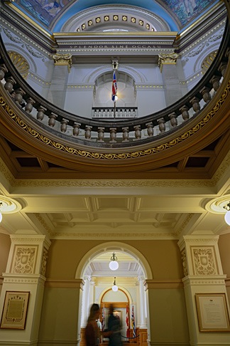 We were pleased to learn that the building was open to the public and wasted no time exploring the public areas inside. The building, which was completed in 1898 and restored in 1973 is in magnificent condition, full of wonderful architectural touches. I picked up the self-guided tour booklet but didn’t really consult it much. It was nice to simply wander around, from room to room, although I do wish we’d taken the guided tour.
Afterward, we walked north on Government Street to the Empress Hotel. I’d read somewhere that the hotel was the place to get afternoon tea, so we found the reservation desk and made reservations for 4:15 PM. That meant we’d be taking the 7:30 PM ferry back to Port Angeles.
Mike had a tourist map with him which identified Fort Street as the place for shopping and dining. So when we reached Fort, we turned east and continued walking. Gradually, we left the tourist area and its shops and tourists behind. The farther we walked, the more “regular” people (i.e., not tourists) we saw.
We also started to get hungry. We wound up at the Saigon Harbour Restaurant on Blanshard Street for a good meal of Vietnamese food. I’ll be honest — we picked it based on the way it looked from outside. It’s just another example of how eating at a small, local place can provide just the kind of dining experience we want.
After lunch, we continued up the south side of Fort Street and walked back on the north side. We stopped at a bakery for a chocolate croissant for dessert, which we ate while walking. We then continued up Government Street, visited a few shops, and bought a few odds and ends.
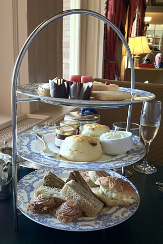 At 4 PM, we headed back to the Empress for tea. Despite our shabby appearance — I was wearing my usual henley t-shirt and jeans and Mike was similarly dressed — they sat us at a table by the window where we could look out at the harbor and watch the people go by. We started with a pair of champagne cocktails. Our waiter was excellent, recommending a tea that suited both of our tastes — I prefer mine without milk; Mike floods his with milk. Then he brought the customary three-tiered plate of goodies, including sandwiches, scones, and sweet treats. I’ve had afternoon tea about a half dozen times and this one was, by far, the best. Highly recommended.
Afterwards, we went back to Hemp & Company, a shop that sells clothes made of hemp and I bought two collared shirts to replace some linen shirts that were wearing thin. We also bought some maple cookies in a tourist shop for some friends of mine in Quincy and some candies from Roger’s Chocolates that turned out to be amazing.
We wandered back toward the ferry terminal. It was about 6:30 by then, but the ferry hadn’t arrived. There were a few horse-drawn carriages nearby and I hired one for a half-hour ride to the south side of the city. The weather was still clear and, when we reached the coast, we could clearly see the mountains of Washington’s Olympic Peninsula in the near distance. It was a nice, slow ride with a talkative young driver who told us a lot about historic buildings, including the limitations on repairs.
We got back to the terminal just in time to board the ferry. I photographed the city as the sun set, casting a golden light over the buildings and boats in the harbor.
The ride back was smooth. A waxing gibbous moon hung in the east when we disembarked in Port Angeles. We drove the truck back to the hotel and settled in for the night, exhausted by our long day of walking.
 I should mention that much of this was old growth forest. An absolutely huge tree grew close to the road and we got out to take a closer look. Its amazing to me that trees this large exist and that so many of them have been cut down. Actually seeing one is a real treat.
 Back on the road, we continued along Route 524 to Edmonds and got on line for the
  There were National Forest Campgrounds along the side of the river. I passed two before I reached the parking area and campground for Silver Falls. I parked and stripped off my gear, locking it up in my bike’s Givi saddlebags. Looking up, I saw the top of the falls — can you see it in the photo? It didn’t seem that far away.
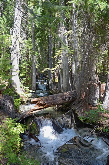 I immediately found myself in a deep, somewhat dark pine forest. As my eyes adjusted to the light, my nose picked up the scent of pine and moisture and my ears heard the sound of rushing water. I came upon the creek immediately — a healthy stream of water gushing over rocks between trees. For me — a desert dweller — it was a real treat.
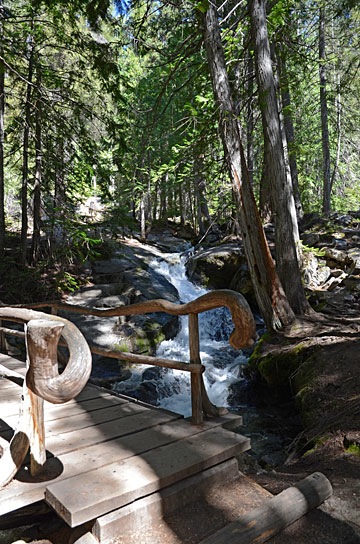 The path was well-maintained, with rustic protective barriers to prevent hikers from accidentally falling into the stream. The bridges were especially rustic looking, sometimes with curved logs making attractive rails. It was surprising to find something so attractively designed on a trail. I began to wonder how much of the trail dated back to the
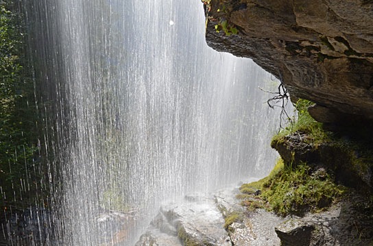
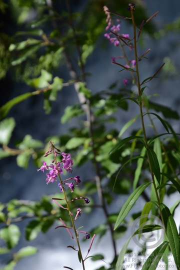 But I stuck with it and was rewarded with a switchback and another climb. A while later, I was back alongside the stream at yet another streamside bench, photographing some beautiful purple flowers just past the peak of bloom.
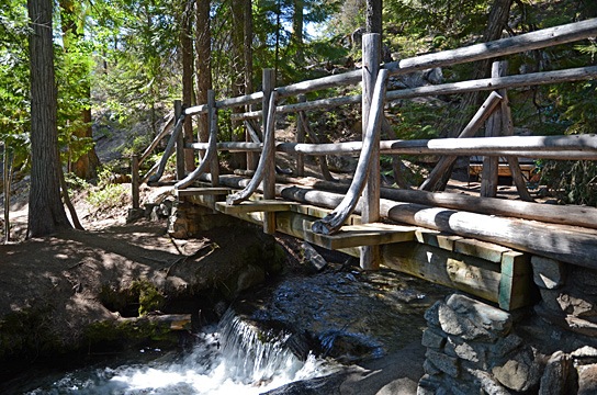
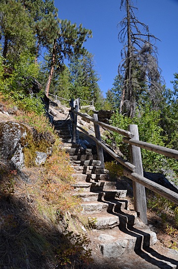 Then I started down the other side of the creek. At first, it was one long flight of stairs after another. Then the trail moved away from the falls in a series of relatively level paths with switchbacks. In some places, the trail emerged from the forest into the sun; not only could I feel the heat on my skin, but I could smell it. Then back into the trees for cooling shade and pine aromas.
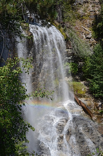 At one point, the trail came back to the falls just below where I’d walked along the ledge on the other side. The mist and sun worked together to produce a small rainbow. I did the best I could to capture the scene with my camera; I really do need to learn how to photograph waterfalls properly.
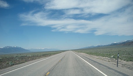 At 6:45 AM, I was in the driver seat of the truck with Alex the Bird in the seat beside mine. We were starting a 1,295-mile drive from Wickenburg, AZ to Quincy, WA. My goal was to make Jackpot, NV that first day — a distance of 725 miles. I spent most of those miles on Route 93, a two-lane road with speed limits up to 70 miles per hour. There was no traffic and certain stretches of the road were straight and flat as far as the eye could see. We made Jackpot before nightfall. After dinner n the casino, I spent the night in the RV with Alex in comfort — in the casino parking lot.
 The next morning, I woke at 6:15, which is late for me. Anxious to get on the road, I rushed around making my coffee and Alex’s breakfast and then buttoning up the RV for another day on the road. It wasn’t until after I topped off the fuel tank across the street from the casino that I realized it was an hour earlier; that part of Nevada is on Mountain Daylight Time. So I got a very early start. I left Route 93 behind in Twin Falls, ID, and hopped on I-84. The route was mountainous and the truck sucked diesel at an alarming rate as I struggled to maintain speed up hills. I left the interstate just past Pendleton and got back on smaller, traffic-free back roads to head north. After 10 miles on I-70 and the last five miles through familiar farmland, I rolled into the parking lot at the Colockum Ridge Golf Course RV Park just after 3 PM.
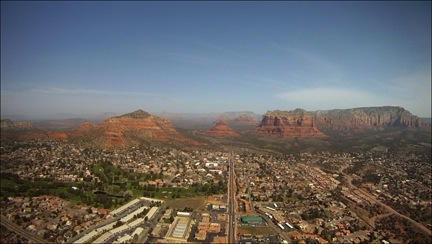 So instead of giving my guests their Phoenix Tour and heading up the Verde River on Day 1, we took a shorter route to Sedona that overflew Lake Pleasant and stayed within several miles of the I-17 corridor. I figured I’d save the scenic flight for when visibility was better. I also expected visibility to be better in the Sedona area and was very surprised that it was not.
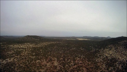 The flight to the Grand Canyon on Day 2 wasn’t anything special — except for that white haze that persisted, even up on the Coconino Plateau. Very odd for Arizona. It wasn’t blowing dust, either — the wind wasn’t strong enough for that. Just an ugly haze.
 Day 3 dawned gray but with plenty of visibility. I even got out and snapped a few
 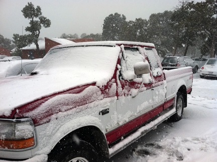 I felt bad for my guests. They’d spent a lot of money on this trip and now they were stuck at a scenic place with no scenery and no helicopter flight to get them to their next destination. So I became their driver for the day. After realizing that the truck was not likely to make it to Desert View (on the east end of the park) before the roads were cleared, we stopped at the Visitor Center and the Geology Museum before heading into Tusayan (the tourist town outside the park) for lunch. The plan was for them to see the IMAX movie across the street next.
 But that plan failed miserably. When I got to the airport, I found the helicopter’s right side — the side facing the weather — completely iced over. The main rotor hub, the tail cone, and the tail rotor were all coated with ice. Even the skids looked frozen to the ground. And, of course, there was a good helping of snow in the fan scroll (again!) and even some inside the air intake port. The temperature had dropped by 10°F and it was now below freezing. It would not warm up again that day. The helicopter was officially grounded.
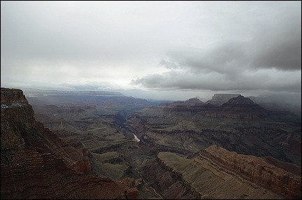 I wound up driving them to Page. The trip should have taken just over 2 hours, but since the weather was clearing enough to see into the canyon, we made several stops along the way. We arrived in Page at 8 PM. I checked them into their room, made sure they were set for the next day’s boat ride, and checked into my room at the Day’s Inn.
 Now what I needed was a thaw — temperatures above 32°F. I must have called the AWOS number for GCN a dozen times before 10:30 AM on Day 4. Then I climbed into my redneck truck and made the trek down to Grand Canyon Airport. It took 2 and a half hours with just one stop to snap
 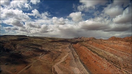 The flight was, for the most part, smooth. I ran the video camera (as you might expect) and captured some good footage over the Little Colorado River Gorge and along the Echo Cliffs. I set down on a helipad at Page Municipal Airport at 3 PM.