After three months contractually bound to the Quincy and Wenatchee areas of Washington, I was finally off contract at the end of August. Mike flew out to Washington and we went on a road trip to the Olympic Peninsula. This series of blog posts is a summary of that trip, with photos.
- Day 1: Wenatchee to Port Angeles
- Day 2: Victoria, BC
- Day 3: Port Angeles to Clallam Bay
- Day 4: Claliam Bay to Lake Quinault
- Day 5: Lake Quinault to Seattle
The start of our five-day vacation.
After fueling our diesel pickup — the only vehicle available to us here — we headed out of Wenatchee on Route 2 toward Stevens Pass. We made a number of stops along the way.
First, Anjou Bakery in Monitor, which makes an outrageously good pear danish. It’s in a funky old building with indoor and outdoor seating. They make coffee drinks, too, but I’ve decided to avoid that on my next trip. Their coffee isn’t very good — at least in my opinion — and it takes far too long for them to prepare it.
Next, Leavenworth. If you’ve ever been to Leavenworth, you’ll know that it’s a manufactured tourist town. They redid the entire town with a Bavarian theme, making it feel almost as if you’re in a Black Forest village somewhere in Germany. (I’ve actually been to Germany’s Black Forest, so I can attest to this.)
For the record, I don’t like Leavenworth. It’s a fake place that exists primarily for tourism. The parking and traffic situation is horrendous. Its multiple shops and restaurants are designed to suck tourists in and relieve them of their money. Little of what they offer is any better than you’d find at any other similarly themed tourist shop or town. I know that all tourist towns are like this and I don’t like any of them. Frankly, I don’t know why so many people go there.
But Leavenworth does have two shops that I love:
- The Cheesemonger is possibly the best cheese shop I’ve ever been to. Not only do they have an amazing selection of cheeses from around the world, but they are well-staffed with knowledgable and helpful counter people. Cheese tasting is not only allowed but encouraged. This shop is my primary reason for subjecting myself to a trip to Leavenworth.
- Cured is a smoked meat shop where you can get excellent bacon, sausage, wursts, jerkies, and more. Their buckboard bacon is to die for. If I make a cheese run, I also stop here for meats. Bonus: there’s motorcycle parking right across the street.
On this visit, we also stopped at the Bavarian Bakery on the right as you come into town from Wenatchee. It was recommended by the folks at Cured for bread; they hadn’t received their delivery yet and I like their rolls with the cheese. My grandfather was German and owned a bakery in Cresskill, NJ when I was a kid. For a while, my family lived in an apartment upstairs. So visiting a real German bakery was a treat for me. We bought some plum cake (which my Grandfather also made), pretzels, a coffee cake, and the rolls. I wasn’t terribly impressed with any of it, but it wasn’t bad. I’m just picky.
We loaded up the cooler that we’d brought along and headed out of town on Chumstick Road. That would take us winding through the mountains, though the tiny town of Plain before reaching Lake Wenatchee. At Route 207, we headed northwest, following 207, then Little Wenatchee Road, then National Forest Development Road 65. I’d ridden this route on my motorcycle the week before but had turned back after 10 miles or so because I wasn’t sure whether it was paved the entire distance.
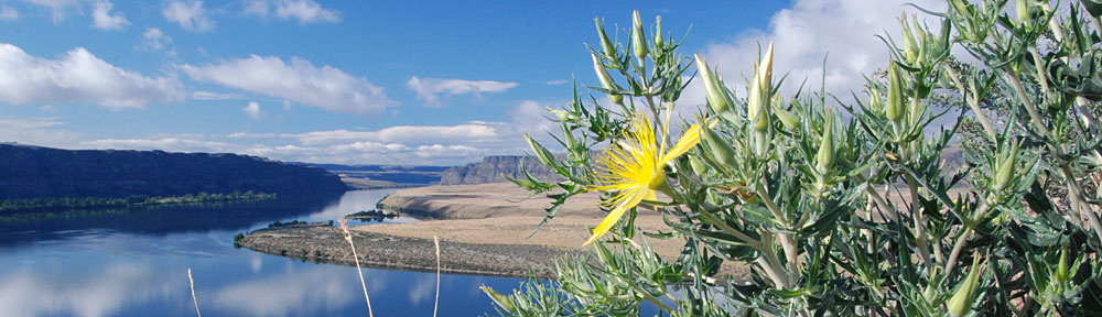
We took a side trip, following a sign that promised a View Point 4 miles up an unpaved road. The road wound up and around through dense forest, finally depositing us at the promised viewpoint. We could see Lake Wenatchee in the light haze.
Another couple was there — a bit older than us and seriously out of shape. They were wrestling with something heavy in a blanket, trying to get it into the back of their pickup. We didn’t snoop until they were gone. Then we followed the short trail they’d come from and discovered a place where people had been cutting stone from the side of the hill. Cutting, like with a stone-cutting saw. The kind of equipment that requires a generator and probably water to cool the blade. I don’t think they had that equipment; they might have been taking a loose rock. It looked like granite to me, but it could have been something else. (What do I know about rocks?) The whole thing was weird; it had taken us 20 minutes to drive the 4 miles; why would anyone lug stone-cutting equipment up there?
We continued along the Forest Road and, sure enough, not far from where I’d turned around on my motorcycle, the pavement ended. We followed the road through the forest, enjoying the views along the way. At one point, a Jeep caught up to us and we pulled aside so it could pass. Otherwise, there wasn’t much in the way of traffic.
 I should mention that much of this was old growth forest. An absolutely huge tree grew close to the road and we got out to take a closer look. Its amazing to me that trees this large exist and that so many of them have been cut down. Actually seeing one is a real treat.
The road we were on ended at Route 2 and we continued through Stevens Pass and down to the west side of the Cascades. That’s when the traffic started up. It was Labor Day afternoon and everyone who had journeyed east for the weekend was heading home. I whipped out my iPad and the Maps app and found some alternate routes that paralleled Route 2. We probably saved about 30 minutes of drive time by taking these longer routes, each of which dumped us back on Route 2 after a pleasant drive through farmland or forest. Then we abandoned Route 2 completely in favor of Routes 522 and 524.
We stopped at Snoqualmie Ice Cream shop in Malby. The ice cream was good, but, in my opinion, not worth the very high price we paid for it. And the girl at the counter who served it had the personality of a wet rag.
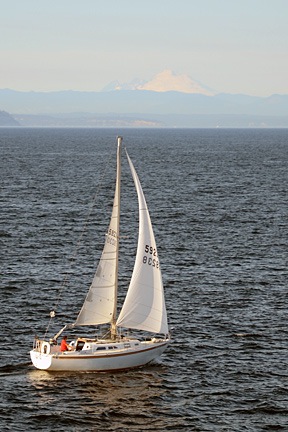 Back on the road, we continued along Route 524 to Edmonds and got on line for the ferry to Kingston. We’d timed it well and didn’t have to wait more than 15 minutes to get on the boat. We went up on deck to check out the view. Mount Baker was clearly visible to the northeast and even Mount Rainier could be seen through the haze to the south. I passed the time photographing sailboats we passed, trying to get Mount Baker in the background.
In Kingston, we didn’t hang around. It was getting late and we were hungry and unsure of where we’d be spending the night. We’d already planned on spending Day 2 in Victoria, BC, so we wanted an overnight stay someplace close to Port Angeles, where we’d pick up the ferry. So we headed that way on Route 104 and then 101.
We detoured to Dungeness. I don’t know what we expected to find there, but we didn’t find any interesting lodging opportunities. We did, however, find the Three Crabs Restaurant right on the bay. If I had to rate this place on service or atmosphere, I’d pan it. It had all the charm of a cheap family restaurant catering to people with low expectations. But the food — well that was a pleasant surprise. I had the best fried oysters ever — and I don’t toss around the word “best” very often at all. That made it worth the visit. (And here’s a tip to restaurant-goers who rate restaurants on Google, Yelp, etc.: don’t order steak in a seafood place.)
We got back on the road and headed toward Port Angeles. By this time, it was getting dark. My maps app suggested the Olympic Lodge and we homed in on it. It was a bit bigger and fancier than we expected. But it was evidently also empty. We went to the desk and they offered us a discounted rate within our price range. We took it. The room was large and comfortable. A fountain at ground level outside our window offered a nice soundtrack to a good night’s sleep.
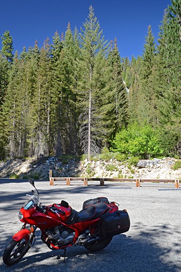 There were National Forest Campgrounds along the side of the river. I passed two before I reached the parking area and campground for Silver Falls. I parked and stripped off my gear, locking it up in my bike’s Givi saddlebags. Looking up, I saw the top of the falls — can you see it in the photo? It didn’t seem that far away.
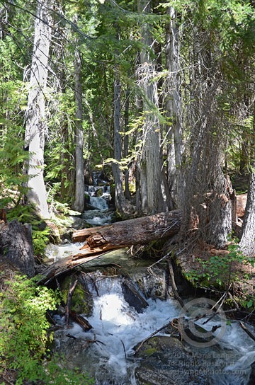 I immediately found myself in a deep, somewhat dark pine forest. As my eyes adjusted to the light, my nose picked up the scent of pine and moisture and my ears heard the sound of rushing water. I came upon the creek immediately — a healthy stream of water gushing over rocks between trees. For me — a desert dweller — it was a real treat.
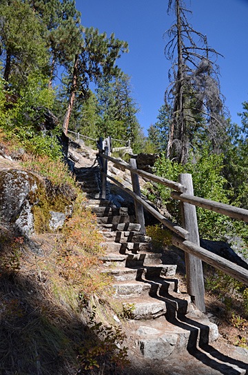
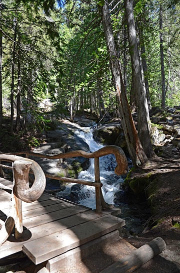 The path was well-maintained, with rustic protective barriers to prevent hikers from accidentally falling into the stream. The bridges were especially rustic looking, sometimes with curved logs making attractive rails. It was surprising to find something so attractively designed on a trail. I began to wonder how much of the trail dated back to the
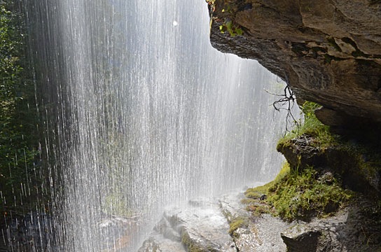
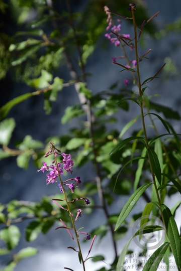 But I stuck with it and was rewarded with a switchback and another climb. A while later, I was back alongside the stream at yet another streamside bench, photographing some beautiful purple flowers just past the peak of bloom.
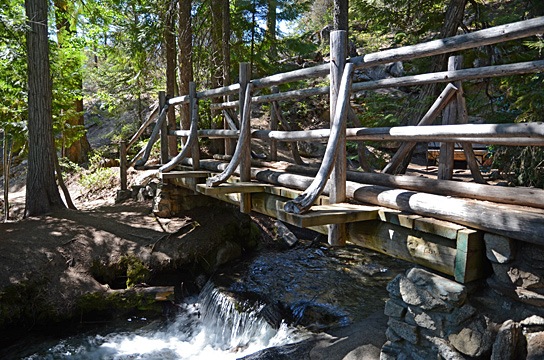
 Then I started down the other side of the creek. At first, it was one long flight of stairs after another. Then the trail moved away from the falls in a series of relatively level paths with switchbacks. In some places, the trail emerged from the forest into the sun; not only could I feel the heat on my skin, but I could smell it. Then back into the trees for cooling shade and pine aromas.
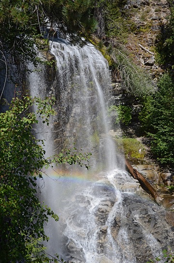 At one point, the trail came back to the falls just below where I’d walked along the ledge on the other side. The mist and sun worked together to produce a small rainbow. I did the best I could to capture the scene with my camera; I really do need to learn how to photograph waterfalls properly.
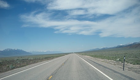 At 6:45 AM, I was in the driver seat of the truck with Alex the Bird in the seat beside mine. We were starting a 1,295-mile drive from Wickenburg, AZ to Quincy, WA. My goal was to make Jackpot, NV that first day — a distance of 725 miles. I spent most of those miles on Route 93, a two-lane road with speed limits up to 70 miles per hour. There was no traffic and certain stretches of the road were straight and flat as far as the eye could see. We made Jackpot before nightfall. After dinner n the casino, I spent the night in the RV with Alex in comfort — in the casino parking lot.
 The next morning, I woke at 6:15, which is late for me. Anxious to get on the road, I rushed around making my coffee and Alex’s breakfast and then buttoning up the RV for another day on the road. It wasn’t until after I topped off the fuel tank across the street from the casino that I realized it was an hour earlier; that part of Nevada is on Mountain Daylight Time. So I got a very early start. I left Route 93 behind in Twin Falls, ID, and hopped on I-84. The route was mountainous and the truck sucked diesel at an alarming rate as I struggled to maintain speed up hills. I left the interstate just past Pendleton and got back on smaller, traffic-free back roads to head north. After 10 miles on I-70 and the last five miles through familiar farmland, I rolled into the parking lot at the Colockum Ridge Golf Course RV Park just after 3 PM.
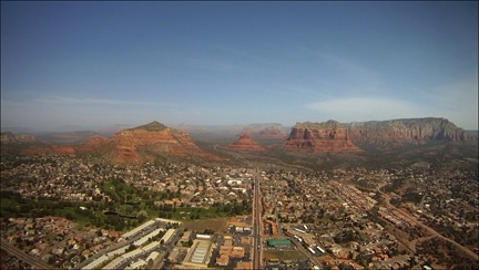 So instead of giving my guests their Phoenix Tour and heading up the Verde River on Day 1, we took a shorter route to Sedona that overflew Lake Pleasant and stayed within several miles of the I-17 corridor. I figured I’d save the scenic flight for when visibility was better. I also expected visibility to be better in the Sedona area and was very surprised that it was not.
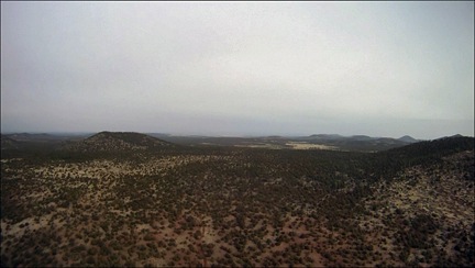 The flight to the Grand Canyon on Day 2 wasn’t anything special — except for that white haze that persisted, even up on the Coconino Plateau. Very odd for Arizona. It wasn’t blowing dust, either — the wind wasn’t strong enough for that. Just an ugly haze.
 Day 3 dawned gray but with plenty of visibility. I even got out and snapped a few
  I felt bad for my guests. They’d spent a lot of money on this trip and now they were stuck at a scenic place with no scenery and no helicopter flight to get them to their next destination. So I became their driver for the day. After realizing that the truck was not likely to make it to Desert View (on the east end of the park) before the roads were cleared, we stopped at the Visitor Center and the Geology Museum before heading into Tusayan (the tourist town outside the park) for lunch. The plan was for them to see the IMAX movie across the street next.
 But that plan failed miserably. When I got to the airport, I found the helicopter’s right side — the side facing the weather — completely iced over. The main rotor hub, the tail cone, and the tail rotor were all coated with ice. Even the skids looked frozen to the ground. And, of course, there was a good helping of snow in the fan scroll (again!) and even some inside the air intake port. The temperature had dropped by 10°F and it was now below freezing. It would not warm up again that day. The helicopter was officially grounded.
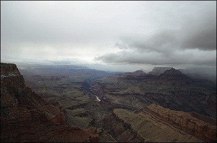 I wound up driving them to Page. The trip should have taken just over 2 hours, but since the weather was clearing enough to see into the canyon, we made several stops along the way. We arrived in Page at 8 PM. I checked them into their room, made sure they were set for the next day’s boat ride, and checked into my room at the Day’s Inn.
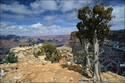 Now what I needed was a thaw — temperatures above 32°F. I must have called the AWOS number for GCN a dozen times before 10:30 AM on Day 4. Then I climbed into my redneck truck and made the trek down to Grand Canyon Airport. It took 2 and a half hours with just one stop to snap
 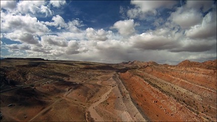 The flight was, for the most part, smooth. I ran the video camera (as you might expect) and captured some good footage over the Little Colorado River Gorge and along the Echo Cliffs. I set down on a helipad at Page Municipal Airport at 3 PM.