A relatively uneventful flight north.
Wickenburg to Seattle Series:
– Prepping for the Long Flight
– My Co-Pilot
– Day One (Wickenburg to Ukiah)
– Day Two (Ukiah to Portland)
– Day Three (Portland to Seattle)
Sorry about the delay in documenting the second day of our trip. I’ve been exhausted and busy and, frankly, when I’m not in front of a computer, I don’t want to be.
Our stay in Ukiah was quite pleasant. My room was comfortable and I slept well. Best of all, I walked across the parking lot the next morning in my t-shirt and lounge pants and was the first customer in Starbucks. In other words: I had a decent cup of coffee.
The helicopter was all fueled and ready to go. Louis did a very thorough preflight and, after saying goodbye to the FBO guy, we climbed in and started up.
Our route would have us following Route 101 north, through an area of low mountains and rivers to the coast at Eureka. From there, we’d follow the coast past Newport and head inland to Portland. That was the plan, anyway.
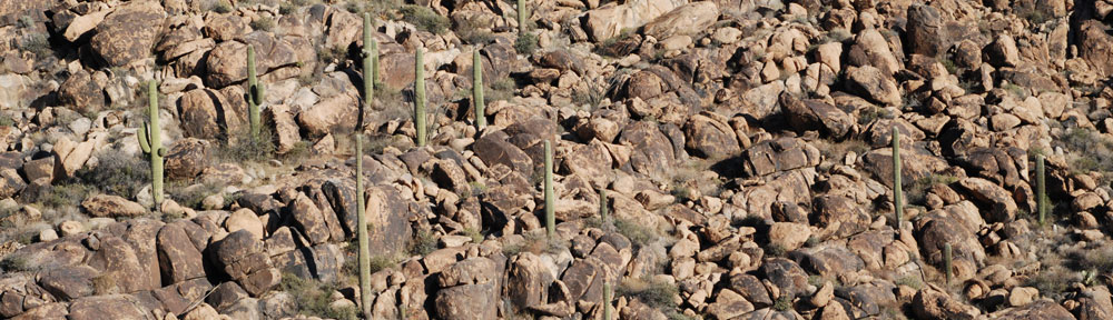
 The morning was cool with a very gentle breeze as we headed north. We were at the northern end of Sonoma Valley, where it narrowed. We climbed into the hills.
 As we climbed, the landscape changed. There were tall pine trees, rocky outcroppings, and rushing rivers below us. At one point, we crossed over a new bridge under construction. Louis circled it at my request so I could get a decent picture of it.
 We continued up route 101 until it dumped us into a valley at Eureka. In the distance, beyond numerous farm fields, we could see the ocean with a marine layer moving it. It appeared that we’d have the same coastal clouds we’d had the day before, farther south. I wasn’t interested in flying over the tops of clouds along unfamiliar coastal terrain. I wanted to go inland. But with fuel at half tanks, I also wanted to top off fuel before we changed course. According to the chart, Murray Field at Eureka had fuel. So we headed in and landed at the field.
The FBO gal greeted us on the radio when Louis set down near the pumps, telling us she’d be right out. Murray didn’t have a fancy self-serve system. In fact, it had the sort of system we had at Wickenburg when I ran the FBO — completely manual. The FBO gal came out to keep us company while we fueled. She was soon joined by a man who, after exclaiming that a “flying tomato” had landed, struck up a lively conversation about Eureka, the Phoenix area (where he’d once lived), and alternate routes.
 By this time, the wind was coming off the ocean, bringing clouds inland with it. You could see wisps of clouds speeding east, over the airport. We were advised to head north along the coast until we got to Crescent City, then follow route 199 (I think) inland to Grant Pass. That’s where we could pick up I-5 north to Portland. I was doubtful; I really didn’t want to fly over the clouds for the 50 to 60 miles to Crescent City. But I decided to take a look. We said some quick goodbyes and started up. I took off, climbing steeply at 1000 feet per minute through a scattered 200-foot ceiling of clouds. From that vantage point, it was easy to see where the clouds ended and the land began. Sometimes the clouds would be out over the ocean. Other times they stretched inland into the mountains. I handed over the controls to Louis and we continued north along the edge of the cloud bank at about 1,500 feet.
We didn’t even realize that we were passing over the Redwood forest until Louis asked me about it and I checked the chart. The tall trees didn’t really look special from above. But when you looked down into the forest, you could clearly see that one kind of tree towered above the others. From down on the ground, these trees are amazing. From 1500 feet above sea level, passing over them was a non-event.
 The cloud bank had shifted out a bit to the ocean by the time we reached Crescent City. It was very tempting to continue north along the coast. But when I looked out beyond the nearest clouds, it seemed to me that the clouds were thickening, climbing higher into the sky. I didn’t want to have to climb with them. And I certainly didn’t want to lose sight of the ground. So I decided to head inland, following the advice of the guy at the FBO. We turned east, found route 199, and followed it.
This route wound along a number of valleys and canyons past tree-covered hills and mountains. The streams and rivers below us were gushing with white water from snow melt. The northwest had had plenty of snow during the winter months and the recent record high temperatures were melting that snow quickly. Later, I’d hear on television about the flooding expected in Portland, Seattle, and other communities near rivers and streams.
After a while, we broke through the mountains into the valley at Grants Pass. We picked up I-5 and headed north into more hilly terrain. I noticed on the chart that a local mountain pass had its own automated weather observation system (AWOS) and I tuned into the frequency to get weather information. A similar station on my route between Seattle and Wenatchee would be useful when it was time to move the helicopter to Quincy for June and July.
At Myrtle Creek, the mountains ended, dropping us into a broad valley. The highway straightened and we followed it. By this time, I was pretty hungry and fuel was dipping to quarter tanks. It seemed like a good time to look for lunch and fuel. As we approached Creswell, just south of Eugene, I heard other pilots talking in the pattern. I asked if there was a restaurant and was told that there was a sandwich place just a quarter mile away. We headed in for landing.
The fuel pumps were decidedly helicopter-unfriendly. Maybe you know the kind: they’re situated at the edge of the ramp and have a shade cover over them that extends out to the ramp area. The shade’s height is about even with a helicopter’s spinning blades. The trick is to hover close enough for the hose and static reel to reach but not close enough to hit the shade with your blades. Louis did a marvelous job, landing to one side so that airplanes could still roll up next to us. I was hoping to leave the helicopter parked while we went to get some lunch.
The hose just reached the helicopter — Louis had to stretch it out while I fueled. I topped off the tanks. Then we used the facilities and I went in search of someone who could tell me where the food was. I found two people in a small trailer that seemed to house a flight school. It turned out that the restaurant was more than a quarter mile away — on the other side of the airport, as a matter of fact — and that he wanted us to move the helicopter before we walked there. I wasn’t interested in either the long walk or moving the helicopter. So we decided to continue on, with the promise of a Chinese restaurant right at the end of the runway at Albany. I like Chinese food and rarely get an opportunity to eat some.
We continued north along I-5. I should mention somewhere here that we caught glimpses of some of the Cascade Peaks along the way: Mount Jefferson, Mount Hood, and later, Mount St. Helens — all huge snow-covered peaks towering above the terrain. We were getting rather close to Portland. It seemed stupid to land at Albany and waste an hour when we could press on to Portland, arrive by 3 PM, and get some food there. So we decided to skip lunch. We snacked on the sugar snap peas I’d brought along and kept in my little cooler.
 About 20 miles south of Portland, I dialed in Portland Approach and told them where we were and where we wanted to go. Although we were landing at Portland, it wasn’t Portland International. It was Troutdale (TTD), which sits on the Columbia River just east of Portland. Neither Louis nor I knew the area, so I used the magic word: “unfamiliar.” We got a squawk code for our transponder and vectors toward Troutdale. When we got closer, we were handed off to Troutdale Tower. I told the controller we wanted to land at “TV Land” — which is what I’d been told — and he guided us in to a ramp near the east end of the runway. The grassy field I’d been told to park in was clearly visible and I told the controller we’d land there. Louis set us down and we shut down.


 I went out for a while and took some photos. It’s so perfectly clear and beautiful outside, with just enough snow to remind you that it’s winter. There’s just a slight breeze blowing; if it picks up it’ll get very cold outside.