Lights at Night

Beautiful, but at a cost.

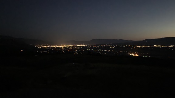
As the days are getting shorter, I’m finally rising and going to bed when it’s dark out again. This morning, I took a few moments to contemplate the predawn lights of Wenatchee from my home. And it really is beautiful.

Lights at Night
The view from my deck looking out towards Wenatchee at 4:51 AM this morning.

When I was a kid, my family would occasionally take a drive up to the east side of the town we lived in, Cresskill, NJ. Back in the 1960s and into the 1970s and beyond, developers had begun building luxury homes on a hillside that climbed away from the town toward the Palisades. We used to call it “the rich people’s hill” because the homes were huge and it was obvious that only rich people lived there. I remember one of those drives being in the evening, after the sun had set and the lights of Cresskill had come on. I remember seeing all those lights, like diamonds in the darkness.

That’s what my nighttime view here reminds me of sometimes.

I cannot begin to describe how wonderful it is to live in a place so removed from, yet within reach of, a small city like Wenatchee. I have all the conveniences that the little city offers — shopping, dining, theaters, nightlife, services, and even an airport with airline service to a real city (Seattle) and beyond. Yet I’m not down in it, crawling around in — or listening to — traffic. Even as I sit here now, typing out my thoughts as the sky brightens out my windows, the only sound is my wine fridge humming and my rooster crowing. Even when they’re spraying down in the orchards far below me, the sound seems more earthy, more natural, than the sounds of the city.

But the lights. Sigh.

I’ve begun to notice bright ones getting closer. When I returned from my winter travels in spring 2018, I noticed four new bright spotlights over some sort of maintenance yard down by the river. You can see them on the right side of this photo: three in one color and one in another. And last spring I noticed a new bright light across the river, likely shining down into someone’s yard. Why?

Here at my home, I have subdued lighting at night. There are solar accent lights along my driveway and the path to my tent and the posts tops on the uncovered side of my deck. There are motion-sensor lights that go on when someone — or something — walks near them. None of these lights shine up. And that’s it. I see no reason to pollute the sky with light at night.

And that’s what it is: light pollution. The only complaint I have about my home is the fact that it never gets truly dark here. (Well, it actually does, but only at night when it’s foggy.) And because I don’t have (or need) curtains on my windows, it never gets dark inside my home.

It was with a bit of sadness that I sold my old telescope last year. It was parked near the door to the deck for years and only used, with disappointing results, once or twice. Although I’m likely to pick up a more compact one with tracking that I can take on my winter travels — plenty of dark sky out in the desert! — I just have no use for one here.

It’s blue hour right now, light enough to see the empty sage land between my home and the orchards and lights beyond it. The city lights are starting to fade. It’ll be a hot sunny day today.

But at night, I’ll see those lights again, enjoying the view while lamenting my loss of dark night sky.

Cherry Drying: Playing the Weather Game

Why relying on forecasts is a bad idea.

Cherry drying? What’s that?

If you don’t know what cherry drying is all about, you can learn more in some of these older posts:
Drying Cherries with the Big Fan (2006)
Cherry Drying 101 (2008)
The Story Behind Walking the Orchards (2008)
I Dry Cherries (2008)
Heck, there’s too many to list. Just check out the cherry drying tag.

If you want to see me in action, check out these two videos on YouTube:
Helicopter Cherry Drying – A Narrated Flight
Cherry Drying with a Helicopter – Again

I’m deep into cherry drying season here in central Washington state. I’ve built a team of five pilots (including me) to cover about 400 acres of cherry trees in this area. We’re all on standby, which means we need to be around during daylight hours, ready to fly if it rains and we need to dry an orchard.

Standby is serious business. My contract with my growers says that I will have a helicopter in the air within 15 minutes of a call. To make that possible, I have to monitor the weather closely throughout the day and evening every single day. I use apps on my phone to get current radar information and the latest forecasts from at least two reliable sources (neither of which is The Weather Channel). And whether I’m home or out running errands, I’m always scanning the sky, noticing a build up of clouds. Even when I’m flying I have the radar layer displayed in Foreflight on my iPad, tracking the directional movement of cells.

I basically live the weather for 10 weeks every summer.

I Become a Weather Source

For good or bad, my clients have come to depend on me for this.

Years ago, I got a lifelong client when I called a grower at 6 AM on a Sunday morning to report rain on his orchard. It was a tough call to make; he was a newlywed living miles away down in town. There had been no rain in the forecast but rain had woken me in the middle of the night. I’d been camped nearby and when I went into the orchard to pick a few cherries for breakfast, I saw how wet the trees were. Do I call? It’s not my job. What do I do? I called. He launched me and drove out to the orchard to take a look. I was about 15 minutes into the job when he called me in the cockpit and said, “These trees are really wet. You probably saved our crop.” His 100+ acres in three different orchards makes up a good portion of my contracted acreage every year.

Last year, I was home doing some chores when I noticed a buildup of clouds out to the northeast, over the Waterville Plateau. That area, which is full of wheat fields, is prone to nasty thunderstorms every summer. There was nothing in the forecast for the two areas we service — Wenatchee/East Wenatchee/Malaga and Quincy — but I didn’t like the way this looked. I checked the radar. Sure enough, it was a big cell and it was moving south, right toward the orchard we service in Quincy. I got on the phone and called my guy based down there to ask what it looked like. He hesitated and then admitted that he was in Leavenworth, at least an hour away. There had been nothing in the forecast so he and his family had gone out for the day. While he hustled back, I called the grower. He lives in East Wenatchee and didn’t see the cloud build up. I told him what I saw on radar, and he headed down to Quincy for a look. Meanwhile, I prepared to fly in case my guy didn’t get back on time. I watched the cell move right on down to Quincy. A while later, the grower called back. The cell had dropped some rain on the far east end of his orchard — not enough to call the pilot out. Yes, it had been a false alarm, but he was glad I’d alerted him. And I think my pilot learned a valuable lesson about trusting forecasts.

I could tell stories like this half the day — after all, this is my twelfth season as a cherry drying pilot. But you get the idea. Forecasts simply can’t be relied upon.

Today’s Forecast

When I went to bed last night, there was no rain in the forecast. It was cloudy as I fell asleep, but I just assumed all that would move off during the night. Wrong. When I woke up just before 4 AM, it was still cloudy and unusually dark for that time of morning.

I checked the radar on my iPad as I do first thing every morning. I was surprised to see some light echos on radar. I’ve learned over the years that even that isn’t an indication of actual rain. Still, it put me on alert.

Text Exchange
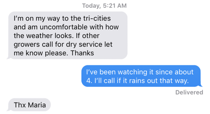
Here’s my early morning text exchange with a client. I really think they like getting a response within seconds when they contact me at odd hours.

So did the text I got from a client who had to leave town to manage picking at another orchard he owns 2 hours away. (Coincidentally, this is the same grower who told me I might have saved his crop a few years back.) Without someone there to check how wet his trees might get in a rain event, he was depending on adjacent growers’ decisions to launch pilots to launch me. I only had one other orchard near him that was on contract, but it was close enough to be a good indicator.

Radar this Morning
The radar image for the Wenatchee area at 5:55 AM this morning.

Around 6 AM, as I was having coffee, I was also watching the weather from my home. It’s perched up at the base of some cliffs, high up over the Wenatchee Valley and offers a 180° to 270° — depending on where you’re standing on my 10 acres — unobstructed view of the whole valley. It’s a perfect perch for someone doing what I do and makes a great base of operations for cherry drying services.

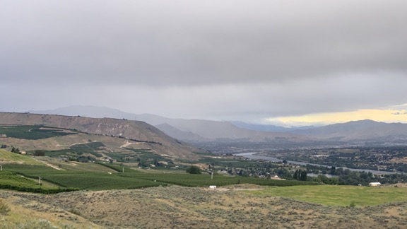
Here’s what I saw on radar and from my window.

Weather from my Deck
Here’s the view from my deck when I captured the radar image above.

I started texting my crew. Of the three guys, Trevor responded within a minute. He gets it, I reminded myself. The other two: nothing.

Then I got a text from my friend Cyndi, who lives up on Wenatchee Heights. (Cyndi’s house was my starting point in this recent video: Flying Home from Taco Night.) “It’s raining!” She said. (It’s funny how many of my friends report rain to me throughout cherry season. I definitely appreciate it.)

I put Trevor on alert but didn’t send him to his helicopter yet. I tried to get the other one in the area, Ben, on the phone. I called once and it went to voicemail. I told him that if he had Do Not Disturb turned on, he should turn it off. Then I called again. It went to voicemail again and I told him that he was in trouble. Then I texted his boss, who was in Portland. Ironically, he responded immediately. I made sure he understood that I wasn’t happy about not being able to reach the pilot I was paying him to be able to reach 24/7. On call meant on call.

Watch My Helicopter Videos on YouTube

Time for a shameless plug…

Flying M Air Logo

If you like helicopters, you’ll love the FlyingMAir YouTube Channel. Check it out for everything from time-lapse annual inspections to cockpit POV autorotation practice to a flight home from a taco dinner at a friend’s house — and more.

The rain moved through the area southeast bound. I texted two of my clients to see how much rain they had. One texted back that the rain had been light but it was very windy. The other called with the same information. Cyndi reported the same thing. It looked like we could stand down. I texted Trevor.

It rained at my house. The wind was howling so hard that only half of my deck showed drops and they dried within seconds of hitting the ground. Then it was gone and only the wind remained.

It’s an hour after I took the photo shown above. The sun is out and there’s some blue sky. Radar shows a “wintery mix” over Mission Ridge, which is south of the orchards we have on contract. Even if we did have some more rain, I’m pretty sure this wind — which has been in the forecast for the past few days — would dry the trees.

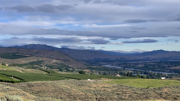
Clearing Weather
It’s an hour later and the weather is clearing out.

This is what I do for 10 weeks every summer: play the weather game.

Snowbirding 2019: The Long Drive

About 1,253 miles in three days. But who’s counting?

Posts in this series:
The Long Drive
At the Backwaters Campsite
In Mesa and Gilbert
A Quick Stop in Wickenburg and Forepaugh
Off Plomosa Road
• Camping at the Big RV Show
• A Trip to Organ Pipe with the WINs
The Tucson Gem & Mineral Shows
Wickenburg Gold Rush Days
• Constellation Park Interlude
• White Tank Mountain Park
Bumming It in Phoenix and Apache Junction
A Dose of Civilization
Return to the Backwaters

Note: I haven’t been blogging nearly as often as I should and I do need to apologize for that. I have some excuses. Do you want to hear them?

  • My 8-year-old laptop is so damn slow that it’s frustrating to use it. I ought to have bought a new laptop this winter, but I bought a Hobie kayak and a cargo trailer instead. (More on both in a moment.)
  • I discovered that the charger for said laptop sucks power out of my RVs batteries faster than my solar panels can put it back in so I haven’t been charging it. The idea of running a generator to charge a laptop is distasteful to me (although I do admit that I used it to charge all my drone batteries the other day).
  • I had seriously sucky Internet service for the first two weeks of my trip. (Of course, that didn’t stop me from getting on Twitter every single day.)
  • I’ve been extremely busy doing things other than sitting in front of a computer. (And isn’t that a good thing?)

Anyway, let me fill you in — as briefly as possible for me — on what I’ve been up to since I left my home in the capable hands of the best house sitter in the world on December 18. I’ll do it in multiple blog posts so I can bang them out more quickly and (hopefully) not put readers to sleep with a very long post.

– Maria


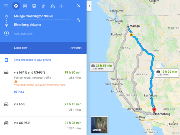
I took the fastest route from Malaga to my first long term campsite on the Colorado River. In case you’re wondering, that’s route 84 to Twin Falls, ID and down Route 93 to Las Vegas, NV. Because I really don’t like to drive in unfamiliar areas at night, I broke the trip up into three days and squeezed it into a weather window that called for some rain and high winds but no snow.

Fastest Route
Google knows its stuff. I’ve tried a bunch of different routes and this one is definitely fastest.

Sinclair
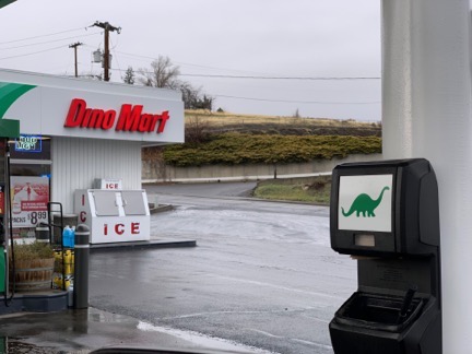
For some reason, Sinclair gas stations really crack me up. Does anyone else remember the old sitcom “Dinosaurs”?

The first day was Malaga to a state park in Glenns Ferry. I drove in light rain for the first half of the day, hitting the forecasted high wind right around Pendleton, OR, where I stopped for fuel and a late breakfast. I’d been a little concerned about my high profile vehicle — I’m driving a pickup truck with a relatively large Lance truck camper on top — but it didn’t really affect me as much as I’d worried. The truck drove well at the speed limit, which was 75 in most of Washington, 65 in Oregon, and as high as 85 in Idaho. (70 mph seems to be the most fuel efficient speed.) I stopped for fuel in Mountain Home right around sunset, so it was pretty dark when I arrived at Three Island Crossing State Park. From what I could see, there was only one other camper — a pull trailer with its lights on. I picked a site on the other side of the campground and backed in. Although the water was turned off for the winter, the electricity was turned on, so I could run my electric heater and use my coffee maker in the morning.

I left before dawn for day two, which took me into Twin Falls and then down route 93. Although 93 is only one lane in each direction, the speed limit was 65 and there was no traffic. I fueled up in Wells, NV and probably should have fueled in Ely. That made things a little tense when my thirsty truck’s low fuel warning came on in the middle of nowhere, NV. Fortunately, I found fuel in Ash Springs, a tiny town that might exist primarily as a fuel stop. From there, it was down 93 to I-15 and I-15 into my next night’s stop, the KOA at Sam’s Town Casino in Las Vegas.

I picked that campground for a few reasons. First, I know it. Second, it’s reasonably priced. Third, it has great, underutilized showers, which is important when your shower stall is your bathroom and you know it’s the only shower stall you’ll have for the next two weeks. Fourth, when I’m getting ready to start two full weeks off the grid, I want a fully charged battery, empty waste tanks, and full fresh water tanks — all of which I could get at a full hookup campsite.

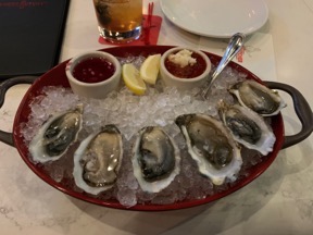
I had dinner at Sam’s Town: a half-dozen oysters on the half shell, an end cut of prime rib which was too big to finish and wound up being fed to dogs over the next week or so, and cheesecake. I stuffed myself, which was a big mistake. Honestly, the prime rib wasn’t even good. I could have spent the same on a much better and lighter meal at MGM Grand; one of their restaurants has an excellent steak tartare.

Oysters Prime Rib
The oysters were amazing. I probably should have had 2 dozen of those and skipped the rest of the meal. Or not?

In the morning, I had a long, hot shower, took care of the waste and fresh water in my rig, and headed out, stopping at Walmart for bottled spring water and Trader Joe’s for other goodies on my way out of town.

I didn’t take the quickest route from Vegas to my final destination. Instead, I took route 95 to I-40, crossed, the river, and drove south on the Arizona side through Lake Havasu.

Clouds
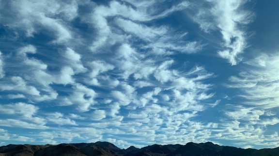
The clouds were amazing as I drove down route 95 south of Boulder City toward I-40.

London Bridge
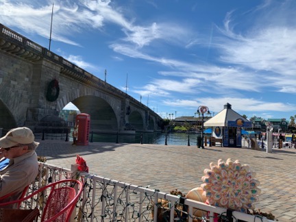
While I was at Lake Havasu City, I stopped for fish and chips at a restaurant near London Bridge.

You see, I’d been thinking about a Hobie inflatable kayak for about a year. I’d left home without my kayak and I wanted another look at the Hobie. At the Hobie dealer in Lake Havasu, I took one for a test pedal/paddle — it has a pedal drive — and bought it. Somehow, we squeezed it into my camper, which was already full with all the additional crap I had to bring south with me to show my jewelry at shows in Arizona.

I arrived in Ehrenberg, AZ around 3:30 PM and stopped at the post office, where I retrieved my box key and collected the mail already waiting for me. (I rent a box there every winter.) Then I drove south on the unpaved Oxbow Road, my fingers crossed. There were three sites I was considering; last year we’d been stuck with the last choice. This year, luck was on my side — I was absolutely thrilled to find my first choice campsite unoccupied. After debating with myself on how I’d park my camper to get the best view of the backwater channel while not completely isolating myself from a friend who’d be joining me, I backed in, dropped the camper’s legs, and pulled my truck away. If my truck could sigh in relief, I think it would.

Camper View
Here’s the view from my camper’s back door. I always try, when parking out in the desert to put something I’d like to look at out my back door where I can see it from my dining table.

My 1250+ mile drive was over.

Flying with a 1914 Curtiss Flying Boat

The challenging part of this photo flight wasn’t the photo flight.

It had been on my calendar for months: take a photographer to fly with a rebuilt 1914 Curtiss F Model Flying Boat, supposedly the only one in existence from the 300 originally built.

My friends Mark and Karen at Century Aviation had been working on it for over a year, restoring it for businessman and aviation enthusiast Bill Nutt from the few parts they had managed to acquire. I saw the start of their work at their annual hangar party in the summer of 2017. By June’s Aviation Day event at the airport, it was pretty much done and on display in one of the FedEx hangars.

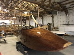
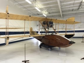
1914 Curtiss Flying Boat Under Reconstruction 1914 Curtiss Flying Boat Fully Restored
The Flying Boat project in August 2017 (left) and in June 2018 (right) when it was pretty much finished. Fun fact: There are more than 8,000 tiny screws holding the wood planks in place on the plane’s hull.

The great thing about this restoration is that the owner wanted a fully functional plane. That meant it had to fly. So they scheduled a test flight for July and contacted me about taking along a photographer to document the flight. Unfortunately, some engine issues caused a postponement and they had to work around the pilot’s schedule. He was next available in mid August so that’s when we rescheduled the flight.

The folks at Century had to disassemble the plane, stow it in a custom trailer built just to transport it, and tow it down to Moses Lake, which was where they planned to fly it. The plane does not have wheels or any landing gear at all; it’s a boat and can only take off and land in water. Although the Columbia River is right here, they felt that Moses Lake, about an hour away by car, would be better. Less possibility of crowds and boat traffic and no obstructions like overhead wires, bridges, or dams. They also needed a place to reassemble and launch the plane; they arranged with some folks who lived on the north end of the lake to use their property.

They drove down on Monday morning and spent the day working on the plane. The test flight was scheduled for Tuesday with the possibility of trying again on Wednesday if necessary.

Getting There

Spoiler alert: the most challenging part of the mission for me was just getting my helicopter to Moses Lake.

We’d decided that I’d go down on Monday so I was ready first thing in the morning to fly. I packed a tent and sleeping bag, all prepared to camp out in the yard. I also brought a cooler with ice and water and a bed for Penny.

I watched the weather all day. I wasn’t worried about storms — it was visibility that was an issue. For three weeks, we’d been dealing with smoke from various fires north of here. The smoke drifted into the Wenatchee Valley and settled in, thick enough to smell. I monitor air quality via an app and website and smoke was giving us “Unhealthy” and even “Hazardous” air. Visibility at the airport just four miles away had gotten as low as 3/4 of a mile. That day, it was hovering around two miles.

Wenatchee Pangborn Memorial Airport has class E airspace. That means that when visibility drops below 3 miles, I can’t fly there without a special VFR clearance. Trouble is, there is no tower at Wenatchee so to request my clearance I need to contact Seattle Center. And the problem I encountered that afternoon, as I idled at my landing zone in a deep valley, was that I simply couldn’t reach Seattle Center on the radio.

I could reach the local Flight Service Station, however, so that’s who I called. They relayed my request to Seattle and relayed the response back to me. There was a plane on approach and I couldn’t get my clearance until he was on the ground.

So I sat there, spinning, burning fuel, grateful that the helicopter has air conditioning. I listened in on Wenatchee’s radio frequency and heard the plane call 10 miles out. That kind of pissed me off because I had a 3-minute flight ahead of me and could have done it at least twice before he even entered the airspace. But okay. Whatever. I waited.

Then he was on the ground and a helicopter made a call. Shit. How did he get clearance before me?

I called Flight Service again to remind him that I was still waiting. He mentioned the helicopter and then told me to hold. I held. Eventually, he came back and gave me my Special VFR clearance to reposition to the airport. I wasted no time climbing out and heading across the river.

It had taken me about 20 minutes from startup to landing less than four miles away.

I ordered fuel, wondering how long it would take for me to get out and on my way to Moses Lake.

Fortunately, the wait to depart was much shorter. After topping off both tanks and checking the oil — hot dip stick! — on level ground, I started back up. This time, I called Seattle Center directly. They had me hold until a cargo plane that had just departed cleared the airspace to the west and then cleared me to depart Special VFR at or below 10,000 feet. Easy enough; I had no intention of losing sight of the ground.

Instead of flying direct, I departed the airport and descended down until I was about 400 feet over the river. The problem with the direct route is that it would take me right over the top of Lower Moses Coulee, which is a relatively wide canyon east of the airport. I worried that once I left the canyon’s west rim I might lose sight of the ground below me and the opposite rim. I don’t like to lose sight of anything when I fly and I wasn’t taking any chances.

I watched my position on Foreflight’s moving map and called Seattle Center to report clear of Class Echo when I was abeam the mouth of Lower Moses Coulee. By that time, I was low enough between the cliffs on either side of the river to have garbled communications with them. I thought I heard them ask for my altitude and heading so I reported both. Then I changed frequencies, eager to silence their nearly constant communications with airliners coming and going around Seattle.

I followed the river down to Crescent Bar and then climbed up over Babcock Bench before setting course for Moses Lake. The farms and orchards of Quincy emerged below me out of what looked like a fog. Visibility was slightly better than it had been in Wenatchee. The air was smooth and I was very surprised to discover, when comparing airspeed to groundspeed, that I I had about a 15 knot headwind. No turbulence at all. I turned on my radar altimeter — the $10K piece of equipment the FAA made me buy — because I was curious about how high up I was comfortable flying in the muck. 350 to 450 feet. I soon lost sight of the hills north of Quincy and had some trouble staying on course with nothing on the horizon to aim for. The radio, tuned into Quincy’s frequency and then Moses Lake’s, was eerily quiet.

My landing zone was on a piece of land three miles west southwest of the airport, within the Class Delta airspace. That meant talking to the tower. Fortunately, visibility there was four miles so a Special VFR clearance was not necessary. I told the controller where I planned to land and he cleared me for transition. I was just setting down when I reported landing assured.

On the Ground in Moses Lake

They had a sprinkler going in an area that would have been a good landing zone, but I didn’t know if they expected me to land there so I didn’t. Instead, I landed in a spot between a small orchard and some overhead wires. There was a burn pile nearby and I was so focused on that, wondering if I’d blow it away, that I was a bit surprised when my left skid touched down before my right one. There was a little slope to my landing zone, but not enough to be an issue. I set down, reduced the throttle to cool down RPM, and opened the door. I dropped Penny out to investigate while I finished shutting down.

One of my hosts, Lois, appeared moments later. When I shut down and got out, she greeted me. She immediately offered up a bed in the house. Faced with the choice of a bedroom near a bathroom or a tent in a smoky yard, I agreed to take the bed.

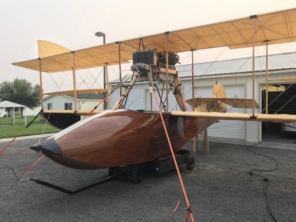
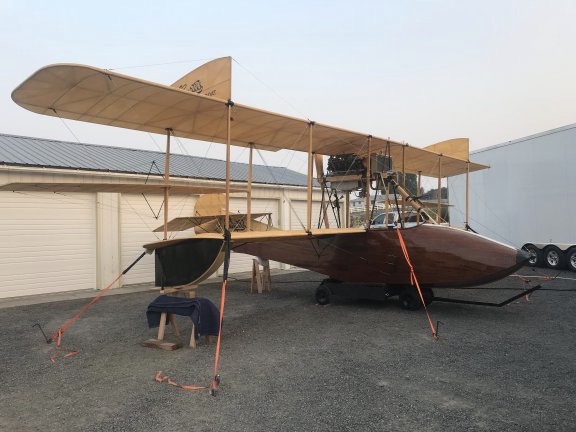
The plane was parked in front of Lois and Virgil’s garage, sheltered on one side by its big transport trailer and on the upwind side by a motorhome. It was tied down firmly at four points; it would be tragic indeed if the strong wind coming out of the east blew it over.

Curtiss Flying Boat in the Driveway
The plane was securely tied down in the driveway, sheltered from the wind on three sides.

Then Karen, Century’s co-owner, pulled up in her car and whisked Penny and me away to a Mexican restaurant in downtown Moses Lake. The Century crew, the plane’s owner (Bill), and a bunch of friends — I think there may have been 20 of us — sat a long table. We enjoyed drinks and huge portions of Mexican food, treated by Bill.

Afterwards, Penny and I hitched a ride back to the landing zone with Bruce, who was staying in the motorhome. (The others were staying in two rented houses in town.) That’s when he told me about flying helicopters in Vietnam and gave me a firsthand account of his participation ferrying people out during the fall of Saigon. He said that they had to toss the helicopters into the water because the helicopters waiting to land were running out of fuel and ditching and the rescue crews were working nonstop to pull people out of the water. (Seriously, kids: never pass up an opportunity to talk to an older person about the amazing things they were part of in their lives.) Now he flies freight in airplanes for a living, but he wished he’d gotten his civilian helicopter rating.

Back at the landing zone, a young guy in a uniform was hanging around by a pickup truck parked near the plane. Hired security. He’d be spending the night. I thought it was completely unnecessary — heck, you couldn’t see the plane from any road or the lake — but better safe than sorry, I guess.

I chatted with my hosts for a while before turning in. I’d been up since 4 AM, which is relatively common for me, and was tired. My bedroom was small — barely big enough for the queen sized bed! — but the bed was comfortable and the place was quiet. After feeding Penny some chicken and rice from my dinner — I’d forgotten to bring dog food which she probably wouldn’t have eaten anyway — I set up her bed on the corner of mine and turned in. I slept relatively well.

Fly Day

I woke around 4:30. This is one of the reasons I hate being a houseguest. I wake up very early and then I have to stay very quiet until other people wake up. So I did what I often do: read articles on the Web, visit Twitter, complete crossword puzzles. That took me to nearly 6 AM. By that time, it was daylight and I was ready to go outside. So I dressed, washed up quietly ,cleaned up the room, gathered my belongings, and slipped outside with Penny in tow.

Curtis Flying Boat, Parked
The plane was safe and sound in the morning. On the right side of this shot, you can see part of the trailer it travels in.

The security guy was gone. Virgil was awake, doing stuff outside. I helped him pick raspberries from his garden for breakfast. We chatted, skirting around the issue of politics. He started to say something about liberals, thought better of it, and was likely relieved that he had stopped talking when I admitted that I leaned left. I said that I wished people would gather information from reliable sources and form their own educated opinions rather than latching on to the opinions of others. And we left it there.

Back in the house, Lois was making breakfast, which consisted of a lot of fresh fruit, oatmeal (the kind you cook, which is honestly the only kind worth eating), and meatless sausage and potato patties. There was no coffee, which I (mistakenly) thought wouldn’t be a problem. Virgil said grace before we put food on our plates. He had a lot to say to the Lord that morning, from thanks for the food to requests for good weather and a successful flight.

Other people started arriving after 7 AM. Bruce came in and joined us. Then some other folks. Soon we had a bunch of cars parked haphazardly around the place and people going in and out to use the bathroom. I thanked my hosts for breakfast and went back outside, where Penny was already giving hell to the three-legged dog from next door.

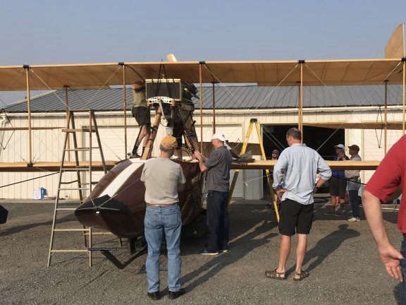
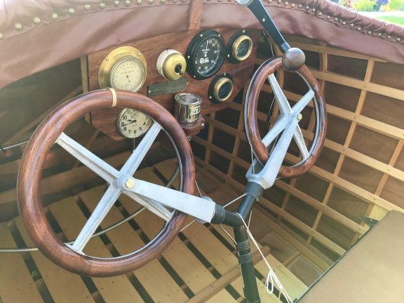
The crew got right to work on the plane. They had to check all the wire fasteners for tightness, add oil and fuel, and do countless other things I have no clue about. There were ladders all over the place. I managed to get a few interesting shots of the plane and its controls while they worked.

Working on the Plane
The crew works to prepare the plane for flight while others look on. That’s the pilot, Rob, in the black shorts.

Cockpit of 1914 Curtiss Flying Boat
The cockpit is pretty simple. For this flight, they had the “everyday” fabric seat cushions in. The leather cushions they made will likely be installed when its on display.

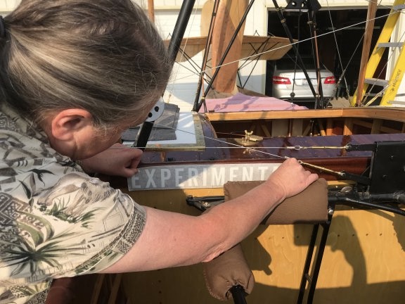
Experimental Label
Karen affixes the Experimental placard to the inside of the cockpit as required by the FAA.

Curtiss Flying Boat Engine
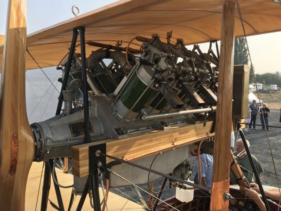
A closeup of the Flying Boat’s engine with pusher prop. This is (obviously) not the original engine, but it was built specifically for this plane based on period designs. You can see Mark’s face framed by the engine supports just below the radiator.

Mark & Karen
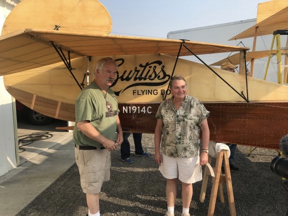
Mark and Karen pose by the plane’s tail for an interview by NCWLife, a local television channel.

First Try

We got all the cars moved out of the way and Virgil moved the motorhome. Mark did a briefing on what would happen next and they started moving the plane, on its cart, down to the water. I had my phone out with a battery pack on it and Periscoped the whole thing. It was long and, in more than a few parts, boring. That’s because it happened at the speed of real life, which tends to be slow. Mark and Karen weren’t taking any chances rushing through things.

Of course, I wasn’t there to put the event on social media. I was there to fly a photographer in my helicopter. That means I needed to be ready to fly when they were. At first, Mark asked me to get the helicopter going just before they started the engine, but when he realized how much I wanted to hear the engine, he said to do it right after they started. So I stuck with it, narrating and answering questions along the way. There weren’t many viewers until right around the time they started the engine. So instead of shutting it down, I handed it off to one of the other bystanders. Apparently, she wasn’t as dedicated as I was and eventually put the phone down without turning off the video. If you do watch it, have patience.

I’d already briefed the photographer, Steve, and told him he could keep shooting until after I got the helicopter started. So it was running when he joined me. I helped him with his life vest — I always supply flotation devices when doing photo flights over water — and made sure he was strapped in. Then I made a radio call to Moses Lake tower, telling the controller we’d be operating over the lake. They were already briefed about what we’d be doing and I’d likely be operating below the airport field elevation anyway. For the rest of the day, all I had to do was call when I took off and call again when I landed. It was automatically assumed that the Flying Boat would be operating at the same time.

When we took off, the plane was just taxiing into the lake. I formed up immediately with it, flying on its left (port) side. Steve is a smart guy who had no problem with my request to sit behind me for the flight. Doing so made it possible for me to see exactly what he saw and put him in position to get the best shots. I’ve dealt with too many stubborn photographers who expect me to get them into position when I can’t see what they’re looking at. I now require all photographers to sit behind me for air-to-air flights.

Rob took the plane down the lake, slowly building speed. We followed off his left shoulder. At first, I was kind of high — the water was glassy smooth and I really don’t like flying low over featureless surfaces. But I worked my way down, matching the speed of the plane below me at or below 100 feet over the water.

It wasn’t very eventful. He didn’t get very far. After a while, he killed the engine and the boat drifted to a stop.

I circled a few times as a boat with some of the crew on board motored over. Of course, I didn’t know what was going on. The Flying Boat didn’t have a radio and my cell phone was with Rita. When they came out with a jet ski and started towing it back to base, I headed back in and landed.

By the time I’d shut down and returned to lakeside, the plane was back. It turned out that there were multiple problems:

  • Water was getting into the boat’s hull. This was probably a combination of seepage and possibly a leak or two.
  • The engine wasn’t getting enough power to get the plane up to speed.
  • There wasn’t enough rudder to steer the plane properly.

Needless to say, we were all very disappointed. As I watched them bail out the plane with a small bucket, I started wondering if the whole thing was a failure.

Second Try

It was still early in the day and the place was crawling with mechanics and engineers so there really wasn’t any reason to give up. I went with one of the guests to a sporting goods store to buy a handheld pump to make it easier to get water out of the boat. Because I had a splitting headache likely caused by caffeine withdrawal, we stopped at an espresso stand for an iced latte. (It worked! Headache was gone before we got back!) Then Home Depot to get some hose.

While we were gone, they did something with the rudder cables to improve steering. Oddly, the design they’d worked with had a wooden block back in the tail; they had no idea what it was for but included it anyway. Apparently, it was to tie the cables in such a way that they wouldn’t rub against another part when the rudder was full left or right. So they were prepared for the fix. I imagined a mechanic back in 1912 having the same problem and solving it with that little wooden block.

Meanwhile, we had lunch — sandwiches with fresh tomatoes from the garden. Penny shared some of my turkey.

Then they were ready to try again. Steve and I headed out to the helicopter. This time we were airborne before they started the engine. We got to see Mark crank it — there was no electric start — and the prop start spinning. Then Mark climbed out of the way and Rob took his seat. As we circled about 200 feet up, he headed off into the lake.

This time, Steve and I paid closer attention to the way the plane moved in the water. We realized that spray from its movement was coming up under the rear horizontal do-dad — heck, sometimes I really wish I knew airplane parts! — and spraying up against the rudder. The hull seemed to ride low in the water. Although Rob seemed to have better steering control, he still didn’t get enough speed to take off. So he killed the engine again. The boat and jet ski moved in and I went in to land.

Third Try

One of the crew bailed out the boat with the hand pump while the others talked to Rob. It seemed that the steering problem. But the water getting in the boat was weighing it down and it seemed to be too low in the back. They decided to try ballast.

They filled two big black garbage bags with gravel and weighed them. I didn’t get the weights. They took one of the bags and secured it at the very front inside the plane’s hull. They were turning the plane around to face the lake when Steve and I headed back to the helicopter.

We launched and circled as they started it back up. It headed out to the lake. The tail was definitely riding higher in the water. Rob seemed determined to get it up to speed as quickly as possible — possibly to minimize water in the hull. He took it pretty far down the lake and I really thought he might take off. But then, suddenly, he killed the engine and let it drift.

It looked for a moment as if the wind might blow it to the opposite shore of the lake, but then the jet ski came out and attached the tow rope and they were headed back. I was back on the ground looking for chocolate chip cookies before they got back.

Fourth Time is the Charm

The verdict was that the weight in the front definitely helped but they needed more. So they secured the other bag of gravel. As they turned around the plane, Steve and I headed back to the helicopter. As I lifted off and called the tower, I said “Let’s hope fourth time is the charm.”

“Good luck,” he replied.

Again, we circled the plane as they started it up and Rob taxied it out. He headed down the lake, right into the wind, picking up speed quickly. He wasn’t messing around — he clearly planned to get it off the water if possible. I had a feeling that they’d all agreed that this would be the last try.

I dropped down as low as I dared, watching the plane the whole time. It looked light on the water.

“I see light under the tail,” Steve called out.

And then it lifted off the water and into the air. It was flying.

Flying Boat Floating
An aerial view of the Flying Boat flying over Moses Lake for the first time on August 21, 2018.

I keyed the mic; the radio was still tuned into Moses Lake tower. “The flying boat is flying,” I told them.

“Fourth try was the charm,” the controller replied. “Congratulations.”

Meanwhile, Steve was snapping photos like crazy. The plane kept moving and I kept moving along with it. It got about 50 feet off the water. It came down for a landing, skirted along the top of the water briefly, and came back up into the air. It flew for a while longer.

We’d gone well over a mile from base and were coming up on a bend in the river with a bluff ahead of us. Our FAA authorization limited the plane to straight and level flight, so it was time to come back down. Rob landed, turned around, and started motoring back on the water, moving fast. For a moment, I thought he might try a tailwind takeoff — the wind wasn’t blowing more than 10 miles an hour — but no, he was just in a hurry. He came all the way back, past base, and turned around. I got the feeling he was going to try another takeoff where onlookers could actually see him. He sped up a bit, crossed the lake, and pointed into the wind. He started moving quickly, but then shut down. I suspect that water in the hull was weighing him down again.

And that was it. We circled around a bit while the boat and jet ski moved back into position to bring him back. I landed and Steve got out while I cooled down the engine and shut down.

Winding Down

Needless to say the entire crew — and the onlookers — were euphoric. The day had started bad but ended great. The only thing that really disappointed the onlookers is that they hadn’t been able to see the plane actually fly; it was too far down the lake for them to see.

I gave helicopter rides to my host and his grandkids. Then I watched them pull the plane out of the water and tow it back up the driveway. I said goodbye to everyone, adding congratulations to Mark, Karen, Bill, and Rob. Then I loaded the helicopter back up, gave one last helicopter ride to the folks who had let us use their boat ramp, and headed home.

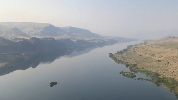
Visibility was much better; I didn’t need a clearance to get back into Wenatchee airspace. Still, I followed the river from Crescent Bar. The water was smooth as ice. I was almost disappointed to set it down at the end of the flight, but I had places to go and things to do and I was already late.

Columbia River Reflections
Just downriver from the mouth of Lower Moses Coulee, the water was glassy smooth.

I Live for This

I realized several times during the 24 hours I was part of the Curtiss Flying Boat crew in Moses Lake just how much I enjoy things like this. I live for opportunities to be part of something amazing and this restored plane was definitely that.

It reminded me a lot of another classic airplane project I’d been involved with back in the early 2000s, when I was still flying my first helicopter, an R22. Back then, it had been a replica 1919 Vickers Vimy, the world’s largest flying biplane at the time. That project predates my blog so I don’t have any posts about it. I can’t even find any photos of it, although I’m sure I have some somewhere. My involvement was several months long but ill-fated; I have a very low tolerance for incompetence and the project was very poorly managed when I was part of it. Still, it was fun flying in formation with a giant four-engine biplane and I did very much enjoy my one and only ride.

Life is short; we need to make the most of the time we have. For eight years out of college, I worked the nine-to-five grind and I pretty much hated it. I was living inside the box that society builds for most of us, the box my family clearly expected me to stay inside as I worked my way up a corporate ladder I had no real desire to be on. Surely there was more to life than an hour-long commute to sit in a cubicle before another commute to get home, repeated daily five times a week, 50 weeks a year.

I got a glimpse of just how much more was out there when I started my second career, as a freelance writer, and got to travel, see more of the country, and speak at computer conferences in San Francisco, Boston, New York, and Toronto. Traveling from hotel to hotel, setting up classrooms for training, teaching people what I knew, getting tastes of the cities I visited. Meeting with publishers and software developers. I enjoyed my behind-the-scenes participation as a computer trainer, speaker, and author.

Later, as my helicopter career began to grow, I got a chance to be involved with the kind of flying missions that most people never even imagine: multi-day helicopter excursions, raptor surveys, pipeline patrols, Grand Canyon tours, desert racing photo flights, cherry drying, frost control, air-to-air photo flights, cattle spotting, horse herding.

I cannot imagine a life without these fascinating kinds of work. A life where every day is the same as the day before it — and the day after it. How do people do it?

And it’s not just the work — it’s the people I meet along the way. People like a businessman who pays to restore classic aircraft to share them with the world. People like the aircraft restorers who can take a pile of scrap wood and fabric and turn it into a beautiful working airplane. People like a helicopter pilot who made 15 flights to help evacuate Saigon before he helped them push his helicopter off the ship. People like an airplane pilot who has flown several airplanes dating back to the early 20th century, when aviation was in its infancy.

Watch My Helicopter Videos on YouTube

Time for a shameless plug…

Flying M Air Logo

If you like helicopters, you’ll love the FlyingMAir YouTube Channel. Check it out for everything from time-lapse annual inspections to cockpit POV autorotation practice to a flight home from a taco dinner at a friend’s house — and more.

I have to add — because it was on my mind so many times on Tuesday — how sad I feel for my wasband, who could have been part of all of this if he hadn’t been so fearful of joining me in my life outside the box. The man I knew well — before he apparently lost his mind — would have really enjoyed the experience, even if he had been stuck on the ground for the flight attempts. He was an engineer, after all, and the plane is fascinating. I could almost imagine him talking to the mechanics, asking questions and learning about the plane’s idiosyncrasies. But I also know that if we’d stayed together, I’d likely miss out on so many of the opportunities I’ve had since our split. What’s sad for him is good for me. I’m sure he’s perfectly happy with his life inside his box. He’ll never know what he’s missing. Most people don’t.

But this is what I live for — experiences that make my life fuller and more interesting. And I’m always looking for the next opportunity.

Want More?

Watch this video produced by NCWLife:
2018 Entiat River Mushroom Hunt, Day 2: 4 Miles of Hiking and a Dozen Morels
In which I do a lot of hiking, see unexpected wildlife, and do my best mushrooming while driving.

I slept great, waking at about 5:30 AM.

I made my coffee and sat down to finish up a blog post I’d started the previous week about an FAA inspection of my new old helicopter. Of course, I couldn’t post it. I had no cell signal at all and didn’t expect to get one for the rest of my time in the area. I was totally off the grid for the next four days.

I made breakfast: buckboard bacon, onions, wild asparagus, tomatoes, spinach, and eggs. While I ate, I began planning my day.

The First Hunt

Cottonwood Campground
A look into the rest of the campground and beyond from near our campsite.

Since we were camped in a narrow part of the valley, it took a long time for the sun to hit the camper and the solar panels on its roof. Once the sun was on us — maybe at around 8:30 AM — it was time for a hike. I figured we’d head across the campground and into an area where more of the burned trees were still standing. I didn’t expect morels to grow in full sun so this would be a good place to start.

Although I initially packed a fanny pack with a bottle of water, small paper shopping bag (for mushrooms), my bright orange pocket knife, a Lara bar, and Penny’s treats, I decided that the hike would probably be short and I could just take was was absolutely necessary: my phone, which was preloaded with a map of the area in GaiaGPS so I wouldn’t get lost; my knife, and the paper bag. Yes, I left water behind. I didn’t expect to walk very far and it was still quite cool out.

I was wearing a long-sleeved knit shirt with a flannel shirt over that. I almost brought along a sweatshirt but (fortunately, as it turned out) decided to leave it behind.

Tall Burned Trees
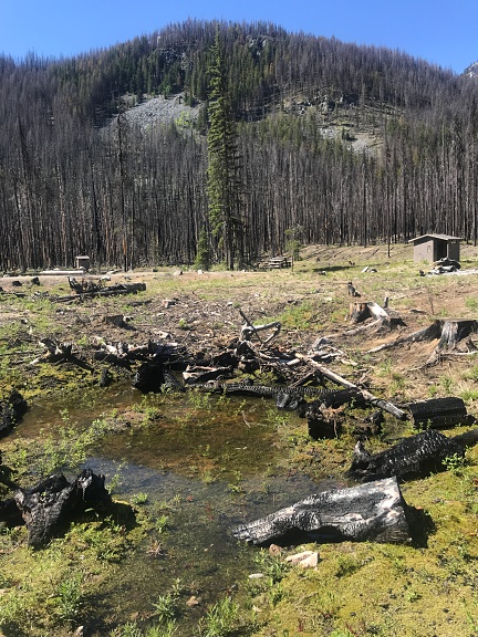
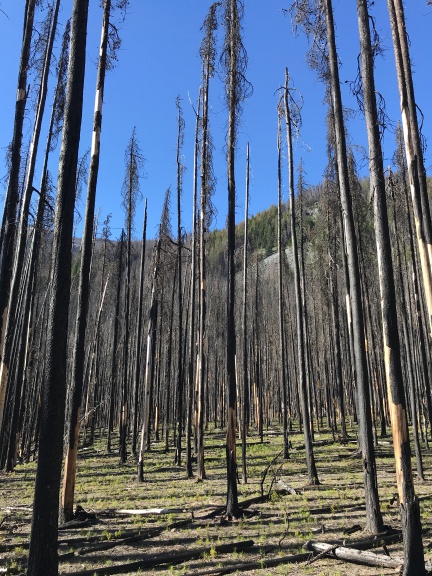
West of the campground was a forest of tall burned trees.

We headed west away from the camper, past the outhouses and stacked logs and picnic tables. Soon we were in the forest of burned trees. It was truly amazing how much damage the fire had done. All of the old underbrush was completely gone and young trees and other plants poked out of the sometimes very thick ash. All around us, the larger trees that had been burned but not toppled stood like silent sentinels. On a different day, it might have been creepy, but that morning was perfectly clear with lots of warm, bright sunlight. Soon, in fact, I had taken off the flannel shirt and was starting to feel warm in the long sleeved shirt beneath it.

New Growth on Burned Forest Floor
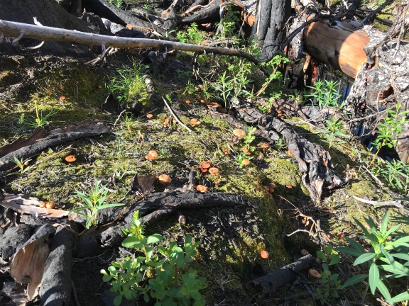
Among the new plants coming up on the forest floor were a multitude of mushrooms.

There were mushrooms everywhere. I have never seen so many in a bright and sunny place. I had no idea what they were, but I took photos. (I actually like photographing mushrooms.) I noticed three distinct varieties of what my friend Sue would call LBMs — little brown mushrooms. I thought for a while about gathering some of them to show when I met up with the group on Friday. They do a big mushroom ID thing on Saturday evening. But there were so many that I figured I could always collect them the next day.

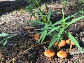
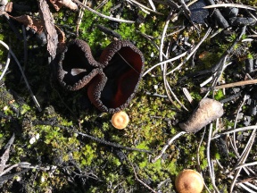
Mushrooms Under Plants Weird Brown Mushroom
Seriously: I like taking pictures of mushrooms.

Did I see any morels? No. As I wandered through the woods, climbing up into an area that seemed to have more vegetation, I didn’t see a single morel. I started wondering why and came up with four possibilities:

  • It was too early for them. It had been cold the night before — probably in the 40s. Someone somewhere had told me that morels need at least three nights in a row with temperatures in the 50s to come up. Was that true? Damned if I know. But I doubted it had been that warm at night at my current elevation of about 3100 feet.
  • Someone else had beaten me to them. After the previous year, I knew this was a real possibility. There’s big money in morel mushrooms and a lot of people hunt for sale rather than consumption. They’re more serious and dedicated than I am. But other than a few footprints I later found on a trail, there was no sign that anyone else had been in the area recently. And the forest is huge; surely they couldn’t look everywhere.
  • My mushroom eyes hadn’t switched on. Searching for mushrooms is a matter of turning on a very specific pattern recognition in your brain. I was obviously seeing mushrooms that looked like mushrooms. But morels didn’t really look like mushrooms. Maybe I wasn’t sufficiently conditioned to find them?
  • Melted Can
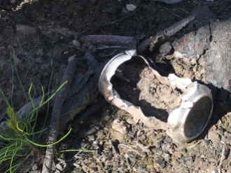
    As this melted can hints, the fire got very hot.

    Morels didn’t grow there. Maybe it was too burned up? Maybe the fire had killed off the mycelia that the morels spring from. It certainly had been a hot fire — that was obvious later when I found a partially melted beer can near a trail. (And seriously: WTF? You can carry in a can full of beer but you can’t carry the damn can out when it’s empty?)

It didn’t matter what the reason was — at least not that day. The point is, I wasn’t seeing any morels.

Penny on the Trail
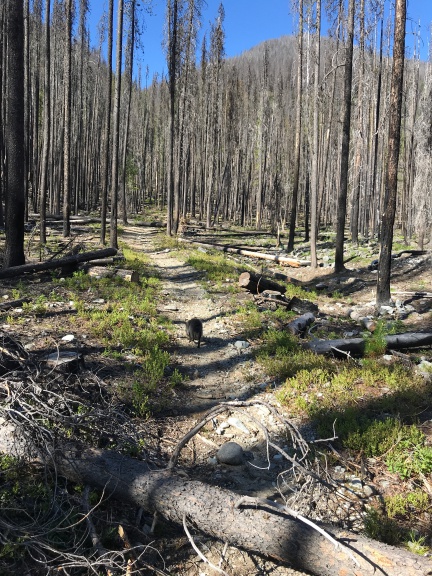
I came upon a well-worn trail that needed some work to clear away fallen trees.

I started heading back, swinging more north to put me on a different path for the return trip. And then I suddenly came upon a trail. I looked at GaiaGPS on my phone and, sure enough, the map I’d loaded in showed a trail. I traced its line on the map and decided it might be worth hiking up to where it crossed a stream. After all, mushrooms were really an excuse to get out hiking. I’d only gone about a mile and I really needed to do more. So I turned and followed the trail up the hill, hearing the sound of rushing water getting louder and louder as I went.

The trail needed work, too. This area of Washington, which is basically the foothills of the North Cascades, has tough winters. Under normal conditions, trees fall in heavy winds or with snow loads. But with so many dead trees weakened by fire damage, there were even more fallen trees than usual. They blocked the trail in more than a few places, requiring Penny and me to go over or around them.

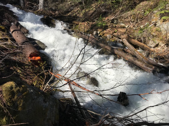
The hike was all uphill, although not really very steep. The trail had gentle switchbacks that made it easier. Eventually, we wound up alongside a wildly rushing cascade of water that cut through the forest. The sound of the moving water drowned out any other forest sound.

Shetipo Creek
The trail took me to Shetipo Creek, which was roaring down the side of the mountain.

Streamside Tank
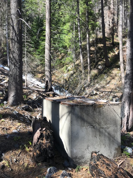
Until the fire, this tank and accompanying pipe system had brought water down to the campground from Shetipo Creek.

There was a concrete tank with wooden planks for a lid and pipes on either end. At one time, this system had taken water out of the creek and funneled it down through pipes, probably to the campground. I touched a hand to the outgoing pipe and could feel neither vibration or cold water running thorough it. I followed the incoming pipe upstream to where it went into the water. I wondered when it had been built and whether it was ever used. (The next day, I spoke to a ranger about it. He told me it had been in use until the fire when much of the pipe, which was plastic laying on the surface, had melted.)

I consulted the map and saw that I’d left the mapped trail some time ago. Odd; I hadn’t seen a fork in the trail. In any case, we couldn’t continue on a trail so we headed back. I felt done.

It was an easy hike back to the camper. I always did hike best downhill. It was around 10 in the morning and had gotten very warm. I worked up a good sweat and could go for a drink of water. I think that motivated me to get back quickly.

First Morel of the Season
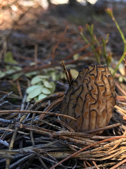
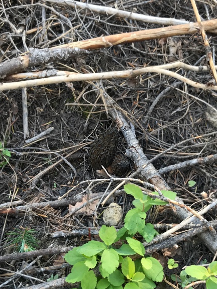
The first morel I found this year was right beside a well-worn trail.

I was near the very bottom of the trail, not far from where it ends at a parking area near the entrance to the campground, when I looked down and saw it: a morel mushroom. It was a lighter color than I’d been expecting and it was relatively small. Since I’ve never found just one morel in a place, I searched all around it. But it was there by itself.

First Mushroom

Of course, I cut it and stuck it in my bag.

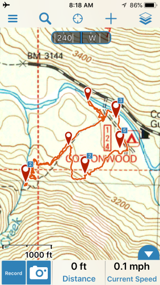
Cottonwood Campground Hike Map
Here’s the finished track in GaiaGPS for my Cottonwood Campground area hike. You can see where I diverged from the trail. The waypoint markers represent places I took photos within the app; the numbers are the number of photos there. If I remember, I’ll upload the track and photos to the GaiaGPS website when I get home and link to it here.

Then I spent another 20 minutes poking around that area, looking for more. I came up empty.

The irony of this: although I had hiked 1.8 miles, the mushroom I found was within 100 yards of my camper.

Another Campground, Another Hike

We went back to the camper, had something to drink, and had a snack. That mean half a liverwurst sandwich for me and some chicken and kibbles for Penny. By then, I’d decided that I’d be better off continuing the hunt at lower elevations. There were a few more campgrounds along the road on the way back to Silver Falls. I’d find a spot in one of them and try another hike.

So I stowed all the loose belongings in the camper, loaded Penny up in the truck, and headed out.

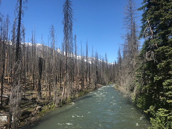
Burned Forest at River
I stopped on the bridge as I was leaving the campground to take this photo. The fire didn’t stop at the river.

It didn’t seem to take long to get to the next campground downriver from Cottonwood: Three Creek. It was a tiny campground, also damaged by fire, and I couldn’t figure out how many sites it had. I backed the camper into the one that was most intact, mostly to get it out of the way in case someone else happened to come in. That was unlikely. I hadn’t seen a single vehicle or person all day.

I didn’t feel very hopeful about this spot, so I didn’t gear up. By this time, I’d changed into a tank top and had the flannel shirt on over it as a sort of lightweight jacket. I put my knife in my pants pocket and my phone in my shirt pocket. But I didn’t bother tracking my hike. I don’t think we even did a half mile. We skirted around the campground, crossed the road, wandered around the forest there until we found a small creek, followed the creek back to the road, crossed the road again, and made our way back to the campground. Along the way, I found an archery arrow. Lots of mushrooms but no morels. The elevation was probably around 2900 feet. Still too cold? Or too burned?

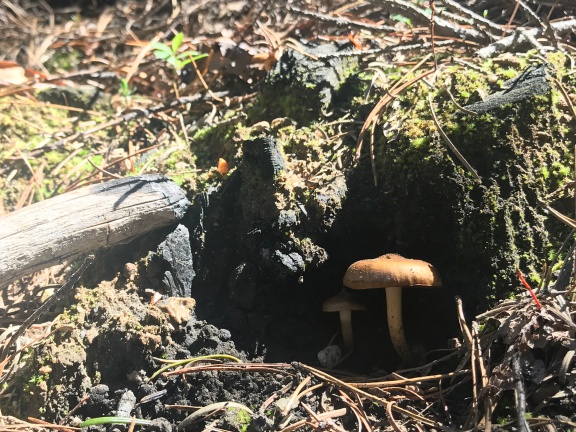
More Mushrooms
The reclusive little brown mushroom and its offspring wait at the mouth of its cave for mushroom hunters with cameras to pass by.

Drive-By Mushrooming

We got back into the truck and continued on our way. I drove slowly, not in any hurry. For much of the drive, the gravel road was narrow with a steep embankment of two to 20 feet in height on the left side of the road. As I drove, I scanned this little hillside with the crazy idea that I might see some mushrooms.

Not so crazy, it seems. I saw what looked like a morel. I might not have the best eyesight, but my vision is finely tuned for pattern recognition sometimes.

Hillside Morels
You see the two morel mushrooms in this photo, right? Try spotting them from a moving truck.

I found a wider place in the road and pulled over as far as I dared. I pushed the button that would fold in my side mirrors just in case someone came by and needed to pass. I shut the engine and, leaving Penny in the truck, got out with my knife and that paper bag. I walked back down the road to where I thought I’d seen the mushroom growing out of the hillside. Before I reached that spot, however, I saw another one. And another one. And another one.

They were all (barely) within reach. I cut them off, one after another. I got to the spot I’d seen the first one from the truck and found three more. They were all the dark brown morels I’d been expecting to find and they were all large.

Of course, a truck drove by just as I was prepping to cut one high on the hillside. I’m sure the driver knew what I was up to. I waved lamely. He waved back. Then he was out of sight around a curve in the road.

I continued hunting along the embankment but came up empty. So I headed back along the road toward the truck. I found a game trail that climbed up the embankment and followed that, continuing my search on higher ground. Nothing. I came back down, now past the truck, and headed back.

I found three more. I cut the first two and was about to cut the third when I remembered a promise I’d made to myself: I wouldn’t take every mushroom I found. I’d leave behind small ones that were hidden behind brush and difficult for others to find. This way, I’d help prevent the morels from being over harvested so they could continue to grow. This last mushroom was a perfect candidate, so I left it right where it was.

I got back to the truck and stowed the bag of mushrooms inside the camper’s back door where it was likely to be cooler than the truck’s dashboard and safer than the passenger side footwell.

Of course, I kept looking as I drove. But other than finding one huge one from the truck much later in the day, I had no further success.

I was passed by not one but three Forest Service trucks going the same way I was. In each case, I pulled over to let them pass. They probably thought I was driving so slow because of the camper and the unpaved road.

At North Fork

I passed Spruce Grove Campground for two reasons: first, the tight right turn would have required multiple maneuvers to make, and second, the sign said “Trailers not Recommended.” Although I wasn’t pulling a trailer, I did have a long, high profile vehicle that required more than the average amount of space to turn around. I had no idea what the condition of the forested campground would be and didn’t feel like dealing with a challenge. So I kept going.

The next campground was North Fork. There was a barricade with a Road Closed sign that had been moved out of the way. I read that to mean that it was open so I pulled in.

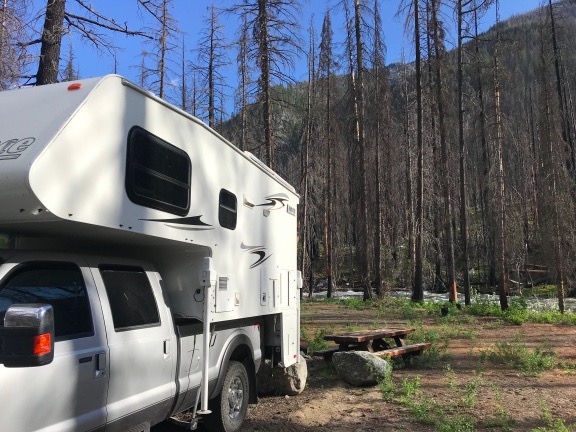
There was a lot of debris all over the campground. Burned and fallen trees, mostly. The mess left from winter. Again, I had trouble identifying more than a few campsites. I backed into one along the river which, unfortunately, was not level. It would do, however. If I decided to spend the night, I could always put the back wheels up on blocks.

North Fork Campsite
Our “campsite” at North Fork Campground.

I made lunch: sardines with minced onions on a bed of mixed greens with balsamic vinaigrette dressing. I drank water. I gave Penny some sardine juice — they had been packed with olive oil — over her kibbles and she ate them up. Then I cleaned off the morels I’d found so far, put them in a plastic container, draped a wet paper towel over them, and stuck them in the fridge.

Morel Collection
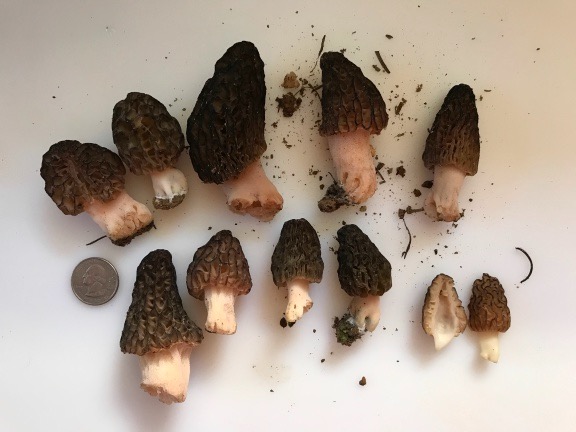
Here are the morel mushrooms I’d collected that morning, before I cleaned them. The one cut in half is the first one I found. Morels are hollow inside.

The elevation there was about 2650 according to the map I’d loaded in GaiaGPS. There was a place called Entiat Falls just 1700 feet downriver. I thought it might make a good hiking destination with a mushroom hunt along the way. I packed the fanny pack with the paper bag, a pair of binoculars, a snack bar, and a bottle of water. Then I grabbed Penny’s leash and we headed out.

I soon discovered that there was no trail from the campground to the falls. A rushing stream — North Fork — crossed the road at a bridge and the only way for us to cross it to continue downstream was to get on the road. On the other side, we went back into the woods, but the going was tough with lots of marshy areas. It didn’t take long before I got tired of trying to find my way and headed back to the road.

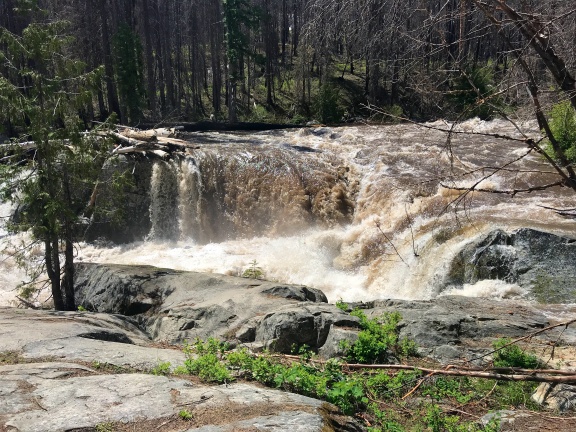
Of course, by that time, we were abeam Entiat Falls. There was a parking space there with an obvious way down to the falls. “Falls” is being generous — all it really is is a place where the river plunges over some really big boulders. It was rushing like mad with a thundering sound and lots of spray.

Entiat Falls
Entiat Falls wasn’t much of a waterfall, but the water sure was moving fast and loud.

I wasn’t done walking yet so we continued down the road. Because we were on the road and not in the woods, I put Penny on her leash. We walked along the oncoming traffic side so I could scan the embankment for more mushrooms. The road was paved there and rather pleasant, with no traffic at all. I could hear birds and the rushing water off to my right and not much else. The temperature was warm, but I was comfortable.

I checked GaiaGPS to see how far I’d gone. 8/10 mile. I decided to go a full mile before turning around and kept walking, scanning the ground at the side of the road, with Penny leading the way on the leash.

I don’t know what alerted me to the movement ahead. Maybe it was Penny. Maybe it was just something I caught in my peripheral vision. My brain said deer — after all, I’d seen at least a dozen of them in the previous 24 hours — before my eyes locked on to what it was.

It wasn’t a deer. It was a bear.

A big, black bear on all fours ambling across the road about 100 yards ahead of us.

Shit.

I turned around and walked as fast as I could back the way we’d come, dragging Penny along with me. To her credit, she didn’t bark. I kept turning around to make sure the bear wasn’t following us, remembering everything I knew — and didn’t know — about bears. Was I supposed to make noise or be quiet? Was I supposed to run like hell or not turn my back on it? Did bears eat people? Small dogs? Or did they eat trees like pandas and koalas? Surely I’d lose a race with a bear. I was so damn out of shape.

And that out-of-shape feeling was confirmed the farther I speed-walked away. Soon I was sweating, panting, nearly out of breath. And I knew exactly how far away the truck was: nearly a mile! If this bear came after me — or if it had friends in the woods up ahead of us — there was no way I’d be able to beat it tback to the truck.

But there was no chase. The bear, which must have seen us, was simply not interested in us. There were no other bears in the area — at least none willing to put in an appearance. After speed-walking for about a half mile, I finally slowed down to catch my breath. I still wanted to get to the truck and camper as quickly as possible, but I wasn’t interested in having a heart attack along the way.

We reached the bridge and, just before crossing it, I looked down and found a morel mushroom. Go figure, eh?

I looked around a bit, but didn’t find any others. No worries. The only thing I wanted to do was get into the camper, close the door, and have a nice, cold drink.

Five minutes later, that’s where I was.

Siesta

I drank a lot of orange juice mixed with water. I used two plastic cups to make ice in the freezer; I had no ice trays with me. Then I crawled up onto the bed to relax and cool down.

Within 10 minutes, I was dead asleep with Penny on the bed beside me.

I slept lightly for the next three hours. I almost got up once but my body told me I wasn’t ready yet so I went back to sleep.

Finally, I dragged myself awake. I looked outside and saw the storm clouds I’d been expecting that day. While it’s true that I couldn’t go online to check the weather, I had checked it before leaving home. Rain was definitely expected and there was the dark storm cloud that would bring it.

I realized that the trees around me were kind of fragile and that a storm with strong winds could topple one or more, possibly onto my camper or across the road. The narrow part of the road between North Fork campground and Silver Falls had looked prone to flooding. I suddenly realized, with my half-awake brain, that I didn’t want to get stuck out that narrow bit of road. It was time to move on to find another place to spend the night and ride out whatever storm might be coming.

So I stowed the loose belongings again, climbed into the truck with Penny, and headed out.

Needless to say, I was looking for bears along the road about a mile from where I’d been parked. No joy. But a little farther down the road, my drive-by mushrooming skills paid off again: I found a humongous morel. I hopped out of the truck, ran across the road, and cut it off for my collection. That made an even dozen.

National Forest Camping

One of the things I like best about National Forests is that unless otherwise posted, you can camp just about anywhere you can park. I had a few ideas for spots just upriver from Silver Falls that I’d seen the previous year and that’s where I headed.

Along the way, where the road got very narrow with embankments on either side, I saw a handful of deer. No more bears.

I drove past the gate that had been closed the previous year and made a right turn. There was a campsite down along the river there, but it was already occupied. I crossed the bridge. The campsite on the other side of the river was occupied, too. I followed the paved road around to the south, noting one empty spot that would do in a pinch. But what I was looking for was a left turn on a narrow gravel road that wound down into the forest, closer to the river.

The spot I remembered was already taken, but there was another spot I didn’t remember about 100 yards before it. It was certainly large enough for me to get the truck and camper in. I almost turned into it, but then I realized that would have my back door facing my neighbors. So, instead, I backed in so my camper door would face the woods and a tiny creek that meandered past.

I got out to check the level inside the back door of the camper, then got back into the truck to reposition. I did this twice. Finally, it was level enough for comfort. I rolled up the truck windows, shut it off, and got out with Penny and my laptop, which had been charging in the truck all day.

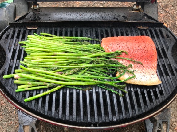
The trees around us looked healthy and not likely to topple in a wind storm. I took out my little grill and set it up on the ground outside the back door. I screwed on the propane can and fired it up. Soon I was grilling up a nice piece of salmon and the last of the wild asparagus I’d gotten from a woman who I’d helped with a bee problem the week before.

Salmon Dinner on the Grill
Salmon dinner on the grill.

Thunder rumbled overhead, but the rain didn’t start until after I’d brought in my dinner. I put some of it aside to include in an omelet later in the weekend and ate the rest. It was good, although I think I would have enjoyed the salmon more if I’d cooked it a bit longer.

By the time I was done eating, it was raining hard. It would continue to rain hard all evening and into the night.

I spent some time working on a blog post about the previous day’s trip up to Cottonwood campground. By 9 PM, I was exhausted — which really surprised me, given the length of my nap earlier in the day. I was dead asleep by 9:30 PM while the rain pattered on the roof overhead.