Personal Aerial Photography

A few thoughts from someone who has been doing it for a long time.

I’ve been doing aerial photography since I began flying helicopters, way back in the late 1990s. At first, it was a few digital images shot awkwardly with my left hand while my right hand was busy on the cyclic. Later, I went through a variety of different cameras mounted in and on the helicopter, some set to automatically shoot whatever was in front of them and others with limited control from inside the cockpit. I had a POV.1 camera in 2008, which I replaced with a GoPro Hero in 2010. Since then, I’ve had a variety of GoPros, right up to a GoPro 3+. (Even I get tired of throwing money at new versions of hardware.) I’ve created numerous still and video images from my helicopter, some of which still amaze me.

Great Salt Lake
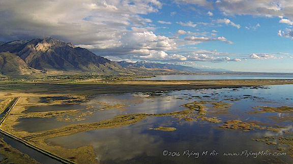
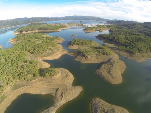
This is one of my very favorite aerial photos: the north end of the Great Salt Lake, shot with a GoPro 3 mounted on the nose of my helicopter as I flew it south to Arizona last autumn. The camera was set to time-lapse mode, shooting one photo every minute. We were probably about 700 feet up here.

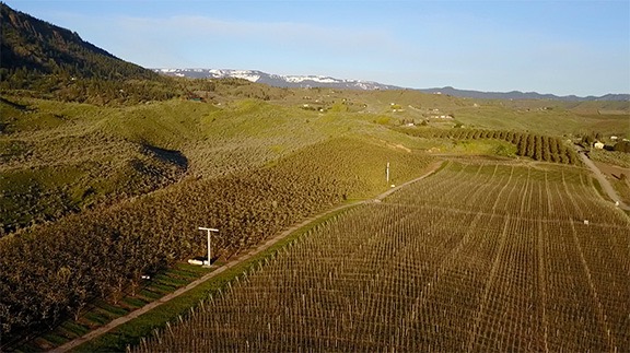
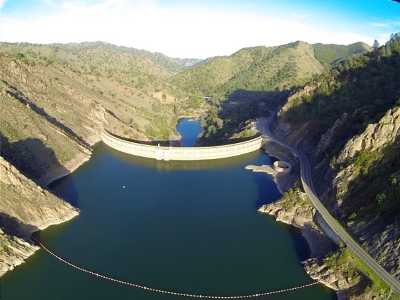
But the point of this discussion is this: I’ve been looking at the world from a different point of view for about 20 years now. It’s not the same point of view as an airliner cruising at 29,000 feet and 500 mph. And it’s not the point of view of a private plane cruising at 1,500 feet and 140 mph. It’s the point of view of a helicopter, usually cruising at an average of only 500 feet at 90 miles per hour, with the ability to stop, make sudden turns, or descend for a closer look.

Pilots get used to seeing the world from this different perspective. After a while, it isn’t anything special. We can get a feel for how different things might look from the air: a canyon, a river, a farm, a junkyard. That doesn’t mean it gets boring — it doesn’t. But it does mean that we don’t see anything special about it anymore.

Kind of sad, isn’t it?

That’s one of the reasons I like flying with first time passengers. I get a reminder of what it’s like to see things from a new perspective.

Part 107 Explained
Want to become a commercial drone pilot? Start by learning all about the FAA’s Part 107. This book will help. Buy the ebook edition on Amazon or from Apple. Or buy the paperback edition on Amazon.

But I was reminded again about the novelty of seeing everyday things from above when I watched a documentary on Lynda.com called “Flight Club: Drones and the Dawn of Personal Aerial Imaging.” Listening to the people explain how they felt when they saw these low-level aerial images really helped me understand just how amazing aerial photography is, especially to folks that don’t have a helicopter at their disposal — which, admittedly, is most people.

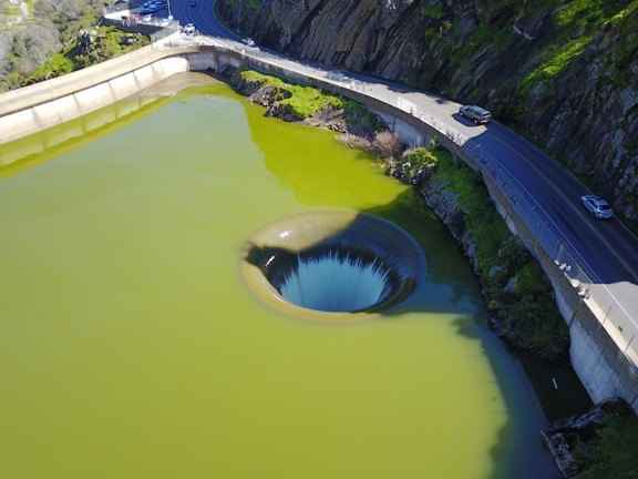
Folks who know me well know how anti-drone I was when they first started appearing on the scene a few years back. But what convinced me that they were serious photography tools is the quality of the images they produced and the ease at which an operator could get them. I dove into drone photography last winter with the purchase of a Mavic Pro and will be doing a lot more of it in the months to come.

If you are curious about drones for aerial photography, I highly recommend you spend 25 minutes or so watching the documentary I saw last night. I think you’ll enjoy it and learn a lot about why people are so excited about it.

If you do watch, let me know what you think.

More about the Wind Machines

A few new videos.

Back in April 2015, I blogged about the wind machines commonly used for frost control in the Wenatchee Valley. Resembling tall fans, different versions of these machines can be found in agricultural areas throughout the west wherever frost — especially early spring frost — is an issue. Around here, they’re often in low areas subject to thermal inversions.

Wind Machine
The wind machines that were running this morning. That’s the Mission Ridge Ski resort in the background. Photo shot with my Mavic Pro.

The machines are fans that generate wind. The blades spin fast — faster than you might think watching the video below — to circulate the air. The fan heads rotate to constantly change the direction of the wind. The net result is that the air is circulated, bringing warm air from above down into the crops.

In the almond orchards of California, they use helicopters to do this. I think it’s because the orchards are so big that they simply can’t install and maintain as many wind machines as they need. The helicopters are likely a lot cheaper in the long run, especially when you have a few years in a row when they’re not needed. I’ve been on frost control contracts for the past five winters now and have yet to turn a rotor blade over an almond tree. (Global climate change?)

This winter was particularly long, setting the tree fruit back two to four weeks. The cherry trees are still blooming around here; last year, the cherries were already beginning to redden in the orchards closest to my home. Nighttime temperatures at my home have been in the low 40s. But in the orchards below me, pockets of colder air form. And this morning, they got cold enough to trigger the temperature-set auto start feature on the wind machines in the closest orchards.

I don’t know exactly when they started. I was up at 4:30, reading before getting out of bed, and I didn’t hear them. But by the time I made my coffee at 5 AM, I could hear them faintly through the walls and windows of my my home. I stepped out on the deck for a better look in the predawn light. The sound was louder and I could see two of the machines to the west spinning. My ears told me that one to the northeast, which I can only see from a handful of spots on my deck, was also spinning.

Here’s the zoomed in video I shot with my phone. When I shut up, you can hear the wind machines.

I did a Periscope — that’s a live Twitter video — of the wind machines. A handful of people tuned in and I answered questions as they came up. I was frustrated that I couldn’t zoom in. I signed off, used the video feature on my phone to capture a short zoomed-in clip, and posted it on Twitter. Then the sun rose and the light got good and I did another Periscope that was mostly to show off how beautiful the area was. The wind machines droned in the background of my voice as I described various things and answered questions.

I went inside, washed some pots from cheesemaking, and listened to the radio. I could hear the wind machines faintly through the walls and windows. I was sort of bummed out that I couldn’t give people a better view.

Part 107 Explained
Want to become a commercial drone pilot? Start by learning all about the FAA’s Part 107. This book will help. Buy the ebook edition on Amazon or from Apple. Or buy the paperback edition on Amazon.

And then I remembered my Mavic Pro.

It took only two or three minutes to set it up. I launched it from my deck, got the video camera going, and sent it to the wind machines, stopping before it got so close that the wind could affect it. The light was beautiful and the image the Mavic sent back to me was clear. I hovered for a while to capture a good clip and then flew around a little, just taking in the view with the camera running. I stopped the video camera, took some stills, and then flew home for some more video of my home and the area around it.

Back inside, I made a fresh cup of coffee and spent a few minutes editing the video and setting it to music. It’s unfortunate that the Mavic doesn’t capture sound, but I understand why: it would be capturing its own buzzing sound, which isn’t pleasant. So music will have to do.

A side note here: I’ve been thinking a lot lately about how much I like living here. I realized — and I think I mentioned in one of those Periscope videos — that I like it here more than anywhere else I’ve lived. I’m not sure if it’s because of the place itself or the fact that I have a home with an amazing view built to exactly meet my needs or because after a stifling relationship that went on a lot longer than it should have I finally have the freedom to do what I want to do with my life and time.

Whatever the reason, I just want to remind readers that we all have just one life and it will eventually end. Don’t waste it stuck in a rut or in a place you’re not happy.

FAR 107 Explained

I wrote a book last week and it’s available now.

Way back in 2012, I self-published three books. The first was the same kind of computer how-to book I’d been writing since 1991. It was about iBooks Author software and was the first book out about it. It sold about 3,000 copies and continues to sell to this day. The other two were less successful. One, about sorting data in Excel, sold a few hundred copies. The other, about making movies, sold about 500 copies. All of them were available in multiple formats, including print.

I was on track to release a book a month when the idiot I was married to decided he needed a mommy more than a wife and found one online. My life got thrown up into the air. Soon I was busy with a divorce and moving and building new home in another state. My goal of publishing a series of short books got put on the back burner. And then my flying business really took off and I didn’t see a real need to revisit that plan.

Until the other day.

I got a call from a local drone enthusiast — that’s what he called himself. He’d seen on Facebook that Flying M Air, my company, had begun doing drone photography. He had some questions about it. I had some time so we chatted on the phone.

During the course of the conversation, he asked me two regulation-related questions that I didn’t know the answer for. And that bothered me. You see, I’d done everything I was supposed to do to get a remote pilot certificate with a small unmanned aircraft system (small UAS) rating. I’d satisfied the FAA’s requirements and had a printout of my temporary certificate sitting on my desk. I should know the answers to his questions, but I didn’t.

So a few days later, when I found myself sitting around the house on a rainy day, I looked up the answers. And then I started a careful re-reading FAR Part 107, which is the FAA regulations for commercial small UAS (AKA drone) flying. And I realized that just like all the other FARs, Part 107 was written in the same government-style “legalese,” with the usual exceptions and cross-references that make them nearly impossible to understand.

And that’s when I realized that some folks might find it helpful to read a translation, in plain English, so they could actually understand the rules.

So I wrote one.

Part 107 Explained
Here’s the book cover. A friend asked how I got the photo. I basically flew my Mavic to face me on my deck early in the morning when the light was good. I’ll get a new shot when the fruit trees are in bloom for the next edition.

FAR Part 107 Explained: A Definitive Guide for Serious Drone Pilots is the result.

I started with the actual text of Part 107 and inserted my translation, in red type, beneath each section or paragraph. Along the way, I provided in-document links to other sections of Part 107 and web links to other FARs and documents that Part 107 refers to. I even included links to helpful web pages for registering a drone, reporting an accident, taking the course I did to satisfy training requirements, and changing your name or address in FAA records.

The resulting document isn’t long — after all, Part 107 is relatively short — but it is complete and works as a stand-alone guide to Part 107.

I generated two formats (so far): Apple iTunes bookstore and Amazon Kindle. I submitted to Apple on Friday and Amazon yesterday. (Guess which one was available first?)

In any case, if you’re interested in flying your small UAS/drone for compensation, I hope you’ll consider investing $6.99 for my book. Right now, it’s available as an ebook only; if there’s a big demand for it, I’ll consider a print version. You can buy it on Amazon.com or buy it from Apple.

And I have to admit that it feels good to be writing books again, even if they’re short ones like this.

Our Government In Action: Commercial Drone Pilot Rating Edition

How much more inconvenient can they make it?

Mavic Pro
My flying camera takes amazing still and video photos.

Regular readers of this blog might know that I bought a Mavic Pro flying camera back in January 2017. Before spending the money, I did my homework on FAR Part 107, which sets forth rules and regulations for commercial sUAS (small Unmanned Aerial Systems, AKA drones) operations. The certification process was pretty simple for existing pilots: study the rules, take an online training course, pass the test at the end of the course, and submit an application to the FAA for the sUAS rating to be added to my existing pilot certificate. I did all of this on December 20, 2016.

I fully expected to get some kind of correspondence from the FAA in the mail. Although some of my mail was forwarded to me while I was traveling this winter, not all of it was. Still, I didn’t get anything from the FAA for this in my forwarded mail or the mail held for me at home. Nothing.

Yesterday, I revisited the process, certain that I had neglected to do something. I followed the trail of multiple websites to find the place where I had filled in my application. I logged in and reviewed the application, which was dated 12/20/16 with a status of “Submitted by Applicant.” There were no additional instructions or useful information to tell me what I needed to do next or whether my application was even being processed.

I made four phone calls. Eventually, I got a guy at the FAA’s Spokane FSDO (Flight Standards District Office). For those of you unfamiliar with that kind of FAA office, its basically a regional office handling local FAA matters like aircraft and pilot certifications and airport operations. He told me that all I had to do was take my printed application to the FSDO and have someone there check my ID. They could then print out a certificate.

I wasn’t sure I’d heard him right. I had to drive to Spokane — which is 3 hours away by car — and show my driver’s license to someone in the office to prove I was who I said I was? So I’d need to spend six hours of my day, plus whatever time it took in Spokane, just to verify my identity?

Yep. Or I could go to the Seattle FSDO in Renton, WA (also 3 hours each way). Or the Portland FSDO in Hillsboro, OR (5-1/2 hour each way).

Of course, if I knew a DPE (Designated Pilot Examiner) who was closer, I could pay him to verify my identity and let him submit the paperwork. Although the FAA guy didn’t say this, I knew what would happen next: the paperwork would disappear into a black hole at the FAA for another three months.

As you might imagine, this completely floors me. In the past few years, I have made numerous very large banking and real estate transactions, each of which required positive identification, entirely via the Internet. Hangar sale, house sale, land sale, loan applications, wire transfers. Transactions worth hundreds of thousands of dollars in total, all requiring that I be identified before completing the transaction.

Why is it that the banks and title companies I worked with were able to verify my identity online when the FAA — which already has the name, address, phone number, and social security number associated with my existing pilot certificate — can’t?

Part 107 Explained
Want to become a commercial drone pilot? Start by learning all about the FAA’s Part 107. This book will help. Buy the ebook edition on Amazon or from Apple. Or buy the paperback edition on Amazon.

Apparently, it’s because the FAA treats this as a brand new pilot certificate instead of an add-on rating. It doesn’t matter that they know who I am because they meet up with me at least once a year for my Part 135 certificate. I still have to jump through this ridiculous and meaningless hoop.

Just to get a piece of paper to make my commercial drone pilot operations legal. In the meantime, hundreds, if not thousands, of drone pilots are out there doing the same kind of work that I want to do without any kind of certification. Heck, I’m willing to bet that at least half of them haven’t even bothered to register their drones.

Is there any wonder why people break the rules? Could it be because the rules are ridiculous and cumbersome to follow?

So today I’ll pull my little Honda out of the garage. I’ll gas it up in town and hit the highway. I’ll drive all the way to Spokane and visit the fine folks in the FSDO there. They’ll look at my license and they’ll check a few boxes on the form I’ve printed out for their convenience. Then they’ll go into a back room and punch some keys on a computer keyboard. Moments later, a piece of paper — my temporary certificate, I guess? — will come out of a printer. They’ll hand it to me and I’ll begin the long drive back home, stopping for gas again along the way.

A whole day of my time blown.

In a few weeks (or months?), I’ll get a new plastic card from the FAA’s main office in Oklahoma. I’ll slip it in to my wallet with my existing pilot certificate — another card to carry around all the time.

But at least I’ll be legal to do commercial drone photography. That’s a lot more than I can say about a lot of the other drone pilots out there.

Lake Berryessa and the Glory Hole

Not something you see every day.

I spent a few weeks in the Sacramento area of California — as I have been since 2013 when I brought my helicopter there for its first frost control contract — in late February and early March. I’ve gotten to know the area pretty well over the past five years and as I continue to explore new places, I also return to the old ones. Lake Berryessa, the largest lake in Napa County, is one of these places.

I first discovered it during a drive up Putah Creek, starting in Winters, CA. From there, I made a stop at the Lake Solano Campground (which I eventually stayed at for the first time this year) and noted its crazy collection of peacocks. Farther up the road, I passed numerous parking areas for fishing and hiking and picnicking. Still farther, the road crossed the creek, wound up a hill, and passed the Monticello Dam, which holds in the waters of Lake Berryessa. Penny and I have hiked in various places along the shore, driven much of the west side’s shoreline, and even flown over it numerous times in my helicopter.

Aerial View of Lake Berryesssa
An aerial view of Lake Berryessa, shot with a GoPro on my helicopter back in March 2014. The water was very low.

For the first four years I’ve been in the area, the lake level was low — very low. This isn’t surprising given the serious drought that affected nearly all of California. All of the lakes I flew over were low. But this year things were different. This year, all the lakes are full, nearly full, or even — in some cases — overflowing. Lake Berryessa is one of the lakes with too much water.

Man-made lakes — basically, any lake that holds water in with a dam — usually have flood control features built in that guide excess water safely out of the lake and into a receiving stream or river. This is normally done with the use of a spillway that can be opened or is automatically utilized before the water level reaches the top of the dam.

Spillways come in different styles. The most common is a sort of water chute that excess water flows down, away from the dam. Most dams have this kind of spillway. The Oroville Dam, which has been in the news a lot lately, has spillways like this, one of which was severely damaged by floodwaters.

Another less common type is an open bell mouth spillway. That’s the type at Lake Berryessa. It’s a round concrete hole not far from the road and the dam. From Wikipedia:

Near the dam on the southeast side of the reservoir is an open bell-mouth spillway, 72 feet (22 m) in diameter, which is known as the Glory Hole. The pipe has a straight drop of 200 feet (61 m), and the diameter shrinks down to about 28 feet (8.5 m). The spillway has a maximum capacity of 48,000 cfs (1360 cms). The spillway operates when there is excess water in the reservoir; in 2017 after heavy rains it started flowing, for the first time since 2006.

Monticello Dam w/Glory Hole
In looking through my archive of photos from 2014, I found a GoPro photo of the dam from the air that clearly shows the Glory Hole when it isn’t in use.

It was in the news in February because the lake had finally filled, after 11 years, and water was flowing into the Glory Hole. Of course, I had to go see it. So when I got the helicopter into California and needed to a “maintenance flight” to check a few things, I headed over there. Sure enough, water was flowing into the hole and a small gathering of people along the road were looking in. I flew by a week later and the water was still flowing in.

I wanted to see it again from the ground, so I returned on Saturday. By that time, Penny and I were on our way home from nearly four months on the road so I had the Turtleback on my truck. Once again, I’m so glad I downgraded from my big fifth wheel; parking in the very crowded parking area was remarkably easy.

There were a lot of people there. It was, after all, Saturday and the Glory Hole had been on the news quite a bit. It made a good, easy, and free point of interest for sightseers.

Glory Hole from the Road
The Glory Hole, photographed from the road. That’s the dam to the right. The water is pretty close to the top.

Penny and I joined the crowd and walked along the road for a good look. The chain link fence made it difficult to get a good photo. The hole is right next to the road and pretty much fills the camera lens. But I did my best.

A guy was out there with a Phantom 4 drone so I decided to give my drone (AKA flying camera) a shot when he was done. I went pack to the truck, put Penny inside, and pulled out my drone. Within about 5 minutes, I had it all set up in a clear area between parked cars and the fence downstream from the dam. When I was sure the other drone had landed, I launched mine.

Understand that I’m still learning how to use my Mavic Pro. I’m also very careful. Immediately after launching, I took it up over the lake, away from people. Then I captured some still and video shots of the Glory Hole from the air, including a short pass where I flew directly over the hole with the camera pointing straight down.

Glory Hole from the Air
I really don’t know why the water looks so green in this shot. I don’t think it’s the camera. It must be something to do with the light.

I tweeted the video clip and got a lot of positive feedback about it. I also got a request to contact the folks at a video licensing company who want to represent me on the resale of the clip to news other media organizations. I’ll all for that, provided my FAA Commercial UAS Pilot certificate has come through; it’s not legal to sell drone photography without it. Need to get home and check my mail to see if the paperwork is there; I applied back in January so I should be good.

I need more practice using my Mavic and I intend to get some on my way home. I had it out again this morning from my campsite at Bodega Bay. I’m hoping to put together a little montage when I get home and share it here on the blog. Stay tuned.

Congratulations! You’ve made it to the end of yet another lengthy blog post here on An Eclectic Mind. If you got this far, you must have gotten something out of what you read. And isn’t it nice to read Web content that isn’t full of annoying ads?

How about doing something to show your appreciation? I’d love it if you’d add a comment at the end of this post to share your feedback with me and others. But I’d really love it if you’d visit my Support page and chip in a few dollars to help cover the cost of hosting this blog and motivate me to keep writing new, interesting content. It’ll only take a moment and I really would appreciate it!