My Traveling Bees

If spring won’t come to the bees, the bees will go to spring.

I was very surprised, about a month ago, when a fellow helicopter operator offered me a 6-week (minimum) frost control contract in the Sacramento area. I’ll explain what frost control is in another post; for now, just understand that it required me to relocate with my helicopter to California for at least the 6 weeks of the contract.

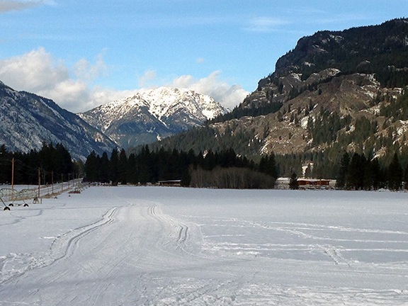
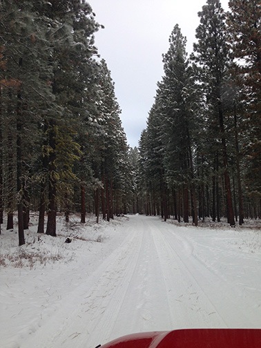
Winter in Washington had been mild, with seasonal daytime temperatures around freezing but very little snow. All that changed about two weeks ago when the temperature dropped and then the snow started falling. Not a lot of snow, but enough to make it actually feel like winter for the first time. It was my first real winter since leaving New Jersey in 1996 or 1997 and although I didn’t exactly mind the cold weather, I was ready for spring. So I was very pleased to be offered an early escape from winter that would bring me back home in time for the local spring.

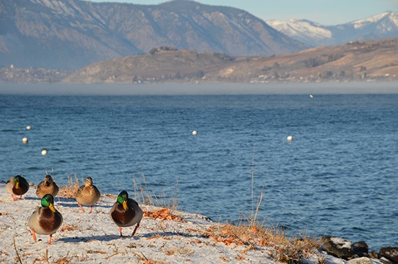
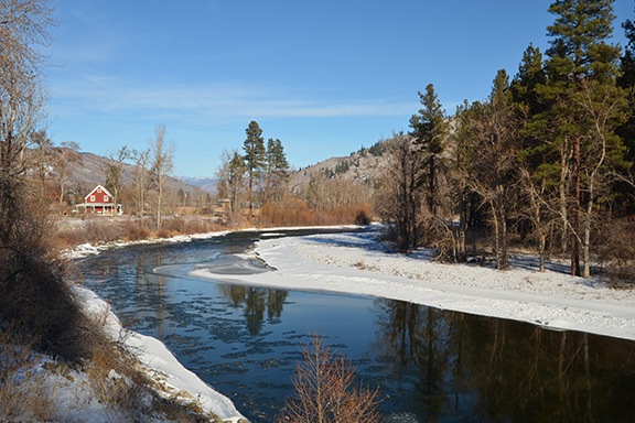
My bees, of course, were all set up for winter. I’d lost one of the three hives and wasn’t sure how the other two were doing. The cold weather was keeping them inside their hives where they’d cluster together around the queen to keep her and themselves warm. It wasn’t a good idea to open up the hives for a good look when it was cold out. I’d already had a peek in late January and had a good enough idea of the situation.

The Crazy Idea

Sometime in the last week before moving my RV out of Washington, I got this crazy idea: it was warm in California and the entire area would be full of blooming almond trees and then walnut trees. If I brought my bees with me, they could skip the last two months of winter and get an early start on spring. I might even be able to get a good start on honey production and do a hive split. And of course, with so many bees in the area for almond pollination, there was even a chance I’d be able to capture a swarm or two.

But could I bring my bees? While it’s true I was driving a full bed pickup truck, I was also pulling a fifth wheel RV. But that fifth wheel had a gooseneck hitch on it, greatly reducing the amount of space the hitch needed in the bed. Could I fit the hives in the pickup bed and still tow the trailer?

The two hives were set up differently. One, the weaker of the two hives, was a single deep hive body with a frame feeder in it to supplement the frames of honey. The other was a deep hive body with a medium body on top; that contained a top feeder. But I didn’t need that top box or feeder for the trip south. I could make that a single deep box high, too. That would fit in the truck bed beneath the fifth wheel.

In all honesty, it wasn’t until the day before I pulled out that I made the decision to give it a try. Even then, I decided that if I couldn’t get it to work out, I’d leave them behind. But late Wednesday morning, I was up at my property with the pickup parked in eight inches of relatively fresh snow near the hive shelter I’d built the previous autumn. And as the temperatures climbed into the high 30s, I was unwrapping the winter insulation from the hives, reconfiguring the taller hive, strapping the hive boxes between their covers and bases, and stuffing rags into the hive entrances. Then I lifted them into the back of the truck. I put the dead hive in there, too; I’d need its components for a hive split or swarm capture and may as well bring it along.

The Drive South

By 12:30 PM — a half hour after my planned departure time, I was at the airport where I’d parked my RV before the snow had come. (Good think I did!) It was all packed and ready to go. I just needed to hook it up to the truck.

When I backed into position, however, I realized that there were bees flying around the back of the truck. On closer inspection, I discovered that they were escaping through the bottom of the hive. You see, I’d replaced the solid hive bottoms with screened bottoms for mite control. While the weaker of the two hives had a Mann Lake screened hive bottom, the other one had a hive bottom made by a friend of mine. He’d used 1/4 inch mesh. As I pointed out to him, he really needed to use 1/8 inch mesh — the bees could squeeze through the larger openings. And indeed, that’s what they were doing. Some of them were coming out for cleansing flights. This would be a problem.

I went into my hangar and found some cardboard. I stuffed it under the hives. Then, for good measure, I stuffed an old saddle blanket I keep in the truck under the hive the bees were coming out of. That would have to do.

Day One
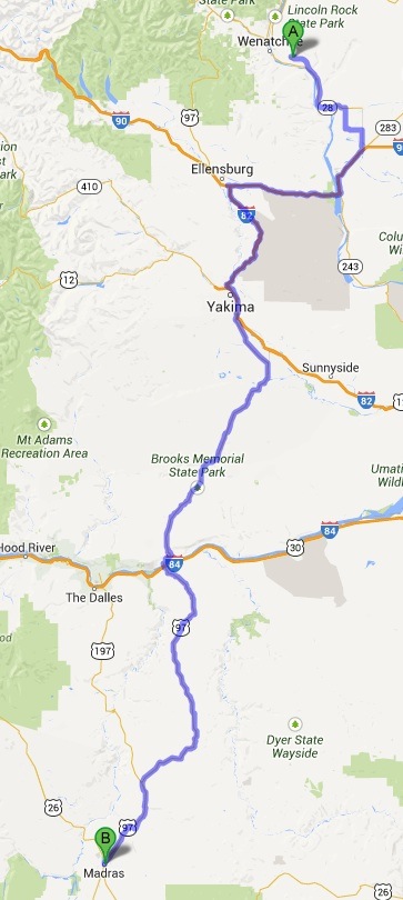
I covered 287 miles the first day of driving.

I hooked up the RV, did my walk around, climbed into the truck, and started off. It was 1 PM and I was hoping to cover about 450 miles that day all the way to a casino near Klamath Falls, OR.

The drive was long but pleasant, with lots of sun and scenery. I drove through Quincy and got on I-90 at George. Then onto Route 97 near Ellensburg. South through Yakima. Cross the Columbia River at Maryhill State Park. Diesel on the Oregon side. Then mile after miles of rolling Oregon farm and ranch land.

It got dark along the way. I don’t like driving in the dark. Weird shit happens.

I changed my destination from Klamath Falls to Bend and then to whatever outpost of civilization I could spend the night in.

I wound up in Madras, parked overnight at a Les Schwab tire dealer parking lot, with a coffee stand on one side of me and a Subway restaurant across the street. I’d driven 287 miles.

I checked the bees before going in for the night. The hives had shifted around a bit, but there were no bees outside the hive. That didn’t surprise me. It was too cold for them to want to come out.

Icy rain fell during the night. In the morning, on my way to the coffee stand at 6:15 AM, I nearly slipped on the ice that had formed in the parking lot.

No sign of life among the bees. But I honestly didn’t expect them to be out and about with temperatures around freezing.

Day Two
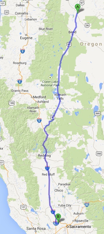
I covered 461 miles on the second day of my trip.

I waited until 7:30 before continuing on my way. (Related: Subway, which opens at 7 AM, sells breakfast sandwiches.)

I continued along Route 97, passing through Bend and Klamath Falls. I was lucky to find a truck stop just before the border of Oregon and California where I fueled up for the second time on the trip. The truck was getting about 300 miles per tank of fuel. (It gets way better mileage than the Chevy I used to drive.) I realized that I might make it all the way to my destination without refueling again.

I followed a remarkably straight piece of road that had to be at least 50 miles long before climbing and descending in the foothills again.

At one point, I had an amazing view of Mount Shasta. Or at least the bottom half of Mount Shasta — the top was in a cloud.

Eventually, I reached Weed and joined up with I-5. The next 100 or so miles were mountainous, which wasn’t much fun in the rain. At least I didn’t have to worry about the bees wanting out.

Lake Shasta looked nearly empty. The water was at least 80 feet below the high water mark.

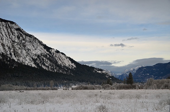
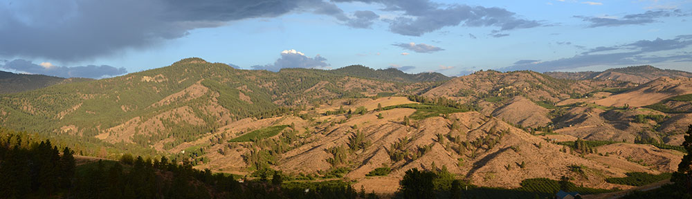
Finally, past Redding, the home stretch. It was great to see flowers on the almond trees I passed.

I got off the freeway at my exit and waited at the stop sign to make a left turn. That’s when I glanced up in the rearview mirror and saw about 200 bees flying around the back of my truck. As I’d driven, the weather had cleared and it had gotten warmer. The hives had shifted; the bees had begun to find their way out. With the truck stopped, they wanted out.

Bees
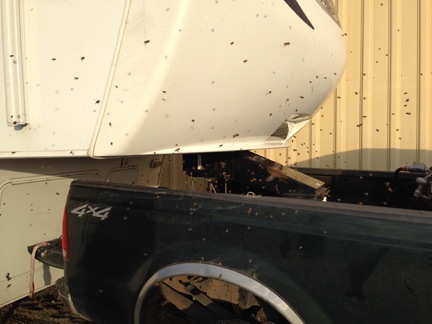
Hundreds of very unhappy bees buzzed around the back of my truck as I parked the RV.

I made my left turn and hurried the last 6 miles to my destination. By the time I was ready to back the RV into its space beside a hangar at the airport, it looked as if there was a swarm of bees in the back of my truck.

It was just after 4 PM and I’d covered 461 miles.

I had to put on my bee suit to unhook the RV. (Thank heaven no one was around to see that.)

I carried the two hives over to the side of the hangar about 25 feet in front of my RV and took the rags out. The bees from the strong hive immediately began flying out. The other hive remained quiet. I was beginning to think it was dead.

I went into town for a richly deserved dinner of chicken chow fun and Chinese ribs from my favorite Chinese restaurant West of the Mississippi. When I arrived at the restaurant, the bees that had been flying around the back of my truck were gone.

Parking the Bees

The next day, the airport manager told me to move the bees to the other end of the airport, in a rough grassy area where they tended to dump junk like old wood, tires, and fencing. We picked a place near the base of a tree. I dropped her off, donned my bee suit, and loaded the bees into the back of the truck. I had to move fast; it was getting warm quickly and the bees were eager to get outside.

I found an old palette in the temporary bee yard and set it up as a base. Then I put the hives on it, one facing northeast and the other facing northwest.

Bee Hives
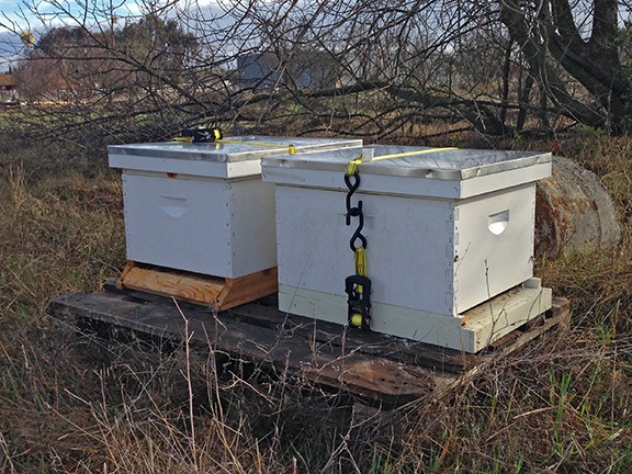
The bees on arrival in their temporary home. (Can you see the hot air balloon in the corner of the photo?)

Later on, I returned with the dead hive and my beekeeping toolkit. I unstrapped the two hives and opened them up one at a time. I was shocked to see the number of bees in the healthier of the two hives. The population looked nearly as high as it did when I last looked inside that summer.

I pulled out and examined a few frames. I replaced empty honey frames with partially filled honey frames from the dead hive. I shuffled the frame around and put some brood frames from the dead hive near the center of the live one. The brood cells were empty, but there was plenty of honey in the cells around them. With luck, the queen would get right to work filling these cells with eggs. I also added a drone frame. (What the heck; why not?) Then I put a medium hive body on top of the deep and filled it with 10 medium frames. I kicked myself for leaving queen excluders at home; later, I’d buy one at the local Mann Lake store.

I closed up that hive — which was a good thing, because the bees were pretty pissed off by then — and moved on to the other one. I really didn’t expect to see anyone alive inside. But there was a clump of bees on two frames on one side of the box. They’d apparently eaten their way through the honey stores in the middle of the box. The clump wasn’t big — maybe 1,000-1,500 bees? I could only hope the queen was in the middle of the clump.

Bees
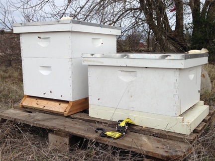
The two beehives after being configured for the next few weeks.

I did some major reorganizing. I removed some very old brood frames and replaced them with newer and cleaner brood frames from the dead hive. Then I added a honey frame filled with honey. I shuffled things around. I had to move the bees, of course — I used my bee brush to brush them into the frames in the center of the hive. Then I closed up the hive. I figure there’s a 50-50 chance of the bees surviving. If they make it through the next week and the queen is still alive, they’ll survive. I’ll examine the hive closely when I return from a trip to Santa Barbara this coming week. If I see the queen or eggs, I’ll know it’s all good. If I see neither, I’ll take action.

Either way, you can bet I’ll report on my progress here.

One more thing: it feels great to be working with my bees again.

You Can’t Get There from Here

Another Apple Maps fail.

I’m planning a trip to Pullman, WA next Thursday to attend a beekeeping seminar. I got the street address of the college campus building I need to go to in an email message. Under OS X Mavericks, I can point to the address to display a map of its location, like this:

Address in Email

I clicked the Open in Maps link to open the location in the Maps application that comes with Mavericks. Then, because I was curious about how long it would take to make the drive, I clicked the Directions button in Maps. I filled in my current location in the Start box and Maps recognized it as my current location. Then I clicked Directions.

Here’s the result:

Maps Fail

If you can’t read the note on the right, here’s what it says:

Directions Not Available
Directions cannot be found between these locations.

Of course, when I went to Google Maps and plugged the same info in, I got complete directions:

Google Maps

Hello, Apple? How about leaving the mapping to the experts? I never asked for Apple Maps on my phone, iPad, or desktop computer.

The apps you provide with the OS are like tools for getting a specific job done. When you provide tools that don’t work, it’s like reaching for a hammer and having it break when you need to bang in a nail.

A Christmas Ski Trip, Day 3: Skiing and Wine Tasting

I finish up my three-day trip with some more skiing and a stop for some wine and lunch at a favorite winery.

(This story has three other parts: Prelude, Day 1, and Day 2.)

I would have slept better if I weren’t so darn sore. In cross-country skiing the day before, I’d used muscles I forgot I had. Overnight, they started complaining about that, leaving me with aches and pains in my upper arms, shoulders, hips, and lower legs.

Three ibuprofen with my morning coffee certainly helped. After letting Penny out to do her business, I breakfasted on the leftover meat plate from the day before, the remains of that 1-pound Honeycrisp apple, and yogurt.

I showered and packed up at a leisurely pace, putting my “street clothes” in my day pack so I could change somewhere before starting the drive home. I layered up in my ski clothes. Penny and I took a little walk around the area. We met up with our downstairs neighbor and his dog, a border collie and chatted for a while. Then I packed up the Jeep, locked the loft cabin, and headed out with Penny.

At Mazama

We took the same route we’d taken the day before to Mazama: Wolf Creek Road. I really liked the quiet drive through the snow-covered forest of tall pines. I felt as if I could have driven along that road all day. The words for the song “Sleigh Ride” kept coming to my mind. It was indeed a “wonderland of snow.” I honestly didn’t realize how much I missed the snow until I got an opportunity to spend so much time in it.

In Mazama, my first stop was the Mazama Store. I’d bought a fleece sweater there two days before and it was too big. Although I’d wanted it for skiing, my trip was nearly over so I figured I’d just return it and get my money back. If they’d been open the day before, I would have exchanged it for a smaller size. Their loss.

Next, I headed back to the Goats Beard Mountain Supplies shop to see if they had any post-Christmas specials. It was a nice shop with lots of winter and climbing gear — nearby Goat Wall is apparently a popular climbing spot in the summer. But as I expected in a small gear shop in a winter tourist destination, no deals were to be had.

Finally, I wandered over to the Mazama Country Inn for breakfast. (I got into the habit of having two breakfasts most mornings when I was dieting back in 2012. It’s pretty easy to do when you wake up as early as I often do.) Eggs over medium, thick bacon cooked to perfection, and a toasted whole wheat English muffin with orange marmalade. What else could I ask for.?

On the way out, I stopped in the ladies room. I realized it would be a perfect place to change my clothes before heading home.

A Little More Skiing

It was close to 11 AM when I drove the Jeep over to the parking area for the easy ski trails I’d practiced at the day before. I wanted to do a few miles just to work on my balance and get my muscles moving again. Because I was able to park in the sun and there were very few people around, I decided to leave Penny behind. She was curled up in her bed, wearing her winter parka. I left the Jeep unlocked; I figured someone would rescue her if there was a problem. I didn’t expect there to be one. It was much warmer that day than it had been the day before. I figured the Jeep would stay at least 40°F in the sun while I was gone.

Map of Easy Trails
These trails are on mostly flat land near the base of Goat Wall in Mazama.

There were two men with a fire going in a portable fire pit at the trailhead. The fire pit was interesting; it had been built on a sled and even had a rope to pull it with. The menu were there to check ski passes, which I wore proudly. (Hell, how often do I get to wear a ski pass?) I put my skis on and took off in the freshly groomed tracks.

I did a little better without Penny on my back. I realize that the main challenge is feeling the edges of my skis and using them to push off better. Bending my knees more will likely help. I signed up for a three-session cross-country ski class at the local college in Wenatchee for January; I’m sure I’ll get much better after that. It’s a matter of building muscle memory, confidence, and balance. Two trips to Leavenworth with a group and instructor in January should give me plenty of practice.

Ski Trails at Mazama
The easy trails go alongside a snow-covered farm field and offer spectacular views of the north Cascade Mountains. Click here to see a panorama of this spot.

I did about 2-1/2 miles in an hour. Not bad. I can still hike faster.

Back at the Jeep, I let Penny out. She ran around a little while I chatted with the guys at the fire pit and stowed my skis. Then we headed back to the Mazama Country Inn, where I changed my clothes for the drive back. A while later, we were on Route 20, heading back down the Methow Valley toward home.

The Drive Home, with Wine

The drive back down the valley wasn’t nearly as pleasant as the drive up two days before had been. It might have been the weather — it was mostly gray all the way. Or it could have been the fact that there were other cars on the road and they kicked up just enough melted ice and snow to keep my windshield wipers and washer fluid working overtime all the way.

I stopped in Twisp for fuel and to visit the bakery my friend had recommended. It was closed. Feeling like I wanted a snack, I went back into the health food store there and bought some lemon bars. Very rich. I got an eggnog latte — likely the last one of the season — from a drive-thru coffee shop on my way out of town.

It was clearer but still overcast when I reached the Columbia River. At least I could see the hills and mountains around me. The whole place had been socked in on my way north two days before.

By the time I got to Chelan, I was ready for lunch. I decided to stop at Tsillan Cellars Winery. In the summer, I take people there for wine tasting and lunch or dinner. But because I fly them in by helicopter, I can’t drink. Now I was driving. Why not have a wine tasting and follow that up with lunch at Sorrento’s? It would finally give me a chance to see what I’d been missing.

My Burger
It was a great lunch, but I could only eat half of it.

I left Penny in the Jeep and went inside. There was only one other person at the long bar and she kept wandering from the bar to a table near the fireplace in the big tasting room. I had the wine server all to myself. I tasted five red wines and would up buying three bottles. Then I headed over to the restaurant, which had just a few tables occupied. I ordered a blue cheese burger and wound up taking half of it to go. Those lemon bars had spoiled my appetite.

I let Penny out again — poor thing was getting too much downtime, although she didn’t seem to mind — before we headed out on the last leg of our trip.

The weather cleared as we reached Route 97A after the tunnel and followed the Columbia River toward Wenatchee. The afternoon sun shined on the hillsides across the river while thin wisps of cloud drifted by. This is the foggy season in North Central Washington, with temperatures and dewpoints nearly matched almost every day. That afternoon was relatively clear, though and it made for a very pleasant final hour of driving.

River View
The afternoon sunlight really made the hillsides along the Columbia River glow.

I didn’t make any other stops on the way home. I pulled into the garage just as the sun was setting. Penny seemed very happy to be back on her home turf.

It had been a great little trip!

A Christmas Ski Trip, Day 2: Skiing and More Skiing

Shaking the rust off.

(This story starts with a Prelude and a summary (with photos) of Day 1.)

Snow and Moon
The sky was mostly clear in the morning, with a half moon hanging high.

Once I set the thermostat down to 60 — thus preventing the rather loud heater from turning on and off all night — I slept like a log. The room was plenty warm and the bed was cozy, with lots of blankets. Penny left her bed empty and, instead, made a sort of nest on the comforter next to me. It was very quiet. I left the curtains wide open so I could see the stars and moonlit terrain when I woke up.

In the morning, I took Penny out for a walk. The fog that had been drifting low over the snow-covered fields the night before was gone. The sky was mostly clear with the last quarter moon hanging high in the sky.

A good day for skiing.

Organic Bulgarian Yogurt
Yes, I bought organic Bulgarian yogurt. I don’t recommend it.

Back in our loft cabin, I made coffee and a breakfast of organic “Bulgarian” yogurt and granola that I’d brought from home. I don’t recommend Bulgarian yogurt; it’s extremely sour. I also cut up the huge Honeycrisp apple I’d bought the day before and stowed it away in my daypack with a bag of almonds for snacking later on.

Outside, the sun’s first light was illuminating the snowy mountains that surrounded the Methow Valley. As I washed up, did the dishes, and waxed my new skis for the first time, I found myself really looking forward to the day ahead of me.

Sunrise
I never get tired of seeing the sun’s first light hit mountains and other landforms, bathing the highest points in a golden glow.

Suiting Up

At about 8:30 AM, Penny and I suited up with our winter gear.

For me, that meant skin-tight leggings made of a fabric that would wick sweat away from my body and what I can only call “snow pants” over them. If you’ve ever been a kid in a cold climate, you know what I’m talking about: nylon pants with a quilted filling. Mine were black with zip pockets, wide legs, and an inner liner near the bottom with elastic that closed around each of my legs. I also layered up on top with another tight wicking fabric undergarment, a fleece sweater, and my bright red waterproof shell. All of these things were new — I had no use for clothes like this when I lived in Arizona, since I seldom went north to the higher elevations where cold winters prevailed. On my feet I wore an ancient pair of thick wool socks — I’d fetched them out of storage before my trip — and a brand new pair of Sorel snow boots that I could also wear with the snowshoes my brother had gotten me for Christmas. I also had a scarf (of course) and a merino wool Buff that I wore as a sort of turtleneck, with the option of turning it into a hat or a balaclava. And thick red ski gloves — did I mention those?


Penny really has trouble with her boots.

Penny’s attire was simpler: she wore her red quilted parka with the fleece lining. I didn’t put on her boots because she can’t really walk in them. Besides, I had a feeling she wouldn’t be doing much walking in the snow anyway.

You might think I was overdressed and I probably was. But the truth of the matter is that I really don’t like to be cold. I made this one-time investment in cold weather gear so I’d be comfortable out on the trail. I was embracing the winter season the only way I knew how.

The Back Road to Mazama

On my way to Mazama on Route 20 the day before, I’d seen a left turn for Wolf Creek Road about halfway between Winthrop and Mazama. The place I was staying was on Wolf Creek Road, but I’d gotten there from Winthrop. Could the same road keep going past my place and eventually meet up with Route 20 on the way to Mazama?

I looked at the topo map I’d saved into Gaia GPS on my iPhone and iPad. It sure looked like it did. And since I’m the kind of person who’d rather explore “shortcuts” than drive the long way around on the beaten path, I decided to give it a try.

Snowy Forest Road
Paved or unpaved? Can you tell? Does it matter? It was a pleasant drive through the woods.

The drive turned out to be very pleasant. About a half mile down the road from where I was staying, a “Pavement Ends” sign announced the end of pavement — it didn’t matter because the roads hadn’t really been plowed in the first place. (In all honesty, I thought all of Wolf Creek Road had been unpaved.) The narrow road, which I could follow from the tire tracks of the few vehicles that had driven it before me, wound through a forest of tall pines, twisting and turning, climbing and descending. After a few slides, I threw the Jeep into four wheel drive and it stabilized. I drove at a steady 20 miles per hour, crunching over snow and long pine needles. Here and there were gated driveways and ungated forest roads turning off into the snowy woods. I realized that I’d need to come back when the snow was gone, possibly with a friend and some camping gear, to explore some of those roads. I really do love exploring back roads with my Jeep.

Within just a few miles, the forest opened up to some fields with homes and snow-covered farm equipment scattered here and there. The tall grass was covered with thick frost — a remnant of the previous evening’s low fog. In some places, I could see clear up the valley, to the towering mountains of the North Cascades.

Frosty Fields
Although the sky was mostly clear, the sun was hidden behind clouds to the southeast, leaving the valley in shadows.

The road turned sharply to the right. A moment later, I was back on Route 20. My morning back road adventure had been less than 5 miles long.

Ski Lesson

It’s important to note here that I’d been cross-country skiing before. Way back in the 1980s, when I first hooked up with the man I’d later marry, we took up cross-country skiing and did trips in the Catskill Mountains of New York State. I clearly remember going out one snowy day on trails near the Mohonk Mountain House near New Paltz. I remember the silence of that afternoon, with the thick wet snow packing up on the bottom of our skis as we cut new trails.

Back then there was only one kind of cross-country skiing — what they now call “classic” — and the skis and shoes were very basic. I still had my set but I left them behind in Arizona when I moved out of my Wickenburg home in May 2013. I didn’t miss them — they were junk — and the crappy plastic shoes had likely been ruined by the mice that often lived in our garage.

New technology had greatly improved both the skis and the boots. I bought a new setup in November. The only thing I miss from my old setup is the blue plastic clips that held the skis and poles together, making them easier to carry and store. I can’t seem to find a set of those anywhere, although I did get a set of ski bones that hold the skis together nicely.

So there I was, in the biggest cross-country ski area in the country, with a brand new cross-country ski setup. But I hadn’t been skiing in at least 20 years.

That’s why I signed up for a lesson.

I showed up early at the Methow Valley Ski School. While I waited for my instructor, I put on my ski boots (for the first time!) and put away my Sorels in the Jeep. Then I fetched Penny and my day pack and settled in to wait on a bench inside where it was nice and warm.

I can’t remember the ski instructor’s name. She was a Swiss woman with an accent very similar to my grandmother’s German accent and almost identical to that of a Swiss couple I was friends with in Wickenburg. The other student was a young Japanese man who didn’t speak English. He was staying with a couple around my age who chatted with me as they dropped him off for his lesson.

Packed Penny
At just 7 pounds, Penny is easily carried in a day pack. In fact, I had to pad the bottom so she could stick her head out.

Needless to say, the lesson was interesting, mostly because of the amount of miming the instructor had to do to communicate with the Japanese guy. We started indoors where we learned how to put on the skis. Even that was different from the old setup. Then I put Penny into the day pack, zipped it so just her head stuck out, slung it over my shoulder, and followed the others outside with my skis and poles. We spent the next hour practicing basic skills on the trails near the ski school shop.

The Japanese guy was pretty funny. He fell a lot and got lots of practice getting up. I only fell once, but I did it spectacularly. I lost my balance coming down a small hill. Because I didn’t want to fall backwards on top of Penny, I purposely fell forward. The backpack shifted up hard and Penny went flying over my head into the snow. We all had a good laugh and it took some time for me to get back up without taking the skis off. Then I got Penny back into the bag and the lesson went on.

One of the things that shocked and pleased me was what “groomed trails” meant. The trails were wide and smooth and had obviously been sort of “raked” over. On either side of the main trail were a pair of cross-country ski tracks, already laid out in the snow at the perfect width. Skiing in these tracks was a real breeze — and a real treat. In my previous cross-country skiing experience, the first person in our group would make the tracks and they were rarely evenly spaced. This alone made the ski pass worth the money I’d spent for it.

Lunch at Jack’s

It was 11:30 by the time the lesson was over and I was hungry for lunch. The ski school folks made some calls and found a cafe down the road, Jack’s Hut at the Freestone Inn, that was open for lunch. I drove over, leaving Penny in the Jeep. The owner was manning the place, which was more of a snack bar than a full-blown restaurant. I sat at the counter where I could watch him work. I had an excellent bowl of chili — probably from a can — with cheese and a chicken quesadilla he made while I looked on.

I was just starting on my quesadilla when the Japanese student and his two American hosts came in. Soon they were seated at the counter with me, enjoying the same food. We chatted a bit about the area, real estate, and skiing. We studied my map and they offered some suggestions for places to go skiing that afternoon.

Mazama Area Map
Here’s a map of the area where I planned to ski. You can download the entire map here.

Then I was done eating and it was time to go. The sun sets early in Washington in the winter time and I was hoping to ski with the sun still on me.

Solo Skiing

Penny and I headed out to the North Cascades Basecamp parking area. I parked and opened my door while I got my things together. Some movement on my left caught my eye and I found myself looking almost eye-to-eye at the biggest black dog I’d ever seen.

The dog was friendly, of course, but quickly frustrated by Penny darting out at him from under the Jeep. I had to snatch her up and put her in the day pack so she’d leave him alone. He wandered off while I chatted with some other skiers who were just getting their skis on when I arrived.

A while later, I was on the Base Camp trail with Penny in the day pack on my back. This particular trail wound through the woods with gentle hills that proved to be quite a challenge for me. I had one fall along the way — fortunately, Penny wasn’t launched out this time. It did take me a minute or two to get back on my skis.

I wasn’t alone on the trail. There were plenty of other skiers, most of whom did not used the classic ski tracks. They were skating on skis. It was wonderful to watch and I was envious of their skill. I decided to visit the local skating rink back home to build up my general skating skills and balance.

Despite the cold — it was between 25°F and 30°F out on the trail — I worked up a nice sweat. Although I never felt uncomfortably warm, I certainly never felt cold, either. It was very pleasant to be outdoors in the winter time, keeping active enough to keep warm, enjoying the steady slush-slush-slush sound of my skies in the tracks as I wound through the woods.

Eventually, the trail went down to a pair of portable bridges across a stream bed. The bridges were designed to be skied over and I had no trouble with the first one. But while I paused to take a photo, I decided that I wanted to practice on easier trails to really get the hang of skiing before I tackled the kind of hilly trail I was on. So after I shot the picture, I crossed back over the bridge and skied back to the Jeep.

Portable Bridge
This was the first time I’d ever seen a portable bridge. Click here for a large panorama of the area shot with my iPhone.

According to the GPS Track app on my phone, I’d skied about a mile and a half. Not very impressive.

I drove back to the place I’d started the day: the easy trails around the Mazama Store and Ski School. Once again, I got out with my skis and put Penny in the day pack. Then we were off down the trail. It was much later in the day and most of the other skiers were on their way back in. But there were other people going out. Although most of them passed me, I managed to pass someone even slower than I was.

I did another two miles in nearly an hour of skiing. I realized that I hiked faster than I skied. I needed practice!

Sun Mountain

Penny in her Parka
Here’s Penny in her parka.

I let Penny out to take a quick walk before we climbed back into the Jeep with the skis. I steered us down Route 20.

Winthrop was completely deserted. Everything was closed and not a single car was parked in town.

I decided to check out Sun Mountain Lodge, which was about 10 miles from downtown Winthrop. I figured I’d see what the place was like and, if I was hungry later, I’d go back for dinner.

But as I drove us up the long and winding road, I started to rethink that. I’d had a long day; did I really want to make the 20 mile round trip twice in one night? It all depended on what I found at the end of the road.

Along the way, I passed Patterson Lake, a mile and a half long lake that was completely frozen over. There were numerous skaters out on the north end of the lake, including hockey players who were playing on a shoveled-out arena. There was even an ice fisherman sitting alone over a hole. As I drove alongside the lake I realized something I’d never thought about before: this area of Washington was a winter sport destination.

If you’re reading this and know winter sport destinations like those in Colorado and Vermont and Utah, you’re probably saying, “Duh.” But this is completely foreign to me. When I lived in New York and New Jersey, we had winters that were just as cold and often as snowy as the winters here. Back there, we had winter sports, but few people really took them seriously. Sure, the skating pond in town was a gathering place for skaters and some hilly areas had sledders. And many people grabbed their skis and headed to the slopes in the Poconos or Catskills. There was no snowshoeing and very little cross-country skiing or snowmobiling — mostly because there simply weren’t many established trails. These sports were just incidental to where we lived, simply because the weather got cold and snowy for a short time every year.

But in the Methow Valley, winter sports were taken very seriously. Why else would there be 200 km — that’s 160 miles, folks — of groomed cross-country ski trails, all mapped out on paper and signs and a Website and even an iPhone app? Why would there be a shooting range on a biathlon trail? Why else would there be snowshoe-only trails and snowmobile speed limit signs? Why else would ski rental and lesson places be open for business on Christmas day when it was tough to find a restaurant for lunch? Why else would there be dozens of people skating on a frozen lake in the middle of nowhere?

And realizing this made me feel really good about where I’d chosen to make my home. Because not only were they serious about winter sports, but they were equally serious about summer sports like hiking, biking, camping, boating, fishing, and so much more. There was no shortage of outdoor activities in north central Washington state with the perfect weather to enjoy it all.

The sun had gone down behind the mountains and clouds when I finally reached the Sun Mountain Lodge. It sits near the top of a mountain — Sun Mountain? — overlooking the Methow Valley. Ironically, the lodge is only 1-1/2 miles as the crow flies from where I was staying off Wolf Creek Road far below.

I left Penny in the Jeep and went inside. I was still wearing my skiing gear, right down to the boots. But when I got into the cocktail lounge for a hot beverage, I saw that I wasn’t the only one.

Meat Plate at Sun Mountain
The meat plate was enough to feed two as an appetizer. I took my time and enjoyed looking out over the view.

I sat near a window where I could look out over the valley. I had a Spanish Coffee, which I found a bit sweet, and ordered a meat plate that included various sliced meats, cheese, crackers, and very spicy stewed apples. The waiter served it with a knife but not a fork; when I asked for a fork, he brought it but explained that because a restaurant reviewer gave them a bad review for serving it with a fork, they no longer provided forks unless asked. I wondered how I was supposed to eat the stewed apples without a fork. I also wondered whether he was trying to insinuate that I should have known better than to ask for one.

When I finished the Spanish Coffee, I ordered an Irish Coffee, which is more to my taste. I only ate half the meat plate — I was still pretty full from lunch — and took the rest to go.

Day’s End

Christmas Road Grader
What else would you do with your road grader at Christmas time?

Penny was glad to see me when I got back. I let her out for a short walk, then loaded her back up and headed back down the hill.

The ice fisherman was the only one still out on the ice. I could see him clearly in the fading light from the light of his headlamp and another flashlight or lamp near his bucket.

By the time we got back to the main road, it was full dark. I drove slowly and carefully — there were signs all over the place about deer strikes and a friend back in Wenatchee had even warned me about deer at night. Sure enough, I saw one cross the road when I stopped to take a photo of a road grader decorated with Christmas lights.

Back at the loft cabin, I let Penny have a good run. Both of the downstairs units were brightly lit up with families celebrating Christmas away from home. Penny and I went upstairs, where I opened a bottle of wine and settled down with a book.

I was sound asleep by 8 PM.

(continued)

A Christmas Ski Trip, Day 1: The Road Trip

There’s nothing like a good little road trip.

(This story starts with a Prelude.)

I watched the weather pretty closely during the week leading up to my trip. We had some freezing rain here and I know they had some sort of weather up around Winthrop. But since I couldn’t change my plans, it didn’t really matter. I decided to bring all my gear — skis, snowshoes, winter hiking boots — so I’d be prepared for anything.

Packing Up, Moving Out

I packed the morning of the trip. There was no rush. I figured I’d leave by 10 AM and since I was up by 7 AM, I had plenty of time to pack.

I remember thinking to myself: I’m on vacation!

I tried to keep packing simple. Really. One bag for my clothes and a laptop. One bag for food, including snacks, a bottle of wine, and Penny’s dog food. Then the odds and ends: Penny’s dog bed, my skis, my ski boots, ski poles, my hiking boots, my snowshoes, my emergency road kit (jumper cables, blanket, water, etc.). I had to stop off at my shed to get my ski stuff and I almost forgot the boots. I also retrieved my daypack from my RV; I’d be using that to carry Penny around on the trails if the snow was too deep for her to walk in.

By the time we were ready to go, the Jeep’s back seat was full. I put Penny on her bed in the front passenger seat, locked up the house, and we hit the road.

It was 9 AM.

I wasn’t in a hurry so I made stops along the way. Caffe Mela for breakfast. (Not the best choice unless your idea of breakfast is a pastry. They do make an excellent eggnog latte, though.) Safeway to pick up a package of bakery cookies for a friend and his coworkers. Stemilt’s Bountiful Fruit store, where I bought 3 apples for the trip, including a 1.15-pound Honeycrisp. (Seriously: where else could you find an apple that big?)

I cut up one of the apples in the Jeep in the parking lot and munched on it as I continued north up route 97A. One more stop at Entiat to visit a friend who had to work that day. I brought the cookies into the construction office where he was overseeing a big park remodeling job. The guys were working on a rock retaining wall down by the river and he was there to inspect the work. The cookies were for him and his co-workers. I spent some time chatting with him and looking at the huge batch of blueprints for the park. Then, after a good Christmas hug, Penny and I hit the road, continuing up 97A.

The Photo Stops

The weather in Wenatchee had been clear with temperatures in the high 20s or possibly low 30s. But as I drove up the west side of the river, I saw low clouds up ahead. That’s a weather phenomena that’s pretty common here in the winter: fog. As the road climbed up toward the tunnel that would lead away from the river and toward Chelan, I stopped for a photo.

Up River Fog
As I climbed away from the river, I could see a fog bank off in the distance.

Tunnel to Chelan
Route 97A passes through this tunnel on the way to Lake Chelan.

I passed through the tunnel and into the hanging valley beyond. The area was familiar to me, yet strange. I’ve flown that way dozens of times in my helicopter, taking people to Tsillan Cellars Winery on the lake. But I very seldom drive that way. I kept expecting to see the lake revealed before me. It wasn’t until I began descending down toward the lake that I finally caught a few glimpses of it. The helicopter ride offers much more dramatic scenery.

There was a thin fog layer right over the water. It was probably about 10-20 feet thick and started at maybe 5 feet off the lake’s surface. To the east a thicker bank of fog hung over the town of Chelan. The sky and water were blue; the snow and ice and clouds were bright white. I could see for miles and miles, all the way uplake to the snow-covered mountains off in the distance.

I stopped for a few more photos, pulling down a street that hadn’t been plowed. My Jeep’s fat tires crunched in the icy snow.

Ducks on a Mission
These ducks were snoozing until I knelt down on the ground to put them in the foreground and the snow-covered mountains in the background. Then they marched toward me; I suspect they thought I was there to feed them.

Fog over Chelan
A layer of fog hung over the town of Chelan.

I drove into town. There were few cars on the road, few people around. Winter in a summer resort area. The road had patches of ice and, more than once, my rear tires spun as I moved away from a stop. Slow and easy; I was re-learning my winter driving skills as I went along.

The fog thickened as I followed the road through town and up toward the airport. At one post, visibility was down to less than 300 feet. Along the road I caught glimpses of the Columbia River far below me. Downriver, the sun was shining through the clouds. Up ahead it was cloudy and gray.

Marginal VFR
It was marginal VFR at the airport but no one was flying. The thick frost you see on the weeds is from freezing fog, another common weather phenomena here in Central Washington State.

Route 97A descended from the airport and joined up with Route 97 to continue up the Columbia River. It was a completely different day, with low clouds and a dismal winter feeling.

Refueling at Pateros

I didn’t stop until I got to Pateros, where I pulled over to top off the Jeep’s fuel tank. I took a short drive through town, getting as far as the Lake Pateros Motor Inn, where we’d stayed in back in 2008. I’d parked my helicopter on the lawn alongside the hotel in a spot that made it very convenient for the few cherry drying flights I did.

I stopped at the Sweet River Bakery, where my wasband and I had come for breakfast each morning during our 10-day stay. Back then, they made the best apple fritters. I ordered an eggnog latte and got an apple-cranberry fritter to go. I’d have it for breakfast in the morning.

We got back on the road, backtracking down to where route 153 turned west along the Methow River. I passed the farm stand with a cherry orchard I’d dried. It was closed.

A Drive Up the Methow

Along the Methow River
Snow, ice, river, sky, trees dormant for winter. I didn’t realize how much I missed winter scenery until I took this trip.

There was ice on the river — so much ice, in fact, that it looked as if I could walk across it. But as I drove upriver, the ice cleared out at the rapids.

The road climbed gently but persistently along the river. The amount of snow along the way increased as we climbed. Soon, we’d climbed away from the fog bank and the sun began to shine again.

It was a really amazingly beautiful day. I stopped for a few more photos. I wanted to remember this trip and the best way to do that would be to document it with photos to act as visual clues. Besides, it was just too darn pretty to pass up.

That’s another benefit of traveling alone; I don’t have to ask permission to stop so I can get out with my camera.

Red House on the Methow
At first glance, the reflection of the red house on the river was much more obvious than I was able to capture with my camera.

I passed through Methow and noticed a restaurant on the side of the road. I have vague memories of having dinner there and there being live music. But it was closed and quiet that Christmas Eve day.

Everything was quiet. I was just about the only car on the road. No traffic! How many other Christmas travelers could say that?

Carlton was a sign and nothing more.

The road twisted and turned along the river, crossing one bridge after another. I reached the junction of Route 20, where route 153 ended. A right turn would eventually take me to Okanogan — which I’d only been to by helicopter in a fly-by years ago. I continued on to Twisp.

The friend I’d visited at work earlier in the day had told me to stop at Twisp’s bakery and the health food store next door. I was hungry for lunch — it was nearly noon — but I didn’t feel like bakery food. The Grover Street Market had a lunch counter, so I went inside to see what healthy choices they offered. I wound up with a bowl of their Curry Stew, which was more like a soup and served so piping hot that I couldn’t eat it at first. It was tasty, with just enough spice to make it interesting. There was enough for two meals so I took half of it to go.

I didn’t visit the Cinnamon Twisp Bakery. I figured I’d visit it on my way back. (That turned out to be a mistake; it was closed on Thursday.)

I took Penny for a short walk through town. Not much was going on, although there were plenty of parked cars. It was sometime around then that I realized that plowing the roads in Washington was optional. All the side streets in town had a reasonably thick layer of icy snow on them. Not really slick — I think they spread gravel or something on them — but certainly not plowed to pavement. They apparently expect people to know how to drive in this kind of snow cover. And people do.

Of course, there were an awful lot of four wheel drive vehicles around.

Winthrop and Beyond

For some reason, I thought I had 20 or more miles to go before I reached Winthrop. I didn’t. It was just about 10 miles down the road.

I pulled out my driving instructions and followed them to Wolf Creek Road and, eventually, to the Chickadee Cabin Loft where Penny and I were staying. It was an upstairs studio apartment in a four-unit building. Next door was vacant but the two downstairs units, which were much bigger, were occupied. The place was at the end of a road in the woods but on the edge of a clearing. The roads weren’t plowed but the Jeep had no trouble getting us where we needed to go.

The “loft cabin” was nice, with a queen-sized bed, futon, TV with VCR and DVD player (and satellite TV), Internet access, kitchenette, and bathroom. There was even a sliding glass door leading out to a small balcony that overlooked a snow-covered meadow. All this was about 6 miles from town.

I unpacked the food and checked the cabinets. There was coffee and coffee filters and even sugar. All I needed was some milk and maybe some yogurt for breakfast. I’d get that in town.

We climbed back into the Jeep and headed into Winthrop. I wanted to find out what trails, if any, were open to cross-country skiing. I figured there would be some kind of ranger station with information in town.

What I found was the local office of the MVSTA. I parked out front and went inside, leaving Penny behind in the Jeep. I spent the next 20 minutes chatting with the two folks inside about which skiing trails were open and where I could get a lesson. It looked like Mazama was the place to be — 15 miles farther up route 20 was where there was more snow and most of the groomed trails. I bought a 3-day pass — in hindsight, two 1-day passes would have saved me a bit of money — and the woman behind the counter called the Methow Valley Ski School up in Mazama to see if they were still open. It was nearly 3:30 PM on Christmas Eve.

A while later, we were in Mazama and I was arranging for a cross-country ski lesson the following day. I brought in my skis and was told that waxless skis need to be waxed — something honestly I didn’t know. I paid for my lesson and a tube of ski wax.

I stopped in next door at the Mazama Store, a new agey market with lots of organic and overpriced food and other merchandise. (I do tend to tell it like it is.) I paid $7 for a quart of organic yogurt and $3 for a quart of organic milk. I also bought a fleece sweater that I wound up returning two days later. I do have to say one thing about the store, though: It has the largest selection of Lodge cast iron cookware I’ve ever seen under one roof. If Lodge makes it, the Mazama Store sells it.

By that time, it was after 4 PM and the sun was setting somewhere behind the mountains all around me. It would be getting dark soon. I loathe driving in the dark these days and had no reason to stick around Mazama so we headed back.

Along the way, I saw plenty of snow-covered fields with a thin layer of fog drifting over them. Advection fog? Radiation fog? I tried to remember what I’d learned in ground school about fog and came up empty. Fog was rarely an issue where I flew in Arizona; it was certainly an issue here in the winter time.

I stopped briefly in Winthrop to take Penny on a quick walk around town. I was curious to see what was open. There was a hotel with a restaurant in town and I walked up the steps to see if it would be open the next day for Christmas dinner. Closed. No big deal. I knew I’d be able to get Christmas dinner at the nearby Sun Mountain Lodge resort if I wanted to.

It was almost dark when Penny and I returned to our loft cabin. I put away the groceries and heated up some leftover smoked ribs for dinner. (I’d made them the day before on my Traeger just so I’d have something to munch while I was away.) We spent the evening relaxing, reading, watching TV.

A nice rest at the end of a long day.

(continued)