I finally get to see a place I’ve heard about numerous times and always wondered about.
I can’t remember exactly when I heard about Slab City, CA. I suspect it was about five years ago when I started visiting the Holtville Hot Springs and listening to the other RVers talk there about free places to camp.
Slab City on Wikipedia
Per Wikipedia, Slab City,
also called The Slabs, is an unincorporated, off-the-grid squatter community consisting largely of snowbirds in the Salton Trough area of the Sonoran Desert, in Imperial County, California. It took its name from concrete slabs that remained after the World War II Marine Corps Camp Dunlap training camp was torn down. Slab city is known for lifestyle that contradicts ordinary civilized lifestyle.
The rest of the Wikipedia entry is extremely informative (and I encourage you to read it), but appears to have been written mostly around 1990 and then edited to add information in 2020. (The editor in me would love to go into that entry and clean it up, but I’ll let experts tackle it.) There are photos, but I suspected that none would do it justice and I wound up being right.
The Trip
I’ve been wanting to check it out for myself for a few years. I decided to make it one of my goals for this year. But I wasn’t interested in dragging all my RVing gear out there, possibly to find a place where I wouldn’t want to camp. I wanted to make it a day trip from my campsite on the Arizona side of the Colorado River. It would be a roughly 2-1/2 hour drive each way.
Sometimes the only thing that prevents me from doing something I genuinely do want to do is motivation. I lacked motivation until this week. That’s when I happened to mention it to a new friend of mine, Bill, who is a full-time RVer. He very unexpectedly said he was interested in checking it out, too. And since he was camped out nearly halfway between my site and Slab City, it made sense for me to pick him up along the way if we did it before he moved on.
I set the date for Wednesday, which was the day after we spoke about it. There was a big holiday weekend coming up and I wanted to stick around near camp. A lot of crazies come out here with their off-road vehicles and I just felt the need to stay where I could keep an eye on things. I’m not a big fan of going out on weekends anyway, mostly because of the greater potential for crowds at my destination. One of the great things about my lifestyle is that I can go places midweek, when there are fewer people around.
That’s why I was in my truck at 8 AM on Wednesday morning with my pups, headed away from camp. I wanted to fill my truck with fuel before going into California — diesel (and other fuel, I guess) is about $1 cheaper per gallon in Arizona than California and with a 30 gallon tank that was about half full, that difference quickly turned into lunch money. I drove up to my favorite cheap gas station on my side of the river, topped off the tank, bought a pack of Oreos with a pint of milk, and set off westbound on I-10.
I was meeting Bill at Desert Center, a little over an hour west of the Colorado River. There was very little traffic, and I could cruise at or around the speed limit of 70 MPH. The stretch of I-10 between Blythe, CA on the Colorado River and Desert Center is pretty dull. A lot of empty desert, some of which has been recently filled in with huge solar energy farms. I listened to an audio book along the way and the time passed quickly. I got off the exit and rolled into the armpit of California that is the town of Desert Center.

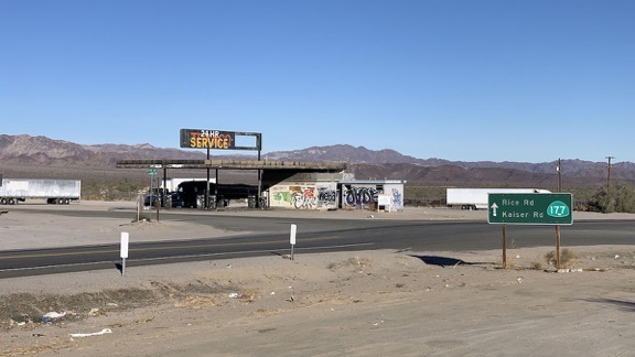
Shot from a trash-strewn vacant lot near the I-10 freeway exit, this view of Desert Center, CA is what greets folks who go there.
I cannot begin to describe how trashy the place is. It’s mostly empty lots and deserted, vandalized, graffiti-painted buildings. There’s trash and broken glass everywhere. A few semis with trailers were parked in various places, engines running; I guess this is an overnight stop for some truckers. I didn’t see any sign of current habitation, which is probably a good thing. I couldn’t imagine anyone actually living there.
I arrived early, of course, and had to wait for Bill, which I didn’t mind. I let the pups out to walk around the sandy lot I’d parked in and had to follow them around to make sure they didn’t step in or try to eat anything disgusting. We wound up waiting in the truck, windows open on the warm morning. But the more I looked around, I the less I liked the idea of Bill parking his custom Mercedes Sprinter van anywhere in the area for the day.
I told him that when he arrived. He looked around and agreed. He told me it had been broken into before and it was very upsetting.
I suggested Chiriaco Summit, a busier exit on the freeway that actually had businesses in operation. It was 19 miles farther in the direction we had to go anyway. He agreed and followed me.
I knew Chiriaco Summit from flying into its tiny airport, visiting the Patton Tank Museum there, and stopping for a bite to eat at Foster’s Freeze. As I pulled in, I realized that the little “town” had grown. There were additional restaurants and a handful of other businesses. Foster’s was now inside the big gas station. There was plenty of parking that would be out of the way yet close enough to activity to not draw attention. The town was all business and neat — a huge difference from Desert Center.
He parked, we went inside the gas station to use the restroom, and Bill bought a cup of coffee for the road. Then we were on our way.
I missed the exit for Box Canyon Road mostly because I was looking north. I was distracted by the Cottonwood Springs Road entrance into Joshua Tree National Park, with lots of RVs camping out in the desert, likely just outside of park boundaries. I never realized there was a road that went south there until I’d passed the exit. Duh. The next exit was six miles west and I made my U-turn there, thus adding 12 miles to the drive.
Box Canyon Road is a great drive on a decently paved road down a wide canyon that I would not want to be stuck in during heavy rain. There were a few folks camped out in there and a few others driving the same direction we were. After a while coasting downhill on the gently curving road, we got a glimpse of the Salton Sea stretched out before us in the distance. Then the winding canyon road leveled out and opened into blocks of farmland.
We saw some very neglected grape vines, lemon trees, pepper plants ready to be harvested, and a bunch of other veggies we couldn’t easily identify. GoogleMaps directed us to make a few turns before dumping us on Route 111, Grapefruit Boulevard. It should have been called Palm Highway there because it was mostly lined with date palms for a while. Then those ended abruptly and we were in the mostly barren desert on the east shore of Salton Sea.
This is not an attractive area of desert. There isn’t much vegetation and anything that was planted and neglected — think mostly palm trees — are dead or dying. Yes, the Salton Sea sparkles just off to the west and there are snow-capped mountains beyond Palm Springs even farther west than that. But the terrain is mostly a light tan color with the occasional tiny settlement, park, or abandoned, vandalized, and grafittied building hinting at past when the area had something to brag about.
Bombay Beach
Slab City turned out to be a lot farther south than I thought. Along the way we passed the Salton Sea State Park and its campgrounds, which turned out to be closed for COVID, and a settlement boasting hot springs off to the east.

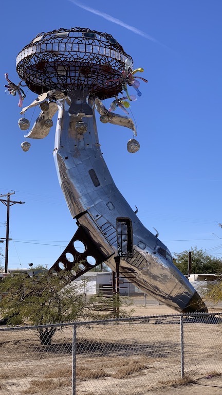
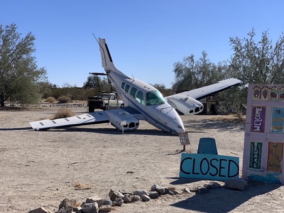
Is this the “Cessna Art” I was supposed to find at Bombay Beach? Is this a Cessna?
We eventually reached Bombay Beach, 223 feet below sea level, with a population 415. I’d been there before and hadn’t been impressed, but a Twitter friend urged me to revisit it, telling me there was some sort of Cessna artwork I needed to see. We drove through, spending a brief time on the sea side of the dike wall before completing a circle of the town. This sentence from Wikipedia sums it up perfectly:
A visitor in 2019 wrote that there were many “discarded homes and trailers long-since abandoned” and that many of the buildings were “windowless husks blanketed in graffiti, surrounded by broken furniture and rubble.”
Basically, the place looks like the ruins of a very poor community, long since vandalized, with a handful of occupied homes and a mildly interesting collection of very large artwork made mostly from junk. It’s a depressing place and I honestly can’t imagine what it must be like to live there.
We got back on the road and continued south.
Slab City

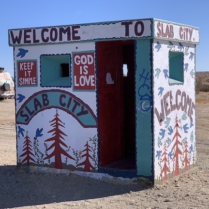
The obligatory photo of the Slab City Welcome sign.
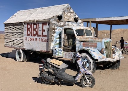
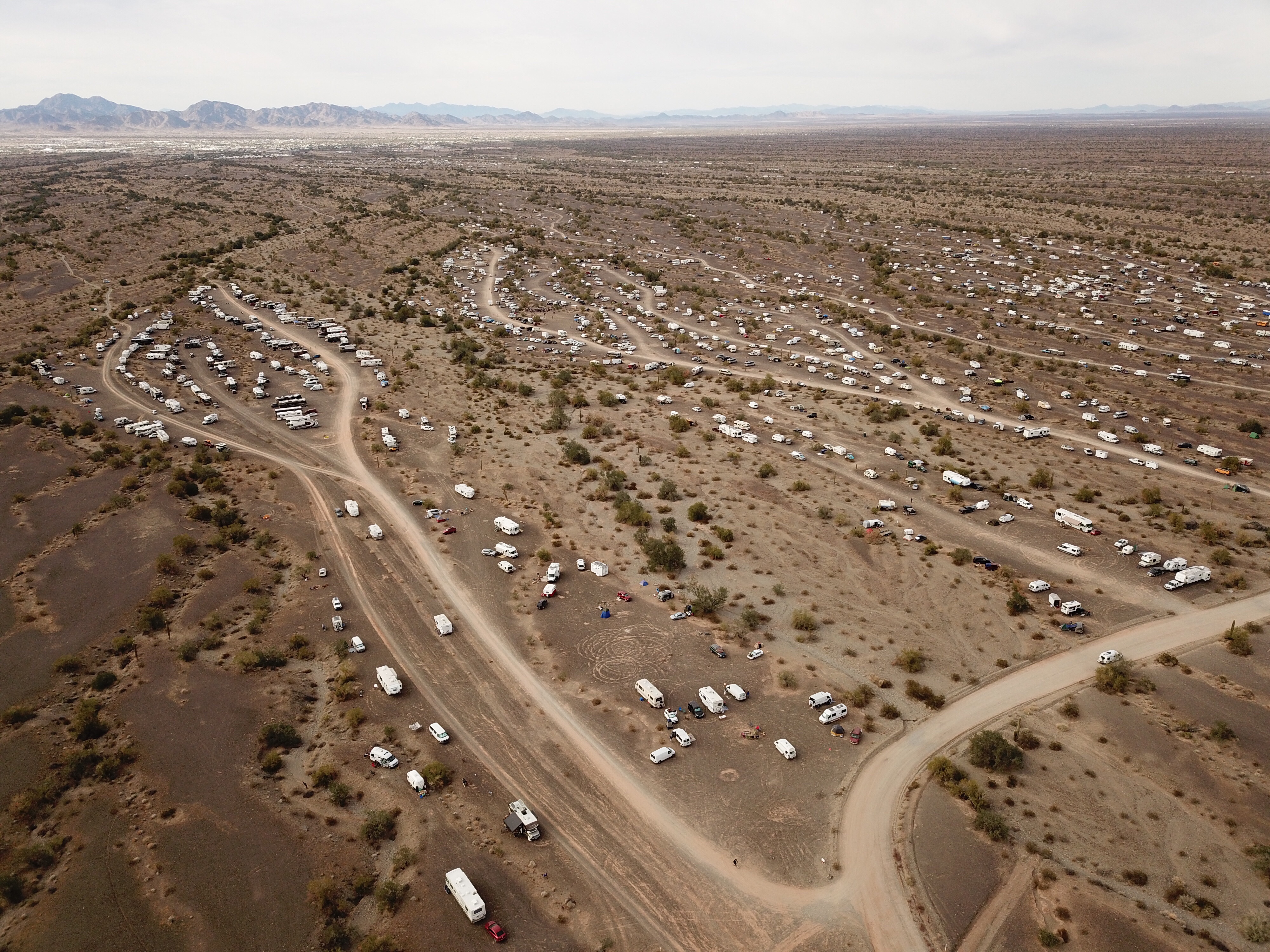
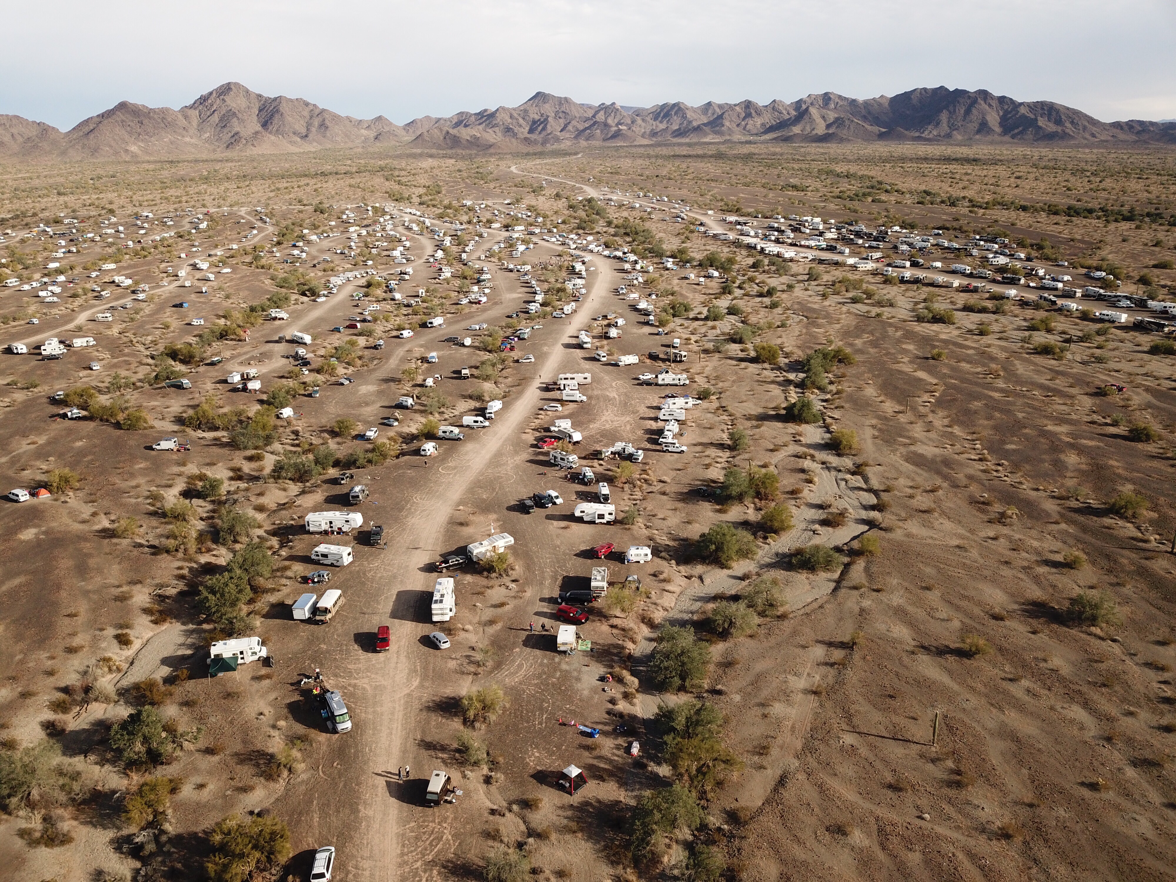
The turn for Slab City was the Main Street for Niland, CA. Although I’d expected it to be a sort of remote place up in the foothills of the mountains beyond, it was actually spread out just a few miles from town. The absolute junkiness of the place hit me immediately. There were all kinds of broken and abandoned RVs and other vehicles, as well as broken and occupied RVs and other vehicles. The more we drove the more trash and decrepitude we saw.

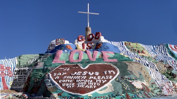
Part of the art (or “art”) installation at Salvation Mountain.
Salvation Mountain, a man-made hill painted with latex paint which had been the life’s work of a deceased resident, was the first of the art installations. Other art was more like “art.” I drove slowly through the area on what seemed like a main road while we stared at the mess around us. Yes, people lived there. There were RVs and mobile homes and shacks and even a few decent buildings. There were street signs and house numbers. There were campgrounds, one of which was hosting one of those mega-motorhomes that sell for about $750K. There was a library that was closed. There was a business at East Jesus that was closed. There was a property that used the burned out shells of RVs as a sort of fence line. The farther we got from the main area of the community, the more trash there was scattered out in the desert.

Salvation Mountain is the primary point of interest in Slab City. Read about it on Wikipedia.

A business at the end of the road to East Jesus was closed due to COVID.
I said I’d take pictures, but I took very few. The above shots are about it. Honestly, there wasn’t much I wanted a picture of.
We followed a sign for Slab LOW, not knowing what it was, and eventually arrived there. It looked like a camping area with a few buildings. Signs said they welcomed members of WIN, LOW, and Escapees — three RVer clubs. (I belong to WIN, Bill belongs to Escapees.) I stopped the truck and we got out to stretch our legs and let the pups run around. There was a single motorhome parked there and while we gave the dogs water — Rosie had puked in the truck; she still gets carsick once in a while — a man came out. Soon we were chatting with him. He lived there full time. He said the place we were at was closing and relocating elsewhere. He told us where but we never found it. Did it matter? No.
There were actually quite a few people living in the area — even if just temporarily. It looked to me as if you could camp for any length of time just about anywhere. But the vibe was about the same — at least to me — as it was at Bombay Beach. It was the ruins of something and no amount of art or “art” could hide it. Squatting on land that no one cared about was a cheap and easy way to live, but I know I could never live like that. Honestly, I’d have trouble even spending a day or two there. Too much trash. A cleanup crew could spend a year filling 30-gallon trash bags and no one would know the difference.
We didn’t stay long. And I have to admit that although Slab City sort of met my expectations, I was disappointed. I was hoping it was something better. Something more interesting. Something I’d like to stay and explore. It wasn’t. It was just a squatter community out in the desert, surrounded by decades of trash.
Lunch, the Fountain of Youth, and a Walk on the Beach
We stopped for lunch in Niland. I’d wanted very badly to go to the Oasis Date Ranch for one of their excellent hamburgers with dates on it but their cafe was closed due to COVID. The Buckshot Cafe in Niland served Mexican and American food. The restaurant itself was closed, but they were taking to-go orders through one of the front windows. We each ordered a chicken torta and wound up eating it in the back of my truck, feeding the dogs nacho chips and french fries.
Back on the road, we turned in at the sign for the Fountain of Youth RV Resort and Spa. The WIN RV group I belong to had camped there for a week in early November, before I headed south. I wanted to see what it was like. It was a typical middle-of-the-desert RV park, filled with mobile homes, park models, and regular RVs. There was a pool, a hot spring fed spa, shuffleboard, a restaurant, and more. Everyone we saw was older than we were except the kid at the gate. The campsites were close together and there were a lot of vacancies. No Canadians this year.
We checked out another RV resort with spa nearby. It was a lot smaller, more casual, and cheaper. Bill was disappointed that although they offered day use options for the spa facilities, clothing was required.
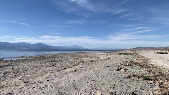
Our last stop in the valley was at a campground along the shore of Salton Sea. I’d stayed there about four years before. I wanted to show Bill the beach, which had been covered with giant barnacles and dead fish back then. The campground was closed, but we parked across the road and walked over. We climbed down an embankment and walked right up to the short. The barnacles were smaller and there were no dead fish.

The beach at Salton Sea. Palm Springs lies at the base of the snow-capped mountain dead center in this shot.
The Drive Back to Camp
Bill used a map app on his phone to guide me back to Box Canyon Road and we climbed up the wide canyon to the I-10 freeway. From there, it was a short drive to Chiriaco Summit. I took my pups for a quick walk with Bill. Then we said our goodbyes and he left to go to camp while I went into Foster’s Freeze for a hot fudge sundae.
I passed Bill on the road right before reaching Desert Center. He’d told me his campsite south of there was dead quiet and pitch black dark. Sounded good to me. My site would not be quiet with all the yahoos in from Phoenix with their ATVs for the long weekend, but I had a good, private camp and wasn’t ready to move. Yet.
I finished listening to the recorded book I’d been listening to along the way. I got back to camp just as the sun set over California.
If I had a bucket list, I could cross off Slab City.
