I have a great, ordinary day.
After spending yesterday being lazy and eating too much, I was determined to make the most of today. So I made rough plans to go for a hike at Red Mountain and then visit my favorite Thai restaurant in Flagstaff. I’d bring Jack the Dog and my good camera. I’d take my time and have a good time.
And that’s exactly what I did.
On the Road
I had a nice leisurely breakfast and spent a few hours reading something I’d written a long time ago. Reading my old fiction is always a bit depressing. I put so much of my time into it and now I realize how much rewriting it would do before I could ever consider publishing it. Both the content and writing style are immature. I wonder how many other writers look back at their old, unpublished work and feel the same way.
By 9:30 AM, I was ready to hit the road. I packed an orange and a bottle of water in a canvas bag, grabbed my camera bag and jacket, and loaded it all into the truck. I put Jack in back — I refuse to get dog hair all over the cloth seats in the cab — and closed the cap on him. Then I headed out.
I stopped to visit Matt and Elizabeth on my way out. They live full-time on the other side of the mesa. In fact, they’re the only people who live full-time on the mesa at all. They were in the middle of cleaning out one of their sheds, getting it ready to turn into a greenhouse. We chatted for a while as Jack wandered around their yard. I remembered that I didn’t have a leash for Jack and asked Matt for a piece of rope. I left with a 6-foot piece of nylon rope that I fashioned into a leash. Although there wouldn’t be many people where I planned to hike, there’s always one in the crowd ready to complain if your dog is off-leash.
We descended down the mesa and through the flatlands below. At route 64, I turned right, heading toward the Grand Canyon. There weren’t many people on the road, which kind of surprised me. It was, after all, Saturday morning. What better time to visit the big ditch?
Planes of Fame
At Valle, a small town at the intersection of routes 64 and 180, I made a brief stop at the Planes of Fame Air Museum. This remarkable aviation museum, which is based at Valle Airport, has an amazing collection of planes and aviation memorabilia. It’s impossible to miss, since General MacArthur’s Constellation is parked right out front. Oddly enough, it gets few visitors, despite the fact that thousands of people drive past each day on their way to or from the Canyon. I highly recommend it; it’s worth the stop for anyone interested in aviation — especially military aviation. And it the name of the place sounds familiar, it’s because it’s associated with the larger Planes of Fame museum in Chino, CA.
I was stopping in to hand over some brochures for Flying M Air. The museum’s lobby walls are lined with brochure racks for things to see and do all over Arizona and I like to keep my brochures there. At the same time, I usually pick up a batch of the museum’s brochures and put them in the racks at Wickenburg Airport. (It’s the least I can do!)
I had a nice chat with the two women there. They still had some of the brochures I’d mailed to them about six months ago. I asked them to put the brochures away until September 1. I told them I was closing down for the summer and there was no sense getting phone calls when I wasn’t ready to fly. They were completely understanding.
Walking Inside a Mountain
On leaving Planes of Fame, I headed southeast on route 180 toward Flagstaff. I’d planned to hike at Red Mountain, the remains of an ancient volcano that had collapsed in on itself thousands of years ago.
We’d discovered Red Mountain years ago, in 2003. While at Flagstaff’s excellent visitor center, we’d stumbled upon a free publication called 99 Things to Do in Northern Arizona. Number 26 was “Walk Inside a Mountain”:
Located 32 miles north of Flagstaff on U.S. 180, Red Mountain is one of the most intriguing sites in the Flagstaff area. The mountain is a volcanic cinder cone that rises 1,000 feet above the surrounding landscape. It is part of the San Francisco Volcanic Fields, a belt of volcanoes stretching through Flagstaff and on to the canyon of the Little Colorado River.
The northeast flank of the volcano is deeply sculpted, with a natural amphitheater in the center….The 2.5 mile round-trip hike is well worth it because you actually get to see what a cinder hill looks like on the inside.
This was enough to pique our interest, so we tracked down the trailhead and paid it a visit with Jack the Dog and a picnic lunch. I remembered it as an interesting yet easy hike — a good destination for another hike with Jack.
Today, I skipped the lunch and just brought along my Nikon D80 with two extra lenses in the fanny-pack style camera bag I bought for such hikes. I let Jack out of the truck and hung his makeshift leash around my neck. Another couple started the hike right after we did, but I let them pass us when I stopped to take a rest.
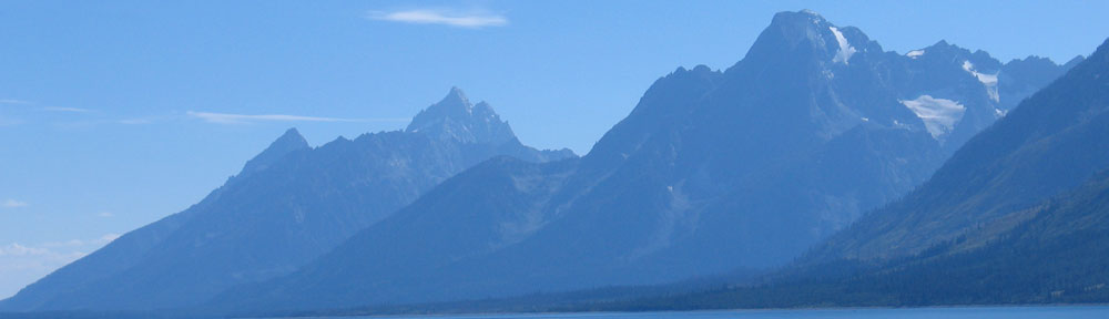
The trail to Red Mountain is an easy gravel pathway, partially eroded but plenty wide in most spots. It winds through typically high desert vegetation: grasses and pinon and juniper pines. Plenty of sun and shade. The path climbs gradually almost its entire length, offering occasionally glimpses of the cinder cone at its end, as well as the San Francisco Peaks and Mount Kendricks, beyond it, to the east.
The trail follows a dry stream bed into a canyon between two steep slopes of dark gray volcanic gravel. These slopes have been here a long time, as evidenced by the huge ponderosa pines growing out of them. They also give the trail a sort of claustrophobic feeling, especially with all the shade from tall trees all around.
The trail ends abruptly at a six-foot tall stone dam completely filled in with silt. A slightly tilted ladder with handrails leans against it. As Jack and I arrived, a group of 5 people were just making their way down. We waited.
One of the people asked, “How are you going to get the dog up there?”
“Oh, he’ll climb it,” I assured them.
“He’ll climb the ladder?”
“Sure.”
By this time, they’d all come down. They stood a few feet away, giving us an audience. I climbed up the ladder and Jack followed me, placing each foot carefully on a step as he climbed.
“It’s a circus dog!” someone called out.
Beyond the dam, we were inside the mountain. It was very different from what lay outside. Inside were mostly red rock formations very similar in appearance to the “hoodoos” at Bryce Canyon National Park hundreds of miles to the north. There were trees and hills and black rock. The force of erosion was quite evident. Jack and I explored the west side of the mountain’s insides and found ourselves winding through a series of narrow slot canyons. Of course, I had my crazy fisheye lens with me. I took a few shots with it, including this shot with Jack the dog. You can’t imagine how much red dust I got on the seat of my pants sliding off this observation point.
Here’s another weird shot with that fisheye lens. For this photo, I lay my flannel shirt, which I’d shed during the hike, on the dusty ground under a small pinon pine tree, facing up. Using the self timer, I snapped the shutter, then moved away quickly so as not to be in the photo. I love taking weird photos like this.
We explored inside the mountain for about 30 minutes. We were the only ones there. I’d forgotten to bring water with me and I knew Jack was thirsty. On the north-facing rocks, there was snow and I led the way to the base of a particularly snowy area, hoping that the snow was melting before it evaporated into the dry desert air. We found a small puddle and Jack had a good drink.
I took a few more shots, experimenting with various lenses and exposures and focal lengths. What I saw through the lens didn’t do the actual scene justice. It was beautiful and surreal.
We headed back to the dam and ladder. A pair of hikers stopped to pet Jack. When we got to the ladder, he carefully made his way back down. I wished I’d gone first and had taken a movie of it with my phone. I don’t think too many people would believe it, especially if they saw the ladder.
One of my favorite photos of Jack the Dog was taken the first time we visited Red Mountain. In it, he’s running towards us on the trail, with the San Francisco Peaks in the background. I decided to reconstruct the photo. When I got to the right spot, I called Jack back to me and snapped this photo. It wasn’t as pretty a day, but I think it’s a better photo.
We reached the truck, where Jack and I had a drink of water. Then I closed him up in the back of the truck and headed out of the parking lot. It was about 1 PM.
I should mention here that I have a photo of Red Mountain taken from the air. You can see it in the post titled “The Winslow Loop.”
The Drive to Flag
I continued southeast on route 180 toward Flagstaff. There was one spot I wanted to visit along the way — the very picturesque Chapel of the Dove. But when I neared it, I saw that its tiny parking lot was full of cars. I figured they must be doing some kind of memorial service and I didn’t want to intrude. So I kept driving. I’ll stop there another day when there’s no one around.
I did stop alongside the road to take this photo for Miraz. If I’m not mistaken, it’s the same spot a photo on one of her recent blog posts was taken. I’m off the ‘net right now, so I can’t check.
Along the way, Route 180 climbs to just over 8,000 feet above sea level. My redneck truck sure didn’t like the elevation. It drove terribly. Even cruise control couldn’t keep up the speed. I’m very glad my trip this summer won’t keep me in the mountains.
Thai Food and Errands
Boy, I sure wish I could remember the name of the Thai restaurant we’ve been eating at in Flagstaff when we’re there. It’s right downtown, across the street from Babbitt’s, with a connecting door to the Hotel Monte Vista. It has the best Pad Thai Noodles I’ve ever had and a really great “combination” soup with a clear broth, rice noodles, chicken, tofu, pork (?), and veggies.
That’s where I went for lunch. I parked the truck in front of the tattoo parlor on Route 66, tied one end of the makeshift leash to Jack’s collar, and walked the two blocks. I tied Jack to a signpost outside the door and went in. After washing my hands three times to get the dirt off them, I settled down for a nice lunch. I only finished half of what they put in front of me, so I took the rest to go. (I’m finishing up the soup now. Yum.)
Afterward, we walked over to the Flagstaff Visitor’s Center to drop off a bunch of Flying M Air brochures. The Visitor’s Center shares space with Amtrack in the original train station right downtown.
Back in the truck, we headed over to the HomeCo Ace Hardware on Butler Road. This is a great hardware store that I’ll take over Home Depot any day. (Having spent much of a summer in the Flagstaff Home Depot, I can assure you that I’m sick of it.) It’s a good-sized place with everything you need and enough floor staff to help you find whatever it is you’re looking for. The True Value Hardware Store in Williams is also very good, although not nearly as big.
Although I was tempted to hit the Barnes and Nobel Bookstore on Route 66, I talked myself out of it. Instead, we hopped right on I-40 and headed west.
I did make one more stop before returning to the mesa: Dairy Queen in downtown Williams. They make the best hot fudge sundae. Even a small one!
Why It Was a Great Day
Now this day may seem pretty ordinary to you. A bunch of errands, a hike, and lunch out. Big deal.
But I enjoyed the whole day immensely — perhaps more than I should have. And knowing that I enjoyed it so much made me enjoy it even more.
Perhaps one of the things that made it so enjoyable was my choice of listening material for the long drives. (I did, after all, drive well over 100 miles today.) I had my iPod plugged in via cassette tape adapter thingie and was listening to podcasts. I was alone, so I didn’t have to worry about missing what was being said because of conversation. The podcasts I listened to — Point of Inquiry — gave me something to really think about. I like getting thoughtful input.
Another thing that contributed to the good day might have been my complete lack of schedule. I had a list of things I wanted to do and plenty of time to do them all. I didn’t need to be someplace — or back at the mesa — at a specific time. So there was no stress, no rush. Very relaxing.
Now I’m back on the mesa, relaxing in our camping shed. Outside, the wind is absolutely howling — they forecast winds 25 to 35 mph with gust up to 50 mph. My windsock is stuck straight out as if starched. Occasionally, the building shakes. But its cosy and safe in here with music on the radio and sunlight coming in through the windows.
And I have leftover pad Thai noodles for dinner.
 Jack also goes hiking with us out in the desert. He’s well behaved on the trail and never bothers other hikers. He’s a bit of a nuisance when we go out to take photos, as we did the other day. He always seems to get into the shot. But now that he’s older — he turned nine this year — he’s starting to slow down and spends a lot more time just relaxing in the scant shade of a tree while we bend over wildflowers and lie prone to shoot up at cacti. It could also be his thick winter coat — which I’ll soon be vacuuming up off my floors and carpets — that keeps him too hot in the springtime to run around.
 I’ve been experimenting quite a bit with foreground/background combinations. This shot of grasses, rocks, and trees with the red rocks in the distance behind them really called out to me. The foreground elements are on the mesa top. About 10 feet beyond them is a sheer cliff with a drop of 300-400 feet. The green trees you see beyond that are full-sized pinon and juniper pines. The red rock cliffs are several miles away. This one’s a “keeper” that I’ll likely put in my
  This second shot is a self-portrait. I broke my third wired shutter release and there’s no way I could have used the self-time for this. So I used the camera remote. Of course, the sensor for the remote is on the camera’s right side (when looking at the front) and I was sitting at the left. Hence the stretched out arm and rather cranky look on my face. It’s a dopey picture and I look like an idiot. I guess that’s why I like it.
 For a moment, I considered panicking. Then I realized how dumb that was and inched backwards on my butt, pulling my feet and walking stick with me. After a few moves, I was on firm enough sand to get back on my feet.


