Personal Aerial Photography

A few thoughts from someone who has been doing it for a long time.

I’ve been doing aerial photography since I began flying helicopters, way back in the late 1990s. At first, it was a few digital images shot awkwardly with my left hand while my right hand was busy on the cyclic. Later, I went through a variety of different cameras mounted in and on the helicopter, some set to automatically shoot whatever was in front of them and others with limited control from inside the cockpit. I had a POV.1 camera in 2008, which I replaced with a GoPro Hero in 2010. Since then, I’ve had a variety of GoPros, right up to a GoPro 3+. (Even I get tired of throwing money at new versions of hardware.) I’ve created numerous still and video images from my helicopter, some of which still amaze me.

Great Salt Lake
This is one of my very favorite aerial photos: the north end of the Great Salt Lake, shot with a GoPro 3 mounted on the nose of my helicopter as I flew it south to Arizona last autumn. The camera was set to time-lapse mode, shooting one photo every minute. We were probably about 700 feet up here.

But the point of this discussion is this: I’ve been looking at the world from a different point of view for about 20 years now. It’s not the same point of view as an airliner cruising at 29,000 feet and 500 mph. And it’s not the point of view of a private plane cruising at 1,500 feet and 140 mph. It’s the point of view of a helicopter, usually cruising at an average of only 500 feet at 90 miles per hour, with the ability to stop, make sudden turns, or descend for a closer look.

Pilots get used to seeing the world from this different perspective. After a while, it isn’t anything special. We can get a feel for how different things might look from the air: a canyon, a river, a farm, a junkyard. That doesn’t mean it gets boring — it doesn’t. But it does mean that we don’t see anything special about it anymore.

Kind of sad, isn’t it?

That’s one of the reasons I like flying with first time passengers. I get a reminder of what it’s like to see things from a new perspective.

Part 107 Explained
Want to become a commercial drone pilot? Start by learning all about the FAA’s Part 107. This book will help. Buy the ebook edition on Amazon or from Apple. Or buy the paperback edition on Amazon.

But I was reminded again about the novelty of seeing everyday things from above when I watched a documentary on Lynda.com called “Flight Club: Drones and the Dawn of Personal Aerial Imaging.” Listening to the people explain how they felt when they saw these low-level aerial images really helped me understand just how amazing aerial photography is, especially to folks that don’t have a helicopter at their disposal — which, admittedly, is most people.

Folks who know me well know how anti-drone I was when they first started appearing on the scene a few years back. But what convinced me that they were serious photography tools is the quality of the images they produced and the ease at which an operator could get them. I dove into drone photography last winter with the purchase of a Mavic Pro and will be doing a lot more of it in the months to come.

If you are curious about drones for aerial photography, I highly recommend you spend 25 minutes or so watching the documentary I saw last night. I think you’ll enjoy it and learn a lot about why people are so excited about it.

If you do watch, let me know what you think.

Killer Floods

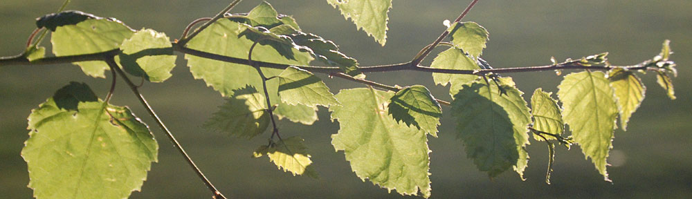
A review with a backstory.

Last summer, I did a flying gig that started in Spokane and had me flying over a good portion of the state. The client was a video production company based in the U.K. that was working on a NOVA documentary about the ice age floods, which are often referred to as the Missoula Floods.

If you don’t know anything about the Missoula Floods, here’s the short version. Millions of years ago, when the Cascades were a chain of active volcanos, they laid down layer after layer of lava that became (mostly) basalt rock. The Ice Ages came and a sheet of ice stretched from the North Pole down into the northern United States. In Montana, the ice sheet formed a dam across the mouth of a valley and huge volumes of water accumulated behind it. Over time, the ice dam was eroded and broke free, releasing all that water very quickly. It came downstream, across Idaho and Washington State, carving out some very interesting canyons and other formations. Then the ice dam was created again and broke again and created again and broke again. This cycle happened at least 15 times, depending on who you talk to, starting about 16,000 years ago. It explains the modern geology of Central Washington state’s coulees (those carved canyons), potholes, dry waterfalls, and so-called Scablands. You can read more about this in Wikipedia. Or you can just watch the documentary I’m reviewing here.

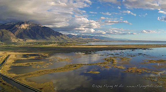
The best way to get an idea of the massive scale of the hydrologic action resulting from the Floods is from the air. Sure, you can take a hike into a coulee or to the top of Dry Falls and look around, but it isn’t until you get a few hundred feet up that you realize just how enormous these places are. So the film crew looked for a helicopter with a Cineflex camera mount. Of course, there aren’t any of those outside a big city and they did have a budget so bringing one in was not an option. They did, however, find my helicopter company, Flying M Air, which, at the time, owned a Moitek gyrostabilized camera mount (which I’ve since sold).

I should mention here that this is the one and only time that damn camera mount got me a flying gig. I bought it to increase my aerial photo business and very seldom used it. I charged a fee for its use and it probably finally paid for itself sometime in 2014; I’d owned it since 2009. It was a beautiful piece of equipment, exquisitely hand made right here in Washington State, but it weighed a ton and took 30 minutes to assemble and another 20 minutes to break down. I hated dealing with it, despite the $500 per use fee I charged. Packed in two huge Pelican cases — one for the mount itself and one for the three Kenyon KS-8 gyros that went with it — it took up space and gathered dust on my garage floor. I sold it to an LA-based pilot for just $5K this past summer. What a steal. The gyros alone were worth more than that — but I don’t miss it one damn bit. It was not one of my best asset acquisition decisions.

The Flights

Turns out that they needed a videographer who could use the mount and had appropriate equipment to mount on it. I turned to Charley Voorhis of Voortex Productions, one of the two local video companies I’ve worked with. Charley has some impressive equipment — I think he brought one of his RED cameras for this gig — and lots of experience with the mount. (I almost wish he’d bought it.) Then I stepped back and let him make his deal with the client. All I cared about was flying.

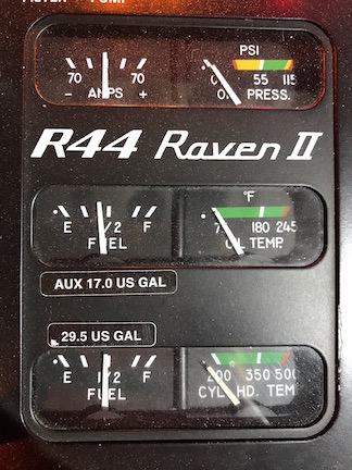
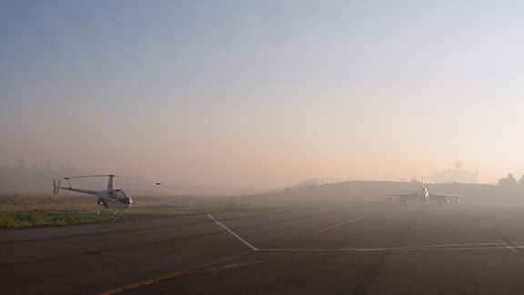
The day of the flight came and we left, bright and early, for Spokane. I’d already set up the mount as far as I could, tying it down with gaffer tape since it would be out of balance until a camera was on it. I’d put the door back on so we could maximize cruise speed to get to the client meeting site; the helicopter is limited to 100 knots with any door off. We got there on time and met at the FBO to come up with a plan. I had them top off the tanks with fuel and removed the door where the camera mount was. Charley set up his camera.

We wound up doing several flights. The first was a long one that started in Spokane, flew directly out to Dry Falls — which is about 2/3 of the way back to Wenatchee — circled that more times than I can count, and then headed down the smaller lakes to Ephrata, past Moses Lake, and over the Potholes Reservoir. On board were me (of course), Charley, and the video director (or producer?) who told Charley what shots to get. The mount took up a whole seat but I wouldn’t have taken a third passenger if I could; I have a strict policy regarding the number of people on board for photo flights and always limit it to three.

Dry Falls Photo Shoot
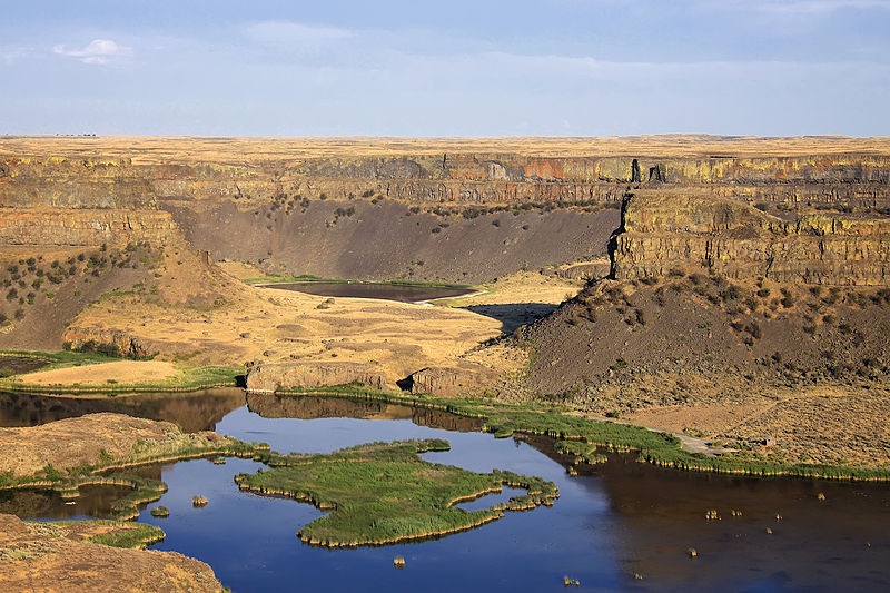
Here’s a closeup of my track, recorded automatically by ForeFlight, for the time we were in the Dry Falls area. What’s ironic here is that we flew around in a noisy helicopter for a good 15 minutes and likely bugged the hell out of people on the ground. A drone probably could have gotten the same footage without disturbing so many people. (Of course, it would have taken most of the day.) But because Dry Falls is a Washington State Park, drones are prohibited. Go figure, huh?

Dry Falls
Photo of Dry Falls by © Steven Pavlov / http://commons.wikimedia.org/wiki/User:Senapa, CC BY-SA 3.0, https://commons.wikimedia.org/w/index.php?curid=16059590 I think that most of the footage shot from my helicopter and used in the documentary was shot in this area.

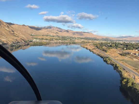
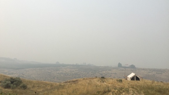
After refueling at Moses Lake — we’d flown about 2-1/2 hours since leaving Spokane — we pretty much high-tailed it back to Spokane. Then we did two flights south past Cheney and east of Ritzville. That’s where the Drumheller Channels are. I’d never even heard of the place, but apparently it’s one of the best examples of the Channeled Scablands. One flight was with the same group on board; the other was with the geologist you see in the documentary. When the geologist was on board, the client’s own videographer flew with me, sitting beside me to shoot the geologist in the seat behind me as he spoke about what we were flying over. That’s probably also when they got footage of my helicopter’s panel and even me. Those two flights each took about a 1-1/2 hours with refueling in Spokane between each one.

After that, we were done. I dropped everyone off in Spokane, retrieved the door, and put it back on. Charley and I sped back to Wenatchee where we went our separate ways.

I think the whole gig was supposed to be just 5 hours, including travel time, but I flew (and billed for) more than 9. It was a very lucrative gig. But what was [almost] better was how much I saw and learned about the geology of the state. That’s one of the reasons I like doing aerial photo work; I get to see and learn a lot.

The Documentary

I have to admit that once my invoice was paid — which took a little effort since the money was coming from the UK — I didn’t give the project much thought. I didn’t even blog about it. That’s probably because last summer was very busy for me and I did a lot of cherry drying work. I even dried cherries later that day. I’d stopped blogging about my interesting flights, although I really don’t know why.

So imagine my surprise when a lawyer friend asked me yesterday in an email if he’d just seen my helicopter in a NOVA episode.

I went online and found the NOVA episode titled Killer Floods immediately. And although I rarely watch television during the day, I’m recovering from a cold and figured it was a good way to kill an hour. So I sat down, fired up the Roku with PBS, and watched it.

Let me start by saying I generally like NOVA documentaries. At least I used to. They’re filled with facts and good videography and leave you feeling better educated about topics than you were before you watched them. But I don’t know if it’s a general trend in documentary filmmaking or just a new NOVA style, but it seems to me that they’re trying too hard to sensationalize the topic or apply it to today’s world.

Two things immediately struck me about this one.

First, the name: Killer Floods. This particular documentary covered three flood events, all three of them were prehistoric. So although it’s likely that they killed something — plants? animals? — they didn’t have an impact on man at the time. In addition, their significance was not the fact that things were killed but more that the flooding changed the shape of the landscape by suddenly and violently eroding and washing away rock.

Second, the attempt to suggest that the three floods documented in the video have anything whatsoever to do with today’s flooding due to climate change. They managed to include footage from the flooding in Houston from Hurricane Harvey — a mere two months before air time! — which has absolutely nothing to do with these three prehistoric floods. Yet the narrator suggested that they might be related. I think that’s stretching it beyond reasonability.

But hey — I get it. They want people to watch so they come up with sensationalized names (see also Killer Hurricanes and Killer Volcanoes), and try to get people interested by pointing to recent events that they’re familiar with. After all, is the average person going to be interested in a documentary about how three prehistoric flood events changed the landscape in relatively remote areas of Central Washington State and Iceland or under the English Channel? I doubt it. NOVA is competing with reality TV, sitcoms, and sports. While I’m interested in just about any topic NOVA covers, most people aren’t. Sad but true.

That said, I thought the documentary was well written and produced, with plenty of good videography, interview clips, and narration. It walked viewers through the logical process of figuring out how each of the three landscape formations they were researching were actually made. (I already explained the one in Washington State; I’ll let you watch the documentary to learn about the other two.) The Washington one was a bit slow for me because I already knew the answer but I found the other two fascinating. I’ve been planning a trip to Iceland for late next summer and may extend it a few days to take in some of the sights shown in the documentary. And now I have a fresh desire to see the White Cliffs of Dover.

But what really tickled me was seeing my helicopter near the very beginning of the documentary, with the Flying M Air logo prominently displayed. Later, a shot shows my door with my name on it. And somewhere else near the beginning, you can see the helicopter’s controls and even a quick shot of me looking like a bit of a bum in my gray sweatshirt.

Those glimpses were enough to get my brother, who never picks up the phone, to give me a call yesterday evening. “I’m watching NOVA. Is that your helicopter?”

And that set off an hour-long conversation about all kinds of things. Heck, I talked more with him yesterday evening than I had all of last year. (Seriously: he just doesn’t like to talk on the phone.)

This obviously isn’t the first time I’ve been involved in a video production. I’ve been flying this helicopter since 2005 and have done countless video/photo shoots over the past 13 years. But I’m pretty sure this is the first one that has appeared on PBS or a highly respected documentary series like NOVA.

It’s about as “big time” as my little company will get — and that’s okay with me.

If you’re going to watch it, watch it soon. The website says it “expires” on December 7. If you’re really interested in flood-related geology, why not get the video? You can buy it on iTunes.

Look for me in the credits.

On Free Rides

Stop asking for them.

Yesterday, I flew for an hour at an event I do every year. It was only an hour because the wind came up, as forecasted, and the turbulence was getting bad enough to start getting me sick. I pulled the plug after only three flights.

River Reflections
The best part of yesterday’s event was the flight to my landing zone in the park before the wind kicked up. The Columbia River was smooth as glass and the few clouds reflected perfectly on its surface.

One of my passengers was a guy who’d been calling me periodically for over two years. He’s handicapped and moves around in a wheelchair. Back when he first called me, he told he only had a few months to live. One of the things on his bucket list was to go flying in a helicopter with his young daughter. Trouble was, he couldn’t afford the $545/hour rate I charged for tours.

News flash: most people can’t. Hell, even I can’t afford that. But that’s the rate I have to charge if I expect to cover all my costs and make a living.

The One-Hour Minimum

I normally have a one-hour minimum for my flights. There’s a good reason for this.

First, you need to understand that I don’t have an office or hangar at the airport that I sit in every day. That would be a huge waste of time and money since there simply isn’t enough business in this area to keep me busy. I’m lucky to get a few tourism-related flights a month — and that’s only during the spring, summer, and autumn. I make most of my living as a cherry drying pilot; if I had to depend on tours and photo flights to make a living, I’d be bankrupt in less than a year. Instead, I keep the helicopter in my garage at home and pull it out on the relatively rare occasion that a client books a flight with me.

Before every flight, I spend about 20 minutes preflighting the helicopter. Then I spend 10 minutes dragging it out of the garage, 2-3 minutes warming it up, and 3-4 minutes flying to the airport before taking another 2-3 minutes to shut it down. If you’re doing the math, you can see that I’ve already had the engine running — burning fuel and oil and clicking the Hobbs meter — for 7 to 10 minutes — without getting paid. Now I wait 10 to 30 minutes for my passengers. I still haven’t seen a dime. I greet my passengers, give them a preflight briefing, and get them on board. Maybe that’s 5 minutes. Now another 2-3 minutes to start up. I do the flight. I come back. 2-3 minutes to shut down. I go inside the airport terminal with them. I collect the money they owe me. They leave. I go back outside. 2-3 minutes to start up, 3-4 minutes to fly home, 2-3 minutes to shut down. Another 10 minutes to drag the helicopter back inside and another 10 minutes to do a post flight inspection.

Have you been paying attention to the numbers here? My time — not including the actual flight — adds up to about 60 to 80 minutes. This is all time that I’m not compensated for. In fact, if the passenger doesn’t show up at the airport at all, I’ve just wasted all that time, as well as the additional time I’ve waited in case they were late.

And the uncompensated helicopter time — time when I’m actually spending real money to have the helicopter running — is 14 to 20 minutes.

Now imagine that the actual ride I gave was only 15 minutes, as so many people have requested. Say they pay me 1/4 of my $545/hour rate or $136. If we round that uncompensated running time to 15 minutes and add it to the compensated running time of 15 minutes, that means I’m getting $136 for a half hour of running time or only $272 per hour.

That’s less that my operating costs, so I’m losing money.

And isn’t my time worth something?

So no, I don’t do flights less than an hour long — except for certain circumstances.

Special Half-Hour Tours

Half-hour tours are a special circumstance. I sometimes offer these on days when I know I’m going to be out with the helicopter.

Suppose someone books a winery tour at 11 AM on a Saturday. I know I have to be at the airport with the helicopter at 11, so I can offer half-hour tours, perhaps starting at 9 AM, for $295 (slightly more than what a half hour would cost). With up to three people on board, that’s a lot more affordable for most folks. And since I have to be at the airport anyway for that other flight, it doesn’t take any additional uncompensated time. Well, maybe waiting time, but not with the engine running.

So I make the offer on my company website or Facebook page. I figure that if folks are serious about going for a flight, they’ll be watching for special offers. But I’ve only sold a few so far, so half the time, I don’t even bother offering them.

Rides at Events

The other thing I do is rides at events. I have a few events I do every year, including the Wenatchee Wings and Wheels car show in East Wentachee that I did yesterday.

These are advertised events and, in many cases, helicopter rides is a main draw. People will come just for the ride. I usually (these days) charge $40/person for a ride that’s 8-10 minutes long. I can make this work financially by not flying with less than 2 people on board and doing a lot of rides. If my ground crew is good and there’s a big crowd of people, I can sometimes average more than my usual hourly rate. It’s not my favorite kind of flying to do, but I really do enjoy being able to take kids flying — this is often the only way it’s affordable for their parents.

And that’s what I kept suggesting to my wheelchair-bound caller. I gave him information about the next upcoming event each time he called. I guess that after a while, he realized that being in a wheelchair didn’t mean I’d do a special flight just for him. (Let’s be real here: if I did a special flight for everyone who called me with a sad story, I’d be broke and have my own sad story.) I didn’t hear from him for a while and, in all honesty, forgot about him. But when I saw him roll up yesterday, I made the connection. He was finally getting his ride with his daughter at a price he was willing and able to pay. He told me numerous times during the flight how much it meant to him and I was happy for them both.

Before his son lifted him out of the helicopter seat to get him back in his wheelchair, he leaned in toward me and said, “You know, I only have six months to live.”

Some People Don’t Give Up

They hung around while I did the few other flights. When I shut down for the day and helped my ground crew load signs and chairs into their SUV, he followed us.

“You know, if you ever go flying and want company,” he started.

Oh, how I wish I had a dollar for everyone who said that to me!

He went on to say that he’d tell all the people in his “group” about it and it would “blow up.” I think he was trying to say that he would promote my services to his group of — well, I never did find out what his “group” was — and they would all come flying with me. But would they be looking for free flights, too? Did he think I wanted my phone to start ringing with more people looking for free flights with me?

How can I run a business if everyone thinks they can get my services for free?

What he doesn’t understand — and what most people apparently don’t understand — is that it costs money to fly the helicopter.

And no, it’s not just gas. It’s oil ($7/quart every 5-8 hours), it’s maintenance (like $300 for an oil change every 50 hours), it’s 100-hour inspections (about $2500 if I’m lucky and they don’t find any problems). It’s a radio altimeter and ADS-B required by the FAA at a cost of $15,000 and $4,000 respectively. It’s insurance at about $15,000 per year. It’s an overhaul every 12 years or 2200 hours at a cost of $220,000. And let’s try to remember that none of it would be possible if I didn’t cough up $346,000 in 2005 to buy the helicopter in the first place.

That’s a shit-ton of money. Maybe it helps explain why I get so pissed off when people expect me to fly them around for free or the cost of fuel?

If I’m going to fly for pleasure, I’m not going to fly it with a pushy stranger full of empty promises. I’m going to fly with a friend or someone else I really like. Or I’m going to fly alone.

I’ve blogged about this in various ways before. I’m not sure if I was ever this blunt. Maybe I’m in a bad mood because I took a loss for yesterday’s event.

Or maybe I’m just sick and tired of people trying to get me to spend my hard-earned money giving them something for free.

In any case, thanks for reading. Rant over.

About Helicopter Fuel Consumption

It’s only part of the cost of operations.

Among the stats recorded for this blog are the search phrases people use to find content here. I can’t tell you how many times I’ve found search phrases related to “helicopter mileage” or “helicopter miles per gallon” or “helicopter fuel burn.” It seems that a lot of people are really interested in learning how much fuel a helicopter burns.

It’s not just the blog, either. I get related questions every time I do a rides gig. I’d say that 1 out of every 10 adult passengers wants to know how many miles per gallon my helicopter gets or gallons per hour my helicopter burns.

Of course, a helicopter’s fuel burn varies based on its make and model — just like an SUV will burn more fuel than a compact car. Bigger engines burn more fuel.

Fuel burn also varies based on conditions, again just like a car. If I cruise alone on a cool day near sea level, the helicopter will be operating efficiently with a light weight to carry and burn less fuel than if I operate near maximum gross weight on a hot day. This is similar to a car’s “highway” and “city” MPG ratings.

Ready for my answer to the question?

My helicopter burns roughly 15 to 17 gallons per hour, depending on conditions.

Helicopters generally take one of two different kinds of fuel. Some helicopters with piston engines, including mine, burn AvGas, which is also known as 100LL, a high-octane, leaded fuel similar to what you might put in a car. (I actually “dispose of” spoiled AvGas in my lawnmower and ATV once in a while. My understanding is that the lead will damage a car’s catalytic converter so I’d never put AvGas in my Jeep or Honda.) Other helicopters with turbine engines, like a JetRanger, burn JetA, which is the same stuff they put in jet airplanes. (It’s also remarkably similar to diesel, although I’ve never put JetA in my truck.)

Aviation fuel prices vary the same way auto fuel prices vary. AvGas and JetA seldom cost the same. These days, my local airport sells AvGas for $5.14/gallon and JetA for $4.04/gallon. The least I’ve ever paid for AvGas was $2.43/gallon way back when I first started flying. The most was around $9/gallon when I needed to refuel at an airport with a fancy FBO that normally caters to business jets. Ouch.

R44 Gauges
I have two tanks that supply the engine with fuel from a single feed (so there’s no need to switch tanks in flight) for a total of 46.5 gallons of usable fuel. (The Master switch is on but the engine is not running in this photo.)

My helicopter can hold about 46 gallons of fuel. I can fly for 2-1/2 to 3 hours on that, depending on conditions. If you figure I average about 100 knots when cruising — that’s 115 miles per hour or 185 kilometers per hour — I can cover about 300 miles on a full tank. Of course, that also depends on wind conditions; I’ll fly fewer miles with a headwind than with a tailwind or no wind.

One more thing. The reason most people seem interested in learning about fuel consumption is because they’re trying to figure out what it costs to fly a helicopter. (At rides gigs, they’re usually trying to figure out my profit.) What they fail to understand is that fuel is only a small part of what it costs to fly. I’ve blogged about this extensively here. Fuel currently accounts for less than a third of my operating costs.

So you can imagine how annoyed I get when people offer to just “pay for fuel” if I fly them somewhere. As if I’m interested in picking up two thirds of the cost of giving them a ride and throwing in my time for free, while forgoing any possibility of a “profit” to help cover the cost of operating my business.

(And what about the $14,000 I need to spend later this year to install a radio altimeter that I’ll never need?)

Anyway, I’m hoping that this post comes up in those searches now. It answers the question succinctly in a way that most people can’t fail to understand.

Another No Fly Decision

Smoke in the area forces me to cancel a scenic flight.

I’ll start this one with a story.

Flashback: Grand Canyon 2004

When I flew for Papillon at the Grand Canyon, Mother Nature threw all kinds of weather at us. In the spring, it was wind, sometimes blowing as hard as 50 miles per hour, causing all kinds of mechanical turbulence on our prescribed tour routes over the forest and Canyon. In the early summer, it was heat and high density altitude, which made the departure and arrival in our rather confined landing zone challenging. Then there were the fast-moving monsoon storms that sped across the terrain, sometimes blocking our path across the canyon and forcing us to shut down when lightning near the airport made it unsafe to refuel. (And yes, we did fly within 20 miles of thunderstorms.) That lightning would often start fires in the forest along the Grand Canyon’s rims, filling the air with thick smoke that made it nearly impossible to see.

Special VFR at GCN
Here’s an early morning view on one of those smokey days at the Canyon. The R22 on the left is mine, parked at transient helicopter parking at Grand Canyon Airport. I used to commute to work by helicopter once in a while; I needed a special VFR clearance to get into the Class D airspace that day. The tall building in the haze is Papillon’s base with its tower.

Honestly: flying at the Grand Canyon is the best experience a helicopter pilot can get. There isn’t much that you don’t experience as far as flying conditions go.

On one late afternoon in August, the area was full of storms and smoke from numerous wildfires. I took off in trail behind at least six other helicopters with another four behind me for one of the short tours. The passengers had come off a bus and their tour had likely been booked years in advance. All 11 helicopters were flying with the same group.

When we reached the Dragon Corridor, where we were supposed to cross the Canyon, we found our way blocked by a thunderstorm that made it impossible to see the other side of the canyon. So one by one we made our radio calls, turned around, went back past the airport, and crossed over the Canyon in the Zuni Corridor. There was a short tour on that side that we’d been taught but Papillon didn’t sell. I’d never flown it, so I basically followed the helicopter in front of me, making the same calls he did when I reached vaguely recalled reporting points.

The air was thick with smoke. The visibility was definitely less than five miles, although it had to be more than three miles for flight to be legal. But maybe that’s what it was at the airport. It wasn’t that over the canyon. At one point, I lost sight of the strobe light of the helicopter in front of me and had to find my way back without him. (We did not have GPSs on board.) I only got a little lost and was very glad to finally see Grand Canyon Airport’s tower. I adjusted my course to put me where I was supposed to be, made my radio call, and landed.

They shut down flights for the day after that.

Afterwards, I went up to the Chief Pilot’s office. His name was Chuck and he’d always struck me as someone who was very reasonable. I complained about the visibility and asked him why we were taking people on scenic flights when we could barely see. His response stuck with me: “If they’re willing to pay and it’s safe to fly, we’ll fly them.”

I swore I’d never take that attitude with passengers in my tour business. Indeed, years later I turned down a flight I could have done because I was certain that wind and turbulence would have made my passengers miserable.

And I’ve turned down flight since. Today is one of those days.

Today: Smoke in the Wenatchee Valley

The hour-long tour for one of my client’s vice presidents and his out-of-town guests has been on my calendar for about two months. I have the passengers names and weights and have done my weight and balance calculations. I know where they want to go and what they want to see.

The smoke started blowing in last week, which is kind of weird because (1) there aren’t any fires nearby and (2) there isn’t much wind. Apparently the fires are mostly in British Columbia (Canada), which isn’t very far from here, was well as in northwestern Washington State, on the other side of the Cascades. There was a rumor going around that there’s a fire in Blewett Pass, which is actually quite close, but I can’t find any information anywhere about that, and I have good sources to check.

Smoke from the Airliner
As this photo from my friend shows, the smoke was a thick blanket up to about 14,000-18,000 feet.

So the smoke is drifting down from Canada on a light breeze. It’s settling in the Columbia River Valley at Wenatchee. And elsewhere. A friend who who took a Horizon Airlines flight out on Thursday sent a picture from 20,000 feet and there was a blanket of smoke right beneath the plane. It was so bad I blogged about it.

For the first few days, it was a light haze. But yesterday it settled in so thick that not only could I smell the smoke, but I couldn’t see the river from my house, let alone the airport on the shelf right above it. Sure enough, the airport was reporting 1-1/4 mile visibility. Instrument meteorological conditions (IMC), meaning that it wasn’t legal for me to fly without getting a special VFR clearance from Seattle.

Bad View
I shot this photo from my deck yesterday when the visibility was at its worse.

Foreflight Weather
Turning on ForeFlight’s visibility layer displays visibility in miles at each airport that provides this data. Clicking the number displays details.

I emailed my client yesterday, asking him to check in with me an hour before the flight. But I wound up calling him this morning, two hours before the flight. I’d used ForeFlight, the basis of my electronic flight bag, to check conditions at Pangborn Memorial Airport, which I could barely see across the river. It was reporting visibility at 2-1/2 miles: IMC.

Could I fly in these conditions? Technically, yes. I could get a Special VFR clearance to leave my home (which is within Pangborn’s Class E airspace) and fly up to Baker Flats where my client would be waiting. That’s in Class G airspace where only 1/2 mile visibility is required for helicopters during the day. I could then do the whole tour, making sure I stayed out of class E airspace or get another clearance if I wanted to enter Class E. So yes, it’s legal.

But is it safe? Well, since I would always remain within sight of the ground and whatever’s at least a half mile in from of me and I can fly at virtually any speed to keep it safe, then yes, it’s safe.

So by Papillon’s standards — at least those back in 2004 when I flew there — I shouldn’t hesitate to do the flight. After all, it’s money in the bank, right?

I don’t think that way. It’s all about passenger experience. Other than me getting paid for a hour of flight time, what’s the benefit? The tour would be terrible — my passengers wouldn’t be able to see more than a mile or two during the entire flight. What’s “scenic” about that?

My client understood perfectly. He was happy to cancel. We agreed that we’d keep an eye on conditions and that if, by some miracle, a wind kicked up and blew some of the smoke out, we could try in the afternoon. Or maybe tomorrow. I’ve got nothing on my schedule. But it’s more likely that we won’t do it at all since his guests are leaving town on the 6 AM flight tomorrow morning. (Provided Horizon can get the last flight in tonight.)

In the meantime, I don’t mind staying home today. It’s better indoors with the windows shut than outside breathing that crap we’re importing from Canada.