I discover geocaching and plan to take it to the extreme.
Years ago — I really don’t know how long — I bought a Garmin GPS 12Map. At this time, it was hot stuff. It was one of the first 12-channel receivers, which means it acquired satellites quickly and managed to hold enough of them in transit to be useful. It had a grayscale screen with a moving map. It had about 1.4 MB of memory, which you use to store detailed maps, so that detail would be available when you were using it. Although it didn’t talk to my Mac, it did talk to my PC. I downloaded Garmin maps into and uploaded waypoints and routes from it to another, more detailed software package.
I used it a lot. This was before I seriously got into flying and I had my Jeep, which we used to take on back roads once in a while. We’d load up the maps for where were were going and take a drive. We always knew exactly where we were and could consult the map to find our way in or out of a location. We also knew the names of all the land forms and other named places we passed.
I also used it for horseback riding. The GPS had an automatic tracking feature. I’d start it up, clear the track log, and attach it to my saddle, antenna side up. It would faithfully record every twist and turn in the trail. When I got to a gate, I’d mark it as a waypoint. Then, when I got back to my office, I’d upload the route information to the mapping software and display the horse trail on a topographic map. Do that a few times on all different trails and, before you know it, you’ve mapped all the trails on a topo map. Cool.
Although I stopped using the GPS regularly, I never really stopped using it. (Not like I stopped using my Palm or my Newton. But let’s not go there, huh?) Most recently, back in September, I pulled it out, loaded a few topo maps into it, and took it on a driving trip on the north side of the Grand Canyon. (I’m pretty sure I wrote about that trip in these blogs somewhere, probably in the “Travels with Maria” category.) Basically, any time I plan to take the Jeep off pavement, I bring the GPS, loaded with appropriate topo maps, with me. I have mounting hardware in the Jeep and a cable that provides power to the GPS. So as long as the engine’s running, I don’t have to worry about batteries.
For the record, I don’t use the GPS to drive from point A to point B on paved roads. If you need a GPS to do highway or city driving (“Turn left here.”), you really shouldn’t be driving. Take a cab or hire a chauffeur. Or ride Greyhound, and leave the driving to them. Or learn how to read a damn map!
Now, five or more years later, my GPS is outdated. Sure, it still does what it always did, but there are so many more GPSes out there with so many more features and so much more power. Color screens, more than 50 MB of memory, more waypoints, etc. For the past year or so — actually, every time I take out the GPS and use it — I think about how nice it would be to store 100 topo maps instead of just 4 or 5. That would certainly save a lot of trips to the PC in my office, just to load up maps. I could load all the maps I normally need and have that detail every time I went out.
But I don’t use it all that much and I can’t really justify the expenditure of $400 to $500 for the latest version of a “toy” I already have. (Hey, at least I could write paying articles about the iPod Photo.) So I haven’t replaced it.
Then I discovered geocaching. Wow, what a silly sport. Person A takes a weatherproof container that can be as small as a film canister or as large as an ammo can and fills it with trinkets like tiny stuffed animals, keychains, stickers, and beads, adds a small notepad with a pencil, marks it as a geocache, and hides it somewhere. He then takes the GPS coordinates (several times, to make sure they’re right) and publishes them on a Web site like www.geocaching.com, along with a name for the cache and a description or hints. Person B, having nothing better to do with his time, gets those GPS coordinates off the Web site and looks for the cache. When he finds it, he removes one relatively worthless item — perhaps the keychain — and replaces it with another relatively worthless item — perhaps a pin-on button. He also makes a note or two in on the notepad and then, when he’s back in front of his computer, he logs his find.
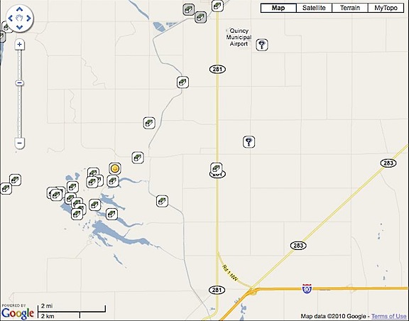
It may sound easy, but it isn’t. I went in search of one yesterday, just to see if I could find it. Named “Airport,” it was on the side of the road, not far from Wickenburg Airport. We zeroed in within 40 feet, stopped the Jeep, and got out to look. Unfortunately, our wet winter had resulted in tall grass and weeds that are now dead and likely hiding places for snakes. We arrived not long after sunset, while it was still dark, and cautiously searched the brush. At one point, my GPS told me I was within 4 feet. But I just couldn’t find it and I wasn’t prepared to push aside dead grass to look harder for it. So we let it go. I’ll try again another day, when I’m better prepared with a stick, a gun full of snake shot, boots, and gloves.
What I like about the idea of geocaching is the challenge of it and the fact that it forces you to go outdoors and explore off pavement. This alone is a good reason for people to do it. Think of all those mall walkers, trying to get exercise by walking in the mall. Now take off their walking shoes and replace them with hiking shoes, give them a GPS, and tell them to find a cache. They’re still getting exercise, but they’re breathing fresh air. They’re also seeing trees and bushes and grass and sky and maybe a few animals rather than whatever’s playing in mall shop windows. And there’s no Starbucks to lure them in for a mochachino. The terrain may be a bit more rugged and not suitable for some of the less steady folks, but I think it could work for lots of people. And even if they don’t find it, they’ll still probably have some fun.
I can imagine it now: five women and a man aged 60 to 75, out in the desert on a trail. They’re wearing sweatsuits that they bought in Wal-Mart, one of them has a sweatband around her head, and another has a walking stick she bought at the Grand Canyon. One woman, the tallest, is holding the GPS up, looking at it through the lenses of her half-frame glasses. (She got the GPS away from the man early on, when it was clear to her that he couldn’t program it.) “It’s this way,” she announces, pointing to her left. The group starts walking.
But seriously, it seems like an interesting activity and a great excuse to get outdoors.
Of course, I’ve started thinking of making it really challenging, not by hiding the cache in tall, potentially snake-filled weeds at the side of the road, but by placing it in a location that’s difficult to get to. A location with no roads or trails. A location that — you guessed it — is accessible by helicopter.
I call it extreme geocaching and it’s for people who need an excuse to go beyond the boundaries of civilization, to places no one ever goes.
All the cache locations would be within a mile of a Jeep-accessible road, but there may not be trails to get to them. It would take real skill and determination to reach them. But it would be worth it, not only for achieving a difficult goal, but for the destination itself. You see, the GPS coordinates wouldn’t take you to a bush or hollow tree. They’d take you to an interesting site with ruins, abandoned buildings, swimming holes, or hot springs. Someplace to explore. And you wouldn’t find dime-store novelties in the caches — there would be stuff with value, like current maps, books, flashlights, CDs, and gift certificates.
There would, of course, be a safe helicopter landing zone within a quarter mile of each of the caches. That would make extreme geocaching the perfect helicopter sport.
Of course, I feel pretty silly talking about extreme geocaching when I can’t even find a metal container on the side of route 60 just outside of Wickenburg.
Anyway, if you have an interest in geocaching, visit the Geocaching Web site. You can enter a zip code near the top of the Home page window to search for caches near you. I was amazed to find that there are about 6 of them within half a mile from my house. (We’ll take the horses out to find them when the weather cools down a bit.)
And if you live in Arizona and want a real challenge, keep checking in here. I expect to establish my first extreme geocache later this month. Use the comments link for this entry if you have any suggestions for what the cache should include. Keep in mind that my budget is $100.

 I had a travel bug (like a dogtag with tracking information) and attached it to a gumby-like figure that I named Smiling Yellow Devil (SYD). I logged it into the Geocaching.com Web site and gave it a “mission”: travel to New Orleans, where @PlagiarismToday lives. With luck, the folks who find SYD will not only keep moving him from cache to cache, but they’ll move him toward New Orleans. It might take years, but eventually, I hope he gets there.