Jumpoff Ridge and Clear Lake

A Jeep drive to an exploratory hike.

Kirk and I spent much of Wednesday morning clearing boxes of items out of my RV (AKA the “Mobile Mansion”) as part of a major cleanup. It was a big job made more manageable by a helper who kept me focused and moving. I suspect that if Kirk and I joined forces for any big job, we’d get it done in record time.

Afterwards, we went inside for a break and lunch. I whipped up some pizza dough and picked eggplant, zucchini, and tomatoes from my garden. By 1 PM, we were each making our own pizza masterpieces, which we later ate out in the shade on the deck.

That took us to 2 PM. Half the day was still ahead of us.

We’d talked about taking out the boat for a short ride, but it was windy down on the Columbia so we put it off for another day. Then Kirk suggested taking the Jeep up onto Jumpoff Ridge, where a road wound along the edge of the cliff. I’m always game for a Jeep ride, so we pulled out the Jeep, loaded Penny and some bottled water on board, and took off.

On Jumpoff Ridge

Jumpoff Ridge is the name of the cliff face due south of my home. It rises more than 1,000 feet from the shelf where my home sits. The side facing me is layered basalt columns that are strikingly beautiful, especially with golden first or last light shining on them. Topo maps and satellite images show a road up there that meanders along the top of the cliff. One of the local property owners, in an attempt to avoid contributing to road association fees, claimed he’d use that road to access his land — yes, his 20 acres does include the cliff face and a sliver of land on top. I’d been wanting to check out the road for at least a year and was looking forward to the drive up there.

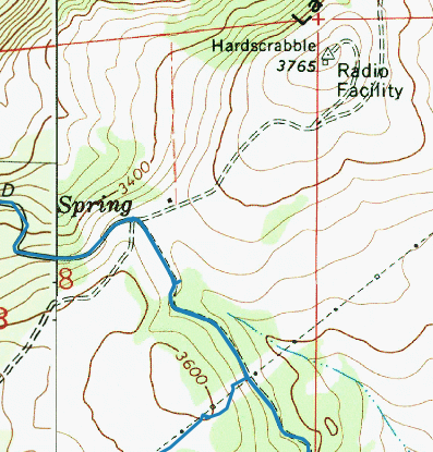
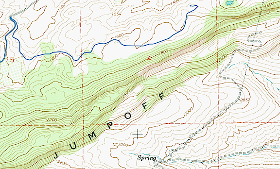
Jumpoff Ridge Topo
A topo map shows the steep cliff on the north side of Jumpoff Ridge. The road we planned to drive is indicated by the double dashed line atop the cliff. The blue track line to the right of the sharp turn is the road I live on, which was built after USGS topo maps were published.

I knew how to get to the road we sought. Follow Joe Miller Road to Stemilt Loop Road and turn left at the church. Then follow that to Jumpoff Ridge Road. From there, it turns to improved gravel. It’s a moderately steep climb through ponderosa pine with tantalizing glimpses of the orchard-filled land in the Stemilt Hill and Wenatchee Heights areas below. There are about a dozen lots, some of them with homes on them, at the top of the road. One of them belongs to one of my charter clients and I’ve landed and departed with the helicopter from his yard at least a dozen times over the past two or three years.

Top of Jumpoff
At the top of Jumpoff Ridge, the topo map showed a 4-way intersection. But there was no left turn to the radio facility.

That’s also where the road splits. A left hand turn at my client’s house would take us to the road we sought, but the only left hand turn we saw looked like my client’s driveway. We could see the antennas — marked “Radio Facility” on the topo map — beyond and knew that’s where we needed to be. But there didn’t seem to be a way to drive through. So we went straight, looking for another left hand turn.

We found it a while later, but it was gated and locked. We kept going, passing under the Bonneville power lines and a handful of other homes. (When people say I live “out there,” they should come visit these people. They’re way out there.) Realizing the road was not likely to take us where we wanted to go, we turned back and had a closer look at that gate. It was securely locked with signs warning against trespassing. The road was strictly for communications company and power company use.

I guess my freeloading neighbor had no idea what he was talking about when he claimed he’d use that road to access his property. (Or, more likely, he was just a lying sack of sh*t.)

We stopped to consult the map I’d preloaded onto my phone’s Gaia GPS app. I’d already told Kirk about Clear Lake, where I’d stopped in November with my friend Don. It had been frozen hard that pre-winter day, after an early hard freeze. Don had bowled rocks across its surface just to hear the weird echoing sound as they bounced and slid. I thought it was a good alternative destination. The map showed a road off the southwest-bound powerline road (which was not gated) that would “shortcut” to it. It even had a name: Rock Ridge Road. We headed off to find it.

The road climbed steeply up a rocky slope and joined up with the Bonneville Power lines. It veered off into the forest and rejoined the powerlines. Then there was our right hand turn, right where the map said it would be. But there was also an “Authorized Vehicles Only” sign. Really? Ugh.

Faced with the choice of going back or taking the longer way around, we kept moving forward. The road was a lot longer than I remembered. It joined and left the powerlines several times, mostly climbing. There were tall pines, surprisingly green grass, and large meadows. I could easily imagine elk grazing there.

My 1999 Jeep Wrangler drove like a champ. I’ve owned this vehicle since new and, quite frankly, I don’t take very good care of it. In fact, I think it’s safe to say that I routinely beat the crap out of it. It had been flashing the Check Engine light on rough terrain on and off, coupled with a stuttering engine, for months.. Earlier in July I’d finally had it checked and fixed. Turned out to be a wiring harness damaged by rodents — a much cheaper fix than I’d been prepared for. This was a good practice run for our upcoming camping trip to Glacier National Park and I was glad to see it running so smoothly.

After miles of rough road, we finally found and made the right hand turn that would take us down off the ridge: Schaller Road, according to the map. It was rocky, rough, and full of switchbacks. That dumped us onto Upper Basin Loop Road. We caught a glimpse of a pickup truck turning onto a road up ahead — the first vehicle we’d seen in over an hour — and kept on straight until we reached the turn for Clear Lake.

At Clear Lake

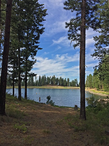
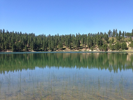
Clear Lake
Clear Lake is a small reservoir in the woods.

Clear Lake is a very small reservoir in the Stemilt Basin. It likely collects and stores water for one of the dozens of Stemilt cherry, apple, or pear orchards in the Stemilt Hill area. The road ends at a locked gate close to the lake. We parked and got out for a walk. Penny was very happy to get out of the Jeep, where she’d been riding on Kirk’s lap since our departure from home. There was no one around and it was peaceful.

The topo map showed another larger lake to the west, on the other side of the ridge: Lily Lake. Although our time was somewhat limited — Kirk had a meeting later that evening in Cashmere and the drive had already taken longer than planned — we set off to see if we could catch a glimpse of the other lake. Like me, Kirk has kayaks and we’re always interested in finding new destinations for a leisurely paddle.

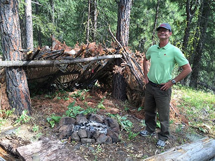
Lean To in the Woods
We stumbled upon this old lean-to in the woods up the hill from Clear Lake.

We followed a trail and then a road and then a trail o the west side of the lake and started the climb up the ridge. Near the top, we found an old lean-to made with branches and the remains of a campsite. But not much else.

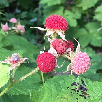
Thimbleberries
Ripening thimbleberries. While not as tasty as raspberries or blackberries, they do make a nice treat.

We dropped down and followed the road back to the southeast. There was another locked gate and we walked around it. That took us southwest on a road that small trees were already starting to reclaim. Thimbleberry bushes lined the road and Kirk and I picked and ate the reddest ones. A small creek roared in a steep but narrow canyon beside us. After about a quarter mile, the road dead-ended at a dam with a valve: the control for the underground pipeline that was filling Clear Lake from the creek. There was no road or trail beyond to Lily Lake.

Dam
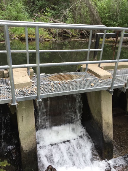
A concrete dam in the forest formed a small pond where a buried pipeline fed Clear Lake. Water over the spillway fed the creek we heard in the ravine beside the road.

After snapping a few photographs, we headed back to where the Jeep waited. We’d visit Lily Lake another day from a road on the other side of the ridge that I’d already spotted on the map. There were other lakes up that way and it would make a good day trip for us, giving me the Jeep outing I wanted with the hiking Kirk preferred. Win-win.

Heading Home

The trip home was uneventful. It was less than a mile back to pavement from Clear Lake. Then back to the church and Joe Miller Road and, eventually, my road.

Kirk snacked on some cold pizza as we loaded up his car. He headed out for his meeting. I heated the rest of the pizza in the oven and snacked on it while unwinding from the bumpy trip, glad to have found an excellent traveling companion for future adventures.

Curious about our route? Click here to see it and all the photos I took.

Putting Away My Toys

Well, most of them, anyway.

July 4th was a big day for me. It marked one week after the concrete had been poured for the slab of my new home. That meant it was safe to drive on it.

But what that really meant to me was that I could move most of my vehicles back into covered parking.

Three of my four garage bays were cleared out and ready to accept vehicles. The fourth was my temporary dining area for entertaining dinner guests. I couldn’t really get a vehicle into that garage anyway because of the pile of scrap lumber out front, effectively blocking the entrance.

My Four-Car Garage
Here’s what the inside of my garage looked like on July 4. It’s a panoramic image; the only way I could shoot the whole thing.

Up for storage: my 1999 Jeep Wrangler, my 2003 Honda S2000, and my 1995 Searay Sea Rayder boat. My 2003 Ford F350 SuperDuty diesel truck would have to wait outdoors.

I backed them all in and took a photo before closing and locking the doors.

Toys Stowed
This might explain why I wanted a 4-car garage.

Later in the week, I parked my 1992 Yamaha Seca II motorcycle between the boat and the table and my 1999 Yamaha Grizzly ATV between the Jeep and the Honda. eventually, they’ll be moved into the RV garage where they’ll be easier to get out when needed.

(None of my vehicles are new, but I like to think they’re in decent shape. And they’re all paid for, which is more than most people can say about the flashy new vehicles that are part of their credit-driven lifestyles.)

After more than 10 years living with my vehicles scattered all over the place or parked out in the hot sun, it’s nice to finally have them all under one roof.

A Seattle Day Trip

Planned, executed, and enjoyed.

Wenatchee to Seattle Map
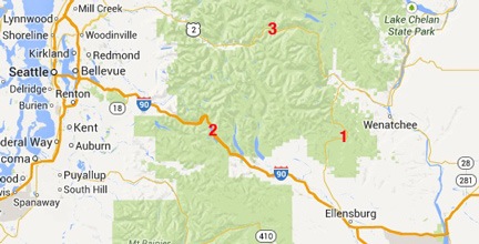
Wenatchee is nearly due east of Seattle. Malaga is under the “c” in Wenatchee on this map. The numbers mark the three passes over the Cascades between Malaga and Seattle: (1) Blewett (Rte 97), (2) Snoqualmie (I-90), and (3) Stevens (Rte 2).

I live in Malaga, WA, a small farming community on the outskirts of Wenatchee on the Columbia River. Although the small city Wenatchee offers just about everything a person needs on a daily basis, some things are only available in big cities. The closest big city is Seattle, 145 road miles away.

As I did when I lived in the Arizona town of Wickenburg — which had far less to offer than Wenatchee — I would often wait until I had multiple big city tasks to complete before planning a trip and getting those things done. Phoenix was closer to Wickenburg and I went there more often. (I actually lived there for a while during the 2011/2012 winter season; I was not very happy, despite the convenience.) Seattle, a three hour drive away, isn’t the kind of place I’d zip off to on a whim or to chase down a needed computer component or decent restaurant meal. (And it certainly isn’t the kind of place I’d want to live — too much cloudy weather!)

But as time went by, I accumulated “excuses” for a day trip to Seattle. I needed to get the battery on my iPhone replaced (under warranty) at an Apple store before November month-end. I wanted to buy cross-country skis without spending the $600+ dollars it would cost me locally for a setup. I was interested in meeting up with some like-minded people in one of the many Meetup groups based in Seattle.

On Saturday morning, a Meetup group notice in my email inbox spurred me to action. One of the groups that interested me was gathering for a weekly hike around Green Lake in Seattle followed by lunch at a local dog-friendly cafe. The hike would be at 11 AM on Sunday. I had nothing else on my calendar for that day. Within minutes, I was planning my day trip.

The Plan

The plan would start at REI’s flagship store on Yale Avenue North, right off I-5. I’d already done some online shopping and found a good deal on cross-country skis, boots, and poles that would save me $200 off what I’d pay locally. (I like to support local businesses with my shopping dollars, but I simply can’t swallow the extra cost these days.) I called the store and had them put the skis on hold for me. The store opened at 10 AM and it would be my first stop.

Next was the hike. That started at 11 and all I needed was the address for the meeting place, the stadium at Green Lake.

I’d finish up with a stop at an Apple Store. A quick search showed me one near the hiking destination, in a place called University Village. I went onto their web page to set up a Genius Bar appointment. I gave some careful consideration to the appointment time. I didn’t want it to be too early, forcing me to cut my time with the meetup folks. But I didn’t want it to be late, forcing me to drive home in the dark with possibly bad weather on the way. Finally, I chose 3:20 PM from the available times.

I then called Apple support and had them pull up the notes on my iPhone case. I wanted to make sure the there was no question about them replacing the faulty battery. I was assured that there would be no problem getting it done while I waited.

I entered all of these items into my calendar as events, making sure I included street addresses. When my calendar synced with my phone and iPad, I’d have them handy throughout the day.

The Drive

There are basically three ways to get to Seattle from Wenatchee.

  • The shortest route (time-wise) takes me north through Wenatchee onto Route 2 west with a turn onto Route 97 south. Route 97 is a relatively narrow, winding mountain road that crosses Blewett Pass at 4,102 feet. The road then descends down to Cle Elum, where I’d turn onto I-90 west. That’s a major freeway that winds up through the mountains and crosses at Snoqualmie Pass at 3,022 feet. After that, the road descends right down into Seattle, just a tiny bit south of center city. This is the route that most mapping apps and GPSes suggest.
  • The shortest route (distance-wise) takes me north through Wenatchee onto Route 2 west and stays on Route 2 through Stevens Pass at 4,061 feet. Route 2 is a winding mountain road and, although it’s a beautiful drive, it seems amazingly long.
  • The longest of the three main routes goes southeast from Wenatchee through Quincy to George where it picks up I-90. From there, it heads west through Ellensburg and Cle Elum, over the mountains at Snoqualmie Pass at 3,022 feet and down into Seattle.

Although I dislike driving on freeways, this was not a pleasure drive. I had a need for speed to make the most of my day in Seattle. In addition, winter weather advisories for the Cascade Mountains made it likely that snow would be falling overnight and possibly on Sunday morning. My experience driving in snow is limited — after all, I lived in Arizona for the past 15 years — and I wasn’t interested in a thrill ride. The way I saw it, the better the road over the mountains, the more likely it would be clear of snow and ice. So I chose the longest of the three ways, adding about 40 miles (but theoretically only 15 minutes) to my one-way drive.

(By the way, in case you think I’m over-reacting to a little weather on my drive over the mountains, consider the fact that WDOT has a whole section of its website dedicated to mountain passes. You can access live webcams, condition information, and restrictions 24/7/365. Indeed, when I was chatting later in the day with various Meetup members, two of them asked me about pass conditions when they heard where I’d driven from.)

I had to take my truck. Cross-country skis would not fit in my Honda S2000 with the top up and top-down driving was not an option with mountain temperatures in the 30s and a real chance of rain or snow. Although the skis might have fit in my Jeep, it’s a soft-top and can’t be secured. I didn’t want those skis disappearing out of my Jeep while I was on my hike or in the Apple Store. So my truck was the obvious choice. It gets decent mileage for a truck (about 15-18 mpg highway) and is comfortable to drive. It also has new all-weather tires.

I packed some emergency gear just in case I got stuck on the road: a blanket, some non-perishable food, some water. I already had tow-straps and emergency reflectors on board. (Note to self: buy flares.) I really didn’t know what to expect and wanted to be prepared.

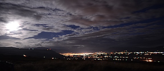
By 7 AM, on Sunday morning, I was ready to go. The sky was just brightening and the full moon was illuminating the world around me where it broke through the clouds. The weather forecast called for good weather in Wenatchee and I had a few second thoughts about my trip to Seattle. After all, the weather forecast for that area was cloudy with a 40% chance of rain and a high of 50°. Not very pleasant. If I stayed home, I could get some work done in the yard.

Moonlight
I snapped this photo right before I left on my day trip to Seattle.

But I was really looking forward to getting things done in Seattle. So I put Penny’s coat on her and bundled her into the truck. A while later, we were on our way south. I had my phone connected to the truck stereo with MapQuest giving me directions and updated ETA info and Downcast playing podcasts from NPR.

There was weather in the Colockum west of Quincy. I’d been flying in that area just a few days before, on a wildlife survey flight. Low, fog-like clouds engulfed the hills and canyons offering glimpses of fresh snow. I thought about flying over the area later in the week and hoped I’d get the opportunity.

It didn’t start drizzling on us until we were on the freeway heading west, just getting close to Ellensburg. The sky was gray with a low overcast. The windmills appeared out of the gloom, rotating slowly as I passed them.

Snowqualmie Pass
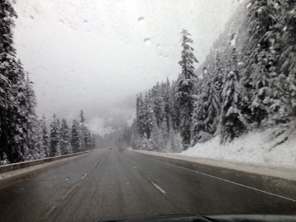
Despite the gray, the thick snow in the pine trees made the scene beautiful.

As we climbed through Cle Elum, I saw the snow level not far above us. Soon there was snow on both sides of the road. The speed limit dropped from 70 to 55. Signs warned about slush on the roadway. Then the speed limit dropped to 45 as we climbed to the pass. The snow was thick on the pine trees and the road was wet with small piles of snow on the shoulders.

It was a non-event, really. The roads were not slippery and there were so few vehicles on the road that the going was easy. Soon we were past the pass and headed down toward sea level. The snow disappeared and even the rain let up a lot. It was a mere drizzle by the time we turned onto I-5 for the last two miles of our trip to Seattle.

REI Flagship Store

REI is a major retailer for outdoor sporting goods for active people — gear for hiking, camping, skiing, paddling, etc. They have locations all over the U.S. I know them from my New Jersey days, but also occasionally visited their Phoenix locations — especially the last year I was in Arizona, when I had become a lot more physically fit and active.

Although REI is not the cheapest source for sporting gear, it is one of the best. They carry good quality equipment at a fair price and have knowledgeable and helpful sales staff. Articles on their website, such as this one about choosing cross-country skis, are extremely helpful when making a purchase decision. They offered a discount on complete ski packages — which I needed — and were having a sale.

My Compact Truck
If it fits in a “compact” spot, it’s a compact vehicle, right?

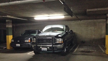
With some difficulty, I maneuvered my pickup into the underground parking lot beneath the building. It was 10 AM when we arrived and cars were just pulling in. Because I foresaw the possibility of a difficult drive out of the lot once it was full, I backed my truck into a spot with a clear drive out. It wasn’t until after Penny and I left that I realized the spot was marked “Compact.”

I took Penny for a walk around the block. It was then that I realized what a neat facility I was at. Not only did they have a huge rock-climbing wall in the front of the store, but there were mountain bike and hiking trails for testing out equipment. The waterfall was a nice touch, too. Sure did drown out the sound of the nearby freeway, anyway.

I put Penny back in the truck and went in to take care of business. There was only one guy in the cross-country ski department and he was waiting on 5 people. He took a moment to pull my skis out of the hold area between helping other people and I tracked down the right length poles and style of boot. Eventually, it was my turn and he fetched the boots in my size. My luck: they didn’t have the boots on display in my size. Instead, they had last year’s model which were comparable but $25 less. They fit perfectly.

I want to take a moment to comment on how different cross-country skis are now compared to when I first began cross-country skiing in the 1980s. Back then, there weren’t many options; the sport wasn’t terribly popular. Nordic skiing hadn’t caught on yet. You’d buy skis strictly on the basis of your height. Boots weren’t boots — they were shoes that didn’t even cover your ankles.

Nowadays, you choose skis based on the type of skiing you want to do and your level of expertise. Sizes are based on the type of skiing, level of expertise, and weight of the skier. Boots are boots — they cover your ankles — and rather than rely strictly on laces, they close up with a combination of laces, zippers, and velcro. (No chance of my feet escaping by accident.) I have no idea how the prices compare; I can only assume they’re more costly. I spent $320 on my complete setup, including tax. But because I went with decent-quality intermediate level skis, I’m certain they’re the last skis I’ll ever need to buy.

Although I’d wanted to spend a little extra time looking at outdoor clothing, I had no time left. I reasoned that I could buy clothes locally and probably save some money if I kept an eye out for sales and closeouts. So I tucked my skis and poles under my arm, grabbed my box of boots, and headed back out to the truck.

Hiking with Strangers at Green Lake

I started hiking with Meetup groups last autumn when I returned to Arizona for my last winter there. I was very fortunate to find the Phoenix Atheist Meetup Group, which does weekly hikes on Sundays. It was a real pleasure to get out with a group of friendly, educated, and intelligent people. I blogged about it last November.

Although I love hiking around the Wenatchee area, I miss the group hikes I enjoyed all last winter in Arizona. So I was very pleased to find that the Seattle Atheists/Agnostics Meetup Group also did hikes, including a weekly Sunday hike around Green Lake.

I should mention here that I prefer hiking in a variety of locations. A 3-mile hike on a paved trail around a lake in a city park didn’t really excite me. I like a longer hike in more varied terrain with lots of new and different things to see and enough challenge to work up a little sweat. What got me interested in going on this hike was meeting new people and hiking in a new place. But if I lived in Seattle, I seriously doubt whether I’d show up for weekly hikes at the same venue.

I used the Maps app on my iPhone to get directions to the park. It was only a few miles away. Penny and I pulled up exactly on time. I parked and locked the truck, put Penny on her leash, and went in search of about a dozen strangers.

I found a likely group of eight or so people standing beside the pathway, chatting. “Is this the Meetup group?” I asked someone.

A man replied. “Yes.”

Remembering one Sunday the previous November when I’d run into three different Meetup Groups meeting in the same place, I asked, “Which one?”

“The godless ones,” he replied with a grin.

I gave him a big thumbs up. “I’m in the right place, then.”

More people came and we introduced ourselves quickly by name. The organizer announced that they wouldn’t be having lunch after the hike because most of the members were going to an exhibit at the Seattle Art Museum afterwards. They we set off on a walk counterclockwise around the remarkably round lake. I fell into place beside two men and we immediately got to chatting about various things.

The pathway was paved with a line down the middle separating the walking path from the biking path. Both were full. So was the gravel path on the inside of the curve. Lots of walkers and bikers and joggers and dogs. Penny was not well behaved and I had to keep her on a short leash. Over-stimulated, one of my companions said and I agreed. She likes to bark and chase other dogs, anyone moving faster than a walk, and bicycles. That accounted for about 75% of the people around us.

The weather held and even improved. Although it was somewhat windy, the wind wasn’t strong enough to be an issue. It put waves on the lake; ducks sleeping on the water with their beaks tucked under their wings bobbed up and down. A sole kayaker, looking odd in a life vest with a sweatshirt under it, paddled around. Overhead, the clouds whizzed by, offering the occasional glimpse of an airliner on final approach to SeaTac.

Later, the hike organizer joined us. The conversation turned to the topics that concern atheists, such as separation of church and state. We shared opinions on Bill O’Reilly, Rush Limbaugh, and Jon Stewart. It was refreshing to talk about these things with like-minded people. Like Arizona, Washington state outside the Seattle area is very conservative and few people I know share my views on these things. I’ve learned not to talk about them until I know where my companions stand. Conservatives in the U.S. tend to be steadfast in their beliefs and will rabidly defend them to the point of offending those who don’t agree. Life’s too short to deal with that crap. That’s why I enjoy the company of a more liberal crowd who can at least debate a topic intelligently with an open mind.

We did the 3-mile walk — I can’t honestly call it a hike — in almost exactly one hour. Members of the group said their goodbyes to hurry off to the museum. I asked my companions if anyone was interested in getting a bite to eat. Several were. I dropped Penny off in the truck, grabbed my wallet, and joined them for a walk one third of the way back around the lake. I paired up with another man, a retired hospital administrator who was thinking of relocating to Ecuador. We talked about that and my career as a writer. There was a Peet’s Coffee shop just outside the park and we went in for coffee and breakfast pastries.

We hung out for nearly two hours, talking about all kinds of things: flying, women’s roles, navigation, health care, the U.S. budget, war, etc. Everyone with an opinion shared it based on facts. There were no crazy, radical opinions. Even when one of us didn’t disagree, we discussed it calmly, with no temper tantrums.

And they kept me honest. When I mentioned that defense accounted for half the U.S. budget, one of my companions said that couldn’t be right. I used my iPhone to pull up my source for that information on the Washington Post website and he was right. Defense accounted for nearly as much as the top expense item, Social Security, but not half the budget. I should have more accurately said that it was the second highest expense item after social security or that it and social security combined accounted for nearly half the budget. I admitted my error — mature, self-confident people are not afraid (or ashamed) of admitting mistakes — and the discussion continued without prejudice. In this day and age, people are so willing to accept “facts” as they are presented; it was refreshing to be challenged. It told me that the people I was dealing with were smart, informed, and not afraid to get the facts in a conversation.

How could I not like that?

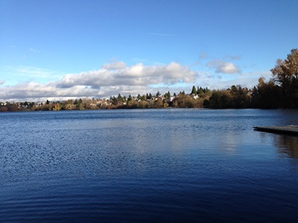
Green Lake
Green Lake? It looks blue to me.

By 2 PM, I was ready to go. We had a 20-minute walk back to the parking lot and I had a 10- or 15-minute drive to the Apple Store. I did not want to miss my appointment. I put my jacket on and said I needed to go. I guess I wasn’t the only one. Everyone else got up to leave, too.

We walked back together, chatting the whole time. By then, the weather had cleared considerably and it had turned into a really beautiful autumn day. I snapped a picture before saying goodbye to my companions and heading back to the truck. I took Penny for a quick walk, used my phone to get directions to the Apple Store, and got back on my way.

Apple Store, University Village

University Village turned out to be a very trendy outdoor shopping center. You know the kind — they spread the stores out in a big area with walkways and streets between them to simulate a town-like atmosphere. It was very pleasant but not very easy to navigate and a nightmare to find parking in when you’re driving something akin to a monster truck.

I did find a parking garage near the Apple Store. It said the clearance was 7 feet and I knew that was okay because the REI parking garage had been 7 feet, too. But in this garage, my radio antenna scraped on every single concrete beam I drove under and I felt myself ducking at more than a few of them. I found an end parking space on the second level and got out, leaving the windows cracked for Penny. She didn’t seem to mind staying behind again — I think she was exhausted from her 3-mile walk spent straining against a 5-foot leash.

The Apple Store was a big open space filled with iPads and iPhones and computers and people. I made my way to the Genius Bar in the back and signed in with an Apple staffer. I was 20 minutes early. He suggested I go grab a cup of coffee — Starbucks was nearby — but I told him I’d rather wait. I figured I’d update my iPad and iPhone apps using the store’s wifi connection. He put me at a table in front of a MacBook Pro and I got to work. I also used the computer to check the weather for my return trip.

Right on time a Genius showed up. We reviewed my issue and he ran a diagnostic on my phone. Sure enough, I now qualified for a warranty battery replacement. He told me it would take 30 to 40 minutes and suggested I come back at 4 PM.

I considered fetching Penny for a walk but decided against it. I felt like having a bite of real food to eat, comfort food, perhaps. The weather had turned gray and drizzly again and with just a danish, an energy bar, and two cups of coffee in my stomach all day, I was ready for something warm. I wandered around the “village” and found a pasta place. I ordered a Mac and Cheese and read a book on my iPad while I ate.

I returned at 4 PM sharp and inquired about my phone. The staffer typed a secret message on her iPod and, a few minutes later, someone handed her my phone. The battery had been replaced at had a 49% charge. I’d charge it on my way home. I used an Apple gift card I had to buy a charging adapter that I needed and left.

Quick and easy.

The Trip Home

Of course, by the time I left, it was after 4 PM. Although I couldn’t see the sunset, it happened right around then. By the time I turned onto I-90 it was starting to get dark.

It was also raining. It rained for most of the drive back, getting darker and darker until it was night. I don’t like driving at night anymore and try to avoid it. But with Washington’s short winter days, it’s not really an option unless you plan to spend much of your time at home. I don’t.

The temperature up in the pass was just above freezing. There were a lot more cars and trucks on the road, too. But again, it was a non-event. I descended down toward Ellensburg, ignoring MapQuest’s advice to get on route 97. I’d driven Blewett Pass once at night in dry conditions; there was no way I would do it at night in the rain with the possibility of ice.

I stopped in Ellensburg for fuel and to take Penny for a quick walk. I missed getting a cup of coffee in one of those coffee shacks so ubiquitous in the northwest by about 10 minutes.

The rain had stopped by the time I got back on I-90. The rest of the drive went by in a blur. I made a quick stop at Fred Meyer in East Wenatchee to return a RedBox video and then drove home. It was exactly 8 PM when I unlocked the door and went inside with Penny.

I’d been gone for about 13 hours and had gotten a lot done. I was nearly ready for ski season — I just needed some clothing items — and had gotten my phone repaired. I’d also met a bunch of smart, friendly people on a walk in a new place. It had certainly been worth the drive.
Jeeping in the Wenatchee National Forest

Exploring my world.

One of the things I love about this area of Washington is the variety of landscape and terrain so close by. I’m surrounded by farmland, orchards, desert, rivers, steams, lakes, forests, and mountains. All of these things are within a 30 minute drive from my home — it just depends on which direction I drive.

Beehive Reservoir
Behive Reservoir isn’t anything special, but it’s a short drive away, up in the mountains south of Wenatchee.

The other day, I briefly explored the area around Beehive Reservoir. I’d driven up there with the goal of checking it out as a possible kayaking destination. The lake I found was small and rather uninteresting. Penny and I walked around its one-mile circumference before continuing up the road. We found a far more interesting web of forest roads that I ached to explore. But without a decent map, I wasn’t comfortable going very far. I decided to return better prepared to explore.

I had a 3-hour window of time on Monday. Penny and I, joined by a friend, climbed into the Jeep and headed out. This time, I had a Wenatchee/Leavenworth trail map with me that clearly identified all the forest roads. We drove up to Beehive Reservoir and kept going.

Our intended destination was Cashmere, on the other side of the mountains. A road numbered 7100 wound through the mountains and a canyon to Cashmere. I’d been on part of the road two years before, picking it up from Number 2 Canyon Road in Wenatchee. It was a relatively easy drive in the Jeep; I figured this would be the same.

But Road 7100 was closed to motor vehicle traffic. They were making improvements somewhere along the way.

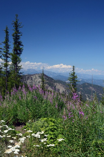
Mountain View
I couldn’t ask for a better day — or better views.

So we followed Road 9712, which went west and then mostly south and east. It climbed pretty steadily into tall pine forest, often skirting the edge of a steep cliff. Every turn offered magnificent views. Although I tried to follow our progress on the map, using turns and trailheads as landmarks, I soon lost track of exactly where we were. That wasn’t a big deal — we could always get back because we didn’t make any turns.

We passed a family of three on mountain bikes: mom, dad, and a girl who couldn’t have been much older than about eight. A strap tied dad’s bike to the kid’s. I guess the logic there was that if the kid went over a cliff, her bike would be saved because it was tied to dad’s. The kid, of course, wasn’t tied to the bike so she’d be lost. Maybe that was the idea. We didn’t see them later on the way back, but their car was still there. Maybe they all went over a cliff. It was not the kind of road suitable for a family outing on bikes. I wonder, sometimes, whether people know how to use their brains.

It was after we made a turn down a steep hill that I got the idea to turn on tracking on my iPhone. I use an app called GPS Track that can keep a breadcrumb trail of where I’ve been. It can also display my position (and track) on a map — if I have a 3G or LTE connection. Since I wasn’t sure whether the road we’d turned down would offer other turns, I turned tracking on. Even if I couldn’t see where we were on a map — which I couldn’t — I’d still be able to follow the track back, even after making a bunch of turns.

At the top of the World
I used my phone to make a panoramic image; my friend used a phone to take a photo of me.

The road we were following descended steadily and then came to an abrupt end in a wide circle with a fire pit in the middle of it. A pickup truck was parked there, but there was no one in sight. We stopped the Jeep and got out to admire the view. We were at about 5,000 feet in elevation and the spot we were on offered a completely unobstructed view of the eastern side of the Cascade Mountains, still blanketed with snow. A variety of wildflowers grew in clumps along the edge of the cliff. It was beautiful and peaceful.

We got out of the Jeep to stretch our legs and take in the view. It was the kind of place that you find it hard to believe exists, a place you know you’re lucky to have stumbled into. I often find places like this when I go exploring in my Jeep. Maybe that’s one of the reasons I like doing it so much.

Panoramic View
Not a bad photo for a phone. (Click it to see a larger version.)

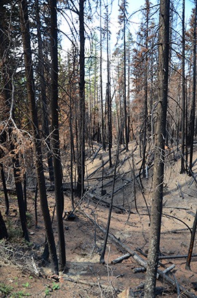
Burned Forest
There was lots of evidence of last year’s fires.

We turned around and headed back up to the main road, then turned onto it and continued on our way. The road wound through more forest, up more hills, and over more loose patches of volcanic rock. In some places, the forest was burned out from the previous year’s fires.

The well-maintained road gave way to a narrower, less maintained track. I decided it might be a good idea to figure out where I was. I stopped the Jeep right in the middle of the road — after all, there was no one around — and pulled out my map. I lamented to my friend that I wished I could find a good GPS app for my phone that enabled me to download detailed topo maps so I wouldn’t need a cell signal to use them.

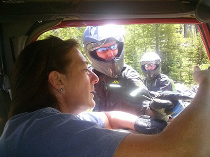
Motorcycle Guidance
We ran into a pair of motorcyclists who helped us figure out where we were on my map and then recommended a great back road driving app.

I was rather absorbed in my map study when two motorcycles came into view in front of us. The riders were completely geared up and riding good bikes with camping gear fastened to them. I moved to the side to let them pass. They came up beside me and must have noticed I was looking at a map. They stopped and asked if we needed help.

I told them that we weren’t lost but we didn’t know exactly where we were. I know that sounds silly, but in my mind, “lost” means not knowing how to get where you need to go. I didn’t need to go anywhere in front of us and I knew how to get back, so I wasn’t lost. I just didn’t know exactly where I was. Makes sense, no?

One of the guys had a GPS and tried to point out on my map where he thought we were. I told them what I’d been telling my friend: that I wished I had an app that would download maps.

Gaia GPS,” one of the guys said immediately. “It’s $20 but worth every penny.”

They went on their way. I had a good LTE connection, so I downloaded Gaia GPS on the spot. (I figured that guys outfitted like that had to know what they were talking about.) I used it for the rest of the drive and even saved a track from it for the trip back from our farthest point.

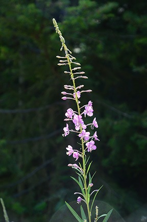
Flower along Road
This flower caught my eye as we drove past; I stopped, got out, and took a photo. It’s nice not being rushed by an impatient companion when you’re out for a drive in the forest.

We continued on our way. Soon, however, I was watching the clock. I had a doctor’s appointment at 3:45 and needed to be home by about 3:00 to drop off my friend and make the trip down to Wenatchee. Not sure how long it would take to get back, I set a deadline of about 1:30 to return. It was about 1:00. That gave us just another 30 minutes to explore.

The road continued to wind through the forest, often with sheer cliffs on one side or the other. When we got a good look out to the southeast, I realized that we were on the far side of Mission Ridge, almost at the same altitude. The valley we looked out over was hazy from the smoke of the Colockup Tarps fire, which had started two days before.

I was looking forward to a particularly steep drop-off alongside a section of the road up ahead — that’s what the topo lines showed on the map, anyway — when I realized it was past 1:30. We had to head back. I’d have to make another trip to continue exploring. I marked a waypoint in Gaia GPS so I’d know where I left off and turned around.

Flowers and Burned Trees
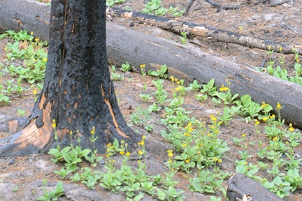
Less than a year after the fire that burned thousands of acres of this forest, flowers were blooming.

The trip back, of course, was much quicker. It always is. We stopped for a nature call and I got some mildly interesting photos of flowers blooming among the burned out trees in the area.

We were back at Beehive Reservoir before we knew it. And back on Squilchuck Road soon after that. In fact, we were back home well before 2:30. We could have stayed out longer after all.

It was a nice trip out — I say that all the time, probably because I enjoy exploring by Jeep so much. I’m looking forward to going out again, perhaps with a hearty picnic lunch, to follow that road to its end.

My Jeep Gets a Name

Courtesy of the State of Washington.

I’ve owned my 1999 Jeep Wrangler since June or August 1999. I bought it new from a Scottsdale dealership. The man who would become my wasband was away (again) at the time, so I made the purchase alone and picked it up with a friend.

The Black Junker

It wasn’t my first Jeep. I’d bought the first used, at my wasband’s recommendation. “Don’t buy a new one,” he’d told me. “It’ll just get all scratched up and you’ll be upset.”

So I bought a used black hardtop Jeep without air conditioning from one of his friends in New Jersey. We drove it across the country to Arizona together. I got sick along the way — it may have been altitude sickness from our drive through Colorado or dehydration because I simply don’t drink enough — and we wound up spending the night in Winslow, just four hours short of our final destination. (Or maybe I’m confusing that trip with the time we drove his old Mustang across the country?)

I sold the hard top and traded the full doors for half doors. We pulled out the boom box speakers — which I gave away to my neighbor’s kids years later. I may have replaced the stereo, which never worked quite right. I don’t remember. Frankly, I don’t want to remember that vehicle.

All I do remember is that damn thing absolutely refusing to start more than a few times when I drove it around town. If it wouldn’t start in front of the supermarket, it might not start 15 miles down a two-track, out of the cell phone service area. I wanted a Jeep for off-roading and it needed to be reliable. This one simply didn’t fit the bill.

Some advice is just plain bad. (I shudder to think of what my life would be like now if I’d taken all of my wasband’s advice over the years. After all, it hasn’t done much for him, either.)

I sold that black piece of junk before owning it even a full year.

The Red Jeep

Jeep and Windmill
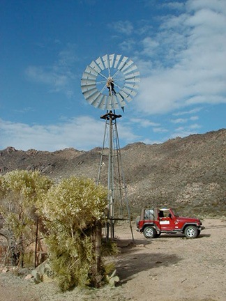
When I “rediscovered” photography in the late 2000s, I used the Jeep extensively to explore the desert with my camera. Windmills were one of my favorite subjects.

I replaced it with a brand spanking new 6-cylinder, 5-speed manual 1999 Jeep Wrangler with a soft top and air conditioning. It was “loaded stock” meaning that I got the best transmission, suspension, tires, etc. that were still considered stock. Afterwards, I added door steps, installed by my wasband. (I’m surprised he didn’t submit a bill to the court for labor.) I also bought a bimini top, but I only used it one season.

Jeep in Snow
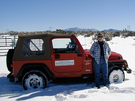
My Jeep had no trouble driving 5 miles to a mesa top on unplowed gravel roads in 20 inches of snow.

I gave that Jeep quite a workout over the following years, taking it as far as Moab for some slick-rock climbing. I beat the crap out of it regularly. It’s been on back roads around Wickenburg and near Prescott and at the Grand Canyon. It’s been in deep snow and across flooded creeks. It’s been places I probably should not have taken it. But then again, isn’t that what a Jeep is for?

Most of the year, the side and back windows were off of it. It got rained on and in a lot.

Jeep Roads
Jack the Dog was a frequent companion on my Jeep excursions.

Sometimes I took off the doors. In fact, I lost the bolts that hold the door hinges on. Every time I took the doors off before driving up to Prescott it would rain or hail.

Oh, yeah. I scratched it, too. But I haven’t shed a tear about that. Arizona pinstriping is what those off-road scratches are called and my Jeep wears them like a badge of honor.

When I went away to Washington in the summer starting in 2008, I missed it. After all, I was stuck driving a big diesel pickup for months on end. I’m a small vehicle person; I like a short car with a narrow wheelbase and tight turning radius. The Jeep was all that and more. It was always good to come home to it and get it back out into the desert. This past winter, in fact, I even joined a local Jeep club and joined them for a few desert drives.

Jeep Drive
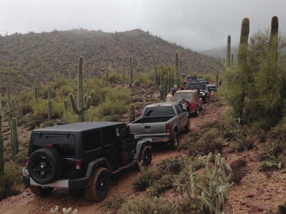
My Jeep, with me and Penny the Tiny Dog aboard, was one of about two dozen 4WD vehicles on this rainy drive through the desert near Wickenburg’s Vulture Peak in January 2013.

The Jeep Moves North

Through Nevada
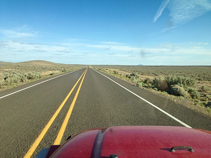
You don’t know straight, flat roads until you’ve driven north or south through Nevada.

I drove the Jeep from Wickenburg, AZ to Quincy, WA in May 2013. It was not a drive I was looking forward to and it was not a drive I enjoyed.

You see, a real Jeep is plenty of fun on dirt roads and two-tracks out in the desert or in the mountains, but it’s no fun at all on highways. My Jeep’s soft top tended to flap at highway speeds. The interior was loud. The ride was stiff.

I made it tolerable by wearing earbuds attached to my phone and listening to podcasts and music along the way. Penny just slept. I wondered whether the 1200 miles with noise like that would damage her hearing, but she seems to be okay.

Once I got the Jeep to Washington, I drove it almost all the time, leaving my big truck parked. It wasn’t a gas mileage thing — my truck gets way better mileage than the old Chevy I drove in previous years. It was just such a pleasure to drive something small and nimble. Something easy to park.

And, of course, once I got the Jeep to Washington, it made sense to register it there.

Alf the Jeep
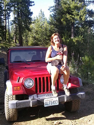
Here I am with Penny just yesterday after a drive around the forest not far from my home in Washington.

And that’s how it got its name: Alf. See? It’s right on the license plate.

Yes, the State of Washington issued plates for the Jeep starting with ALF. That’s Alf. Obviously that has to be the Jeep’s name.

You see, unlike some other people I know, I don’t name my vehicles. How can I? No name jumps out at me so I simply don’t give them a name.

But this name did jump out at me. And it’s easy to remember. And, somehow, it’s suitable for an off-road vehicle that gets the crap beat out of it regularly.

My Jeep has 52,000 miles on it and it’s 14 years old. I think we’ll be sharing a lot of adventures — now up here in the Pacific Northwest — for many years to come.