Campground Grief

I have the worst campground stay ever, mostly because of the campground manager’s psychotic wife.

I’m snowbirding again, traveling in Arizona with my truck camper, which I hope to sell. I’d planned to come down here on a much shorter trip in my little Honda S2000. As the weather at home got gloomier and gloomier, I decided to load up the camper and head out early, spending more time with friends and enjoying the desert. My house-sitter was thrilled to be able to check in early; he’s a skier and loves spending winters at my house.

This has been a rocky journey. The first hurdle was serious truck troubles in Kingman, AZ that took time and money to resolve. Fortunately, I had both, although I’d prefer to spend them on other things. Then I had some camper battery issues near Tucson. More money, not much time, got the batteries replaced.

But, in general, the trip has been great so far. I visited a bunch of friends, saw some property for a potential relocation next year, and have been buying the cabochons I need to make jewelry — something I hope to get back to as soon as I return home.

Quartzsite is my current stop and I booked three nights at what I thought was Rice Ranch at the corner of Keuhn and Rte 95, very close to Tyson Wells where my friend Janet has a booth selling her artwork. I’d stayed there before and it was extremely convenient for me, as well as being far enough off the freeway that it was pretty quiet at night.

And that’s where my Quartzsite visit went south.

My Mistake: Booking at Rice Ranch North

You see, it turns out that I didn’t book at Rice Ranch. I booked at Rice Ranch North, which is east of Rice Ranch and completely unaffiliated. So when I turned up at Rice Ranch in the dark after driving 4 1/2 hours from Phoenix in too much traffic — rush hour there, construction near Quartzsite — I couldn’t find the entrance.

I called the number for the place and left a message. A woman called right back and directed me to their place, which I’d driven right past. It was crazy dark and, when I found my way in, she directed me with a flashlight to back into a spot.

I was angry and flustered about being somewhere I didn’t expect to be — somewhere that wasn’t walking distance from Tyson Wells in the dark or with bags of purchases and dogs on leashes. When I mentioned that I might nose in, the woman said I wasn’t allowed to. When I asked her why, she said that “everyone else would want to.” What kind of juvenile nonsense was that? I don’t take kindly to idiotic rules and pushed back. It turned into a bit of a shouting match. Finally, she went away.

I was supposed to visit Janet at Tyson Wells on arrival and there was no way I was going to walk there in the inky blackness. So I backed out, found my way out the exit — after making two wrong turns; I did mention it was dark, didn’t I? — and went to Tyson Wells. I relaxed a little with her. We both agreed that it didn’t matter which way my rig pointed as long as I was parked in my site. After about 45 minutes, I went back to the campground, found my site, and nosed in.

Intimidation and Another Surprise

I was feeding my dogs less than 5 minutes later when someone outside said “knock knock.” It was a man’s voice. He said he was the manager.

Feeling intimidated by the appearance of a stranger in the dark, I opened the door just enough to talk to him. He said I had to back in because that was the rule. When I asked him why, at least he had a decent reason: he was worried about people tripping over my power cable, hose, sewer pipe, etc. I assured him that would not be a problem. I told him I’d had a long drive with a lot of traffic, was very tired, and was someplace I didn’t expect to be. He said that we’d talk about it in the morning and left.

(As Janet wondered the next morning, how could people trip over my cables and hoses if they were contained in my site? What would other people be doing in my site?)

After feeding and walking my dogs, I went out to plug in. There was no 30 amp power at my site, which is what my rig takes. Just 20 amp (household current) and 50 amp. Fortunately, I have an adapter. I plugged in and made a mental note not to run the coffee maker and microwave at the same time.

My Daily Routine

I slept like crap. I hate listening to freeway noise and there’s no escaping it at that campground.

In the morning, I was up as early as usual. At around 7, I unplugged, stored my cable, and left the campsite. Since I couldn’t easily walk from the campsite to Tyson Wells, I figured I’d just park at Tyson Wells every day. The camper has For Sale signs on it and it would be better to be someplace where a possible buyer might see it anyway.

I needed to get there early to get a good spot. I wound up parking on the main road, backed in so my camper door would be by the walkway and safer to get my pups in and out. That’s one of the benefits of my setup: I can fit in just about any parking space.

I took my pups on a short hike with Janet and her dogs at around 8:30, then stowed my pups in the camper, took out my ebike, and went to the rock show at Desert Gardens. I spent hours there. Then I got back, took my pups for a walk, stowed them again, and walked around the south side of Tyson Wells. Lots to see and buy! Parking at Tyson Wells during the day was working out very well for me.

At around 5 PM, after making dinner arrangements with Janet, I took the camper back to the campground. I passed the manager’s wife as I came in and noted that she was watching me closely. I backed in — it was easier that way since I had to plug in and unplug again in the morning. She didn’t bother me.

Janet came a while later and drove us to dinner at Taco Mio. (Highly recommended. I’m re-heating my leftovers on the stove now as I type this.) She dropped me back off around 7:30. I walked my pups again, then closed up for the night. No one bothered me.

That was Wednesday. On Thursday, I did pretty much the same thing, but took a different parking spot a bit farther down the road at Tyson Wells. This time, after our walk I treated myself to an excellent (but expensive!) cinnamon roll before putting the pups into the camper for the day.

Then I was off to the Pow Wow, which was the main show I’d come to Quartzsite for. It’s on the other side of the freeway, an easy ride from Tyson Wells (or the real Rice Ranch). I spent the whole day walking around looking at rocks.

After lunch and more rocks, I was burned out and went back to Tyson Wells. I told Janet I’d make dinner and she agreed to come to my campsite.

I stopped at RV Pitstop to get my propane bottles filled and Reader’s Oasis (which is sad without Paul) to look for affordable old atlas books. Then back to the campground. It was sometime around 4 PM. I backed in. This time, I plugged in power, connected my hose, and even connected my sewer pipe. I’d be leaving the next day and wanted to dump my waste tanks and top off my water tank before departure. I also wanted a good hot shower to get some of the Quartzsite dust off me. (If you’ve ever been here, you know what a losing battle that is.)

For the rest of the afternoon and into the evening, trucks came and went in a truck yard I hadn’t noticed before between the campground and the freeway. There was some talk over either a loudspeaker or a radio turned way up. This was the first time I’d heard it, since I hadn’t spent much time at the campground during the day. It was pretty annoying at times. Even Janet commented on it after she arrived around 5:30.

We had dinner inside my rig, watching a nice sunset at the end of what had been a cloudy — with even some rain! — afternoon. She stayed until about 7:30. After struggling with Quartzsite’s notoriously bad evening internet service — a topic for another blog post — I retired to my bed with a book and had another fitful night of sleep listening to freeway traffic.

The Psycho Bitch Goes Psycho

I had already decided to take Friday off from rock shopping. I figured I’d have a leisurely morning, dump my waste tanks, fill my water tank, and leave just before 11 AM, which was checkout time. I was looking forward to microwaving that leftover burrito from Taco Mio before unplugging and pulling out.

I dealt with the sewer tank first. That required me to dump everything, lift the hose — because the campground had a sewer port that was idiotically extended at least 10 inches above the ground — and continue lifting until all the waste was out. Then I had to add water to the toilet with the toilet chemical. Then clean the sewer hose. Then hook up the water filter and fill the fresh water tank.

Somewhere during this process, I left the back door of the camper open. My pups had been on the bed in a patch of sunlight. When I was finished with the hoses and had stowed them, I grabbed their leashes, ready to take them for a quick walk before I heated my early lunch. But they were not in the camper.

They were nowhere in sight.

I knew this wouldn’t end well, but I could never imagine just how poorly it would end. I called and called. The manager’s wife was in a golf cart and called out to me, “Are you looking for your dogs?”

I called back that I was. She pointed. I headed that way, still calling. The dogs appeared. I put them in the camper and closed the door.

The manager’s wife came up to me and I asked her, “Did they shit anywhere?” There’s one thing I’m very good about and that’s cleaning up after my dogs. So many places forbid dogs because of a few inconsiderate people that let their dogs shit all over the place. I’m not one of those people. I figured she was coming over to me to tell me that they’d made a mess somewhere and I was ready to go clean it up.

But no. She came to lecture me. “I don’t know,” she said. “Your dogs need to be on a leash here.”

“I didn’t even know they’d gotten out,” I said in my defense.

And then she went psycho.

She started screaming at me and kicked me out of the campground.

I had to laugh at her. I had 45 minutes left in my stay and she had decided to kick me out. She started ranting about me coming and going and told me she thought I was going to leave Wednesday and not come back. I said I’d paid for three nights and I wanted to use them. I told her that if she’d offered me a refund, I would have left. She said they had a 7 day refund policy. I said I wasn’t about to leave when I’d paid for the site.

She totally wigged out. It was as if she’d been harboring this anger against me since my arrival on Tuesday night and had used my loose dogs as an excuse to explode. It was crazy weird.

Broken Cable
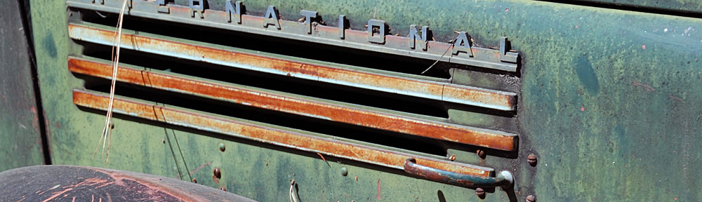
The cable wasn’t like this before she yanked it out. The yellow thing is the adapter I needed to use because my site didn’t have 30 amp power.

When I told her I wasn’t going to leave until checkout time at 11 AM and went to drop off a poop bag in the nearly overflowing garbage dumpster, she stalked over to the power pedestal, roughly pulled out my power cord, and locked the box. I plugged it into the other side of the pedestal, thinking about the yummy burrito waiting to be heated! She yanked it out again. This time, she broke the cable.

I told her I wasn’t leaving until 11 AM. She threatened to call the police. I told her to call them. She must have told me another 10 times to leave and I just laughed at her. She got more and more angry. It was so funny to watch.

Then I tried to talk to the owner, who other people said was in a motorhome nearby. I spoke to a very nice older woman who seemed nearly as flustered as I was. But then the psycho bitch ran over and started trash talking me to her. I went back inside my camper, not even sure if I’d been speaking to the owner after all.

The psycho bitch came raving back to my rig and yelled at me to leave. I told her to call the police. I told her I’d paid up until 11 AM and that’s when I was leaving.

It was comical to see how crazy she got. She said she’d call 911 — as if I were some sort of emergency. She finally got someone on the phone. She was parked in her golf cart right next to my rig and read someone my license plate. She gave them my first name and when she couldn’t come up with my last name, I opened the window and told her what it was. I think she was extra annoyed when I spelled it for her.

And then she started lying to the cops. She told them that I said I was leaving but instead I was sneaking in and out at night so no one could talk to me. Utter bullshit. I was back at the campsite every single day before dark — she’d even watched me come in on Wednesday! Her lies totally pissed me off, so I called the cops, too. I told them what was going on and that I wanted to set the fact straight. The woman I spoke to said that there was only one officer for Quartzsite — poor woman! — and that she was already backed up on several calls. I gave the woman who answered the phone my name and phone number and told her that I saw no reason to wait around. I asked that the responding officer call me.

And then I loaded my pups into the truck and left. It was 10:45 AM. The psycho bitch was standing at the golf cart with two or three older women watching the road for the police car. It’s nearly 1 PM now and I wouldn’t be surprised if she is still waiting.

Back to the Desert

I drove out to the desert about a mile from there and found a nice spot for the rest of the day and the night. And don’t tell anyone, but my dogs were loose for 15 minutes!

Parked in the Desert
Although the BLM land in the desert around Quartzsite isn’t exactly scenic, it is free, quiet, and lacks psychotic managers.

I’d wanted to take the day off to do some writing, but never dreamed I’d be writing about nonsense like this. People who can’t keep their cool dealing with guests should not be running campgrounds. I’ll have a peaceful night here, away from the freeway. Tomorrow, I’ll be back at Tyson Wells for my morning hike with Janet and her dogs.

And yes, I’ve learned my lesson: the next time I book a campsite, it won’t be online. It’ll be on the phone where I can verify the location of the campground and the features available at my site.

Snowbirding 2021: A Visit to Slab City

I finally get to see a place I’ve heard about numerous times and always wondered about.

I can’t remember exactly when I heard about Slab City, CA. I suspect it was about five years ago when I started visiting the Holtville Hot Springs and listening to the other RVers talk there about free places to camp.

Slab City on Wikipedia

Per Wikipedia, Slab City,

also called The Slabs, is an unincorporated, off-the-grid squatter community consisting largely of snowbirds in the Salton Trough area of the Sonoran Desert, in Imperial County, California. It took its name from concrete slabs that remained after the World War II Marine Corps Camp Dunlap training camp was torn down. Slab city is known for lifestyle that contradicts ordinary civilized lifestyle.

The rest of the Wikipedia entry is extremely informative (and I encourage you to read it), but appears to have been written mostly around 1990 and then edited to add information in 2020. (The editor in me would love to go into that entry and clean it up, but I’ll let experts tackle it.) There are photos, but I suspected that none would do it justice and I wound up being right.

The Trip

I’ve been wanting to check it out for myself for a few years. I decided to make it one of my goals for this year. But I wasn’t interested in dragging all my RVing gear out there, possibly to find a place where I wouldn’t want to camp. I wanted to make it a day trip from my campsite on the Arizona side of the Colorado River. It would be a roughly 2-1/2 hour drive each way.

Sometimes the only thing that prevents me from doing something I genuinely do want to do is motivation. I lacked motivation until this week. That’s when I happened to mention it to a new friend of mine, Bill, who is a full-time RVer. He very unexpectedly said he was interested in checking it out, too. And since he was camped out nearly halfway between my site and Slab City, it made sense for me to pick him up along the way if we did it before he moved on.

I set the date for Wednesday, which was the day after we spoke about it. There was a big holiday weekend coming up and I wanted to stick around near camp. A lot of crazies come out here with their off-road vehicles and I just felt the need to stay where I could keep an eye on things. I’m not a big fan of going out on weekends anyway, mostly because of the greater potential for crowds at my destination. One of the great things about my lifestyle is that I can go places midweek, when there are fewer people around.

That’s why I was in my truck at 8 AM on Wednesday morning with my pups, headed away from camp. I wanted to fill my truck with fuel before going into California — diesel (and other fuel, I guess) is about $1 cheaper per gallon in Arizona than California and with a 30 gallon tank that was about half full, that difference quickly turned into lunch money. I drove up to my favorite cheap gas station on my side of the river, topped off the tank, bought a pack of Oreos with a pint of milk, and set off westbound on I-10.

I was meeting Bill at Desert Center, a little over an hour west of the Colorado River. There was very little traffic, and I could cruise at or around the speed limit of 70 MPH. The stretch of I-10 between Blythe, CA on the Colorado River and Desert Center is pretty dull. A lot of empty desert, some of which has been recently filled in with huge solar energy farms. I listened to an audio book along the way and the time passed quickly. I got off the exit and rolled into the armpit of California that is the town of Desert Center.

Desert Center
Shot from a trash-strewn vacant lot near the I-10 freeway exit, this view of Desert Center, CA is what greets folks who go there.

I cannot begin to describe how trashy the place is. It’s mostly empty lots and deserted, vandalized, graffiti-painted buildings. There’s trash and broken glass everywhere. A few semis with trailers were parked in various places, engines running; I guess this is an overnight stop for some truckers. I didn’t see any sign of current habitation, which is probably a good thing. I couldn’t imagine anyone actually living there.

I arrived early, of course, and had to wait for Bill, which I didn’t mind. I let the pups out to walk around the sandy lot I’d parked in and had to follow them around to make sure they didn’t step in or try to eat anything disgusting. We wound up waiting in the truck, windows open on the warm morning. But the more I looked around, I the less I liked the idea of Bill parking his custom Mercedes Sprinter van anywhere in the area for the day.

I told him that when he arrived. He looked around and agreed. He told me it had been broken into before and it was very upsetting.

I suggested Chiriaco Summit, a busier exit on the freeway that actually had businesses in operation. It was 19 miles farther in the direction we had to go anyway. He agreed and followed me.

I knew Chiriaco Summit from flying into its tiny airport, visiting the Patton Tank Museum there, and stopping for a bite to eat at Foster’s Freeze. As I pulled in, I realized that the little “town” had grown. There were additional restaurants and a handful of other businesses. Foster’s was now inside the big gas station. There was plenty of parking that would be out of the way yet close enough to activity to not draw attention. The town was all business and neat — a huge difference from Desert Center.

He parked, we went inside the gas station to use the restroom, and Bill bought a cup of coffee for the road. Then we were on our way.

I missed the exit for Box Canyon Road mostly because I was looking north. I was distracted by the Cottonwood Springs Road entrance into Joshua Tree National Park, with lots of RVs camping out in the desert, likely just outside of park boundaries. I never realized there was a road that went south there until I’d passed the exit. Duh. The next exit was six miles west and I made my U-turn there, thus adding 12 miles to the drive.

Box Canyon Road is a great drive on a decently paved road down a wide canyon that I would not want to be stuck in during heavy rain. There were a few folks camped out in there and a few others driving the same direction we were. After a while coasting downhill on the gently curving road, we got a glimpse of the Salton Sea stretched out before us in the distance. Then the winding canyon road leveled out and opened into blocks of farmland.

We saw some very neglected grape vines, lemon trees, pepper plants ready to be harvested, and a bunch of other veggies we couldn’t easily identify. GoogleMaps directed us to make a few turns before dumping us on Route 111, Grapefruit Boulevard. It should have been called Palm Highway there because it was mostly lined with date palms for a while. Then those ended abruptly and we were in the mostly barren desert on the east shore of Salton Sea.

This is not an attractive area of desert. There isn’t much vegetation and anything that was planted and neglected — think mostly palm trees — are dead or dying. Yes, the Salton Sea sparkles just off to the west and there are snow-capped mountains beyond Palm Springs even farther west than that. But the terrain is mostly a light tan color with the occasional tiny settlement, park, or abandoned, vandalized, and grafittied building hinting at past when the area had something to brag about.

Bombay Beach

Slab City turned out to be a lot farther south than I thought. Along the way we passed the Salton Sea State Park and its campgrounds, which turned out to be closed for COVID, and a settlement boasting hot springs off to the east.

Bombay Beach Art
Is this the “Cessna Art” I was supposed to find at Bombay Beach? Is this a Cessna?

We eventually reached Bombay Beach, 223 feet below sea level, with a population 415. I’d been there before and hadn’t been impressed, but a Twitter friend urged me to revisit it, telling me there was some sort of Cessna artwork I needed to see. We drove through, spending a brief time on the sea side of the dike wall before completing a circle of the town. This sentence from Wikipedia sums it up perfectly:

A visitor in 2019 wrote that there were many “discarded homes and trailers long-since abandoned” and that many of the buildings were “windowless husks blanketed in graffiti, surrounded by broken furniture and rubble.”

Basically, the place looks like the ruins of a very poor community, long since vandalized, with a handful of occupied homes and a mildly interesting collection of very large artwork made mostly from junk. It’s a depressing place and I honestly can’t imagine what it must be like to live there.

We got back on the road and continued south.

Slab City

Welcome to Slab City
The obligatory photo of the Slab City Welcome sign.

The turn for Slab City was the Main Street for Niland, CA. Although I’d expected it to be a sort of remote place up in the foothills of the mountains beyond, it was actually spread out just a few miles from town. The absolute junkiness of the place hit me immediately. There were all kinds of broken and abandoned RVs and other vehicles, as well as broken and occupied RVs and other vehicles. The more we drove the more trash and decrepitude we saw.

Truck at Salvation Mountain
Part of the art (or “art”) installation at Salvation Mountain.

Salvation Mountain, a man-made hill painted with latex paint which had been the life’s work of a deceased resident, was the first of the art installations. Other art was more like “art.” I drove slowly through the area on what seemed like a main road while we stared at the mess around us. Yes, people lived there. There were RVs and mobile homes and shacks and even a few decent buildings. There were street signs and house numbers. There were campgrounds, one of which was hosting one of those mega-motorhomes that sell for about $750K. There was a library that was closed. There was a business at East Jesus that was closed. There was a property that used the burned out shells of RVs as a sort of fence line. The farther we got from the main area of the community, the more trash there was scattered out in the desert.

Salvation Mountain
Salvation Mountain is the primary point of interest in Slab City. Read about it on Wikipedia.

East Jesus Plane Art
A business at the end of the road to East Jesus was closed due to COVID.

I said I’d take pictures, but I took very few. The above shots are about it. Honestly, there wasn’t much I wanted a picture of.

We followed a sign for Slab LOW, not knowing what it was, and eventually arrived there. It looked like a camping area with a few buildings. Signs said they welcomed members of WIN, LOW, and Escapees — three RVer clubs. (I belong to WIN, Bill belongs to Escapees.) I stopped the truck and we got out to stretch our legs and let the pups run around. There was a single motorhome parked there and while we gave the dogs water — Rosie had puked in the truck; she still gets carsick once in a while — a man came out. Soon we were chatting with him. He lived there full time. He said the place we were at was closing and relocating elsewhere. He told us where but we never found it. Did it matter? No.

There were actually quite a few people living in the area — even if just temporarily. It looked to me as if you could camp for any length of time just about anywhere. But the vibe was about the same — at least to me — as it was at Bombay Beach. It was the ruins of something and no amount of art or “art” could hide it. Squatting on land that no one cared about was a cheap and easy way to live, but I know I could never live like that. Honestly, I’d have trouble even spending a day or two there. Too much trash. A cleanup crew could spend a year filling 30-gallon trash bags and no one would know the difference.

We didn’t stay long. And I have to admit that although Slab City sort of met my expectations, I was disappointed. I was hoping it was something better. Something more interesting. Something I’d like to stay and explore. It wasn’t. It was just a squatter community out in the desert, surrounded by decades of trash.

Lunch, the Fountain of Youth, and a Walk on the Beach

We stopped for lunch in Niland. I’d wanted very badly to go to the Oasis Date Ranch for one of their excellent hamburgers with dates on it but their cafe was closed due to COVID. The Buckshot Cafe in Niland served Mexican and American food. The restaurant itself was closed, but they were taking to-go orders through one of the front windows. We each ordered a chicken torta and wound up eating it in the back of my truck, feeding the dogs nacho chips and french fries.

Back on the road, we turned in at the sign for the Fountain of Youth RV Resort and Spa. The WIN RV group I belong to had camped there for a week in early November, before I headed south. I wanted to see what it was like. It was a typical middle-of-the-desert RV park, filled with mobile homes, park models, and regular RVs. There was a pool, a hot spring fed spa, shuffleboard, a restaurant, and more. Everyone we saw was older than we were except the kid at the gate. The campsites were close together and there were a lot of vacancies. No Canadians this year.

We checked out another RV resort with spa nearby. It was a lot smaller, more casual, and cheaper. Bill was disappointed that although they offered day use options for the spa facilities, clothing was required.

Our last stop in the valley was at a campground along the shore of Salton Sea. I’d stayed there about four years before. I wanted to show Bill the beach, which had been covered with giant barnacles and dead fish back then. The campground was closed, but we parked across the road and walked over. We climbed down an embankment and walked right up to the short. The barnacles were smaller and there were no dead fish.

Salton Sea Beach
The beach at Salton Sea. Palm Springs lies at the base of the snow-capped mountain dead center in this shot.

The Drive Back to Camp

Bill used a map app on his phone to guide me back to Box Canyon Road and we climbed up the wide canyon to the I-10 freeway. From there, it was a short drive to Chiriaco Summit. I took my pups for a quick walk with Bill. Then we said our goodbyes and he left to go to camp while I went into Foster’s Freeze for a hot fudge sundae.

I passed Bill on the road right before reaching Desert Center. He’d told me his campsite south of there was dead quiet and pitch black dark. Sounded good to me. My site would not be quiet with all the yahoos in from Phoenix with their ATVs for the long weekend, but I had a good, private camp and wasn’t ready to move. Yet.

I finished listening to the recorded book I’d been listening to along the way. I got back to camp just as the sun set over California.

If I had a bucket list, I could cross off Slab City.

Snowbirding 2020 Postcards: Catalina State Park, Round 1

I visit an extraordinary state park for the first time and sleep through much of my stay.

I was scheduled to spend the first full week of February in Tucson, AZ where I was taking five jewelry making classes. The first one was scheduled for Monday, February 3, at 9 AM sharp. Although I’d booked a campground in Tucson starting on Monday, I had no accommodations lined up for Sunday night and did not relish the thought of driving in rush hour traffic from Phoenix to Tucson first thing Monday morning. So I drove to Tucson and worked on getting a place to stay once I was there. I figured that in a worst case scenario, I could camp out at a Walmart or casino parking lot.

Saguaro Cactus
How’s this for an iconic image of the Sonoran desert and Arizona in general?

I wasn’t feeling well that day. I’m not sure what was going on, but I had a low-grade headache and felt very tired. So after making a number of stops at dog shelters — long story there — I was very glad that a call to Catalina State Park that Sunday evening assured me that there was space for me in overflow parking.

I had never been to Catalina, but a friend of mine who had a girlfriend in the Tucson area had suggested it as a place to camp during my trip to Tucson. Three months in advance, I’d tried to reserve a site but it was already fully booked. Snowbirds, of course. People kinda sorta like me. So I’d found an RV park in the city that was affordable and closer to where my training was being held. Trouble was, the office was closed on Sundays so check in wasn’t allowed. (Am I the only one who thinks that’s weird?)

Sunday afternoon saw me driving up to the Catalina State Park gate/ranger station, getting out of my truck, and getting assigned a space in one of the overflow campgrounds. I’d left my cargo trailer behind in the Phoenix area, so parking was not a big deal. I drove through some gorgeous Sonoran desert scenery, found the campground, found spot #13, and backed in. Then I locked up the truck, climbed into my camper, and basically passed out on my bed for a 2-hour nap.

I felt a lot better when I woke up. It was late afternoon and the light was just getting good. It was too late for a hike, but not too late for a quick walk in the desert behind my campsite. I took the photos you see here — magnificent saguaro cacti and rugged desert peaks. I regretted that I’d have to leave by 8 AM to get to my class.

At Catalina State Park
This was also shot within sight of my campsite. It was absolutely gorgeous there.

Snowbirding 2019: Off Plomosa Road

Some rockhounding and a campsite on the edge of the desert crowd.

Posts in this series:
The Long Drive
At the Backwaters Campsite
In Mesa and Gilbert
A Quick Stop in Wickenburg and Forepaugh
Off Plomosa Road
• Camping at the Big RV Show
• A Trip to Organ Pipe with the WINs
The Tucson Gem & Mineral Shows
Wickenburg Gold Rush Days
• Constellation Park Interlude
• White Tank Mountain Park
Bumming It in Phoenix and Apache Junction
A Dose of Civilization
Return to the Backwaters

I left Wickenburg for what would be a 17-day stay in the Quartzsite area just after noon on Friday. The first part of that stay was completely unstructured; I’ll tell you a little about it here.

The First Rockhounding Hike

On my Christmas wish list was a book called Gem Trails of Arizona and my brother got it for me for Christmas. I packed it and took it south with me. The same book was being sold by my next door neighbor at the Flagg Gem and Mineral Show in Mesa and I had a chance to thumb through it. I was motivated to try a few of the sites and, since one of them was right along my route to Quartzsite from Wickenburg, I figured I’d start there.

Understand that I’m only interested in one kind of stone: stones I can polish into cabochons to put into jewelry. Crystals don’t interest me very much at all. Neither do minerals that show all kinds of cool features that might interest collectors. If it can’t be polished into a cabochon, I’m just not interested.

That said, this particular site, titled Brenda Jasper in the book, was said to have “some very colorful jasper. Specimens show a variety of markings and inclusions, including yellow and red flower patterns, moss, paisleys, and some streaked with purple and blue. In addition, there is a host of multicolored materials, as well as some possessing only single shades of yellow, orange, purple or red.” Putting aside the redundant nature of this description, this sounded just like what I was looking for. I had some experience polishing jasper and it was all good. Best of all, the site was a short walk from the main road, Route 60, and the description mentioned a parking area about a half mile away that I’d likely be able to get my rig with its trailer into.

I used Google Earth in an attempt to find the place and its parking area on the map. What I found didn’t match what was described, but it might be close. It looked like plenty of room for me to park. I set up Google to guide me there. About an hour after leaving Wickenburg on an uneventful drive, I arrived. I eased the truck and trailer off a lip between the road and the parking area, moved up enough that someone could get in behind me, and killed the engine.

I wasn’t sure if I was in the right place. After all, the place I’d parked wasn’t mentioned at all in the description. The description also said that I’d have to crawl under a fence, but when Penny and I crossed the road, there was a narrow gap in the fence that was clearly designed to let people but not cattle through. Beyond that was a trail and we started up it, heading south.

I immediately saw small pieces of what I assume is yellow jasper. I picked up a few that could be cut into cabochons without slabbing. There was red jasper, too, and I collected some of that. We hiked up the trail and into the rocky hills. Up there I found some small crystals, which I left behind. None of them were very impressive, although they might make a good find for kids just starting out as rockhounds. Best to leave it for them.

We spent about an hour wandering around and I collected a bunch of rocks that I thought might polish up nicely. Even though the book’s instructions on how to get there were not exactly accurate, I had definitely found the right place and some usable rocks. As for the more impressive patterned and multi-colored materials, they’d either been picked out or required digging, which I was not prepared to do.

Brenda Jasper
Here’s a view from the saddle of the little mountain we climbed during my rock hunt. That white dot in the middle of the photo is my truck with the camper on top.

Satisfied, we went back to the rig, climbed in, and continued our drive.

Plomosa Road

What I learned at Plomosa Camp

Over the next few days, I learned a few things at this campsite:

First, because my solar panels are mounted on the front of my camper’s roof and tilt slightly down toward the front, knowledgeable friends had advised me to park with the front facing south to maximize solar energy collection. At this campsite, I parked with the front facing southwest, despite the fact that I like my camper door (in the back) to face south to maximize sunlight indoors. Yes, I collected more sunlight — while the sun was out. But I was also unhappy because of limited light inside and the fact that I could see neither sunrise nor sunset through the camper’s windows. (It reminded me of the cavelike condo my wasband had in Phoenix.) And since we had two overcast and rainy days, solar collection wasn’t sufficient to keep my batteries topped off during the day for part of the stay so I had to run my generator anyway.

Second, people in RVs use their generators too damn much. One night someone nearby had his running until after 11 PM. Seriously? What the hell are you doing in your box that you need a generator running that long? Shut off the fucking television and talk to your companion. Play cards. Read a book. Have sex. Go out and look at the stars. None of these things require a noisy generator. Stop being so fucking selfish.

Third, during a government shutdown when there are no BLM rangers around, people pretty much ignore the signs and park wherever they damn please. So by the end of my stay I was no longer on the edge of the camping area; there were people parked around me in every direction.

I had spent enough time studying the rockhounding book to know that the 14-day camp area on BLM land adjacent to Plomosa Road would be a good, free location to camp that was central to several other rockhounding sites. With that mind, when I got into Quartzsite I turned north on route 95 toward Parker, then made the right turn onto Plomosa.

Plomosa is a paved road that runs between route 95 and the small town of Bouse. The camping area stretches along the road to the north and south, limited mostly by a few washes and sandy areas that RVs can’t easily get through. There were a lot of RVs already parked out there and I didn’t want to be near any of them. So I headed out on Plomosa, planning to park somewhere beyond the throng.

My plans were dashed, however, by a sign on the road that said, “No Overnight Camping Beyond this Point.” Crap.

I turned around and pulled off the road the first place I could. Okay, I thought. I’ll go north in the desert beyond all of these people.

Dashed again. Another series of signs about 1/4 mile into the desert that said the same thing. They basically formed a barrier beyond which the BLM simply didn’t want you to camp.

Fine. I parked 50 feet in from one of the signs. I was on the edge of the camping area with no one anywhere near. That would have to be good enough.

I disconnected the trailer, then pulled the truck and camper around so the door of the camper was at a 90° angle to the back doors of the trailer. Then I dropped the camper legs and pulled the truck away. I set up the saw horses under the camper, since I expected to stay for more than just a few days and wanted it as stable as possible.

Plomosa Campsite
Here’s how I set up my camp on Plomosa Road. I use the saw horses any time I expect to stay for more than a few days.

Aerial View of My Plomosa Road Campsite
Here’s an aerial view of my Plomosa Road campsite, snapped with my drone before the camping area got crowded. My camp is at the bottom; this shot looks southwest.

By this time, it was late afternoon and I was done for the day. Mother Nature rewarded me with a beautiful sunset.

Plomosa Road Sunset
Sunset from my campsite on Plomosa Road.

I made myself a quick dinner, relaxed, and was asleep before 9 PM.

More Rockhounding

In the morning, Penny and I got an early start on a rockhounding trip to two sites farther up Plomosa Road toward Bouse. The first site — or group of sites — was called “Plomosa Road Minerals” and promised quartz, jasper, agate, calcite, and other stones I knew could polish up nicely. And the directions seemed clear enough, even offering a mile marker on the road as a landmark.

But it wasn’t that easy. When I got to the mile marker, it wasn’t clear which road I needed to turn at. It was another BLM camping area and there were dozens of people camped out there. There were far more roads than the directions indicated.

Cacti
I spent too much time looking for rocks and not enough time taking photos of the desert around me. Here’s one of the photos I did stop to take.

I did my best to find Site A, which was the closest and seemed to be the easiest to find. But it wasn’t clear where I was supposed to go. I wound up parking near a mining claim on a hill and wandered around far enough away that I wouldn’t violate the claim. (At least I tried to.) I found a handful of stones that looked interesting, although I have no idea what they are.

I tried to find Site C next and failed miserably.

When I tried to find Site B, following the instructions to the letter, I got lost when it said to head toward “a small mountain range” and there was no mountain range anywhere near or in front of me.

Then I decided to try using the GPS coordinates provided in the book to zero in on a site. They were presented in degrees with decimal minutes — for example, 33° 49.78′ N and 114° 03.95′ W — and I needed to convert them to decimal degrees to enter them into Google maps on my iPhone (since I still can’t figure out how to type a ° symbol on iOS) — for example, 33.8296 -114.0658. When I entered the coordinates, the pointer showed me a location that was nowhere near where the directions sent me. In one case, the GPS pointed to a location on the other side of Plomosa Road from the location indicated on the piss poor map in the book.

I checked the book’s introduction to see why the coordinates might be off and found this paragraph [my comments added]:

This edition provides GPS coordinates to assist with finding the sites. Coordinates were taken using a DeLorme Earthmate GPS PN-20 [perhaps pre-WAAS?] and/or supplied by David A Kelty, author of The GPS Guide to Western Gem Trails [which is probably the book I should have bought]. It is important to understand, however, that determining exactly where to take the reading is a little difficult [How so? Find a rock, take a reading. Seems simple to me.] and might actually be misleading [ya think?]. In some cases, if a site is quite extensive, an approximate mid-point coordinate is given [which makes sense]. In other spots, due to mountain or canyon wall interference, a GPS reading was taken and then either confirmed or modified [?!] using a computerized mapping program. Please do not think the the GPS coordinates will place you exactly on top of the absolute best part of any given site. [I don’t expect that, but I do expect them to match the directions and get me to the rocks.] They are provided only to assist in confirming that you are at or near [within a few miles, apparently] where you should be. The maps [which are NOT to scale] and driving instructions should be your primary source of information in regard to site access [so you’re pretty much screwed because those stink].

As my inserted comments indicate, I was starting to realize that the book was not to be relied upon. Although revised in 2009, I suspect that the author didn’t make much of an effort to visit every single site in the book. That would explain the unclear directions, erroneous GPS coordinates, and crude, inaccurate maps.

Still, I’d done okay with the Brenda site. Maybe this group of sites was a bad one. I’d try another: Bouse Hematite & Jasper. This one provided instruction from Bouse that included a cattle guard as a landmark. To make sure I had the right cattle guard, I drove all the way into Bouse. While I was there, I had lunch at a cafe — the only one in town. Then I was back on the road, following the directions.

I knew there would be a problem when the directions said to turn right 0.3 miles past the cattle guard and there was no turn there. Instead, there was a turn at the cattle guard. I turned. I tried to follow the directions and I think I may have gotten close. But there was nothing worth picking up when I finally stopped for a look.

By that time, I was pretty much done and started heading back to the camper. Along the way, I caught sight of an old mine off in the distance. When I found a road that might take me close, I followed it. I parked the truck in a turnout just before the road descended into a sandy wash. Penny and I got out to walk around. I eventually found a handful of stones that may have included jasper and chrysocolla. The mine sites were really nothing more than survey sites. We got back in the truck and headed back.

When we reached the camper, I discovered that a group of about 10 fifth wheel campers had parked nearby. I’d be listening to their generators whenever I was at camp for the rest of my stay.

Moon Mountain

The next day, I went into Quartzsite for propane and water. It had been cold at night and I was using my heater. Just because I’m camping doesn’t mean I need to be uncomfortable.

But I also thought I’d take the opportunity to try to find one more site from the book: Moon Mountain Petrified Wood. This site promised petrified wood, agate, and jasper. If I found it, I felt I could trust the book for more rockhounding. If I didn’t, I figured I’d stow the book in a cabinet for the rest of the trip.

The search started off bad. It directed me to Avenue 24E or Moon Mountain Road. There was no Avenue 24E in Quartzsite but there was a Moon Mountain Avenue. Unfortunately, Moon Mountain Avenue ends with a roadblock and a few tentative 4×4 trails into a sandy wash beyond. I turned left and then made a right onto a road that seemed to go the same place as Moon Mountain Road on the book’s crappy map. It was called Boyer Road and later called Boyer Gap. I followed it along a bumpy graded road heading northwest into the empty desert. The book told me I’d be heading toward “distant cliffs in the northwest” but the only rise I saw out there was what looked like a small mountain range and it was very far away. Was I on the right road?

I continued bumping along until I found a fork in the road that may have been the one in the book. I kept right. The road got worse. The book’s directions said to “continue approximately 9.5 more rough and sandy miles.” I was driving at about 15 miles per hour. The thought of spending more than 30 minutes bumping along a road that may or may not be the right one and may or may not take me to a viable rockhounding site was depressing. I tried plugging in the GPS coordinates and it told me I was going the right direction. But Google Maps satellite view didn’t show any kind of road at all where the coordinates were.

Was this another wild goose hunt?

It could be.

Did I really want to drive all the way out there and not find what I was looking for?

No. I turned around and went back.

At Camp and Beyond

I filled my propane and water bottles back in town and went back to camp. There were more RVs parked nearby. In fact, the camping area was really starting to fill up. This didn’t surprise me much. Quartzsite’s peak time for winter visitors was during the big RV show that ran (this year) from January 19 through 27. It was January 13, a week before the craziest part of the month would begin. The desert dwellers were beginning to arrive in force.

Nails
One of my camp chores was to pull all the nails and other metal debris out of the fire pit I drove over when I parked my camper. (I honestly didn’t see it.) I bought a high-powered magnet in Quartzsite just for the task. I got this is what I got the first time I worked the pit; I got the same amount when I did it again a few days later in preparation for getting the camper back on the truck.

I did camp chores: topping off my water supply, installing the filled propane tank, taking out my portable barbecue grill to grill up some more of the ribs I’d smoked at home and brought with me, vacuum sealed and frozen. I took it easy. I wrote blog posts — I was terribly behind in my trip reporting (and still am).

I also took out my drone and sent it up for a few flights to document the RV-filled desert around me. I was in Quartzsite to do drone photography (again) although I really wanted to do more work with my jewelry. I did finally spend some time making a few pendants.

Plomosa Road
Here’s a look west down Plomosa Road just after dawn one day. The desert was just starting to fill with RVers.

On Monday, Penny and I headed up to Parker. I needed to do laundry before the RV show started, since once I was set up in the big RV show tent I didn’t think I’d get much time to take care of things like that. I figured I’d also do some grocery shopping, get some documents printed, and then head down to Ehrenberg to check for mail. A neat little loop. That took most of the day. Although I really like the laundromat in Parker, the number of winter visitors competing for washers and dryers makes doing laundry almost a blood sport.

That afternoon, after we got back, it started to rain. Hard. I love a good desert rain, but this was more of a deluge. Visibility dropped to less than a quarter mile and the mountains around me disappeared. So did a lot of the RVs. The desert me, which was mostly flat there with a slight slope, developed pools of water that flowed like little streams anywhere it had flowed in the past. It kept me and Penny inside the camper for the rest of the day.

Flooding
The view out my back door at the peak of the rainstorm.

A Day in Quartzsite

The next day, I headed into Quartzsite for my meeting with the RV show owners. I’d be doing some drone photography for them and they wanted to make sure I knew exactly what they wanted. After chatting for a while inside the big toy hauler they were using as an office, I went out with Kenny in a golf cart to tour the rain-soaked venue.

The big RV show tent had gone up while I was in the Phoenix area or Wickenburg. This really disappointed me, since I was hoping to create a time-lapse movie of its erection. After all, how often do you see men raise a 65,000 square foot tent? It would have made such a cool movie. Maybe next year?

At that point, they were putting the finishing touches on the interior of the tent, which Kenny drove right into. I got to see where my little 10×10 booth would be. I got to think about how I could get aerial footage inside the tent without violating FAR part 107 — specifically, flight over people. Show management was expecting huge crowds on Saturday morning and they wanted to make sure I was able to show just how busy the show was.

Stones
Here are some of the stones I bought that week.

Afterwards, I headed over to Tyson Wells, which was between shows. The rock show had just ended on Sunday and Sell-A-Rama was due to start on Friday. My friends Janet and Steve would be out in a day or two to start setting up for the next show. The weird thing about Tyson Wells is that if you’re signed up for two consecutive shows and have the same spot in both shows, you can keep your booth open on that week between shows. So about half the venue had open booths. Before the week was out, I’d do my big stone shopping trip, buying more than 70 cabochons from my favorite shop.

On To My Next Destination

On Wednesday morning, I packed up my camper, put it back onto my truck, and connected the trailer again. It was time for a little “luxury” — a sort of full hookup campsite at the RV show in Quartzsite. As I drove away from the now crowded camping area, I wondered how long it would be before someone else slipped into my vacated spot in the desert.