 I check out a few points of interest from the air.
As you may have read in another entry, I am addicted to flying. If I don’t get a “fix” every few days, I get crazed. And here at Howard Mesa, where there’s not much else going on to keep me busy, I get crazed a lot easier than I would elsewhere.
Today I decided to make an early morning breakfast run. The destination was Winslow, which has a restaurant at the airport, but there was no reason to go straight there. (Especially since “straight there” would require me to overfly Mt. Kendricks, which is a bit too tall to fly over comfortably.) So I decided to swing north for the flight out and south for the flight back.
I was ready to leave by about 6:30 AM. Horses fed, masked, and sprayed. Dog confined in screened-in room. Bird in cage. iPod, camera, handheld GPS, and decibel meter on board. I started up, warmed up, and took off. I reset the trip computer and track log in my handheld GPS. I just got the GPS for my birthday. It’s a Garmin GPSMap 60c. A bit of a step up from my old GPSMap 12. I wanted it because it could store more maps than the old one and had WAAS capabilities, which could make it more accurate — something I’ll need if I ever get serious about geocaching. I left the GPS on to track my progress. The idea was to transfer the resulting tracklog to my laptop and use Terrabrowser to superimpose it over either a topo map or satellite photos. (I’m writing an article about doing this for Informit.com, so I don’t want to go into any detail here.) Here are the first pass results of this experiment. The white and black areas are ones I didn’t have satellite images cached for. The red letters are referenced throughout; A is my starting point at Howard Mesa.
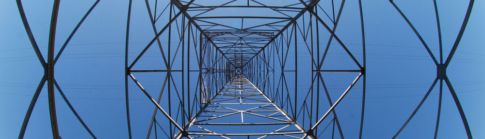
 I headed northeast, right into the sun. Not good. I’d forgotten to put my hat on and the sun was shining right in my face, flickering through the blades. (I hate when that happens.) So I moved my headset down around my neck, put my hat on, and then put my headset back over my ears. Doesn’t sound like a big deal, does it? Well, you try to do it with one hand — your left hand. It was worth the struggle, though. The hat shaded my eyes nicely. I hit route 180 and followed it east, toward Flagstaff. I wanted an aerial view of Red Mountain, which I wrote about in another blog entry a few weeks ago. I had my camera and managed to snap two photos. Here’s one of them. Neither really shows the mountain well, but it’s hard to take pictures left-handed while flying a helicopter right toward a mountainside.
Then I headed on a more northerly track. I wanted to intersect with the Little Colorado River, but didn’t want to fly as far as Cameron. The high desert I flew over was deserted — at least at first. Then I flew into the outskirts of the Navajo reservation and began seeing small ranching settlements beneath me. There were some cows, but mostly sheep. The homes out there were picturesque, with rolling green hills all around and a good view of the San Francisco Peaks, which is one of the Navajo’s sacred mountains. I saw round hogans with doors facing east, livestock pens, and outhouses. Life is simpler out there. Way simpler. I crossed highway 89, which runs from Flagstaff to Page, and got into more rugged terrain. There were fascinating rock formations below me and, every once in a while, another Navajo homestead. Then I spotted the Little Colorado River valley. I reached the river and was very disappointed to find it dry. I turned right (B) and followed it toward Winslow.
 This was my second trip along the Little Colorado River. It isn’t a very exciting flight, but it is mildly interesting. There are a few remains of Navajo homesteads and something that looked like an old mine. The highlight, of course, is usually the Grand Falls of the Little Colorado. But without any water falling over the big cliff, it was extremely disappointing. From that point, I headed pretty much straight toward Winslow cutting across the high desert, 300 feet above the ground at 100 knots.
I landed at the airport (C), shut down, and went into town. All that is covered in another entry I wrote earlier today.
After chatting with two guys who had flown in from Redlands, CA to look at a business in Winslow — I can’t imagine what business in Winslow would be worth flying 450 miles in a Cessna to see — I climbed back on board and started up. While I was waiting to warm up, I used my decibel meter to get a reading on the ambient noise level inside the cockpit. About 100 decibels. Not good. I wanted to get a reading because I want to be able to fly with Jack the Dog and Alex the Bird and I’m worried about damaging their hearing. Alex travels in a lucite box and the sound levels are probably lower inside it, but I can’t imagine them being that much lower. Oddly enough, I checked the sound levels again after taking off, at 100% RPM, and they were pretty much the same. I didn’t expect it to get quieter, of course. But I also didn’t expect it to stay the same.
 I headed west along I-40 for a short while, then spotted the “mountain” formed around Meteor Crater and headed straight toward it. I’d tried to get a summer gig at the Crater and they wanted me, but they also wanted $15 million in insurance, which I cannot get. (I don’t know anyone who can, either.) I like to fly over the crater when I’m in the area. I think it’s the best view; about 400 feet above the rim. I circled it once (D) and took a few pictures, then headed back toward I-40 again. I followed I-40 for a while, then decided to follow the traces of old Route 66. I did that past Twin Arrows, Winona, Flagstaff, Belmont, and Parks. It’s interesting the way the road fades in and out of existence along the way.
 When I got close to Williams, I caught sight of the black smoke spit out by the Grand Canyon Railroad’s steam engine. I caught up with it just short of Howard Mesa and managed to take a halfway decent photo of it from the air. (Remember, I’m doing this left-handed, and, in this case, through the passenger side window, while flying a helicopter. So cut me some slack.) Back at Howard Mesa, I followed the state road up to my property. I flew low and slow, trying to check out the road work they’d been doing. They were still working on it. I probably gave the road grader guy a mini heart attack when I passed him 50 feet off the deck about 100 feet to his left at 60 knots. (He’ll have something to tell his wife tonight.) I set down on my pad and shut down. I’d logged 2.1 Hobbs hours and had gotten a good fix.
Oh, and in case you’re wondering about point E on the photo map, that’s the Grand Canyon. I didn’t fly over it, but doesn’t it look cool from space?
 The hotel wasn’t very impressive from the outside. But step inside and WOW. The restoration work was incredible. Although I didn’t much care for the weird paintings that adorned the walls — paintings that probably have architect and designer Mary Jane Colter spinning in her grave — the place was beautiful.
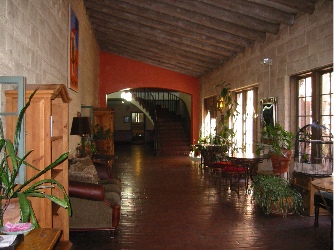 Afterwards, I explored the place, checking out the various public rooms on the main floor. I had my camera with me and snapped about a dozen photos so I could show Mike what the place was like. Beautifully decorated, beautifully restored. There was a garden in a courtyard out front and a lawn with covered patio in back facing the tracks. It was easy to imagine what staying at this place had been like years ago. I grabbed a brochure, noted the moderate room rates, and decided to talk Mike into making the trip for a weekend stay sometime in the future.
 I didn’t see or smell smoke all day yesterday. But in the evening, as the sun was setting, I saw the smoke on the northwestern horizon. Probably the fire out in the St. George area about 120 miles away. This morning, the smoke from Arizona’s big fire — the second biggest in its history — had drifted north, past the San Francisco Peaks, shrouding the eastern horizon. I almost missed the sunrise. The sun fought to be seen through the thick smoke, appearing as an orange globe poking out through the top of the thickest of it. There was little light from the sun at first. Then, when it broke clear of the cloud layer, I could feel its bright warmth. The smoke cloud faded back to a blue-gray blanket on the horizon.
 Howard Mesa was beautiful. Or maybe I should say that it was more beautiful than usual. The grass was knee-high and green and the seed tops swayed with the wind. The San Francisco Peaks were still snow-covered, off in the distance. Best of all, we seemed to have the whole place to ourselves — as usual.
 The trail, which was wide enough for hikers, bikers (the pedal kind, that is), or horseback riders, was smooth and covered with crushed red cinders. In places, it was heavily eroded, but not enough to make walking a problem. That was a good thing, because I hadn’t brought hiking shoes. I was wearing my red Keds and that’s probably the only kind of surface I could have walked 3 miles on. The trail climbed gently most of the way. It wound through the trees, then dropped into a smooth-bottomed wash and climbed toward the mountain in that. Soon, we were in a canyon with slopes of dark grey volcanic gravel on either side of us. It was fine stuff, like the red cinders we walked on. There were a few interesting formations right at the mountain’s entrance. Beyond them, we could see the red hoodoos inside the mountain.
 It appears to me that Red Mountain had once been a plain old mountain. Volcanic activity on one side had caused black lava to spew out of the ground. This undermined the mountain, causing a slide that took out about 1/3 of the mountain side. The result was the amphitheater the booklet told us about. Of course, this is all conjecture based on what it looked like. There was no interpretive sign in the parking area or elsewhere and no ranger to explain what we were seeing. I could have it completely wrong.
 There are two ways into the mountain, both of which were described in the book. At the head of the wash we’d been following, someone had built a neat rock dam. A ladder climbed the six or eight feet up to the top of the dam where silt had backed up, raising the ground to the top of the dam. That’s how we went. Jack took the ladder like a champ. The other way was to climb up over a gray cinders covered slope. That’s probably the only way you could get in with a horse. (I know my horse doesn’t climb ladders.) Our way was easier. Inside the mountain’s amphitheater was exactly as the booklet had described. Lots of rock formations made of red sandstone carved by wind and water, with a bunch of dark gray formations just to make things interesting. We walked up to the head of the canyon, passing a family having lunch with their dogs. One dog, a Corgi, came yapping out after us, followed by a dog that looked like a mix of every dog breed in the world. Jack had some sniffing with them, then followed us.
 I took this photo of Jack as we neared the parking area. It’s the new desktop picture on my laptop. That’s the San Francisco Peaks in the background; you can see Jack running on the trail, tongue hanging out, on the left.