Waiver Flight

I do my first flight with a TSA Waiver.

On Saturday evening, I did my first photo flight that required a TSA waiver.

As most pilots should know, there is a temporary flight restriction (TFR) over certain sporting events. I can’t remember the specifics, but college football games definitely fall into the category.

I’d been contacted by a photographer from Minnesota who needed to take some aerial photos of the December 1 football game at Sun Devils Stadium in Tempe, home of ASU. The flight required a waiver from the TSA to enter the airspace.

Getting the Waiver

Getting the waiver isn’t difficult, but it does require some effort and a lot of patience. Start by going to the TSA/FAA Waiver and Authorization page on the TSA Web site. You’ll register as a user and log in. You’ll then have to provide information about the event and why you want a waiver. Be prepared to enter information about the pilot and all passengers, including pilot certificate numbers and social security numbers. Click the button to submit the information.

You’ll see a page telling you that you need to fax TSA an authorization letter. This is a letter from the folks that manage the venue that says they know you’re coming and have given you permission to operate. TSA will not grant a waiver without this so don’t skip this step.

Now wait while the TSA does all their background checks.

A few days — and I do mean few — before the event, you’ll get a fax or e-mail with the waiver document. It includes an authorization number and a bunch of other info about the waiver.

You’re Not Done Yet

If you’re a trusting soul, you might believe you’re all done and clear to enter the airspace. Not so fast! As my client warned me, local air traffic control sometimes has no idea that you got a waiver.

On the day of the event, start by calling the Flight Service Station at 800-WX-BRIEF. Talk to a briefer. Tell him your name and N-Number and let him know about your operation. Give him any info he wants. He might not want any, but it’s important to get this call on record.

Next, call the tower for the controlling airspace. In my situation, Sun Devils Stadium is within the Phoenix Class Bravo airspace, so I called Phoenix tower. Well, I didn’t at first — the phone number doesn’t seem to be listed anywhere. So I called Sky Harbor Airport and talked to someone in “Air Side Operations.” He called the tower and called me back with a fax and phone number. I faxed the waiver (twice, by accident; don’t ask), then followed up with a phone call. I told the controller what I was planning: several flights in the vicinity of the stadium before and during the game.

“You know the stadium is on the approach path for runways 25, right?” the controller said.

“Yes,” I replied (see image below).

“If you’re too close, we might have to ask you to move to the south when a plane is coming in.”

I assured her that I was prepared to do anything they needed me to do.

Sun Devils Stadium

As shown here in this GoogleMaps image, Sun Devils Stadium is on the approach to the south side of Sky Harbor International Airport.

Finally, remember to bring a copy of the waiver with you, just in case someone asks to see it. You’re required to have it with you during the flight.

Dodging Jets

My Saturday flight was delayed until the absolute last minute. The weather all day was rainy and windy, with low clouds and bad flying conditions. My client had flown in from Minnesota that morning. He called several times throughout the day. Finally, at 4 PM, he gave me the green light. He wanted me at Sky Harbor in time for sunset.

By that time, the weather in Wickenburg was much improved, with blue skies to the west and overhead. Mike and I headed out at top speed, racing with the sun. We landed at Cutter. Mike got out and took the front passenger door off and went into the FBO with it. He returned moments later with my client. To save time, I didn’t even shut down.

After a quick safety briefing — the guy has probably been in more types of helicopters than I have — we took off to the stadium. I reminded the tower that I had a waiver. I was told to proceed east, remaining south of the runways and to let them know when I was ready to turn north and get on station.

The sun had just set behind a partly cloudy western horizon when we were ready to get into position. It was 5:30. The game was scheduled to start at 6 PM. The stadium was half-full and both teams were warming up on the field.

That’s when the fun began. I was literally right in the path of landing aircraft, including some heavy metal. Since I was just below the altitude of approaching aircraft, wake turbulence was a real issue. Every few minutes, the tower and I would have an exchange like this:

“Helicopter Zero-Mike-Lima, traffic three miles to the east is an Airbus heavy landing at the south complex.”

I’d look and see landing lights coming right at me. “Zero-Mike-Lima has the traffic in sight.”

“Helicopter Zero-Mike-Lima, retain visual separation from the traffic. Caution wake turbulence.”

“Zero-Mike-Lima.”

Depending on where we were, and how close the plane was, I’d react. Either I’d continue on a slow pass along the east side of the stadium, 600-800 feet up or I’d break off the pass, dropping altitude to gain speed and move to the south. After moving out of the way, I’d maneuver slowly out there until the landing plane was abeam the stadium, then zip back in for another pass.

When I say this happened about 20 times during 2 separate 20-minute flights, I’m not exaggerating. I was the fly dodging the big metal fly swatters. At night.

(In all honesty, it’s a lot easier to see other traffic at night because of their landing lights. It’s just not always easy to judge distances.)

My client was extremely understanding and patient. He was familiar with the danger of wake turbulence. I’d been warned about it by my first flight instructor and that was as much as I wanted to know about it. I never wanted to experience it firsthand. So I was careful and we didn’t get into any.

At one point, the tower asked how much longer we’d be. My client held up a hand with five fingers. “Five minutes,” I reported. I soon realized why he was asking. The planes started coming continuously, giving us few chances for additional passes.

Finally, after one good slow pass, my client announced he was done.

The tower was just telling a Boeing 737 on final where we were. When he told us about the Boeing, I was already on my way back. I asked permission to land and was cleared, told to stay south of the runway. The Boeing passed us on the ground just as I started my descent over the FedEx ramp.

My client left me and Mike returned with the door. We flew back to Wickenburg in the darkness, not seeing stars in the clear night sky until we were well past the bright lights of Phoenix.

Leaving Las Vegas — NOT!

Photos from a short flight.

A little while ago, I took off from Las Vegas’s McCarran International Airport on my way home to Wickenburg. Before I left, however, I rigged up the junky tripod I keep under the front passenger seat with my camera, fisheye lens, and cable release. I strapped it all in with a seatbelt for safety.

The idea was to snap a few photos while I flew. This would be an experiment and I didn’t really expect to get any good images.

The interesting scenes started right after I left. I departed on the taxiway parallel to runway 19R, following the departure route the local helicopter tour pilots use. It requires a steep climb to 3,000 feet while making a turn to the right. The hotel casinos closest to the airport are right out my window.

Here are a few of the best shots. Remember: the camera is sitting on a short tripod on the front passenger seat wearing a 10.5mm lens.

Leaving Las Vegas
This is one of the first shots I snapped after takeoff. I was a few hundred feet off the ground. And yes, on the right side of the photo is a 30-story black pyramid with a giant vodka ad pasted to it.

Leaving Las Vegas
This is a look right down the Strip. The wide angle lens makes everything look pretty far away. It wasn’t. At the direction of the tower, I flew right over the top of Mandalay Bay. I couldn’t have been much more than 100 feet off the roof.

Leaving Las VegasThis photo is the last one I snapped on the flight. I was flying east on Tropicana at 3000 feet MSL. Then the Alt (short for alternator) light on my panel illuminated and didn’t go out. That meant there was a pretty good chance I had an alternator failure. And if there’s one thing any pilot will tell you, it’s not a good idea to start a 2-hour flight across empty desert without an alternator.

I was still within McCarran’s airspace so I called the tower and told the controller I wanted to come back because I had an alternator light. The tower cleared me to turn around and reverse my course. Because two or three helicopters had taken off right behind me on the same route, I dropped down to 2500 feet. They flew over me. The tower asked if I needed assistance. I think he was prepared to scramble the foam trucks. I assured him that I’d be okay. An airliner landed on Runway 19R and I came in behind it to the ramp. Even though there hadn’t been any real danger, I was happy to be on the ground.

After shutting down the helicopter, I crawled underneath to take a look. I no longer had an alternator belt. I suspect that pieces of it are scattered over Tropicana Boulevard.

As I write this, I’m sitting in a recliner with my feet up and my PowerBook on my lap. The comedy channel is on a high-def television in front of me. Other pilots are lounging around with laptops. I’m thinking of ordering a pizza.

A mechanic from Silver State in North Las Vegas may make it out here this afternoon. But there’s no way he’ll get the fan scroll off and the belt replaced early enough for me to get out of here before sunset.

So it looks like I’m not leaving Las Vegas today.

As for my photo experiment, I think I’ll try the 18 mm lens for the next flight.

Some Things are Better Seen from the Air

The Goosenecks of the San Juan.

Mike Reyfman took this photo during one of our photo flights this past October. It’s an aerial view of the Goosenecks of the San Juan River.

Goosenecks of San Juan River

To give you a sense of scale, the line with the little box at the end of it in the lower-left corner of the photo is a road with a parking area. There are cars parked in the parking area. You can’t see them in this photo at this size.

The landscape of the San Juan River area near Mexican Hat Utah is simply magnificent. I did a lot of flying in this area with Mike’s group, then had the pleasure of heading upriver as far as Shiprock and Farmington, NM. The few photos I took while flying simply cannot compare to the images Mike captured.

If any photographers are out there reading this, let me take you some cool places like this! Visit Flying M Air’s Web site for information about aerial photography from my helicopter.

The Big September Gig, Day Six

One last photo flight and the long flight home.

I was ready to go in the lobby with my luggage at 6 AM the next morning. The motel — like most “standard” motels these days — offered a free breakfast. It was the usual collection of high-carb breakfast junk food and juice from concentrate. I was nursing a cup of weak coffee at 6:30 AM when Mike appeared. After loading the SUV with luggage and waiting while the two of them had a cigarette, we headed back to the airport.

We pulled the left side doors off the helicopter and stowed them in their SUV, which they parked alongside a hangar nearby. Then I fired up the helicopter and started the warmup process. It was cold that morning — 37° F — and my papered aircraft usually doesn’t like starting on cold mornings after spending the night outdoors. But that morning it started right up, ready for more.

The Flight

Dawn broke through a layer of haze as we started off toward Shiprock. Suddenly, my passengers were in a hurry. With doors off, my speed was limited to 100 knots, but I used it all and got out there just as the light was getting good.

We made several slow flights over the north-south ridge line, as close to the ridge as I dared, so they could shoot up the ridge with Shiprock in the background. With each pass, we got closer to the peak. The shadows from the ridge and peak were long but got shorter with every pass.

As Mike snapped photos, he made lots of ooh and aah sounds, punctuated occasionally with a soft wow. At one point, he showed me the image in the LCD panel of his camera. Wow was an understatement. I’m hoping he shares a lo-res copy of the image with me so I can put it here.

We kept at it for quite some time. Then they told me to head on back to Farmington. As we neared the airport, they shot a few more images of the town — mostly fields alongside the river. The tower cleared me to land and I set down on the pad. Then it was over.

Getting Ready for Departure

We put the doors back on and loaded in my luggage. We said some parting words, and shared hugs. I handed over the piece of paper I’d been using to keep track of all the flight times. Mike passes my costs along to his passengers based on the amount of time each of them flew and I’d been keeping meticulous records for him for the past six days.

They drove off and I placed my fuel order with the FBO girl, who was still on duty. She gave me a lift back to the FBO office so I could use the facilities and settle my bill. When she dropped me off at the helicopter again, I handed over a pair of tens: one for her and one for the previous day’s FBO guy.

A while later, I was in the air, heading southwest.

If you look at a Denver sectional — which is where you’ll find Farmington and the area around it — and you trace a route that’ll bring you toward the Phoenix area (on the Phoenix sectional), you’ll soon find that there isn’t much in the way of airports between the two points. I estimated the flight at just under 3 hours which I should be able to do with the full tanks of fuel I had on board. But having come close to running out of fuel on long trips across open desert before, I wasn’t planning on doing it in one shot. I wanted a fuel stop. That meant stopping at Winslow.

But how to get there? I wasn’t interested in overflying the Chuska Mountains. It was getting windy and I simply didn’t feel like being tossed around while I climbed over 8,000 foot peaks. If I went around to the north, I’d overfly Chinle. If I went around to the south, I’d overfly Window Rock. I chose south.

Empty Rez HomeI don’t remember too much about the flight. I know that the first 40 to 50 minutes was spent flying first across some half-neglected farmland and then over relatively flat open and deserted desert. One highlight was seeing a pretty large herd of sheep being tended by a single dog; when he heard me coming, he rounded all the sheep up into a frantic group. After that, I got my camera ready for other photo ops. But the only interesting things I passed were the remains of old hogans or corrals.

Empty Rez HomeYes, I was still on the Rez. The Navajo reservation, as I’ve said earlier in this narrative, is huge. I was flying from near its most northeastern point (Farmington) to near its most southwestern point (near Flagstaff). It would take me about an hour and a half just to make that flight.

Empty Rez HomeI rounded the southern end of the Chuska Mountains and adjusted my course slightly to the west to overfly Window Rock. I started to climb. The terrain below me was rising with tall pines all around. The few homes I flew over looked more like winter residences than year-round homes.

A few very interesting rock formations appeared just outside of Window Rock. I tried to get photos but discovered that my camera’s card was filled. (I’d left photos on it from a previous trip when I started this one and didn’t even know it.) I managed to delete a photo (while I was flying!) so I could take one as I came into town.

Window Rock, AZ

Then I was over Window Rock, which is named for a huge hole in a rock on the north side of town. The government offices are built nearby it and there’s a park so you can walk right up to the formation. I’d been there on the ground when visiting the Navajo Nation County Fair in previous years. This time, I saw it but couldn’t snap a photo. How annoying!

I reprogrammed my GPS for my next waypoint: Winslow and made a slight course adjustment. For a while, I continued flying over tall pines. Then the terrain started to slope down and the pines faded away. I fumbled with my charts to switch to the right area on the Phoenix sectional. Although I was using a GPS for navigation, it’s always a good idea to know where you are on a sectional. I used landmarks such as powerlines and roads to track my route. Soon I was in the painted desert, flying between low buttes in an almost barren terrain.

As I neared Winslow, I tuned into its frequency. A helicopter was just departing to the south. An airplane was on its way in. I saw the Little Colorado River’s green belt and the town beyond it. A while later, I was landing on the ramp.

Oil Leak and a Long Walk

The first thing I noticed after shutting down were the spots of oil all over the ground under the helicopter. Oil from the helicopter.

Now I’d been noticing a higher-than-usual oil consumption during the past few days. I’d also been noticing more oil than usual in the engine compartment, which I try to keep clean. I’d been at a complete loss as to exactly where the oil was coming from. There wasn’t so much oil that it was a serious problem. It was more of an annoyance. Something to get looked at but not something to stop flying over. After all, it was holding enough oil to keep gauges in the green.

I called Ed, my Wickenburg (engine) mechanic and talked to him about it. Could he look at it as soon as I came in? I had a 6-day excursion coming up on Sunday (four days away) and would be in deep doo-doo if I couldn’t do it. He promised to check it out when I flew in.

I went with the FBO guy to the FBO office and put in a fuel order to top off the tanks. The girl at the counter ordered a cab to take me into town. The cab dispatcher said it would be 15 minutes.

I plugged my iPod’s charger into an outlet at the FBO office. (Guess I didn’t mention that I’d been listening to music during the entire flight. The iPod connects to the helicopter’s intercom system so it automatically cuts out when someone comes on the radio.) Then I used the restroom and stepped outside to wait. It was 9:45 AM, back on MST. (I was off the Rez.) A beautiful day with light winds. I waited.

And waited.

After about 15 minutes, I called the cab company to see what the status was.

“I told her it would be a while,” the woman snapped at me.

“Well, it’s a nice day so I’m going to start walking,” I told her. “So if you see someone walking on the side of the road toward town, it’s me. You can pick me up where you find me and take me the rest of the way.”

“I have two other people in front of you,” she said.

“Fine,” I replied.

We hung up and I started walking.

You can probably figure out the rest. I walked all the way into town. It’s about a 2-mile walk and I can’t say it’s very interesting. But the weather was nice and I can use the exercise. I just wish I was wearing my walking shoes instead of those damn Keds. They’re simply not designed for long distance walking.

By the time I got to La Posada — 45 minutes after I’d started walking — I was hot and a bit cranky. They sat me at a table near the window so I could look out over the gardens and the train tracks. I ordered eggs on polenta with green sauce — my favorite breakfast there — and started tanking up on iced tea. Then I paid my bill and went to the hotel desk to see if they could call a different cab company to pick me up.

The girl at the desk offered to run me over to the airport. We had a nice drive and, at the end, I gave her the money I would have given the cab driver. “Lunch on me,” I told her. That was two fares the cab company lost that day.

The Last Leg

I settled my bill with the FBO and walked out to the helicopter. The oil problem didn’t seem any worse, so it evidently leaked only when the engine was running. I added a quart of oil, did a quick preflight to make sure I wasn’t missing anything obvious, and climbed on board. Then I started up, warmed up, and headed southeast toward Sedona.

Although a straight-line route would have taken me south of Sedona, it also would have kept me away from any airport that I could have used if the oil leak started giving me bad indications — like loss in oil pressure or increase in oil temperature. So I chose a route that put several airports within range: Flagstaff, Sedona, Cottonwood, Prescott. I didn’t actually overfly any of these places. I just kept them within a short flight distance in case I felt a need to land. Sure, you can land a helicopter almost anywhere, but landing in the middle of nowhere, miles from help, isn’t exactly the best situation to put yourself into.

But everything was fine. I completed the flight in just under an hour and a half, flying a route I’d taken many, many times. It felt good to see familiar mountains and roads again. And it even felt good to see Wickenburg Airport in the haze as I descended from the Bradshaw Mountains.

Oil Leak Investigated

I was still cooling down the engine on the ramp when Ed came out of his hangar. He stood patiently nearby until the blades stopped spinning. I opened up the side panel, where he could clearly see oil splattered all over the top of the battery box. He’d cleaned the box cover when he’d done an oil change before the trip. I’d cleaned it at least twice during the trip.

His main concern was that the oil leak was coming from the filter — which would mean he’d screwed up on the oil change. But that was not the problem and I knew it wasn’t. Ed is extremely conscientious about his work. Heck, the man won’t even give you a bill for work done until he knows he’s done it right.

I offloaded my luggage and towed the helicopter into one of Ed’s hangars. He went to work on it. I was still at the airport a while later when he came up with his verdict: the oil was leaking from one of the engine’s connections to a magneto. All he had to do was tighten a bolt.

We pulled the helicopter out onto the ramp between two rows of hangars and let it down off its towing equipment so its skids were flat on the ground. Although I hardly ever run it up near the hangars, there was no one around other than Ed, his assistant Kenny, and me. All the hangars were closed. So I fired it up while Ed sat a safe distance away, looking at the affected area through a pair of binoculars. I ran it at idle speed (55% RPM) and then at warm-up speed (68% RPM) for about five minutes before Ed signaled that it was okay to shut down. The leak had been fixed.

I put the helicopter away and headed home for some well-deserved rest.

The Big September Gig, Day Five

Rest, a great ferry flight, and a tall ship in the desert.

I woke Tuesday morning with one thought in my mind: a nice hearty breakfast in the lodge’s restaurant. It was a clear morning with millions of stars in the dark sky. The air was fresh and dust-free, thanks to the previous day’s rain.

My clients had spent the night camping on Hunt’s Mesa, where they probably still were, waiting for sunrise in the cold, damp, predawn light. They didn’t need me until 5:30 PM at Shiprock Airport, about 75 nautical air miles away. I’d have to fly there later in the day. There was no rush.

I made myself a cup of coffee and waited for a normal time to take the walk up to the lodge. I have the nasty habit of waking up very early every morning, no matter what time I go to bed at night. The result: I have a lot of free time in the morning when most people are still asleep. I filled it by working on my blog entries for the trip.

Helicopters at Monument Valley
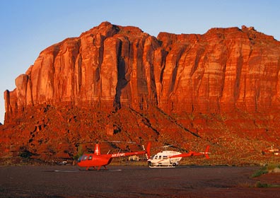
Outside, as dawn broke, a young Navajo man stepped out of the car that had been parked next to the Long Ranger on the helipad beside mine. Turned out, he’d been hired as security for the helicopter and had spent the night in his car.

Breakfast

I brought my little laptop up to the lodge with me to check my e-mail, send captions for the Introduction figures to my editors, and post the blog entries for the first two days of the trip. All that only took about ten minutes. Then I climbed up to the restaurant. I was surprised to see that it was nearly empty — after all, it was almost 8 AM. The hostess handed me a menu and told me to sit at one of the tables by the window. I chose a table for two along the bench seat that looks out over the valley.

Immediately after seating myself, I realized that the man beside me was enormously fat. The pedestal tables are bolted into the floor — probably so they’re less likely to tip over — and the man who sat on the long bench seat simply could not fit his gut between the seat back and the table. So he sat catty-corner, with half his body in the space between his table and mine, stuffing his face with fry bread and breakfast fixings. All the while, he chatted with his wife, who was also pretty hefty. I was rather surprised by their British accents; I’d expected them to be Americans.

I had a wonderful breakfast of huevos rancheros on Navajo fry bread. It was the best meal I had at Goulding’s and enough food to hold me over for most of the day.

Meanwhile, back at the strip…

After breakfast, I walked back to the office and checked out, after making sure my key would continue to work until noon. I wasn’t planning to walk back up to the office. Then I made the long walk back down to the landing strip and my room in the hangar.

Camera on Helicopter
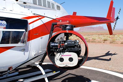
The camera guys were out with their truck again, working on the mount they’d put on the Long Ranger. Now they had a big ball on one side that turned out to be the camera mount and camera. The pilot and his fuel guy came by for a quick chat with them before they all took off for a meeting at the nearby high school, where the rest of the film crew were gathered.

I spent most of the morning goofing off, slowing getting my stuff packed up and stowed away in the helicopter. I took a few more photos for a panoramic image I still haven’t stitched together. I also took some photos of the Valley, where low clouds hung about the buttes in the early morning light.

Ferry Flight to Shiprock and Farmington

By 11:30, I was packed up and ready to go. I left my key in the room, took a few last photos of the area, and climbed on board Zero-Mike-Lima. I was just lifting off from the pad when the pilot and crew for the Long Ranger returned.

Monument Valley from the Air
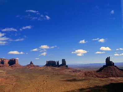
I flew through the northwest corner of Monument Valley, snapping a few photos along the way. These weren’t the great artistic photos my passengers had snapped during our flights. They were quick point-and-shoot images taken left-handed through the plexiglas. A way to document my trip and share images with blog readers. (I still hope to get a few low-res images from the photographers to share here.)

I made a quick pass of Goosenecks so I could snap the photo I showed on the Day Four entry for this trip. Then, spotting boats on the San Juan River, I followed the twisting canyon upriver. I was about 1/3 down into the canyon, cruising along at about 90 knots, marveling at the rock layers around me when I realized that the canyon twisted a bit more than I was willing to tackle at that speed. I could either slow down to make the sharp turns or climb and pop out of the top of the canyon. I climbed. The Canyon opened up and I was treated to a bird’s eye view of some fascinating rock uplift formations.

San Juan Rock Formations

San Juan Inflow
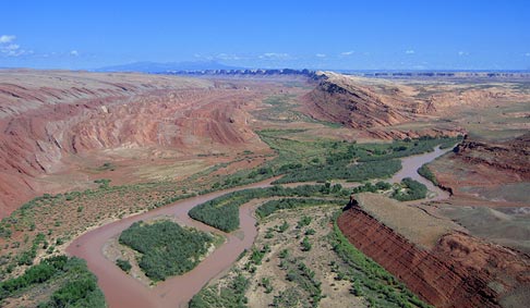
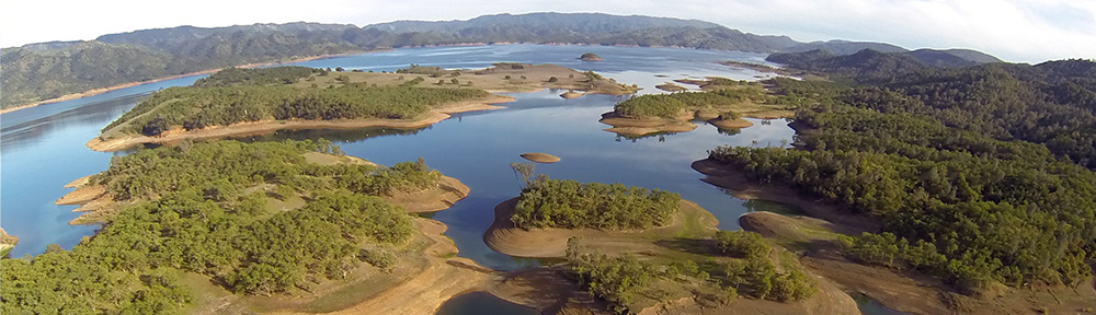
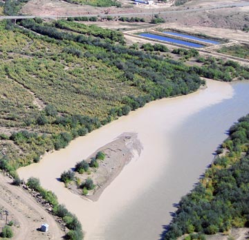
The canyons leveled out and I continued following the river through relatively flat terrain. The river, which was a greenish tan color, was being fed in many places by side streams of silty runoff water from the previous day’s rain. It was interesting to see the places where the two water flows met.

I flew low over the river — sometimes as low as 150 feet. I saw wild horses in two places. There were long stretches of abandoned farm fields and empty land.

Four Corners MonumentMy GPS clearly showed the intersection of four state lines. I was approaching Four Corners — the only place in the U.S. where four states meet in one place. This is a weird, arbitrary man-made tourist attraction. I flew over and saw a monument surrounded by parking surrounded by typical Navajo craft-seller shacks. I could clearly see a fee booth along the drive from the road to the monument. Yes, people were paying money to see the intersection of four state lines.

After a quick photo, I climbed out and continued on my way. A short while later, I rounded a bend and saw Shiprock rising out of the desert miles away.

Shiprock from a DistanceShiprock gets its name from its appearance: it looks like a tall ship — you know, the kind with sails — floating on the flat desert floor. You can see it from miles and miles away. The remains of an ancient volcano, it dominates the horizon. This is what my clients wanted to photograph at sunset and sunrise.

The river ran right to the town of Shiprock, which is about 12 miles northeast of the rock. The airstrip was south of town, 6 miles to the east of the rock. I flew over to take a look. I saw a single runway which appeared to be in decent condition and a ramp area with markings that looked as if they could be for a fire helicopter or some other emergency helicopter. There were no buildings, no planes, and no sign that the airport was regularly used by anyone. A single windsock was bright orange and in good shape.

Good Airport Management and Service

I turned to the east, toward Farmington. There was an airport there in Class Delta airspace where I could get fuel. I’d contacted one of the FBOs by phone, so they were expecting me. I listened to the ATIS recording while still 20 miles out and was surprised to hear that the airport was closed to fixed wing traffic. Turned out, they were doing runway maintenance. (At least some airport managers understand that you can keep an airport open to helicopters when runways are being worked on.) I flew between two coal-fueled power plants, made my call to the tower, and got instructions to come in from the south. A while later, I was on one of three helipads on the east end of the airport.

John from Bisti Aviation drove up in a SUV and waited for me to shut down. He brought me back to the FBO office, which was clean and comfortable (although reeked of air freshener — what is it with people?) and had WiFi. He offered me a courtesy car, which I eventually took into town for a bite to eat at the Three Rivers Brewery in historic downtown Farmington.

Courtesy Car
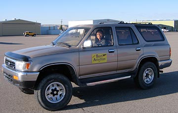
I do need to say a bit more about this courtesy car. It was the absolute worst car I’d ever driven in my life. It was a Toyota SUV with manual transmission. I have no trouble driving a stick shift car — all three of my vehicles have manual transmission. But the clutch pedal on this one would stick to the floor. You’d put it in first gear and start moving, then go to push the clutch down to shift into second, but the pedal was already on the floor and the clutch was not engaged. I quickly learned to use the toe of my shoe to pull the pedal back up after each shift. I kept things simple by sticking to first and second gear and parking in the very first spot I found in town. On the way back, I had a bit of trouble and thought I’d actually finished off the transmission. But then I got it moving again and returned it to the FBO. It was an interesting experience — very funny but frustrating at the same time.

Back to Work

I was in the FBO office, checking e-mail and doing other online things, when Mike called. They were on their way to Shiprock. Could I meet them at the airport?

It was a bit earlier than we had planned, but I had no trouble with his request. I packed up my things and piled them neatly in a corner, out of the way. Then I got a lift out to the ramp where my helicopter was waiting, all fueled and ready to go. A while later, I was in the air, heading west toward the low-lying sun. It was about 4 PM. Sunset was at 6:51.

At Shiprock Airport
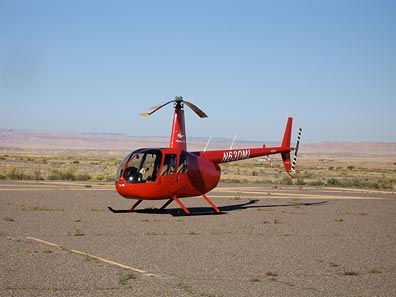
Four SUVs and a crowd of Russians waited for me at Shiprock’s lonely little airstrip. The wind was howling from the southeast. I set down on the ramp, cooled down the engine, and shut down. As I joined my future passengers, I wondered what the local police would think if they drove up and found a helicopter and four SUV loads of Russians on temporary visas.

We took three doors off the helicopter and loaded in the first bunch of passengers. The goal was to make three flights out to Shiprock. The first two would have to be quick to allow enough time for the third, which was for Mike and Oleg. Unfortunately, right after takeoff, my door popped open. I couldn’t get it closed while I was flying, so I had to turn around and land, close the door, and take off again. Two minutes lost.

It took four minutes to fly to the Shiprock formation from the airstrip. We then made three round-trip passes on the west side of the rock. It was my first time up close and personal with Shiprock and I was astounded by the beauty of the formation. But what really got me was the narrow ridges of lava on sandstone that radiated from the formation on three sides. The north-south ridge on the south side was the most pronounced, towering at least 100 feet off the desert floor.

We returned to Shiprock airport within 22 minutes of departure. The second flight took 20 minutes. Then Mike and Oleg, who flew for almost an hour with me. The sun was just setting when they called it quits.

I dropped them off at Shiprock’s airport. There wasn’t a soul around. The rest of their group had driven to the base of Shiprock to get some photos from the ground. We’d seen some of them along the north-south ridge. It was going to be dark soon and I didn’t want to wait for my doors. So I left them there and took off to the east, back to the lights of Farmington. The airport opened to airplane traffic at 7 PM, but there was only one on the radio as I came in. I landed at the same pad I’d had that afternoon and the Bisti Aviation SUV, this time driven by a petite young woman, drove up to meet me.

Outback and the Super 8

It was a while before Mike and Gleb returned with my doors. They were buzzed into the airport property and took a wrong turn. The FBO person and I found them as they were trying to get directions from some men working in a hangar.

Mike and Friend at Outback
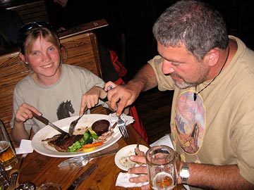
We put the doors on, stowed my luggage in their SUV, and took off in search of the Super 8 where we were staying. That’s when we discovered that Farmington was a lot bigger than we’d all thought. The motel was on the far east side of town, right next door to a Wal-Mart. Before checking in, though, we hit an Outback Steak House for a quick meal. It was after 9 PM and I kept things light.

Mike and Gleb and a few others talked about whether they’d want another flight in the morning. They spoke in Russian, so I had no clue what they were saying. I knew that their next day would take them to to someplace called the Bisti Badlands. Then I think they planned to hit Mesa Verde before heading out to the annual Balloon Festival in Albuquerque. My part of their trip was nearly over, but they had 5 days left.

My room was remarkably comfortable. I was just settling in when Mike knocked on my door. They wanted another flight. They’d meet me at 6:15 AM in the lobby. It would be just two of them: Mike and Gleb. I called the FBO, which was open 24/7, and put in a fuel order, asking her to top off the tanks sometime before 6 AM.