An update on this year’s snowbirding trip.
Regular blog readers probably know that for the fourth (or fifth?) winter in a row, I’ve gone south with my RV to escape the dreary weather and short days in the Wenatchee area of Washington where I live. Once again, I’ve gone to Arizona, where I visited with friends and then camped out along the Colorado River with a friend and later at the Holtville Hot Spring in California.
My Booth(s)
Although I’d planned to spend some time boating and camping at Martinez Lake north of Yuma, electrical issues with my RV brought me north to Quartzsite about a week early. I decided to take a booth at the Tyson Wells Gem and Rock Show, mostly because it was a cheap campsite with water and electrical hookup. I figured I’d set up my Tyson Wells booth early and see if I could make any sales.
The day after I got there, I decided to invest in a canvas skirt for the overhang on my truck camper. Let me explain. My RV is what’s called a “slide-in truck camper.” It basically sits in the bed of my big Ford F350 diesel pickup with the part containing my sleeping area over the cab of the truck. When I park someplace for longer than a day or two, I take the camper off the truck. The camper has motorized legs that come down and lift it up, I drive the truck away, and then I lower the camper down closer to the ground. Although I don’t need them, I have a pair of heavy duty collapsable saw horses that I put under the body of the camper; they hold about half its weight and stabilize it while it’s off the truck. The overhang where my sleeping area is is still high enough for me to walk under. Adding a canvas skirt around it gives me a sheltered storage area for my bike and the items I’ve been toting around in my boat. It’s like adding a storage shed to my camping setup. This would come in handy the following week.
Unfortunately, the space I got for the gem show was in a lightly trafficked part of the show and sales were virtually non-existent. Fortunately, another space opened up in a better part of the show and I moved into it. But since it was a single-sized (14×28) spot — instead of a double-sized (28×28) spot like my original spot — I had to get creative. Instead of setting up my 10×10 shelter, which would not have fit in the spot with my camper, I backed my camper in, pulled the truck out, and set up that canvas skirt. I then used the space inside it as my booth, simply removing the front panel every day. Because no one needs to come into my booth — everything is done at a table along the show aisle — there are no worries about tall people hitting their heads. At night, I snap and zip the front panel on to close the booth.
The new spot was much better. Although I didn’t sell any of the aerial photo services I wanted to sell, I had a brisk business selling sky lanterns. Sky lanterns — paper hot air balloons — are extremely popular out here where there are tens of thousands of people camped out in the desert, mostly in groups with evening campfires. I found a supplier of “eco-friendly” sky lanterns — no wires in the frame — with built-in fuel cells. This gave me a competitive edge a week later when the Sell-A-Rama show started and a competitor started selling slightly cheaper sky lanterns. Everyone who uses sky lanterns feels some guilt about littering the desert; wire-free lanterns helps them feel a little less guilty.
I set off some sky lanterns with friends at their campsite the other night. Here’s a video of one launch.
Of course, I had to move again for Sell-A-Rama. I waited until my friends had moved into their triple spot next door with their massive fifth wheel camper and then I backed my camper into one of my two spots, pulled out the truck, and parked in my spot beside it. I’d been told that in order to have a full hookup site for Sell-A-Rama, I needed a double spot. This is an unfortunate management decision; forcing vendors to pay for space they don’t need leaves a lot of gaps in the show area and makes it tougher for vendors to earn enough to cover booth fees. Although my friends wanted me to set up my 10×10 shelter, I couldn’t see any reason to do so — it meant a lot more setup and teardown work and stress when one of Quartzsite’s famous windstorms come through. My “camper booth” met all my needs and was very easy to manage. And I liked the idea of being able to park my truck beside my camper.

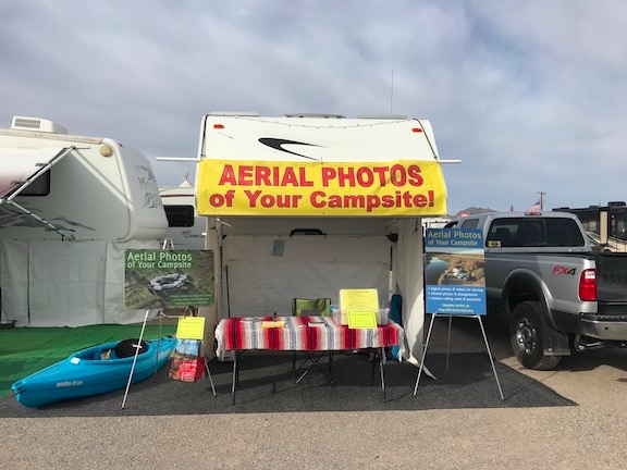
The final incarnation of my booth at Tyson Wells. I bought the kayak for my own use but stuck a price tag on it just to see if someone would buy it.
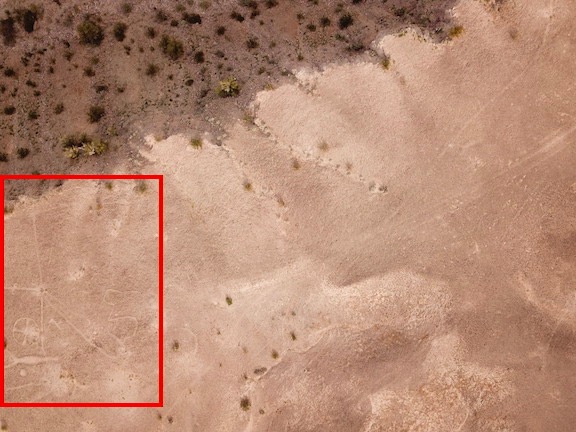
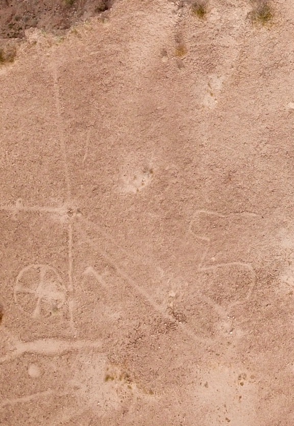
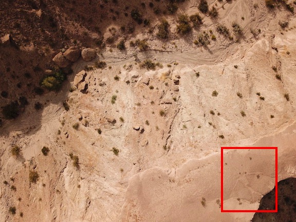
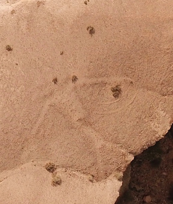
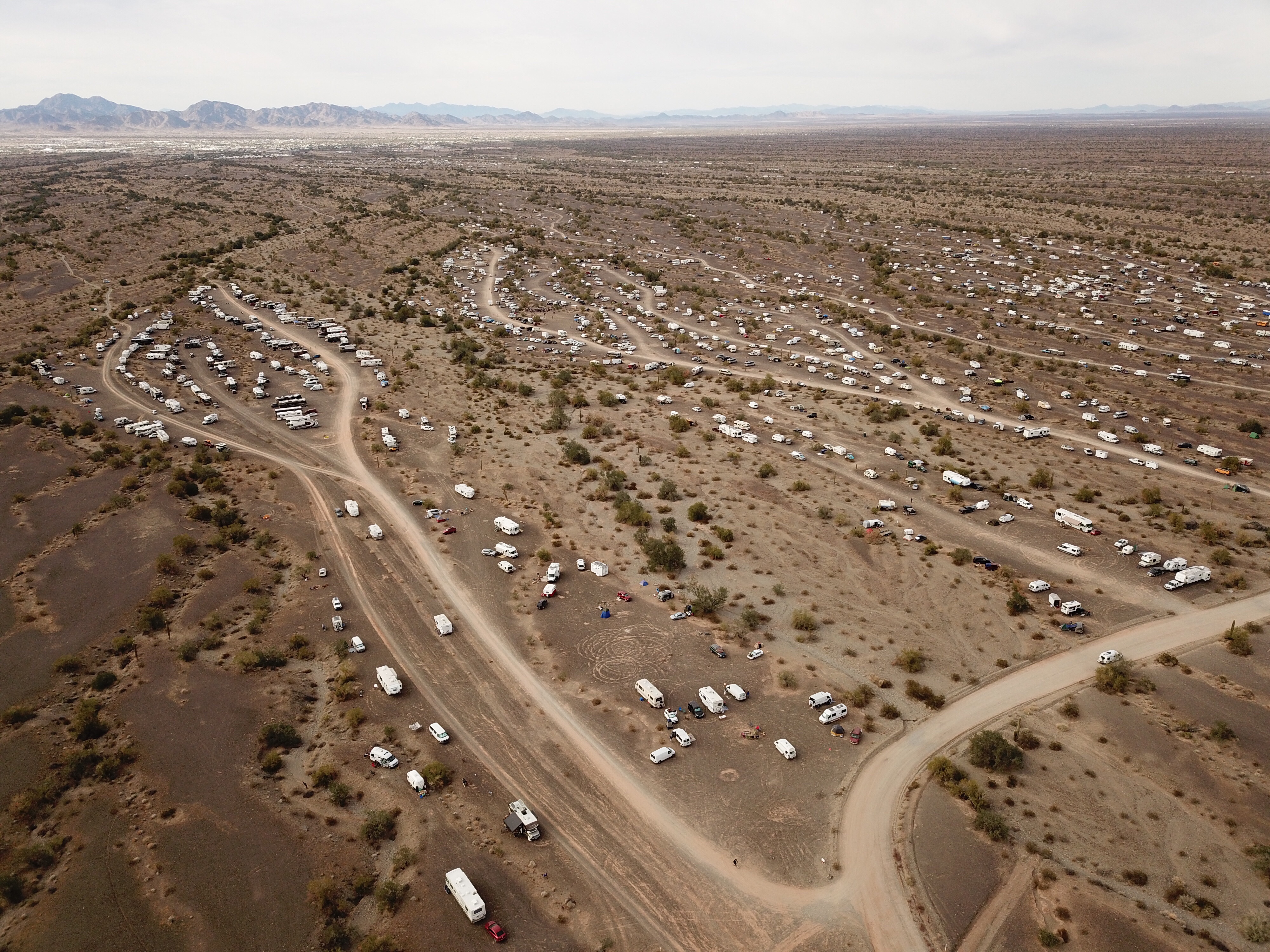
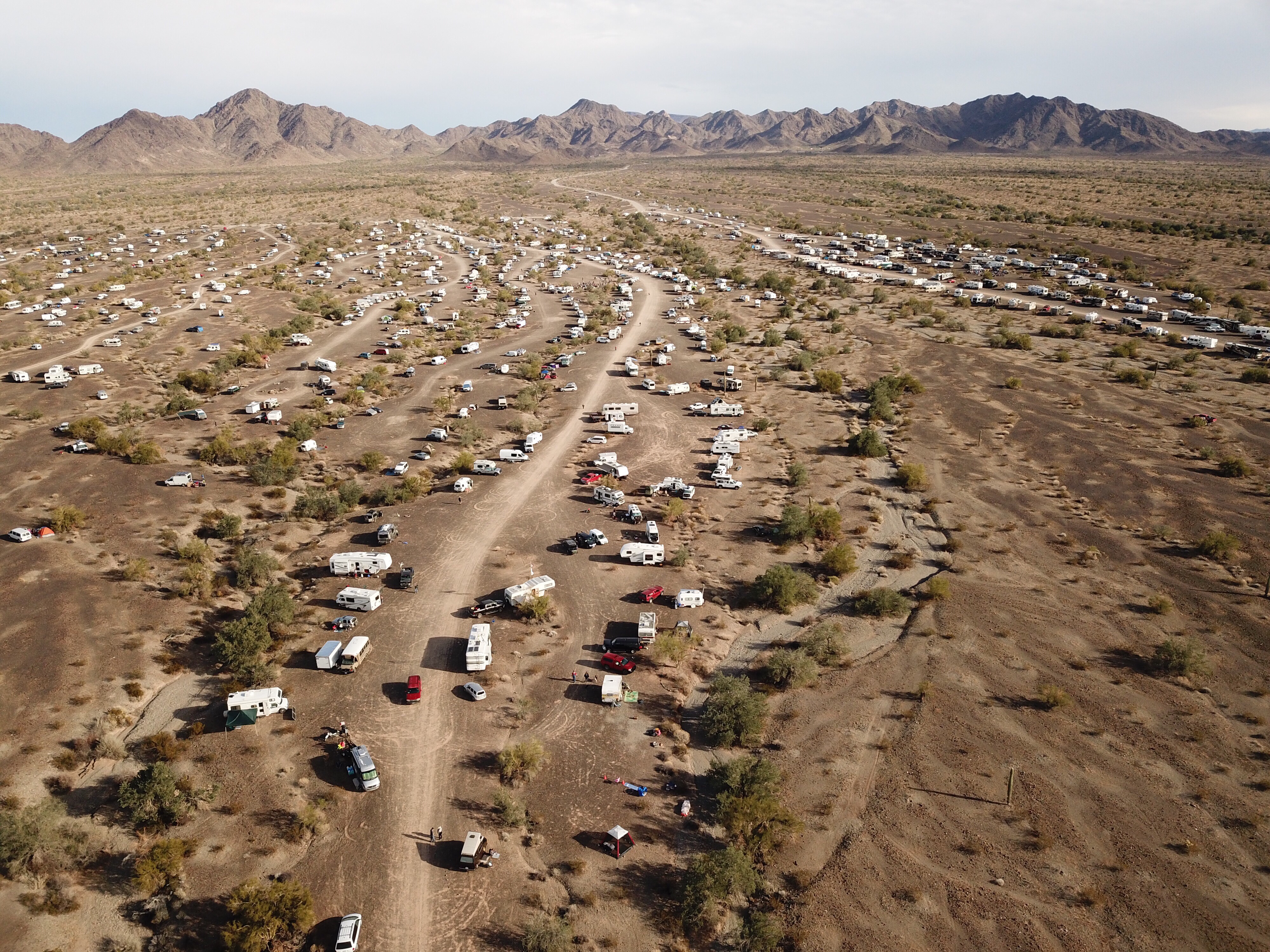
Sell-A-Rama is the biggest show at Tyson Wells. It’s held the same time as the big RV and Vacation show across the street at a time when Quartzsite has the most winter visitors. There has to be at least 10,000 RVs parked out in the desert and every day all those people come into town to shop or at least look at what’s being offered. My new location gets a lot of traffic and I’ve sold about 200 sky lanterns so far — at 3 for $10. (If I’d known I’d sell so many, I would have bought at wholesale prices and turned a better profit.) I’ve also done aerial photos of campsites for three clients and booth photos for two vendors. I do all this with my Mavic Pro; you can see many of the photos I’ve been taking in a Google Drive folder I set up for public access.
The Vendors
I’ve learned a few things about the folks who do this kind of work. Many are year-round vendors — they go from show to show selling whatever it is that they sell and living in their RVs, sometimes on site like here or sometimes offsite. It’s not an easy life. They come to a show and spend hours setting up their booths — putting up a shelter structure, setting out tables or shelves, and putting out merchandise. In the morning, they take down whatever tarps or canvas protected their merchandise overnight, then spend the day sitting in the booth, selling and watching out for shoplifters. They often eat meals in their booth and they seldom get breaks. At the end of the day, they cover it all back up and get some time to themselves. They do this every day for as long as the show lasts — in this case, 10 days. Then, at the end, they stow whatever merchandise is left, tear down the booth, clean up their space, and head off to their next gig.
The folks who seem to do the best are the food vendors who have to charge high fees because their booths are more costly and they need additional permits for food service. Other folks who do well are the ones with inexpensive items that are either fun or deemed “necessary.” For example, one couple sell hand-painted wooden signs with fun sayings on them; they paint the signs and even do custom ones and sell them for just $10 each. They can actually make new inventory on site and do so most days. Another very large booth that’s under a tent sells cheap tools and other household items. They must have hundreds of different items in there ranging in price from 25¢ to $5 each. I think it’s impossible to walk through without finding an item you “need.”
The Shoppers
The people who come to these shows are mostly retired. What really shocks and bothers me, however, is how many of them:
- Ride around on “mobility devices” when they probably don’t need to. It’s one thing if you are unable to walk or cannot walk long distances, but another when you’re just plain lazy. Time and time again, throughout the day, I’m reminded of the scene in Wall-E, with fat people getting around on chairs.
- Carry their dogs around in modified baby strollers or baby carriers. Seriously: I see hundreds of strollers a day and have yet to see one with a human child in it. Instead, they wheel around their dogs. I even saw one woman wearing her dog on her chest with its legs sticking straight out. There’s something sick about this.
Yesterday, I saw an overweight man riding a two-seater mobility device that was pulling a wagon with two dogs in it with a two-wheeled shopping cart in tow behind that. He rolled down the aisle slowly, moving just his head to take in the view of the booths he passed. If I had my phone handy, I would have taken a photo and plastered it all over Twitter to give my followers something to laugh at.
Yet there are many other people who are walking around — sometimes with obvious difficulty — because they’re not lazy SOBs and still have enough pride to move under their own power. Some of them have walkers with wheels and little seats they can use to rest when they need to. I have a lot of respect for these people — and very little for those who can obviously move a lot better under their own power yet choose to ride around on electric carts.
In general, all of the shoppers are looking for a deal. They only things they want to buy are things that are novel or would score points with friends/family members or are cheap. I hear all day about what a great idea my aerial photos are, but none of the folks saying that seem the least bit interested in spending $29.95 to get a photo. Yet if I offered to do it for free, I’m sure they’d be all over it.
My ADD

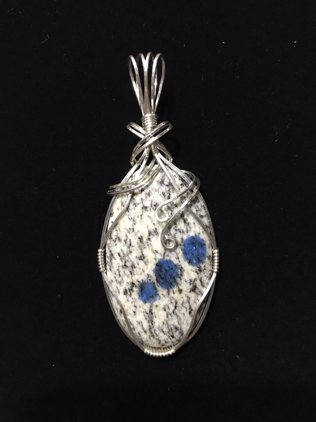
This is my first sterling silver wrap. The stone is a Montana Moss Agate, beautifully polished to a teardrop shaped translucent cabochon. (I really love Montana Agate.) Many thanks to my friend Dorothy for walking me through the process, providing tips, and letting me use her silver supply.

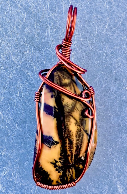
Mike, another vendor here, gave me this odd-shaped cabochon of yellow feather jasper. I wrapped it in antiqued copper. He was so tickled when I showed it to him that he gave me another cab to wrap.
As anyone who knows me might imagine, I’m having a serious problem spending all day in one place. Although I had my booth open promptly at 9 AM for the show’s starting dates, I’ve slacked off more than a little since then. I almost didn’t open at all on Tuesday. Making sales has been motivating me; I’m eager to sell out on the third batch of 80 sky lanterns I ordered, which arrived on Tuesday afternoon, mostly because I don’t want to have to store them for the rest of my travels.
The one thing that is really making booth time bearable is my new jewelry wrapping hobby. I’ve made about 10 pieces so far and am getting better with each one. Of course, I’m spending all my sky lantern sales proceeds on supplies for that — I’ve got a stockpile of about 40 cabochons, including several that were gifted to me by cab makers who want to encourage my efforts. After working with a jewelry maker friend, Dorothy, on my first piece with real silver wire, I placed an order for more silver to make finer quality pieces. I’ve also begun exploring other wrapping methods using hammered copper wire. So I sit in my booth and make jewelry while people walk by and tell me what a great idea the aerial photos are (but don’t buy), occasionally getting up to explain how a sky lantern works and pocket $10 for three of them. I usually close up my booth by 4 PM — a full hour before quitting time — mostly so I can see what’s going on at the rest of the show and across the road at the RV show.
My Takeaway
I guess the biggest problem I have about living here at the show is being in my little box among dozens of other little boxes with people in them. When I camp out in the desert, I sleep with the blinds open; here, I feel a need to close them. I don’t see as many stars at night. When I watch the sunrise from my window, it’s hard to see past the banners and wires and balloons. I hear trucks on the freeway. It’s like living in a city.

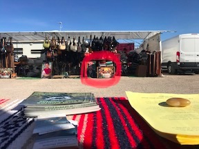
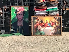
Here’s the view from my booth: a large booth manned by four Mexican men selling Mexican-made blankets, ponchos, wallets, and belts. It’s pretty weird looking at Frida Kahlo and Jesus at the Last Supper every day.
But I don’t regret it. Even if I don’t earn enough to cover my booth fees — which appears likely at this point — I don’t regret spending the money to try this kind of life, even for just three to four weeks. My friend Janet, who is an amazing artist, has been doing this show (and others) for years and I’ve always been curious about it. Now I’m not curious anymore.
Will I do it again? Probably not.
Today is Thursday. In about a half hour, Janet and I will go for our morning “power walk.” Then I’ll come back, take a shower in my tiny bathroom, and put on clean clothes. I’ll have my booth open by 10 AM, just as the old folks start shambling down the aisle, reading my sign (“Aerial Photos of Your Campsite!”) out loud — why do old people always do that? — and pointing to my sky lanterns and saying “that’s what we saw in the sky last night!”
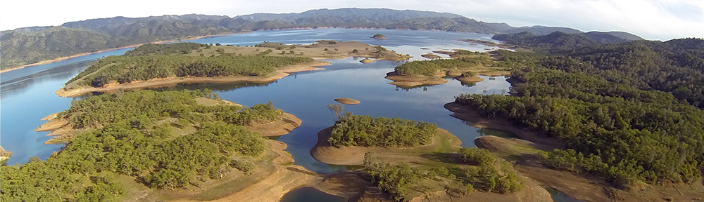
Just a few more days. Then I pack up and get back on the road. I’ll be boating on Lake Havasu or paddling up the Bill Williams River this time next week.