Quincy Tales: Fire!

A report from my summer camp.

Smoke Near QuincyThere was a big fire northwest of Quincy on Sunday. I first saw the smoke when I first drove into the Quincy Lakes area and didn’t think much of it. I figured someone was burning brush or trash. But when I next saw the smoke, it looked like a big, white mushroom cloud. Later in the day, the base of the smoke had spread. It was obviously a wildfire.

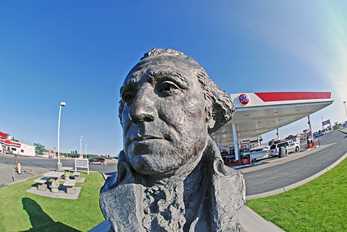
I was concerned for a while that it might have been orchards burning. Maybe even one of my orchards. So after I finished my trip through Quincy Lakes and my visit to Cave B (where this photo was taken), I drove up as far as the turnoff to Crescent Bar. I could then get a better idea of where the fire was. It seemed to be in the highlands beyond the farmland.

Meanwhile, on Monday, when I drove to/from Wenatchee, I saw a helicopter with a Bambi bucket going between the fire site and the Columbia River. The smoke was greatly reduced, but it was obvious that they were still working on fire control.

Next time I’m out with my helicopter, I’ll check it out.

Flying Things of Quincy Lakes

A few photos of the wildlife I spotted during my day trip to Quincy Lakes.

I spent most of Sunday at Quincy Lakes, a weird area of small lakes nestled among the rocks southwest of Quincy. I brought along my camera and my big lenses. Unfortunately, I didn’t bring along my tripod. But I did manage to get three pretty good shots of the critters flying around there.

I’m pretty sure this is a redwing blackbird. I could be wrong. If anyone knows, please share info in the Comments.

I have no clue what this bird is. I don’t have any of my bird books with me and my Internet connection isn’t as reliable as I need it to be to look things up. Know what it is? Use the Comments link or form.

A butterfly.

Exploring the Columbia River by Air

Fighting stir-craziness by taking the helicopter out for a spin.

I must have brought Arizona weather — the clear cloudless skies but not the heat — with me to central Washington. Since Thursday, the weather here has been pretty much perfect. Saturday was the fourth beautiful day in a row. It was also the sixth day since the last time I’d flown. And while I could have spent another day in my camper or under its awning, reading or writing, with time off for a walk or a bike ride, I was ready to do something more substantial.

It was time to go flying.

Zero Mike Lima in its Quincy HangarI put it off as long as I could. But by 12:30, I was on my way to the airport, where Zero-Mike-Lima is resting in a rented T-hangar. I put the pilot door back on, stowed my helmet in the big plastic storage box I keep in the hangar to keep dust off my things. Then I installed my POV.1 camera on the helicopter’s nose and hooked it into the audio system. The helicopter had already been pre-flighted on Tuesday when I thought I was going to fly for work, so I just hooked up the tow bar and dragged the helicopter out to the ramp.

I took my time about it. I wasn’t in any rush. Truth is, I still hadn’t decided on where I was going to go. In fact, even when I took off at about 1 PM, I didn’t know for sure where I was going.

I headed southwest, over the golf course and campground where I’m staying. Then I continued on toward the Gorge Amphitheater. There’s a resort/winery near there called Cave B and I wanted to identify it from the air. I’m also hoping to get some tour flights on nice days with some of their guests. (It’s nice to fly, but it’s nicer to fly when someone else is paying you to do it.) From there, I hopped on the Columbia River, making a hard right to follow it upriver toward Wenatchee.

The Columbia River is one of the great rivers of America. It starts somewhere up in Canada and winds southwest through valleys, canyons, and steep gorges, with numerous dams along the way. The dams aren’t in place to hold back water in an arid land. Instead, they’re in place to generate electricity. This gives the residents of Washington State cheap, reliable power. It also makes a little place like Quincy, WA attractive for companies like Microsoft and Intuit, both of which have built data centers among the crops.

Orchard at Crescent BarIn this area, where the river flows in a wide valley, there’s often orchards alongside. The first of these along my flight path was at Crescent Bar, where a cherry orchard stretches up the side of the hill. Crescent Bar is a recreational area, with campgrounds, condos, boat ramps, and a golf course. It was surprisingly quiet that day — a Saturday — and I could only assume that cold water or high gas prices kept boaters out of the water.

I continued upriver, snapping photos of the orchards I was responsible for drying that season. The photos didn’t come out very good; there was a lot of glare in the cockpit bubble. Most of these orchards are not far above water level. It’s warmer at these elevations than it is on higher terrain, closer to Quincy. I’d be drying the higher elevation orchards in the next part of the season. Maybe, if I was lucky, I’d be sent farther north when that was done, perhaps to dry cherries closer to the Canadian border in August.

Rock Island DamI got a photo of the Rock Island Dam as I overflew it. I know it’s not the best photo, but it does give you an idea of the kinds of dams along this river. Most of them are short and wide, spanning the river and allowing the water to drop just a few feet. This is apparently enough to generate mass quantities of electricity. The drawback to all this is the power lines — they’re all over the place anywhere near a dam. This is a hazard for low-flying aircraft. Although I’ve cruised parts of the Colorado River at just a few hundred feet, I’d never do the same here. Too many damn wires!

Approaching Wenatchee from DownriverBeyond the dam was the outskirts of Wenatchee. I took one photo while still downriver, hoping to capture the snow-capped mountains in the distance, but forgot to take any photos while closer. Instead, I let the POV.1 video camera do the job. Here’s a segment of video as I flew along the Columbia River through Wenatchee. East Wenatchee is on the right and Wenatchee is on the left.

(Keep in mind that the video camera is mounted on the outside of the helicopter, on its nose. I have no way to adjust it in flight, so sometimes I mention things that simply are not visible to the camera.)

I continued on up the river, passing over a number of dams and overflying more small communities on the banks of the river. I could have lived in any of those houses — at least in the summer months. I assume the area gets pretty darn cold in the winter.

I reached Chelan Falls about 40 minutes into the flight and followed them up to Lake Chelan. The falls were a beautiful turquoise blue color — probably a trick of the light on the rushing water. The video doesn’t do it justice. I overflew the town and flew partway up the northeast shore of the lake, then made a U-turn and returned back to the Columbia River. I’ll have to explore Chelan another time. (If the weather continues to keep me free from flying duties, I may drive up tomorrow!)

I continued up the Columbia with the vague idea of flying to the Coulee Dam. I was overflying another dam when I checked my chart and realized I still had quite a distance to go. I honestly can’t afford to spend too much unpaid time in the helicopter, so I cut the flight short, climbing up out of the valley to the southeast. At first, I thought I’d go back to Ephrata for fuel, but then decided to beeline it to Wenatchee. I wanted to check out the fuel facility there, since I’m likely to stop there for fuel when drying some of my orchards.

I landed and topped off my tanks at the self-serve pumps. It’s vital that I have full tanks of fuel when I start flying for cherry work, and I brought the level all the way up to the top of both tanks. Then I went inside to chat with the guys in the FBO. One, the guy at the desk, was a “nice young man” kind of kid — 18 years old, friendly, eager to help. He asked me questions about flying helicopters for a living. The other guy, the line guy, was a bit older and kind of crude and bossy. When I mentioned I was in the area to dry cherries, he cut me off before I could finish talking and told me to move my helicopter to the end of the ramp. I told him I wasn’t based in Wenatchee and I think he had a problem understanding that. I tried to limit my conversation to the desk guy, but the line guy kept butting in. After a while, I got tired of it and left.

Upriver from Crescent BarI flew back along the Columbia River as far as Crescent Bar, then climbed up to Quincy. The video below records that 15-minute flight, beginning just after takeoff in Wenatchee.

It had been a great flight with near perfect weather. But I’m looking forward to doing the kind of flying that brought me here. You can bet I’ll report on that when I get a good taste of it.

A Day Off — Kind Of

Good weather sets me free.

If you’ve been following this blog, you know I’m in Quincy, WA, with my helicopter on a cherry drying contract.

The contract requires me to be on “standby” during daylight hours seven days a week. Here in Washington these days, that’s basically from 5 AM to 9 PM. During that time, I can receive a call from one or more of the three growers I’m currently covering. I’m expected to respond quickly, to fly my helicopter over to the orchard(s) and begin drying. The cherries must be dried within 2-3 hours to prevent damage. I have 78 acres to cover, and if you figure 40 acres an hour, I don’t have much time to waste.

Of course, I don’t have to dry the cherries if they don’t get wet. So if it doesn’t rain, I’m not likely to be needed. That’s when I can move a bit farther afield.

And that’s what I did yesterday. It was a beautiful day with no chance of rain, so I took a “day off” and went to Wenatchee.

Now, Wenatchee is only 30 car miles from Quincy. And my orchards are between Wenatchee and Quincy — one of them is actually closer to Wenatchee than Quincy. So if the weather changed over my orchards while I was in Wenatchee, I’d know and be able to hightail it home. So I don’t in any way feel that I was being irresponsible with a day trip to Wenatchee while I was on standby.

Besides, I had work to do in Wenatchee. I’d finally gotten the missing gaskets for my fuel tank setup and had reassembled the tank and pump. For some reason, however, I couldn’t get the pump to work. I figured it might have to do with the tank not being primed. Since I had to fill the tank anyway, I figured I’d get it filled in Wenatchee and troubleshoot the problem there.

So I hit the road and drove to Wenatchee. It’s a pleasant drive, much of which is along the Columbia River. There’s a spot along the way where you turn a bend in the road and the Rock Island Dam is spread out before you. If I could find a place to pull over and take a photo, I would. So far, no luck.

I crossed a bridge and made my way onto Wenatchee Avenue. From there, I went to Wenatchee Petroleum near 6th Street. The folks there were very pleasant. I moved the truck over to their pump and Ken topped off my tank. We couldn’t fill it to the very top because fuel kept spitting out, so I only took 12 gallons. But the price was good and I’m likely to get all my refills there.

I experimented with my pump and it still wouldn’t work. It seemed to be the pump motor. I worked my phone and tracked down the local dealer for the pump, which turned out to be just a block away. After I explained that no, I didn’t have separate suction pipe, the suction pipe was built into the tank itself, we got down to business. We fiddled with the switch and pump. Suddenly, it started working. The problem appeared to be in the switch. I think it had some moisture in it that was preventing it from working properly. Once it dried out, it worked.

For the first time since installing my $2,000+ fuel transfer system nearly a month ago, it worked. (It was about f*cking time.)

Downtown WenatcheeWith that load off my mind, I could goof off a little. I drove into downtown Wenatchee and parked right on Wenatchee Avenue. I immediately spotted a Mongolian BBQ restaurant. I hadn’t had Mongolian BBQ in 10-15 years and my stomach was grumbling for lunch — it was 12:15 PM, after all — so I went in. I had a great lunch. Then I came back out into the sunshine and walked a few blocks down and then up Wenatchee Avenue, looking into the shops. There’s a great sporting goods shop on the east side of the street and I’ll probably be going back next week to buy a new bicycle seat there. I treated myself to a vanilla ice cream with a shot of espresso on top before heading back to the truck.

Two more stops. First, Home Depot to buy a large plastic planter, potting soil, and some plants for a little garden at my camper. Tomatoes, basil, and some flowers. Then Safeway in East Wenatchee for a few groceries. I was very disappointed that they didn’t sell 8 O’Clock Coffee, which is my favorite brand.

I took the road past Wenatchee Airport on the way back. It might be a little longer than route 28, but it’s a pleasant drive through farmland with occasional views of the Columbia River Valley before joining up with Route 28 near Rock Island.

It was nice having a day off.

And I guess I have a pretty good deal: I only have to work when the weather is bad, so I always have nice weather on my day off!

Flying Again

I fly for the first time in almost three weeks.

On May 19, I dropped off my helicopter for its annual inspection at Seattle’s Boeing Field. I would be spending the summer in Quincy, 100+ miles to the east, on a series of cherry drying contracts. I wanted the helicopter in top condition for the job and the mechanic in Seattle, Rich, was highly recommended by several Robinson helicopter owners.

From Seattle, I made my way back home on a zig-zag route via airliner: Horizon Air from Seattle to Wenatchee and back to Seattle. Alaska Air from Seattle to Oakland. U.S. Air from Oakland to Phoenix. I had all kinds of business along the way. But I was back in Wickenburg by May 22.

Without a helicopter.

It hit me hard — the sudden realization that if I felt like going flying, I couldn’t. Rain came and the desert flooded and I couldn’t take a quick trip in the helicopter to see it from the air. A potential customer wanted a day trip to the Grand Canyon but I couldn’t provide the service. Fortunately, I kept myself busy with preparations for the long drive from Wickenburg to Quincy (learn more here, here, and here), so I really shouldn’t have goofed off in the helicopter anyway.

I came to Quincy and settled in. Then I began looking for weather window — a date when the weather in both Seattle and Quincy — and all points in between — would be good enough for the hour-long cross-country flight. Complicating the matter was the bad weather in Seattle. Rich had painted my main rotor blades and needed to track and balance them. Trouble is, if he flew in the rain, some of that nice new paint would be worn off. So he hadn’t finished the job.

But my contract date was fast approaching, so there wasn’t any time to wait. My weather window was Sunday, June 8. Rain was a definite possibility on June 9, the day before most of my contracts started. One grower had already told me he might call on June 9. I pushed Rich and he took care of the last details on Saturday evening. Yes, it was raining. And yes, some of that nice paint was worn off. But the job was finished.

I made arrangements with one of the employees at the local golf course where I’m camped to take me from Quincy Airport, where I’d leave my truck, to Wenatchee Airport, where a Horizon flight would take me to Seattle. (He and his wife would make a day in the relatively big city of Wenatchee and I’d give him enough money to cover gas and lunch. A good deal for all.) I’d purposely skipped breakfast so I could eat at the airport cafe. When I arrived and learned that the cafe was closed on weekends, I was extremely disappointed. I had to satisfy my angry stomach with peanut butter crackers from a vending machine.

The flight was on a 37-seat turbo prop airplane. I don’t remember the model number. We took off from Wenatchee and the pilots spiraled us up over the city, climbing to about 20,000 feet to cross the Cascades. Below us were scattered clouds with snow-capped mountains poking through. My seatmate flies the route regularly and seemed interested in aviation, so we chatted a bit. The man beside him, visiting from New Zealand, told us stories about how helicopters are used there. The 30-minute flight went quickly and, before long, we were landing at Sea-Tac.

Rich had kindly offered to pick me up at Sea-Tac and drive me to Boeing Field, which is only 6 miles away, so before long I was riding north on back streets in his Hummer. A while later, I was on the ramp at Boeing Field’s “Pad 6,” looking at a helicopter so clean and beautiful that I couldn’t believe it was mine. Not only had Rich done all the mechanical work for the helicopter, but he’d done some “body work.” He’d painted the main rotor blades and they looked almost new. He’d touched up the side panels damaged by a dangling seatbelt during doors-off operations and had replaced the fairing damaged by a bird strike when the helicopter was only 11 hours old. The bill for all this work was quite staggering, but it was worth it to have the helicopter brought back up to near-factory condition by an experienced mechanic who obviously cares a lot about his work.

I retreated to his office and spent about 15 minutes doing some flight planning. I hoped to follow I-90 from Seattle all the way to the Columbia River, then head south for a stop at Desert Aire in Mattawa. Then I’d head north to Wenatchee to top off my fuel before landing at Quincy. This chart segment gives you an idea of my planned route:

Planned Route

I wanted to have the helicopter in its hangar before sunset — preferably before 6 PM. It was 2:30 PM and I thought I had a good shot at it.

The big question mark was Snoqualmie Pass. It wasn’t a very high pass — only 3,004 feet — but during the past few days, it had been subject to foggy conditions due to low clouds. It was cloudy in Seattle (what else is new?) but it was a beautiful day in Quincy, on the other side of the Cascades. How would the pass be? I called Flight Service and asked. She didn’t have information for Snoqualmie Pass, but she did have conditions at Stampede Pass, just to the south. “Visibility 10 miles” was all I had to hear. I was good to go.

Rich gave me some advice for departure. Ask the tower for a north departure, stay below 500 feet MSL as I climb over the hills, then head northeast to the I-90 floating bridge. Follow I-90 all the way. Pretty easy stuff.

I climbed in, started up, and warmed up. I listened to the ATIS; wind was light out of the south. When I asked for my departure, the tower assumed I wanted to take off into the wind. I asked to depart direct to the north. I was by myself and had plenty of power for a tailwind takeoff — especially one in such a light wind. I was cleared and took off.

I regret not setting up my video camera for the flight. I had excellent views of downtown Seattle as I headed north. I flew low over the hills northeast of the airport, being careful to remain north of Renton’s airspace. I caught sight of the bridge and headed straight for it, climbing to 700 feet. I followed the bridge so I’d have a landing platform in the event of an emergency and crossed the lake. Then I headed up I-90, into the mountains.

Following I-90 from SeattleI took photos as I flew. Most of them didn’t come out very well. The ones you see here are passable. In this shot, I’ve just left the Bellevue/Renton area. You can see the thick clouds hanging low over snow-capped peaks beyond Preston.

The flight was quiet. There weren’t any airports along the way and my iPod’s battery was unexpectedly dead. There was nothing to listen to.

The air was a bit bumpy — a 3 on my 1 to 10 scale of turbulence. (Later, I’d hit a few 8s that would require me to reduce power and speed.) So although flying conditions weren’t perfect, they certainly weren’t uncomfortable.

The scenery, however, was beautiful. As I climbed into the mountains, I got up close and personal with snow-covered peaks and saw more than a few waterfalls. This was a real treat for me. In Arizona, there’s seldom much snow or big pine trees at the altitudes where I fly. And water! It was all over the place!

Snowqualmie PassAs I neared Snoqualmie Pass, the space between the mountains narrowed. I-90 wound along mountain slopes in a canyon. The clouds seemed lower. I began to wonder whether I’d be clouded in after all.

Crossing the CascadesBut then I was through the pass and descending past a series of long, narrow lakes on the east side of the pass. Beautiful scenery. I caught sight of a few grass airstrips along the way and found them on the sectional chart I’d left folded open on the passenger seat. I took a picture of one of them, but it was too out of focus to keep, let alone share here.

Approaching EllensburgI continued my descent. Soon I was coming out of the Cascades, approaching the rolling hills so similar to those around Quincy. I overflew Ellenburg Airport and continued east along I-90.

At this point, you might be wondering why I didn’t just cut to the southwest to my first stop. Unfortunately, there was a Restricted Area alongside the river there. By following I-90 and then turning south at the river, I could pass to the north and east of the area.

OrchardsI crossed the river 1,000 feet above it, just south of the I-90 bridge. Then I headed south through a gap in basalt cliffs. And that’s when I caught sight (and took a photo) of a typically nighmarish orchard setup. In this photo, you see fruit trees separated by tall poplar trees planted as wind breaks. The tall trees might be 80 feet tall; the trees in the orchard blocks between them might be 10 to 20 feet tall. If any of those trees were cherry trees, some poor pilot would be maneuvering between the tall trees after a rainfall to dry the shorter ones. I’m just glad none of these orchard blocks are mine.

I continued south to Desert Aire, a runway in a small planned community alongside the river. I landed at the north end, not far from an R44 parked on the dirt. To spare my blades any more wear and tear, I parked on the pavement. As I cooled down the engine, I called Jim, another pilot who makes and sells Robinson-compatible cell phone adapters. I needed one to stay in touch with the growers while I worked.

I’d never met Jim before, but we hit it off right away. The helicopter pilot community is small and we had several friends in common. He was a great guy who offered a bunch of advice for drying cherries. I soaked it in. We talked for quite a while — until after 6 PM — and I finally told him I needed to go. He gave me one of his units to try out for a while and I hooked it up. Unfortunately, it won’t work with my Bose headsets, which have a special powered jack. I have to use it with one of my David Clark’s. The battery is dead in the one with active noise reduction (ANR) and the helicopter seemed a lot louder than usual on my way north. But I called Mike once I was in the air — press two buttons on the phone and talk, then press a button to disconnect. The setup will also work with my helmet, which doesn’t have ANR either. (I hope I don’t suffer hearing loss by the end of the summer.)

The Gorge AmphitheaterAlthough I’d planned to stop at Wenatchee, I decided to go straight to Quincy instead. I’d fuel up the next day. I was tired and just wanted to put the helicopter away and go home to my camper. So I punched Quincy (80T) into my GPS, flew up the river past the Gorge Amphitheater (shown here), and homed in on Quincy, flying over my trailer at the golf course on the way.

When I landed, I kicked up enough dust to take some more paint off my blades. At least it wore off evenly. I’m glad Rich didn’t see it.

But my day wasn’t over yet. As I was pushing open the hangar door, it jumped its track. It was stuck open 4 feet. I couldn’t budge it. So I called the guy who rented it to me, Mark. He was in town and promised to be there in 10 minutes. He and another guy drove up. The other guy had a crowbar. They pried the door up and back onto the track. Then they realized that the track had a break in it and needed welding. Mark promised to have it done the next day.

They supervised as I backed the helicopter into the hangar. It’s a tricky thing. The hangar is not deep enough to park the helicopter with its blades positioned front and back, as I normally keep them. Instead, they have to be positioned on either side of the cockpit, like wings on an airplane. I have to back in almost exactly centered — too far to either side and a blade would hit the hangar wall. I also couldn’t pull it back too far or the tail would hit the back wall. I was surprised at how easy it was to back it in, despite the restrictions. Unfortunately, it wasn’t deep enough to keep the tow bar on the helicopter. Once the helicopter was in place, I had to disconnect the tow bar and move it to the side. Not ideal and not even convenient, but it works. It’s good to keep the helicopter out of the sun and dust.

By this time, it was 7:30. I hadn’t eaten anything all day except those stupid peanut butter crackers and a Milky Way Midnight candy bar. So I went to eat at one of the local Mexican restaurants. I ate only half of what was on my plate and took the rest home with me.

Alex was glad to see me.

But all I could think about was how good it was to have the helicopter back with me again and how much I looked forward to flying regularly.