On Pipelines and Strip Mines

Two interesting charters.

One of the best things about flying in a helicopter is that it offers perfect, unobstructed views of things on the ground. That makes it a perfect platform for an otherwise difficult task: pipeline survey.

Arizona (and other states, I assume) is crisscrossed with buried pipelines. Water, petroleum, natural gas. You can see these pipelines on the ground by the signs posted at regular intervals along their length. You can see them from the air by the “scars” their construction has left on the earth.

On Tuesday, I had the pleasure of doing my first pipeline survey job. My client and two companions hired me to pick them up in Tucson and fly them along their pipeline to a point just past Benson, AZ — perhaps 30 miles away by air. The pipeline followed I-10 for a while, then followed the course of a railroad track. The client is preparing to do some work on the line that’ll require digging and drilling. I didn’t ask for details — it’s none of my business — but they were primarily concerned with access for their equipment, especially in two or three riparian areas along the pipeline’s route.

The pipeline has obviously been in place for along while. I could tell by the condition of the earth’s surface above it. There was a scar, but in some places, it was difficult — if not downright impossible — to see. There was lots of vegetation growing over it in some places. In others, where it crossed deep washes, my passengers voiced some surprise that it had not been exposed. It had obviously been placed deep in the ground where the earth protected it.

The flight consisted of flying along the length of the pipeline, then circling (to the left) around each place where it was crossed by a major wash or river. There were quite a few of these places. My client had placed a GPS with its tracking feature enabled on the floor in the front of the helicopter so it could trace our route on a map. He’s likely to have a curved line with lots of loops on it. The loops are good — they’ll clearly indicate where we investigated potential problem areas for the project. One of the areas was so troublesome that we spent nearly 20 minutes circling it. I still have a clear picture of the wash, access roads, railroad, and nearby ranch in my mind. My client, of course, has photos. He took 90 pictures on our 1.6 hour flight.

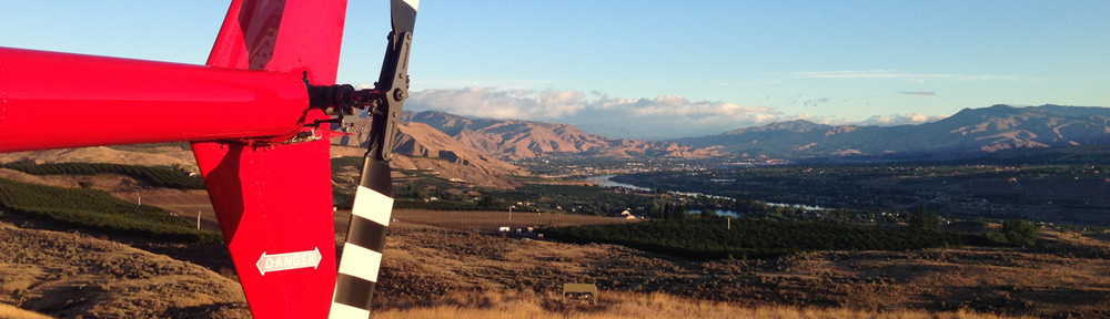
The flight was interesting to me because it took me over terrain I hadn’t flown over before. The only other flight I’d done in the Tucson area was my “Border Patrol” flight with a photojournalist back in July. That flight had taken me from Nogales to Tucson on the west side of I-19, with thunderstorms to the east as we closed in on Tucson. This time, I was southeast of Tucson, over the rising desert terrain that leads to Benson and the San Pedro River. Not much to report, although there were some interesting land formations east of the river where the pipeline began its climb into the higher terrain of southeastern Arizona.

The flight ended with 4.2 hours of billable time, which certainly is welcome the same month I pay my annual helicopter insurance bill.

A more common job for me is sightseeing. On Wednesday, I did a custom sightseeing job out of Falcon Field in Mesa, AZ, for three men who wanted to explore the canyons and mines southeast of the Phoenix area. We started with a flight up the Salt River, keeping a respectable altitude to avoid the wilderness area below us. That took us over or near the four Salt River Lakes: Saguaro, Canyon, Apache, and Roosevelt. The first two lakes were full of water, while the second two were below capacity. There were some boats on the water, but not many that midweek day.

From Roosevelt lake, we flew east, high over the Salt River’s winding course, then headed south toward some smoke to check out what turned out to be a controlled burn. We hooked up with US 60 to the east of Globe and followed it west. That took us over the mining towns of Globe and Miami where we had a birdseye view down into a huge, active open strip copper mine. I’ve overflown the open pit mine at Bagdad, AZ many times, but the mine at Miami had to be at least 10 times the size. My passengers had driven past the place just the other day and were very interested in seeing what was hidden from the ground.

We continued along US 60 to Superior, then turned south to get a good look at what my passengers said was the largest strip mine in the world, between Superior and Kearny. It certainly was huge — both deep and wide, surrounded by leech fields and tailings piles. We could see giant dump trucks — and a few normal sized vehicles that provided a sense of scale — driving up and down the ramps to the mine’s bottom.

From there, we headed back, following the course of the Gila River for a short while, then hugging the mountain foothills to avoid an oddly placed Restricted area that appeared on both my chart and GPS. We followed US 60 into Apache Junction, where my passengers pointed out the condo they were staying in and speculated whether it was one of their wives that they saw in the hot tub. Then back into Falcon Field. A total of 1.7 billable hours.

On both flights, I had wonderful, friendly passengers who didn’t make unreasonable requests and seemed pleased with their flights. My helicopter handled very well (as usual) and I enjoyed the flying. But the best part of all — at least for me — was getting out and flying someplace different.

My helicopter is now down in Mesa, AZ, getting it’s annual inspection. I expect it back right before Christmas. Then it’s back to doing the work I like best — taking people for flights around Arizona.

Flying in Snow Showers

Learning from experience.

We plan to spend Christmas weekend at our “camp” on Howard Mesa. We wanted to check the place out to make sure everything was okay before driving up there. It’s a three-hour drive but only a one-hour flight by helicopter. So, with about 5 hours to spare on Sunday morning before I had to do a presentation for the local writer’s group, we planned to fly up for an hour or two then.

We started checking the weather forecast on Saturday. Howard Mesa is between Williams, AZ, and the Grand Canyon’s South Rim (closer to Williams). The weather for both didn’t look good. Temperatures in the high 20s, high winds, and scattered snow showers. The three weather forecasts we checked (National Weather Service, Intellicast, and Weather.com) each had a different story to tell. NWS was most optimistic. Weather.com was most dire.

When the sun rose on Sunday morning, it illuminated a cloud bank that seemed to be passing over Wickenburg on its way northeast. To the north, the clouds looked low over the Weaver Mountains. But we could still see the top of Antelope Peak. The weather forecasts showed a front moving through. Show showers, winds 20 gusting to 30. But DUATS, a pilot weather service, didn’t paint as bad a picture.

I figured it was worth a try.

We got off the ground at 8:45 AM with full tanks of fuel and a few odds and ends we wanted to store in our shed. The winds at Wickenburg were light, out of the southwest. We climbed over the Weavers about 500 feet below the cloud bottoms. Ahead, the sky was dark with clouds that hung low. But visibility was good and we could see our next mountain landmark — Granite Mountain, west of Prescott. And we had a whopping 25-knot tailwind. So we kept going.

By the time we reached Granite Mountain, the sky ahead was completely overcast. We could see the Mongollon Rim and Mingus Mountain to the east. But to the north, the top of Bill Williams Mountain was obscured and the clouds seemed to be drifting downward. To the west, it looked like rain was falling. But to the east of Bill Williams, the clouds were higher and the way seemed clear. We could detour that way. So we kept going.

By the time we’d climbed the rim and were approaching the southeast side of Bill Williams Mountain, there were showers ahead of us. But they weren’t rain showers. They were snow showers. We flew into them and tiny pellets of snow pelted the cockpit bubble and mast. There was a dusting of snow in the forest beneath us. When I looked out at the fairing for the helicopter leg closest to my door, I saw tiny bits of white ice accumulating on the leading edge. Not a good thing. If ice were accumulating there, could it be accumulating on my rotor blades.

I have no experience with icing conditions, but I know icing is not a good thing. Yet the engine was running fine, my power setting was low, and the blades were behaving nicely. No loss of lift. We seemed okay. So we kept going.

Ahead of us, to the east of Williams, AZ, there were scattered snow showers all over the place. The sky and ground was a mix of dark and light. Occasionally, we’d catch a glimpse of blue sky through the speeding clouds a few hundred feet overhead. When the snow stopped, the ice on the skid leg fairing disappeared. When it started again, more ice appeared. We moved from tiny spots of sunlight to the deep, cool shade of low clouds. According to the AWOS, the visibility at Williams airport was 3 miles. We could see farther, but only in certain directions. Things were looking dicey, but according to the GPS, we were only 6 minutes away. Sheesh. How could I turn back? I could still see where I was going and there were plenty of places to make a precautionary landing if I needed to. So we kept going.

The worst of the snow showers appeared to be between us and Howard Mesa. We were less than 10 miles away and couldn’t see it. We started flying between snow showers, real scud running. I wish I had a GPS to track our path. We probably drew a line like a drunken sailor.

The six minutes turned out to be 10. The showers parted and we saw Howard Mesa before us. Then our neighbor’s house. Then our shed. I put on the brakes as I passed our windsock. It was hanging straight out. I turned into the wind and came in for a landing as a fresh show shower pelleted us.

It felt good to be on the ground.

We spent about two hours there, checking things out. It was a good thing, because some pipes were broken and we’ll need to bring tools and parts up with us for Christmas weekend to fix them. But at least we know what to expect.

While we worked, the weather blew around and past us. The wind had to be blowing at least 20 knots. Snow came and went. Some of the hard little crystals accumulated on the ground around the shed. I wanted to wait until things cleared up a bit before departing, but the weather wasn’t cooperating. It was a constantly changing scene, with snow showers and sun, with visibility ranging from a mile to five miles.

Finally, we could wait no more. We climbed back into the helicopter — which had remained ice-free — and I started it up. The weather around us must have changed 10 times while the engine warmed up. I kept changing my mind about which way we’d fly after takeoff. Finally, we were ready to go. I picked up and the wind hurried us through ETL. I departed to the west, which had the best visibility.

Now we were flying into the wind, around one snow shower after another. The scud running lasted almost until we reached Granite Mountain. Our path took us farther to the west than we usually flew, west of Ash Fork, Paulden, and Chino Valley. Visibility never got really bad — certainly not enough to make me worry. It was just an inconvenience. It took us an extra 30 minutes to get home.

It was my third experience with scud running — we really don’t get much bad weather here in Arizona — and when it was over, I felt okay. I never felt worried or as if I were out of control. There were always several options for getting to a safe haven, whether it was a clear place out of my way or a precautionary landing in a field. I think Mike and I learned a lot from the experience.

Back in Wickenburg, the wind was light. Big fluffy clouds floated by in a blue sky. No indication of the stormy skies less than 100 miles to the north.

R44 Pilot Finds Missing Family

Another example of how private helicopter pilots can help their communities.

A friend of mine e-mailed me this story from the San Francisco Chronicle last night: “PILOT HAD HUNCH: It led him to wife, kids.”

The short version: James Kim and his wife and two children went missing in the mountains. John Rachor, a private helicopter pilot and owner of an R44 helicopter (like mine), decided to follow up on a hunch he had about where they may have made a wrong turn. He found the wife and kids alive and safe. Sadly the husband was later found dead, having died while trying to walk for help.

Wickenburg is lucky to have not one but three privately owned helicopters. The three pilots — Ray, Dave, and I — know the immediate area better than 95% of Wickenburg’s population. We know about canyons and trails and hidden ruins that most people couldn’t imagine. Certainly better than the APS or Sheriff’s office helicopter pilots — after all, we fly around here all the time.

Although I hope we’re never needed to help out with a search, I also hope that the local authorities wouldn’t hesitate to ask us to help out if they needed a few more eyes in the sky. After all, since we can each take four pairs, that’s twelve more people that can help save a life.

Predawn Flight to Scottsdale

An early morning charter.

Earlier in the week, I took a reservation for a 7 AM flight out of Scottsdale with a photographer, his assistant, and their client. The job was a photo shoot in the Camelback Mountain area. The idea was to catch the early morning light shining on the mountain with the city of Phoenix in the background.

It was a great idea, but there was one minor problem: a cold front moved through the area yesterday and temperatures in Phoenix are actually getting down near freezing. The coldest part of the day is right before dawn. The sun was scheduled to rise at 7:18 AM. And when we do a photo flight, we fly with at least one door off.

But I’m getting ahead of myself here.

What I really wanted to write about was my flight down to Scottsdale.

I left my house at 5:30 AM. It was 27°F outside. And dark. Very dark.

I drove to the airport, parked my Jeep in front of the hangar, and pulled the hangar door open. It was only slightly warmer inside the hangar. I had to turn on the light in there to see what I was doing — normally I get plenty of light through the two skylights on the roof. I’d preflighted the helicopter the afternoon before, so it was ready to go. Only thing I still needed was fuel.

I pulled the helicopter out onto the ramp, closed the hangar door, and pulled it up to the fuel island. I was wearing my brown leather flight jacket, which I don’t get a chance to wear very often here in Arizona. I was also wearing my O.J. gloves. Those are the brown leather gloves that are so tight, every time I pull them on, I say to myself, “If the gloves don’t fit, you must acquit.” Sheesh. And I didn’t watch a minute of the trial.

I fueled in the dim light shining over the fuel island. Although the airport was deserted, there was a lot of noise coming from the industrial park on the other side of the runway. They must start work early at one of the manufacturing places over there.

I disconnected my tow equipment and drove it over to the airplane parking area, where I left it for the day.

It took two tries to start the helicopter. My helicopter simply does not like cold weather. I ran the starter for a while to give it every opportunity to start on the first try, but it wasn’t going to cooperate. I had to give it a second priming. Then it started right up.

While the engine warmed up, I turned on the runway and taxiway lights. Wickenburg, like most airports, has pilot controlled lighting (PCL). It enables a pilot to turn on the runway and taxiway lights by clicking the push to talk button on his radio. I tried 5 clicks. The runway lights came on. Then I tried 7. The taxiway lights came on, too.

I let the engine warm for about 10 minutes. The whole time, I waited for my cell phone to ring. The client had until 6:15 AM to cancel. That was my estimated departure time. If he canceled after that, I would charge him a cancellation fee to cover my cost of flying all the way down to Scottsdale for nothing. The helicopter wasn’t ready to go until 6:20. No call from the client, so I brought the engine RPM up to 102% (a Robinson thing), picked it up to a hover, scooted sideways away from the fuel island, turned, made my radio call, and took off along the taxiway parallel to Runway 5.

The sky to the east was beginning to glow reddish orange, but it was still very dark in Wickenburg. So dark that I flew over the taxiway all the way to the end, just in case the engine decided to go back to sleep. If I was going to have an emergency landing, I wanted that landing to be somewhere I could see. Those nice blue taxiway lights made it pretty obvious where the pavement was. Not so as I turned to the southeast and flew over the homes of Wickenburg.

I climbed to about 3000 feet — that’s 1000 or so feet off the ground southeast of Wickenburg — so I wouldn’t have to worry about hitting any granite clouds. I could see the lights of Phoenix far out in the distance. I could also see some mountains on the horizon that looked like Four Peaks but much closer. It turned out that they were Four Peaks. Not only was it cold out, but it was incredibly, beautifully clear. Not a cloud in the sky. The sky above me was a deep, dark blue that got lighter to the southeast until it blended with the red and orange glow of the sun beneath the horizon. And scattered in front of me were millions of city lights.

Sights like these simply cannot be photographed — at least not while flying a helicopter. It’s too dark for a good exposure. And even if the shot did come out without blur or windscreen glare, the foreground would be featureless blackness — not the gently rolling hills and small mountains that I could see beneath me. I wish I could share the view with readers using more than just words, but although the images of the flight are imprinted on my mind, they can’t be reproduced as images here. My words will have to do.

I had programmed Scottsdale into my GPS and a direct flight would take me over Deer Valley Airport, which is only 9-1/2 miles west. I normally fly around Deer Valley. The airport is usually so busy with flight training aircraft on its two runways that the controllers don’t want helicopters transitioning over the top. I listened to the ATIS (Automated Terminal Information System; a recording of airport conditions) and learned that the wind was out of the northeast at 6 knots and the altimeter setting was an amazing 30.49 (it would later get up to 30.54 — the highest pressure reading I’d ever seen). The Tower frequency was pretty quiet as I approached. I listened to the tower tell an inbound airplane to make a straight in landing, then requested my transition. It was immediately granted. A few minutes later, I was flying over the airport at about 2500 feet. Channel 15’s helicopter was flying low over route 101 nearby. When the controller pointed him out, I acknowledged that I’d seen him. Then the controller told me to contact Scottsdale and cut me loose.

I almost always approach Scottsdale from the northwest, so approaching from almost due west was weird. It was still nighttime — at least as far as I was concerned — and the area around the airport was a sea of lights. By this time, however, the sky was much brighter. The smooth water of the CAP canal that wound just north of the airport reflected the sky, looking like a bright, blue-gray ribbon.

I called Scottsdale tower and was told to report a half mile out. Channe1 15’s helicopter was still following the 101, now toward Scottsdale. I was at least 500 feet above him and now south of his position. I started my descent. A few times, I lost my bearings — so many lights! But I recognized Scottsdale Road and Greenway as I crossed the intersection. I made my 1/2 mile call and was told to land at my own risk — the usual thing for helicopters at towered airports.

At Scottsdale, the ramp was full of private and fractional jets. They were crammed into parking spots, obviously towed there. I flew along the ramp behind them, lined up with a row of parked planes, and set down in front of the terminal. It didn’t take long for the helicopter to cool down. It was 6°C on the ramp.

The photo flight a while later went well. The sun rose while I was giving the safety briefing and reviewing the flight path with my passengers. We took off a while later, crossed the runway, and headed toward Falcon Field, another airport in Mesa. When we were almost due east of Camelback, I turned and headed west. The photographer wanted the helicopter close to the mountain, but he had a huge lens on the camera and I knew we’d be too close. We made four passes of Camelback and Squaw Peak, each time moving a little farther away. The last time, we were almost in Scottsdale’s airspace.

All the time we flew, the photographer’s door was off. His camera lens was so long that I had to slow down so he could shoot the pictures — otherwise there was just too much wind when he put the camera lens out in the slipstream. The poor guy was freezing. I sat up front in reasonable comfort beside their client with the heat on full. My right hand was cold — my O.J. gloves are too tight to wear on my right hand when I grip the cyclic — but the rest of me stayed pretty warm.

As we made our passes, I kept a sharp eye out the cockpit and on my GPS’s traffic display for the aircraft that were flying past. We were listening to Sky Harbor’s north tower frequency, but since we were out of their airspace, I wasn’t talking on it. I heard the controller point me out to another airplane in the area once, so I know he saw us on his screen. I saw more than a few planes flying past.

The view was beautiful. The heavy winds the day before had blown most of the smog out, so the city was crystal clear. The low-lying sun cast an orange-yellow light on the mountain sides, leaving the northwest sides in shadow while illuminating the city’s tall buildings in the background. The last pass of Camelback and the third pass of Squaw Peak were probably the best.

The photos will be used for an advertisement about the Valley Metro light rail system Phoenix is finally installing. Unlike New York, which I’m quite familiar with, Phoenix has a really crappy mass transit system. That’s one of the reasons there’s so much traffic and smog. These photos will be used for “before” and “after” shots. “Before” will be a photo touched up to look really smoggy, like a normal Phoenix morning. “After” will be a photo touched up to remove the smog we saw that day — which really wasn’t nearly as bad as usual. The ad will try to convince people to take mass transit to clean the air.

I won’t offer my opinion on the ad strategy but I do like the idea of the photos. And it’ll be neat to see them, knowing that they were taken from my helicopter today.

We returned to Scottsdale by 8:15 AM.

I had two meetings with other potential clients. I had coffee with one of them and breakfast with the other. Then I made some inquiries about office space in Scottsdale at the airport, bought a few things at the pilot shop, and left.

By that time, it was late morning. All the magic of the predawn flight was a dim memory.

Doing Gigs

It has its ups and downs.

By “gig,” I mean a helicopter rides job. You know — like at a carnival or air show.

At Robson's Mining WorldFlying M Air makes approximately 20% of its money doing helicopter rides at outdoor events. These events, which range from small-town celebrations (Robson’s Mining World (see photo), Yarnell Daze, Old Congress Days) to county fairs (Mohave County Fair) to full-blown air shows (Thunderbird Balloon Classic and Air Show) are probably the hardest work I have to do. Not only do I have to arrange the event with its management and ensure that I have a safe landing zone nearby, but I have to get together a ground crew of reliable, amiable people to handle money collection, passenger briefings, and loading/unloading. And then I have to do the ups and downs.

I’ve been fortunate in the past to find two good local teams to help out. Darlene and Dave live in Wickenburg and have helped out on two events so far. John and Lorna live in Maine but spend their winters here in Wickenburg and have helped out on winter events for the past two or three years. And of course, I always have Mike, who oversees the whole ground operation.

The ground crew is just about as important as the pilot in this kind of work. They need to be responsible, alert individuals who pay attention to what’s going on around them. We do “hot loading” at these events — that means the engine is running while people are getting on and off the helicopter. That means the rotors are spinning. While the main rotor isn’t much of a concern — it’s spinning 10-12 feet above the ground where it’s not likely to hit anyone walking nearby — the tail rotor is a major concern. It’s spinning back there at head level and even though there’s a guard and warning signs on the helicopter, it’s still possible for someone to walk into it. I need my ground crew to make sure no one walks behind the helicopter at any time. I want my ground crew to use physical force if necessary — grab the guy! — to keep a person from walking back there. Not everyone is prepared to do that.

(A side note here: one of the ways I help protect people from the tail rotor is to park with the tail rotor away from where people might be. In other words, I park facing the crowd. Then there’s no reason to go around the back of the helicopter. This may seem like common sense, but it’s amazing how few helicopter pilots don’t stick to this rule. They’ll park facing into the wind (because it’s easier for them) or park facing a runway (for reasons I don’t begin to understand). Having attended the Robinson Factory Safety Course twice, I clearly remember the story of a Long Beach mishap that occurred primarily because the pilot parked with his tail rotor facing his passengers. I’d rather learn from other people’s mistakes than my own.)

I also need a money person who is friendly and a good sales person. I once did a gig with a real wimp taking the money. She just stood there, waiting for people to come up. She spoke in a whisper and did nothing to convince the people who walked up to her table that what they really wanted that day was a helicopter ride. I think that if I had Darlene or Lorna at the table that weekend, I would have taken at least 30 more people for flights. That’s more money for the business and less time sitting on the ground, spinning, waiting for passengers.

The ups and downs are my part. I generally do 6-8 minute rides, but we’ve recently had some success with 3-4 minute rides. That’s a lot of takeoffs (ups) and landings (downs). The challenge here is that I’m usually working in a relatively small space and often have only one way in and out. Obstacles include other activities (I won’t fly over a fair or gathering of people), buildings, wires, fences, and trees. So every takeoff is a maximum performance takeoff and every landing is a confined space landing. And one of the two may be with a tailwind. While I don’t mind taking off with a tailwind (up to 10 knots seems to be okay, depending on my load), I don’t like landing with one. And cross-wind operations are always tricky, especially if the winds are gusting. My goal is to make it look easy no matter what the conditions are, to assure my passengers, through experience alone, that they are in good hands.

With all this comes huge responsibility. Not only do I need to make the ride fun for my passengers, but I need to make it safe. A mishap — even a small one — would be a very bad thing. I think of myself as an ambassador for the helicopter industry. What I do might be the only helicopter operation some of my passengers ever witness. I want them to tell others how good it was, how safe they felt, how much confidence they had in their pilot. And — oh, yes — how much they want to do it again.

I know it’s my experience at the Grand Canyon back in the summer of 2004 that made me pretty darn good at doing ups and downs. At the GC, we operated in very challenging conditions — high winds in the early season, hot temperatures in the mid season, and low visibility in the late season. Although we never operated in unsafe conditions, we certainly operated in many conditions that the average pilot would not normally fly in. The flying was highly restricted, requiring certain takeoff, flight, and landing paths. You couldn’t for example, change your approach to landing just because the wind had shifted; you needed to wait for the tower to change that path. And when you’re operating at high altitude (the airport was 6300 feet) with full loads (I often was within 100 pounds of max gross weight), you learn how to handle power and milk the system for what you need. My goal on every flight was to make every single landing perfect. Of course, I wasn’t able to do that, but by aiming for perfection every single time, I got very good at it. I took that experience away with me and use it on every flight I do.

Now compare this kind of work to a Sedona day trip, like the ones I do from Wickenburg and the Phoenix area. I meet the passengers myself, give them a safety briefing, and load them on the helicopter with the engine off. I then start up, warm up, and take off. The flight is about an hour and neither flying nor navigation require much skill. I point out places of interest and enjoy the scenery with my passengers. Then I land at the airport, cool down, shut down, and escort my passengers to the terminal for whatever activities they have planned. A few hours later, I do the same thing to return to our starting point. As far as real “work” is concerned, a charter has very little. And the revenue is based on flight time, so I’m guaranteed a certain amount of profit for each flight.

Gigs, on the other hand, have a ton of work and a very unreliable revenue stream. When things are going well, I can indeed make more per hour than I can with a charter. But I should, shouldn’t I? I have a lot more work to do (all those ups and downs!) and need to cover the expenses of my ground crew and the gig itself. And there’s always the gig that goes bad — like the Spring Break gig in Lake Havasu I tried two years ago. I took a bath on that gig, losing over $1,600 in ferry time, permits, fees, and hotel costs. Live and learn — but ouch! That one hurt.

But hey — that’s what I signed up for when I started this business. And I still get a lot of pleasure out of taking passengers for their very first helicopter rides.