The drive is longer than it needed to be but shorter than I expected.
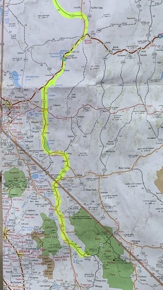
Here’s my route from Death Valley through Nevada.
After too many days with bad Internet (in Tecopa) and no Internet (in Death Valley), I plotted my trip home on a paper map that I found in my truck. The map, an oldish AAA map of western states and provinces, showed just the level of detail I needed, with Arizona, California, and Nevada on one side and Oregon, Idaho, Washington, and British Columbia on the other. I had a highlighter in my “Office” box and used it to trace lines. My goal was to explore a mostly new route, trying to get on some roads I hadn’t driven on before. Eventually, however, I knew I’d have to end up on Route 97 in Oregon, which was least likely to be affected by snowfall. I did not want to get delayed by snow in mountain passes on the way to the Columbia River crossing as I had been the previous year.
In hindsight, I’m not sure why I bothered to explore new roads when I had no intention of stopping along the way. At this point in my winter travels, I’m in GO HOME mode and I pretty much motor along with the goal of getting home in the fewest number of days. I don’t regret the route I chose, but I wish I hadn’t selected it while in that mode. Hindsight = 20/20.
Plotting the Drive
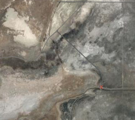
Google Maps satellite view makes it look as if I camped in the middle of a dry lake bed. I didn’t. My site (marked with the X) was along a canal, surrounded by trees.
I started writing about my drive home in my previous blog post, where I considered Solo Travel. At the end of that post, I reported that I’d parked in a campsite in the Humboldt State Wildlife Management Area (WMA), which appears in the most recent iteration of Google Maps satellite view as a dry lake bed. It was not dry. Not only did I have to negotiate a single-lane road of mud with deep tire tracks from my predecessors — with a 3200 pound camper on the truck and at least 3000 pounds in a trailer behind me — but there was water on both sides of that road for the entire 2-mile distance. My campsite about a mile down another road was along a well-defined and full canal, complete with a boat ramp and water fowl.
I guess this proves that you really can’t trust satellite view for accurate information. (And yes, I brought some of that mud home on my truck.)
Not that it mattered anyway. I use an app called Ultimate CG which draws on a database of publicly owned, noncommercial campgrounds throughout the country to find potential campsites when I’m traveling with my camper. (My friend Bill, who travels a lot more than I do, uses a similar app called AllStays, which seems to draw on the same database but adds other confirmed overnight parking spots.) When I’m in transit — in other words, on my way from one point to another — and just need a place to stay for the night, I’m not too picky. Although I could stop at any truck stop for the night, a lot of truckers keep their rigs or attached refrigeration units on all night and it can be noisy. I prefer a quiet spot, especially one where I can let my pups out to do their business without worries about traffic. That’s how I wound up at Humboldt.
It was exactly what I wanted/needed for the night. Dead quiet after the wind died down and super dark. No one else came into the “campground,” which was really nothing more than a parking area by the boat ramp with a restroom (that I didn’t use). The weather forecast claimed I could get snow overnight, but in the morning, when it was light enough to see, I saw that the fresh snow had stopped about 500 to 1000 feet above my elevation.
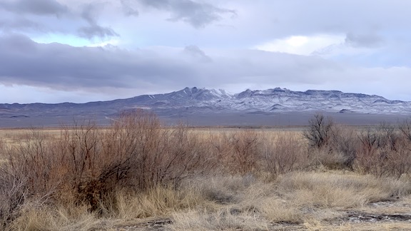
I could see in the morning that the snow level had stopped 500 to 1000 feet above my elevation.
Saturday’s First Leg
My first order of business after securing the camper and loading my pups into my truck was getting fuel. According to my truck’s mileage computer, I had 62 miles left before empty. Another app showed me there was fuel in Lovelock, 11 miles away. I backtracked through the area, glad that the muddy part of the road seemed drier and a bit less slippery. I drove through farmland — mostly dormant alfalfa, I think — to town, navigated to a truck stop with the cheapest diesel, and filled up. The pump stopped at $75, which is relatively common, and I dutifully re-inserted my credit card to get the pump going again to top it off. (It would be a good thing that I did.)
I had plotted a route through Nevada and into Oregon that would take me on I-80 to Winnemucca and then on a series of smaller numbered routes through northwestern Nevada and into Oregon, meeting up with route 97 south of Bend. Easy enough to follow. I programmed it into Google Maps and got on my way.
The first hurdle to jump was the snowstorm. It started as flurries and got heavier as I went along. Soon, the road surface started to get covered. I passed a flashing light saying that I needed chains or snow tires to continue. I had neither; my truck has all-terrain tires and I’m not sure if that’s good enough to meet traction tire requirements. Visibility dropped. So when I saw an exit up ahead, I got off the freeway. I’d driven less than 20 miles.
There was a gas station at the exit but a sign for a restaurant at the end of the ramp pointed away from it. Maybe I could wait out the storm with some breakfast? I turned left, went under the freeway, and saw nothing but a road thick with snow going off into the distance.
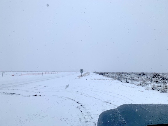
Put yourself in my shoes. If you were driving a truck with camper weighing roughly 12,000 pounds and towing another 3,000 pounds in a snowstorm without snow tires or chains on any wheels, would you have driven down this country road?
I pulled over onto a snow-covered shoulder and consulted Google maps. The restaurant was up the road. I didn’t want to drive that far. I shut off the engine and went into the camper with my dogs.
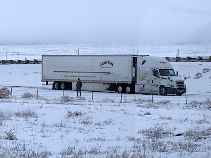
It’s nearly impossible to see in this zoomed-in shot, but this guy was wearing shorts. His dog is hidden behind some of the weeds.
The nice thing about traveling with an RV is that you have all the conveniences of home with you wherever you go. I pulled out the kettle and made myself a cup of tea. I watched the traffic go by on the freeway, including snow plows that shot streams of wet snow high up and away from the road. I watched a few cars and trucks come down from the freeway, park for a moment alongside the ramp, and then continue on their way to either the gas station or back up to the freeway. One of these was a big semi. A guy in shorts got out with his dog. I watched him watch his dog scamper about alongside the road. Then they both got back into the cab and the truck drove away.
My pups were bored. They didn’t know what we were doing there and had no clue what that white stuff coming out of the sky was. (They have very limited experience with snow.) They looked out the window and bugged me a bit while we waited.
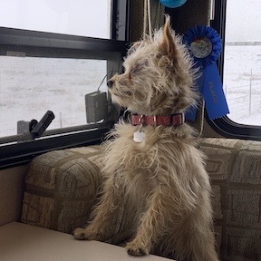
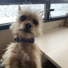
Rosie and Lily were bored while we waited.
The snow stopped rather suddenly and it got brighter out. I put away the kettle, transferred the remainder of my tea into a travel mug, and left the camper with my pups. They ran around a bit in the snow before letting me put them in the truck. I made a U-turn, got back on the freeway — which had been plowed and was completely free of snow or ice — and continued on my way.
From that point on, I started monitoring the outside temperature; I’d once hit ice unexpectedly on a mountain road and didn’t want that to happen when I was traveling at 65 mph with a load. But the temperature stayed above freezing — and even got into the 40s — for the rest of the day.
I got off the freeway in Winnemucca, a typical large Nevada town with plenty of casinos and other places to leave money. I would have stopped at the Pizza Hut — I’m a sucker for those meat lovers personal pan pizzas — but it was still closed at 10:05 AM. (Who knew?) So I just followed the signs for route 95 north and kept going.
I turned left onto route 140, which went due west straight as an arrow as far as the eye could see. A sign at the turn said something like “Next Services 66 miles” and if I’d been thinking clearer, I would have stopped for a photo. Folks back east have no idea how far apart some towns can be out west and are often amused by signs like that. The road cut straight across the flat desert, between a number of dry lake beds, reached a tiny rock outcropping, bent slightly to the right, and cut through more flat desert. The whole time I was driving, I could see weather up ahead: thick clouds that seemed to brush the desert floor. Rain? Snow? I had no idea. All I knew is that the wind was howling and my truck’s computer claimed I was getting less than 10 miles per gallon.
I passed alongside one of these weather squalls and some rain hit my windscreen. Then I was through it.
A few cars passed me during that 66 (or whatever) miles. I passed a few going the opposite direction. There were a handful of what looked like ranches along the way. Then the terrain started getting hillier as I approached the town of Denio and the left turn to stay on route 140. There was a sad little gas station at the intersection. I kept going. Another sign said something like “Next Services 75 miles.” The road here wasn’t flat and dull. It climbed into the hills.
I’d gone about 50 miles when I started wondering whether I’d have enough fuel to get to my planned fuel stop at Lakeview.
I watched my mileage rate decrease until it was less than 9 miles per gallon. The hills were really making the truck work and the curves made it nearly impossible to coast downhill safely. There were a few spots with very steep — think 8% and 9% — downhill grades where I needed to work not only the truck’s transmission — Tow mode automatically downshifts as needed for engine braking — but the brakes. Getting behind a very slow compact car in one of these areas prevented me from coasting down as fast as I might have. What looked like it might be a gas station in Adel didn’t have any signs for diesel.
To further stress me, I’d come into patches of weather like snow or rain. At one point, near the end of the leg, when my truck’s computer said I had less than 30 miles left until empty, I came upon a busy ski area with lots of traffic in the area. I was behind a huge truck bearing alfalfa that crawled along the road. I watched those miles tick down and wondered how long it would take Good Sam to bring me 5 gallons of diesel after I called.
I reached the intersection of 395 and turned left, toward town, behind that hay truck. I’d asked Google where the nearest diesel was and it told me I’d need to go 5 more miles — exactly what my truck said it could do before empty.
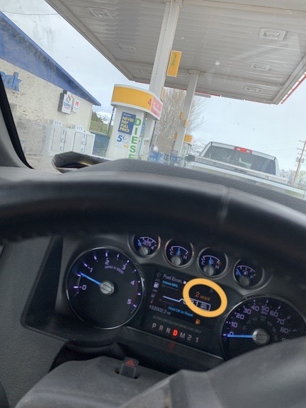
Can you read it? 2 miles left!
Then I saw the green numbers lit up on a gas station’s fuel price sign in the distance. Diesel! I pulled in behind another vehicle at the pump. At least if I ran out of fuel it would be easy enough to get it into my tank. My truck’s computer said I had 2 miles left until empty. Whew!
In my defense, when I got off the freeway in Winnemucca, my truck’s computer had told me I had almost 100 miles more range than Google told me I needed to drive. But the headwinds and the windy mountain roads really increased my fuel consumption. So even with my rule of making sure there’s 100 miles of wiggle room between distance and calculated range, I almost didn’t have enough fuel for the drive. Lesson learned. I guess.
Lakeview into Oregon
After fueling up, I immediately made a wrong turn. Unfortunately, I didn’t realize it until I’d gone about 10 miles.
You see, for some reason my phone decided that even though it had a 4-bar LTE connection, it wasn’t going to connect me to the Internet. So instead of programming the next leg into Google, I had rely on signs — imagine that — to point me in the right direction. I should have realized that something was up when my next destination — the relatively big town of Bend — did not appear on any sign. But Klamath Falls, also on route 97, did appear so I turned that way.
But as you might have surmised, I like being able to keep track of how far it is to my next destination. So I pulled over and fiddled with my phone, trying to get it to connect to the Internet. When that didn’t work, I took out my marked-up map, flipped to the correct side, and took a close look. That’s when I realized I was on the wrong road. I was on Route 140 heading west. I should have been on Route 395 heading north.
To be fair, either one would have taken me where I needed to go. But the correct route would have dumped me much farther north on Route 97, saving time.
I made a U-turn. My phone came out of its stupor a short while later and I was able to program Google Maps for Bend via routes 395 and 31. I continued on my way.
With the stress of a nearly empty fuel tank gone, the drive was much more pleasant. Route 395 wound through a hilly area before forking off to the right at the junction of Route 31. I went left and found myself driving on a very pleasant road that soon dropped me into a lake-filled valley. The mid afternoon sun lit the countryside with a gorgeous glow as I motored along a cliff face along the bank of Summer Lake. I had passed up the Summer Lake hot springs — along with others along the way — and I started thinking how nice it might be to do a road trip bouncing from one hot spring to another on a long, circuitous route.
Eventually, the road climbed up into the mountains and entered a national forest. I had plenty of fuel, but it was starting to get near time to find a place to park for the night. The national forest would be perfect, but the roads were snow covered and each turn into the forest had a yellow Area Closed sign. COVID? Seriously, I don’t understand the logic of closing outdoor recreation areas when being outdoors is so much safer than being indoors in close contact with others.
About 10 miles short of La Pine, I found a slush-covered forest road without a sign, drove in, and eventually found a spot where I could back my trailer into a cleared area (in the snow) with my truck’s nose pointing out toward the road. I shut down, let my pups run around for a while in the snow, and then went in for the night.
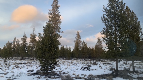
The view out my dining area window just before sunset.
My campsite had internet access via cell phone and I caught up on email and texts with various friends. I updated my house sitter with my estimated time home: Monday instead of Sunday. I watched a few videos on YouTube and Disney Plus. (I’m still not sure about WandaVision.) I was in bed before 9.
The road had some traffic that seemed alarmingly close to my rig. I was startled by the sound of a train’s horn that seemed so close I honestly expected the train to be visible from my window. (The crossing was less than 1/4 mile away; I passed it on my way out the next day.) But by 9 PM, it had pretty much settled down. I worried about my 1/2 filled propane tank having enough gas and my batteries having enough power to keep my heater going overnight; I expected it to get down into the 20s. I put an extra blanket on the bed. I slept as good as usual.
The Last Leg
In the morning, while I sipped my coffee at 5:30 AM, I plotted my route to my next expected overnight stop: Maryhill State Park in Washington. It was only 3 1/2 hours away.
What? That close? How long to get home?
Google told me I could be home in 6 1/2 hours. I did some math. If I got on the road by 6 AM, and had two fuel stops, I could be home before 2 PM.
To say I hustled to get out of there is an understatement. My bed, my shower, and my dishwasher were calling me while the rest of the amenities of my home were waving encouragingly in the background. I had my pups fed and in the truck by 5:50 AM.
The slushy ground that had been so easy to back into the night before was gone, replaced with a hard icy surface that had no desire to let its trespasser go easily. I spun wheels in 2WD and 4WD. Crap. How embarrassing would it be to call Good Sam for a 10-foot tow?
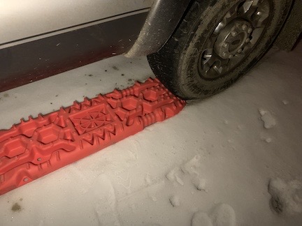
You know the Girl Scout motto, right? Be prepared.
But no call would be necessary because I was now prepared. After an incident in sand back in late November, I’d bought a pair of heavy duty plastic traction plates. They were in the back seat area of the truck. I grabbed a lantern from the camper and deployed the orange plastic devices in front of each of my back wheels. Then, for good measure, I locked the front hubs and put the truck in 4L.
12,000 pounds of truck pulling 3,000 pounds of cargo trailer out of an icy patch of ground at 30°F? No problem. The truck immediately started moving, crawling out of the crunchy ground as if to say, “What the hell are those orange things for? I don’t need that shit.” I pulled onto the road, put my flashers on, and retrieved the traction plates. Then I unlocked the hubs, got back into the truck, shifted into 4H, and got on my way.
The rest of the drive was uneventful. I passed through one deserted looking town after another. It was early on a Sunday and I couldn’t even find a Starbucks in Bend that was open. I drove at the speed limit as the sun came up on a cloudy day. I was on Route 97 by now — a road I’ve been on many times before. (It was my primary route when driving from home to the Sacramento area of California during my frost control days.) As usual, I passed one point of interest after another without stopping. (Maybe I can visit them on my hot springs road trip?)
I found a great price on fuel in Madras, where I’d planned to stop anyway, and topped off the tank. Again, it took two credit card inserts because the fuel pump stopped at $75 the first time. I let the girls out to do their business.
I’d seen a sign for Black Bear Diner in Madras and even found a parking space on the road near it when I got there, but I decided that I didn’t want to spend time eating in a restaurant — or even going into a restaurant in an area that was still showing so many Trump signs — so I opted to stop at a Starbucks up ahead. (I’m a real sucker for their Double Smoked Bacon breakfast sandwich.) But that Starbucks was in a Safeway supermarket and it didn’t have breakfast sandwiches. I wound up getting a breakfast burrito at the deli counter.
I went back to the truck and ate in the parking lot while using the Fred Meyer app to place a grocery order that I could pick up on my way home. I was 262 miles away. Technology for the win!
More driving, more miles put behind me. Route 97 in northern Oregon winds through a number of small farming communities but not much else. The terrain is a combination of rocky formations from Oregon’s volcanic past and grass-swept plateaus, some of which still had some snow on them. When I saw the wind turbines in the distance, I knew I was getting close to the river. A long, downhill glide down a canyon deposited me in Biggs Junction, where I normally buy fuel on my way south. I didn’t need fuel yet so I didn’t stop.
I did stop on the other side of the river, in Maryhill State Park. They had a nice wide parking area with grass where I let my pups out for a quick run and pee. We stayed less than 10 minutes before getting back on the road and climbing up out of the Columbia River Valley toward Yakima.
I tried calling my sister and actually managed to talk to her for a short while before I lost the signal in some hilly, forested terrain on the Yakama reservation.
More driving. I’d finished the recorded book I’d been listening to since leaving Tecopa and listened to a few podcasts.
As I descended down into the Kititas Valley, I started thinking about ice cream. I turned east on the Interstate, not interested in braving Blewett Pass with my rig. In Vantage, I exited the freeway and stopped at Blustery’s for a chocolate banana milk shake. It cost me more than $8 (!) with tax but was exactly what I needed. I sipped it all the way to Quincy.
I stopped at Fred Meyer for my groceries. It was a real pleasure to restock for the week without having to go into the store. Does Fred Meyer realize that we actually buy less — thus saving money — when we don’t go into the store?
Meanwhile, I’d updated my housekeeper and others about my revised return date and time. A neighbor suggested that I stop at her house before going home so I could scout my driveway entrance. I drove down my road, which was remarkably clear of snow and ice, and drove up to her house. She greeted me with a container of soup so I wouldn’t have to cook that night. Her husband loaded me up into his new 4WD truck and drove down to my house for a look at the road conditions. I immediately noticed that the road got worse right after the winery, which was about a half mile from my home.
My driveway is about halfway down a pretty steep hill. It’s a left turn that starts with a little downhill part and then curves to the left before straightening out. To make the turn with my trailer, I’d have to go wide. The snow was on half the road — the left half. It was also on my driveway. That meant I’d have to drive slowly down the hill, come to a stop (or near stop) before my driveway, and make a very controlled left hand turn into my driveway, crawling down the snowy slope until I got onto the straight part.
I told him I could do it and we went back so I could give it a try.
Back behind the wheel, I took the downhill part of my road in 1st gear with 4WD turned on. I successfully came to a stop just short of my driveway, but then my truck started to slide. I stopped again, it slid again. One more time. Each time this happened, I got a little further down the road, ever closer to my driveway entrance.
I realized I had a choice: I could continue down the road, make a U-turn somewhere, and then approach from downhill. I’d done this successfully before with bad road conditions. Or I could take my foot off the brake and keep it off and let first gear roll me into my driveway.
I opted for the second plan. Mentally crossing my fingers, I released the brake and guided 15,000 pounds of truck and trailer into my narrow, snow-covered driveway. The ice crunched under my big wheels. My truck stayed on course without slipping. A look in a side mirror showed my trailer following it in faithfully. Then I was in the straight, flat part, heading for the concrete pad in front of my big garage door.
I was home!
Happy Ending
I got home this year a whole month earlier than last year. A lot of people are surprised by that, mostly because I came home when it was still cold and snowy.
What most folks don’t seem to understand is that I don’t stay away in the winter because of the cold or snow. I stay away because of the darkness.
The days this far north are short. There’s a whole 6-week period where the sun doesn’t clear the cliffs near my home and I get absolutely no direct sunlight. I left home roughly six weeks before the winter solstice, when the days are shortest. Doesn’t it make sense for me to return home six weeks after it?
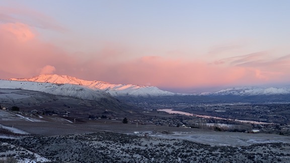
Here’s the view out my kitchen window this morning as I was writing this. We had fresh snow at higher elevations (including my home) overnight.
And, for the record, I like snow. (Cold, not so much.)
I might even get some cross-country skiing in — if I can finally get the new top on my Jeep.
Discover more from An Eclectic Mind
Subscribe to get the latest posts sent to your email.

For those of us without the time or wherewithal (at present) your travelogues are a treat – Thanks M~
Thanks so much! I know I slacked off a lot this past winter, but I’m trying to make up for that now.
That was great writing Maria.
Thanks, Bob! I’m glad you were able to get the comment feature working, too.
Quite the travel adventures. On those 2 miles left, the term I’ve always heard was “driving on fumes”
Exactly!