I send the drone up for one last look at our camp in relation to surroundings.
Our camp, which was home to six people at its peak, is down to just three of us. Karen and Steve left a little over a week ago; they couldn’t seem to get work done with some much nature to distract them. (Steve loves to go fishing.) Janet left on Sunday morning to set up camp at Tyson Wells in Quartzsite, where she’ll be selling her artwork for the next three weeks. I moved Lily Rose, my mobile jewelry shop, over to my Tyson Wells spot yesterday afternoon. I toyed with moving T2, my camper, over there later in the day but decided I wanted one more night along the river. I admit that I was thinking a lot about Penny, who can be off-leash here. Once we get to Quartzsite, she’ll need to be tied up whenever we’re around other people. The Canadians, of course, are still here and will remain a few weeks after I’m gone.
After doing my last power walk along the levee road and driving down as far as what we call “Janet’s Camp” — maybe 6 miles south? — to see who was camping down along the way, I came back to my much smaller campsite community and sent up my drone for a few late afternoon shots. Here they are.

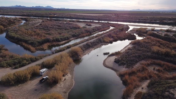
Here’s a shot of my campsite looking west. In this shot, you can see my path to the levee road and the channel coming in from the river. You can also see the backwater channel on the other side of the road from our site and the island it makes. While everything looks pretty flat in this shot, I’m about 10 feet above the river/channel average level and another 5 to 10 feet below the level of the levee road.

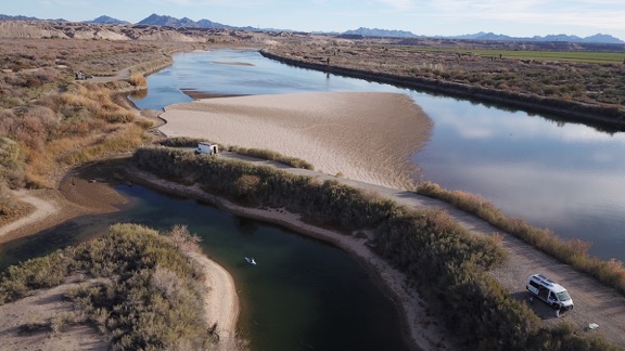
Here’s a shot of the backwater channel south of ours, on the other side of the road with the southern tip of its island. I see here that the opening to the river is pretty much dried up. That huge sandbar would be covered with water when they release enough from Parker and Palo Verde Dams, but right now it looks as if you could walk right down it, wade across the channel, and step into California. The levee road runs in an arc from the right side of the shot to the center. To the end, it’s just 1/2 mile from our camp, making a nice, brisk one-mile round trip walk.

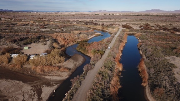
This shot is looking northeast from where the road from our camp makes the turn onto the levee road. You can see the narrow entrance to our backwater channel from the river on the left. Those folks camped on the left are only a few hundred yards from us by air but several miles away by road. The white van on the road belongs to Steve, who had come to go fishing with the Canadians; they’re on their way back here.

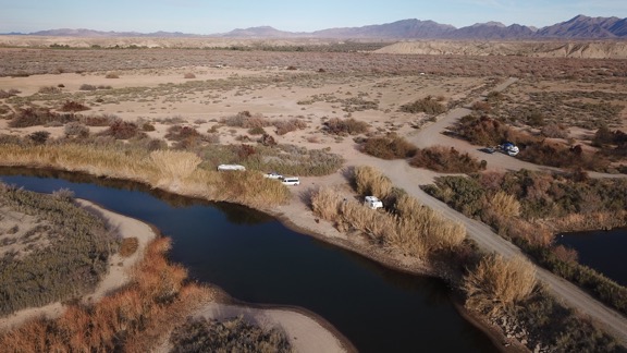
Here’s another look at our camp from the air, this time from the west. You can see the top of T2 (my truck camper); my truck is hidden by the tall bamboo. On the Canadian’s side of camp, you can see their fifth wheel and truck, as well as Steve’s van, which has just arrived. If you’ve got really sharp eyes, you can see Penny chasing the van.
I feel extremely lucky to have arrived at this camp shortly after the previous occupants left. This site is one of the best on the river and my personal favorite, mostly because of the long backwater channel for paddling — it goes two miles north, which is almost all the way to the freeway — the privacy, and the relative proximity to pavement (only three miles). I know for a fact that when I leave on Monday, my spot will be taken within two hours.
I’m sad to say goodbye to this camp, but it’s time to move on.
Discover more from An Eclectic Mind
Subscribe to get the latest posts sent to your email.

Where did all the water go?
Last year the channels all seemed full. Is that just my imagination?
Water level depends on what they let out of the upstream dams. Although we had a few high water days, the water has been low for the past week. Very disappointing.