A short overnight visit to a geologically interesting place.
– Introduction
– The Colorado River Backwaters
– Quartzsite
– Wickenburg
– Phoenix
– Home
– Back to the Backwaters
– Return to Wickenburg
– Valley of Fire
– Death Valley
– Back to Work
When I left Wickenburg that Sunday morning, I was technically on my way to my late winter job in the Sacramento area of California. Indeed, I had to be in Sacramento to catch a 6:40 AM flight home on Friday to fetch my helicopter. But I’d planned the drive with enough time to make two stops along the way. The first was Valley of Fire State Park near Overton, NV.
Valley of Fire gets its name from the vibrant red rocks that jut out of the desert floor in this area of Nevada. It’s full of scenic overlooks, easy to difficult hiking trails, and plenty of interesting sandstone formations. In the right light, it’s quite photogenic. It’s also easy to visit. Only 50 miles from Las Vegas, it gets quite a few visitors on weekends — as I soon found out.
Camping with the Mobile Mansion
When I planned the trip, I didn’t realize it was a holiday weekend — since when is President’s Day right after Valentine’s Day? — and had half expected to be able to slide into a campsite inside the park that Sunday afternoon when weekenders left. I’d also been assured by a friend who’d been there weeks before that if all the campsites were taken, I could park my rig in “overflow parking.”
Wrong on both counts.
When I arrived in early afternoon after a long but pleasant drive up Route 93 from Wickenburg, the weekenders weren’t quite through with their weekends and the first come, first served campgrounds were marked “Full.” I managed to park my rig along the curb in a completely full Visitor Center parking lot and went in to talk to a ranger. She confirmed what I’d already learned on the Self-Pay Station signs: camping in designated sites only. But she was extremely helpful, offering suggestions for camping on Bureau of Land Management (BLM) land west of the park or Bureau of Reclamation land east of the park.
Since the Reclamation land was closer, I soon found myself backtracking out the park entrance I’d come in and then turning north along the main road there. In a few miles, I found the gravel road I thought she’d referred to and made a right onto it. I could see a few other campers out there, quite far from the road. Since I wasn’t interested in exploring with the mobile mansion behind me — it’s seriously difficult to turn that sucker around in a narrow space — I opted for the first “pull through” spot I could find: a narrow road that climbed up a hill with a relatively level spot on top. I approached it from the east after turning around in a wide area and parked with the Mobile Mansion’s big back window facing out toward the lake. When I got it level enough that I didn’t have to worry about it rolling back down the hill, I dropped the landing gear and disconnected it from my truck. Then I put out the slides, gave Penny some food and water, locked it back up with Penny inside, and headed back into the park.
Another free campsite, courtesy of our government.
I later discovered that the location the ranger had referred to was about a half mile farther down the road where there were literally dozens of RVs, some of which were even bigger than mine, parked. I was glad that I wasn’t among them, though — I know half of them would be running generators past dark; likely watching satellite TV instead of the stars. There was no one within a quarter mile of my site and the closest campers were in tents. I had no intention of ruining their quiet evening with my generator so it was all good.
Afternoon Photo Shoot
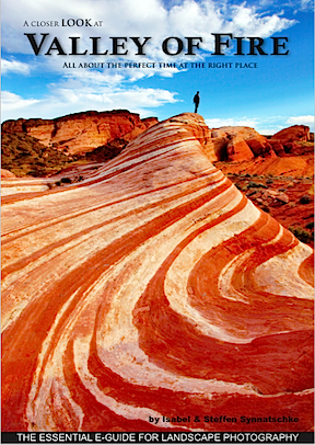
Want to learn more about what’s photogenic in the park? Start with this €4 ebook.
It was nearly 4 PM and the sun was low in the west when I got back into the park. I took the road north from the Visitor Center. I was very interested in hiking out to a formation called the Fire Wave, which was best viewed in the afternoon. My photographer friend Rebecca, who had been to the park recently, had recommended an ebook about the park: A Closer Look at Valley of Fire by Isabel & Steffen Synnatschke. That’s where I learned about the Fire Wave, which is pictured on the cover, and it was exactly the kind of scenery I like to shoot.
Of course, what had been described in the book as something off the beaten path had since gotten its own marked path. The parking lot there was completely full and there were people all over the place. Even if I could have parked, I doubted I could get the kind of scenery-only photos I wanted. On top of that was the authors’ note that the scene was best shot just after sunset and numerous signs that warned that anyone out on the trails after sunset was trespassing. So it seemed to me that a walk down to the Fire Wave that afternoon would be a frustrating waste of time.
I continued out to the end of the road, finding every single parking area completely full with day trippers who were out of their cars and climbing all over the rocks. While it’s nice to see families enjoying the outdoors together, I really wish I’d come on a weekday when it would likely be a lot less crowded. I turned around at the end of the road and headed back.
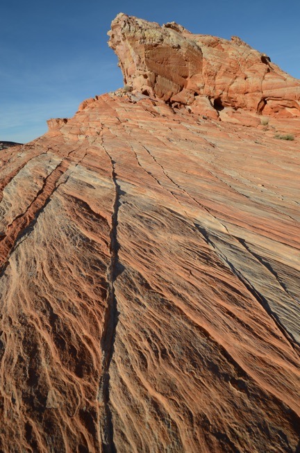
I spent an hour shooting various rock outcroppings with various lenses from various positions. It was nice working alone, unrushed with plenty of time to experiment.
I wound up parking at an almost empty parking lot beyond the Fire Wave’s lot on the way back. From there, I struck out into the desert to the northeast with the thought of maybe coming up on the Fire Wave or an area like it from the other side. That didn’t pan out, but I did find some interesting rock outcroppings to photograph. I walked about a mile with Gaia GPS turned on in my phone to record my track. In addition to my phone, which I used to take a few photos for my Gaia track, I had my Nikon with me, along with three lenses. I got a chance to use my 10-24mm lens, which I rarely use, to take some really wide angle shots. As the sun got lower and lower, the shadows grew, giving the rocks a three-dimensionality they wouldn’t have when the sun was higher in the sky. The tricky part was keeping my shadow out of some of the shots. And I tried to tread carefully among the sometimes delicate rock formations to keep from crushing thin rock ridges beneath my feet.
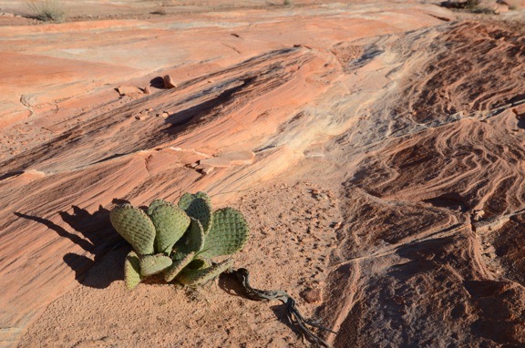
Another wide angle shot, this one featuring a type of prickly pear cactus that would likely be in full bloom with large pink flowers within two months.
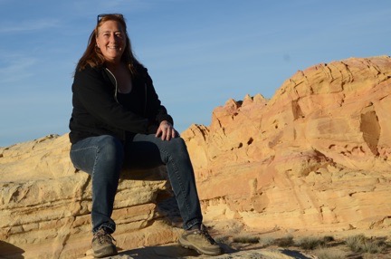
I seldom share selfies — I usually don’t like the way they turn out — but was very pleased with this one.
On the way back to the truck, I stopped for a selfie with the park behind me. The battery in my camera’s remote was apparently dead — no real surprise there — so I did it the old fashioned way, with the camera’s self-timer. I was very pleased to get a good shot on the first try.
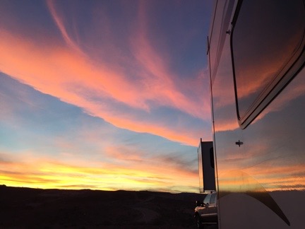
Another beautiful desert sunset, reflected on the side of the Mobile Mansion.
I explored a bit more of the park before the sun set, trying to find a good place for a morning shoot the next day. Then I headed back to the Mobile Mansion. Penny, as usual, was glad to see me. We went for a walk and I watched the sun set. Later, while I was having dinner, I watched the flickering dots of nearby campfires through my big back window, marveling at how bright the moonlight was.
Morning Photo Shoot
I was up, as usual, before sunrise. My closest neighbors had started a campfire, likely to keep warm. I could see it flickering off in the distance. It reminded me of my days at the backwaters in January and early February.
I made a cup of coffee to go and grabbed a snack bar for breakfast. Then, as the sky brightened to the east, Penny and I were in the truck, headed into the park.
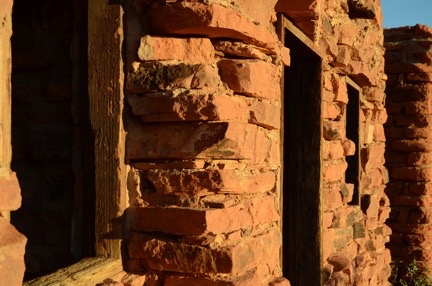
I love the textures of the wood window frames and stone walls at the Cabins.
Although I’d read through the Valley of Fire book looking for ideas of where to go for that morning shoot, I decided, in the end, to keep it simple: I’d go to the Cabins, a trio of stone cabins built by the Civilian Conservation Corps (CCC) to house workers years ago. The book panned the Cabins as a photographic destination, claiming it wasn’t interesting unless they were lit from inside. I disagree. I was there before sunrise — trespassing? — and began shooting almost immediately. The first light on the cabins was extraordinary and I got more than a few interesting shots. I was the only one around and, again, it was a real pleasure to shoot on my own without having to deal with other photographers or tourists. (Honestly, I don’t understand why people go on photo excursions where they have to jockey with other photographers for a good spot to take a shot.) My only challenge was keeping an eye on Penny — and keeping her out of my shots.
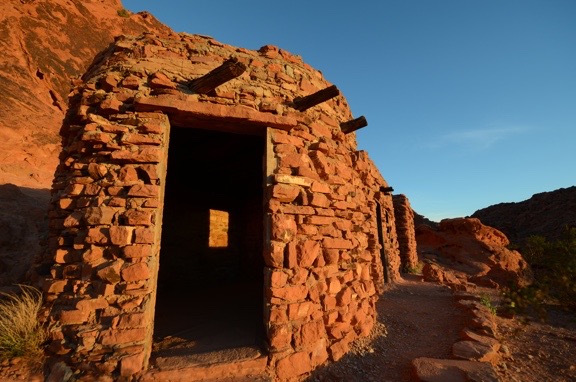
The Cabins at Valley of Fire, shot with a 10mm lens at first light. No, I didn’t retouch this (or any other image) here. It really was that red.
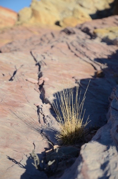
Yet another wide-angle close up. The light had already become too harsh by the time I shot this.
Afterwards, I drove farther into the park, retracing my route from the afternoon before. It was around 7 AM, the Visitor Center was still closed, and there wasn’t another soul in sight. I parked alongside the road in one of the numbered dips where the road crosses a wash, got out alone, and began hiking down a slot canyon. The sun hadn’t climbed high enough to illuminate the canyon walls and there were deep shadows. According to the book, the canyon would eventually end up by the Fire Wave. I didn’t get that far, however — the canyon was full of water about a quarter mile in.
I turned around and went back to the truck, then crossed the road and headed off to the west. By that time, however, the light had become bright and harsh — not good for photographing desert landscapes. It was time to go.
Hooking Up and Heading Out
After taking a drive through the west side of the park, Penny and I headed back to the Mobile Mansion. It was around 9 AM. People were just starting to come into the park.
After a quick drive farther down the road where I’d parked — mostly to scout it out for better sites for a future stay — I returned to my rig and began the relatively quick task of hooking it up to the truck and getting ready to move on. Although it’s big, I’ve learned over the years that if I don’t take a lot of stuff out of storage while I’m parked, it’s pretty quick to close up for travel.
By 10 AM, we were rolling back down the gravel hill and onto the pavement. We’d have to drive through the park again — it was the shortest route to I-15. I had to show my pay stub at the ranger station on the west side to exit. Then we were on our way to our next destination: Death Valley.
Discover more from An Eclectic Mind
Subscribe to get the latest posts sent to your email.
