An easy trail through the woods, with breathtaking views of the Wenatchee Valley and Mission Ridge.
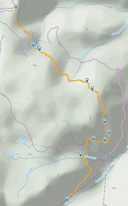
Here’s our track, as recorded with the GaiaGPS app on my iPhone. The markers show where I took photos; click here to see hike stats with all photos. Elevation is in meters, not feet.
On Monday, I went hiking with my friend Sue. We hike on and off throughout the year, but mostly in the spring and fall, when it’s neither too hot nor too cold. Our hikes are always local — there are dozens of trails within 10 miles of my home — so they seldom take more than a few hours out of my day. Since Sue is retired and I’m “semi-retired,” we usually hike during the week when there are fewer people out and about. I’m especially interested in avoiding mountain bikers, who can come up on us suddenly. I usually allow Penny to walk off-leash on these hikes and I don’t want to worry about her causing a wreck with someone on two wheels.
Monday’s hike was on the so-called Pipeline Trail, which runs from Liberty Beehive Road (NF 9712) into Mission Ridge Ski Resort. It’s named for the pipeline that runs under it, bringing water from reservoirs in the mountains down to other reservoirs used by orchards in the Squilchuck area. (It might actually terminate at Beehive Reservoir, which we passed on the way up to the trailhead.) The trail is not marked, but it’s unmistakable — it looks a lot like a road heading south along the edge of the mountain. There’s a parking lot across the road for another popular trail: Devils Gulch. I can’t find the trail we took on any map. But that might be because it’s so damn easy that a serious hiker wouldn’t even consider it a “hike.”
But there’s nothing wrong with an easy hike on a beautiful post-summer day when the sky is clear, the air is fresh, and just a few of the trees are starting to show autumn colors. So when Sue suggested it, I was all over it.
Getting There
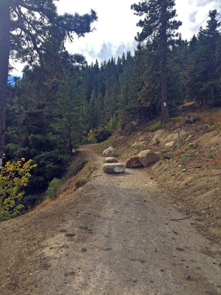
Here’s the start of the trail. The trail is road-like in most places; the boulders were obviously placed to keep 4-wheeled vehicles off.
Getting there is pretty easy — if you can find the turn for Beehive Reservoir.
Go up Squilchuck Road from Wenatchee. Continue on it past Squilchuck State Park where it becomes Mission Ridge Road. Take the right hand turn onto Beehive Road (NF 9712), which is improved gravel. This is right before a sharp switchback curve to the left. I don’t think it’s marked at all and it’s easy to miss, so slow down after you pass the park. (One of these days, I’ll have to find a mile marker to help guide people.) Drive up Beehive Road for at least 3-4 miles. You’ll pass the reservoir on your right and may see people camping near there. Keep going. Eventually, you’ll see a right turn into a parking area with trailhead signage and an old horse loading platform. That’s the Devils Gulch trailhead. Park there. You can then cross the road to where the Pipeline Trail cuts off from the road.
I’m pretty sure you need a Discover Pass to park there. I have one but it wasn’t with me (as usual). Without any other option, I decided to take my chances on getting a ticket. (I didn’t get one; weekday off season is pretty safe.)
We drove up in my truck, which I was using for garbage duty that day. (Long story.) When we got out, the chill in the air hit me immediately. Our climb along paved and gravel roads had brought us to an elevation of about 4800 feet and at 8:30 AM, it was downright cold. I’d dressed in layers — a tank top and a long-sleeved cotton shirt — and donned the third layer, a fleece hoodie, before strapping on my fanny pack and grabbing Penny’s leash. Then the three of us headed out across the road.
The Hike

Here’s a view between some of the tall pines — including one dead from a long-ago fire — down the Columbia River.
There’s really not much to say about the hike other than what I’ve already said. It climbs gently along the side of the hill, with sweeping views out to the Wenatchee Valley, Squilchuck Canyon, and Mission Ridge Ski Resort areas along the way. In some places, it’s densely wooded. In others, it’s fully exposed.
Recent improvements to the trail — it was under construction last year with lots of heavy equipment — included cement blocks designed to prevent runoff damage. Each time we crossed over one of these, we could hear water trickling beneath it. We crossed several tiny creeks and one large one that required hopping from rock to rock to keep our feet dry.
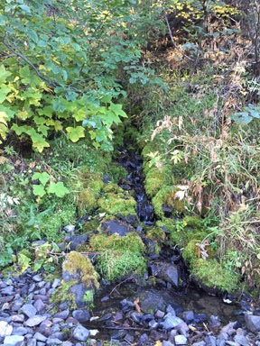
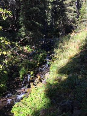
We crossed numerous little creeks along the way. It was nice to see water flowing this late in the season.
That large creek was Lake Creek, which comes down from Marion and Clara Lakes (see map above). The trailhead from Mission Ridge’s parking lot to the two lakes crosses right near the creek. I’d taken that trail up — a steep climb for the first part of the hike! — to the lakes several years ago with some friends. More recently, I’d taken the opposite end of the trail from NF 9712 to the two lakes with Kirk. Either way, that’s a great hike, although I admit I prefer the less strenuous hike from NF 9712, which has the added bonus of a Jeep ride at the beginning and end to get to the trailhead.

Flowers along the trail.
There were some, but not many, wildflowers along the trail. Sue knows flowers (and rocks, by the way) and was able to identify most of them. I didn’t take many pictures because the only camera I had with me was the one on my phone. (I’ve become lazy about photography lately.) But I did capture a few images to document what was blooming at 4800 feet in mid September.
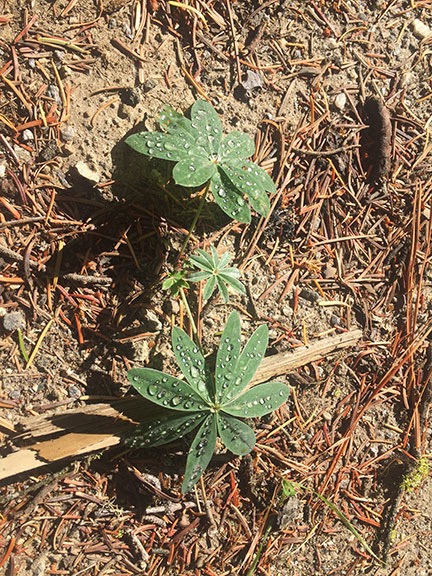
Dew on lupine leaves.
It was also neat to see plants covered with dew along the way. Contrary to popular belief, not all of Washington gets the endless rain showers of Seattle. The east side of the Cascade Mountains is desert-like — indeed, you need to irrigate if you want anything other than native sagebrush and bunch grass to grow. So dew is not a common phenomena. But at this elevation with the low morning temperature, there was plenty of dew on the ground. In many cases, it made the leaves of short plants sparkle in the sunlight.
Sue had come with the idea of looking for chanterelle mushrooms, which apparently grow in densely wooded patches of the forest near here. She had a specific location in mind to look. I’m going on a weekend-long mushroom seminar later this autumn and was hoping that this hike would give me some experience before the trip. But pipeline construction had torn out much of the vegetation Sue remembered being in that area and we didn’t even bother to look.
Eventually, the trail intersected with one of Mission Ridge’s ski trails. Signs facing down the trail we’d just come up warned skiers that the trail was not patrolled. We continued along the trail where it met with one of Mission Ridge’s service roads. We even crossed under one of the ski lifts. From that point, the trail began a steeper climb. I consulted my GPS to see how far we’d walked and was shocked to see that we’d done more than three miles. Sue agreed that was enough so we turned around and headed back.
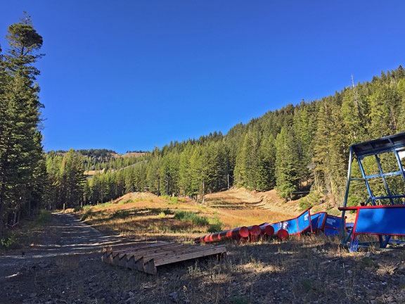
This is as far as we got on our hike. (Coincidentally, it’s the only time I’ve been inside the Mission Ridge ski resort; I do cross-country skiing, not downhill.) The trail climbed more steeply past this point.
The walk back was just as pleasant as the walk out had been. Even though we were covering the same territory, we saw different things. The conversation was interesting; Sue is a great hiking partner who knows how to tell interesting stories and listen without interrupting when her companion tells one.
Penny, of course, had a great time. Although I’d brought along her leash, I didn’t have to put it on her once. There was no risk of bothering other hikers or getting hit by cars on a road. And little wildlife other than birds and some squirrels or chipmunks that I never saw.
Back at the Truck
We got back to the parking area at about 11:20 AM. We’d been on the trail for about 2 hours and 45 minutes and had covered a round-trip distance of 6.2 miles.
This out-and-back hike is suitable for hikers/walkers of all ages. There’s nothing strenuous about it. I think would be especially appealing in the springtime, though, when there’s more water running and plenty of wildflowers. I hope to be back next April or May.
Discover more from An Eclectic Mind
Subscribe to get the latest posts sent to your email.
