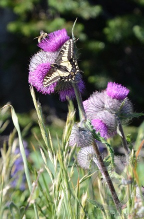
After three months contractually bound to the Quincy and Wenatchee areas of Washington, I was finally off contract at the end of August. Mike flew out to Washington and we went on a road trip to the Olympic Peninsula. This series of blog posts is a summary of that trip, with photos.
- Day 1: Wenatchee to Port Angeles
- Day 2: Victoria, BC
- Day 3: Port Angeles to Clallam Bay
- Day 4: Claliam Bay to Lake Quinault
- Day 5: Lake Quinault to Seattle
Back on the road, exploring Olympic National Park and the Pacific Coast of Washington.
We left the hotel in Port Angeles early on Wednesday. With half a cup of unsatisfactory hotel room coffee in my stomach, I hit the Starbucks in the local Safeway supermarket while Mike topped off the truck with diesel. Then we started up the road to Hurricane Ridge in Olympic National Park, leaving Port Angeles behind.
It was so early that when we reached the park entrance, no ranger was there to check our park pass.
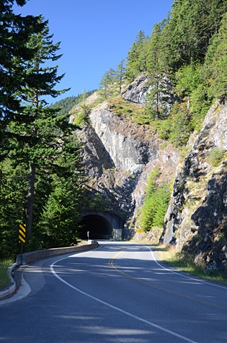 The road climbed south slowly into the mountains on a narrow strip of park land. We found a parking area right before one of two tunnels and Mike parked the truck. There was a view to the northeast and we could clearly see the Juan De Fuca Strait, which runs between Washington and Canada’s Vancouver Island. It was relatively hazy and the conditions weren’t good for photography.
I spotted a paved path that wound into the woods and we followed it with our coffee cups and bags of breakfast pastries in hand. At the end of the short path was a viewpoint that looked southeast. The air was hazy; a wildfire was burning out in that direction beyond the mountains. Some interpretive signs talked about the rivers that ran invisibly in the cuts between mountain arms in front of us. I wasn’t sure, but I thought I could hear the water rushing in the distance.
We sat down on some steps and had our breakfast. A few people came and went.
Back in the car, we continued up the road. I should mention here that it was a remarkably beautiful day for that area of the country — not a cloud in the sky. Apparently, the area gets a lot of rain. We didn’t see any for the entire time we were traveling there, although we did run into some marine layer fog banks — more on that later.
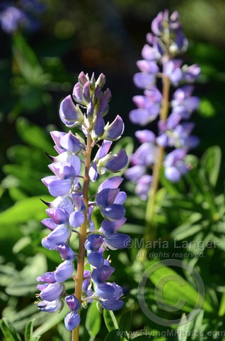 Near the end of the road was the Hurricane Ridge visitor center, a building with a gift shop, food, and great views to the south. There were also a few paved and unpaved paths that wound through grassy, flower-strewn meadows. We parked the truck and went for a walk. The quantity and size of lupine were phenomenal. Tall stalks of magnificent purple flowers seemed to grow everywhere.
Although the views in every direction were magnificent, a layer of smoke and haze from the wildfires miles away made it difficult to capture images of what should have been pristine wilderness. There was still snow on the peaks to the south of us and, with a pair of binoculars, we could examine the few remaining glaciers from afar. (There was also snow at our elevation, mostly on the north side of hills that would get little direct sunlight during the day.)
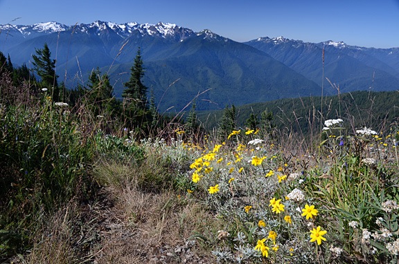
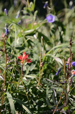
Mike and I spent quite a bit of time photographing the wildflowers. Although lupines dominated the scenery, there were some other wildflowers to capture in pixels. You can see two of my better closeup shots below. (You can click any photo with a watermark to see a larger version in my photo gallery.)
We weren’t the only photographers up there, either. I saw at least two other people with tripods. (I was using my monopod.) You really needed some kind of platform to steady the camera when doing closeup images of the flowers.
After close to two hours exploring the area, we hopped back in the truck and continued down the road to the trailhead for Hurricane Hill. We wandered about a half mile up the trail, trying hard to lose a group of noisy hikers who seemed to pause every time we did. We finally turned around and walked back to the truck, eager to continue our trip.
We retraced our route back down the road, turning just after the park gate onto Little River Road. This road, which was mostly outside the park limits, was a “shortcut” that would take us to the Elwha area of the park. It was mostly paved; the unpaved part was smooth enough. We drove past patches of clearcut forest, along with areas of obviously new growth. The Olympic Peninsula — as well as much of Washington and Oregon states — have many tree farms where trees are planted and harvested for lumber. Most of the old growth forest is gone; the trees in the new forests have straight, narrow trunks.
We turned into the park road toward, heading toward an observation point. We flashed out park pass at the ranger and got a map for our efforts. Then we followed the Elwha River south. The water was rushing — even this late in the year — and there were huge pileups of tree trunks deposited by seasonal flooding.
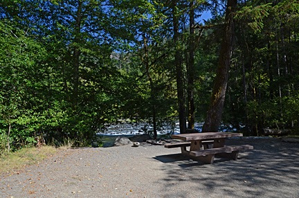 We were hungry and planned to dig into some of the cheese we’d brought along when we got to the observation point near the end of the road. But the road was closed for some kind of construction. So instead, we turned into the Altair Campground, which was mostly empty, and pulled into the first campsite, which was right along the river. We carried the cooler over to the picnic table, opened it up, and had a great meat, cheese, cracker, and cucumber lunch.
Afterwards, we headed out of the park, following route 101 northwest. A Piedmont on Crescent Lake, we turned north on a road that wound through more forest to Route 112. Eventually, we were back on the north coast of the peninsula.
We made a brief stop at a small park where we walked along a rocky beach. The tide was mostly out and the weeds that had been deposited on the shore were stinky and buzzing with flies. We didn’t stay long.
Route 112 left the shore and came inland, intersecting with Route 113. We followed 112 north to Clallam Bay. From there, we passed through the small communities of Sekiu, which appeared to be a very large RV park, and Neah Bay, a town on Makah Reservation. We followed the signs to Cape Flattery on a road that cut through the tip of the peninsula to bring us to the ocean side. We followed the road to the end where there was a relatively full parking area for the Cape Flattery trail.
Despite the fact that this trail is so far away from “civilization,” it’s really worth visiting. It immediately dives into the forest on an easy-to-follow pathway that descends gently under a dense canopy of evergreen trees. Most times, this trail is likely dripping wet with typical coastal rain forest weather, but the day we visited it was damp but mostly dry, with bright afternoon sunlight filtering through the branches. Where the trail was likely to encounter mud, it was “paved” with wooden planks or round cross-sections of large logs. It gave off a sort of magical feeling, as if we’d entered into a fairy tale, following the path of Little Red Riding Hood or Hansel and Gretel — but without the danger at the end.
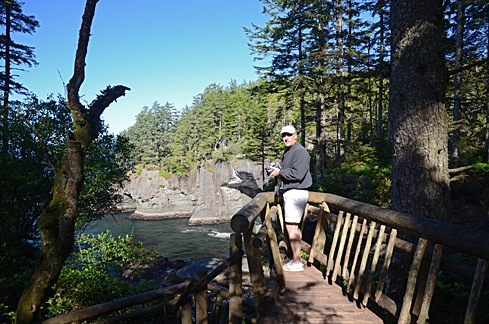 As we got closer and closer to the point, we could clearly hear the ocean waves crashing against rocks. There were a handful of short side trails to points where you could see the rocky shoreline. Some of them had been built up with rustic log rails to prevent a fall into the water below.
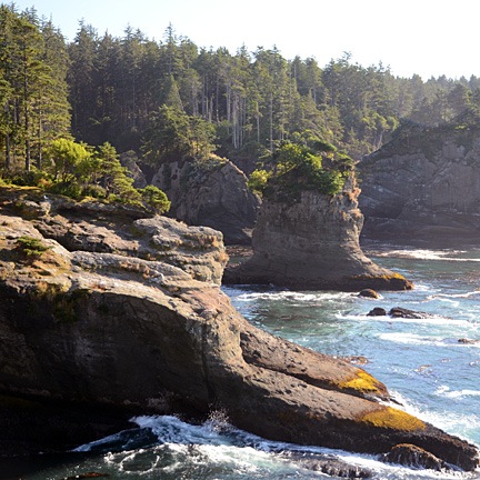 At the end of the trail was a platform that looked out to the northwest. There was an island out there with a lighthouse on it. To the north, was the opening of the strait and Vancouver Island; a container ship slowly made its way in toward the ports. Waves crashed on the shore against odd-looking formations called “stacks.”
 Beyond the platform, a lone tree grew like a natural bonsai right at the edge of the cliff. Its gnarled trunk was twisted and curved from years of exposure to the elements. It made an interesting foreground subject for a view of the ocean and stack beyond it. I can imagine the shot being much better, with first light on the scene and a coastal mist partially obscuring the offshore landmarks.
By this time, it was late afternoon and we needed a place to spend the night. We debated about driving all the way back to Forks, which was on the way south. The Maps application on my phone — once I got back within range of the network — mentioned lodging farther south on the coast. I called the phone number. A recording answered and said the office was closed. It was 5:30 PM. I couldn’t understand how a place with cabins could just close at 5. We drove past and saw a bunch of relatively nice cabins, mostly unoccupied, adjacent to an RV park. The office was indeed closed. Their loss.
So we backtracked through Neah Bay and headed toward Forks. Despite very promising signs at Neah Bay about lodging, there was no place there I’d even consider staying. Between Sekiu and Clallam Bay, we spotted a motel with a restaurant next door. We pulled in.
I can’t remember the name of the place and that’s probably a good thing. It was not pleasant. The unit they put us in was at the end of a single-wide manufactured building. It consisted of two very small rooms, one of which had a kitchen it it. Although the place was clean, it was extremely run down and had a weird smell. I think it caters to fishermen. It did have a full sized refrigerator, which was good for us, because it let us store our remaining cheese and re-freeze the bottled water and freezer packs we were using to keep them cold. And it was quiet. And the restaurant was next door.
And, oh yeah: it was pretty cheap.
We had dinner in the restaurant next door. I had a fried fish platter, which was actually pretty good. We shared an ice cream sundae. Then we went back to our room with its cardboard walls, and called it a day.
I was exhausted.
Discover more from An Eclectic Mind
Subscribe to get the latest posts sent to your email.

