Jeeping in the Wenatchee National Forest

Exploring my world.

One of the things I love about this area of Washington is the variety of landscape and terrain so close by. I’m surrounded by farmland, orchards, desert, rivers, steams, lakes, forests, and mountains. All of these things are within a 30 minute drive from my home — it just depends on which direction I drive.
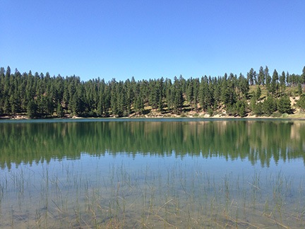
Beehive Reservoir
Behive Reservoir isn’t anything special, but it’s a short drive away, up in the mountains south of Wenatchee.

The other day, I briefly explored the area around Beehive Reservoir. I’d driven up there with the goal of checking it out as a possible kayaking destination. The lake I found was small and rather uninteresting. Penny and I walked around its one-mile circumference before continuing up the road. We found a far more interesting web of forest roads that I ached to explore. But without a decent map, I wasn’t comfortable going very far. I decided to return better prepared to explore.

I had a 3-hour window of time on Monday. Penny and I, joined by a friend, climbed into the Jeep and headed out. This time, I had a Wenatchee/Leavenworth trail map with me that clearly identified all the forest roads. We drove up to Beehive Reservoir and kept going.

Our intended destination was Cashmere, on the other side of the mountains. A road numbered 7100 wound through the mountains and a canyon to Cashmere. I’d been on part of the road two years before, picking it up from Number 2 Canyon Road in Wenatchee. It was a relatively easy drive in the Jeep; I figured this would be the same.

But Road 7100 was closed to motor vehicle traffic. They were making improvements somewhere along the way.
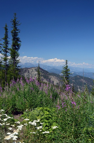
Mountain View
I couldn’t ask for a better day — or better views.

So we followed Road 9712, which went west and then mostly south and east. It climbed pretty steadily into tall pine forest, often skirting the edge of a steep cliff. Every turn offered magnificent views. Although I tried to follow our progress on the map, using turns and trailheads as landmarks, I soon lost track of exactly where we were. That wasn’t a big deal — we could always get back because we didn’t make any turns.

We passed a family of three on mountain bikes: mom, dad, and a girl who couldn’t have been much older than about eight. A strap tied dad’s bike to the kid’s. I guess the logic there was that if the kid went over a cliff, her bike would be saved because it was tied to dad’s. The kid, of course, wasn’t tied to the bike so she’d be lost. Maybe that was the idea. We didn’t see them later on the way back, but their car was still there. Maybe they all went over a cliff. It was not the kind of road suitable for a family outing on bikes. I wonder, sometimes, whether people know how to use their brains.

It was after we made a turn down a steep hill that I got the idea to turn on tracking on my iPhone. I use an app called GPS Track that can keep a breadcrumb trail of where I’ve been. It can also display my position (and track) on a map — if I have a 3G or LTE connection. Since I wasn’t sure whether the road we’d turned down would offer other turns, I turned tracking on. Even if I couldn’t see where we were on a map — which I couldn’t — I’d still be able to follow the track back, even after making a bunch of turns.
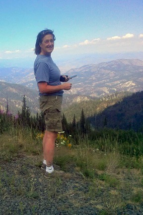
At the top of the World
I used my phone to make a panoramic image; my friend used a phone to take a photo of me.

The road we were following descended steadily and then came to an abrupt end in a wide circle with a fire pit in the middle of it. A pickup truck was parked there, but there was no one in sight. We stopped the Jeep and got out to admire the view. We were at about 5,000 feet in elevation and the spot we were on offered a completely unobstructed view of the eastern side of the Cascade Mountains, still blanketed with snow. A variety of wildflowers grew in clumps along the edge of the cliff. It was beautiful and peaceful.

We got out of the Jeep to stretch our legs and take in the view. It was the kind of place that you find it hard to believe exists, a place you know you’re lucky to have stumbled into. I often find places like this when I go exploring in my Jeep. Maybe that’s one of the reasons I like doing it so much.

Panoramic View
Not a bad photo for a phone. (Click it to see a larger version.)
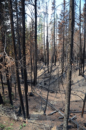
Burned Forest
There was lots of evidence of last year’s fires.

We turned around and headed back up to the main road, then turned onto it and continued on our way. The road wound through more forest, up more hills, and over more loose patches of volcanic rock. In some places, the forest was burned out from the previous year’s fires.

The well-maintained road gave way to a narrower, less maintained track. I decided it might be a good idea to figure out where I was. I stopped the Jeep right in the middle of the road — after all, there was no one around — and pulled out my map. I lamented to my friend that I wished I could find a good GPS app for my phone that enabled me to download detailed topo maps so I wouldn’t need a cell signal to use them.
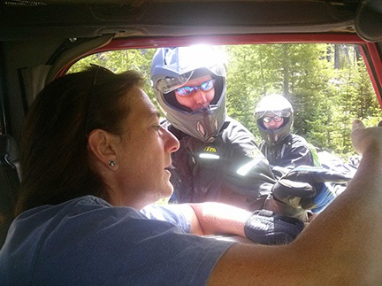
Motorcycle Guidance
We ran into a pair of motorcyclists who helped us figure out where we were on my map and then recommended a great back road driving app.

I was rather absorbed in my map study when two motorcycles came into view in front of us. The riders were completely geared up and riding good bikes with camping gear fastened to them. I moved to the side to let them pass. They came up beside me and must have noticed I was looking at a map. They stopped and asked if we needed help.

I told them that we weren’t lost but we didn’t know exactly where we were. I know that sounds silly, but in my mind, “lost” means not knowing how to get where you need to go. I didn’t need to go anywhere in front of us and I knew how to get back, so I wasn’t lost. I just didn’t know exactly where I was. Makes sense, no?

One of the guys had a GPS and tried to point out on my map where he thought we were. I told them what I’d been telling my friend: that I wished I had an app that would download maps.

Gaia GPS,” one of the guys said immediately. “It’s $20 but worth every penny.”

They went on their way. I had a good LTE connection, so I downloaded Gaia GPS on the spot. (I figured that guys outfitted like that had to know what they were talking about.) I used it for the rest of the drive and even saved a track from it for the trip back from our farthest point.

Flower along Road
This flower caught my eye as we drove past; I stopped, got out, and took a photo. It’s nice not being rushed by an impatient companion when you’re out for a drive in the forest.

We continued on our way. Soon, however, I was watching the clock. I had a doctor’s appointment at 3:45 and needed to be home by about 3:00 to drop off my friend and make the trip down to Wenatchee. Not sure how long it would take to get back, I set a deadline of about 1:30 to return. It was about 1:00. That gave us just another 30 minutes to explore.

The road continued to wind through the forest, often with sheer cliffs on one side or the other. When we got a good look out to the southeast, I realized that we were on the far side of Mission Ridge, almost at the same altitude. The valley we looked out over was hazy from the smoke of the Colockup Tarps fire, which had started two days before.

I was looking forward to a particularly steep drop-off alongside a section of the road up ahead — that’s what the topo lines showed on the map, anyway — when I realized it was past 1:30. We had to head back. I’d have to make another trip to continue exploring. I marked a waypoint in Gaia GPS so I’d know where I left off and turned around.
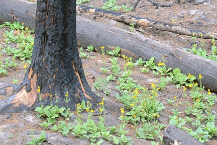
Flowers and Burned Trees
Less than a year after the fire that burned thousands of acres of this forest, flowers were blooming.

The trip back, of course, was much quicker. It always is. We stopped for a nature call and I got some mildly interesting photos of flowers blooming among the burned out trees in the area.

We were back at Beehive Reservoir before we knew it. And back on Squilchuck Road soon after that. In fact, we were back home well before 2:30. We could have stayed out longer after all.

It was a nice trip out — I say that all the time, probably because I enjoy exploring by Jeep so much. I’m looking forward to going out again, perhaps with a hearty picnic lunch, to follow that road to its end.

A Walk in the Woods

Another day, another hike with new friends.

One of the few things I miss about Arizona is the hikes I did with the Phoenix Atheist Meetup Group (PAMG). This 1700+ member group has a small subgroup that goes hiking in Arizona almost every single Sunday of the year. I began hiking with them when I returned to Arizona in September 2012 after my fifth summer work season in Washington and hiked with them periodically throughout the autumn, winter, and spring months. With them, I explored the area around the Superstition Mountains, Sedona, Prescott, Flagstaff, and even Wickenburg. They’re a great group of people — smart, friendly, educated, and open-minded. I made a lot of new friends that last winter in Arizona and already miss some of them very much. If you live in the Phoenix area and are looking for a group to hike with, I highly recommend meeting up with them. Tell them Maria, formerly of Wickenburg, sent you.

Although there are plenty of hiking opportunities here in the Wenatchee area of Washington, finding folks to hike with wasn’t quite as easy. Wenatchee is a much smaller city than Phoenix — although it’s much larger than Wickenburg — and there aren’t as many meetup groups. I did join a few that sounded promising. Among them is the NCW Freethinkers, which is based in nearby Cashmere, WA. (NCW, by the way, stands for North Central Washington, the commonly used label for the area where I now live.

At a recent pot luck BBQ meetup in Wenatchee, I told the group about my hikes with PAMG. Another member had been thinking of hiking as a group. He rose to the challenge and came up with the hike we did Sunday, to Clara and Marion Lakes.

Getting There

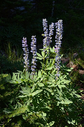
Lupine
Lupine is still blooming in the higher elevations near Wenatchee. A splash of sunlight illuminated this plant while leaving the forest behind it in relative darkness.

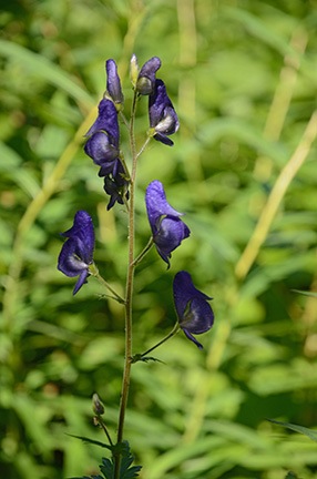
Western Monkshood
According to the National Audubon National Society Field Guide to the Pacific Northwest, this is Western Monkshood.

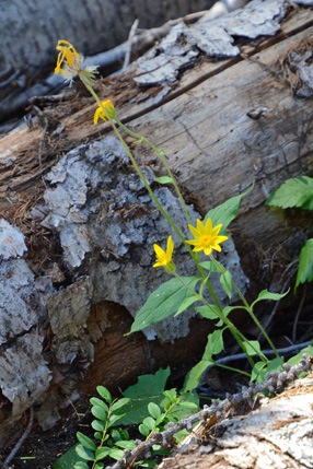
Heart-Leaf Arnica
According to the excellent Washington Wildflowers iPhone app, this is Heart-leaf Arnica.

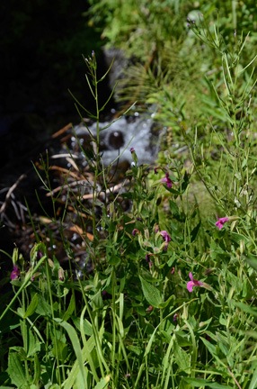
Purple Monkey Flower
This Purple Monkey Flower was past its peak of bloom alongside a stream. Still beautiful, though.

Getting there was quick and easy for me — I was less than 10 miles away.

The trailhead is at the Mission Ridge ski resort’s lower parking area. Just take Squilchuck Road until it turns into Mission Ridge Road and keep going to the end. I currently live about two miles off Squilchuck so I was likely the closest hiker.

The road winds up into the canyon, past orchards and into the tall pines. There are amazing views back into Wenatchee from most bends in the road. Along the way I passed the turnoff to Beehive Lake, which I’d explored by Jeep only a few days before, and another trailhead I’d hiked with Penny the previous year. It’s amazing to me how much there is to do outdoors so close to where I live.

I arrived right on time after handling a few bee-related chores earlier that morning. Four other hikers were waiting for me. There were two other dogs, too — a 120-pound Rottweiler and a smaller Border Collie mix that reminded me of my dog, Charlie, left behind in Arizona. (Poor Charlie probably spends far more time curled up on a dog bed in front of a television in a Scottsdale subdivision than running around, off-leash, in the woods.) While I chatted with the other hikers, Penny tried to make friends with the other two dogs. The Rottie ignored her completely while the Border Collie immediately began playing with her.

I could tell then that it would be a good hike for both of us.

The Hike

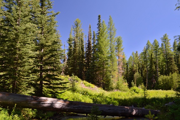
When it became clear that a sixth hiker who’d RSVPed would not be showing up after all, we hit the trail. It immediately began a relatively steep climb with occasional switchbacks in a dense alpine-like forest. There were pine and other trees and dense underbrush. The air was cool and the sound was hushed. Wildflowers typical of the Pacific Northwest — which I still need to learn! — added splashes of blue, yellow, red, and white along the way.

I took up a place near the rear of the group, stopping more than a few times to take photos along the way. Although my uphill hiking endurance is far better now than it was when I was a fatty, I still need an occasional rest stop to catch my breath on steep climbs. Framing shots with my camera offered a good excuse to do so.

The Rottie and his owner led the pack, setting a brisk pace for all of us. Meanwhile, Penny and her new friend, now off-leash, began a chasing game up and down the trail. I swear those dogs covered three or four times the terrain as the rest of us.

The trail leveled off when it intersected with the Pipeline Trail. That’s also where it crossed a small rushing stream of snowmelt coming from somewhere high above us on the mountain. After taking a short break near the stream, we continued the climb on the narrow trail up to the lakes. Either it wasn’t quite as steep here or I was getting used to it because I had no trouble keeping up and needed fewer and fewer photo/rest stops along the way.

After a while, we came upon an open marshy area. We thought it was Clara Lake, dried up. But a post-hike examination of my route (tracked via GPS) shows that it was just an unnamed marshy area.

Near Clara Lake
Silly us. We thought this beautiful, flower-filled marsh area was a dried up Clara Lake, but that lake was still ahead of us on the trail.

Clara Lake Shore
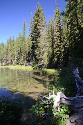
Along the shore of Clara Lake.

Swimming Rottie
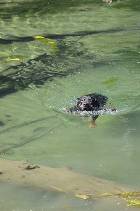
Not only did the Rottweiler (appropriately named Tanker) like to fetch sticks, but he didn’t mind swimming to get them.

Penny the Adventure Dog
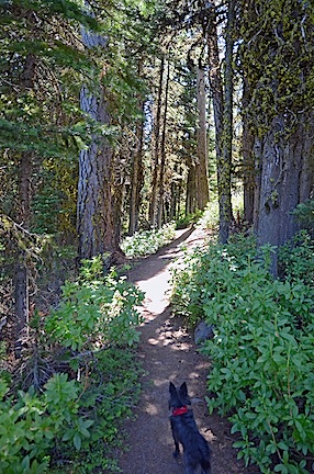
Penny, as usual, kept ahead of me on the trail. It was such a pleasure to walk in the cool shade of the forest. When I lived in AZ, I dreamed about hiking in places like this.

The lake we came to a short while later was Clara Lake. Surrounded by tall pines and bordered on one side by a slide of volcanic rock, the small lake featured clear clean water and a collection of floating logs. We paused for a while and watched Mike’s dog swim to fetch large sticks, then moved to a shady area on the other side of the lake for a rest and snack. Some of us wandered around the vicinity.

Because we thought we were at Marion Lake — the second of two lakes on the trail and our intended destination — we didn’t go any farther. Looking at my GPS track now, I see that another 1/4 mile up the trail would have brought us to another lake. Oh,well. I think I’ll make that another hike, perhaps in the autumn when the trees are changing color. There’s another trail to the lakes down from a forest road that’s not quite as long or steep.

We headed back the way we’d come a little while later. It was a lot easier — almost all downhill. But steep! My knees really felt it. (I fully expected to be in serious pain the next morning — especially in my calves — but my body surprised me and took the workout without complaint.)

As usual, the hike back was quicker than the hike up. We passed several mountain bikers along the way — they were all walking their bikes up the steep trail. I wondered where they planned to ride and whether the ride down would be as wild as I envisioned. I also thought of the trail’s winter use — for snowshoeing. That’s a sport I might need to explore if I decide to spend winters here. I’ve already decided to get a new set of cross-country skis and explore trails in the Leavenworth area.

Back at the trailhead, the group split up. Although I was invited to join the others for beers at a local microbrewery, I decided to head home for a shower and a little R&R instead. I’d been running myself ragged for the past week and needed a break.

Besides, I’d promised a winemaker friend that I’d come visit her for a tasting that weekend and the weekend was almost over. I still had plenty on my calendar for the day.

Wine Tasting by Helicopter

Let me be your designated driver.

I started doing wine tasting tours by helicopter in North Central Washington’s wine country back in the summer of 2011, but really got into full swing in the summer of 2012. Back then, I offered two-, three-, and four-winery tours. I’d pick passengers up at one winery and fly them to another. Then I’d wait around for them to finish and fly them to the next. Repeat until done.

I soon learned that doing a three- or four-winery tour was a really good way to waste an entire day of my time for very little financial return on that time investment.

And I don’t get me started on the couple from hell, who managed to turn a four-winery tour into a full day that included five wine tastings, forced me to do four deadhead flights, and pushed me over the edge when my nerves and emotions were already frazzled.

Still, it wasn’t until nearly a full week of seemingly nonstop cherry drying in June that I realized I really didn’t want to do wine tasting tours like that. I wanted a quick and easy day where I’d be compensated properly not only for the helicopter’s flight time but for for my time. A full hour of flight time with just one destination.

After doing some research, I realized that the best destination would be Tsillan Cellars Winery at Lake Chelan. I’d do scenic flights there and back with time on the ground for my passengers to enjoy a wine tasting and a meal in their very nice restaurant. The flight was outrageously beautiful and the destination was someplace I really wouldn’t mind spending a few hours of down time. Perfect.

On Sunday, I took three passengers to Tsillan Cellars. They were the same ladies who were supposed to do a four-winery tour late last summer with me. Unfortunately, the destination winemakers had pulled the plug on the scheduled date — for reasons I still can’t comprehend. (That was an eye-opening experience that taught me to be careful about who I partnered with for winery visits. I do not like disappointing my clients and won’t do business with people who disappoint me.) I offered this trip as a long overdue substitute and they agreed. I picked them up at Wenatchee Pangborn Memorial Airport at 11 and we made the flight in beautiful weather.

I had the helicopter’s nosecam set up with my new GoPro Hero 3 Black camera and it was running for the entire flight up there. On Monday, I edited the video down to a 2:45 promo with music and captions. I put it on YouTube. Here it is:

I haven’t finished updating Flying M Air’s website with information about the Tsillan Cellars wine tasting flights, but I hope to do it soon. And I hope to be doing lots of these flights throughout the rest of the summer and into autumn.