A blog post with a vlog post.
In an effort to minimize the ums and uhs of my on-the-fly narration, for this video about last week’s trip to St Thomas Overlook, Stewart Point, Henderson/Las Vegas, and Boulder City, I wrote a script and just read it into my computer. Since I had the script, I figured I may as well turn it into a blog post, too. There are some photos here but the video has a lot more photos, maps and, well, videos.
Here’s the video:
And now here’s the blog post.
After leaving Valley of Fire State Park, we did a little exploring in the Overton Arm area of Lake Mead. We started off with a drive down a narrow, unpaved road to the St Thomas townsite overlook. St Thomas used to be under water. Now that water levels are so low, the ruins of the town are visible again. There’s a three mile loop hike to get down there from the overlook, but I didn’t go. I didn’t take any photos from the overlook, either, although I did see some of the ruins with binoculars.
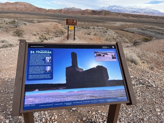
Here’s the sign at the overlook for St. Thomas Point. YOu couldn’t really see any of the town without either making the 3-mile hike or using binoculars.
After that, I made a quick trip back to Overton to buy some fixit supplies and a few grocery items. Then back into the park.
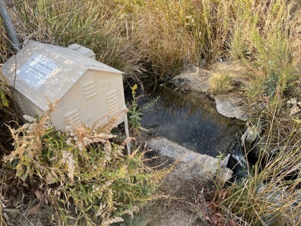
Blue Point Spring was very disappointing. Rogers Spring, a bit farther down the road, is supposed to be a lot nicer.
We made a quick stop with a short hike at Blue Point Spring. It was a depressing little hike that led to a gurgling pipe with water flowing into a narrow creek that dried up only a few dozen feet away. Not recommended.
Then down the road to Stewarts Point, our overnight destination. This was down a long, partially paved road. I met a ranger along the way and he gave me all kinds of information about the area, including a park map and some information about water flows in the lake. He told me I could park anywhere down there but warned me not to get too close to the water because the ground there could be soft.
When I got out there, I discovered at least a dozen other RVers parked all over the place. There was plenty of room to find a spot away from them all. I packed into a spot at the edge of a steep drop off with the back of my camper facing the lake so I’d have a good view.
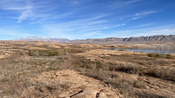
The view out the back of my camper wasn’t too shabby.
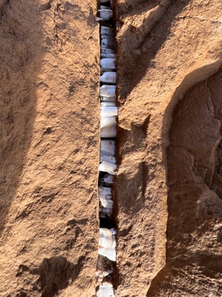
An interesting mineral was growing in cracks in the clay-like mud.
After I’d set up the camper, I made lunch, grabbed some snacks for me and my pups, and headed down to the lake. We spent some time having lunch along the water and watching water birds. I discovered some sort of mineral growing in cracks of the clay-like mud at and in the water; some Twitter friends later identified it as gypsum. I found traces of burros in the area but we never saw any. We went back up to the camper and spent the rest of the day just relaxing. We had a nice sunset.
I was still having battery issues so I left the heat off overnight, hoping to be able to turn it on in the morning. But in the morning, with the temperature around 30°F outside, my batteries were dead again. Rather than deal with the generator, I made coffee in a travel mug, broke camp, and headed out as soon as it was light enough to see.
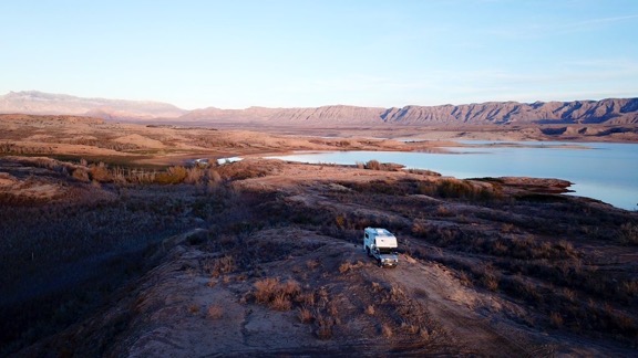
Don’t tell anyone, but I sent up the drone for a few minutes around sunset to get this shot of my campsite from the air.
The rest of the morning was spent in Henderson and Las Vegas troubleshooting and ultimately fixing that battery problem. I cover it in detail in my blog; you can find a link in the video description.
When that was done, I treated myself to a nice lunch in Boulder City. I felt I deserved it.
Then my pups and I took my bike and their trailer on the Historic Railroad Trail that runs from the Lake Mead Visitor Center to the Dam. It was surprisingly chilly and there was just enough wind to keep the ride from being pleasant. I stopped for some photos of the lake that showed how far the water level had come down since the highest levels back in the 1980s. Instead of turning around after the last tunnel, I kept on the steep gravel trail down toward the dam. This turned out to be ultimately disappointing since I couldn’t easily get close to the dam with my bicycle and I didn’t want to leave it locked up out of sight for too long. We wound up coming back along the road, which was a lot easier than pedaling uphill in gravel, even with electric assist.
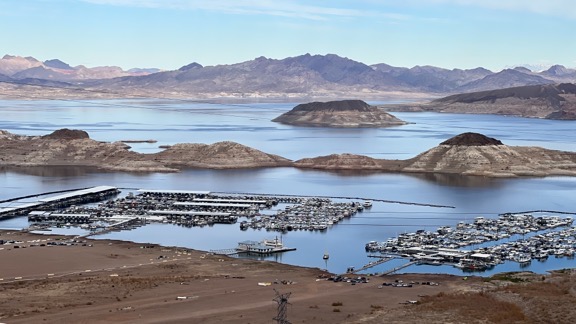
This shot of the marina gives you a pretty good idea of how far down the water level has come; most of those islands were submerged in the 1980s.
By that time, I felt done for the day. I packed up the bike and trailer, put my pups back into the truck, and left Boulder City for our next destination: Willow Beach Campground on the Arizona side of the Colorado River. I’ll tell you more about that in the next video.
