My first real job as a pilot is actually the next step in my learning experience.
Before I started working at Papillon, my only flying experiences had been in Robinson R22 and R44 helicopters, with an hour here and there in a Bell 47, Rotorway Exec, and Hughes 500c. I was a piston pilot. I knew Robinson helicopters extremely well. And I knew the basics of flying any other helicopter.
The work I do at Papillon is taking me to the next level. Actually, it may be helping me skip a few levels to get to a much higher level.
A New (to Me) Ship
The first big difference is the ship I’m flying. No, it’s not a state of the art Eurocopter or fancy NOTAR ship. It’s a plain old (emphasis on old) Bell 206L1 Long Ranger with the Allison C30P conversion. The engine conversion gives it more power than a standard 206L1. And that’s a good thing, because at the Canyon, we need all the power we can get.
Ground school covered all the details of how the ship’s systems work. I’ll be the first to admit that I didn’t fully understand everything I was taught. But I understood enough to pass a check ride and to intelligently preflight every morning.
Starting is a challenge. The problem is hot starts — getting the turbine outlet temperature (TOT) too high during start. It’s evidently easier to hot start when you start off the helicopter’s battery. So when you’re new at Papillon, they encourage you to start with an APU (auxiliary power unit). I’m not taking any chances. I’ve been flying for about two months and I still always start with an APU.
Learning about Torque
Another challenge is flying without overtorquing the engine. There’s a torque meter that displays the current power setting. I equate it with the manifold pressure gauge on an R22/R44. But they’re very different. If you redline an R22, the worst that can happen is that you get a rotor RPM droop. If you overtorque a turbine engine, all kinds of inspections have to be done. And if you really overtorque it, it’ll cost $100,000 to fix things back up the way they should be. Although Papillon won’t take that out of my paycheck, I still don’t want to be the one who does it.
Of course, there isn’t much of a chance of overtorquing in cruise flight. It’s when you’re hovering, taking off, or landing that it’s more likely to happen. And that’s where my re-education began.
Trouble is, the Robinson taught me that when I’m landing, I can reduce power on the way down and pull it all back in relatively quickly at the bottom, to come to a landing. Doing that in a 206 could easily result in an overtorque or a hard landing. So I learned to reduce power well before I begin my descent. Then, as I’m coming down, I increase power. The result is a smooth, controlled landing to a hover.
And let’s not even talk about what the Robinson taught me about pulling power at take-off! If I did that in the 206, I’d be overtorquing at least once a day.
Another interesting thing about torque is that pressing the left pedal increases torque. This can really get you into trouble in a crosswind. If you let it start getting away from you, rotating to the right, you can quickly get beyond the point where left pedal can stop you. This happened to me once and it almost got ugly. The trick, I found, is to lower the collective if you have to add a lot of left pedal. That reduces the amount of pedal you need to press and reduces power so pressing the darn pedal doesn’t overtorque the ship.
(If you’re an experienced turbine helicopter pilot reading this, you may be thinking, “Duh-uh.” Have patience. All this is new to me and I’m learning as I go along. If you find this too boring to read, move on to something else. Or go watch TV.)
Wind: Friend or Enemy?
I’ve also learned a lot about flying in strong winds. Someone once told me he had a flight instructor who said, “The wind is your friend.” I think that can be true. But I also think the wind can be your enemy.
Why a friend? Well, suppose you’re flying at max gross weight on a hot day and you need to take off from a helipad in a relatively confined area at 6600 feet MSL. You point your nose into that 20 knot wind, push the cyclic forward a bit, and voila! You’re at ETL (effective translational lift) and climbing. Same goes for landing. You can stay in ETL as you descend and maybe even as you hover to your helipad if there’s enough of a headwind.
Why an enemy? Well, what if that 20 knot wind at the helipad isn’t a headwind? What if it’s a crosswind? Or, worse yet, as you’re trying to set down on the pad, what if it’s a tailwind? Or what if it’s 24 gusting to 36? Or gusting to 50? (Yes, it does get that windy.)
I’ve flown in very strong winds and I’ve learned that taking off and landing isn’t always the biggest problem. At the Canyon, the problem is sometimes in the Canyon itself. Those nasty winds make nasty turbulence as they whip over the enormous rock formations. 3,000 foot-per-minute updrafts aren’t unheard of. Neither are their counterparts: 3,000 foot-per-minute downdrafts. Turbulence that smacks you from one side as you come past a butte. Or makes your helicopter seem like the car on a roller coaster.
Oddly enough, sometimes the worst turbulence are over the forest south of the rim. When you’re flying about 200 feet over the treetops, you’re really in it. It can seem pretty bad and you can feel bad for your passengers. But then you break over the rim and enter the Canyon and everything calms down. Go figure.
There’s no pattern to it. All the pilots have their own theories of how things should be when the wind is blowing from one direction or another. But it’s not science and it isn’t reliable. You never know how it’s going to be until you’re in it. And then it’s too late to do anything about it.
Power Settings
I’ve also learned a lot about power settings for different ships at different weights in different conditions. Papillon’s rule of thumb is to set the ship’s power to 70% torque and leave it there for the whole tour. While this might work in most situations, it doesn’t work in all of them.
For example, a relatively fast ship can do a North Canyon tour in the allotted time at 70% torque, but the same ship will come in too early on an Imperial Tour at that setting. So I set the power based on speed. I’d like to do 95-105 knots for a North Canyon Tour and 90-100 knots for an Imperial Tour. The difference in torque settings is usually about 5%.
Then there’s the descent on the east side of the Dragon. Both tours require a relatively quick descent in 2 to 3 miles. On a North Canyon tour, I descend from 8200 feet to 7500 feet. On an Imperial Tour, I descend from about 8800 feet to 7500 feet. If I follow the rules, I should be at 70% during the descent, pushing the cyclic forward to nose down. But that also increases my speed. Never exceed speed (Vne) at that altitude is around 115 knots. If I’m already doing 105 knots in straight and level flight, a 500-1000 foot per minute descent is going to make me exceed Vne. So I need to reduce power — sometimes to as low as 50%.
Turbulence has a lot to do with power settings, too. If there’s a lot of turbulence, you have to reduce power. And if there are a lot of updrafts and downdrafts, power must be adjusted to keep you within the allowable altitude range.
Fortunately, I haven’t had much of a need to increase power during the tour yet. At least not beyond 75% or so.
I’m Here to Learn
Every day is a new learning experience and I’m glad. After all, that’s why I’m here. Living in my own semi-controlled, R22 dominated world isn’t much of a challenge. But flying in all kinds of conditions in a ship that’s far more sophisticated, is like going away to school. I’ll learn more about flying helicopters this summer than I have in the past four years.
And the paycheck is kind of nice, too.

 I wrote a bunch of books, mostly revisions. Quicken 2004: The Official Guide, which I finished earlier in June, was published. That was followed by Microsoft Word 2003 for Windows: Visual QuickStart Guide, Mac OS X 10.3 Panther: Visual QuickStart Guide (expanded to 600+ pages!), Microsoft Excel 2003 for Windows: Visual QuickStart Guide, QuickBooks Pro 6 for Macintosh: Visual QuickStart Guide. As I write this, I’m finishing up Quicken 2005: The Official Guide and have two new titles and a revision under contract for the rest of the summer. Oh, yeah. I revised the Spreadsheet chapter for the latest edition (I’ve lost count) of The Macintosh Bible. The Panther book sold like crazy and continues to sell well, although returns from the Jaguar book are eating into royalties now.
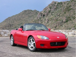 I bought a new car. It’s my midlife crisis car, a Honda S2000. Very fast. Very difficult to keep clean on the dusty roads where I live. In 10 months, I put only 4500 miles on it. Heck, this car has to last the rest of my life. I’ll drive the Jeep into the ground first. I sold my RC Helicopter, which I wasn’t flying. Heck, it’s easier to fly the real thing.