Wheat Fields, Mountains, Valleys, and a Very Long Drive

What I’ve been up to — and why I’ve been too busy to blog.

I haven’t been blogging regularly for the past week or so. That’s because I’ve been on the move.

Monday, July 28

Combine in ActionI spent the morning cleaning out my hangar at Quincy for departure the next day. Then I flew up to Chelan and met my friend Jim. He flew us in his helicopter to Spokane, ID for lunch and then on to Coeur D’Alene, ID where he’s based. He demonstrated a confined space landing by setting down in the parking area of his business property in downtown Coeur D’Alene to offload a bunch of stuff. Then we went to the local airport, fueled up, and picked up his wife for the return flight to Chelan. I got some great photos of combines in action on the dry wheat fields. We landed at Chelan with just enough time to chat with another helicopter pilot before it was time for me to fly back to Quincy.

Tuesday, July 29

I spent much of Tuesday morning preparing to leave Quincy. I had to disassemble my helicopter tow bar and stow its pieces in the back of my truck, then clear out everything else still in the hangar I’d been renting. I also had to drop off my last month’s rent. I bought some cherries and other fresh fruit, too.

I had just enough time for a quick shower before visitors started coming. Louis, who would fly with me later in the day to Seattle, arrived first. Then Teresa, Jim’s wife, arrived with Jim’s pickup. He bought the remaining fuel in my transfer tank — about 50 gallons of 100LL — for $4/gallon. A great deal for both of us, since I wanted the fuel out to lighten up my truck. We pumped the fuel from my transfer tank to Jim’s and Teresa departed.

Then Louis dropped me off at Quincy Airport and drove my truck to Wenatchee. I took my helicopter to Wenatchee to meet him and we flew from there to Seattle’s Boeing Field, on a marginal weather flight I reported in some detail here. After a chat with my mechanic there, Louis and his mom dropped me off at SeaTac. I had a pretty good halibut dinner at Anthony’s before I caught a flight back to Wenatchee. I was back in my camper by 9:30 PM, exhausted.

Wednesday, July 30

Wednesday was the big day. I packed up the camper, stowed Alex the Bird on board the truck in his travel box, hooked up the camper to the truck, and pulled out. I’d been in my campsite for just a few days short of two months.

Palouse FallsMy destination was Walla Walla, WA, about 150-200 miles away. I chose a route that kept me on back roads. I don’t think I ever saw so much wheat in my life. My chosen route took me past Palouse Falls, so I stopped in and got some photos. It was an interesting place and well worth the stop.

From there, I continued on to Walla Walla, with a stop at a drugstore soda fountain in Dayton for an ice cream sundae. I checked into the Four Seasons RV Park around 5 PM, set up the camper for a two-night stay, and went out to grab some dinner. I wound up at a restaurant called Luscious, where I had an excellent polenta dish and a glass of wine.

This is also the first day I gave my new SPOT Messenger a workout. You can track my progress for this entire trip on my Share page, http://www.tinyurl.com/FindMaria. You’ll have to page back using controls under the Waypoints list to see the track for that day.

Thursday, July 31

There was something about dinner that didn’t agree with me, no matter how tasty it was, because I was up at 3 AM, leaning over the camper’s toilet and choking it all back up. I hate to puke but what they say is true: you do feel better when you’re done. But I wasn’t operating at 100% the next day, which I’d set aside to explore opportunities in Walla Walla.

It’s no secret that I pretty much hate where I live right now. Wickenburg is a dead town, full of ultra conservative retirees who live there only half the year and don’t spend much of their money in town when they’re around. They don’t have an emotional investment in the town and don’t seem to care what happens to it. As a result, new businesses — other than those that cater to the budget-conscious — don’t last more than a year or so. There are few decent restaurants and very few shopping opportunities. If it weren’t for the newly built and then remodeled Safeway Supermarket and a handful of longtime other businesses, I don’t know how I could live there at all. To make matters worse, the Mayor and Council seem more interested in growing the town’s population base for the financial benefit of their families and cronies than building an economic base that includes good-paying jobs that’ll attract young, vibrant people. The Chamber of Commerce pushed for an in-town “bypass” that’s destroying downtown parks and other facilities and adding a “roundabout” that’s sure to cause daily accidents. I love my home and its immediate surroundings and it’s painful to see how they’re destroying whatever was good about the town. There’s nothing else here for us anymore. All of our friends in our age group have already left town. We’re the only ones left.

So I’m exploring possibilities and Walla Walla was high on my list. I spent some time checking out the very pleasant historic downtown area, where it was nice to not be the youngest person on the street. Then I went over to the airport to meet with the airport manager about moving my flying business there. She was extremely helpful and enthusiastic and said a lot of things that made me believe I’d be welcome there. (What a refreshing change that was.) There would certainly be a lot more opportunities in that town than where I’m based now. I also checked out a few wineries — there are dozens in the area! — although I couldn’t do any tasting with my stomach so iffy all day.

By 4 PM, I was exhausted. I went back to the camper to relax and wound up staying in for the rest of the night.

Friday, August 1

On Friday, I needed to get an early start. I was expected in Salt Lake City at 6 PM. I’d be spending the night at the home of my friend and editor, Megg, and her family. Utah (MDST) is 1 hour ahead of Washington (PDST) so I’d already lost an hour. Trouble was, I needed to visit the post office to see if a General Delivery letter (containing a large check) had arrived. So I got as much prepared as possible before 9 AM and drove into town again. The check was there. I stopped at an excellent bakery that had been highly recommended by a Twitter friend and bought a fruit tart to bring to my friend’s place. Then I gassed up the truck.

Back at the camper, I was all ready to hook up the trailer when I realized that I was missing a leverage bar I needed for the hitch. I wasted an hour searching for it, then gave up and went to Home Depot to buy a replacement. That little fiasco cost me another hour. I didn’t get on the road until 10:30 AM.

That meant I had to take highways. I drove down to Pendleton and hopped on I-84 eastbound. And thus started a very long, very grueling day of driving. The trouble is, my 1994 Ford F150 8-cylinder pickup truck, when towing, is no match for hills and mountains. On flat areas (or downhill, of course), I could get it up to 65 MPH. But as soon as I started to climb, my speed deteriorated. Down to 35 MPH. Trucks were passing me.

And the roads through eastern Oregon and southern Idaho are very hilly.

I plowed on, stopping only for fuel and some fast food that I ate while driving. The hours slipped away. I was just entering the Salt Lake basin area when the sun set. It was about 8 PM. After making two wrong turns, I pulled up in front of Megg’s house just after 9 PM. I’d been on the road for more than 10 hours and was exhausted.

Megg fed me and helped me bring Alex the Bird’s cage into her dining room. By 11 PM, I was asleep in her guest room.

Saturday, August 2

We got up early and hit the farmer’s market in downtown Salt Lake City. This was, by far, the best farmer’s market I’d ever been to. Plenty of fresh produce, baked goods, and other items you’d expect to find at such a place, as well as other non-food items that generally dominate most other farmer’s markets in this country these days. Megg had her 5-year-old son, Cooper, along and we joined Megg’s friend and her 5-year-old son for coffee and scones at a shady table in the park. I felt as if I could have spent the whole day there — it was so pleasant.

AlbionBut we headed out to the Snowbird ski resort area, where we took a hike in Albion Basin. The area had been recommended by photographer and Twitter friend Ann Torrence, who linked to a photo of the place that made it irresistible. The three of us hiked about 2 miles round trip to Cecret Lake (also spelled Secret Lake). I took a lot of photos; this is one of them. The place was amazingly beautiful. Again, I think I could have spent the whole day there. But we didn’t have a whole day. In fact, I was hoping to be back on the road by 1 PM.

The departure time slipped as we went to the Snowbird Ski Resort and took the tram to the top of Hidden Peak. I’m so out of shape I was huffing and puffing at 11,000 feet. We headed back to Salt Lake City where I scrambled to get everything together. It was 3:30 when I said goodbye and hit the road again with Alex.

My goal had been to reach Page, AZ before nightfall. That simply was not going to happen — especially with the way my truck was climbing hills. I wound up in Beaver, UT, where I had dinner at a truck stop before pulling into an RV park for the night. I didn’t unhook the trailer or pop out any of the beds. Instead, I just plugged in the power cord, opened the sofa, and snuggled up in a comforter with a pillow.

Sunday, August 3

Reflecting PoolI pulled out of the RV park at 6 AM sharp and continued south on I-15 to SR 20 to US 89. It wasn’t until I got to Mt. Carmel Junction that I stopped for breakfast and fuel. I was back in familiar territory — the turn at this junction leads to Zion National Park. After breakfast, I continued down through Kanab, stopping to take a photo of a reflecting pool alongside the road along the way. Then I continued east and was very pleased to see the silhouette of Navajo Mountain off in the distance.

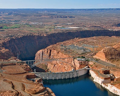
I arrived at the Glen Canyon Dam visitor’s center at 10:30 AM. Mike was already there with his truck and Jack the Dog. We had another breakfast in Page, then went to the airport to chat with the folks I’ll be flying for there, and finally to the campground, where we were told we were “lucky” to get a spot. (There’s more to this story, but I don’t feel like going into it now.) We spent the rest of the day picking up a few things for the camper and then just taking it easy. We had dinner in town, then came back to the trailer and watched a movie on my laptop before falling asleep.

Monday, August 4

We did a lot of chores that morning. We had to button up the camper to move it to another site (which we were “lucky” to get) that was suitable for monthly use. It turns out, the only thing that made it suitable was an electric meter, so if I sucked too much electricity, they could charge me for it. The new site is right near the road, which I’m not happy at all about. But I’m hoping it’ll be close enough to the office to connect to the WiFi network there.

We left Mike’s truck with the trailer and climbed back into my truck with the stuff I wouldn’t need anymore — including Alex’s cage. Then the four of us headed home. We’d gotten about 15 miles south of Page when Mike realized he’d forgotten his cell phone. We went back to fetch it, then bought milk shakes that were way too big (and way too expensive) for the ride. At 2 PM, we were in Flagstaff, where we stopped for a Thai food lunch. We were still full from the damn milk shakes, so we wound up taking most of the food home with us.

We were in Wickenburg by 5:30 PM. I fetched one of my cars from my hangar and came home.

Busy enough for you?

So that’s a whole week and then some, all accounted for here. You can see why I didn’t blog regularly. Hopefully, this long post will make up for it — if you could last through it all.

We hit the road again on Friday morning, when we fly to Seattle to fetch the helicopter and bring it down to Page. I hope to be able to share more stories and photos with readers then.

Until then, remember that you can track my progress for most of my trips these days on my SPOT Share page, http://www.tinyurl.com/FindMaria. Use controls under the waypoints list to scroll back through previous days.

And be sure to check out my photo gallery for larger images of what I’ve shared here: http://www.FlyingMPhotos.com/.

Almost Scud-Running

Flying through a mountain pass in marginal conditions.

Louis and I flew from Wenatchee (EAT) to Seattle’s Boeing Field (BFI) yesterday afternoon. The flight required us to cross the Cascade Mountains. There are two passes to choose from: Snoqualmie, which I-90 goes through and Stevens, which State Route 2 goes through. I’d wanted to take Stevens — I’d already traveled Snoqualmie once and wanted a change — but the decision would not be mine.

It was a weather issue, of course. After weeks of picture-perfect weather here on the east side of the Cascades, a cold front had moved in. Rain clouds were coming over the Cascades. It even drizzled in Quincy.

As I flew out of Quincy Airport for the last time this season, I took a good look at the ridge between Ellensburg and the Columbia River, where all those windmills are lined up. The sky was dark out that way, with thick gray clouds. Although the windmills were clearly visible, I could also see the vertical streaks of falling rain. It looked as if a flight up I-90 was out of the question.

But the picture was worse when I reached the Wenatchee area and could see out toward Stevens pass. The sharp, rocky mountains are closer there and the clouds clung to them like cotton balls rubbed across coarse sandpaper: lots of wisps in an 8 to 10 knot breeze. The clouds were definitely lower; the pass was definitely higher.

It looked as if scud-running would be in my near future.

If you’re not a pilot, or you’re a very new pilot, you might not know the term scud-running as it pertains to aviation (or anything else, for that matter). I define scud-running as flying in variable visibility conditions, when you have steer around low clouds or fog enroute to get to your destination. Scud-running is never a good idea. In fact, it’s usually a bad idea. More than a few pilot have met their end hitting a “granite cloud” while attempting to run the scud.

Helicopters, however, are uniquely suited for scud-running. We normally fly low, so the clouds have to be really low to affect our flight. We can travel at a wide range of speeds, from 0 to (in my case) 115 knots, so we can take our time and really look at what’s around us before committing to a path. And if that path turns bad, we can make a 180° turn to get out of it in a very narrow space. Best of all, if things get really out of hand, we can always land in a field or parking lot and wait out the problem.

Don’t get me wrong: I’m not recommending scud running to any pilot. It’s dangerous. I’m just saying that if you’re flying a helicopter and the clouds start to close in, you’re more likely to live to tell about it — if you handle it right — than someone flying a plane.

In Wenatchee, I checked the weather. I used Duats to get conditions in Stampede Pass, which is just south of Snowqualmie pass, and every other place along the way on both routes. There was no information handy for Stevens Pass, but my eyes had told me enough. Stampede pass had ceilings of 6000 feet. That was more than enough for me. Then I checked the radar in motion to see which way the rain I’d spotted near the windmills was going. It was driving northeast. We were north of the rain; it would pass to the south of us if we flew direct to Ellensburg or Cle Elum. It was cloudy and raining on the other side of the cascades, with 4,000 foot ceilings. Wind was light everywhere, so turbulence wouldn’t be an issue.

I decided to take Snowqualmie Pass.

We started up and I took off on a steep, 1,000 foot per minute climb from Wenatchee Airport. We had to cross the river and then cross the high ridge on the other side. To our left, the rainclouds were moving east. To our right, the low clouds were stuck on mountain peaks. The ridge was clear; the clouds were at least 1,000 feet above it. I aimed slightly to the south of the GPS’s direct-to Ellensburg, pointing the helicopter at the friendliest piece of sky.

I gave Louis the controls when we reached the ridge. He continued the climb, but adjusted our route to intercept with Ellensburg. We climbed closer to the clouds. I thought for a while about how I use a GPS for en route navigation — as a sort of general guide. Louis was putting us on the GPS track. Whatever.

We topped the ridge and the land dropped down toward Ellensburg on the other side. We stayed pretty high. Didn’t seem any reason to descend to a 500-foot cruise altitude when we’d just have to climb again. I set Cle Elum as the next go to waypoint in the GPS. Louis adjusted course to head west.

Ahead of us, the mountains closed in. I-90 threaded its way through them in one narrow valley after another. Although we still had at least 2,000 feet of cloudless sky right above us, the clouds dropped up ahead. The entrance to the mountainous area looked shrouded in a white haze. It didn’t look good.

I dialed in the Stampede Pass ASOS. It assured us that the ceilings were 1700 feet. Plenty of space for us. But we weren’t going through Stampede Pass. We were going through Snowqualmie Pass. They were very close, but would they have the same conditions?

We continued on. I paid close attention to the high-tension power lines that ran along the side of the road. If we had to descend and turn, I wanted to make sure I knew exactly where those wires were.

The road climbed into the mountains. We stayed at pretty much the same altitude until we were about 500 feet above the road. Then we climbed with it. We slipped into the white haze, which turned out to be a light mist. Tiny raindrops covered the helicopter’s cockpit bubble. Visibility was still okay, but there wasn’t enough moisture to bead up and run off the window, so we had to look through all those little droplets. Still, so far, so good.

We passed the two little airports at Cle Elum and I punched the next airport into the GPS: Easton State. If I have to make a precautionary landing, I like to do it at an airport, so I like to keep an airport dialed into the GPS. Sure, we could land in a big parking lot or field, but that’s a good way to get unwanted attention in these little towns.

Meanwhile, the clouds continued to come down. My internal alarm systems came to life when we started flying between low-hanging wisps of clouds. The last time I’d done that, I’d flown into one I hadn’t seen. That produced about 2 seconds of terror before I made a descending 180° turn to get out. I didn’t want to be there again. I told Louis, who was still flying, about my experience.

We passed Easton State. The next airport was Bandera, on the other side of the pass. I punched it in. We were now flying in a deep canyon, about 400 feet over a lake and I-90. The wires were not an issue anymore. At the west end of the lake, the highway made a sharp turn to the left into what looked like a cloud bank.

Crossing the Mountains

I listened to the Stampede Pass ASOS again. Now the ceilings were 1400 feet — still not bad. We weren’t far from there. We continued to the end of the lake, where we could see into the next canyon. Visibility was still okay, so we went in. This was the narrowest part of the canyon with very little room to maneuver. The clouds stayed high enough. The misty rainfall continued. We were okay, but I knew it could turn bad at any time.

Then we were through the pass and the road started to descend. The clouds went down with it. So did we. We’d made it through the pass but I still wasn’t sure whether we’d have a clear enough shot out of the mountains. We could never see more than a few miles ahead of us because of the mist and the twisty turns of the canyon.

But by the time we passed Bandera, it was obvious that we wouldn’t have to turn back or land. As the road continued to descend, the clouds stayed put. I tuned in the ATIS for Boeing Field and heard 10 miles visibility with 4000 foot ceilings. We landed there about 20 minutes later.

Here’s our entire route, laid out on a sectional chart;

EAT to BFI via Snowqualmie Pass

I wouldn’t call this experience scud running, but it was about as close as you could get. I don’t think too many airplanes would have made this flight successfully without getting into the clouds — granite or otherwise. Although something small and slow like a Piper Cub could have handled the altitude and airspeed, the uncertainty of what lay ahead, coupled with the extremely narrow spaces that would make it impossible for an airplane to turn around, would make this a very dangerous flight for any plane.

I’ve been in worse weather situations than this one, but I don’t think I entered into this one lightly. The entire time we were in the mountains with low clouds, I kept thinking about escape routes, landing zones, obstacles to turning, and what could happen if we let it. In Arizona, I don’t get much practice flying weather. While I think that what we experienced yesterday was marginal VFR at best, other pilots more accustomed to weather flying might think I was taking the whole thing too seriously.

But it’s when you let your guard down that Mother Nature sometimes steps forward to slap you in the face.

Gone to the Wind[mills]

A visit to Washington’s other source of alternative energy.

Washington state is widely known for its cheap, reliable electric power. One reason it’s cheap is because it’s hydroelectric — the Columbia and other rivers in Washington have been dammed up with numerous hydroelectric plants, many of them built as part of the New Deal in the 1930s. (An interesting side note here: we visited the Grand Coulee Dam and learned on the tour that power wasn’t one of the reasons the dam was originally built. The two primary reasons were irrigation and flood control. I really ought to write about that tour in another post.)

Anyway, Washington is also on the leading edge of renewable power generation from wind generators or windmills. Puget Sound Energy (PSE) has two facilities, one of which is on a series of ridges in Kittitas County, 18 miles east of Ellensburg. This Wild Horse Wind Facility is clearly visible from my camp just south of Quincy, about 20 air miles away. It’s also open to the public for tours. So on Saturday afternoon, feeling a dire need to get away from the book project I’m working on, I headed out to see the place close up.

It’s easy to get to. From I-90, take the exit for Vantage, which is on the west side of the Columbia River. After stopping for a burger at Blustery’s, head up the old Vantage Highway. You’ll get to the turn for Wild Horse about 12 miles up the road. It’s hard to miss — the road is clearly marked and you can see lots of windmills from the main road.

Wild Horse Wind FacilityFollow the entrance road about three miles as it winds up a hill. You’ll pass a bunch of windmills along the way — the road actually passes quite close to a few of them. Eventually, you’ll see the Visitor Center at the top of the site. Behind it are a few windmills that, when seen with the building in front, look absolutely enormous.

When I arrived, an all-girls camp group was there. The girls were in their early teens. I managed to latch on to one of their tours, which included a walk up eight or so steps into the tower at the bottom of one of the windmills. Afterward, I wandered around a bit, got technical information about the facility, and took plenty of photos.

WindmillWant some stats? The facility is on a 9,000 acre site overlooking the Columbia River Basin. It was started up in December 2006 with 127 wind turbines. Each turbine is capable of producing up to 1.8 megawatts of power in 31 mph winds, for a total of 229 megawatts. The turbines start generating power at 9 mph of wind and are programmed to feather their blades and basically shut down when winds exceed 56 mph to avoid damage. Since the site is usually pretty windy, the facility does a pretty good job generating power.

Each turbine sits atop a 221-foot tall tower. (See the flight of steps at the very bottom of the tower in this photo? It has about 8 steps. That should give you an idea of scale.) The foundations go down 25 to 32 feet and each have 120 anchor bolts around the 13-foot wide tower base. The bolts are huge, as you might imagine.

The turbines, which are manufactured in Denmark, generate power at 690 volts. A transformer inside the turbine housing, steps up the power to 34.5 kilovolts. These turbines are atop the tower (of course) and are about the size of a typical RV or motorhome. They’re reached from a ladder inside the tower.

Windmill BladeThe blades are also huge. There was one on display outside the visitor center and I snapped a photo with my fisheye lens (which explains the distortion) of the girls gathered around it. Each of a windmill’s three blades is 129 feet long, 11.6 wide near the hub, and 1.6 feed wide at the tip. They’re made of composite materials, are hollow, and weigh 7 tons each. When you figure the length of the rotor blade into the total maximum height of the windmill, you get 351 feet.

It’s no wonder I can see them from 20 miles away.

We all know that the environmentalists are concerned about windmills and their impact on birds and bats. I asked about this. I was told that the facility averages 2 dead birds per turbine per year. I think more are killed being hit by cars. The folks at Wild Horse take the situation seriously and collect and bag all birds found. Bats are not an issue there.

For me, the most amazing part of visiting the windmills was the sound they made as they were spinning.

After my tour in the Visitor Center vicinity, I hopped on the truck and followed the dirt road around the facility. I was out to take photos and I got a few interesting ones.

If you’re in the area, I recommend a visit to the Wild Horse Wind Facility. Try calling 888-225-5773 if you need more info; I can’t seem to find the official Web site for the facility.

And if there’s a wind or other alternative energy facility open to the public for tours in your area, make it a point to visit with your kids. It’s a great way to learn about energy options.

George Washington at the 76

Am I the only one who thinks this is funny?

On Saturday, on my way back from Ellensburg, I stopped off in George to buy a quart of milk. George is 5 miles south of my camper, and despite the fact that I’d driven past the town a half dozen times, I’d never stopped there.

The cleanest looking place in town to buy milk was the 76 gas station. I pulled in and parked. That’s when I spotted the bronze bust of George Washington. Moments later, I realized I was in George, Washington. (Duh-uh.) And then I realized that the 76 (as in 1776) sign was right behind George’s head.

So I took the photo.

George in Washington

Am I the only one who thinks this whole thing is funny?

Ginkgo Petrified Forest

Petrified logs, petroglyphs, and more.

On Saturday, I treated myself to an afternoon outing. My intended destination was the Wild Horse Wind Facility in Kittitas County. But I made a few stops along the way. One of them was the Interpretive Center for the Ginkgo Petrified Forest State Park near Vantage, WA, on the Columbia River.

I’m familiar with petrified wood. Arizona is home of the Petrified Forest National Monument (on I-40, east of Winslow) and I’ve been there a few times. But this forest was different. In Arizona, the wood was petrified as it became part of sedimentary rock. Here, the wood was encased in lava. But the results are similar: wood that’s been turned to rock.

I’ll admit I did the lazy tourist routine. I didn’t take a hike on the 3 miles of trails. It was hot and the trails were hilly. And I did have another destination. Instead, I stopped at the Interpretive Center about a mile north of Vantage. The small building offered sweeping views of the Columbia River from a cliffside perch, as well as many samples of polished petrified wood, scientific exhibits for all ages, and a small movie theater with visitor’s choice of informational movies about the area.

Petrified WoodAfter studying the various displays, I went outside. There we numerous petrified logs between the building and the parking area. I had my good camera with me and tried to get some shots of the textures of these logs. Here’s one of them. What I find most interesting about petrified wood is the colors. While I’m sure there’s a good chemical and geological explanation for all the colors, it would probably be lost on me. I don’t really care how they got the colors. I just like the colors.

Ginkgo PetroglyphsAround the side of the building is a display, behind an iron fence, of some petroglyphs that were rescued from floodwaters when the Wanapum dam was completed downriver in 1963. But to understand why the rocks these drawing appear on look so uniform, I need to discuss the geology of the area a bit.

The entire area sits on layers of basalt from repeated lava flows in prehistoric times. With each flow, the land rose. Then, 15,000 to 13,000 years ago, a huge lake, Glacial Lake Missoula, formed in what is now Montana. It broke through the “dam” created by a finger of ice age glacier and quickly carved through the area. It did this at least 25 times over a period of 2,000 years, carving out canyons known as coulees. You can read more about the Missoula Floods on Wikipedia.

Because the basalt from lava flows forms as columns of rock — think Devils Tower (of Close Encounters of the Third Kind fame), which is similar — the force of the floodwaters carved away complete columns of rock, leaving behind other columns. The Columbia River flows in one of these canyons from Crescent Bar (west of Quincy and south of Wenatchee) to Vantage and beyond.

Ginkgo PetroglyphsFrom 1000 to 300 years ago, native people drew on these columns of dark rock near the river’s edge. There’s actually an impressive variety of petroglyph drawings. About 300 of them were physically moved from what would soon be Lake Wanapum to the side of the Interpretive Center at the park. That’s what I saw and what is pictured here. (And no, the building isn’t curved. I was using my silly fisheye lens in an effort to capture more petroglyphs in a tight space.)

I highly recommend a visit to the park, even if you’re just passing through the area. It’s not far from the Vantage exit on I-90, just west of the Columbia River. Vantage has fuel and a handful of restaurants. (I recommend a “Logger burger” at the burger joint on the corner closest to the highway.) There’s also camping in the area for RVs and tents. If you want to make it a quick stop, you can visit the Interpretive Center in less than an hour. But if you want a more in-depth look at the petrified logs and aren’t too lazy to walk, continue up the road to the park’s hiking trails. Be sure to bring plenty of water; I don’t think there’s much there.

For more info, check out the Ginkgo Petrified Forest/Wanapum Recreational Area Web site or give them a call at (509) 856-2700.