We apparently found what we were looking for but didn’t know until much later.
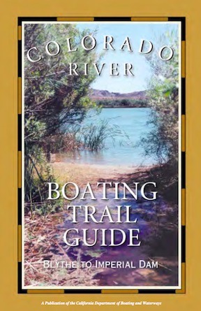
This little book was written for folks in kayaks and canoes, but still has good information for a shallow draft boat like my Sea Rayder.
Back in November, when I was still home planning my snowbirding trip, I stumbled upon a PDF booklet titled Colorado River Boating Trail Guide: Blythe to Imperial Dam. My little sport jet boat was already in Arizona with my camper, waiting for my return and I knew I’d be spending part of December and possibly January camping along the river. I needed destinations to explore and this little book had them.
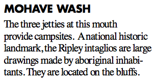
Here’s the entry for Mohave Wash. Seems pretty straightforward, no? Just boat down to the jetties.
Fast forward to December. I was camping out with my friend Janet along the Colorado River south of Ehrenberg, AZ and thumbed through a printed copy of the book that I’d brought with me. (It’s only 16 pages.), I found an interesting entry on page 6 for Mohave Wash. It mentioned the Ripley intaglios, which I’d never heard of. At the time, we were camped on one of the many backwaters at about river mile 7.5; Mohave Wash was at river mile 11.5, only four miles away. It seemed like a good destination for a test drive of my newly repaired boat.
(Yes, my boat broke on this trip. Fortunately, the problem occurred before we left the backwaters for a ride on the river and I was able to limp back to camp. Later, I got it to limp back to the boat ramp and onto the trailer for a ride to the boat shop in Blythe, which was probably pretty happy to have the business right before Christmas. It was the forward/reverse cable, but I got the throttle cable replaced, too. The boat was gone for a week and when I got it back in the water, I was very anxious to get it out on the water for testing.)
Janet, Penny, Dually (Janet’s dog), and I headed out on December 26 as soon as the water was high enough to get out of the backwaters. (The water levels varied throughout the day based on the demand for power from Parker Dam 70+ miles upstream and irrigation needs in California. The backwaters and river generally became navigable for my little boat after noon each day and remained that way until after sunset.) The throttle worked more smoothly than ever before. It was a warm, sunny day and it felt good to feel a 30 mph wind in my hair as we sped down the river at my little boat’s top speed. We kept an eye out for shallow water and found some, but the boat’s shallow draft let us glide over it.
After a while, we saw some bluffs off to the left and figured they must be the ones in the description. We began looking for the jetties.
And didn’t find them.
Maybe my idea of a “jetty” differs from the person who wrote that book. My idea of a jetty is a finger of land or rock that juts out perpendicularly (or nearly so) into a body of water. I think of the rock jetties jutting out into the Atlantic Ocean for erosion control. Or the jetties on either side of the entrance to a harbor. There was nothing even remotely resembling that along the river.
Yet here were the bluffs that the intaglios were supposed to be on top off. And we’d gone about four miles. This had to be it.
I pulled off into the shallow water on the Arizona side and we got out. It was a dumb spot; there was nothing to tie off onto. So I moved the boat to a new spot where Janet found a huge rock to tie the boat to. The water made an eddy there, so there wasn’t much chance of the boat leaving without us. We got on shore. Janet brought her fishing pole and I brought my drone.
Of course I did. I had no intention of climbing to the top of bluffs to find something I could only see from the air.
While Janet fished, I launched the drone, using my sweatshirt as a landing pad. I sent it up over the bluffs with the lens pointed straight down and studied the images it sent back to me. I took video (or thought I did), landed, swapped batteries, and took off again. On the second flight, I snapped a few photos. I didn’t see anything resembling an intaglio on screen.
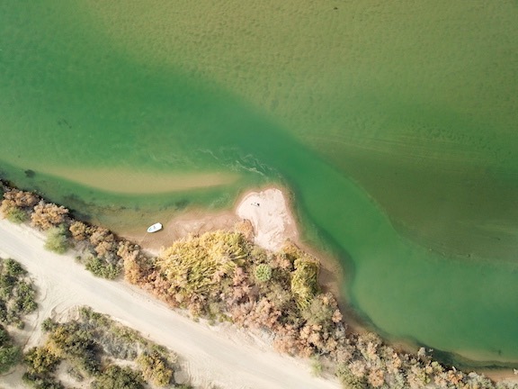
A drone’s eye view of the “jetty” (?) where we stopped along the river.
I landed the drone again and we packed up to go. The bluffs were large and it seemed that the chances of me finding anything on my two short flights was very slim. I was disappointed, but not too surprised.
We got back into the boat, cast off, and drifted back into the current. I started the engine and we went a mile or two farther down river before turning around and going back to camp. It had been a nice outing, despite my failure to find the intaglios.
Days later, I offloaded the drone images from its MicroSD card to one of the portable hard disks I use to archive my photos. I took a look at what I’d shot. That’s when I realized that I didn’t have the video camera running during that first flight so I had no visual record of it. But the photos I took during the second flight were there and I took a quick look at them.
And got a pleasant surprise.
Although I didn’t see anything on the screen during the flights, the two random photos I took while over the bluffs both revealed intaglio figures.
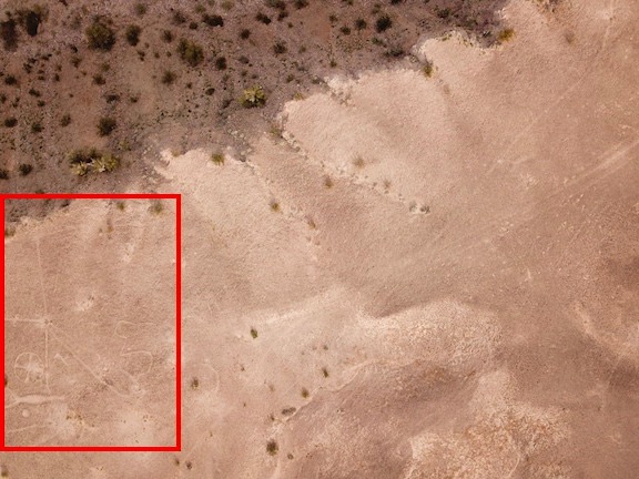
I was very surprised to see the intaglios in this image. I wonder what I missed when I thought the video camera was running?
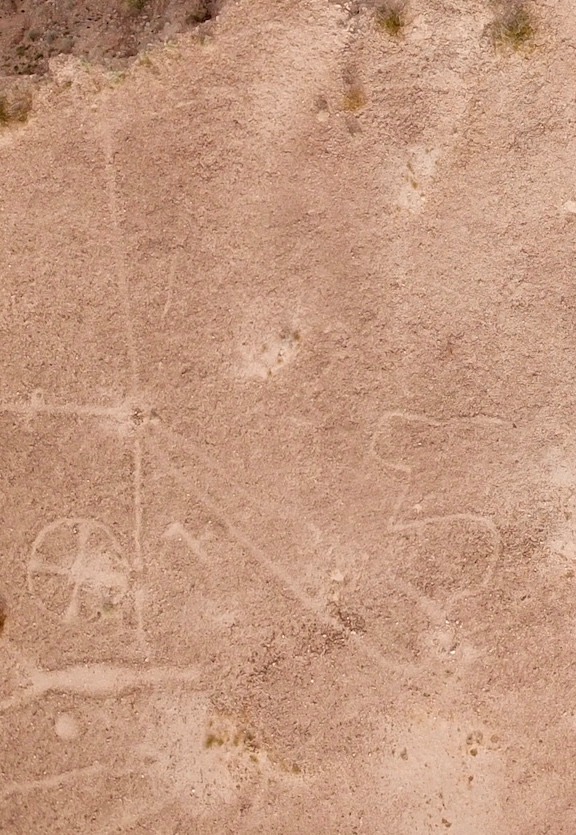
Here’s a closeup of that part of the image.
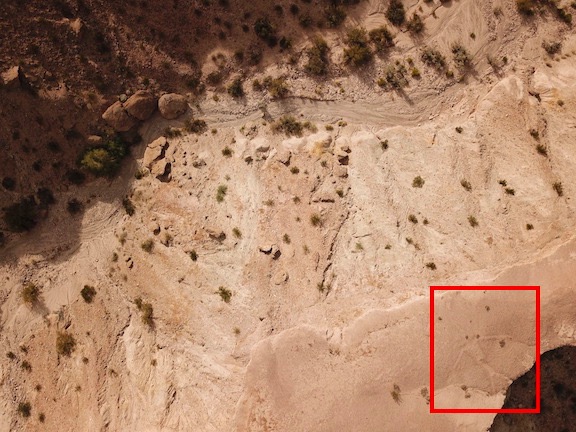
I didn’t notice the figure in this photo until I looked at it in preparation for writing this blog post.
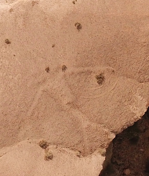
Here’s a closeup. This is definitely man made. (So are the tire tracks nearby.)
Seeing that I managed to capture intaglios on both of the two images I shot while over the bluffs makes me wonder what else I missed.
Of course, I do have the GPS coordinates, so it would be easy enough to go back and explore some more. I’d probably drive, though; there is a road nearby and the bluffs aren’t that high. Seems like a good destination for next year’s trip to this part of Arizona.
If you’re interested in intaglios, be sure to check out this post: “Snowbirding 2018 Postcards: The Blythe Intaglios.”
And these are both great examples of how a drone can be used to see and capture images of things that simply can’t be appreciated from the ground.
Discover more from An Eclectic Mind
Subscribe to get the latest posts sent to your email.

Accidental discoveries like that are great fun.
I can’t stop speculating about the ‘meaning’ of these scratchings on the hard-baked Mesa pans. The Peruvian Nazca lines are made in the same way and perhaps by the same people?
There are about 20 published explanations ranging from the occult, to extra-terrestrials and fancy religious notions concerning prayers for water.
I just see them as graffiti, bored nomads scratching their ‘tags’ on the rock, saying “I was here first”.
I think you’re right about graffiti. Or maybe drawings to impress their deities.
Are you able to appreciate these from ground level, or only from overhead? I love reading about your travels, work, and your home! Thanks for blogging!
I think you can get a sense of them from the ground. They aren’t that big. But they are better viewed from overhead.
And thanks for the kind words — and for reading what I put here!
It is a ceremony site.please be respectful when visiting and please do not post GPS locations there are no fences to protect these sites. Thank you kindly
Actually, there are fences. And the GPS coordinates are on Google Maps. That’s how I learned about it.
But I’m always respectful when visiting archeological sites. We need to protect what people left behind. But that doesn’t mean we can’t visit and appreciate them.