
What a great trail!
On Wednesday, I went hiking with my new midweek hiking friends, Sue and Jerry. They’re both retired and they know a lot of local trails — including more than a few just a short distance from our homes.
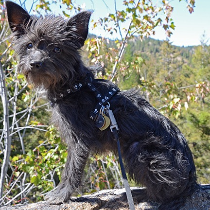
I found this photo of Penny shot that day in August 2012. She was probably about 5 months old here.
Wednesday’s hike was actually on two different trails: Devils Spur and Beehive. We drove up toward Mission Ridge on Mission Ridge Road and parked at the last switchback, which is the trailhead for the Devils Spur Trail. There’s a viewpoint there where you can look down into Squilchuck Valley — I’d been there a few times in the past — and a closed road that led off into the forest. I’d hiked a bit on that road with Penny the Tiny Dog back in 2012, but hadn’t gone far, mostly because I was worried about Penny and the potential for encountering predatory animals on a trail I knew nothing about.
But Sue and Jerry knew the trail well. It wound into the forest, a former road blocked off for hiking and biking only. I was surprised to see felled trees and cleared forest a little way in — it certainly hadn’t been like that two years ago — but realized it likely had to do with the 2012 fires that occurred after my hike with Penny. Then the forest returned to its natural dense growth.
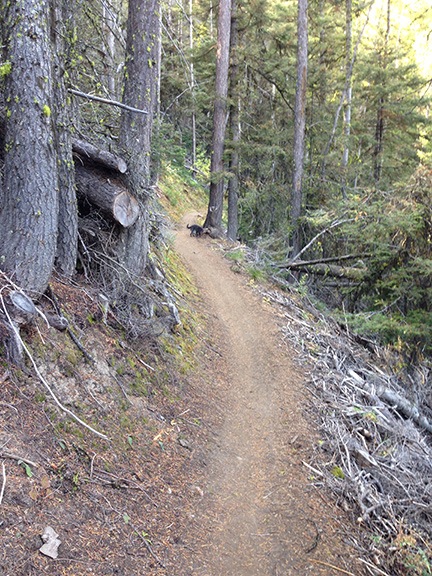
Can you see Penny sniffing at something up ahead on the trail?
It was cool and moist in the shade — so unlike the desert around my home less than 10 miles away. I was glad I’d worn a fleece sweatshirt. But just when it got uncomfortably cool, the trail would open up to a dry, exposed patch, full of warm sunlight. The sweatshirt came off. And just when I was starting to get really hot, the trail dove back into cool, shady forest. It made the switch over and over for the entire length of the hike.
Jerry accompanied us about a mile up Devils Spur trail. Just before the trail narrowed, he turned back. He has a bit of acrophobia and a while later, I realized why he didn’t want to continue with us — the trail wound along a narrow ledge on a cliff face of volcanic talus. Instead, he went back to get the car and drive it around to the Beehive Trailhead where we’d emerge some time later.
Sue and I (with Penny) continued along the trail. Sue is very knowledgeable about the mushrooms we saw along the way and even pointed out some clearly visible fossils on a rocky outcropping the trail passed. Penny ran ahead as she always does, occasionally running back to hurry us along. The trail climbed about 600 feet over about 2 miles — a gentle grade that didn’t require many rest stops. It was a perfect day for hiking, with calm winds, cool air, and clear skies.
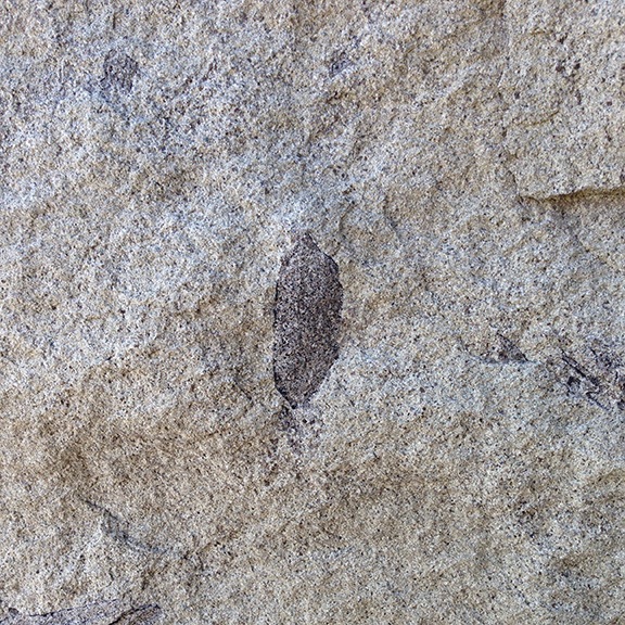
I would have walked right past this rock full of fossils if Sue hadn’t pointed it out. This leaf was especially clear and easy to see.
The trail approached the old Pipeline trail, which runs alongside Forest Road 9712. I’d driven quite a distance on that gravel road in 2013 several times, including with my friend Janet, who was visiting from Colorado. Recently, I’d taken the Jeep up there with my friend Bob and noted that they were doing some sort of work on the pipeline. That Wednesday, they were hard at it and as we got close, we heard the steady beep-beep-beep trucks backing up. We never did see them, though. The trail reached 9712 where it turned back downhill as the Beehive Trail and we started our descent to Beehive Reservoir.
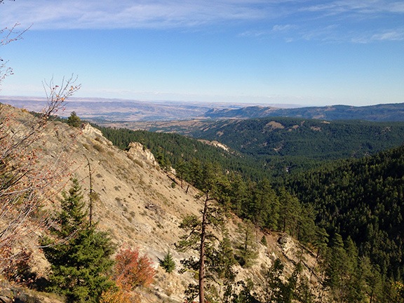
There were sweeping vistas down toward Wenatchee from various points along the trail. My home is at the base of the cliffs nearly dead center in this photo.
We were about a mile down the trail when we saw another hiker approaching from the other direction. It was Jerry. He’d parked the car and walked up to meet us. I assumed we were close, but there was still another mile or so to go. I think he got the same length hike we got, but did two out-and-backs rather than a long one-way hike.
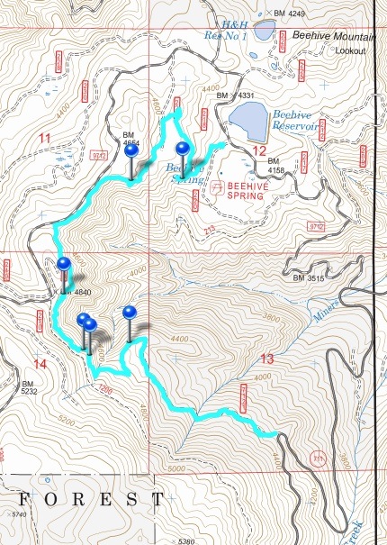
Here’s our track as recorded by Gaia GPS. The blue pins indicate places I took photos; the photos are uploaded with the track on Gaia Cloud.
The hike was just the right length for me: just over 4 miles. I tracked it with Gaia GPS on my iPhone, which I highly recommend to anyone who hikes with a smartphone. (The main benefit: being able to load detailed topo maps before starting the hike so a cell phone signal is not necessary to view live location-on-map data.) I took photos along the way and later uploaded the track and photos to the Gaia Cloud.
It was a great hike — one I hope to do again, perhaps with my Meetup group. This is certainly the right time of year for it. Many thanks to Sue and Jerry for introducing it to me!
Discover more from An Eclectic Mind
Subscribe to get the latest posts sent to your email.