The view from above.
In November, Mike and I took my helicopter to the San Diego area for business. The flights to and from San Diego were over some of the most interesting — and boring — desert terrain out there.
Our route to San Diego from Wickenburg (E25) took us southwest, skirting around the restricted area north of Yuma, where we landed for fuel. (Fuel there was $1.20/gallon cheaper than at my home base.) Then almost due west along I-8, over the Glamis Dunes and Imperial Valley, which lies below sea level. Finally, a climb over some mountains and a descent down to Gillespie Field (SEE).
On the return flight, we took a different route. We flew east along I-8, then northeast to the northern tip of the Salton Sea to Chiriaco Summit and then along I-10 to Blythe, where we refueled. (The fat guy is gone.) From there, we overflew Quartzsite before making a bee-line for Wickenburg.
You can see the approximate routes below; click the map for a larger view with readable labels.
Mike’s got his private pilot certificate and 100 hours of flight time in helicopters, so he’s legal (per my insurance company) to fly passengers. So he did most of the flying. I had my door off for the Yuma to El Cajon part of the flight and took photos — mostly over the Glamis dunes. It was nice to be a passenger for a change — to be able to use my camera without left-handed contortions. I also had the POV.1 video going for part of the flight, although the sound crapped out part of the way.
Anyway, here are a few of the photos I took on the flight. You can find more of my aerial photos — as well as larger versions of these — in my photo gallery.
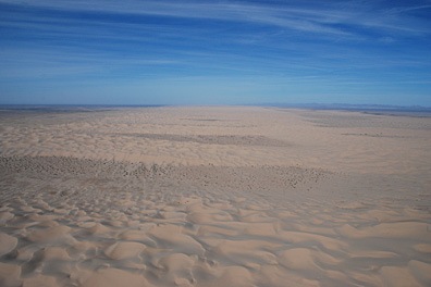
 Glamis Sand Dunes
Formally known as the Algodones Dunes or the Imperial Sand Dunes Recreation Area, the Glamis Dunes is a huge series of sand dunes west of the Colorado River, northwest of Yuma, AZ in California. The dune field stretches 45 miles north to south and 6 miles east to West. This photo shows only a portion of the dunes, looking north from the I-8 area. The dunes are extremely popular for off-road vehicles; this photo was taken on a relatively quiet Friday morning.
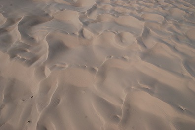
 Sand Dunes
Here’s a closeup shot of the Algodones Dunes from the air. This shot was taken from about 500 feet above the ground, over I-8, just west of the Arizona-California border.
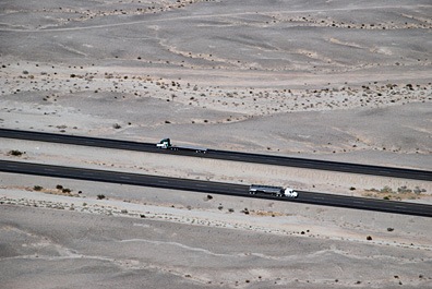
 Desert Freeway
The folks back east probably have no concept of the long distances of nothingness on a freeway that cuts through the desert. This shot of two tractor trailer trucks passing each other in the barren wasteland of the Imperial valley’s southern extremities might give them an idea.
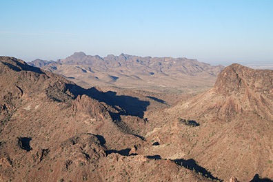
 Desert Mountains
The mountains just seem to go on forever in this aerial shot of mountains in southwest Arizona, not far from Quartzsite. Lake afternoon light casts long shadows.
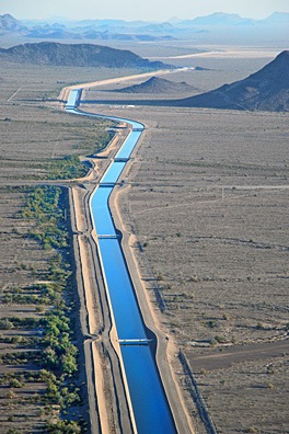
 CAP Canal
The Central Arizona Project (CAP) snakes its way through the Arizona desert, bringing water from the Colorado River and its lakes to Phoenix and its suburbs. This shot was taken just north of Hope, AZ on our return flight to Wickenburg.
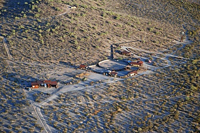
 Forepaugh Ranch
This ranch is nestled at the base of two hills in Forepaugh, AZ, out of sight from the main road (Route 60) only a mile or so away. It reminds me of an earlier day of ranching, when remote ranches were self-sufficient homes on the range.
Discover more from An Eclectic Mind
Subscribe to get the latest posts sent to your email.


